Items Similar to Great Britain, N. France: A Large 17th C. Hand-colored Map by Sanson and Jaillot

Want more images or videos?
Request additional images or videos from the seller
1 of 20
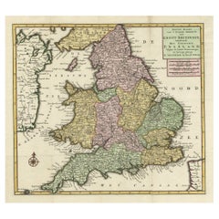
Nicholas Sanson d'AbbevilleGreat Britain, N. France: A Large 17th C. Hand-colored Map by Sanson and Jaillot1693
1693
$1,900
$2,37520% Off
£1,474.85
£1,843.5720% Off
€1,672.95
€2,091.1920% Off
CA$2,712.90
CA$3,391.1220% Off
A$2,989.39
A$3,736.7420% Off
CHF 1,550.55
CHF 1,938.1920% Off
MX$35,554.82
MX$44,443.5220% Off
NOK 19,614
NOK 24,517.5020% Off
SEK 18,374.16
SEK 22,967.7020% Off
DKK 12,494.43
DKK 15,618.0420% Off
About the Item
This large hand-colored 17th century copperplate engraved map entitled "Le Royaume D Angleterre, distingué en ses Provinces. Par le Sr. Sanson. Geographe du Roy. Presenté A Monseigneur Le Dauphin" was originally created by Nicholas Sanson d'Abbeville and published by Hubert Jaillot in "Atlas Nouveau" in Paris in 1693. It depicts England, portions of Scotland, Wales and Ireland, the English Channel and portions of Normandy in northern France. It includes London, Windsor, Oxford, Canterbury, Dover, Calais, Rouen and many other landmarks. There is an elaborate ornate cartouche in the right upper corner that includes the royal coat-of-arms surrounded by flags and spears, female angels, putti blowing horns, a horse, the ocean and a globe.
The map consists of two sheets joined as one along a horizontal joint. The map has original hand-coloring and it is printed on antique hand-made laid, chain-linked paper with wide margins. The sheet measures 38" high and 24.88" wide. There is mild offset resulting from contact with the color on the opposite sides of the map over hundreds of years in the atlas. There is one spot over the English Channel, but the map is otherwise in very good to excellent condition.
Nicholas Sanson d'Abbeville (1600-1667) was one of the greatest French cartographather of French cartography. Sanson opened his first printing business in Paris in 1638. The king recognized his skill and knowledge and made him the official geographer to the court. He eventually served two kings in this capacity. Sanson was succeeded by his sons and son-in-law in the business and as geographers to the king. In 1692 his plates were purchased by the prominent Parisian cartographer Alexis Hubert Jaillot (1632-1712), who continued to publish his maps and atlases with a dual Sanson and Jaillot attribution. Jaillot went on to serve King Louis XIV.
- Creator:
- Creation Year:1693
- Dimensions:Height: 38 in (96.52 cm)Width: 24.88 in (63.2 cm)
- Medium:
- Period:1690-1699
- Framing:Framing Options Available
- Condition:
- Gallery Location:Alamo, CA
- Reference Number:Seller: # 47531stDibs: LU117328930772
Nicholas Sanson d'Abbeville
Nicholas Sanson d'Abbeville (1600-1667) was one of the greatest French cartographather of French cartography. Sanson opened his first printing business in Paris in 1638. The king recognized his skill and knowledge and made him the official geographer to the court. He eventually served two kings in this capacity. Sanson was succeeded by his sons and son-in-law in the business and as geographers to the king. In 1692 his plates were purchased by the prominent Parisian cartographer Alexis Hubert Jaillot, who continued to publish his maps and atlases with a dual Sanson and Jaillot attribution. Jaillot went on to serve King Louis XIV.
About the Seller
5.0
Platinum Seller
Premium sellers with a 4.7+ rating and 24-hour response times
Established in 2011
1stDibs seller since 2019
296 sales on 1stDibs
Typical response time: 1 hour
- ShippingRetrieving quote...Shipping from: Alamo, CA
- Return Policy
More From This Seller
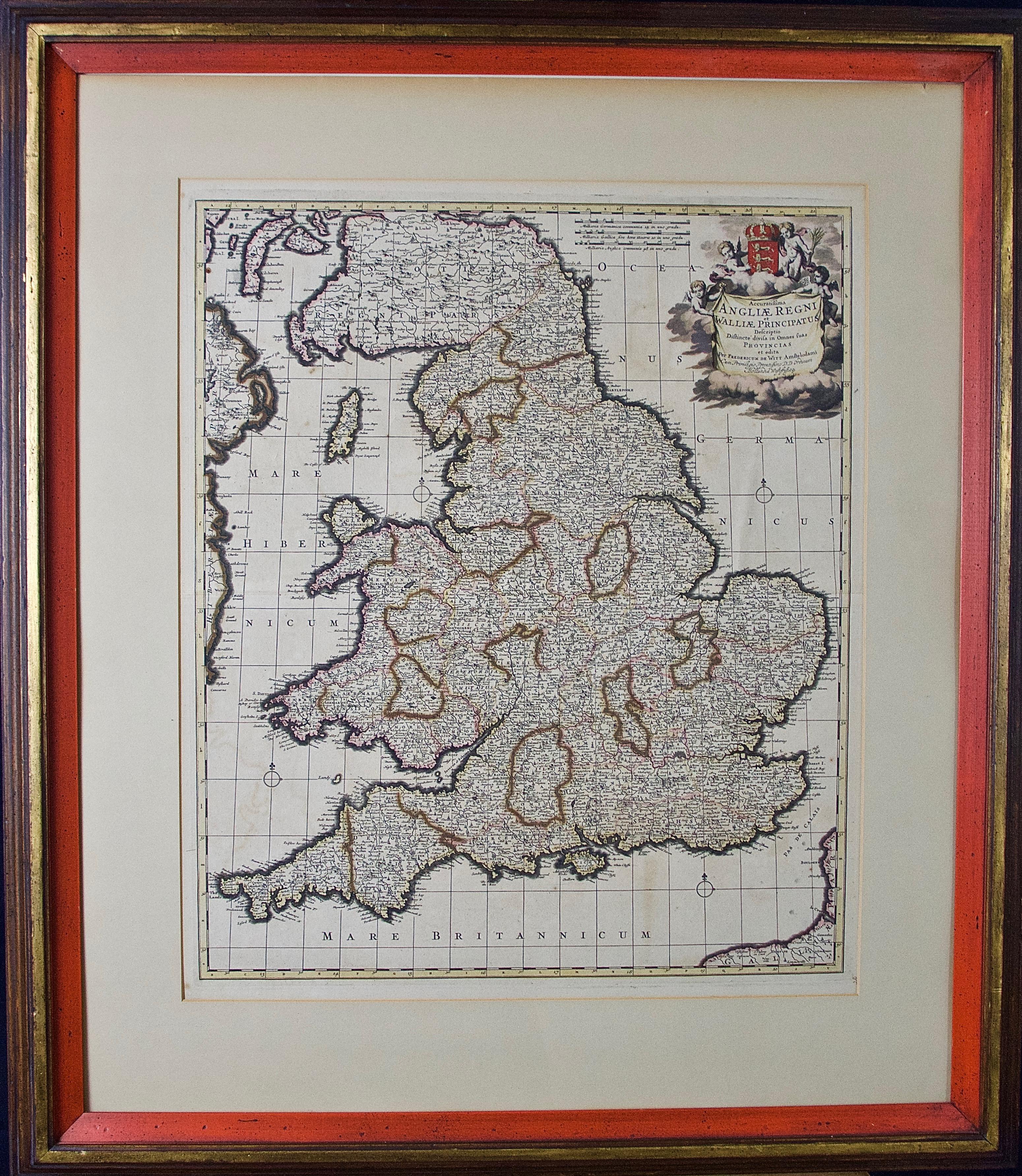
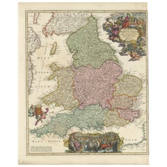
View AllEngland and the British Isles: A Large 17th Century Hand-colored Map by de Wit
By Frederick de Wit
Located in Alamo, CA
This is a large hand-colored 17th century map of England and the British Isles by Frederick de Wit entitled "Accuratissima Angliæ Regni et Walliæ Principatus", published in Amsterdam in 1680. It is a highly detailed map of England, Scotland, the Scottish Isles...
Category
Late 17th Century Other Art Style Landscape Prints
Materials
Engraving

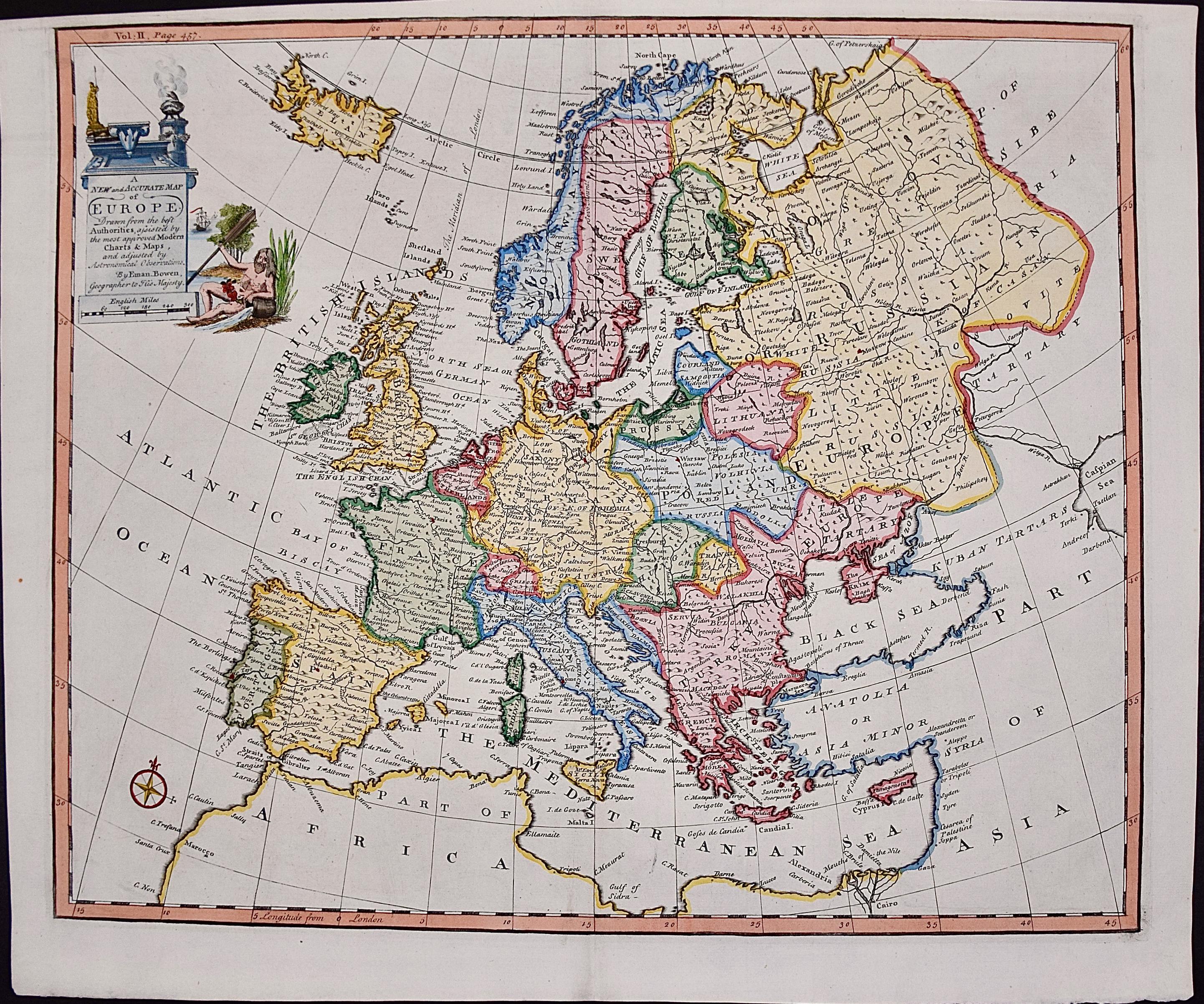
Europe: An Original 18th Century Hand-colored Map by E. Bowen
Located in Alamo, CA
This is an original 18th century hand-colored map entitled "A New & Accurate Map of Europe Drawn from the Best Authorities Assisted by the Most Improved Modern Charts and Maps." by E...
Category
Mid-18th Century Old Masters Landscape Prints
Materials
Engraving

$940 Sale Price
20% Off
The Normandy Region of France: A 17th C. Hand-colored Map by Sanson and Jaillot
By Nicholas Sanson d'Abbeville
Located in Alamo, CA
This large hand-colored map entitled "Le Duché et Gouvernement de Normandie divisée en Haute et Basse Normandie en divers Pays; et par evêchez, avec le Gouvernement General du Havre ...
Category
1690s Landscape Prints
Materials
Engraving

The Loire Valley of France: A 17th C. Hand-colored Map by Sanson and Jaillot
By Nicholas Sanson d'Abbeville
Located in Alamo, CA
This large 17th century copper plate hand-colored engraved map entitled "Gouvernement D'Orleans et la Generalite divisee en ses Elections Par...
Category
1690s Landscape Prints
Materials
Engraving

Southeastern England: A 17th Century Hand-Colored Map by Mercator and Hondius
By Gerard Mercator
Located in Alamo, CA
A 17th century copperplate hand-colored map entitled "The Sixt Table of England" by Gerard Mercator and Jodocus Hondius, published in Amsterdam in 1635 in 'Cosmographicall Descriptio...
Category
1630s Landscape Prints
Materials
Engraving
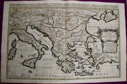
Southern Greece: A Large 17th Century Hand-colored Map By Sanson and Jaillot
By Nicholas Sanson d'Abbeville
Located in Alamo, CA
This large original hand-colored copperplate engraved map of southern Greece and the Pelopponese Peninsula entitled "La Moree Et Les Isles De Zante, Cefalonie, Ste. Marie, Cerigo & C...
Category
1690s Landscape Prints
Materials
Engraving

You May Also Like
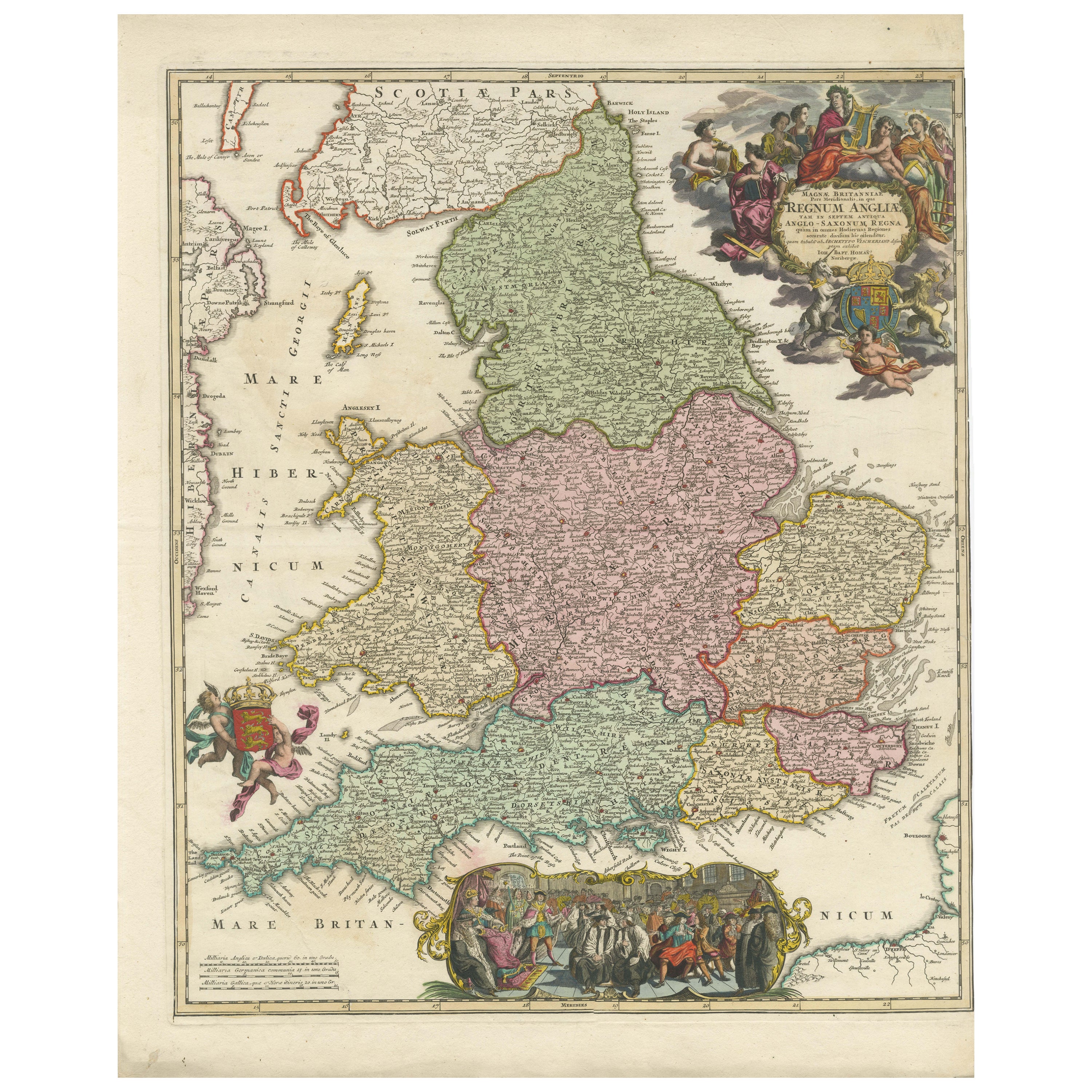
Rare 1690 Map of England by Nicolaes Visscher II – Heptarchy Depicted
Located in Langweer, NL
Map of England 1690 by Nicolaes Visscher II – Heptarchy and Counties Shown
Antique 1690 map of England by Nicolaes Visscher II, showing the Anglo-Saxon Heptarchy and detailed county...
Category
Antique Late 17th Century Dutch Maps
Materials
Paper
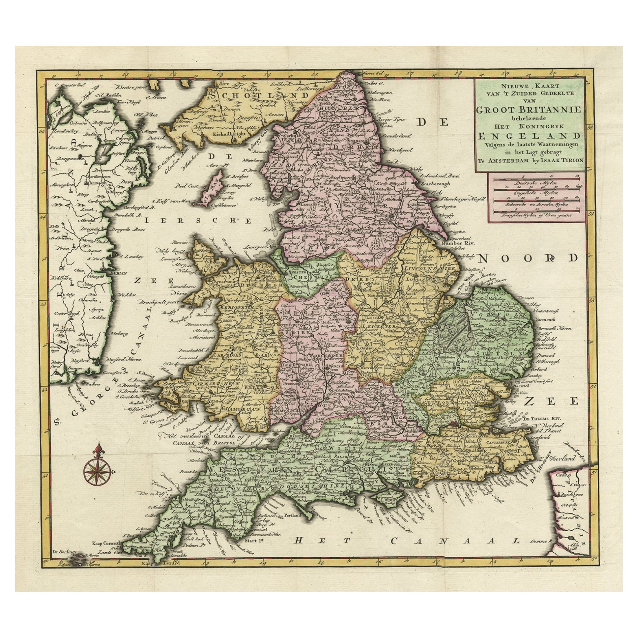
Antique Map of the South Part of Great Britain by Tirion, c.1750
By Isaak Tirion
Located in Langweer, NL
Antique map titled 'Nieuwe Kaart van 'T Zuider Gedeelte van Groot Britannie behelzende Het Koningryk Engeland (..).'
Attractive map showing the south part of Great Britain; the K...
Category
Antique 18th Century Maps
Materials
Paper
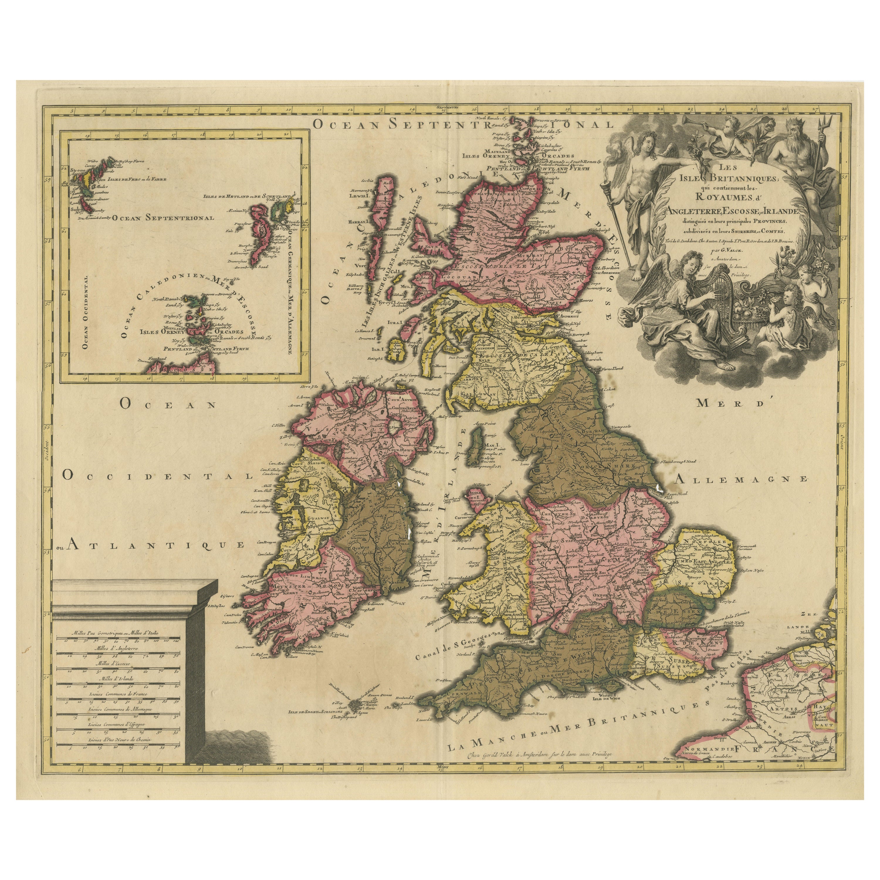
Rare Hand-colored Map of the British Isles by Gerard Valk, Published circa 1700
Located in Langweer, NL
Map of the British Isles by Gerard Valk circa 1700 – Hand-Colored Engraving
This elegant copperplate engraving titled *Les Isles Britanniques, qui contiennent les Royaumes d'Anglete...
Category
Antique Early 1700s Dutch Maps
Materials
Paper

Antique Map of England and Ireland by Lattre, 1789
Located in Langweer, NL
Antique map titled 'Les Royaumes d'Angleterre d'Ecosse et d'Irlande'. Original antique map of England and Ireland. Originates from 'Petit Atlas ...
Category
Antique 18th Century Maps
Materials
Paper

Antique Map of England with French Title, 1806
Located in Langweer, NL
Antique map titled 'L'Angleterre.' Map of England by Robert de Vaugondy, revised and published by Delamarche in 1806. Source unknown, to be determined.
...
Category
Antique 19th Century Maps
Materials
Paper
Antique Map of the British Isles by H. Chatelain, 1719
By Henri-Abraham Chatelain
Located in Langweer, NL
Beautiful hand colored large format map of the British Isles, with large insets of the Eastern and Western Hemispheres and the coats of arms for Engl...
Category
Antique Early 18th Century Maps
Materials
Paper

More Ways To Browse
Antique Hand Chain
King Louis Xiv
Putti Angels
Hand Colored French Engravings
Tattoo Nude
Toshio Iezumi
Used Cremation Urns
Vintage Beach Boys
Vintage Electric Chair
Vintage Taxi Cabs
Wild Bunch
Yves Klein Blue
1950 Fashion Illustrations
Antique Poster Food
Arman Resin
Baroque Painting Angel
Botanical Print Rose
Bronze Hippo