Mid-19th Century Landscape Prints
to
21
712
206
29
17
2
Overall Width
to
Overall Height
to
511
18
11
5
3
1
96
48
34
22
18
1,016
2,097
9,950
4,107
117
119
689
516
588
1,111
1,475
1,737
1,302
598
657
707
258
1
588
207
181
126
121
93
91
80
78
73
63
62
52
51
49
48
45
42
39
34
650
190
126
102
63
66
710
411
261
Period: Mid-19th Century
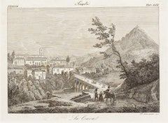
La Cava (The Cave) - Etching by Francesco Mochetti - 1843
Located in Roma, IT
Image dimensions: 14.7 x 19.8 cm.
La Cava is an original black and white etching on paper, printed in 1843 as a plate of the print suite "90 Views of the citi...
Category
Modern Mid-19th Century Landscape Prints
Materials
Etching
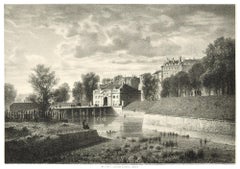
Interieur de Geneve. Porte Neuve - Lithograph by A. Fontanesi
Located in Roma, IT
Image dimensions: 15 x 22 cm.
This splendid lithograph Interieur de Geneve. Porte Neuve is part of the series of 20 prints dedicated to views of the city of Geneva, engraved by the ...
Category
Mid-19th Century Landscape Prints
Materials
Lithograph
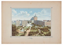
Colberg - Original Lithograph Mid 19° Century
Located in Roma, IT
Image dimensions: 17.6 x 24.4 cm.
Colberg is a beautiful color lithograph on paper, printed by von Led Kempner and published by von Schaffstein and C. Koln, Rhein.
This modern art...
Category
Mid-19th Century Landscape Prints
Materials
Lithograph
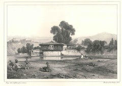
Au Bord d'une Rivière - Original Lithograph by A. Decamps
Located in Roma, IT
Au Bord d'une Rivière is an original artwork realized by Alexandre Decamps in 1831.
Original lithograph on paper.
Very good conditions.
Original artwork representing a river with ...
Category
Mid-19th Century Landscape Prints
Materials
Lithograph
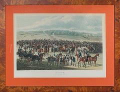
"The Betting Post At Epsom" 1836 by James Pollard
Located in Bristol, CT
Hand-colour sporting plate by James Pollard (1792-1867)
Title: Epsom, The Betting Post
Published 1836 by Ackermann & Co
Print Sz: 14"H x 19 1/2"W
Frame Sz: 20"H x 26"W
w/ birds...
Category
Mid-19th Century Landscape Prints
Materials
Lithograph
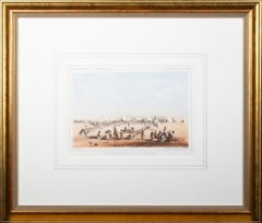
'Distribution of Goods to the Assiniboines' original John Mix Stanley lithograph
Located in Milwaukee, WI
In the mid-nineteenth century, the United States government set out to survey and document its newly acquired lands and territories west of the Mississippi. The goals of these surveys were manifold: to produce topographical maps, to document flora and fauna, and to document natural resources to build the emerging US economy. These surveys, and the images from them, also functioned to build the new sense of American identity with the landscape, condensing vistas into the 'picturesque' tradition of European image making. Thus, the entire span of US territory could be seen as a single, cohesive whole.
This lithograph comes from one of six surveys commissioned by the Army's Topographic Bureau in 1853, which sought to find the best route to construct a transcontinental railroad. The result was a thirteen-volume report including maps, lithographs, and technical data entitled 'Explorations and Surveys to ascertain the most practicable and economical route for a Railroad from the Mississippi river to the Pacific Ocean.'
When it came to depicting the Assiniboine people, as seen in the present print, Stanley chose to juxtapose their encampment, marked by tipis in the distance, with the encampment of the Isaac Stevens survey party. In the foreground, commemorating this moment, Isaac Stevens can be seen presenting trade goods, which are known to include thirty two dressed skins and two robes. The survey leader Isaac Stevens noted being grateful for the generosity of the Assiniboine, commenting: "I felt very grateful indeed to those Indians, for their kindness to my men, their proffer of kind feeling and hospitality to myself and the survey." This description and this image, however, are arguably depicted through rose-colored glasses: to the Assiniboine people, this meeting may well have included stressful diplomatic relationships and have indicated a threat to the sovereignty over the territories agreed to be theirs by the 1851 Treaty of Fort Laramie.
5.75 x 8.75 inches, image
6.5 x 9.25 inches, stone
17 x 19.75 inches, frame
Artist 'Stanley Del.' lower left
Entitled 'Distribution of Goods to the Assiniboines' lower center margin
Publisher 'Sarony, Major & Knapp. Lith.s 449 Broadway N.Y.' lower right
Inscribed 'U.S.P.R.R. EXP. & SURVEYS — 47th & 49th PARALLELS' upper left
Inscribed 'GENERAL REPORT — PLATE XIV' upper right
Framed to conservation standards using 100 percent rag matting with French accents; glazed with UV5 Plexiglas to inhibit fading; housed in a gold reverse ogee moulding.
Print in overall good condition; some localized foxing and discoloration; frame in excellent condition.
John Mix Stanley...
Category
Romantic Mid-19th Century Landscape Prints
Materials
Lithograph
'Lieutenant Crovers Despatch – Return of Governor Stevens to Fort Benton'
Located in Milwaukee, WI
In the mid-nineteenth century, the United States government set out to survey and document its newly acquired lands and territories west of the Mississippi. The goals of these surveys were manifold: to produce topographical maps, to document flora and fauna, and to document natural resources to build the emerging US economy. These surveys, and the images from them, also functioned to build the new sense of American identity with the landscape, condensing vistas into the 'picturesque' tradition of European image making. Thus, the entire span of US territory could be seen as a single, cohesive whole.
This lithograph comes from one of six surveys commissioned by the Army's Topographic Bureau in 1853, which sought to find the best route to construct a transcontinental railroad. The result was a thirteen-volume report including maps, lithographs, and technical data entitled 'Explorations and Surveys to ascertain the most practicable and economical route for a Railroad from the Mississippi river to the Pacific Ocean.' In particular, the print comes from the northern survey, commanded by Isaac Stevens, which explored the regions between the 47th and 49th parallels.
5.75 x 8.75 inches, image
6.5 x 9.25 inches, stone
17 x 20 inches, frame
Artist 'Stanley Del.' lower left
Entitled 'Lieutenant Crovers Despatch – Return of Governor Stevens to Fort Benton' lower center margin
Publisher 'Sarony, Major & Knapp. Lith.s 449 Broadway N.Y.' lower right
Inscribed 'U.S.P.R.R. EXP. & SURVEYS — 47th & 49th PARALLELS' upper left
Inscribed 'GENERAL REPORT — PLATE XXXVII' upper right
Framed to conservation standards using 100 percent rag matting with French accents; glazed with UV5 Plexiglas to inhibit fading; housed in a gold reverse ogee moulding.
Print in overall good condition; some localized foxing and discoloration; minor surface abrasions to frame.
John Mix Stanley...
Category
Romantic Mid-19th Century Landscape Prints
Materials
Lithograph
Facade of the Pronaos of the Temple of Edfou - David Roberts - orientalist
Located in London, GB
David Roberts
1796 - 1864
Facade of the Pronaos of the Temple of Edfou
First Edition lithograph
Full plate: 208
Presented in a acid free mount
We have all 250 of the Lithograph set...
Category
Mid-19th Century Landscape Prints
Materials
Lithograph
Kom Ombo - David Roberts - Orientalist
Located in London, GB
David Roberts
1796 - 1864
Kom Ombo
First Edition lithograph
Full plate: 210
Presented in an acid free mount
Category
Mid-19th Century Landscape Prints
Materials
Lithograph
Boston
Located in Missouri, MO
John William Hill (1812-1879)
"Boston" 1857
Hand-Colored Engraving
Site Size: 29 x 41 inches
Framed Size: 39 x 52 inches
Born in London, England, John William Hill came to America with his family at age 7. His father, John Hill, was a well-known landscape painter, engraver, and aquatintist. John William had a career of two phases, a city topographer-engraver and then, the leading pre-Rafaelite school painter in this country. Employed by the New York Geological Survey and then by Smith Brothers...
Category
Pre-Raphaelite Mid-19th Century Landscape Prints
Materials
Engraving, Aquatint
Price Upon Request
