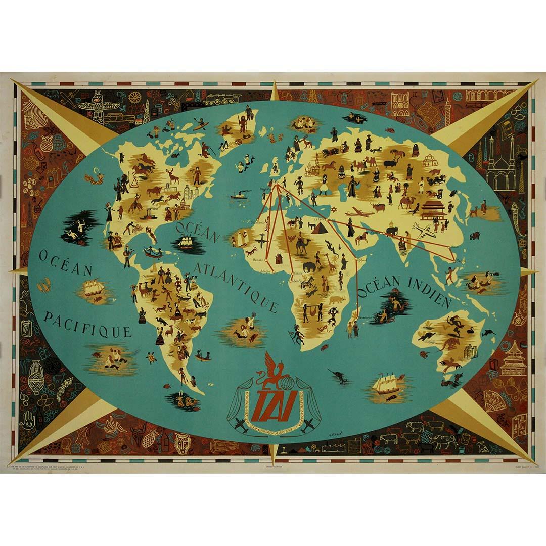
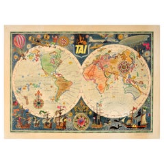
Items Similar to Circa 1950 original poster by Luc-Marie Bayle for TAI - World map


Want more images or videos?
Request additional images or videos from the seller
1 of 8
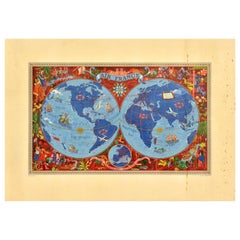
Lue Marie BayleCirca 1950 original poster by Luc-Marie Bayle for TAI - World mapCirca 1950
Circa 1950
$1,793.42
£1,327.67
€1,500
CA$2,481.65
A$2,735.96
CHF 1,431.37
MX$33,565.17
NOK 18,018.08
SEK 16,849.75
DKK 11,426.08
About the Item
This circa 1950 original poster, created by Luc-Marie Bayle, celebrates the global reach of TAI (Transports Aériens Intercontinentaux), one of France’s pioneering airline companies. With its elaborate and decorative cartographic design, the poster is a stunning blend of aviation history, adventure, and artistic craftsmanship.
Bayle, a naval officer, artist, and illustrator, was renowned for his detailed and whimsical map-style illustrations, often incorporating historical and maritime elements. This world map, presented in a double-hemisphere format, is rich in symbolic imagery, compass roses, and stylized routes, highlighting TAI’s international air connections.
The poster pays homage to the evolution of travel, featuring sailing ships, hot air balloons, and vintage aircraft, while the airline’s modern planes soar through the sky, marking the dawn of a new era in intercontinental air travel. The TAI logo, emblazoned with a mythical griffin, reinforces the company's identity as a leader in long-distance flights.
Founded in 1946, TAI played a crucial role in expanding French aviation across Africa, Asia, and the Pacific, before merging with UTA (Union de Transports Aériens) in 1963. This poster not only serves as an advertisement but also as a work of art that captures the romance of global exploration and the golden age of aviation.
A true collector’s piece, this mid-century travel poster embodies the excitement and elegance of post-war air travel, making it a standout example of vintage airline advertising.
Airline - Planisphere - Map
Printed by Hubert Baille in Paris
- Creator:Lue Marie Bayle (French)
- Creation Year:Circa 1950
- Dimensions:Height: 22.84 in (58 cm)Width: 31.5 in (80 cm)
- Medium:
- Period:
- Condition:Very good condition.
- Gallery Location:PARIS, FR
- Reference Number:1stDibs: LU1792215957062
About the Seller
5.0
Gold Seller
Premium sellers maintaining a 4.3+ rating and 24-hour response times
Established in 2021
1stDibs seller since 2022
171 sales on 1stDibs
Typical response time: 1 hour
- ShippingRetrieving quote...Shipping from: PARIS, France
- Return Policy
Authenticity Guarantee
In the unlikely event there’s an issue with an item’s authenticity, contact us within 1 year for a full refund. DetailsMoney-Back Guarantee
If your item is not as described, is damaged in transit, or does not arrive, contact us within 7 days for a full refund. Details24-Hour Cancellation
You have a 24-hour grace period in which to reconsider your purchase, with no questions asked.Vetted Professional Sellers
Our world-class sellers must adhere to strict standards for service and quality, maintaining the integrity of our listings.Price-Match Guarantee
If you find that a seller listed the same item for a lower price elsewhere, we’ll match it.Trusted Global Delivery
Our best-in-class carrier network provides specialized shipping options worldwide, including custom delivery.More From This Seller
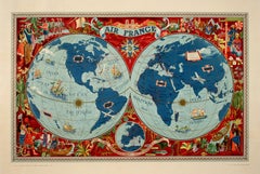
View AllCirca 1950 airline poster by Luc-Marie Bayle - TAI Planisphère
Located in PARIS, FR
This enchanting original circa 1950 airline poster by French naval officer and artist Luc-Marie Bayle was created for TAI (Transports Aériens Intercontinentaux), one of France’s most...
Category
1950s Prints and Multiples
Materials
Paper, Lithograph
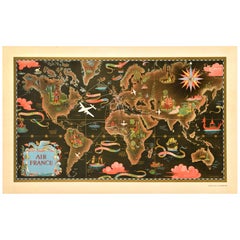
Circa 1950 Original travel poster - T.A.I. - French airline
Located in PARIS, FR
This stunning original travel poster, created around 1950 by French illustrator F. Lesourt, was commissioned by the Compagnie de Transports Aériens Intercontinentaux (TAI), a prestig...
Category
1950s Prints and Multiples
Materials
Paper, Lithograph

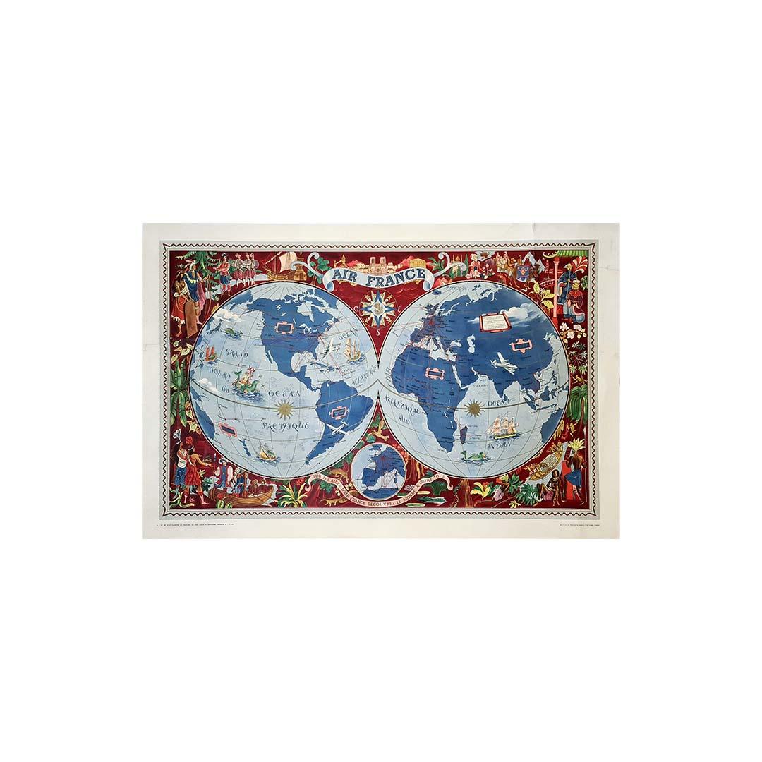
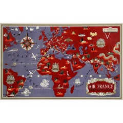
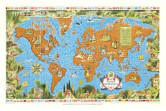
1953 Lucien Boucher Original poster for Air France - Planisphere - Aviation
By Lucien Boucher
Located in PARIS, FR
Lucien Boucher 🇫🇷 (1889 - 1971) was a French painter, engraver, poster artist and draftsman.
He studied ceramics at the Sèvres school before being sent to the front in 1914.
Taken ...
Category
1950s Prints and Multiples
Materials
Paper, Lithograph, Linen

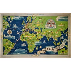
Circa 1950 Air France "Réseau Aérien Mondial" world map by Lucien Boucher
By Lucien Boucher
Located in PARIS, FR
The circa 1950 Air France "Réseau Aérien Mondial" poster, designed by French illustrator Lucien Boucher, is a vivid representation of the ai...
Category
1950s Prints and Multiples
Materials
Paper, Lithograph
1937 Original planisphere by Lucien boucher - World map
By Lucien Boucher
Located in PARIS, FR
Original poster
Airline Company - Map - Tourism
West - Northern - Orient - Midi
In 1937, Lucien Boucher, a renowned French illustrator, unveiled his masterpiece, the "Planisphère ...
Category
1930s Prints and Multiples
Materials
Linen, Lithograph, Paper
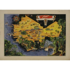
Original map poster by G. Carriat Rolant for AOF (Afrique Occidentale Française)
Located in PARIS, FR
The circa 1950 original map poster by G. Carriat Rolant for AOF (Afrique Occidentale Française) is a notable example of mid-20th-century cartographic art and colonial-era representation. Numbered 584 out of 1000, this limited-edition piece was edited by Paul Bory...
Category
1950s Prints and Multiples
Materials
Lithograph, Paper
You May Also Like
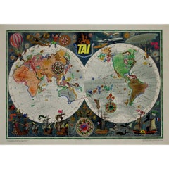
Original Vintage Travel Poster TAI Airline Planisphere Map Luc Marie Bayle
Located in London, GB
Original vintage travel advertising poster - TAI Transports Aeriens Intercontinentaux Map of the World - Colourful planisphere by Luc-Marie Bayle (1914-2000) showing the airline's ro...
Category
Vintage 1960s French Posters
Materials
Paper
Original Vintage Travel Poster Air France Planisphere Illustrated Map Boucher
By Lucien Boucher
Located in London, GB
Original vintage travel poster advertising Air France featuring a stunning planisphere design by the French artist Lucien Boucher (1889-1971). C...
Category
Vintage 1950s French Posters
Materials
Paper
Original Vintage Travel Route Poster Air France Planisphere Map Lucien Boucher
By Lucien Boucher
Located in London, GB
Original vintage planisphere travel route map poster promoting Air France the global air network of the French national airline carrier. Design by Lucien Boucher (1889-1971) featurin...
Category
Vintage 1940s French Posters
Materials
Paper
Original Air France Map Poster Planishere Created by Lucien Boucher in 1952
By Lucien Boucher
Located in Boca Raton, FL
This is one a series of well-designed maps by Lucien Boucher for Air France during the 1950's. This image, created in 1952, colorfully presents the routes of Air France as well as vi...
Category
1950s Prints and Multiples
Materials
Lithograph
Original 100 Years of the Red Cross World Map vintage planisphere poster
By Lucien Boucher
Located in Spokane, WA
This is a vintage poster titled "Realisation de la Ligue de la Croix-Rouge, Geneva," commemorating one hundred years of the Red Cross from 1863 to 1963. Due to its folds, the poster ...
Category
1960s American Modern Landscape Prints
Materials
Lithograph
Antique World Map by P. Schenk '1706'
By Peter Schenk
Located in Langweer, NL
Antique map titled 'Diversa Orbis Terrae. Visu Incedente per Coluros Tropicorum, Ambos Ejus Polos, et Parciularis Sphaerae Zenith, in Planum Orthographica Projectio (..) Plat Ontwerp van verscheyde Aert-klooten (..)'. One of the earliest Dutch World Maps to focus on a more modern cartographic style, based on Carel Allard's map of 1696. This map represented a noteworthy shift from the traditional decorative Dutch 17th century maps where the margins would be full of classical mythological...
Category
Antique Early 18th Century Maps
Materials
Paper

$5,165 Sale Price
20% Off
More Ways To Browse
World Map
Hemispheres Map
Naval Aviation Poster
Tai Poster
Carlos Merida
Danish Lithographs
Donald Sultan Poppies
Paintings By George W Bush
Picasso Carmen
The Twelve Apostles
Vintage Calendar Prints
Vintage Government Posters
American Airlines Vintage Posters
Battle Of Britain
Canyon De Chelly
David Klein Twa
David Roberts Egypt
Fisherman Etching