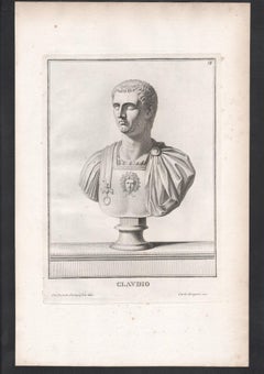
Set of 9 Roman Emperor bust C18th Grand Tour engravings, c1750
View Similar Items

Want more images or videos?
Request additional images or videos from the seller
1 of 10
Carlo GregoriSet of 9 Roman Emperor bust C18th Grand Tour engravings, c17501750
1750
About the Item
- Creator:Carlo Gregori (1719 - 1759)
- Creation Year:1750
- Dimensions:Height: 11.03 in (28 cm)Width: 7.09 in (18 cm)
- Medium:
- Movement & Style:
- Period:
- Condition:Some foxing spots - see photos.
- Gallery Location:Melbourne, AU
- Reference Number:1stDibs: LU124426302612
About the Seller
5.0
Platinum Seller
Premium sellers with a 4.7+ rating and 24-hour response times
Established in 2005
1stDibs seller since 2019
576 sales on 1stDibs
Typical response time: 2 hours
Authenticity Guarantee
In the unlikely event there’s an issue with an item’s authenticity, contact us within 1 year for a full refund. DetailsMoney-Back Guarantee
If your item is not as described, is damaged in transit, or does not arrive, contact us within 7 days for a full refund. Details24-Hour Cancellation
You have a 24-hour grace period in which to reconsider your purchase, with no questions asked.Vetted Professional Sellers
Our world-class sellers must adhere to strict standards for service and quality, maintaining the integrity of our listings.Price-Match Guarantee
If you find that a seller listed the same item for a lower price elsewhere, we’ll match it.Trusted Global Delivery
Our best-in-class carrier network provides specialized shipping options worldwide, including custom delivery.More From This Seller
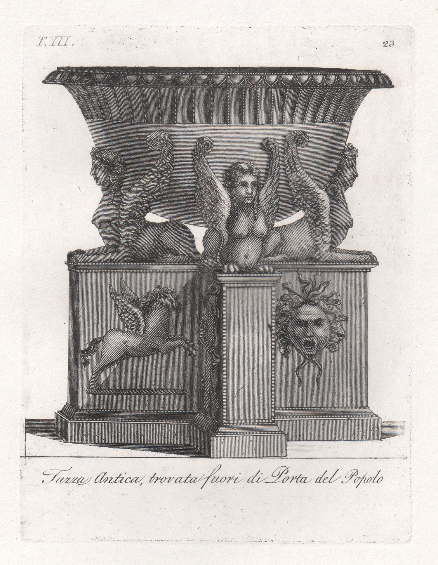
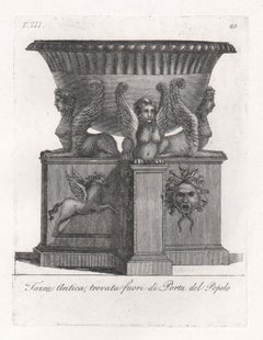
View AllClassical Roman vase, early 19th century Italian Grand Tour engraving, c1820
By Carlos Antonini
Located in Melbourne, Victoria
Italian Neoclassical engraving depicting the Roman bronze and marble vases in collections of antiquities in Rome. Circa 1820.
175mm by 130mm (platemark) 330mm by 215mm (sheet size)
Category
Early 19th Century Renaissance More Prints
Materials
Engraving
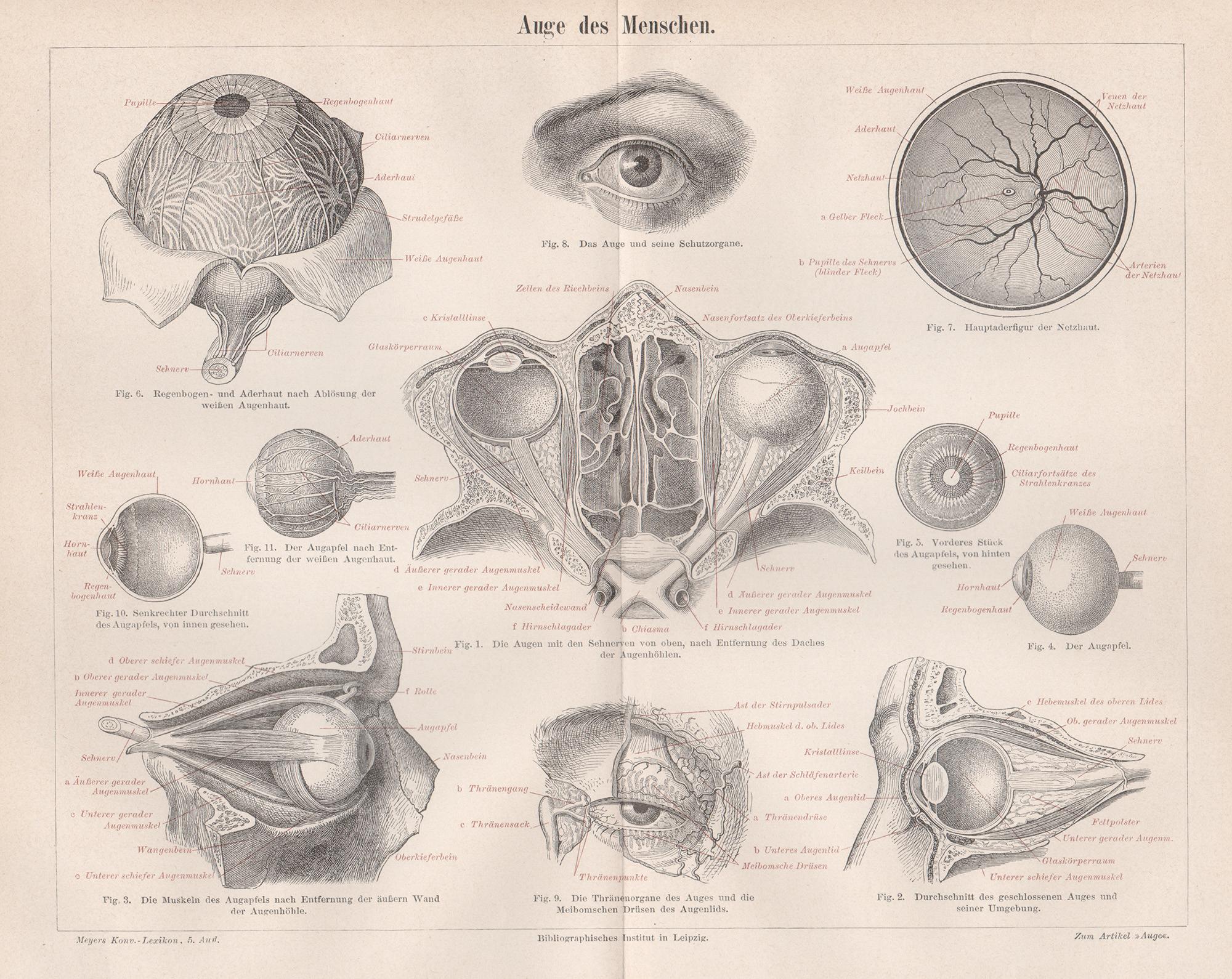
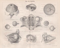
Human Eye, German antique medical anatomy wood-engraving print
Located in Melbourne, Victoria
'Auge des Menschen'
(Human Eye)
German wood-engraving, circa 1895. Central vertical fold as issued.
240mm by 305mm (sheet)
Category
Late 19th Century Naturalistic More Prints
Materials
Engraving
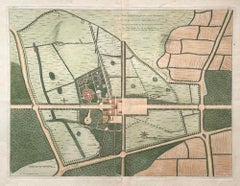
Plan of the Park, Garden and Plantations of Goodwood, 18th century engraving
By Colen Campbell
Located in Melbourne, Victoria
Plan of the Park, Garden and Plantations of Goodwood in Sussex the Seat of his Grace the Duke of Richmond and Lenox &c
Copper-line engraving with later hand-colouring by Hendrik Hul...
Category
18th Century English School Landscape Prints
Materials
Engraving
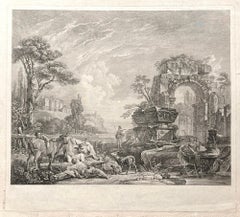
Les Bergers Romains, landscape with Roman ruins, 18th century engraving
Located in Melbourne, Victoria
Les Bergers Romains
Copper-line engraving by Jean Jacques Leveau (1729-1786) after Pierre Mettay (1728-1759). C1755.
Proof, before lettering. Laid, watermarked paper.
A landscap...
Category
18th Century French School Landscape Prints
Materials
Engraving
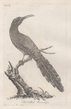
Red-billed Promerops, 18th century bird engraving by John Latham
By John Latham
Located in Melbourne, Victoria
Copper-line engraving. 1781. From John Latham's 'General Synopsis of Birds' 1781-1785, and its Supplements. Plate number top left. Laid paper.
John Latham was the leading English or...
Category
Late 18th Century Naturalistic Animal Prints
Materials
Engraving
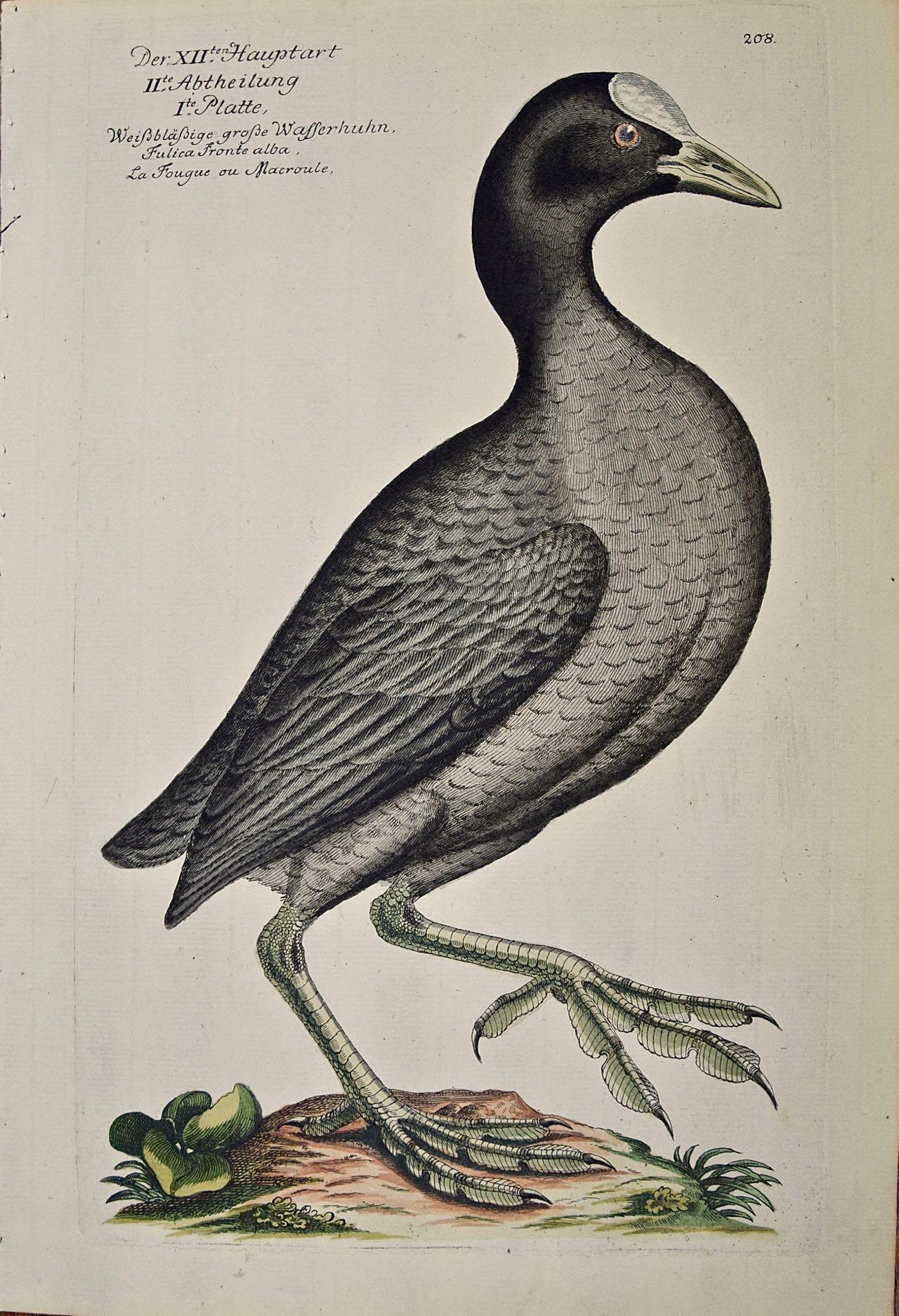
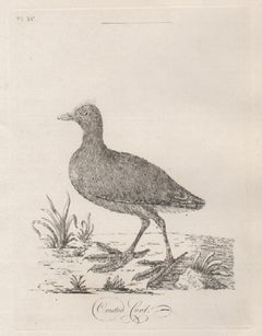
Crested Coot, 18th century bird engraving by John Latham
By John Latham
Located in Melbourne, Victoria
Copper-line engraving. 1781. From John Latham's 'General Synopsis of Birds' 1781-1785, and its Supplements. Plate number top left. Laid paper.
John Latham was the leading English or...
Category
Late 18th Century Naturalistic Animal Prints
Materials
Engraving
You May Also Like
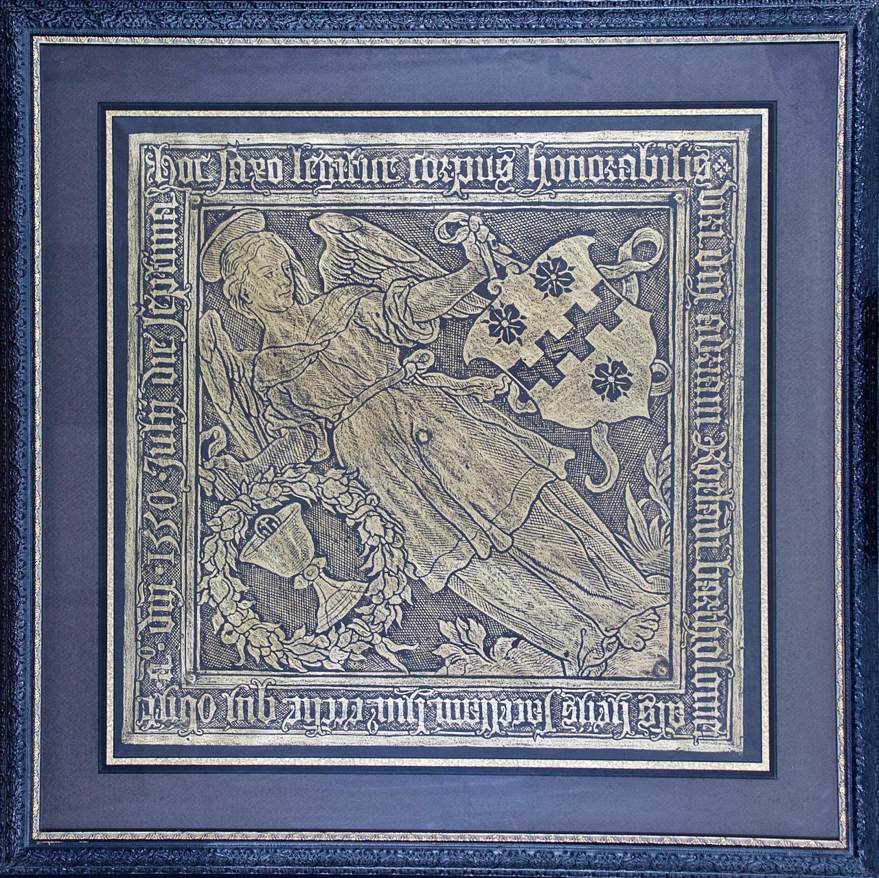
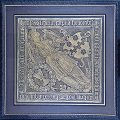
Framed Rubbing of 1550 Brass Monument in Grote Kerk Church, Breda, Netherlands
Located in Alamo, CA
This is an engraving of a tomb monument rubbing that has been highlighted with gold color on a dark grey to black background. The rubbing is of a brass plaque on a stone slab. It has...
Category
16th Century Northern Renaissance Figurative Prints
Materials
Engraving
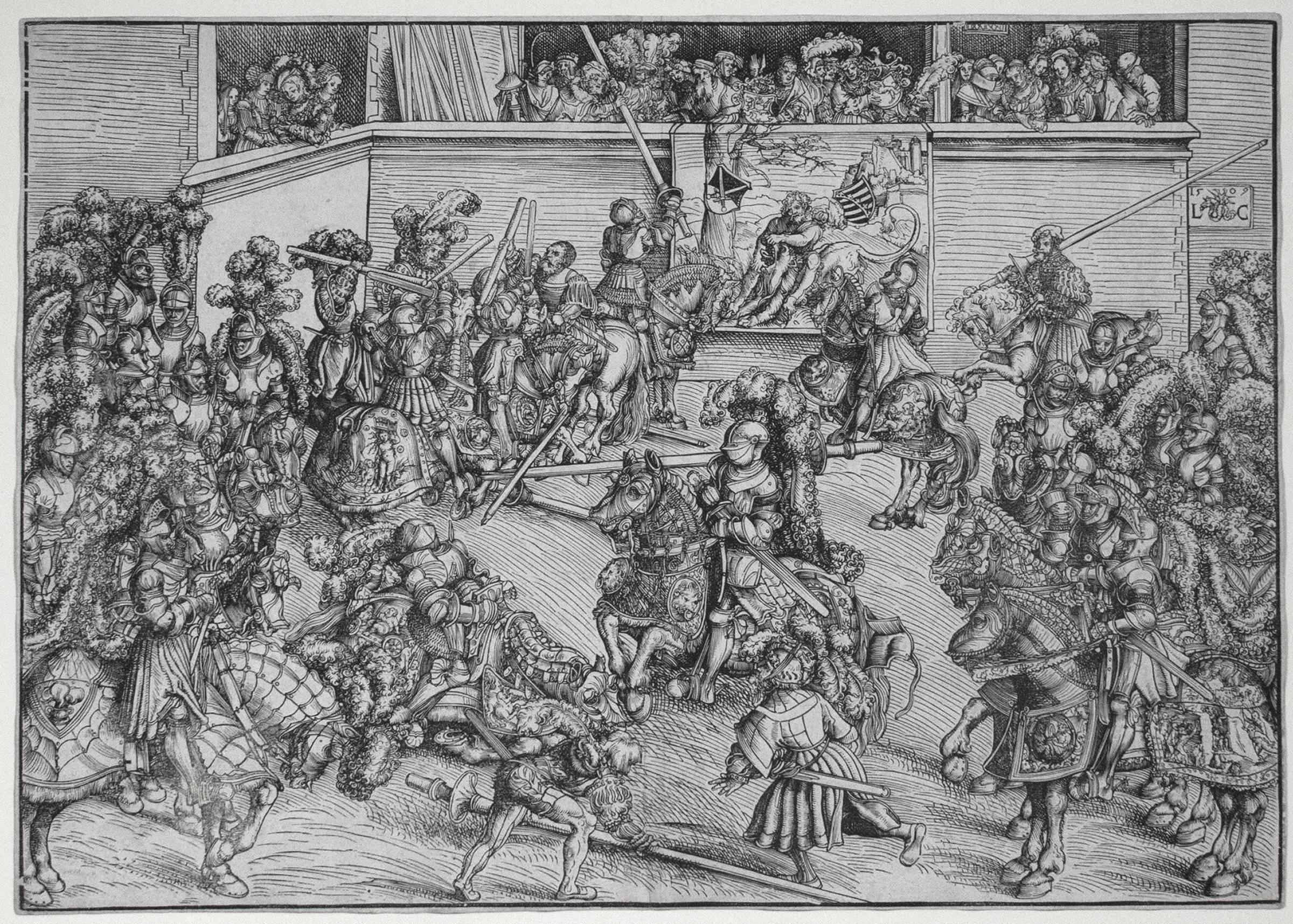
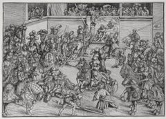
The Second Tournament with the Tapestry of Samson and the Lion
By Lucas Cranach the Elder
Located in Chicago, IL
Watermark:
Bull's Head with Serpent and Cross (Briquet 1575, dated 1492 by Briquet)
Provenance:
Martin Folkes (Lugt 1034)
Reverend G. L. Blake (Lugt 1172)
Reference:
Bartsc...
Category
18th Century and Earlier Northern Renaissance More Prints
Materials
Woodcut
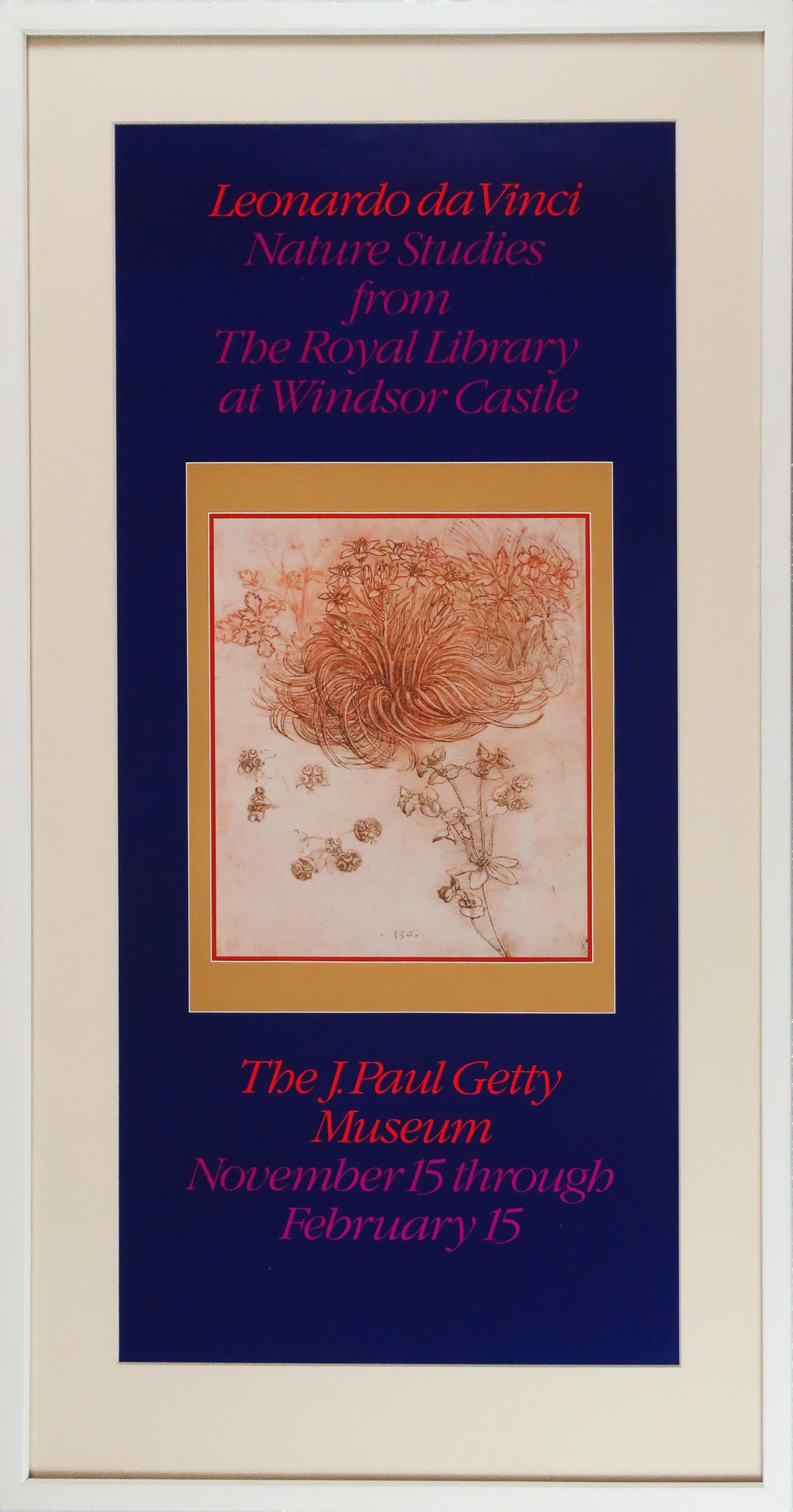
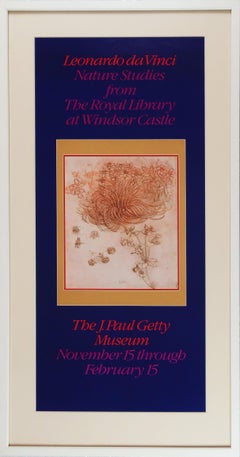
Nature Studies from the Royal Library at Windsor Castle
By Leonardo da Vinci
Located in New York, NY
Leonardo da Vinci
"Nature Studies from the Royal Library at Windsor Castle"
The J. Paul Getty Museum, November 15, 1980 - February 15, 1981
Exhibition Poste...
Category
15th Century and Earlier Renaissance Still-life Prints
Materials
Offset
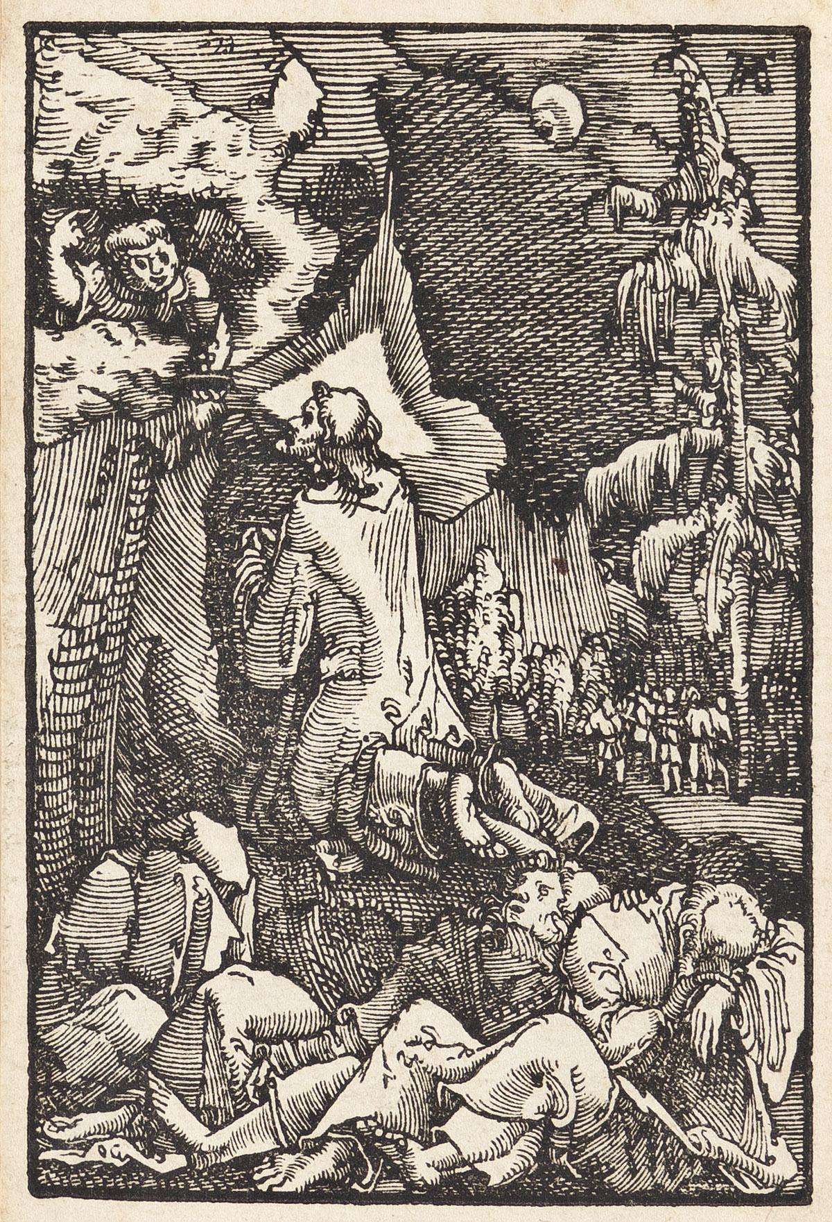
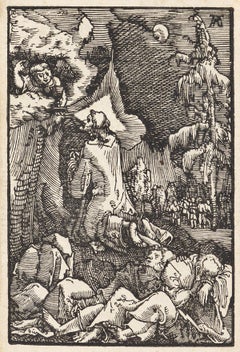
Christ on the Mount of Olives
By Albrecht Altdorfer
Located in New York, NY
A brilliant and early impression of this woodcut. Dark, well-inked, with strong contrasts and no sign of wear. From "The Fall and Salvation of Mankind Through the Life and Passion of Christ."
Category
16th Century Renaissance Figurative Prints
Materials
Woodcut
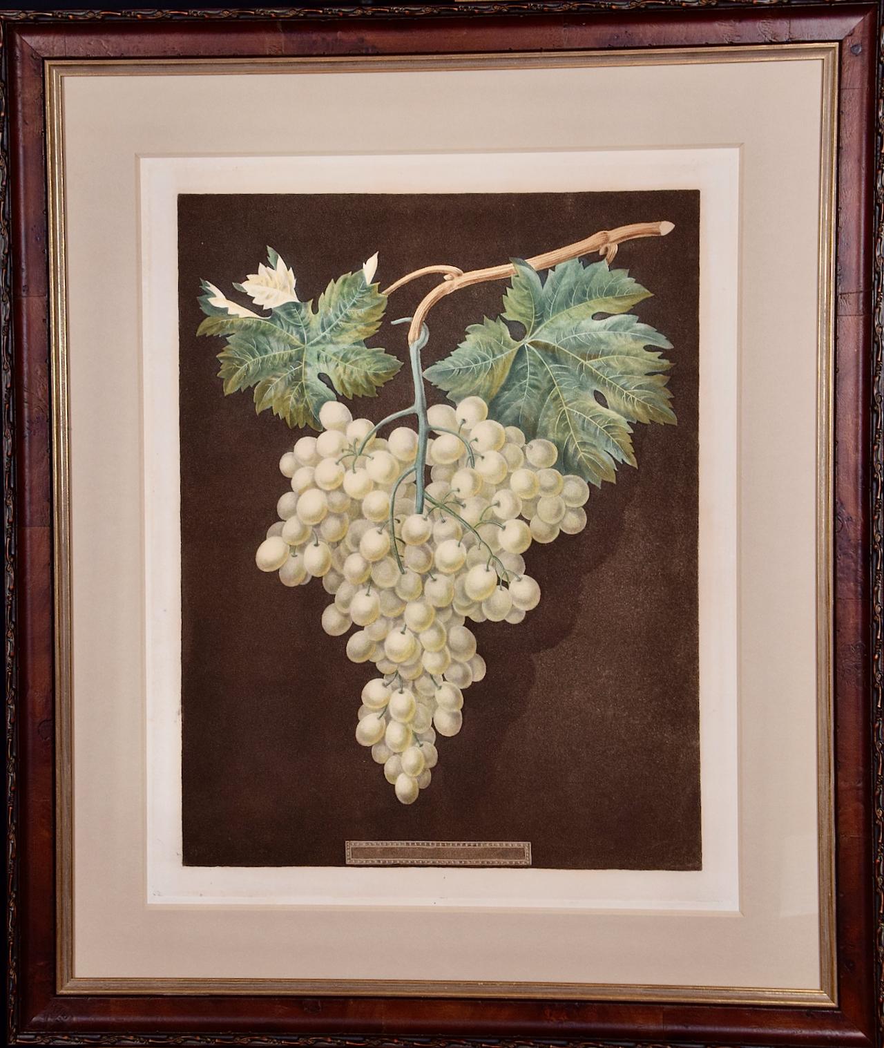
White Hamburgh Grape: A Framed 19th C. Color Engraving by George Brookshaw
By George Brookshaw
Located in Alamo, CA
This is a 19th century colored aquatint and stipple engraving finished by hand entitled "White Hamburgh Grape", drawn and engraved by George Brookshaw and published in London in 1812 as plate 60 in his 'Pomona Britannica; or, A Collection of the Most Esteemed Fruits'. It depicts a cluster of pale green grapes still on the vine. The vine and leaves are shown in attractive shades of green and brown. The plant lays on a brown textured background with shadows to impart 3-dimensionality. The scene is reminiscent of an engraving in an 18th century artistically stylized human anatomy atlas. There is a light brown title rectangle in the lower center which is blank, suggesting this may be a more rare preproduction proof. There are wide white margins.
This striking engraving is presented in a reddish brown decorative wood frame with a darker brown scroll-work outer trim and a gold-colored inner fillet and a thick light beige mat. The frame measures 26" high, 22" wide and 1.13" deep. It is glazed with UV conservation glass. There is a tiny spot in the lower margin on the left and another in the left margin. The print and frame are otherwise in excellent condition.
There is a second Brookshaw engraving that is framed in identical moulding, although a slightly different size and a different color mat. It depicts a Silver Rock Melon. The two prints would make a striking display pairing...
Category
Early 19th Century Naturalistic Still-life Prints
Materials
Engraving, Aquatint

Map of the World: An Original 18th Century Hand-colored Map by E. Bowen
Located in Alamo, CA
This is an original 18th century hand-colored map entitled "A New & Correct Chart of All The Known World Laid down according to Mercator's Projection" by Emanuel Bowen. It was published in 1744 in London in John Harris's "Navigantium atque Itinerantium Bibliotheca" or "A Complete Collection of Voyages and Travels". This highly detailed and colorful map depicts the world. as it was known in the mid 18th century. A majority of the northern and central portions of Canada and America are left blank due to the purity of knowledge at the time this map was published.
The map is embellished with four Compass Roses in the lower left, lower center, lower right and center, along with many rhumb lines. There a is a decorative title cartouche in the upper left. This colorful, attractive, historical and interesting 1744 map presents the entire world on Mercator's projection as it was understood in the middle part of the 18th century, before the landmark explorations of Captain’s Cook, Vancouver, Wilkes and others. It is an example of a nautical chart, a type of map that was designed specifically for use by mariners. The map is centered on the equator and includes both the Eastern and Western Hemispheres. The continents of North America, South America, Europe, Africa, and Asia are depicted, as well as various islands in the Atlantic, Pacific, and Indian Oceans. The map is laid out according to the Mercator projection, a type of cylindrical map projection that was developed in the 16th century by Flemish cartographer Gerardus Mercator. This projection has the advantage of preserving angles and shapes, making it useful for navigation. The map presents a paucity of inland detail, particularly for the Americas, but major cities, geographical landmarks, and regions are included. Ocean currents and Tradewinds are identified, as well as the magnetic declination lines or magnetic variance, which refers to the difference between true north and compass north. The continents are color coded, enhancing the beauty of this map. The three compass roses indicate the directions of the cardinal points.
The depiction of the western coast of America, the Pacific and Australia are interesting. There was very little exploration of Australia between the navigations of William Damper in 1699 and Tobias Furneaux in 1773. Most of the maps detail relies on the 17th century Dutch expeditions to Australia's western coast, by Abel Tasman and William Janszoon. Van Diemen's Land (Tasmania) and New Guinea appear connected to the Australian continent. New Zealand appears as a single landmass. North of New Zealand there is a landmass labelled 'Ter d' St. Esprit' which probably represents the New Hebrides Islands. This map precedes the accurate exploration of the South Pacific and east coast of Australia by Captain James Cook later in the 18th century. The map includes ‘Drakes' Port,' the site where Sir Francis Drake supposedly landed in 1579 during his 1579 circumnavigation of the globe. Here he claimed territory for England, restocked, and repaired his vessels. Drake named the region New Albion. The exact location of Drake's Port is a cartographic mystery. Drake's Harbor is believed to be in the region of San Francisco Bay, Bodega Bay, San Pablo Bay...
Category
Mid-18th Century Old Masters Landscape Prints
Materials
Engraving
