Items Similar to Map of the County of Buckingham From an Actual Survey

Want more images or videos?
Request additional images or videos from the seller
1 of 5
Christopher & John GreenwoodMap of the County of Buckingham From an Actual Survey1817-1832
1817-1832
$550
£428.20
€486.93
CA$790.74
A$868.39
CHF 453.49
MX$10,364.59
NOK 5,745.28
SEK 5,354.82
DKK 3,636.77
About the Item
Cartographers Christopher (1786-1855) and John (1791-1867) Greenwood were surveyors from Yorkshire, who undertook an ambitious project to produce a series of large-scale maps of the counties of England, Wales and Scotland.The maps represent a remarkable and impressive surveying achievement forming an important record of the counties depicted.
In the years 1817-1832 the Greenwood brothers published the Atlas of The Counties of England from an Actual Survey. This Atlas was finely drafted and engraved and decorated with large vignettes of prominent buildings of the county. This map of Buckingham County is beautifully hand colored and is in very good condition. There is a vignette of Stowe House in the lower left corner.
- Creator:Christopher & John Greenwood (1786 - 1867)
- Creation Year:1817-1832
- Dimensions:Height: 25.25 in (64.14 cm)Width: 31 in (78.74 cm)
- Medium:
- Period:
- Condition:
- Gallery Location:Paonia, CO
- Reference Number:1stDibs: LU78033567391
About the Seller
4.9
Gold Seller
Premium sellers maintaining a 4.3+ rating and 24-hour response times
Established in 1978
1stDibs seller since 2017
131 sales on 1stDibs
Typical response time: 3 hours
- ShippingRetrieving quote...Shipping from: Paonia, CO
- Return Policy
More From This Seller
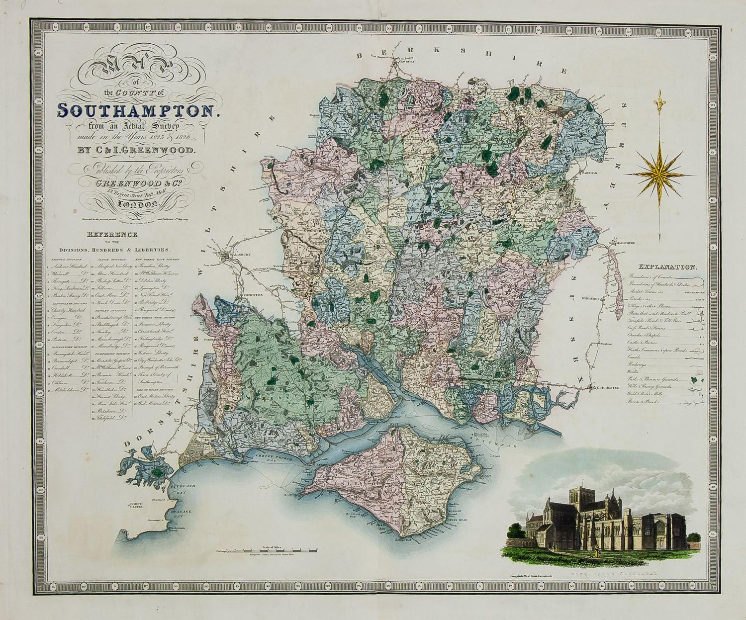
View AllEngland Map of the County of Southampton from an Actual Survey
Located in Paonia, CO
Cartographers Christopher (1786-1855) and John (1791-1867) Greenwood were surveyors from Yorkshire, who undertook an ambitious project to produce a series of large-scale maps of the counties of England, Wales and Scotland.The maps represent a remarkable and impressive surveying achievement forming an important record of the counties depicted.
In the years 1817-1832 the Greenwood brothers published the Atlas of The Counties of England from an Actual Survey. This Atlas was finely drafted and engraved and decorated with large vignettes of prominent buildings of the county. This map of Southampton County is beautifully hand colored and is in very good condition. There is a vignette of Winchester Cathedral...
Category
19th Century Other Art Style Landscape Prints
Materials
Engraving

Map of Tabula Geographica Territorium Civitatis Svevo=Hallensis by Homann 1762
By Homann Heirs
Located in Paonia, CO
Map of Tabula Geographica sistens Territorium Liberae Sacri Romani Imperi Civitatis Svevo=Hallensis in suas Praefecturas divisum unacum finitimis Regionibus delineata a Mattheo ...
Category
1760s Other Art Style More Prints
Materials
Engraving
Antique 1765 Wine Country Folding Map of France, Bordeau etc.
Located in Paonia, CO
Route du Carosse de Bordeaux, part de Paris tous les Mardis a 11 matin. a et pafse 1765 is a comprehensive map with two routes through the wine country of France starting in Paris going south...
Category
1760s Other Art Style Landscape Prints
Materials
Etching

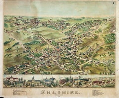
Birds Eye View of Cheshire Connecticut 1882 lithograph pub. by O. H. Bailey
Located in Paonia, CO
View of Cheshire, Connecticut, 1882. Original lithograph was drawn and published by O. H. Bailey & Co. , a prominent 19th century map maker. The map shows a bird’s eye view of the town as it used to be, including street names and old landmarks. Beautifully colored historic map...
Category
1880s Other Art Style Landscape Prints
Materials
Lithograph
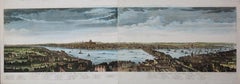
A View of London as it was in the Year 1647 pub. by Boydell 1756
Located in Paonia, CO
A View of London as it was in the Year 1647 is a hand colored copper engraving published by the well known British publisher and engraver John Boydell (1720-1804) and engraved by R.Benning sold at Cheapside London 1756. Panoramic view on two sheets conjoined as issued linen mounted. Lettered with title in French and English along the base of the image including a numbered key to the structures. In very good condition except for one 1/8 inch tear in the sky to the left of the middle seam that is barely noticeable. This is a large very detailed panorama of London...
Category
1750s Other Art Style Landscape Prints
Materials
Etching
Carte Particuliere Des Coste De Bretagne qui Comprend Morlaix
By Pierre Mortier
Located in Paonia, CO
Carte Particuliere Des Costes De Bretagne qui Comprend Morlaix, Saint Paul de Leon, les Sept Isles, et L’Isle. Faite par ordre Exprez Du Roy de France is from the collection of ch...
Category
1690s Landscape Prints
Materials
Engraving

You May Also Like
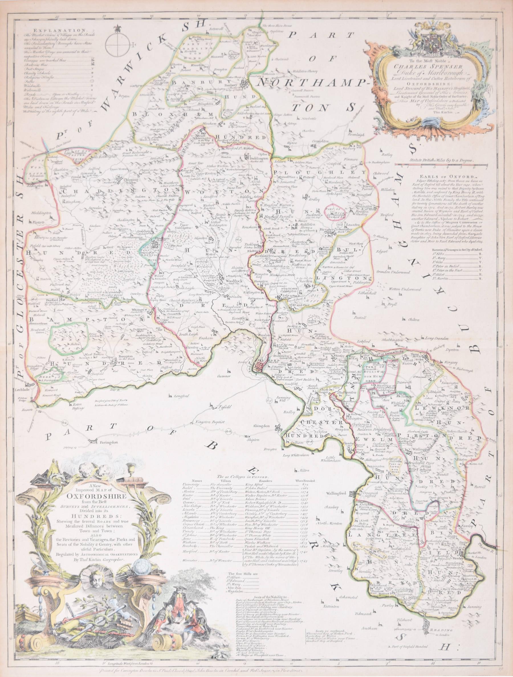
Map of Oxfordshire coloured 18th century engraving by Thomas Kitchin
By Thomas Kitchin
Located in London, GB
To see our other original maps, scroll down to "More from this Seller" and below it click on "See all from this Seller" - or send us a message if you cannot find the poster you want....
Category
1760s Landscape Prints
Materials
Engraving

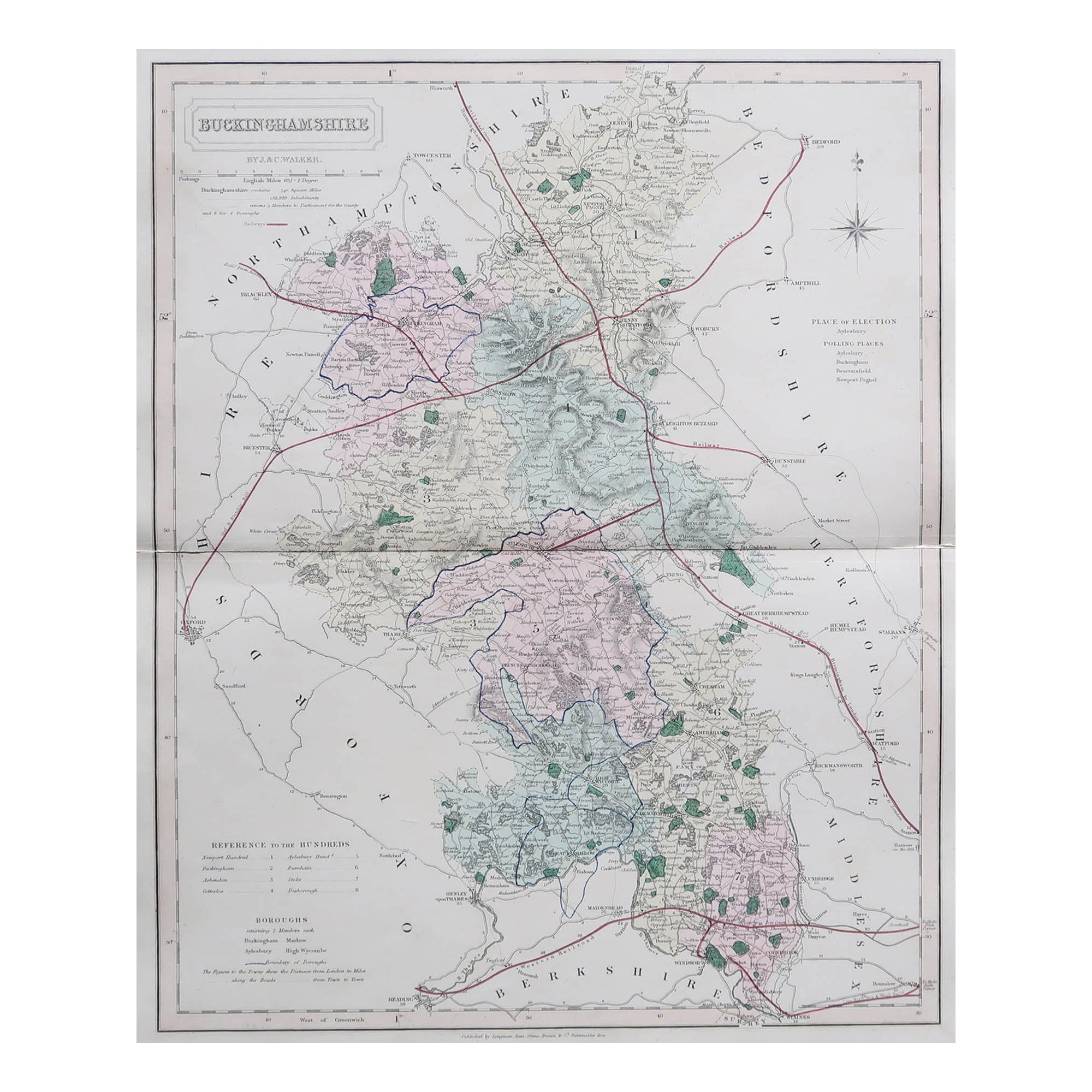
Original Antique English County Map, Buckinghamshire, J & C Walker, 1851
Located in St Annes, Lancashire
Great map of Buckinghamshire
Original colour
By J & C Walker
Published by Longman, Rees, Orme, Brown & Co. 1851
Unframed.
Category
Antique 1850s English Other Maps
Materials
Paper

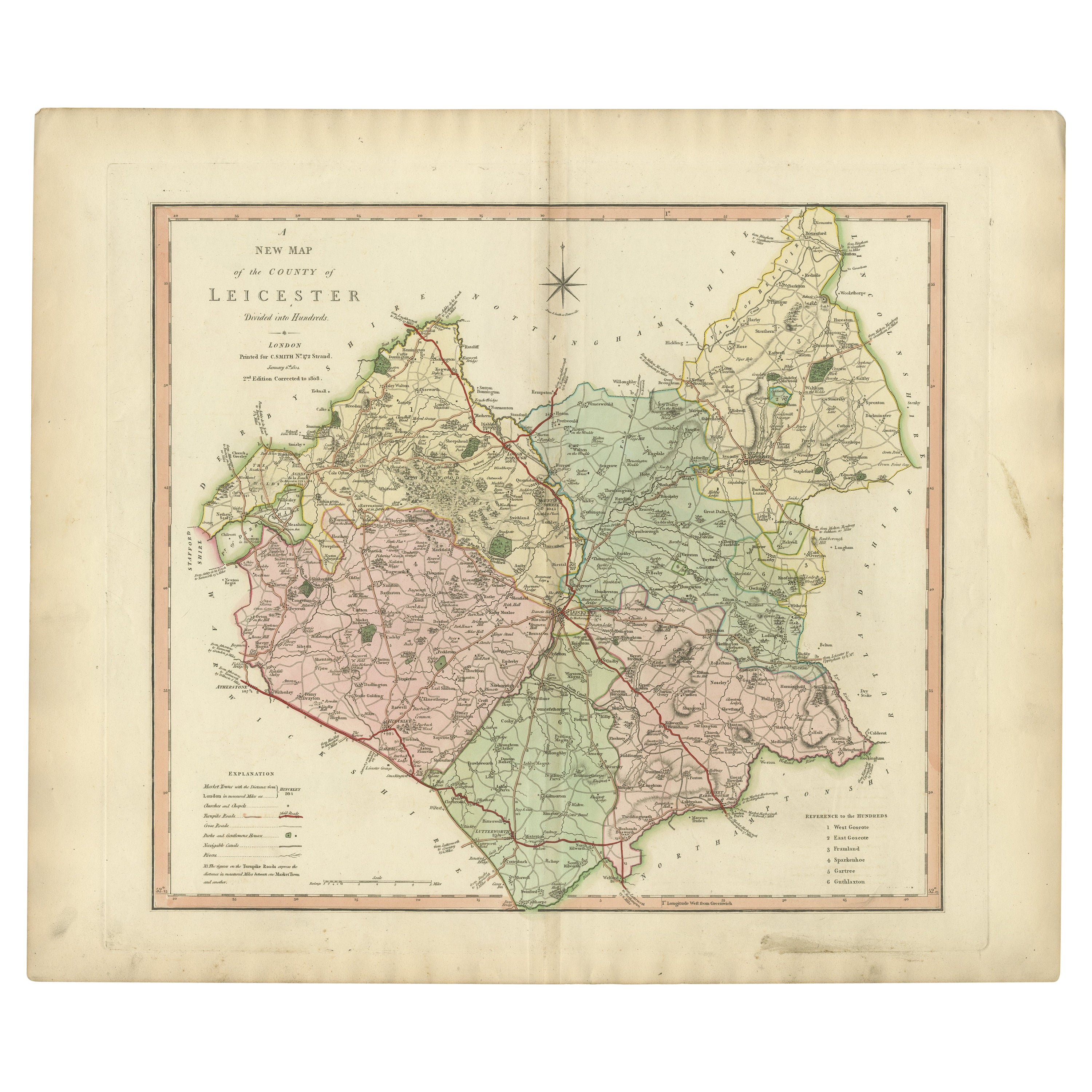
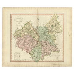
Antique County Map of Leicestershire, England, 1804
Located in Langweer, NL
Antique county map of Leicestershire first published c.1800. Villages, towns, and cities illustrated include Lutterworth, Ashby, Hinkley, and Marke...
Category
Antique Early 1800s Maps
Materials
Paper
$305 Sale Price
20% Off
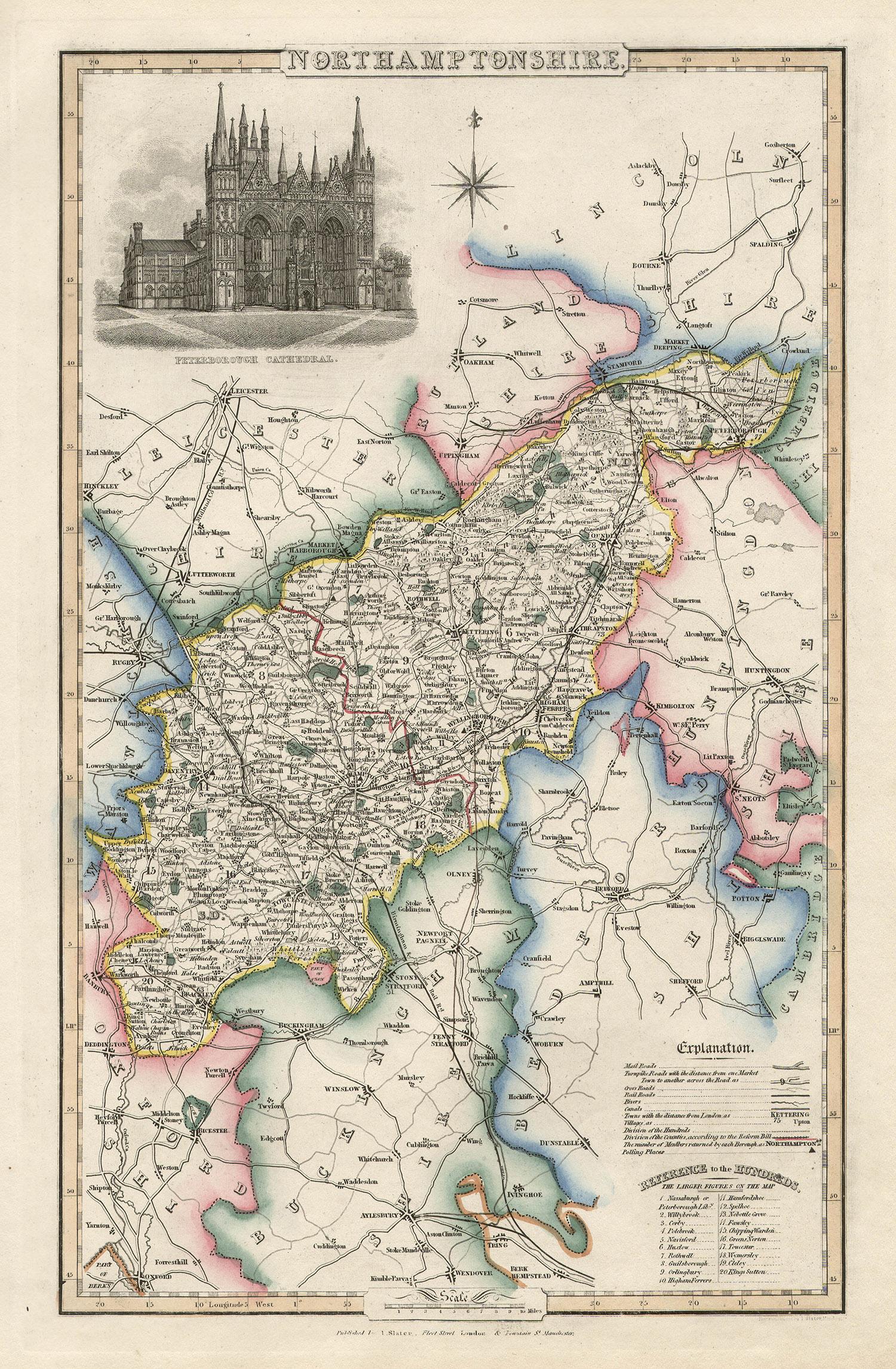
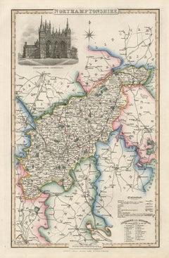
Northamptonshire, English County Antique map, 1847
By Isaac Slater
Located in Melbourne, Victoria
Steel-engraved map with original outline colouring by Isaac Slater. A detailed engraved map of the English county with title, scale, and key. Decorated with an uncoloured engraved view of 'Peterborough...
Category
19th Century Naturalistic Landscape Prints
Materials
Engraving
Antique Decorative County Map of Huntingdonshire, England, 1804
Located in Langweer, NL
Antique county map of Huntingdonshire first published c.1800. Cities illustrated include Kimbolton, Chesterton, Folkesworth, and Great Stewkeley.
Charles Smith was a cartographer ...
Category
Antique Early 1800s Maps
Materials
Paper
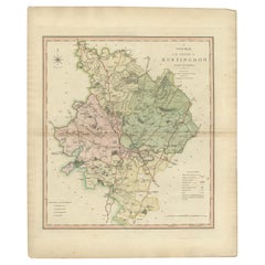
$305 Sale Price
20% Off
Original Antique English County Map, Huntingdonshire, J & C Walker, 1851
Located in St Annes, Lancashire
Great map of Huntingdonshire
Original colour
By J & C Walker
Published by Longman, Rees, Orme, Brown & Co. 1851
Unframed.
Category
Antique 1850s English Other Maps
Materials
Paper

More Ways To Browse
Antique Surveyor
Scotland Map
Antique Maps Scotland
Antique Maps Of Wales
Vintage Filipino Posters
Vintage Fitness Posters
Vintage Hockey Posters Prints
Vintage Posters Barcelona
Vintage Posters Wengen
Vintage Railway Carriages
Vintage Rolex Poster
Vintage Showgirls Art
Vintage Sugar Poster
Vintage Us Army Posters
Wiesbaden Poster
Yoko Ono Imagine Peace
York Railway Poster
Yoshitomo Nara Real One