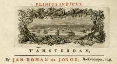
Title page - Ambonian Cabinet of Curiosities by Rumphius - Engraving - 18th c.


1 of 2
Jorg Eberhardt RumphTitle page - Ambonian Cabinet of Curiosities by Rumphius - Engraving - 18th c.1741
1741
About the Item
- Creator:Jorg Eberhardt Rumph (1628 - 1702)
- Creation Year:1741
- Dimensions:Height: 16.15 in (41 cm)Width: 9.85 in (25 cm)
- Medium:
- Movement & Style:
- Period:1740-1749
- Condition:Very good. Minor printing crease. Irregular left margin. General age related toning and occasional light soiling as visible on the scan. Please study scan carefully.
- Gallery Location:Zeeland, NL
- Reference Number:Seller: 247451stDibs: LU59235122921
Authenticity Guarantee
In the unlikely event there’s an issue with an item’s authenticity, contact us within 1 year for a full refund. DetailsMoney-Back Guarantee
If your item is not as described, is damaged in transit, or does not arrive, contact us within 7 days for a full refund. Details24-Hour Cancellation
You have a 24-hour grace period in which to reconsider your purchase, with no questions asked.Vetted Professional Sellers
Our world-class sellers must adhere to strict standards for service and quality, maintaining the integrity of our listings.Price-Match Guarantee
If you find that a seller listed the same item for a lower price elsewhere, we’ll match it.Trusted Global Delivery
Our best-in-class carrier network provides specialized shipping options worldwide, including custom delivery.You May Also Like
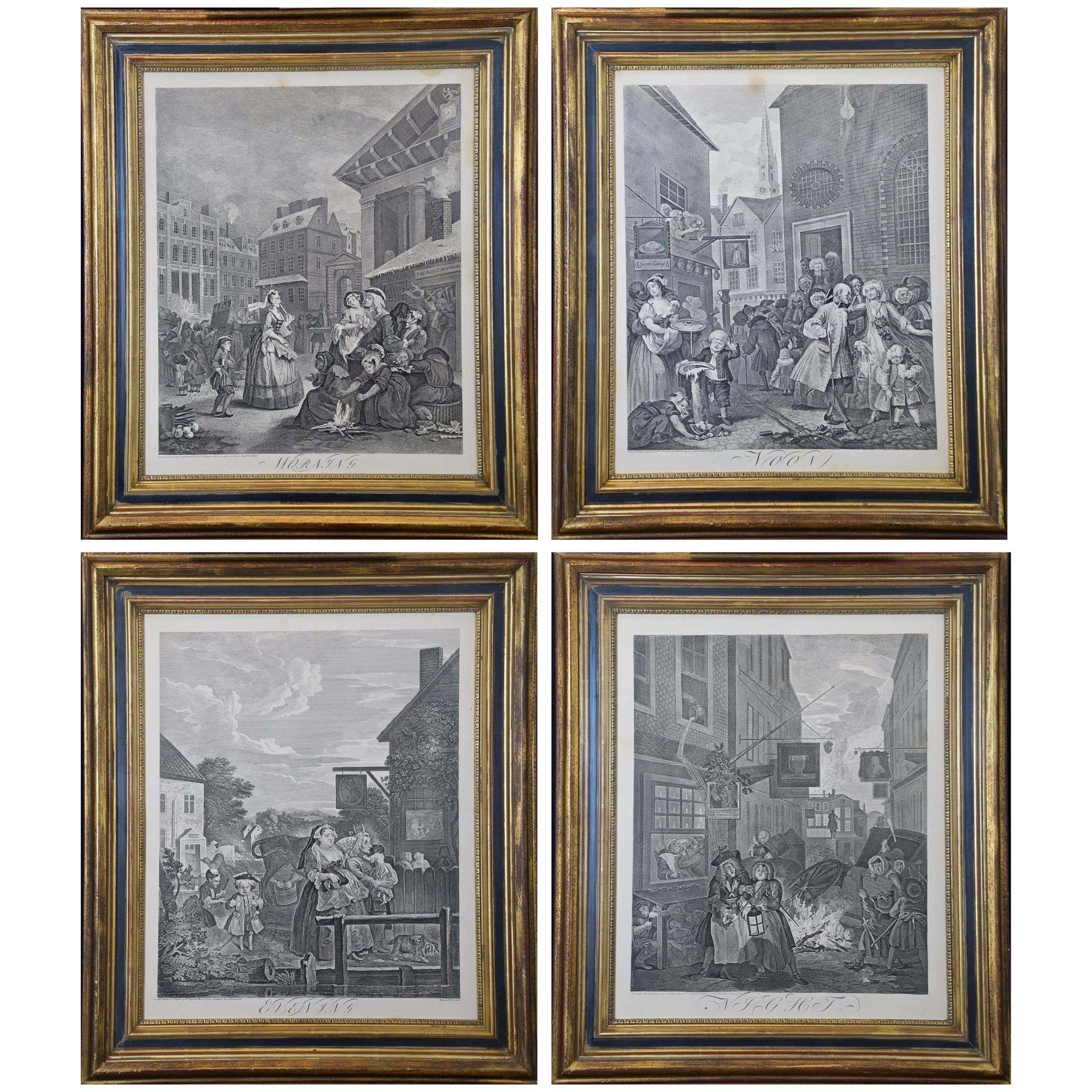
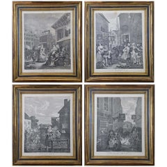
Four Framed Hogarth Engravings "Four Times of the Day"
By William Hogarth
Located in Alamo, CA
The four plates in this "Four Times of the Day" set were created utilizing both engraving and etching techniques by William Hogarth in 1738. Hogarth's original copper plates were refurbished where needed by James Heath and these engravings were republished in London in 1822 by Braddock, Cradock & Joy. This was the last time Hogarth's original copper plates were used for printing. Most were melted down during World War I for the construction of bombs. Printed upon early nineteenth century wove paper and with large, full margins as published by William Heath in 1822. The inscription below each print reads "Invented Painted & Engraved by Wm. Hogarth & Publish'd March 25. 1738 according to Act of Parliament".
These large folio sized "Four Times of the Day" engravings/etchings are presented in complex gold-colored wood frames with black bands and scalloped gold inner trim. A majority of each thick impressive frame is covered with glass applied near the outer edge. Each frame measures 25.75" high, 22.25" wide and 1.88" deep. There are a few small dents in the edge of these frames, which are otherwise in very good condition. "Morning" has two focal areas of discoloration in the upper margin and some discoloration in the right margin, a short tear in the left margin and a short tear or crease in the right margin. "Noon" has a spot in the upper margin that extends into the upper image, but it is otherwise in very good condition. "Evening" has a faint spot in the upper margin, but it is otherwise in very good condition. "Night" is in excellent condition.
The "Four Times of the Day" series is in the collection of many major museums, including: The British Museum, The Metropolitan Museum of Art, The Tate Museum, The Chicago Art Institute and The Victoria and Albert Museum.
Through this series Hogarth is portraying early 18th century London street life at "Four Times of the Day". His characters are exhibiting their personalities, quircks, strange activities, but he also wants to draw attention the disparities between the wealthy aristocracy and the common working class.
Plate 1, "Morning" depicts morning in Covent Garden in the winter in front of Tom King...
Category
Mid-18th Century Old Masters Landscape Prints
Materials
Engraving, Etching
Map of the World: An Original 18th Century Hand-colored Map by E. Bowen
Located in Alamo, CA
This is an original 18th century hand-colored map entitled "A New & Correct Chart of All The Known World Laid down according to Mercator's Projection" by Emanuel Bowen. It was published in 1744 in London in John Harris's "Navigantium atque Itinerantium Bibliotheca" or "A Complete Collection of Voyages and Travels". This highly detailed and colorful map depicts the world. as it was known in the mid 18th century. A majority of the northern and central portions of Canada and America are left blank due to the purity of knowledge at the time this map was published.
The map is embellished with four Compass Roses in the lower left, lower center, lower right and center, along with many rhumb lines. There a is a decorative title cartouche in the upper left. This colorful, attractive, historical and interesting 1744 map presents the entire world on Mercator's projection as it was understood in the middle part of the 18th century, before the landmark explorations of Captain’s Cook, Vancouver, Wilkes and others. It is an example of a nautical chart, a type of map that was designed specifically for use by mariners. The map is centered on the equator and includes both the Eastern and Western Hemispheres. The continents of North America, South America, Europe, Africa, and Asia are depicted, as well as various islands in the Atlantic, Pacific, and Indian Oceans. The map is laid out according to the Mercator projection, a type of cylindrical map projection that was developed in the 16th century by Flemish cartographer Gerardus Mercator. This projection has the advantage of preserving angles and shapes, making it useful for navigation. The map presents a paucity of inland detail, particularly for the Americas, but major cities, geographical landmarks, and regions are included. Ocean currents and Tradewinds are identified, as well as the magnetic declination lines or magnetic variance, which refers to the difference between true north and compass north. The continents are color coded, enhancing the beauty of this map. The three compass roses indicate the directions of the cardinal points.
The depiction of the western coast of America, the Pacific and Australia are interesting. There was very little exploration of Australia between the navigations of William Damper in 1699 and Tobias Furneaux in 1773. Most of the maps detail relies on the 17th century Dutch expeditions to Australia's western coast, by Abel Tasman and William Janszoon. Van Diemen's Land (Tasmania) and New Guinea appear connected to the Australian continent. New Zealand appears as a single landmass. North of New Zealand there is a landmass labelled 'Ter d' St. Esprit' which probably represents the New Hebrides Islands. This map precedes the accurate exploration of the South Pacific and east coast of Australia by Captain James Cook later in the 18th century. The map includes ‘Drakes' Port,' the site where Sir Francis Drake supposedly landed in 1579 during his 1579 circumnavigation of the globe. Here he claimed territory for England, restocked, and repaired his vessels. Drake named the region New Albion. The exact location of Drake's Port is a cartographic mystery. Drake's Harbor is believed to be in the region of San Francisco Bay, Bodega Bay, San Pablo Bay...
Category
Mid-18th Century Old Masters Landscape Prints
Materials
Engraving

Persia, Armenia & Adjacent Regions: A Hand-colored 17th Century Map by De Wit
By Frederick de Wit
Located in Alamo, CA
This colorful and detailed 17th century copperplate map by Frederick De Wit was published in Amsterdam between 1666 and 1690. It depicts the Caspian Se...
Category
Late 17th Century Old Masters More Prints
Materials
Engraving

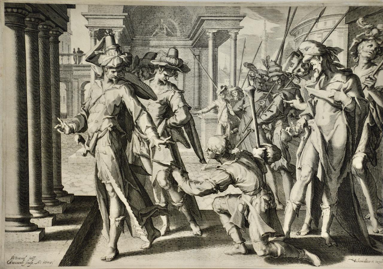
"Allegory of Justice": A 17th Century Old Master Engraving by van Swanenburg
By Willem van Swanenburg
Located in Alamo, CA
This old master engraving entitled "Allegorie op de Rechtspraak" is by Willem van Swaanenburg after a painting by Joachim Wtewael, published by Ch...
Category
Early 1600s Old Masters Interior Prints
Materials
Engraving
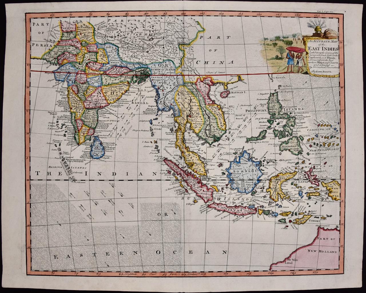
Map of the East Indies: An Original 18th Century Hand-colored Map by E. Bowen
Located in Alamo, CA
This is an original 18th century hand-colored map entitled "An Accurate Map of the East Indies Exhibiting the Course of the European Trade both on the Continent and Islands" by Emanu...
Category
Mid-18th Century Old Masters Landscape Prints
Materials
Engraving

Mediterranean and Adriatic Seas: Original 18th Century Hand-colored Map by Bowen
Located in Alamo, CA
This is an original 18th century hand-colored map entitled "An Accurate Chart of The Mediterranean and Adriatic Sea's; with the Archipelago & Part of the Black Sea. Exhibiting all th...
Category
Mid-18th Century Old Masters Landscape Prints
Materials
Engraving
