Items Similar to Ancient Map of Mexico - Original Etching - 19th Century


Want more images or videos?
Request additional images or videos from the seller
1 of 2
UnknownAncient Map of Mexico - Original Etching - 19th Century19th Century
19th Century
$360.53
£266.05
€300
CA$497.34
A$545.25
CHF 285.76
MX$6,621.45
NOK 3,565.15
SEK 3,373.93
DKK 2,283.91
About the Item
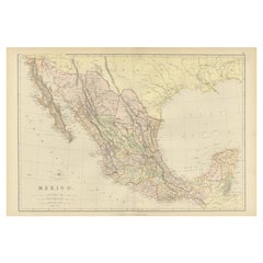
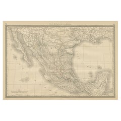
This Map of Mexico is an etching realized in 19th century.
The state of preservation of the artwork is good with some small missing papers on the right angles. At the top of the paper, the inscription “Longitudine del Meridiano dell'Isola del Ferro”, whilst at the bottom, just below the image, the inscription “Longitudine O. di Parigi”. At the top right, the number of the sheet "Tav.37 is printed.
- Creation Year:19th Century
- Dimensions:Height: 7.88 in (20 cm)Width: 9.85 in (25 cm)Depth: 0.04 in (1 mm)
- Medium:
- Period:
- Framing:Framing Options Available
- Condition:Insurance may be requested by customers as additional service, contact us for more information.
- Gallery Location:Roma, IT
- Reference Number:Seller: M-1087531stDibs: LU65036930462
About the Seller
4.9
Platinum Seller
Premium sellers with a 4.7+ rating and 24-hour response times
1stDibs seller since 2017
7,707 sales on 1stDibs
Typical response time: 2 hours
- ShippingRetrieving quote...Shipping from: Roma, Italy
- Return Policy
Authenticity Guarantee
In the unlikely event there’s an issue with an item’s authenticity, contact us within 1 year for a full refund. DetailsMoney-Back Guarantee
If your item is not as described, is damaged in transit, or does not arrive, contact us within 7 days for a full refund. Details24-Hour Cancellation
You have a 24-hour grace period in which to reconsider your purchase, with no questions asked.Vetted Professional Sellers
Our world-class sellers must adhere to strict standards for service and quality, maintaining the integrity of our listings.Price-Match Guarantee
If you find that a seller listed the same item for a lower price elsewhere, we’ll match it.Trusted Global Delivery
Our best-in-class carrier network provides specialized shipping options worldwide, including custom delivery.More From This Seller
View AllMap of South America - Original Etching - Late 19th Century
Located in Roma, IT
This Map of South America is an etching realized by an anonymous artist.
The state of preservation of the artwork is good with some small diffused stains.
Sheet dimension: 41.5 x 27
The artwork represents the map South America...
Category
Late 19th Century Modern Figurative Prints
Materials
Etching
Map of North America - Etching - 19th Century
Located in Roma, IT
Map of America is an etching realized during the 19th century.
Good condition.
Category
Early 19th Century Modern Figurative Prints
Materials
Etching
The Americas - Vintage Map - 18th century
Located in Roma, IT
The Americas is a very beautiful vintage map realized in the 18th century by an Italian cartographer.
Very good conditions, on the right side the inscript...
Category
18th Century Figurative Prints
Materials
Paper, Etching

Ancient Map of Oceania - Original Etching - 19th century
Located in Roma, IT
This Map of Oceania is an etching realized in the 19th century.
The state of preservation of the artwork is good. At the top of the paper, the inscription “Longitudine del Meridiano...
Category
19th Century More Prints
Materials
Etching

Map of the World - Original Etching - 1820
Located in Roma, IT
Map of the World is an Original Etching realized by an unknown artist of 19th century in 1820.
Very good condition on two sheets of white paper joine...
Category
1820s Modern Figurative Prints
Materials
Etching

Map of Guadalupe - Lithograph - 19th Century
Located in Roma, IT
Map of Guadalupe is a Lithograph realized by Various artists in the 19th Century, part of the suite "France Pittoresque".
Good conditions.
Category
Late 19th Century Modern Figurative Prints
Materials
Lithograph
You May Also Like
1882 Antique Map of Mexico Highlighting Geographical and Political Boundaries
Located in Langweer, NL
This 1882 map of Mexico, published by Blackie and Son as part of the 'Comprehensive Atlas and Geography of the World,' provides a highly detailed representation of the country's geog...
Category
Antique 1880s Maps
Materials
Paper
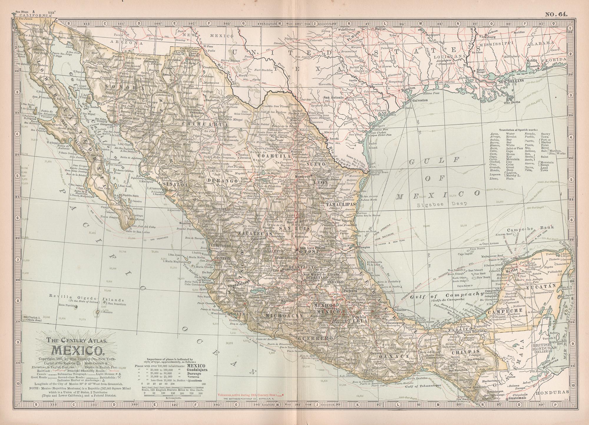
Mexico. Century Atlas antique vintage map
Located in Melbourne, Victoria
'The Century Atlas. Mexico.'
Original antique map, 1903.
Central fold as issued. Map name and number printed on the reverse corners.
Sheet 29.5cm by 40cm.
Category
Early 20th Century Victorian More Prints
Materials
Lithograph

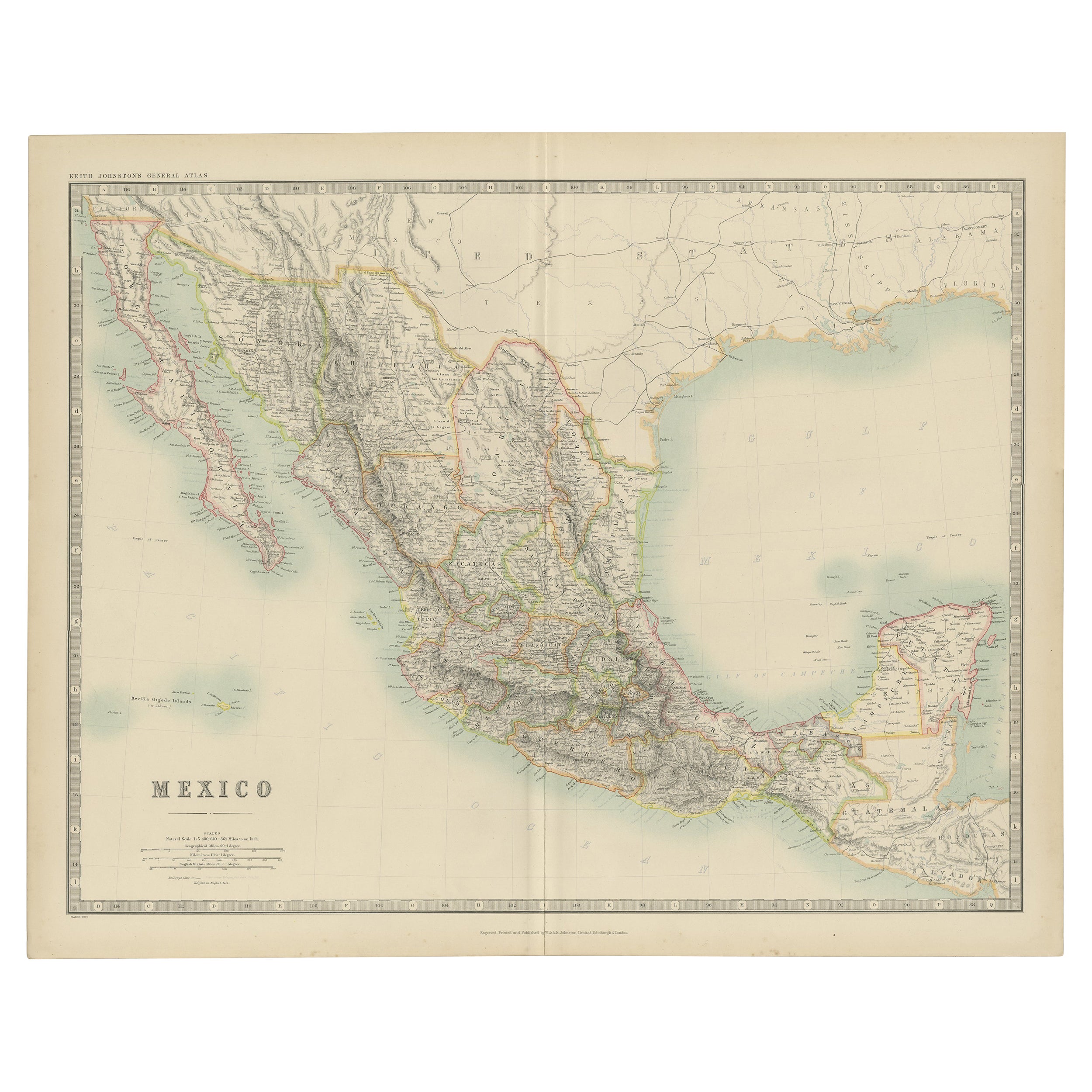
Antique Map of Mexico by Johnston, '1909'
Located in Langweer, NL
Antique map titled 'Mexico'. Original antique map of Mexico. This map originates from the ‘Royal Atlas of Modern Geography’. Published by W. & A....
Category
Early 20th Century Maps
Materials
Paper
$240 Sale Price
20% Off
Antique Map of Mexico and Central America by Johnson '1872'
Located in Langweer, NL
Antique map titled 'Johnson's Mexico (..)'. Two maps one one sheet showing Mexico and Central America, with inset maps of Tehuantepec and Panama. This map originates from 'Johnson's ...
Category
Antique Late 19th Century Maps
Materials
Paper

$288 Sale Price
20% Off
Antique Map of Mexico, Central America and West Indies by A & C. Black, 1870
Located in Langweer, NL
Antique map titled 'Mexico, Central America and West Indies'. Original antique map of Mexico, Central America and West Indies with inset map of Panama railway. This map originates fr...
Category
Antique Late 19th Century Maps
Materials
Paper

$168 Sale Price
20% Off
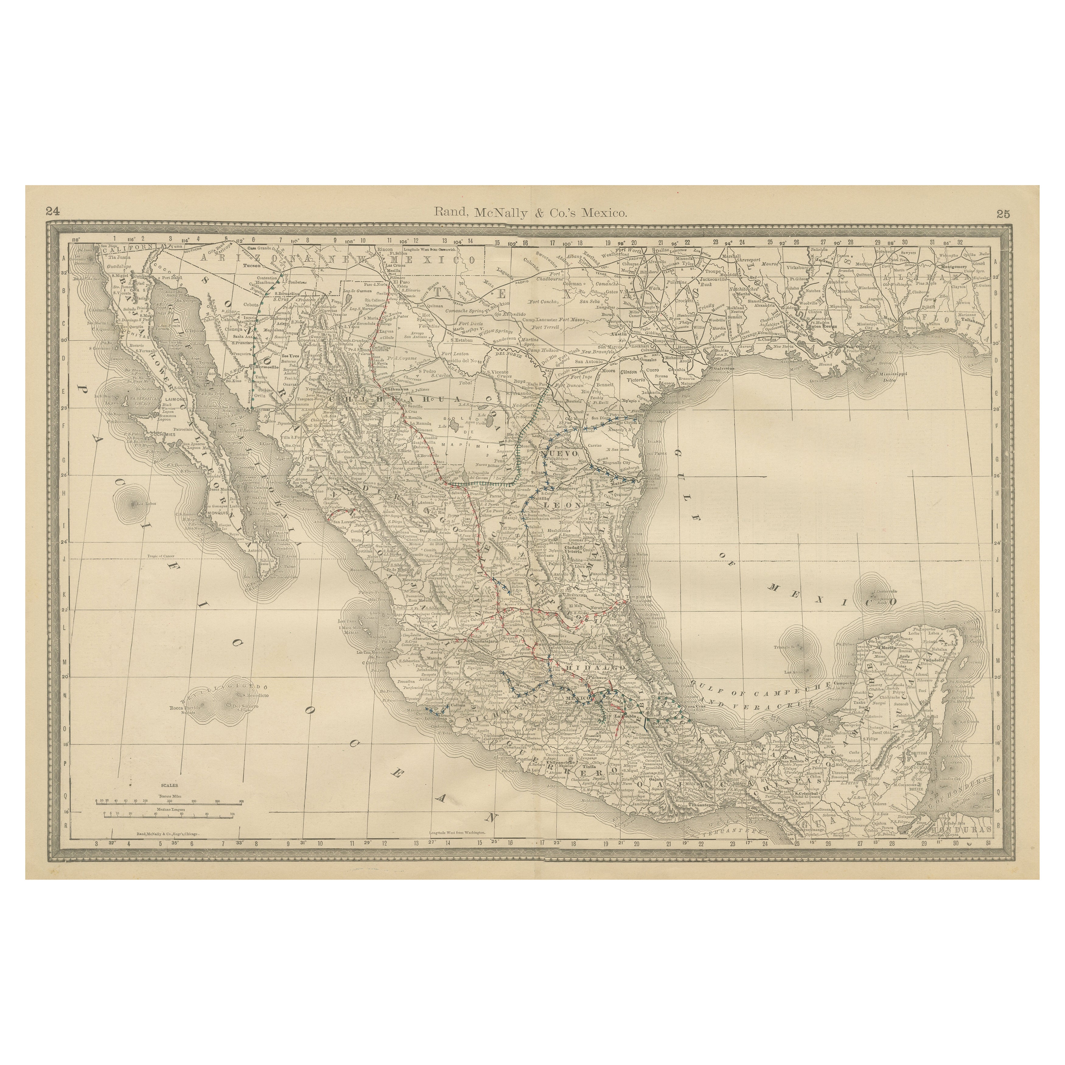
Mexico Antique Railroad Map c.1888 – Cities, States & Land of the Aztecs
Located in Langweer, NL
Antique Map of Mexico – Rand McNally, circa 1888
This antique map titled *“Rand, McNally & Co.’s Mexico”* was published around 1888 and depicts Mexico in the late 19th century, a pe...
Category
Antique Late 19th Century American Maps
Materials
Paper
More Ways To Browse
Ancient Maps
Antique Map Mexico
Lake Garda Vintage Poster
Lela Bliss
Lennon Woman
Levi Andy Warhol
Li Sheng
Libro Poster
Lifesaver Pop Art
Lizzie Riches
Lux Soap
Marcus Uzilevsky
Marino Marini Jongleur Et Chevaux
Maurin Green Devil
Musee Matisse Nice Vintage Poster
Naomi Limont
New Mexico Travel Posters
Nicolas De Poilly