Antique Map Philadelphia
3
to
8
73
26
81
31
22
13
10
10
8
8
7
7
6
5
5
3
2
2
2
2
2
2
1
1
1
1
1
1
1
1
1
1
4
3
2
1
1
Sort By
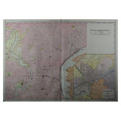
Large Original Antique City Plan of Philadelphia, USA, circa 1900
By Rand McNally & Co.
Located in St Annes, Lancashire
Fabulous colorful map of Philadelphia
Original color
By Rand, McNally & Co.
Published
Category
Early 1900s American Antique Map Philadelphia
Materials
Paper
No Reserve
H 20.5 in W 27.5 in D 0.07 in
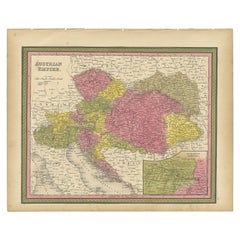
Colourful Old Map of the Austrian Empire, with an Inset Map of Vienna, 1846
Located in Langweer, NL
Antique map titled 'Austrian Empire'.
Old map of the Austrian Empire, with an inset map of
Category
1840s Antique Map Philadelphia
Materials
Paper
H 13.78 in W 17.13 in D 0 in
Decorative Antique Map of Germany, 1846
Located in Langweer, NL
Antique map titled 'Germany'. Old map of Germany.
This map originates from 'A New Universal
Category
1840s Antique Map Philadelphia
Materials
Paper
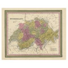
Colourful Antique Map of Switzerland, 1846
Located in Langweer, NL
Antique map titled 'Switzerland'. Old map of Switzerland.
This map originates from 'A New
Category
1840s Antique Map Philadelphia
Materials
Paper
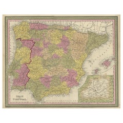
Old Map of Spain and Portugal, with an Inset Map of the Region of Madrid, 1846
Located in Langweer, NL
Antique map titled 'Kingdom of Spain and Portugal'.
Old map of Spain and Portugal, with an
Category
1840s Antique Map Philadelphia
Materials
Paper
H 13.78 in W 17.13 in D 0 in
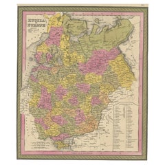
Antique Map of Old European Russia, 1846
Located in Langweer, NL
Antique map titled 'Russia in Europe'. Old map of European Russia. This map originates from 'A New
Category
19th Century Antique Map Philadelphia
Materials
Paper
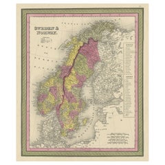
Old Colourful Map of Sweden and Norway, 1846
Located in Langweer, NL
Antique map titled 'Sweden & Norway'. Old map of Sweden and Norway.
This map originates from 'A
Category
1840s Antique Map Philadelphia
Materials
Paper
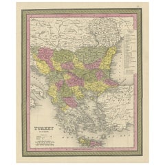
Old Colourful Decorative Map of Turkey in Europe, 1846
Located in Langweer, NL
Antique map titled 'Turkey in Europe'. Old map of Turkey in Europe.
This map originates from 'A
Category
1840s Antique Map Philadelphia
Materials
Paper
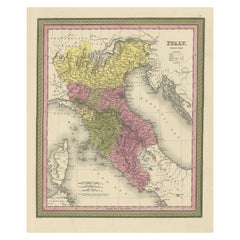
Old Antique Colourful Decorative Map of Northern Italy, 1846
Located in Langweer, NL
Description: Antique map titled 'Italy North Part'.
Old map of Northern Italy. This map
Category
1840s Antique Map Philadelphia
Materials
Paper
Antique Map of Spain and Portugal by Mitchell, 1846
Located in Langweer, NL
Antique map titled 'Kingdom of Spain and Portugal'. Old map of Spain and Portugal, with an inset
Category
19th Century Antique Map Philadelphia
Materials
Paper
Antique Nicely Colored Map of Holland and Belgium, 1846
Located in Langweer, NL
Antique map titled 'Holland and Belgium'. Old map of the Netherlands and Belgium. This map
Category
19th Century Antique Map Philadelphia
Materials
Paper
Antique Map of Denmark, Original and Decorative, c.1846
Located in Langweer, NL
Antique map titled 'Denmark'. Old map of Denmark. This map originates from 'A New Universal Atlas
Category
19th Century Antique Map Philadelphia
Materials
Paper
Antique Map of Sweden and Norway by Mitchell, 1846
Located in Langweer, NL
Antique map titled 'Sweden & Norway'. Old map of Sweden and Norway. This map originates from 'A New
Category
19th Century Antique Map Philadelphia
Materials
Paper
French Geographical, Statistical and Historical Map of Pensylvania, 1825
Located in Langweer, NL
1825 French Map of Pennsylvania, with a List of Prominent Rivers, Descriptions of Mountains, Climate
Category
1820s Antique Map Philadelphia
Materials
Paper
H 20.08 in W 25.99 in D 0 in
Louisiana: A Framed 19th Century Map by O. W. Gray
By Gray and Co
Located in Alamo, CA
This framed 19th century map of the Louisiana territory was published in "Gray's Atlas of the
Category
Mid-19th Century American Other Antique Map Philadelphia
Materials
Paper
Antique Map of Germany from an American 19th Century Atlas, 1846
Located in Langweer, NL
Antique map titled 'Germany'. Old map of Germany. This map originates from 'A New Universal Atlas
Category
19th Century Antique Map Philadelphia
Materials
Paper
"The United States from the Latest Authorities" Antique Wall Map, 1835
Located in Colorado Springs, CO
noted.
The map is bordered with vignettes of Boston, New York, Philadelphia, Hartford, Cincinnati
Category
1830s American Antique Map Philadelphia
Materials
Paper
Antique Map of the United States of North America by Johnston '1909'
Located in Langweer, NL
America ( South West Sheet ). With inset maps of Chicago, San Francisco, Philadelphia and Boston. This map
Category
Early 20th Century Antique Map Philadelphia
Materials
Paper
Original Antique Map of the State of New Jersey Published in France
Located in Langweer, NL
edition is a completely revised map, with better engraving quality than the original Philadelphia edition.
Category
Early 19th Century Antique Map Philadelphia
Materials
Paper
1856 U.S. Coast Survey Map of Chesapeake Bay and Delaware Bay
Located in Colorado Springs, CO
Presented is U.S. Coast Survey nautical chart or maritime map of Chesapeake Bay and Delaware Bay
Category
1850s American Antique Map Philadelphia
Materials
Paper
1863 "Lloyd's New Map of the United States, the Canadas, and New Brunswick"
Located in Colorado Springs, CO
Presented is “Lloyd's New Map of the United States, the Canadas and New Brunswick, From the latest
Category
1860s American Antique Map Philadelphia
Materials
Linen, Wood, Paper
H 37 in W 49.5 in D 1 in
1842 Wall Map of the United States by J. H. Young, Published by S. A. Mitchell
Located in Colorado Springs, CO
city map insets of the vicinities around Boston, New York, Philadelphia, Baltimore and Washington
Category
1840s American Antique Map Philadelphia
Materials
Paper
H 45 in W 38 in D 1 in
Plan for the City of Washington by Andrew Ellicott, Antique Print, 19th Century
Located in Colorado Springs, CO
Washington. Published by Thackara & Vallance, Philadelphia, 1792. Later impression printed on 19th century
Category
Late 19th Century American Antique Map Philadelphia
Materials
Paper
H 36 in W 43.75 in D 3 in
Harness Racer at Belmont Park 1884, Philadelphia
Located in Wiscasett, ME
Park in Philadelphia, which had a very active harness racing course established in 1880. It also
Category
1880s Folk Art Antique Map Philadelphia
Materials
Oil
"Harness Racer at Belmont Park 1884, Philadelphia" by Agustus Kollner
Located in Wiscasset, ME
Park in Philadelphia, which had a very active harness racing course established in 1880. It also
Category
1880s American Folk Art Antique Map Philadelphia
Materials
Paint, Paper
Louisiana: A Framed 19th Century Map by O.W. Gray
Located in Alamo, CA
This framed 19th century map of the Louisiana territory was published in "Gray's Atlas of the
Category
1870s Antique Map Philadelphia
Materials
Engraving
H 20 in W 22.63 in D 0.88 in
Maps of the Ancient World and the Posterity of Noah, 1820
Located in Langweer, NL
Two maps on one sheet. Hhand colored engraved lithograph, depicting the world as known to the
Category
19th Century Antique Map Philadelphia
Materials
Paper
HOMANN, Johann Baptist (1663-1724) Nova Anglia. Septentrionali Americæ implantat
Located in Bristol, CT
Map Sz: 18 3/4"H x 22 5/8"W
Frame Sz: 27 1/2"H x 31"W
Nuremberg: Homann Heirs, [circa 1740
Category
1740s Antique Map Philadelphia
Materials
Paper
1929 'South America' Limestone Frieze Phila Civic Center
Located in New York, NY
This unique limestone frieze depicts a map of South America and formerly was part of the façade of
Category
1920s American Art Deco Antique Map Philadelphia
Materials
Limestone
George Washington after the Painting by Rembrandt Peale, circa 1856
Located in Colorado Springs, CO
Philadelphia in 1856. The portrait is modeled after a bust portrait by the noted American artist, Rembrandt
Category
1850s Antique Map Philadelphia
Materials
Paper
Rare French Bronze Sculpture “Last Days of Napoleon” after Vincenzo Vela
By Vincenzo Vela 1
Located in Shippensburg, PA
chair his left nervously clutched rests on a map of Europe of 1814 spread on his lap, that Europe whose
Category
19th Century French Romantic Antique Map Philadelphia
Materials
Bronze
H 11 in W 10.18 in D 6.25 in
Catskill Sawmill
By John William Hill
Located in Missouri, MO
States in 1819, initially living in Philadelphia. In 1822 the family moved to New York, where Hill
Category
1860s Hudson River School Antique Map Philadelphia
Materials
Canvas, Oil
Japanese Children with Tortoise
By Harry Humphrey Moore
Located in New York, NY
portraitist Samuel Waugh in Philadelphia, where he met and became friendly with Eakins. He also received
Category
Late 19th Century Antique Map Philadelphia
Materials
Oil, Wood Panel
Interior of a Japanese House
By Harry Humphrey Moore
Located in New York, NY
portraitist Samuel Waugh in Philadelphia, where he met and became friendly with Eakins. He also received
Category
Late 19th Century Antique Map Philadelphia
Materials
Oil, Wood Panel
Japanese Girl Promenading
By Harry Humphrey Moore
Located in New York, NY
portraitist Samuel Waugh in Philadelphia, where he met and became friendly with Eakins. He also received
Category
Late 19th Century Antique Map Philadelphia
Materials
Oil, Wood Panel
Japanese Tea Garden
By Harry Humphrey Moore
Located in New York, NY
portraitist Samuel Waugh in Philadelphia, where he met and became friendly with Eakins. He also received
Category
Late 19th Century Antique Map Philadelphia
Materials
Oil, Wood Panel
Matthew Albert Lotter 18th Century Map of Philadelphia
By Matthew Albert Lotter
Located in Southfield, MI
A superb, and rarely found original copperplate colored and engraved map of Philadelphia made in
Category
1770s German George III Antique Map Philadelphia
6, 19th Century hand-colored maps printed by Anthony Finley of Philadelphia 1824
Located in San Antonio, TX
cartographic center, Philadelphia. Finley's work is a good example of the quality that American publishers were
Category
Early 19th Century Academic Antique Map Philadelphia
Materials
Lithograph, Pastel
H 13 in W 10.38 in D 0.07 in
Lithograph of the First 11 U.S. Presidents, Philadelphia, 1846
By Samuel Augustus Mitchell 1
Located in Acworth, GA
Rare large chromolithograph on canvas of the First 11 U.S. Presidents, Philadelphia, 1846.
1846
Category
1640s American American Classical Antique Map Philadelphia
Materials
Canvas, Linen
Richardson's New Map of the State of Texas
By Willard Richardson 1, Charles Desilver
Located in Houston, TX
). Richardson's New Map of the State of Texas Including part of Mexico Compiled from Government Surveys and Other
Category
Mid-19th Century American Other Antique Map Philadelphia
"History of The Expedition Under the Command of Captains Lewis and Clark" Books
By Paul Allen
Located in Houston, TX
Paul Allen, Esquire.
In two volumes:
VOL. I and VOL. II.
Philadelphia: Published by Bradford
Category
Early 19th Century American Other Antique Map Philadelphia
H 5.13 in W 8.32 in D 3 in
L' Amerique Septentrionale (North America with California as an Island)
Located in New York, NY
Original and rare 1702 map of North America showing California as a island stretching as far north
Category
Early 1700s Realist Antique Map Philadelphia
Materials
Engraving
"George Washington and His Family", circa 1864 Framed Lithograph
Located in Billerica, MA
entering on the far right. On the table is a map showing the plan for the city of Washington at the
Category
Mid-19th Century American American Colonial Antique Map Philadelphia
Materials
Paper
New York with the City of Brooklyn in the Distance
By John William Hill
Located in New York, NY
Philadelphia. In 1822 the family moved to New York, where Hill apprenticed in aquatint engraving in his
Category
1850s Realist Antique Map Philadelphia
Materials
Engraving
1858 "Mitchell's New National Map Exhibiting the United States" Hanging Wall Map
By Samuel Augustus Mitchell 1
Located in Colorado Springs, CO
published in Philadelphia in 1858.
The map presents a compelling picture of an evolving American West
Category
1850s American Antique Map Philadelphia
Materials
Paper
H 84 in W 80.5 in D 6 in
1889 Original Map of Colorado
Located in Colorado Springs, CO
This attractive map of Colorado was published in 1889 by William M. Bradley & Bros, a Philadelphia
Category
1880s American Antique Map Philadelphia
Antique Map of Asia with Decorative Border and Inset Map of Australia, 1849
Located in Langweer, NL
Antique map titled 'Asia'. Original antique map of Asia, with decorative border and inset map of
Category
19th Century Antique Map Philadelphia
Materials
Paper
H 13.78 in W 17.13 in D 0 in
1847 Guide Map of the U.S., from Phelps's Travellers Guide, Antique Map
Located in Colorado Springs, CO
Philadelphia, Boston and Baltimore, with smaller maps of Pittsburgh, Cincinnati, Chicago and St. Louis.
A
Category
1840s American Antique Map Philadelphia
Materials
Paper
1846 "Traveller's Guide and Map of the United States" Antique Wall Map by Ensign
Located in Colorado Springs, CO
Ensign's Traveller's Guide and map of the United States, containing the roads, distances, Steam
Category
1840s American Antique Map Philadelphia
Materials
Paper
H 42.25 in W 53 in D 3.75 in
Map of the State of Texas
Located in Dallas, TX
an early state map of Texas, published in Philadelphia 1848, panhandle pictured inset at left
Category
19th Century American Antique Map Philadelphia
Materials
Paper, Ink
1818 Carey Atlas Correct Hand-Colored Map of Virginia
Located in Colorado Springs, CO
VIRGINIA" Published by M. Carey & Sons, Philadelphia.
This original, historic Map of Virginia is found
Category
1810s North American Antique Map Philadelphia
1900 Plan of the City of Washington Antique Map
Located in Colorado Springs, CO
engraved by James Thackara and John Vallance in Philadelphia, and was the first printed plan of our
Category
Early 20th Century American Antique Map Philadelphia
Materials
Paper
1839 Antique Ornamental Map of the United States, by William Chapin
Located in Colorado Springs, CO
This is a wonderfully "ornamental" hand-colored wall map of the United States from 1839, the first
Category
19th Century American Antique Map Philadelphia
Materials
Paper
1845 United States Hanging Wall Map by T & E. H. Ensign
Located in Colorado Springs, CO
"Ensign's Traveller's Guide and Map of the United States, Containing the Roads, Distances, Steam
Category
1840s American Antique Map Philadelphia
Materials
Paper
Antique Map "Routes Between New York & Washington" New York Baltimore Washington
Located in Colorado Springs, CO
contained A Guide Between New York, Philadelphia, Baltimore and Washington. The map is now beautifully
Category
1830s American Antique Map Philadelphia
Materials
Paper
H 30.5 in W 9.75 in L 30.5 in
1846 Antique Map of Texas, Oregon, California, and Regions Adjoining by Mitchell
By Samuel Augustus Mitchell 1
Located in Colorado Springs, CO
Territory, California, and the Transmississippi West. Published in 1846 from Philadelphia, Mitchell's map of
Category
1840s American Antique Map Philadelphia
Materials
Paper
H 32.5 in W 31.5 in D 2 in
1852 Plan of the City of Washington, After Andrew Ellicott, Antique Map
Located in Colorado Springs, CO
Issued in "Maps of the District of Columbia and City of Washington", this is a fine 19th century re
Category
1850s American Antique Map Philadelphia
Materials
Paper
Map of Africa by Tanner
Located in Alamo, CA
Tanner's Universal Atlas by Matthew Carey & Son in Philadelphia in 1834. At the time this map was published
Category
Mid-19th Century Other Art Style Antique Map Philadelphia
Materials
Engraving
Early Flag of Philadelphia, Probably 1874-1876, Printed on Blended Fabric
Located in York County, PA
EARLY FLAG OF PHILADELPHIA, PROBABLY 1874-1876, PRINTED ON A WOOL & COTTON BLENDED FABRIC AND HAND
Category
19th Century Antique Map Philadelphia
1850 Map of Massachusetts, Connecticut, and Rhode Island, Antique, Hand-Colored
Located in Colorado Springs, CO
Philadelphia.
Condition:
Overall this map is in age appropriate condition. Some discoloration and foxing is
Category
1850s American Antique Map Philadelphia
Materials
Paper
H 29.75 in W 34 in D 2.25 in
- 1
Get Updated with New Arrivals
Save "Antique Map Philadelphia", and we’ll notify you when there are new listings in this category.
Antique Map Philadelphia For Sale on 1stDibs
Find many varieties of an authentic antique map philadelphia available at 1stDibs. Frequently made of paper, animal skin and bone, every antique map philadelphia was constructed with great care. There are many kinds of the antique map philadelphia you’re looking for, from those produced as long ago as the 18th Century to those made as recently as the 21st Century. Each antique map philadelphia bearing Victorian hallmarks is very popular. A well-made antique map philadelphia has long been a part of the offerings for many furniture designers and manufacturers, but those produced by Dr. Charles L. Mitchell, Edmondo de Amici and George Griffin Lewis are consistently popular.
How Much is a Antique Map Philadelphia?
An antique map philadelphia can differ in price owing to various characteristics — the average selling price 1stDibs is $1,700, while the lowest priced sells for $45 and the highest can go for as much as $49,500.
More Ways To Browse
Swiss Jazz Festival
Continental Airline
Puzzle Atlantic Blue
Mens Platinum Necklace
Peter Max Watercolor
Peter Max Space
Portrait Modern Male Nude Oil Painting
Filipino Map
Moon Map
Salvador Dali Exhibition Poster
James Allen Oil
Reclining Nude Male
Golden Pearl And Platinum
Carmen Opera
Venezuela Poster
Three Men Naked
Retro Scientific Poster
Antique Half Eternity
