Map Hawaii
6
to
10
39
37
26
25
17
16
14
11
8
7
7
6
5
5
5
5
5
4
4
3
3
3
3
3
2
2
2
1
1
1
1
3
3
2
1
1
Sort By
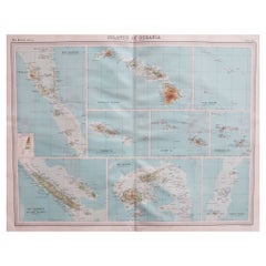
Large Original Vintage Map of The Pacific Islands Including Hawaii
Located in St Annes, Lancashire
Great map of The Pacific Islands
Unframed
Original color
By John Bartholomew and Co
Category
Vintage 1920s British Maps
Materials
Paper
No Reserve
H 18 in W 23 in D 0.07 in
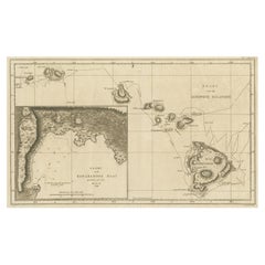
Map of the Hawaiian Islands with a Large Inset of Karakakooa Bay, 1803
Located in Langweer, NL
Antique map titled 'Kaart van de Sandwich Eilanden'.
Map of the Hawaiian Islands with a large
Category
Antique Early 1800s Maps
Materials
Paper
No Reserve
H 11.82 in W 19.1 in D 0 in
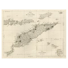
Rare Antique Map with Timor and Nearby Islands Plus an Inset of Hawaii, 1825
Located in Langweer, NL
Antique map titled 'Essai sur la Geographie de l'Ile Timor.'
A map showing Timor and the
Category
Antique 1820s Maps
Materials
Paper
H 13.39 in W 19.69 in D 0 in
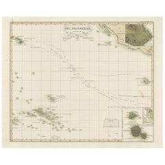
Antique Map of Eastern Polynesia, 1849
Located in Langweer, NL
Antique map titled 'Ost-Polynesien'. Interesting variant issue, with large detailed insets top
Category
Antique Mid-19th Century Maps
Materials
Paper
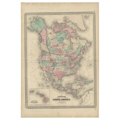
Antique Map of North America by Johnson, '1872'
Located in Langweer, NL
the Hawaiian group or Sandwich Islands. This map originates from 'Johnson's New Illustrated Family
Category
Antique Late 19th Century Maps
Materials
Paper
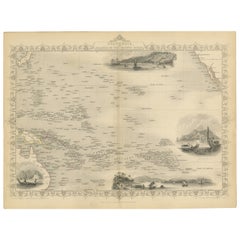
Map of Polynesia Highlighting Cultural Landscapes and Maritime Activities, 1851
Located in Langweer, NL
John Tallis & Company was a London-based map publisher that flourished during the 19th century
Category
Antique 1850s Maps
Materials
Paper
H 10.71 in W 14.26 in D 0 in
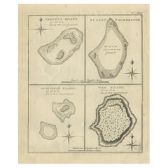
Antique Map of Harvey Island and Surroundings by Cook, 1803
Located in Langweer, NL
largely uncharted areas of the globe. He mapped lands from New Zealand to Hawaii in the Pacific Ocean in
Category
Antique 19th Century Maps
Materials
Paper
Free Shipping
H 13.19 in W 16.34 in D 0 in
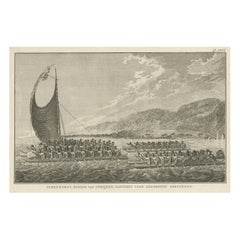
The King of Owyhee, Sandwich Isles 'Hawaii' with Gifts for Captain Cook, 1803
Located in Langweer, NL
Antique print Hawaï titled 'Terreeoboo, Koning van Owhijee, Kapitein Cook geschenken brengende'.
Antique print depicting Tereoboo, King of Owyhee, bringing presents to Captain Co...
Category
Antique Early 1800s Maps
Materials
Paper
H 11.03 in W 16.74 in D 0 in
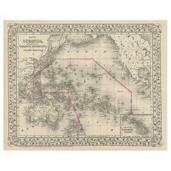
Old Map of the Pacific, Incl Australia, Polynesia, Melanesia and Malaysia, 1872
Located in Langweer, NL
Antique map Oceania titled 'Map of Oceanica exhibiting its various divisions, island groups & c
Category
Antique 1870s Maps
Materials
Paper
No Reserve
H 12.21 in W 15.16 in D 0 in
Captain Cook's Exploration of Tahiti 18th C. Hand-Colored Map by Bellin
By Jacques-Nicolas Bellin
Located in Alamo, CA
This beautiful 18th century hand-colored copper plate engraved map is entitled "Carte de l'Isle de
Category
Antique Mid-18th Century French Maps
Materials
Paper
H 11.38 in W 17.5 in D 0.13 in
Map of Australia, New Zealand, Part of China, Japan and Southeast Asia, 1857
Located in Langweer, NL
German Antique map titled 'Australien'. Map of Australia, New Zealand, part of China, Japan and
Category
Antique 19th Century Maps
Materials
Paper
No Reserve
H 23.23 in W 27.96 in D 0 in
Very Decorative Original Antique Map of the World, Published in France in c.1780
By Rigobert Bonne
Located in Langweer, NL
Antique map titled 'L'Ancien Monde Et Le Nouveau en Deux Hemispheres' - Double hemisphere map of
Category
Antique 18th Century Maps
Materials
Paper
H 10.24 in W 17.6 in D 0 in
Old Map Showing the Tracks of Cook Between North America and Asia's Coast, 1803
Located in Langweer, NL
Description: Antique map titled 'Kaart van de Noord-West kust van Amerika en de Noord-Oost kust van
Category
Antique Early 1800s Maps
Materials
Paper
H 20.87 in W 29.14 in D 0 in
USA Map Florida Maine Hawaii Gold Charm
Located in New York, NY
Large octagonal charm. In the center is an applied figural map of the United States, embossed with
Category
Vintage 1940s American Pendant Necklaces
Materials
14k Gold
The Dole Map of the Hawaiian Islands.
Located in New York, NY
Original color lithograph. Honolulu. Hawaiian Pineapple Company, 1950.
Category
1950s Prints and Multiples
Materials
Paper
Final Voyage: The Death of Captain Cook at Kealakekua Bay, Hawaii, 1779
Located in Langweer, NL
This engraving for sale depicts a scene of Karakakooa Bay in Owyhee (Hawaii), where Captain James Cook
Category
Antique 1770s Prints
Materials
Paper
American Election Map and 1960 Presidential Fact Sheet, Published 1960
Located in Langweer, NL
. Includes inset maps of Hawaii and Alaska with small American flags noting they were the final two states
Category
Vintage 1960s Posters
Materials
Paper
H 17.9 in W 24.9 in D 0.002 in
Captain Cook's Exploration of Tahiti: 18th C. Hand-colored Map by Bellin
By Jacques-Nicolas Bellin
Located in Alamo, CA
This beautiful 18th century hand-colored copper plate engraved map is entitled "Carte de l'Isle de
Category
Late 18th Century Landscape Prints
Materials
Engraving
Antique Print of a Fortress in Guangzhou in China, c.1850
Located in Langweer, NL
various areas in the Pacific – the Hawaiian Islands, China, and Cochin China, to extend protection to a
Category
Antique 19th Century Prints
Materials
Paper
Antique Print of a Garden in Guangzhou in China, circa 1850
Located in Langweer, NL
the French flag in various areas in the Pacific – the Hawaiian Islands, China, and Cochin China, to
Category
Antique 19th Century Prints
Materials
Paper
Antique Print of a Street Kitchen in Guangzhou in China, circa 1850
Located in Langweer, NL
the French flag in various areas in the Pacific – the Hawaiian Islands, China, and Cochin China, to
Category
Antique 19th Century Prints
Materials
Paper
Antique Print of European Factories in Guangzhou in China, circa 1850
Located in Langweer, NL
nature; to show the French flag in various areas in the Pacific – the Hawaiian Islands, China, and Cochin
Category
Antique 19th Century Prints
Materials
Paper
Le Coste Nord Ovest Dell' America E Nord Est Dell' Asia Delineate Sulle Ultime O
Located in Bristol, CT
Map Sz: 14 1/2"H x 19 7/8"W
Frame Sz: 21"H x 26 3/8"W
A fine example of Cassini's 1798 map of
Category
1790s Prints and Multiples
Materials
Paper
Pocket Globe, Nicholas Lane, London, post 1779
By Nicholas Lane
Located in Milano, IT
, 1779, as his place of death, Kealakekua Bay in the Hawaiian Islands, is marked on the map. It is indeed
Category
Antique 1780s English Other Models and Miniatures
Materials
Leather, Wood, Paper
Rare Antique Engraving of a Beautiful Woman of Eaoo in Tonga, by Cook, 1803
By Cook
Located in Langweer, NL
Pacific objects to be brought back to Europe. He was killed in Hawaii in 1779.
John Webber was the artist
Category
Antique 19th Century Prints
Materials
Paper
H 9.45 in W 5.32 in D 0 in
Cemetery on Amsterdam Island, French Territory in the Indian Ocean, ca.1785
Located in Langweer, NL
a British explorer, navigator, cartographer, and captain in the Royal Navy. Cook made detailed maps
Category
Antique 1780s Prints
Materials
Paper
H 9.85 in W 15.36 in D 0 in
"'BLUEBONNET FIELDS" TEXAS HILL COUNTRY FRAMED 29.5 X 41.5
By Dwight Holmes
Located in San Antonio, TX
, Yellowstone, Grand Tetons, Red Rock Country, Hawaii, etc. He maintains a studio at 2401 Sherwood Way, San
Category
1970s Impressionist Landscape Paintings
Materials
Oil
H 24 in W 36 in D 3 in
Magnetic, Abstract Painting
Located in San Francisco, CA
>About the ArtistConceptually nuanced dimensions map out artist Jason Astorquia’s otherworldly
Category
21st Century and Contemporary Abstract Abstract Paintings
Materials
Acrylic
Captain James Cook: 18th C. Portrait by William Hodges After Cook's 2nd Voyage
By William Hodges
Located in Alamo, CA
Ocean and discovered many island groups, including the Hawaiian islands, which he named the Sandwich
Category
1770s Portrait Prints
Materials
Engraving
Original Engraving of Rotterdam Island, Nowadays Nomuka, Kingdom of Tonga, c1800
Located in Langweer, NL
, and noted in his maps the indigenous name of Amamocka, a misspelling of ?a Nomuka, ?a being a subject
Category
Antique Early 1800s Prints
Materials
Paper
H 11.62 in W 14.77 in D 0 in
TRAVELS, acrylic on three canvases, Abstract Painting, pastel Colors
By Frances Barth
Located in Cody, WY
to a more evident landscape/mapped space that has a geological narrative. Frances had studied geology
Category
2010s Abstract Abstract Paintings
Materials
Canvas, Acrylic
"BLUEBONNET" #10 OF COMFORT TEXAS Volkenburg Mountain
By Dwight Holmes
Located in San Antonio, TX
, Yellowstone, Grand Tetons, Red Rock Country, Hawaii, etc. He maintains a studio at 2401 Sherwood Way, San
Category
1980s American Impressionist Landscape Paintings
Materials
Oil
"Cenizo" San Carlos Mexico area Burros Mts. in the Distance
By Dwight Holmes
Located in San Antonio, TX
, Tennessee, Georgia, in the Great Smokies, Yellowstone, Grand Tetons, Red Rock Country, Hawaii, etc. He
Category
1980s Impressionist Landscape Paintings
Materials
Oil
H 31 in W 43 in D 4 in
Antique City Maps, Hawaii, gold leaf, unframed
Located in Los Angeles, CA
different city or state. We can customize any map. Printed on a gold leaf paper and framed in acrylic box
Category
2010s Contemporary More Prints
Materials
Gold Leaf
Antique City Maps, Hawaii, gold leaf, acrylic box frame
Located in Los Angeles, CA
different city or state. We can customize any map. Printed on a gold leaf paper and framed in acrylic box
Category
2010s Contemporary More Prints
Materials
Gold Leaf
Rare 1790s Russian Map of the World
Located in La Jolla, CA
published at the end of the 18th century.
The maps show Hawaii, but Tasmania (Van Diemens Land) is still
Category
Antique 1790s Russian Prints
Materials
Paper
"Rene Russo & Cheryl Tiegs, Hawaii 1974" Silver Gelatin Print by Helmut Newton
By Helmut Newton
Located in Los Angeles, CA
In "Rene Russo and Cheryl Tiegs, Hawaii, 1974" Helmut Newton captures the two famous model
Category
1970s Modern Black and White Photography
Materials
Silver Gelatin
H 20 in W 16.5 in D 0.02 in
Map of the Eastern Hemisphere by Bonne - Engraving - 18th Century
Located in Zeeland, Noord-Brabant
(…).' - Handsome map of the Eastern Hemisphere, illustrating the cartographic updates provided by Cook, including
Category
1780s Contemporary More Prints
Materials
Engraving
Map of the Western Hemisphere by Bonne - Engraving - 18th Century
Located in Zeeland, Noord-Brabant
.' - Detailed map of the Western Hemisphere, illustrating the cartographic updates provided by Cook, including
Category
1780s Contemporary More Prints
Materials
Engraving
Court Ceremony (triptych - work in 3 panels)
By Frances Barth
Located in New York, NY
to include referential markers and moved to a more evident landscape/mapped space that has a
Category
1980s Abstract Abstract Paintings
Materials
Canvas, Acrylic, Charcoal
Stacking (3 panels - triptych)
By Frances Barth
Located in New York, NY
referential markers and moved to a more evident landscape/mapped space that has a geological narrative
Category
2010s Abstract Abstract Paintings
Materials
Gesso, Acrylic, Wood Panel
1937 Hawaii Map "The Dole Map of the Hawaiian Islands" by Parker Edwards
Located in Colorado Springs, CO
islands of Hawaii. The map depicts the Hawaiian Islands of Hawaii, Maui, Kahoolawe, Lanai, Molokai, Oahu
Category
Vintage 1930s American Maps
Materials
Paper
1937 "The Dole Map of the Hawaiian Islands, U.S.A"
Located in Colorado Springs, CO
Offered is a stunning "Dole Map of the Hawaiian Islands'' from 1937. The work was designed by
Category
Vintage 1930s Maps
Materials
Paper
1858 "Mitchell's New National Map Exhibiting the United States" Hanging Wall Map
By Samuel Augustus Mitchell 1
Located in Colorado Springs, CO
Presented is a beautifully engraved, large hanging wall map of the United States, Mexico, and West
Category
Antique 1850s American Maps
Materials
Paper
H 84 in W 80.5 in D 6 in
Mitchell's New National Wall Map Exhibiting the United States, circa 1856
Located in Colorado Springs, CO
and the World on Globular Projection, and Hawaii (The Sandwich Islands).
The map was one of the
Category
Antique 1850s American Maps
Antique Map of Islands in the Pacific Ocean, Centered on Hawaï, 1844
Located in Langweer, NL
Antique map titled 'Islands in the Pacific Ocean'.
Detailed map of the Pacific, centered on
Category
Antique 19th Century Maps
Materials
Paper
ALANUI olive green silk HAWAII MAP Kimono Knit Coat Jacket S
By Alanui
Located in Zürich, CH
100% authentic Alanui oversized long cardigan in Hawaiian map print with rainbow-striped trim in
Category
21st Century and Contemporary French Parkas
Map of Oahu Hawaii Charm Vintage 14 Karat Gold Honolulu Fine Jewelry Pendant
Located in Torrance, CA
Finely detailed vintage Oahu charm crafted in 14k yellow gold.
The unique charm highlights a Map
Category
Mid-20th Century Unknown Modern Pendant Necklaces
Materials
14k Gold, Yellow Gold
Antique Engraving of the Cemetery of Tongatapu, Friendly Islands, 1785
Located in Langweer, NL
Tongatapu, Friendly Islands. This map originates from volume 1 of 'Troisième voyage de Cook, ou, Voyage à
Category
Antique 1780s Prints
Materials
Paper
Fine 18th Century English Terrestrial Pocket Globe by Cary, London, 1791
By Cary’s
Located in Oxfordshire, United Kingdom
a map entitled “The World as it was known in Cæsar’s time agreable to D’Anville”, on the other half
Category
Antique Mid-18th Century British George III Globes
Materials
Paper, Shagreen
18th Century George III Terrestrial Pocket Globe by Cary, Dated 1791
Located in Oxfordshire, United Kingdom
navigate the Northwest passage. Following a stop in Tahiti, Cook made formal contact with Hawaii, before
Category
Antique Early 19th Century English George III Aviation Objects
Materials
Plaster
Island People on Blue Mountain V
By Mildred Howard
Located in Lyons, CO
these and other found pages and maps, I have incorporated chine collé, gold leaf, images from antique
Category
21st Century and Contemporary Contemporary More Prints
Materials
Monoprint
Antique Print of British Explorer Captain James Cook, 1779
Located in Langweer, NL
Pacific Ocean and to Australia in particular. He made detailed maps of Newfoundland prior to making three
Category
Antique 1770s Prints
Materials
Paper
From the Rooftops (New York City Urban Fire Drawing on Paper)
By Paul Chojnowski
Located in Hudson, NY
, Nemacolin Woodlands, Farmington, PA
Mapped, from here to there, Margaret Thatcher Projects, NY 2004 Night
Category
2010s Contemporary Figurative Paintings
Materials
Archival Paper
H 18 in W 25 in D 1.5 in
Original Antique Map of Hawaii and Hispaniola, 1889
Located in St Annes, Lancashire
Great map of Hawaii and Hispaniola
Drawn and Engraved by W. & A.K. Johnston
Published By A
Category
Antique 1880s Scottish Victorian Maps
Materials
Paper
Dole's Color Map of the Hawaiian Islands, circa 1937
Located in Colorado Springs, CO
“The Dole Map of the Hawaiian Islands U.S.A. Being a Descriptive Portrayal of the History
Category
Vintage 1930s Maps
Antique Map of the Philippine Islands and Hawaii, 1903
Located in Langweer, NL
Colorful double page map, centre fold as issued. Map number and title on verso. Published in
Category
Early 20th Century Maps
Antique Map of Hawaii, New Zealand, Fiji and Surrounding Islands
Located in Langweer, NL
Original antique map of Hawaii, New Zealand, Fiji, Tonga, Samoa, French Polynesia, Marquesas, and
Category
Antique Late 19th Century Maps
Materials
Paper
Large Original Vintage Map of The Pacific Islands Including Hawaii
Located in St Annes, Lancashire
Great map of The Pacific Islands
Unframed
Original color
By John Bartholomew and Co
Category
Vintage 1920s British Maps
Materials
Paper
1 bid
No Reserve
H 18 in W 23 in D 0.07 in
Antique Map of Australia by C. Gräf, 1857
Located in Langweer, NL
Antique map titled 'Australien'. Map of Australia, New Zealand, part of China, Japan and Southeast
Category
Antique Mid-19th Century Maps
Materials
Paper
- 1
Get Updated with New Arrivals
Save "Map Hawaii", and we’ll notify you when there are new listings in this category.
Map Hawaii For Sale on 1stDibs
With a vast inventory of beautiful furniture at 1stDibs, we’ve got just the map hawaii you’re looking for. A map hawaii — often made from paper and plaster — can elevate any home. Whether you’re looking for an older or newer map hawaii, there are earlier versions available from the 18th Century and newer variations made as recently as the 20th Century. When you’re browsing for the right map hawaii, those designed in Georgian styles are of considerable interest. A well-made map hawaii has long been a part of the offerings for many furniture designers and manufacturers, but those produced by Jacques-Nicolas Bellin, Cook and James Cook are consistently popular.
How Much is a Map Hawaii?
Prices for a map hawaii start at $50 and top out at $19,500 with the average selling for $707.
