Map Louisiana
4
to
4
93
15
48
37
23
17
14
12
10
10
9
7
7
6
5
5
5
3
3
2
2
2
2
2
1
1
1
1
1
1
1
1
19
7
3
2
1
Sort By
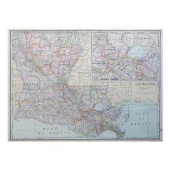
Large Original Antique Map of Louisiana, USA, C.1900
Located in St Annes, Lancashire
Fabulous map of Louisiana.
Original color.
Engraved and printed by the George F. Cram Company
Category
Antique 1890s American Maps
Materials
Paper
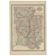
Antique Map of Arkansas, Mississippi and Louisiana by Johnson, 1872
Located in Langweer, NL
Antique map titled 'Johnson's Arkansas (..)'. Original map of Arkansas, Mississippi and Louisiana
Category
Antique Late 19th Century Maps
Materials
Paper
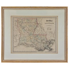
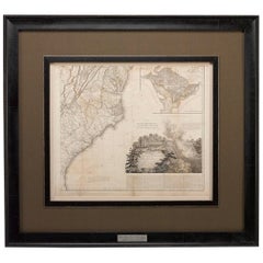
Louisiana: A Framed 19th Century Map by O. W. Gray
By Gray and Co
Located in Alamo, CA
This framed 19th century map of the Louisiana territory was published in "Gray's Atlas of the
Category
Antique Mid-19th Century American Other Maps
Materials
Paper
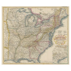
Antique Map of the Eastern United States with Inset Map of Texas
Located in Langweer, NL
Territorien'. This map extends as far west as Louisiana and only includes the northern portion of Florida
Category
Antique Mid-19th Century Maps
Materials
Paper
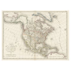
Antique Map of North America, 1821
Located in Langweer, NL
Antique map of America titled 'Carte de l'Amerique septentrionale'. Scarce map of North America
Category
Antique 19th Century Maps
Materials
Paper
1812 United States Map, by Pierre Tardieu, Antique French Map Depicting the U.S.
By Pierre François Tardieu
Located in Colorado Springs, CO
fine works including maps of Louisiana, Mexico, Russia, and Asia in addition to his illustrations of
Category
Antique 1810s French Maps
Materials
Paper
H 43.5 in W 48 in D 2.25 in
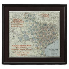
1908 "Map of Texas" by The Kenyon Company
Located in Colorado Springs, CO
Presented is an antique map of the state of Texas, printed as a pocket map in 1908 by The Kenyon
Category
Antique Early 1900s American Maps
Materials
Paper
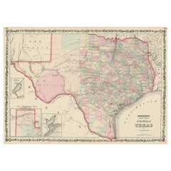
Large Antique Map of the State of Texas, 1861
Located in Langweer, NL
surveyed. The map also includes an inset of Sabine Lake on the border of Texas and Louisiana and another
Category
Antique Mid-19th Century Maps
Materials
Paper
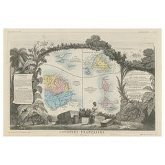
Original Steel Engraved Map of French Colonies in America, 1854
Located in Langweer, NL
Antique map titled 'Colonies Francaises (en Amerique)'. Detailed map bordered by vignettes showing
Category
Antique Mid-19th Century Maps
Materials
Paper
Free Shipping
H 13.12 in W 18.71 in D 0.02 in
1866 Ensign & Bridgman's Rail Road Map of the United States
Located in Colorado Springs, CO
borders of Minnesota, Iowa, Missouri, Arkansas, and Louisiana. As alluded to in its title, the map
Category
Antique 1860s American Late Victorian Maps
Materials
Paper
Captain Cook's Exploration of Tahiti 18th C. Hand-Colored Map by Bellin
By Jacques-Nicolas Bellin
Located in Alamo, CA
America (New France, Acadia, Louisiana) are particularly valuable. He died at Versailles. The map was
Category
Antique Mid-18th Century French Maps
Materials
Paper
H 11.38 in W 17.5 in D 0.13 in
Antique Map of the Eastern United States with Only the Northern Part of Florida
Located in Langweer, NL
Territorien'. This map extends as far west as Louisiana and only includes the northern portion of Florida
Category
Antique Mid-19th Century Maps
Materials
Paper
H 14.45 in W 17.92 in D 0.02 in
Louisiana. USA Century Atlas state antique vintage map
Located in Melbourne, Victoria
'The Century Atlas. Louisiana'
Inset map of 'New Orleans and Vicinity'.
Original antique map, 1903
Category
Early 20th Century Victorian More Prints
Materials
Lithograph
Louisiana: A Framed 19th Century Map by O.W. Gray
Located in Alamo, CA
This framed 19th century map of the Louisiana territory was published in "Gray's Atlas of the
Category
1870s Landscape Prints
Materials
Engraving
H 20 in W 22.63 in D 0.88 in
Steven, Route 10, Louisiana
By Amy Stein
Located in New York, NY
environment. Most of the photographs from this series can be found on a Google Map that documents my travels
Category
Early 2000s Contemporary Portrait Photography
Materials
C Print
Cheerleaders, New Orleans, Louisiana
By Amy Stein
Located in New York, NY
environment. Most of the photographs from this series can be found on a Google Map that documents my travels
Category
Early 2000s Contemporary Portrait Photography
Materials
C Print
A Louisiana Wild Heart II
Located in New Orleans, LA
alligator activists. While Louisiana contends with the highest rate of wetlands loss in the country, she
Category
2010s Contemporary Mixed Media
Materials
Canvas, Thread
A Louisiana Wild Heart I
Located in New Orleans, LA
alligator activists. While Louisiana contends with the highest rate of wetlands loss in the country, she
Category
2010s Contemporary Mixed Media
Materials
Canvas, Thread
Six Flags Park, St. Bernard Parish, Louisiana
By Amy Stein
Located in New York, NY
environment. Most of the photographs from this series can be found on a Google Map that documents my travels
Category
Early 2000s Contemporary Landscape Photography
Materials
C Print
Joan Miró, Exhibition Poster, Louisiana Art Museum, Denmark, 1998/1999, Framed
By Joan Miró
Located in Warszawa, Mazowieckie
Poster from the Joan Miró exhibition, Louisiana Art Museum in Denmark from September 18, 1998 to
Category
1990s Danish Mid-Century Modern Posters
Materials
Paper
No Reserve
H 31.89 in W 24.02 in D 0.79 in
New France and Labrador - Graphite Drawing, Landscape, On Antiqued Map
By Don Pollack
Located in Chicago, IL
Coeur d’Alenes trail in Northern Idaho. It is a place of rugged and stark beauty barely on the old maps
Category
21st Century and Contemporary Contemporary Landscape Paintings
Materials
Canvas, Oil
Captain Cook's Exploration of Tahiti: 18th C. Hand-colored Map by Bellin
By Jacques-Nicolas Bellin
Located in Alamo, CA
America (New France, Acadia, Louisiana) are particularly valuable. He died at Versailles. The map was
Category
Late 18th Century Landscape Prints
Materials
Engraving
Boudicca
Located in New Orleans, LA
alligator activists. While Louisiana contends with the highest rate of wetlands loss in the country, she
Category
2010s Contemporary Mixed Media
Materials
Canvas, Thread
Ghost Coast I
Located in New Orleans, LA
alligator activists. While Louisiana contends with the highest rate of wetlands loss in the country, she
Category
2010s Contemporary Mixed Media
Materials
Canvas, Thread, Acrylic
Ghost Coast II
Located in New Orleans, LA
alligator activists. While Louisiana contends with the highest rate of wetlands loss in the country, she
Category
2010s Contemporary Mixed Media
Materials
Canvas, Thread, Acrylic
Luna
Located in New Orleans, LA
alligator activists. While Louisiana contends with the highest rate of wetlands loss in the country, she
Category
2010s Contemporary Mixed Media
Materials
Canvas, Thread
Theia
Located in New Orleans, LA
alligator activists. While Louisiana contends with the highest rate of wetlands loss in the country, she
Category
2010s Contemporary Mixed Media
Materials
Canvas, Thread
Artemis (diptych)
Located in New Orleans, LA
alligator activists. While Louisiana contends with the highest rate of wetlands loss in the country, she
Category
2010s Contemporary Mixed Media
Materials
Canvas, Thread
French Empire Style Porcelain Cartographic Cabinet Plate
Located in Fort Lauderdale, FL
map of North America highlighted with an apple-green and gilt border with neoclassical motifs.
This
Category
Antique Early 19th Century French Empire Ceramics
Materials
Porcelain
Personal Memoirs of P. H. Sheridan, First Edition, Two-Volume Set, 1888
Located in Colorado Springs, CO
is highly illustrated, with 27 maps and 17 plates. The book is presented beautifully rebound in
Category
Antique 1880s American Books
Materials
Leather, Paper
Thomas Wimberly "Global Forefront" Thank you Print For Pandemic Workers Nurse AP
By Thomas Wimberly
Located in Draper, UT
Thomas Wimberly III is an artist and designer from southern Louisiana. After earning his BFA in
Category
2010s More Art
Materials
Screen
History of the Nineteenth Army Corps by Richard B. Irwin
Located in valatie, NY
Louisiana and the Gulf Coast. This edition contains his original battlefield maps and charts.
Category
Vintage 1980s American Books
Materials
Paper
Memoirs of General William T. Sherman, First Edition, Two-Volume Set, 1875
Located in Colorado Springs, CO
Florida, California, New York, Kansas, and Louisiana. Yet the bulk of the writing is focused on the Civil
Category
Antique 1870s American Books
Materials
Leather, Paper
H 9.38 in W 6.38 in D 3.88 in
Plan de la Nouvelle Orléans - Original Lithograph - 1880
Located in Roma, IT
toponomastic map of the city of New Orleans, theatre of the Battle of Liberty Place, or Battle of Canal Street
Category
1880s Modern Figurative Prints
Materials
Lithograph
Viking woman -Shield maiden- exotic daguerreotype reproduction Framed
By FPA Francis Pavy Artist
Located in Lafayette, LA
relics from the Viking age—ancient artifacts, scrolls with runic inscriptions, and maps depicting distant
Category
2010s Surrealist Figurative Photography
Materials
Inkjet
Section 30 - Landscape Painting, Original Oil on Canvas
By Don Pollack
Located in Chicago, IL
via bicycle following Lewis and Clark. His work has utilized maps, documents, photography, painting
Category
21st Century and Contemporary Contemporary Landscape Paintings
Materials
Canvas, Oil
DELIVERY, NINE MILLIMETER FLAG, 2001 Gouache Painting
By Marc Roder
Located in Surfside, FL
Gallery, Miami, FL
2004 “Northern Map and Bindle”. Solo show, Dorsch Gallery, Miami, FL
2003 “Miami
Category
Early 2000s Pop Art Still-life Paintings
Materials
Gouache, Laid Paper
Living Dangerously, Original Oil Painting, Large Scale Fictional Book Cover
By Don Pollack
Located in Chicago, IL
work has utilized maps, documents, photography, painting, and installation.This work was routed in a
Category
21st Century and Contemporary Contemporary Figurative Paintings
Materials
Canvas, Oil
Section 35
By Don Pollack
Located in Chicago, IL
via bicycle following Lewis and Clark. His work has utilized maps, documents, photography, painting
Category
21st Century and Contemporary Contemporary Landscape Paintings
Materials
Canvas, Oil
Silent Running
By Don Pollack
Located in Chicago, IL
via bicycle following Lewis and Clark. His work has utilized maps, documents, photography, painting
Category
21st Century and Contemporary Contemporary Figurative Paintings
Materials
Canvas, Oil
Battle For Yellowstone, Original Oil Painting of Oversized Fictional Bookcover
By Don Pollack
Located in Chicago, IL
,– such as a 3000 mile journey via bicycle following Lewis and Clark. His work has utilized maps
Category
21st Century and Contemporary Contemporary Figurative Paintings
Materials
Canvas, Oil
I'm Witnessing a Forest Fire-Oil Painting, Fictional Penguin Classic Book Cover
By Don Pollack
Located in Chicago, IL
bicycle following Lewis and Clark. His work has utilized maps, documents, photography, painting, and
Category
21st Century and Contemporary Contemporary Landscape Paintings
Materials
Oil, Canvas
H 31 in W 19 in D 1.5 in
Chicago Portage - Serene Wooded Landscape with Stormy Skies, Oil on Canvas
By Don Pollack
Located in Chicago, IL
Coeur d’Alenes trail in Northern Idaho. It is a place of rugged and stark beauty barely on the old maps
Category
21st Century and Contemporary Contemporary Landscape Paintings
Materials
Canvas, Oil
Why! (Is It Easier to Get a Gun than an Education, A Gun Instead of Help?)
By Ron Bechet
Located in New Orleans, LA
medium: map, gun parts, paint on wood panel
Ron Bechet is a Professor of Art in the Department
Category
2010s Contemporary More Art
Dracula
By Don Pollack
Located in Chicago, IL
via bicycle following Lewis and Clark. His work has utilized maps, documents, photography, painting
Category
21st Century and Contemporary Contemporary Figurative Paintings
Materials
Canvas, Oil
Large 1804 Hand-Colored Map of America After the Louisiana Purchase
By Aaron Arrowsmith
Located in La Jolla, CA
Fine example of Arrowsmith's map of America, in four sheets.
An excellent map of America on the
Category
Antique Early 1800s English Federal Prints
Materials
Paper
1764 Map "Carte Reduite Du Globe Terrestre"
By Jacques-Nicolas Bellin
Located in New York, NY
Original 1764 hand-colored copperplate engraved map by Jacques Nicholas Bellin, titled "Carte
Category
1760s Landscape Prints
Materials
Engraving
1772 Map of Part of "West Florida"
Located in New York, NY
Original 1772 hand-colored copper plate engraving full title "A Map of Part of West Florida, from
Category
1770s Realist Landscape Prints
Materials
Engraving
1774 Map of Lower Hudson Bay by Nicolas Bellin
By Jacques-Nicolas Bellin
Located in New York, NY
Copper engraved map showing the lower part of the Hudson's Bay over Ontario and Quebec (Karte von
Category
1740s Realist Landscape Prints
Materials
Engraving
Moll's Famous "Beaver Map"
Located in San Francisco, CA
Harbour of Charles-Town", and a map of Louisiana and East Florida.
Moll's famous "Beaver Map
Category
Antique 18th Century and Earlier English Maps
1860 Map of South Central United States by Swanston, Antique Hand-Colored Map
Located in Colorado Springs, CO
"United States. North America. The South Central Section. Comprising Texas, Louisiana, Mississippi
Category
Antique 1860s British Maps
Materials
Paper
H 28.5 in W 24 in D 1 in
1828 "Map of the United States" by T. Ensign
Located in Colorado Springs, CO
peak at the time of this map’s publication. In 1803, President Thomas Jefferson’s Louisiana Purchase
Category
Antique 1820s American Maps
Materials
Paper
1842 Map of Lewis and Clark's Expedition of North America
Located in Colorado Springs, CO
territory of Louisiana and in the Oregon country, Clark’s map became a factor in the Westward Movement
Category
Antique 1840s American Maps
Materials
Paper
Grant's Siege of Vicksburg, Civil War Era Military Map, circa 1863
Located in Colorado Springs, CO
states of Arkansas, Louisiana, and Texas from the rest of the Confederacy.
This map is incredibly
Category
Antique 1860s American Maps
Materials
Paper
1856 a New Map of the Union with the Adjacent Islands and Countries
Located in Colorado Springs, CO
This is a very rare hanging wall map of the North, Central, and part of South America. The map is
Category
Antique 1850s American Maps
Louisiana Purchase Map, 1804
Located in Houston, TX
Louisiana Purchase.
Original antique map on paper displayed on a white mat with a gold border. Mat fits a
Category
Early 1800s More Prints
Materials
Ink, Watercolor, Handmade Paper
Giltwood Framed and Matted Map
Located in Tarry Town, NY
Giltwood framed and matted library / study room map of Arkansas, Mississippi, Louisiana. Each map
Category
Early 20th Century Posters
Materials
Giltwood, Paper
Crayon or Pastel on Muslin Naive Map of America
Located in York County, PA
NAÏVE MAP OF AMERICA, CRAYON OR PASTEL ON MUSLIN, CA 1920-30, WITH A MYRIAD OF INTERESTING
Category
Early 20th Century Paintings
Materials
Cotton
Exceptional Naive Antique Map of America, Crayon or Pastel on Muslin, 1920-30
Located in York County, PA
LARGE, NAIVE MAP OF AMERICA, CRAYON OR PASTEL ON MUSLIN, CA 1920-30, WITH A MYRIAD OF INTERESTING
Category
20th Century Paintings
H 60.5 in W 58.75 in D 1 in
Gulf of Mexico, Florida, C. America, Cuba: 18th C. Hand-colored Map by Bellin
By Jacques-Nicolas Bellin
Located in Alamo, CA
This beautiful 18th century hand-colored map entitled "Carte du Golphe du Mexique et des Isles de
Category
1750s Landscape Prints
Materials
Engraving
- 1
Get Updated with New Arrivals
Save "Map Louisiana", and we’ll notify you when there are new listings in this category.
Map Louisiana For Sale on 1stDibs
Choose from an assortment of styles, material and more with respect to the map louisiana you’re looking for at 1stDibs. Each map louisiana for sale was constructed with extraordinary care, often using paper, animal skin and fabric. Your living room may not be complete without a map louisiana — find older editions for sale from the 18th Century and newer versions made as recently as the 20th Century. A map louisiana, designed in the Art Nouveau, Empire or neoclassical style, is generally a popular piece of furniture. You’ll likely find more than one map louisiana that is appealing in its simplicity, but Jacques-Nicolas Bellin, Aaron Arrowsmith and Gray and Co produced versions that are worth a look.
How Much is a Map Louisiana?
A map louisiana can differ in price owing to various characteristics — the average selling price 1stDibs is $1,838, while the lowest priced sells for $1 and the highest can go for as much as $26,500.
More Ways To Browse
Midcentury Nathan
St Louis Vintage
Anchor Link Chain
Large Garden Cross
Gothic Louis
Vintage Wall Divider
18th Century Pennsylvania
Vintage Black And White Card
18th Century French Travel
Antique Coral Rings
Antique Coral Ring
Dior Air 2
Wall Light Gallery 7
Antique Buffalo
Vintage Campaign Fashion
Rocking Machine
Set 6 Columns
18th Century Campaign
