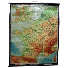
Roll Map
1
to
5
106
98
102
95
60
56
37
17
13
10
10
7
6
6
5
4
4
3
3
2
2
2
2
1
1
1
1
1
1
1
1
1
32
11
11
10
9
Sort By
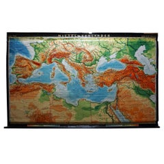
Vintage Rollable Map Mediterranean Countries Wall Chart Mural Poster
Located in Berghuelen, DE
A decorative countrycore pull-down map depiciting countries surrounding the Mediterranean sea
Category
Vintage 1970s German Country Prints
Materials
Canvas, Wood, Paper
H 62.21 in W 103.94 in D 0.79 in
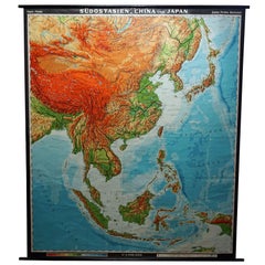
Vintage Rollable Map Southeast Asia China Japan Wall Chart
Located in Berghuelen, DE
A classical pull-down school map showing the popular region of Southeast Asia with China and Japan
Category
Late 20th Century German Country Prints
Materials
Canvas, Wood, Paper
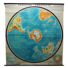
Southern Hemisphere of the Earth Rollable Map Vintage Wall Chart
Located in Berghuelen, DE
A great pull-down map or vintage wall chart illustrating the southern hemisphere of the earth
Category
Mid-20th Century German Country Prints
Materials
Canvas, Wood, Paper
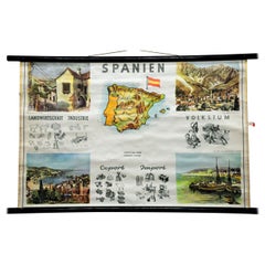
Cottagecore Wall Chart Spain Landscape Culture Souvenir Rollable Map Poster
Located in Berghuelen, DE
A countrycore vintage pull-down wall chart depicting Spain with a map and coloful pictures of
Category
Vintage 1960s German Country Prints
Materials
Canvas, Wood, Paper
H 25.2 in W 39.38 in D 0.79 in
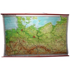
Vintage Rollable Map Northern Germany Poland Seaside Wallchart Baltic Sea
Located in Berghuelen, DE
The large impressive cottagecore pull-down map illustrates Northern Germany, Poland and parts of
Category
Late 20th Century German Country Prints
Materials
Canvas, Wood, Paper
H 60.63 in W 95.67 in D 0.79 in
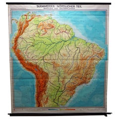
Vintage Rollable Map Wall Chart South America Brasilia and Neighbour States
Located in Berghuelen, DE
A classical pull-down school map showing South America with Brasilia and its neighbor states
Category
Mid-20th Century German Country Prints
Materials
Canvas, Wood, Paper
H 84.65 in W 77.56 in D 0.79 in
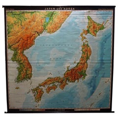
Vintage Rollable Map Asia Japan Korea Wall Chart Poster Countrycore Decoration
Located in Berghuelen, DE
A decorative country core pull-down map depicting Japan and Korea. Published by Haack-Paincke
Category
Late 20th Century German Country Prints
Materials
Canvas, Wood, Paper
H 76.38 in W 78.75 in D 0.79 in
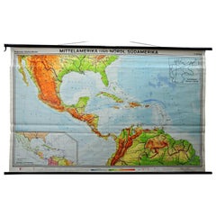
Large Rollable Map Central America Northern South America Wall Chart Poster
Located in Berghuelen, DE
A fantastic pull-down wall chart depicting a map of Central America and Northern South America
Category
Mid-20th Century German Country Prints
Materials
Canvas, Wood, Paper
H 60.24 in W 96.86 in D 0.79 in
Vintage Mural Rollable Map Wall Chart France Benelux Countries South England
Located in Berghuelen, DE
A cottagecore pull-down wall chart map illustrating France and the Benelux countries (the
Category
Mid-20th Century German Country Prints
Materials
Canvas, Wood, Paper
H 75.99 in W 61.03 in D 0.79 in
Northern Hemisphere of the Earth Rollable Map Vintage Wall Chart World Mural
Located in Berghuelen, DE
A great pull-down map or vintage wall chart illustrating the northern hemisphere of the earth
Category
Mid-20th Century German Country Prints
Materials
Canvas, Wood, Paper
H 70.48 in W 66.93 in D 0.79 in
1915 "San Francisco City and County" Hanging Map by W. Bashford Smith
Located in Colorado Springs, CO
past use and storage as a rolled map. Scattered tiny black spots, contained mostly to the index and
Category
Vintage 1910s American Art Deco Maps
Materials
Wood, Paper
Antique Chicago Illinois National Map Commercial Rollup Classroom Census Map 47"
Located in Dayton, OH
, IN. Paper map with linen trim, suspended from rolled metal poles at upper and lower edge.
Dimensions
Category
Early 20th Century North American Maps
Materials
Paper
H 47 in W 41 in D 0.05 in
Large Antique 1859 Map of North America
Located in Sag Harbor, NY
This Map was made by Augustus Mitchell in 1859 It is in amazing condition for being 163 years old
Category
Antique Mid-19th Century American Maps
Materials
Canvas, Paper
Large Scale Antique Scroll Map of Lincolnshire, England, Dated 1778
Located in St Annes, Lancashire
paper laid on canvas
Original ebonized wood frame with lovely turned finials
The map can be rolled
Category
Antique 1770s English Georgian Maps
Materials
Wood, Paper
Free Shipping
H 84 in W 60 in D 1.5 in
Very Large Vintage Map of Canada, German, Education, Institution, Cartography
Located in Hele, Devon, GB
This is a very large vintage map of Canada. A German, quality printed educational or institution
Category
Mid-20th Century German Maps
Materials
Paper
H 77.56 in W 85.04 in D 1.19 in
Massive Vintage Wall Map of the Soviet Union 'Sowjetunion' by Karl Wenschow
By Denoyer-Geppert
Located in San Diego, CA
A massive vintage wall map of the Soviet Union (Sowjetunion) published by Karl Wenschow in Munich
Category
Mid-20th Century American Maps
Materials
Wood, Paper
Antique Map of the Harbour of Praia, Santiago Island, Cape Verde, c.1750
Located in Langweer, NL
Antique map titled 'A Draught of ye Harbour of Praya in the Island St. Jago (..)'. Uncommon map
Category
Antique 18th Century Maps
Materials
Paper
Old Engraving of the Trarbach Battle in Rhineland-Palatinate, Germany, c.1710
Located in Langweer, NL
the regiment’s casualties. However, the ‘Blenheim Roll’ does name the 32 officers entitled to share in
Category
Antique 1710s Maps
Materials
Paper
H 7.88 in W 9.45 in D 0 in
Canton Famille Rose Plate, ca. 1840
Located in Banner Elk, NC
map, with two other rolled maps, indicating that they are probably minstrels.
Condition, very small
Category
Antique 1780s Chinese Chinese Export Porcelain
Materials
Porcelain
Europe Map Vintage Rollable Mural Countrystyle Wall Chart Decoration
Located in Berghuelen, DE
The vintage pull-down map shows the European continent / Europe. Published by Haack-Painke, Justus
Category
Vintage 1970s German Country Prints
Materials
Canvas, Wood, Paper
Vintage German Map Rhineland Rollable Wall Chart Poster Print
Located in Berghuelen, DE
A country core vintage pull-down map illustrating the popular German region of the Rhineland
Category
Vintage 1960s German Country Prints
Materials
Canvas, Wood, Paper
North America Map Economy Wall Chart Rollable Poster Vintage Mural
Located in Berghuelen, DE
A vintage pull-down map showing the economy of North America, published by Harms. Colorful print on
Category
Late 20th Century German Country Prints
Materials
Canvas, Wood, Paper
Map Mural Rollable Poster Vintage Wall Chart Australia New Zealand Polynesia
Located in Berghuelen, DE
Map Mural Rollable Poster Vintage Wall Chart Australia New Zealand Polynesia
A beautiful vintage
Category
Vintage 1970s German Country Posters
Materials
Canvas, Wood, Paper
H 70.87 in W 64.57 in D 0.79 in
Vintage Mural Map Rollable Wall Chart Poster Australia New Zealand Indonesia
Located in Berghuelen, DE
Vintage Mural Map Rollable Wall Chart Poster Australia New Zealand Indonesia
The vintage pull-down
Category
Vintage 1970s German Country Posters
Materials
Canvas, Wood, Paper
H 39.38 in W 48.04 in D 0.79 in
Australia and Oceania Vintage Art Map Poster Rollable Wall Chart Mural
Located in Berghuelen, DE
Australia and Oceania Vintage Art Map Poster Rollable Wall Chart Mural
The classical geographical
Category
Vintage 1970s German Country Posters
Materials
Canvas, Wood, Paper
H 82.29 in W 66.93 in D 0.79 in
Countrycore Mural Vintage Map Wall Chart Rollable Poster Central South Africa
Located in Berghuelen, DE
The cottagecore pull-down mural map depicts Middle and South Africa. Published by Westermann
Category
Vintage 1970s German Country Posters
Materials
Canvas, Wood, Paper
H 68.51 in W 83.86 in D 0.79 in
Vintage Mural Map Mediterranean Sea Near East Countries Rollable Wall Chart
Located in Berghuelen, DE
A large countrycore pull-down map showing the countries surrounding the Mediterranean Sea
Category
Vintage 1970s German Country Prints
Materials
Canvas, Wood, Paper
H 58.67 in W 105.91 in D 0.79 in
Canada Greenland North America Map Vintage Mural Rollable Wall Chart Countrycore
Located in Berghuelen, DE
A classical pull-down map of Canada and Greenland (North American Continent). Used as teaching
Category
Vintage 1970s German Country Posters
Materials
Canvas, Wood
H 74.81 in W 79.14 in D 0.79 in
Vintage Map Wall Chart Countries of North America Rollable Mural Poster
Located in Berghuelen, DE
The vintage pull-down school map illustrates the countries / states of North America. Published by
Category
Late 20th Century German Country Prints
Materials
Canvas, Wood, Paper
H 51.19 in W 39.38 in D 0.79 in
Vintage Rollable Mural Map Wall Chart Print Scandinavia Norway Sweden Finland
Located in Berghuelen, DE
A great impressive cottagecore map illustrating Scandinavia (Norway, Sweden, Finland, Denmark and
Category
Mid-20th Century German Country Prints
Materials
Canvas, Wood, Paper
H 83.47 in W 73.63 in D 0.79 in
Picture Poster Old Testament Rollable Wall Chart Religious Mural Israel Map
Located in Berghuelen, DE
A traditional pull-down wall chart illustrating picutres of the old testament, published by Ewald Becker, Hamburg. Colorful print on paper reinforced with canvas.
Measurements:
Width...
Category
Mid-20th Century German Country Prints
Materials
Canvas, Wood, Paper
H 64.18 in W 65.36 in D 0.79 in
Middle East Saudia Arabia Israel India Map Rollable Mural Vintage Wall Chart
Located in Berghuelen, DE
The pull-down school map is depicting the region of the Middle East (Turkey, Israel, Egypt, Saudi
Category
Late 20th Century German Country Prints
Materials
Canvas, Wood, Paper
H 60.63 in W 76.38 in D 0.79 in
Religious Bible Mural Journey of Apostle Paul Rollable Vintage Map Wall Chart
Located in Berghuelen, DE
A colorful picturous map showing the journey of the apostle Paul, published by Becker´s Hamburg
Category
Late 20th Century German Country Prints
Materials
Paper, Canvas, Wood
H 66.15 in W 85.44 in D 0.79 in
Vintage Picture Poster Wall Chart Rollable Large Map Peoples Republic of China
Located in Berghuelen, DE
A vintage wall chart illustrating a map of people's republic of china. Used as teaching material in
Category
Late 20th Century German Country Prints
Materials
Canvas, Wood, Paper
H 63 in W 84.26 in D 0.79 in
Lenny - Rock N Roll Hall of Fame
By Noah Becker
Located in Dallas, TX
artwork was created to commemorate that Lenny was going to be inducted in the Rock N Roll Hall of Fame
Category
21st Century and Contemporary Neo-Expressionist Figurative Paintings
Materials
Mixed Media, Leather, Wood
Late 20th Century Educational Geographic Map - Australasia
Located in Hook, Hampshire
Map – Australasia. Good quality roll up school educational geographic map from the Czech republic. The
Category
Late 20th Century Czech Posters
Materials
Cotton
Late 20th Century Educational Geographic Map - Hemispheres
Located in Hook, Hampshire
Map – Hemispheres. Good quality roll up school educational geographic map from the Czech republic. The
Category
Late 20th Century Czech Posters
Materials
Cotton
Magnificent Detailed "Map of Africa" Silk Scarf
Located in New York, NY
This magnificently detailed "Map of Africa" silk scarf shows the wonderful wildlife
Category
1980s Italian Scarves
Late 20th Century Educational Geographic Map - USA Topography
Located in Hook, Hampshire
Geographic Map – USA Topography. Good quality roll up school educational geographic map from the Czech
Category
Late 20th Century Czech Posters
Materials
Cotton
Late 20th Century Educational Geographic Map - African Climate
Located in Hook, Hampshire
Geographic Map – African Climate. Good quality roll up school educational geographic map from the Czech
Category
Late 20th Century Czech Posters
Materials
Cotton
Late 20th Century Educational Geographic Map - Worlds Resources
Located in Hook, Hampshire
Geographic Map – Worlds Resources. Good quality roll up school educational geographic map from the Czech
Category
Late 20th Century Czech Posters
Materials
Cotton
Late 20th Century Educational Geographic Map - Worlds Oceans
Located in Hook, Hampshire
Geographic Map – Worlds Oceans. Good quality roll up school educational geographic map from the Czech
Category
Late 20th Century Czech Posters
Materials
Cotton
Late 20th Century Educational Geographic Map - World Atlas
Located in Hook, Hampshire
Map – World Atlas . Good quality roll up school educational geographic map from the Czech republic
Category
Late 20th Century Czech Posters
Materials
Cotton
Late 20th Century Educational Geographic Map - Scandinavian Topography
Located in Hook, Hampshire
Educational Geographic Map – Scandinavian Topography. Good quality roll up school educational geographic map
Category
Late 20th Century Czech Posters
Materials
Cotton
H 73.23 in W 59.85 in D 0.4 in
Late 20th Century Educational Geographic Map - Earths Lithosphere
Located in Hook, Hampshire
Geographic Map – Earths Lithosphere. Good quality roll up school educational geographic map from the Czech
Category
Late 20th Century Czech Posters
Materials
Cotton
Late 20th Century Educational Geographic Map - Japan - Korea
Located in Hook, Hampshire
Geographic Map – Japan – Korea. Good quality roll up school educational geographic map from the Czech
Category
Late 20th Century Czech Posters
Materials
Cotton
Late 20th Century Educational Geographic Map - European Countries
Located in Hook, Hampshire
Geographic Map – European Countries. Good quality roll up school educational geographic map from the Czech
Category
Late 20th Century Czech Posters
Materials
Cotton
Late 20th Century Educational Geographic Map - Atlantic Currents
Located in Hook, Hampshire
Geographic Map – Atlantic Currents. Good quality roll up school educational geographic map from the Czech
Category
Late 20th Century Czech Posters
Materials
Cotton
Late 20th Century Educational Geographic Map - South Asia Topography
Located in Hook, Hampshire
Geographic Map – South Asia Topography. Good quality roll up school educational geographic map from the Czech
Category
Late 20th Century Czech Posters
Materials
Cotton
Late 20th Century Educational Geographic Map - African Industry (1728.2)
Located in Hook, Hampshire
Educational Geographic Map – African Industry. Good quality roll up school educational geographic map from the
Category
Late 20th Century Czech Posters
Materials
Cotton
H 63.78 in W 46.07 in D 0.4 in
Late 20th Century Educational Geographic Map - European Countries (1728.14)
Located in Hook, Hampshire
Educational Geographic Map – European Countries (1728.14). Good quality roll up school educational geographic
Category
Late 20th Century Czech Posters
Materials
Cotton
H 68.51 in W 63 in D 0.4 in
Late 20th Century Educational Geographic Map - African Industry (1728.1)
Located in Hook, Hampshire
Educational Geographic Map – African Industry. Good quality roll up school educational geographic map from the
Category
Late 20th Century Czech Posters
Materials
Cotton
H 64.18 in W 46.07 in D 0.4 in
Late 20th Century Educational Geographic Map - Continent Of Americas Industry
Located in Hook, Hampshire
Educational Geographic Map – Continent Of Americas Industry. Good quality roll up school educational
Category
Late 20th Century Czech Posters
Materials
Cotton
H 73.23 in W 51.58 in D 0.4 in
Late 20th Century Educational Geographic Map - Australia Topography And Economy
Located in Hook, Hampshire
Educational Geographic Map – Australia Topography And Economy. Good quality roll up school educational
Category
Late 20th Century Czech Posters
Materials
Cotton
H 66.15 in W 57.88 in D 0.4 in
Late 20th Century Educational Geographic Map - South African Topography (1728.5)
Located in Hook, Hampshire
Educational Geographic Map – South African Topography. Good quality roll up school educational geographic map
Category
Late 20th Century Czech Posters
Materials
Cotton
H 64.18 in W 45.28 in D 0.4 in
Late 20th Century Educational Geographic Map - South African Topography (1728.4)
Located in Hook, Hampshire
Educational Geographic Map – South African Topography. Good quality roll up school educational geographic map
Category
Late 20th Century Czech Posters
Materials
Cotton
H 70.48 in W 45.28 in D 0.4 in
Vintage Pull-Down Map Germany BRD / DDR History Wall Chart
Located in Berghuelen, DE
A classical rollable vintage wall chart illustrating a map of Germany (Federal Republic of Germany
Category
Mid-20th Century German Country Prints
Materials
Canvas, Wood, Paper
Vintage Mural Map Pull Down Wall Chart North America Economy Finances
Located in Berghuelen, DE
A classical rollable wall chart showing the economy of North America. Publishd by the Paul List
Category
Mid-20th Century German Country Prints
Materials
Canvas, Wood, Paper
H 53.55 in W 39.38 in D 0.79 in
Land Use and Livestock North America Picture Map Wall Chart Poster Mural
Located in Berghuelen, DE
The vintage rollable picture map of North- and Middle America shows land use and livestock
Category
Late 20th Century German Country Prints
Materials
Canvas, Wood, Paper
H 47.25 in W 35.44 in D 0.79 in
GUCCI F/W 2016 Pink Multicolor Historic Garden Aerial Map Pleated Midi Skirt
By Gucci, Alessandro Michele
Located in Thiensville, WI
GUCCI F/W 2016 Pink Multicolor Historic Garden Aerial Map Print Pleated Midi Skirt
Brand
Category
2010s Italian A-Line Skirts
- 1
Get Updated with New Arrivals
Save "Roll Map", and we’ll notify you when there are new listings in this category.
Roll Map For Sale on 1stDibs
Find many varieties of an authentic roll map available at 1stDibs. Frequently made of wood, canvas and fabric, every roll map was constructed with great care. You’ve searched high and low for the perfect roll map — we have versions that date back to the 20th Century alongside those produced as recently as the 20th Century are available. When you’re browsing for the right roll map, those designed in Mid-Century Modern styles are of considerable interest. Many designers have produced at least one well-made roll map over the years, but those crafted by Denoyer-Geppert are often thought to be among the most beautiful.
How Much is a Roll Map?
Prices for a roll map start at $280 and top out at $1,200 with the average selling for $420.
