Wine Maps
to
8
91
8
70
58
26
20
14
14
12
10
9
9
8
7
3
3
2
2
2
2
2
2
1
1
1
1
1
1
1
1
4
1
1
1
1
Sort By
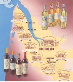
Wine Map of Bordeaux
Located in New York, NY
Original color lithograph for Établissements D. Cordier S.A. Draeger, Imp., circa 1938.
Category
1930s Prints and Multiples
Materials
Paper
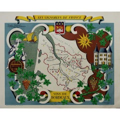
Stunning illustrated wine map by French artist Rémy Hétreau in the 1950s
Located in PARIS, FR
This stunning illustrated wine map, created by French artist Rémy Hétreau in the 1950s, is a
Category
1950s Prints and Multiples
Materials
Paper, Lithograph
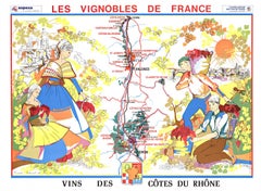
Original Vins Des Côtes du Rhône, French Wine Map vintage poster
Located in Spokane, WA
Original Les Vignobles de France - Cote du Rhone vintage wine map poster. Horizontal. Size 36.5
Category
Late 20th Century American Modern Landscape Prints
Materials
Lithograph
H 27 in W 36.5 in D 0.04 in
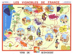
Original Vins du Sud-Ouest vintage French wine map poster
Located in Spokane, WA
Original Les Vignobles de France , Vins du Sud-Quest French vintage wine map poster. Horizontal
Category
Late 20th Century American Modern Landscape Prints
Materials
Lithograph
H 27 in W 36.5 in D 0.04 in
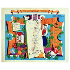
Original Vintage Poster Vignobles De France Vins De Bourgogne Burgundy Wine Map
Located in London, GB
Original vintage drink advertising poster promoting French wines (one of a series issued by the
Category
Vintage 1950s French Posters
Materials
Paper
H 26.78 in W 33.27 in D 0.04 in
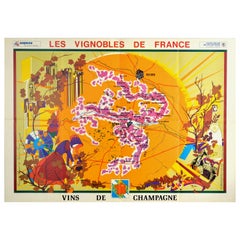
Original Vintage Poster Vineyards Of Champagne Wine Map Les Vignobles De France
Located in London, GB
of France Wines of Champagne featuring a pictographic map of the Champagne wine region framed by an
Category
Vintage 1960s French Posters
Materials
Paper
H 26.38 in W 37.01 in D 0.04 in
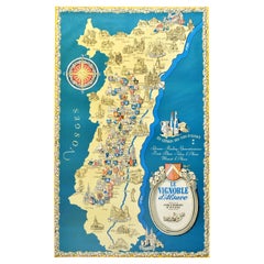
Original Vintage Poster Les Vignobles d'Alsace Vineyards French Wine Map Rhine
Located in London, GB
Wine Information Centre Colmar France. The poster features a colourful decorative map of the Alsace
Category
Vintage 1950s French Posters
Materials
Paper
H 38.98 in W 24.02 in D 0.04 in
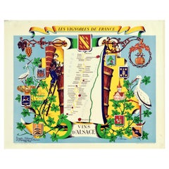
Original Vintage Poster Vignobles De France Vineyards Vins D'Alsace Wine Map Art
Located in London, GB
Original vintage drink advertising poster promoting French wines (one of a series issued by the
Category
Vintage 1950s French Posters
Materials
Paper
H 26.78 in W 33.27 in D 0.04 in
Original Vintage Poster Vignobles De France Vins Du Val De Loire Valley Wine Map
Located in London, GB
Original vintage drink advertising poster promoting French wines (one of a series issued by the
Category
Vintage 1950s French Posters
Materials
Paper
H 26.78 in W 33.27 in D 0.04 in
Antique Map of the Famous French Wine Area of Correze, 1854
Located in Langweer, NL
Antique map titled 'Dépt. da la Corrèze'. Map of the French department of Correze, France. This
Category
Antique 19th Century Maps
Materials
Paper
Antique Map of Jura, a Famous Wine Area in France, 1854
Located in Langweer, NL
Antique map titled 'Dépt. du Jura'. Map of the French department Jura, France.
Jura is a
Category
Antique 19th Century Maps
Materials
Paper
Map of Rhône: Culture and Commerce in Lyon's Silk and Wine Legacy, 1852
Located in Langweer, NL
white wines, including Côte-Rôtie and Condrieu.
These maps are not just navigation tools but also serve
Category
Antique 1850s Maps
Materials
Paper
Old Map Focusing on the Wine Region of Metz, the Moselle Region of France, 1657
Located in Langweer, NL
Antique map of France titled 'Territorium Metense'.
Old map focusing on the wine region
Category
Antique 1650s Maps
Materials
Paper
H 19.69 in W 23.63 in D 0 in
Rare Hand-Colored Map of of the Wine Region Burgundy in France by De Wit, c.1688
Located in Langweer, NL
exquisite map of the Duchy of Burgundy, published after 1688, is a fascinating example of Dutch cartographic
Category
Antique 1680s Maps
Materials
Paper
H 20.83 in W 24.41 in D 0.01 in
Old Map of the French Department of Nièvre, France
By Victor Levasseur
Located in Langweer, NL
quality of these wines. The map is surrounded by elaborate decorative engravings designed to illustrate
Category
Antique Mid-19th Century Maps
Materials
Paper
Antique Map of Nièvre ‘France’ by V. Levasseur, 1854
Located in Langweer, NL
quality of these wines. This map originates from ‘Atlas National de la France Illustré’. Published by A
Category
Antique Mid-19th Century Maps
Materials
Paper
Antique Map of Meurthe ‘France’ by V. Levasseur, 1854
Located in Langweer, NL
Lorraine and the Alsace-Lorraine wine region. This map originates from ‘Atlas National de la France
Category
Antique Mid-19th Century Maps
Materials
Paper
Antique Map of Mayenne ‘France’ by V. Levasseur, 1854
Located in Langweer, NL
area is part of the Loire Valley wine region. The map is surrounded by elaborate decorative engravings
Category
Antique Mid-19th Century Maps
Materials
Paper
Antique Map of Marne ‘France’ by V. Levasseur, 1854
Located in Langweer, NL
department is home to the Champagne region where the world's finest sparkling wine is produced. The map is
Category
Antique Mid-19th Century Maps
Materials
Paper
Hand Colored Antique Map of the Department of Nièvre, France
By Victor Levasseur
Located in Langweer, NL
quality of these wines. The map is surrounded by elaborate decorative engravings designed to illustrate
Category
Antique Mid-19th Century Maps
Materials
Paper
Hand Colored Antique Map of the Department of Marne, France
By Victor Levasseur
Located in Langweer, NL
department is home to the Champagne region where the world's finest sparkling wine is produced. The map is
Category
Antique Mid-19th Century Maps
Materials
Paper
Levasseur's 1852 Cartographic Portrait of Gironde: Celebrating the Bordeaux Wine
Located in Langweer, NL
This original hand-colored map is from the "Atlas National Illustré," a work by Victor Levasseur, a
Category
Antique 1850s Maps
Materials
Paper
H 20.67 in W 14.06 in D 0 in
Douro: The River of Tradition and Wine in Portugal, 1903
Located in Langweer, NL
The uploaded image is a historical map of the Beira Baixa region in Portugal. The map details the
Category
Antique Early 1900s Maps
Materials
Paper
Cartographic Treasures: A Journey Through the Gascogne and Guyenne Regions, 1680
Located in Langweer, NL
Guyenne, known for their wine production, in France.
This map is a rare edition, unsigned, and has a
Category
Antique Late 17th Century Maps
Materials
Paper
H 20.08 in W 23.82 in D 0.02 in
1944 original map "Les vins de Champagne – Montagne de Reims" by Louis Larmat
Located in PARIS, FR
wine culture. Published as part of the broader "Atlas de la France Vinicole", this map specifically
Category
1940s Prints and Multiples
Materials
Paper, Lithograph
Antique 1765 Wine Country Folding Map of France, Bordeau etc.
Located in Paonia, CO
comprehensive map with two routes through the wine country of France starting in Paris going south to Orleans
Category
1760s Other Art Style Landscape Prints
Materials
Etching
1946 original map "Les vins des côteaux de la Loire - Bourgueil" by Larmat
Located in PARIS, FR
creating detailed and artistically engaging wine maps, and this particular map is no exception. His maps
Category
1940s Prints and Multiples
Materials
Paper, Lithograph
1946 original map "Les vins des côteaux de la Loire - Pouilly-sur-Loire" Larmat
Located in PARIS, FR
and detailed representation of the famous Loire Valley wine regions. This map, part of Larmat's
Category
1940s Prints and Multiples
Materials
Paper, Lithograph
1941 original map "Les vins de Bordeaux - Loupiac, ..." by Larmat
Located in PARIS, FR
, marked by the tumult of World War II, the map reflects the resilience of the Bordeaux wine industry
Category
1940s Prints and Multiples
Materials
Paper, Lithograph
1943 original map " Les vins des Côtes du Rhône - Groupe Septentrional"
Located in PARIS, FR
document and a visual tribute to one of France’s most renowned wine-producing areas.
This map focuses on
Category
1940s Prints and Multiples
Materials
Paper, Lithograph
1943 original map "Les vins des Côtes du Rhône" by Larmat
Located in PARIS, FR
regions. Printed by Dorel in Paris, this map focuses on the Côtes du Rhône wine region, one of the oldest
Category
1940s Prints and Multiples
Materials
Paper, Lithograph
1943 original map "Les vins des Côtes du Rhône - Groupe Meridional"
Located in PARIS, FR
vineyards of the Rhône wine region. This map was published by Dorel in Paris during the German occupation of
Category
1940s Prints and Multiples
Materials
Paper, Lithograph
1944 original map Les vins de Champagne – Vignobles du Bar-Séquanais
Located in PARIS, FR
map as part of his extensive work in documenting the country’s diverse wine landscapes. His focus on
Category
1940s Prints and Multiples
Materials
Paper, Lithograph
1941 original map "Les vins de Bordeaux - Médoc, Haut-Médoc" by Larmat
Located in PARIS, FR
wine regions in France. Printed by Dorel in Paris, this map provides a meticulously detailed view of
Category
1940s Prints and Multiples
Materials
Paper, Lithograph
1941 original map "Les vins de Bordeaux - Régions de Sauternes" by Larmat
Located in PARIS, FR
sweet wine-producing areas in the world. Printed by Dorel in Paris, this map is part of Larmat’s wider
Category
1940s Prints and Multiples
Materials
Paper, Lithograph
1941 original map "Les vins de Bordeaux - Graves, Graves supérieurs" by Larmat
Located in PARIS, FR
most prestigious wine regions. Printed by Dorel in Paris, this map provides a meticulous depiction of
Category
1940s Prints and Multiples
Materials
Paper, Lithograph
1941 original map "Les vins de Bordeaux - Saint-Émilion, Pomerol..." by Larmat
Located in PARIS, FR
The 1941 original map by L. Larmat, titled "Atlas de la France vinicole – Les vins de Bordeaux
Category
1940s Prints and Multiples
Materials
Paper, Lithograph
1941 original map "Les vins de Bordeaux - Entre-deux-mers, Graves... " by Larmat
Located in PARIS, FR
, capturing the intricate landscape of Bordeaux’s renowned wine regions.
The map emerged during a tumultuous
Category
1940s Prints and Multiples
Materials
Paper, Lithograph
1946 original map "Les vins des côteaux de la Loire - Vouvray " by Larmat
Located in PARIS, FR
most revered wine regions. Part of Larmat’s distinguished Atlas de la France Vinicole, this map
Category
1940s Prints and Multiples
Materials
Paper, Lithograph
1941 original map "Les vins de Bordeaux - Blayais, Côtes de Blaye" by Larmat
Located in PARIS, FR
as one of the world’s foremost wine-producing areas, is richly depicted in this map, which captures
Category
1940s Prints and Multiples
Materials
Paper, Lithograph
1947 original map "Les eaux-de-vie de France - Le Cognac petite Champagne"
Located in PARIS, FR
collections of wine and spirits maps. These maps provide both an educational resource for those in the
Category
1940s Prints and Multiples
Materials
Paper, Lithograph
1941 original map "Atlas de la France vinicole - Les vins de Bordeaux" by Larmat
Located in PARIS, FR
part of a renowned series that visually mapped the most famous wine regions of France. Created by L
Category
1940s Prints and Multiples
Materials
Paper, Lithograph
1944 original map "Les vins de Champagne – Vallée de la Marne" by Louis Larmat
Located in PARIS, FR
, imparts distinct freshness and fruitiness to the wines produced here. Larmat's map offers a detailed
Category
1940s Prints and Multiples
Materials
Paper, Lithograph
1943 original map "Les vins des Côtes du Rhône - Chateauneuf du Pape " by Larmat
Located in PARIS, FR
, this map meticulously illustrates two of the most prestigious wine appellations in the southern Rhône
Category
1940s Prints and Multiples
Materials
Paper, Lithograph
1944 original map "Les vins de Champagne – La côte des blancs" by Louis Larmat
Located in PARIS, FR
of France's wine regions earned him a lasting legacy in the world of viticulture. His maps, including
Category
1940s Prints and Multiples
Materials
Paper, Lithograph
Beautiful geographical poster of Burgundy created by Alain Cornic in 1979
Located in PARIS, FR
Beautiful geographical poster of Burgundy created by Alain Cornic in 1979.
Map - Tourism - Alcohol
Category
1970s Prints and Multiples
Materials
Linen, Paper, Lithograph
Original Vintage Poster Vignobles De France Vins De Bourgogne Burgundy Wine Map
Located in London, GB
Original vintage drink advertising poster promoting French wines (one of a series issued by the
Category
1950s More Prints
Materials
Paper
Original Vintage Poster Vineyards Of Champagne Wine Map Les Vignobles De France
Located in London, GB
of France Wines of Champagne featuring a pictographic map of the Champagne wine region framed by an
Category
1960s More Prints
Materials
Paper
Original Vintage Poster Les Vignobles d'Alsace Vineyards French Wine Map Rhine
Located in London, GB
Wine Information Centre Colmar France. The poster features a colourful decorative map of the Alsace
Category
1950s More Prints
Materials
Paper
Original Vintage Poster Vignobles De France Vineyards Vins D'Alsace Wine Map Art
Located in London, GB
Original vintage drink advertising poster promoting French wines (one of a series issued by the
Category
1950s More Prints
Materials
Paper
Original Vintage Poster Vignobles De France Vins Du Val De Loire Valley Wine Map
Located in London, GB
Original vintage drink advertising poster promoting French wines (one of a series issued by the
Category
1950s More Prints
Materials
Paper
Gilt Framed Vintage French Cote De Beaune Wine Region Poster 1972
Located in Alton, GB
Framed Cote De Beaune region wine map from 1972. The print has been removed to clean the glass, the
Category
Vintage 1970s French Posters
Materials
Paper
Gilt Framed Vintage French La Cote De Nuits Wine Region Poster 1972
Located in Alton, GB
Framed La Cote De Nuits region wine map from 1972. The print has been removed to clean the glass
Category
Vintage 1970s French Posters
Materials
Paper
Copper Engravings Maps of Wine Regions
Located in Atlanta, GA
Hand colored Copper Engravings, Maps of the Wine Regions by Le Vasseur, mid 19th century
Category
Antique 19th Century French Prints
Gilt Framed Vintage Wine Regions of France Map
Located in Alton, GB
Framed French wine region map 1973. The print has been removed to clean the glass, the frame has
Category
Vintage 1970s French Posters
Materials
Paper
Original Vintage Wine Map Poster Les Vignobles De France Loire Valley Vineyards
Located in London, GB
Original vintage drink advertising poster promoting French wines (one of a series issued by the
Category
Vintage 1950s French Posters
Materials
Paper
H 26.78 in W 33.27 in D 0.04 in
Original Vintage Poster Les Vignobles De France Vineyards Wine Map Cockerel Logo
Located in London, GB
Production Metropolitaine featuring a colourful pictorial map design showing a line of dancing wine growers
Category
Vintage 1960s French Posters
Materials
Paper
H 38.19 in W 24.81 in D 0.04 in
Antique Map of Jura, a Famous Wine Area in France, c. 1852
Located in Langweer, NL
Antique map titled 'Dépt. du Jura'. Map of the French department Jura, France.
Jura is a
Category
Antique 19th Century French Maps
Materials
Paper
Decorative Antique Map of the Famous French Wine Region of Burgundy, ca.1660
Located in Langweer, NL
Description: Antique map titled 'Gouvernement General du Duche de Bourgogne, Comte de Bresse
Category
Antique 1660s Maps
Materials
Paper
H 19.69 in W 23.23 in D 0 in
17th Century Hand-Colored Map of Bordeaux Region of France by Mercator/Hondius
Located in Alamo, CA
the cities of Bourdeaux and Bayonne in the Bordeaux wine district. The map is oriented with the west
Category
Antique Mid-17th Century Dutch Maps
Materials
Paper
H 10.75 in W 13.5 in D 0.13 in
- 1
Get Updated with New Arrivals
Save "Wine Maps", and we’ll notify you when there are new listings in this category.
