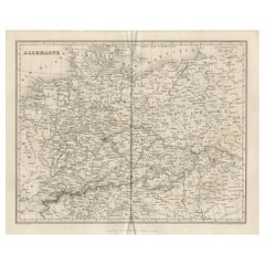
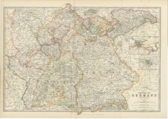
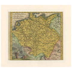
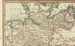
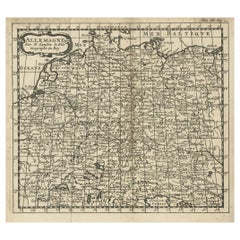
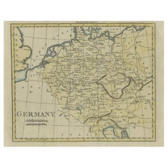
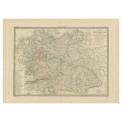
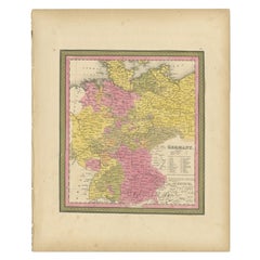
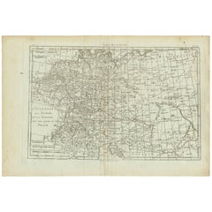
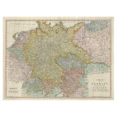
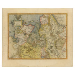
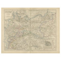
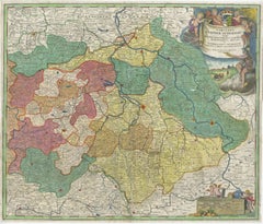
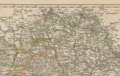
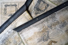
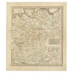
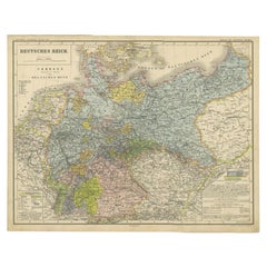
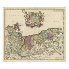
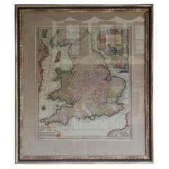
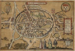
Antique Map of Germany by Balbi '1847'
Located in Langweer, NL
Antique map titled 'Allemagne'. Original antique map of Germany.
Category
Antique Mid-19th Century Maps
Materials
Paper
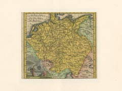
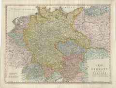
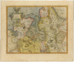
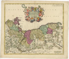
Antique Map of Germany by Balbi '1847'
Located in Langweer, NL
Antique map titled 'Allemagne'. Original antique map of Germany.
Paper

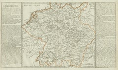
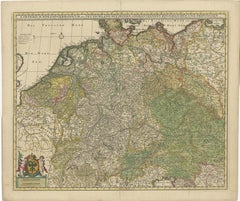
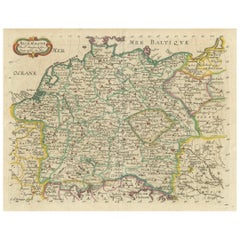
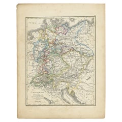
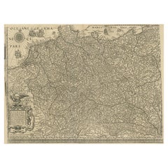
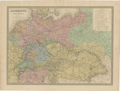
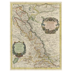
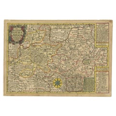
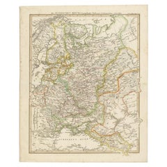
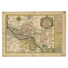
Antique Map of Germany by Clouet, 1787
Located in Langweer, NL
Antique map titled 'L'Allemagne'. Antique map of Germany.
Paper
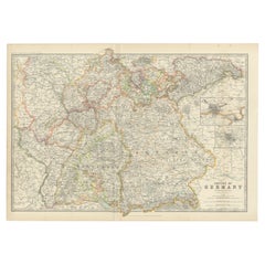
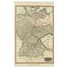
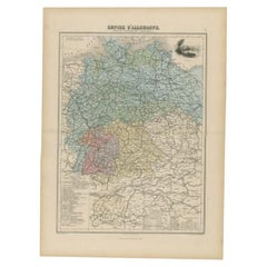
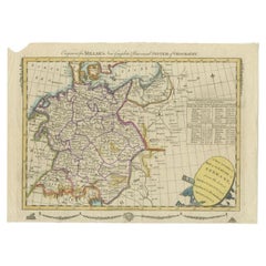
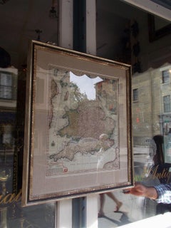
Antique Map of Germany by Johnston '1909'
Located in Langweer, NL
Antique map titled 'Empire of Germany'. Original antique map of Germany.
Paper
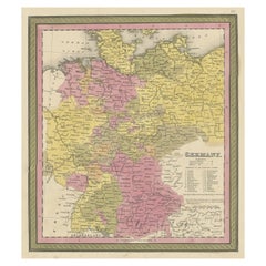
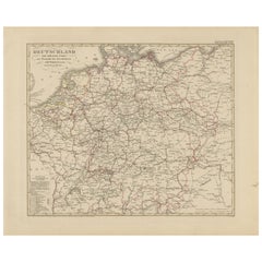
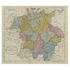
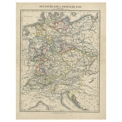
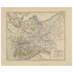
Decorative Antique Map of Germany, 1846
Located in Langweer, NL
Antique map titled 'Germany'. Old map of Germany. This map originates from 'A New Universal Atlas Containing Maps of the various Empires, Kingdoms, States and Republics Of The Wo...
Paper
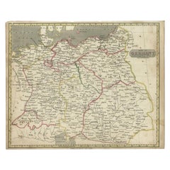

Antique Map of Germany by Walker, 1820
By R. Walker
Located in Langweer, NL
Antique map Germany titled 'Map of Germany as defined by the Peace of Paris'.
Paper


Antique Map of Germany by T. Kitchin, circa 1770
Located in Langweer, NL
Antique map titled 'An Accurate Map of Germany (..) '. Drawn from the best Authorities by T.Kitchin Geogr."
Paper
Antique Map of Germany by Hederichs 'circa 1740'
Located in Langweer, NL
Antique map titled 'Germania'. Rare miniature map of Germany and surroundings.
Paper

$1,034Sale Price|20% Off
H 20.67 in W 24.22 in D 0.02 in
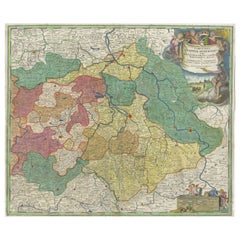
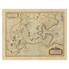
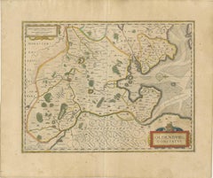
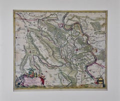
Antique Map of Germany and Central Europe, ca.1690
Located in Langweer, NL
Original antique map of Germany covering the central part of Europe with Germany in the center and the Netherlands in west.
Paper


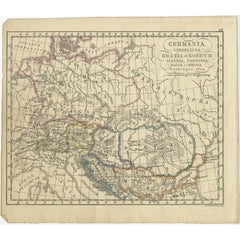
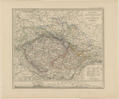
Antique 1842 Map of Germany by Pierre M. Lapie, Mid-19th Century
Located in Langweer, NL
Antique map titled 'Carte de la Germanie Ancienne'. Map of Germany.
Paper


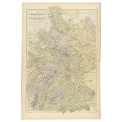
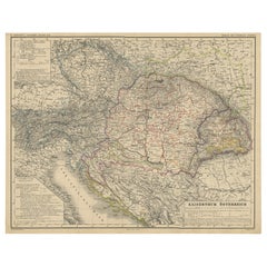
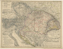
Antique Map of Germany with the Empire of Austria by Wyld '1845'
Located in Langweer, NL
Antique map titled 'The Confederated States of Germany with the Empire of Austria, and The Kingdoms of Prussia and Poland'.
Paper

Map of Germany - Original Etching - 1820
Located in Roma, IT
Map of Germany is an Original Etching realized by an unknown artist of 19th century in 1820.
Etching
$223
H 16.54 in W 9.85 in D 0.01 in
Antique Map of Germany c.1830 by Thomas Kelly – Hand-Coloured Copper Engraving
Located in Langweer, NL
Antique Map of Germany by Thomas Kelly, London, circa 1830, with hand colouring Finely engraved map of Germany titled 'Germany', published by Thomas Kelly at 17 Paternoster Row, Lon...
Paper
$399
H 14.77 in W 17.88 in D 0.01 in
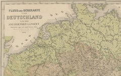
Antique Map of Germany & Railways – Transport Network Overview, 1857
Located in Langweer, NL
Antique Map of Germany & Railways – Transport Network Overview, 1857 Striking 19th-century map titled "Deutschland und angränzende Länder zur Übersicht der Eisenbahnen und Hauptstra...
Paper

$340
H 14.77 in W 17.88 in D 0.01 in
Antique Map of Germany, Netherlands, Belgium & Switzerland – Stülpnagel, 1857
Located in Langweer, NL
This detailed political map captures the patchwork of states and territories that characterized Germany and its neighboring regions prior to the unification of the German Empire in 1...
Paper

$105
H 6.5 in W 7.29 in D 0 in
French Antique Miniature Map of Germany and Surrounding Countries, 1721
Located in Langweer, NL
Antique map Germany titled 'Allemagne Par N. Sanson le Fils Geographe du Roy'.
Paper

Decorative Hand-Colored Map of Germany by Nicolas Sanson, 1648
Located in Langweer, NL
Title: Hand-Colored Map of Germany by Nicolas Sanson, 1648 This hand-colored map, titled "Allemagne," was created by Nicolas Sanson, a prominent 17th-century French cartographer and...
Paper

Rare Antique Map of Germany with English Text, c.1690
Located in Langweer, NL
Antique map Germany titled 'Germani by Robt. Morden'. Rare antique map of Germany.
Paper
$282
H 13.86 in W 10.44 in D 0.01 in
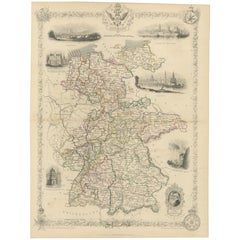
Ornate Hand-Colored Map of Germany by John Tallis with Vignettes, ca. 1850
Located in Langweer, NL
Title: Hand-Colored Map of Germany by J. Tallis, ca. 1850 This beautifully hand-colored map of Germany, published by John Tallis & Co. around 1850, provides a comprehensive depictio...
Paper

Antique Map of Germany from an Old English Atlas, c.1802
Located in Langweer, NL
Antique map titled 'Germany'. Antique map of Germany engraved for 'Atlas to Walker's Geography'.
Paper

Antique Map of Germany in Roman Times, Showing Roman Provinces, 1825
Located in Langweer, NL
Old map of Germany and surroundings originating from 'Atlas der Oude Wereld'.
Paper

Antique Map of Germany from a 17th Century Pocket Atlas, 1685
Located in Langweer, NL
Antique map titled 'Nova Totius Germaniae descriptio.' Miniature map of Germany, from the pocket atlas 'Introductionis in Universam Geographiam tam Veterem quam novam ..
Paper

Antique Map of Germany by Pierre M. Lapie, Engraved, 1842, France
Located in Langweer, NL
Antique map titled 'Carte d'Allemagne (..)'. Map of Germany.
Paper
$176
H 6.11 in W 6.89 in D 0 in
Antique Copper Engraved Map of Germany in the Early 18th Century, c.1740
Located in Langweer, NL
Antique map Germany titled 'Allemagne'. Rare miniature map of Germany and surroundings.
Paper

$246
H 14.57 in W 10.04 in D 0 in
Antique Map of Germany During the Mid-18th Century, Published in 1747
Located in Langweer, NL
Antique map Germany titled 'A New & Accurate Map of Germany'.
Paper

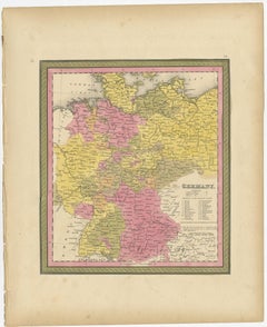
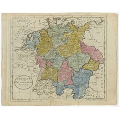
Antique Map of Germany from an American 19th Century Atlas, 1846
Located in Langweer, NL
Antique map titled 'Germany'. Old map of Germany. This map originates from 'A New Universal Atlas Containing Maps of the various Empires, Kingdoms, States and Republics Of The World ...
Paper
$142
H 10.63 in W 13.59 in D 0 in
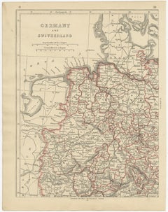
Antique Map of Germany and Switzerland from an Old Dutch School Atlas, 1852
Located in Langweer, NL
Antique map titled 'Duitschland en Zwitersland'. Map of Germany and Switzerland.
Paper

Antique Map of German Colonies by Meyer, 1895
Located in Langweer, NL
Antique map titled 'Deutsche Kolonien.' Lithographed map of the German Colonies.
Paper
$235Sale Price / set|20% Off
H 12.21 in W 9.65 in D 0.02 in
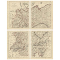
Antique Map of Germany and Switzerland by Lowry, '1852'
Located in Langweer, NL
Antique map titled 'Germany and Switzerland'. Four individual sheets of Germany and Switzerland.
Paper


Antique Map of Germany of German in Roman Times, c.1660
Located in Langweer, NL
Antique map Germany titled 'Germaniae Veteris Typus'. Antique map probably by Blaeu or based on an earlier state by W.
Paper
$165
H 8.27 in W 10.24 in D 0 in
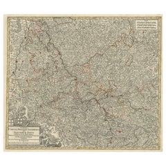
Antique Map of Germany, the Netherlands, Bohemia, Bavaria and Switzerland, 1785
Located in Langweer, NL
Antique map titled 'Germany and the Netherlands from the latest authorities'.
Paper
$340
H 14.77 in W 17.88 in D 0.01 in
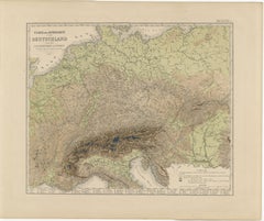
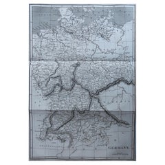
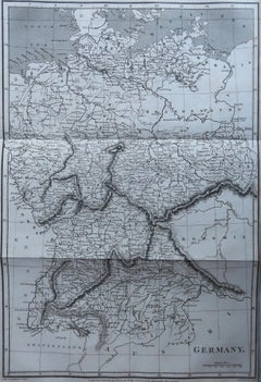
1855 Relief Map of Germany and the Alps Showing Rivers and Terrain
Located in Langweer, NL
1855 Engraved Map of Switzerland with Cantonal Borders by Stülpnagel This finely detailed antique map of Switzerland, titled "Die Schweiz," was published in 1855 by the renowned Ger...
Paper

$775
H 20.25 in W 23.5 in D 0.07 in
18th Century Hand-Colored Homann Map of Germany, Including Frankfurt and Berlin
By Johann Baptist Homann
Located in Alamo, CA
The firm flourished, becoming the leading map publisher in Germany and an important entity in the European map market.
Paper

$1,351
H 20.67 in W 24.73 in D 0 in
Regional Map of Germany, inc Hamburg, Luneberg, Hannover, Braunsweig etc, c.1720
Located in Langweer, NL
The firm remained in being until the next century and had a wide influence on map publishing in Germany. Apart from the atlases the firm published a very large number of individual m...
Paper
$165
H 10.24 in W 15.04 in D 0.02 in
Antique Map of Germany, Bohemia, Hungary and Part of Poland by R. Bonne ‘1780’
Located in Langweer, NL
This map shows current Holland, Germany, Belgium, Switzerland, Austria, Slovenia, Croatia, Hungary, Czech Republic, Slovakia and Poland.
Paper
$130
H 12.88 in W 10.32 in D 0 in
Antique Map of Germany and Switzerland from an Old Dutch School Atlas, c.1873
Located in Langweer, NL
Antique map titled 'Deutschland en Zwitserland'. Old map depicting Germany and Switzerland.
Paper
Large Antique Map of the German Empire
Located in Langweer, NL
Antique map titled 'A Map of Germany (..)'. Large antique map of the German Empire, highly detailed.
Paper

$2,068Sale Price|20% Off
H 15.08 in W 19.38 in D 0.02 in
Antique Map of the German Empire with decorative Title Cartouche
Located in Langweer, NL
Very rare antique map of Germany. The map first appeared in 1606, with views in margins and a portrait of the emperor.
Paper


$502Sale Price|20% Off
H 21.66 in W 25.52 in D 0.02 in
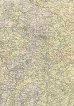
Antique Map of present-day North-Rhine Westphalia, Germany
Located in Langweer, NL
Detailed regional map of Germany showing the region bounded by the Maas River in the west and to part of Westphalia in the East.
Paper

Antique Map of the German Empire by Migeon, 1880
Located in Langweer, NL
Antique map titled 'Empire d'Allemagne'. Old map of Germany.
Paper
$900Sale Price|20% Off
H 17.72 in W 21.66 in D 0.02 in
Antique Map of Westfalia, Germany by Mercator/Hondius, circa '1620'
Located in Langweer, NL
Antique map titled 'Westfalia cum dioecelsi Bremensi'. Original antique map of Germany.
Paper
$462
H 20.91 in W 27.64 in D 0.01 in
Germany & Central Europe – Antique 1865 Map by Andriveau-Goujon, Paris
Located in Langweer, NL
Antique Map of Germany and Central Europe – “Allemagne et Europe Centrale” by Andriveau-Goujon, 1865 This large, finely engraved map titled “Allemagne et Europe Centrale” was publis...
Paper
$411
H 17.33 in W 21.66 in D 0.01 in
Germany Map with Berlin Inset – Het Duitsche Keizerrijk, Nieuwe Hand-Atlas 1876
Located in Langweer, NL
Germany Map with Berlin Inset – Het Duitsche Keizerrijk, Nieuwe Hand-Atlas 1876 This detailed 19th-century map of Germany, titled “Deutschland (Het Duitsche Keizerrijk),” was publis...
Paper
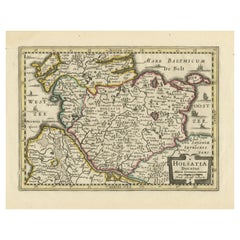

Antique Map of Holstein, Germany
Located in Langweer, NL
Antique map titled 'Holsatia Ducatus'. Original old map of Holstein, Germany.
Paper
Antique Map of Saxony, Germany
Located in Langweer, NL
Original antique map titled 'Circulus Saxoniae Superioris'. Original antique map of Saxony, Germany.
Paper
German Antique Map of Oceania, 1895
Located in Langweer, NL
Antique map titled 'Oceanie.' Map of Oceania. This attractive original old antique print / plate / map originates from 1885-1907 editions of a famous German encyclopedia: 'Meyers gro...
Paper
$517
H 14.77 in W 17.88 in D 0.01 in
1858 Map of Southwestern Germany & Switzerland – Bavaria, Württemberg, Baden
Located in Langweer, NL
Antique Map of Southwestern Germany & Switzerland – Bavaria, Württemberg, Baden, 1858 Detailed antique map titled "Südwestliches Deutschland mit Bayern, Würtemberg, Baden, Hohenzoll...
Paper

$399
H 14.77 in W 17.88 in D 0.01 in
Antique Map of Northeastern Germany – Saxon & Prussian States, 1858
Located in Langweer, NL
Ideal for historians, map collectors, and those with ancestry in northern or eastern Germany.
Paper

$517
H 14.77 in W 17.88 in D 0.01 in
Antique Map of Eastern Germany, Bohemia, Moravia & Silesia – 1858
Located in Langweer, NL
Antique Map of Eastern Germany, Bohemia, Moravia & Silesia – 1858 Detailed 19th-century engraved map titled "Östliches Deutschland mit Böhmen, Mähren und Schlesien" (Eastern German...
Paper
Antique Map of The German Empire (West Sheet), 1882
Located in Langweer, NL
Transport yourself to the heart of history with an original Antique Map of The German Empire (west sheet) from 'The Comprehensive Atlas and Geography of the World,' meticulously craf...
Paper
$380
H 8.35 in W 10.75 in D 0.01 in
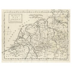
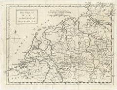
Seat of War Westphalia Map - Antique Military Map Netherlands Germany, 1763
Located in Langweer, NL
Seat of War Westphalia Map 1763, Antique Military Map Netherlands Germany An elegant mid-18th century engraved map titled “The Seat of War in the Circle of Westphalia,” dating to 17...
Paper
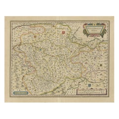

Antique Map of the Duchy of Westphalia, Germany
Located in Langweer, NL
Original antique map titled 'Westphalia Ducatus'. Fine map of the Duchy of Westphalia, Germany.
Paper


$648Sale Price|20% Off
H 21.03 in W 23.63 in D 0.02 in
Antique Map of the Westphalia region of Germany
Located in Langweer, NL
Antique map titled 'Circulus Westphaliae (..)'. Original old map of the Westphalia region, Germany.
Paper
Old German Map of the Austrian Empire, ca.1870
Located in Langweer, NL
Antique map titled 'Kaiserthum Österreich'. Old map of the Austrian Empire.
Paper
Antique Map of the Region of Oldenburg, Germany
By Willem Blaeu
Located in Langweer, NL
Antique map titled 'Oldenburg Comitatus'. Detailed old map of Oldenburg, Germany.
Paper

German Antique Map of Australia, Meyers, 1885
Located in Langweer, NL
This attractive original old antique print / plate / map originates from 1885-1907 editions of a famous German encyclopedia: 'Meyers grosses Konversations-Lexikon
Paper

$404Sale Price|20% Off
H 24.61 in W 18.23 in D 0.02 in
Antique Map of the Archdiocese of Cologne, Germany
Located in Langweer, NL
Antique map titled 'Archevesche et Eslectorat de Cologne avec ses Enclaves'. Original old map of the Archdiocese of Cologne with the course of the Rhine from Andernach to Wesel with ...
Paper

$394Sale Price|20% Off
H 19.97 in W 23.51 in D 0.02 in
Antique Hand-colored Map of Brandenburg, Germany
Located in Langweer, NL
Antique map titled 'Marchionatus Brandenburgicus'. Original antique map of Brandenburg, with Königsberg and Stettin, Germany.
Paper
Unavailable
H 23 in W 27 in D 1 in
Group of Four 18thC German Maps by Johann Baptist Homann Dated from 1720-1757
By Johann Baptist Homann
Located in Bedford, Bedfordshire
Homann/Homann Erben Nuremberg Map of Saxony, Germany, and Czech Republic 1740 J.
Parchment Paper
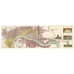
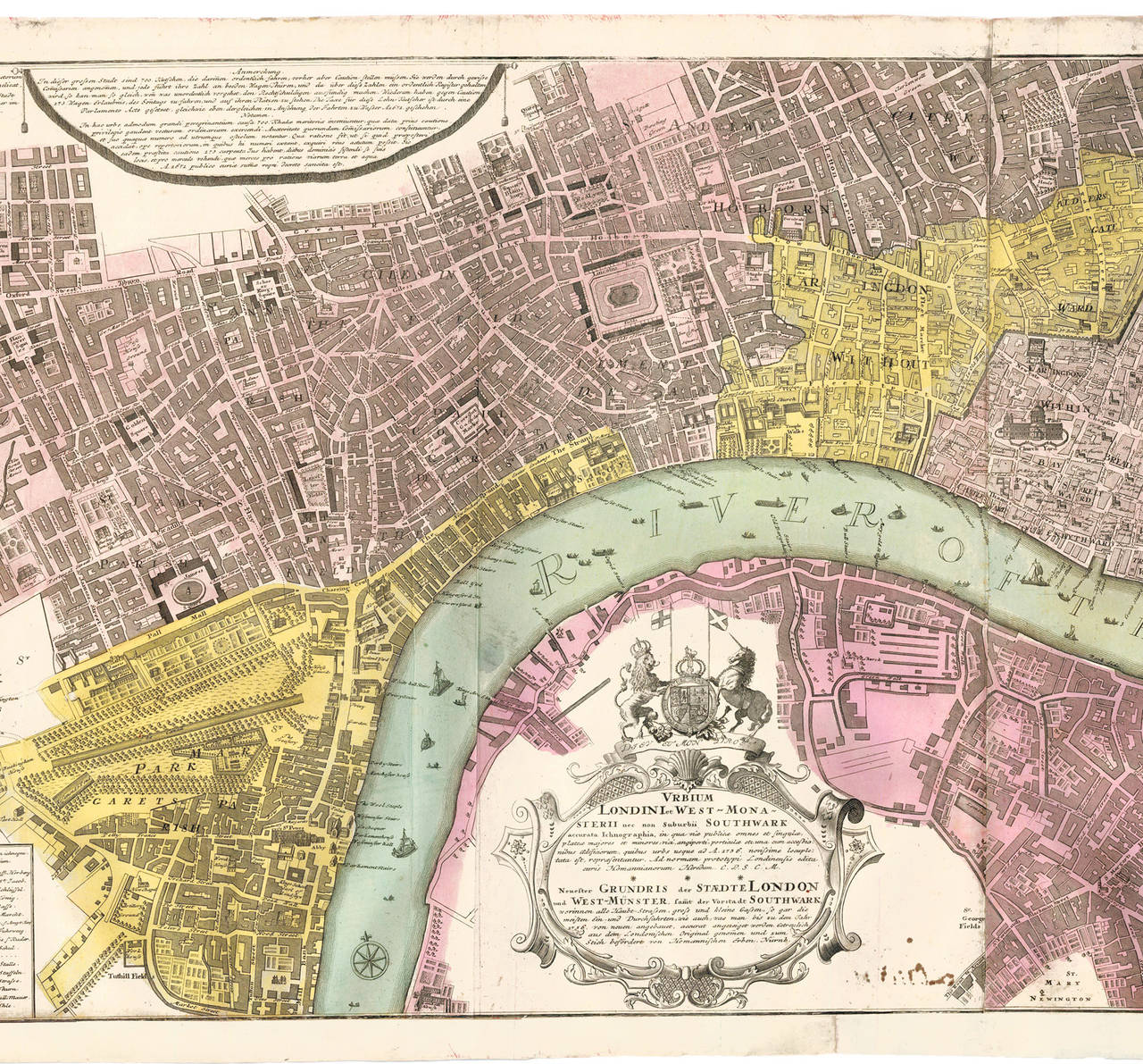
Hand-Colored Panoramic Map of London, 1736
By Homann Heirs
Located in New York, NY
Urbium Londini et West-Monasterii nec non Suburbii Southwark accurata Ichnographia by Homann Heirs. Nuremberg, 1736. Title in both Latin and German with elegant cartouche decorated w...
Paper, Watercolor
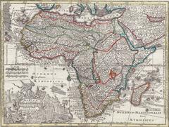
Hand-Colored Map of Africa, circa 1744
By Matthew Seutter
Located in New York, NY
Seutter, Matthew. Africa. From Atlas minor praecipua Terrarum Imperia... Augsburg, circa 1744. Original engraving with old hand-coloring. Image size: 7 5/8 x 10 1/8 inches.
Paper
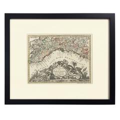
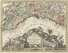
Hand-Colored Map of Genoa, circa 1744
By Matthew Seutter
Located in New York, NY
Seutter, Matthew. Genova [Genoa]. From Atlas minor praecipua Terrarum Imperia... Augsburg, circa 1744. Original engraving with old hand-coloring. Image size: 7 5/8 x 10 inches.
Paper
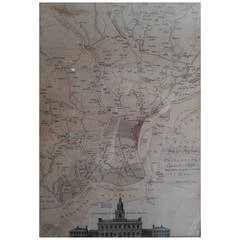
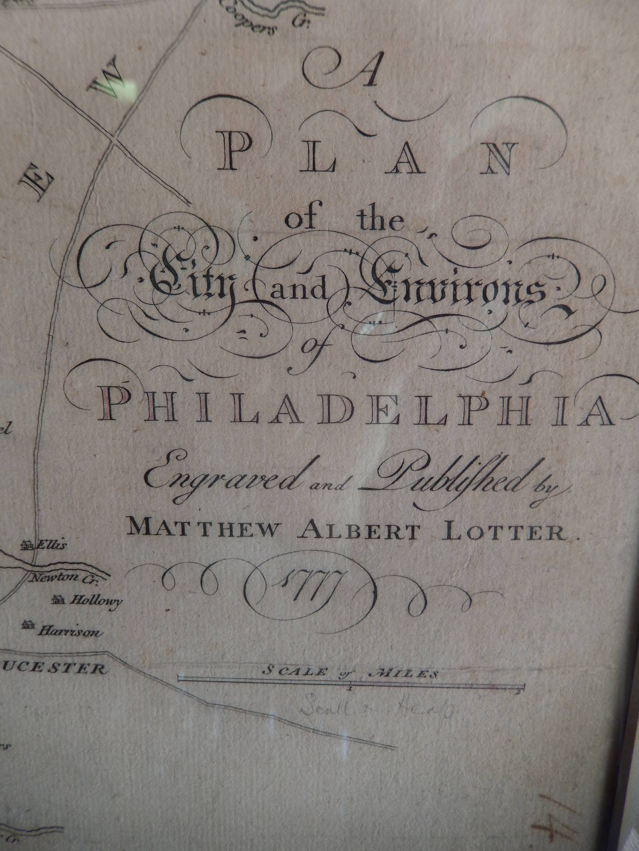
Matthew Albert Lotter 18th Century Map of Philadelphia
By Matthew Albert Lotter
Located in Southfield, MI
A superb, and rarely found original copperplate colored and engraved map of Philadelphia made in Augsburg, Germany by Matthew Albert Lotter, dating to 1777.
Hand-Colored Map of Southern Italy, circa 1744
By Matthew Seutter
Located in New York, NY
Seutter, Matthew. Neapolis Regnum... From Atlas minor praecipua Terrarum Imperia... Augsburg, circa 1744. Original engraving with old hand-coloring. Image size: 10 3/16 x 7 11...
Paper
1900s Stielers Hand Atlas 100 Maps
Located in Seguin, TX
Stielers Hand Atlas, Gotha: Justus Perthes, Germany, circa 1905. Linen covered wood box containing 100 folded individual loose leaf maps of the world, text in german.
Paper
Unavailable
H 69 in W 89 in D 1.2 in
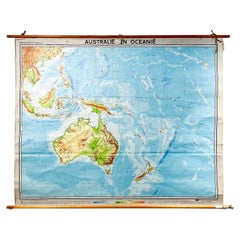
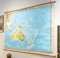
Mid-Century Dutch Topographical Wall Map of Australia and Oceania on Linen
Located in Houston, TX
This large wall map was printed in Germany in 1961 and is mounted on linen on a simple wooden dowel frame with leather loops for hanging.
Linen, Wood, Paper
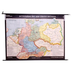
German Vintage school map of Central Europe, 1961
Located in Prague 8, CZ
Old Vintage school paper map of Central Europe. It was produced in 1961 in Germany.
Wood, Paper
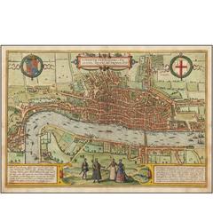
One of the First Maps of London
By Georg Braun and Frans Hogenberg
Located in La Jolla, CA
Fine example of this important early bird’s-eye view of London, which appeared in Volume 1 of Braun & Hogenberg's Civitates Orbis Terrarum. The view was based on a now-lost twenty...
Paper
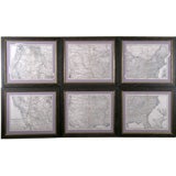
Set of 6 Maps the United States
By A. Steiler
Located in Florham Park, NJ
ADOLPH STIELER (1775-1836) JUSTUS PERTHES (1749-1812) Stieler’s Hand Atlas Justus Perthes Geographic Institute, Publisher Gotha, Germany 1879-82 Copper Engraving Outlined in Or...
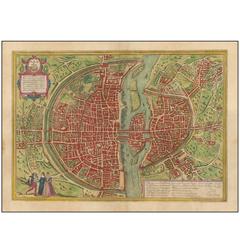
One of the Earliest Modern Maps of Paris
By Georg Braun and Frans Hogenberg
Located in La Jolla, CA
Fine example of this iconic plan of 16th century Paris, which appeared in volume 1 of Braun & Hogenberg's six volume civilities orbits terrarum. This plan is copied from the "Prem...
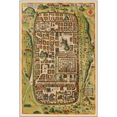
Superb 16th Century Map of Jerusalem
By Georg Braun and Frans Hogenberg
Located in La Jolla, CA
Fine example of Braun & Hogenberg's two-sheet map of Jerusalem, based upon Christian Van Adrichom's plan of ancient Jerusalem and its suburbs at the time of Jesus Christ. The plan...
Paper
Unavailable
H 46.86 in W 33.08 in
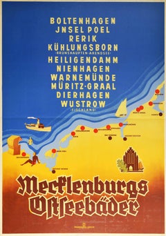
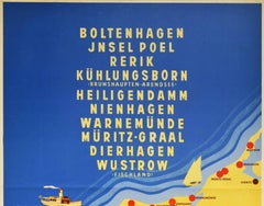
Original Vintage Poster Mecklenburg Germany Baltic Sea Beach Resorts Travel Map
Located in London, GB
Original vintage travel poster promoting Mecklenburg Baltic seaside resorts - Boltenhagel, Jnsel Poel island, Rerik, Kuhlungsborn (Brunshaupten-Arendsee), Heiligendamm, Nienhagen, Wa...
Paper
Unavailable
H 32.29 in W 48.04 in D 1.97 in
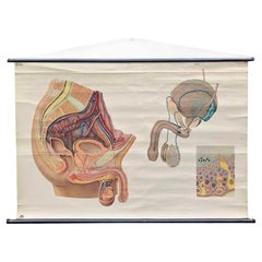
Vintage Wall Chart or Pull-Down Map of Male Anatomy, 1950s
Located in Hemiksem, VAN
An original vintage pull-down chart of the male anatomy. This poster shows the different parts of the male reproductive system. The chart has a splendid color design and detailed dr...
Wood, Paper
One of the Earliest Views of Moscow
By Georg Braun and Frans Hogenberg
Located in La Jolla, CA
Decorative full color example of Braun & Hogenberg's first view of Moscow, from a slightly elevated viewpoint from across the frozen Moskva River, first published in 1575. The wal...
Paper

Original Antique Map of Germany. C.1780
Located in St Annes, Lancashire
Great map of Germany Copper-plate engraving Published C.1780 Crease to top left corner Unframed.
Paper


Antique Map of Germany including surrounding countries
Located in Langweer, NL
Antique map titled 'Tabula Germaniae'. Orginal antique map of Germany by Claes Jansz.
Paper


Antique Map of Germany by J.B. Elwe, 1792
Located in Langweer, NL
Antique map titled 'Germanie vulgo Duitschland (..)'. Decorative map of Germany with Silesia, Bohemia , Netherlands, Belgium, Elzas, Switzerland, Tyrol and Austria.
Paper


Antique Colourful Map of Germany with Many Details, c.1770
Located in Langweer, NL
Antique map Germany titled 'An Accurate Map of Germany, drawn from the best authorities'.
Paper


Original Antique Map of Germany with Decorative Cartouches, c.1690
Located in Langweer, NL
Antique map of Germany and surroundings. With decorative cartouches.
Paper

Antique Map of Germany by T. Kitchin, circa 1780
Located in Langweer, NL
Attractive map with decorative cartouche from "A New Geographical, Historical, and Commercial Grammar and Present State of the Several Kingdoms of the World by William Guthrie, print...
Paper

Antique Map of the Federate States of Germany, c.1820
Located in Langweer, NL
Original antique map of Germany. Source unknown, to be determined.
Paper

Antique Map of the Region of Gotha, Thuringia, Germany, 1749
By Schreiber
Located in Langweer, NL
Map of the region of Gotha, Germany. This map originates from 'Atlas Selectus von allen Konigreichen und Landern der Welt' by Johann Georg Schreiber.
Paper

Antique Map of the German Empire by Millar, 1782
Located in Langweer, NL
Antique map titled 'A New & Correct Map of the Empire of Germany, from the latest Improvements and Regulated by Astronomical Observations'.
Paper

1597 German Map of Alexandria by Georg Braun and Frans Hogenberg
By Georg Braun and Frans Hogenberg
Located in Chapel Hill, NC
1597 Map of Alexandria by Georg Braun and Frans Hogenberg, Germany.
Paper

Antique Map of the German Empire by Kiepert, c.1870
Located in Langweer, NL
Antique map titled 'Deutsches Reich'. Old map of the German Empire.
Paper

Antique Map of Europe Made by German Geographer, c.1870
Located in Langweer, NL
Antique map titled 'Europa'. Old map of the European continent.
Paper

Old German Map of the New-Guinea and Bismarck Archipelago, 1895
Located in Langweer, NL
This attractive original old antique print / plate / map originates from 1885-1907 editions of a famous German encyclopedia: 'Meyers grosses Konversations-Lexikon
Paper

German Antique Map of the Russian Empire in Europe, c.1825
Located in Langweer, NL
Original antique map of the Russian Empire in Europe. This map originates from 'Stielers Handatlas'.
Paper


Set of 4 Antique Geographical Maps French-German War 1870-71
Located in Casale Monferrato, IT
Elegant late 19th century set of four antique geographical maps relating to the positioning of the armies in the Franco-German War 1870-71.
Paper

Sold
H 20.08 in W 12.21 in D 0 in
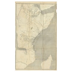
Antique Map of Eastern Africa, Engraved by a German Missionary, 1858
Located in Langweer, NL
Original antique map of Eastern Africa. This map originates from 'Reisen in Ost-Afrika, ausgeführt in dem Jahren 1837-55' by J.L.
Paper
Sold
H 21.86 in W 25.6 in D 0.01 in
Decorative Antique Map of Pomerania, in Germany and Poland, ca.1730
Located in Langweer, NL
Antique map titled 'Ducatus Pomeraniae'. Decorative map of the area of Pomerania, in present day eastern Germany and Poland.
Paper

Sold
H 28.94 in W 30.71 in D 0.4 in
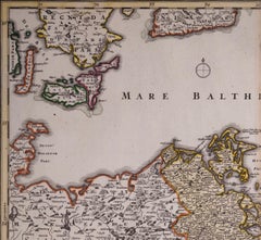
Antique Map of the Coast of Holland and Germany by Janssonius 'c.1650'
Located in Langweer, NL
Two maps with the Dutch and German North Sea coast of Friesland, with West Frisian Islands and below East Frisian Islands with inset map of the Elbe around Hamburg.
Paper

Germany West of the Rhine: A Hand-colored 18th Century Map by de Wit
By Frederick de Wit
Located in Alamo, CA
This original 18th century hand-colored map of the county of Moers, Germany entitled "Illustrissimo Celsissmo Principi GUILIELMO HENRICO D.G.
Paper
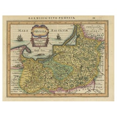
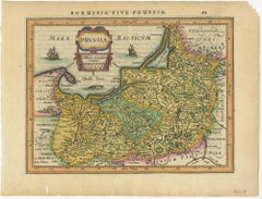
Original Decorative Antique Map of Prussia, 1628
Located in Langweer, NL
Antique map titled 'Prussia'. Original antique map of Prussia, a historically prominent German state that originated in 1525 with a duchy centered on the region of Prussia on the sou...
Paper

Sold
H 11.03 in W 14.77 in D 0.01 in
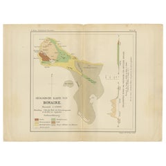
Geological Map of Bonaire - Dutch West Indies by Karl Martin, 1888
Located in Langweer, NL
Geological Map of Bonaire 1888 Dutch West Indies by Karl Martin This finely executed geological map of Bonaire was published in 1888 as part of Karl Martin’s major scientific work B...
Paper


Antique Map of the Region of Halberstadt by Schreiber, 1749
Located in Langweer, NL
Antique map titled 'Das Fürstenthum Halberstadt (..)'. Map of the region of Halberstadt, Germany.
Paper


Antique Map of the Region of Merseburg by Schreiber, 1749
Located in Langweer, NL
Antique map titled 'Das Stifft Merseburg (..)'. Map of the region of Merseburg, Germany.
Paper
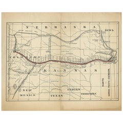
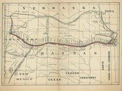
Antique Map of the Kansas Pacific Railroad, circa 1900
Located in Langweer, NL
Lithographed map of the Kansas Pacific railroad. German text on verso which reads 'Kansas Pacific Eisenbahn Gesellschaft erste Hypothek-Anleihe (..)'.
Paper
Sold
H 9.75 in W 12.88 in D 0.63 in
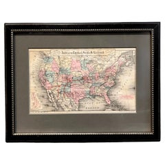
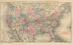
1879 Map of the United States, Showing the Santa Fe Railroad by GW & CB Colton
By G.W. & C.B. Colton
Located in Colorado Springs, CO
The Santa Fe railroad actively and successfully promoted settlement in Kansas among German communities in Europe, with maps and pamphlets just like this one.
Paper
Sold
H 33 in W 28.75 in D 1.25 in
Framed Britannia Map Hand Tinted and Colored, Signed Matthaus Seutter, C. 1725
Located in Charleston, SC
Framed and Matted Britannia Map hand tinted and colored with gilt frame. Signed Matthaus Seutter, 1725 Seutter was one of the most important and prolific German map publishers of t...
Glass, Giltwood, Paper


Framed Handcolored Map of Asia by Matthaus Seutter
Located in Essex, MA
Framed under plexy, matted.
Paper
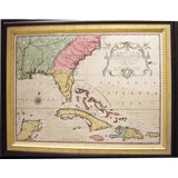
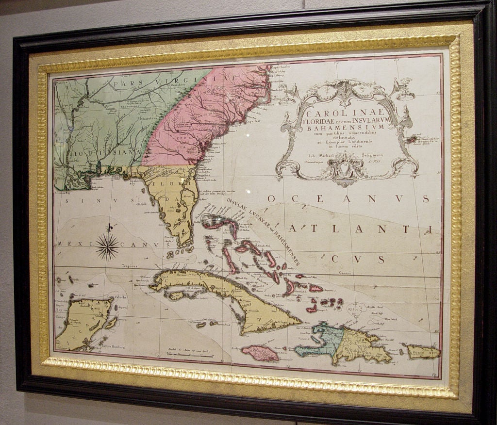
An Early Map of Florida and the Carolinas by Seligmann
Located in Downingtown, PA
Seligmann's Sammlung verschiedener auslaendischer und seltener Vögel was published in nine parts between 1749 and 1776, and included a German translation of Catesby's work with re-en...
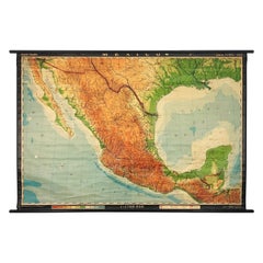
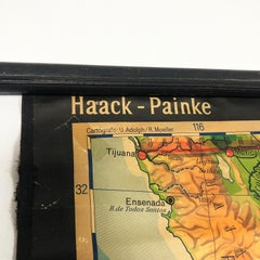
Extra Large Midcentury School Map of Mexico by Haack Painke Kooyman
Located in Mexico City, CDMX
We offer this extra large midcentury school map of Mexico by Haack Painke Kooyman, circa 1960. This vintage item remains fully functional, but it shows sign of age through scuffs, di...
Canvas

Sold
H 62.21 in W 80.32 in D 0.79 in
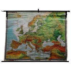
Fantastic School Map Physical View of Europe Wall Chart Poster Print Decoration
Located in Berghuelen, DE
An impressive wall chart depicting a map of Europe. Used as teaching material in German schools.
Canvas, Wood, Paper
Sold
H 18.9 in W 24.02 in
Franz Hogenberg after Georg Braun - 19th Century Engraving, Map of Canterbury
Located in Corsham, GB
A charming map of Canterbury c.1588 by German topo-geographer Georg Braun.
Engraving

Sold
H 35.44 in W 23.23 in D 0.04 in
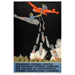
Rare Original Vintage WWII Poster British Soviet Handshake Nazi Berlin USSR
Located in London, GB
При каждом их рукопожатьи трещит фашистская германия - below an image of two smiling pilots in British and Soviet war planes shaking hands as they drop bombs on Berlin / Берлин again...
Paper

Sold
H 41 in W 31.5 in
PWW-777 - Eric Mack - Contemporary Abstract Collage Painting Based off the Grid
Located in Signal Mountain, TN
Using a grid to create the framework of the painting, Mack has utilized Zerox copies adhered by a matte medium to create graphic imagery of electronics from the 90s, small bits of a ...
Canvas, Paper, Oil, Acrylic

Original Antique Map of Germany. C.1780
Located in St Annes, Lancashire
Great map of Germany Copper-plate engraving Published C.1780 Crease to top left corner Unframed.
Paper
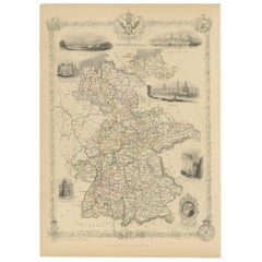

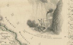
Antique Map of Germany by Tallis, 1851
Located in Langweer, NL
Antique map titled 'Germany'. Map of Germany. Showing vignettes of the Palace at Saxe Gotha, birthplace of Prince Albert; Coburg; Cologne; Dresden; Luther’s house in Frankfurt; silve...
Paper


Original Antique Map of Germany by Tallis, Circa 1850
Located in St Annes, Lancashire
Great map of Germany Steel engraving Many lovely vignettes Published by London Printing & Publishing Co. ( Formerly Tallis ), C.1850 Original colour Free shipping.
Paper
Sold
H 16.75 in W 10.5 in D 0.07 in
Original Antique Map of Germany, Sherwood, Neely Jones, Dated, 1811
Located in St Annes, Lancashire
Great map of Germany Copper-plate engraving by Cooper Published by Sherwood, Neely & Jones.
Paper

Sold
H 21.07 in W 25.12 in D 0 in
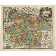
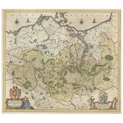
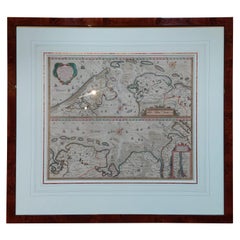
Large Map of Germany with Berlin, Bremen, Hamburg, Osnabruck & Magdeburg, c.1680
Located in Langweer, NL
Two decorative title cartouches adorn the map surrounded by cherubs, putti, and coats of arms of the major cities in Germany.
Paper


Mountain and Water Chart of Germany, or the German Federation, 1842
Located in Langweer, NL
A map of Germany divided into states. Published in Leipzig: J.C.
Paper

Antique Map of the Region of Gommern in Germany, 1749
By Schreiber
Located in Langweer, NL
Map of the region of Gommern, Germany. This map originates from 'Atlas Selectus von allen Konigreichen und Landern der Welt' by Johann Georg Schreiber.
Paper

Antique Map of Trier, Mainz, Cologne and surroundings, Germany
Located in Langweer, NL
Original antique map of the region of Trier, Mainz and Cologne, Germany.
Paper
Antique and vintage collectibles and curiosities can bring whimsy and wonder to any interior.
Decorating with old scientific instruments, historical memorabilia and vintage musical instruments, as well as other authentic collectibles and curiosities that can be found on 1stDibs, presents an opportunity to create a unique, natural history museum-like atmosphere in your home that can provoke conversation as often as it pays tribute to how far we’ve come in understanding our world.
And bringing collectibles and curiosities into your space is actually on trend — Wunderkammern, or curiosity cabinets, were all the rage in Europe during the 1500s and continued to have adherents there and in the U.S. in the following centuries. Today, however, they’re experiencing a real surge in popularity and influencing how many interior designers are furnishing and decorating homes — combining contemporary with antique, scientific with tribal, earthly with extraterrestrial, Les Lalanne tables with Flemish tapestries.
The original Wunderkammern were entire rooms filled with objects demonstrating their owners’ worldly knowledge: A proper one included artificiala or preciosa (objets d’art); naturalia (such as skeletons, shells, minerals); exotica (taxidermy or dried plants); and scientifica (scientific instruments), frequently alongside religious relics and ancient artifacts.
Pay tribute to a history of rich and diverse musical traditions that have taken shape all over the world by decorating your home with a collection of antique and vintage musical instruments — with a little help from strong hanging wire or some wall hooks, vintage brass instruments such as a gong, French horn or trumpet can help elevate a home office or complement the efforts you’ve made to ensure a welcoming vibe in your home’s entryway. Bells or antique wind instruments can add provocative metallic contrasts to dark woods as tabletop decorative objects.
Create an intriguing focal point with Georgian scientific instruments, such as stick barometers with mahogany cases or lacquered brass telescopes. These items stem from an era named for the monarchies of the four King Georges, who ruled England in succession starting in 1714 (plus King William’s reign, which lasted until 1837). Just as there was beautiful jewelry produced during the period that today is coveted by collectors, there is much to be found in the collectibles and curiosities realm too.
Wanderlust, nostalgia and a shared love of good design are contributing factors to certain trends in decorating — just as vintage trunks and luggage have reappeared as furniture or home accents in a bedroom or foyer, decorating with globes, maps or nautical objects is similarly rooted in the allure of travel and a penchant for the stylish finishing touch that collectibles bring to our homes.
Find a wide range of antique and vintage collectibles and curiosities on 1stDibs.
It’s never too early for good design. These interiors combine elevated furnishings and a youthful spirit, resulting in spaces that are at once elegant and whimsical.
Produced in 1843, the well-preserved volume is evidence of the author's exacting specifications.
New or old, the coverlets add old-time charm to any space.
Get into the games! These items celebrate the events, athletes, host countries and sporting spirit.
French trendsetter and serial collector Daniel Rozensztroch tells us about his obsession with objects related to seafaring men.
It's hard to resist the allure of a beautiful pool. So, go ahead and daydream about whiling away your summer in paradise.
The sought-after designer worked with the team at Hoffman Creative to produce a monograph that beautifully showcases some of Studio Shamshiri's most inspiring projects.
Italian writer and collector Umberto Pasti opens the doors to his remarkable cave of wonders in North Africa.