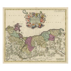
Decorative Antique Map of Pomerania, in Germany and Poland, ca.1730
View Similar Items


Want more images or videos?
Request additional images or videos from the seller
1 of 5
Decorative Antique Map of Pomerania, in Germany and Poland, ca.1730
About the Item
- Dimensions:Height: 21.86 in (55.5 cm)Width: 25.6 in (65 cm)Depth: 0.01 in (0.2 mm)
- Materials and Techniques:
- Period:1730-1739
- Date of Manufacture:circa 1730
- Condition:
- Seller Location:Langweer, NL
- Reference Number:Seller: BG-12425-21stDibs: LU3054326680432
About the Seller
5.0
Platinum Seller
These expertly vetted sellers are 1stDibs' most experienced sellers and are rated highest by our customers.
Established in 2009
1stDibs seller since 2017
1,916 sales on 1stDibs
More From This SellerView All
- Decorative Original Antique Map of Southern Germany, c.1730Located in Langweer, NL"Antique map titled 'The South West Part of Germany. Containing ye Dominions of the Archbishops and Electors of Mentz Y Treves, and of ye Elec. Palatine of ye Rhine; with Franconia, ...Category
Antique 18th Century Maps
MaterialsPaper
- Decorative Hand-Colored Antique Map of Groningen in the Netherlands, ca.1730Located in Langweer, NLAntique print, titled: 'Groningae et Omlandiae Dominium vulgo de Provincie van Stadt en Lande (…) ' - This map shows Groningen, the Netherlands. Lower left scale sticks in the decora...Category
Antique 1730s Maps
MaterialsPaper
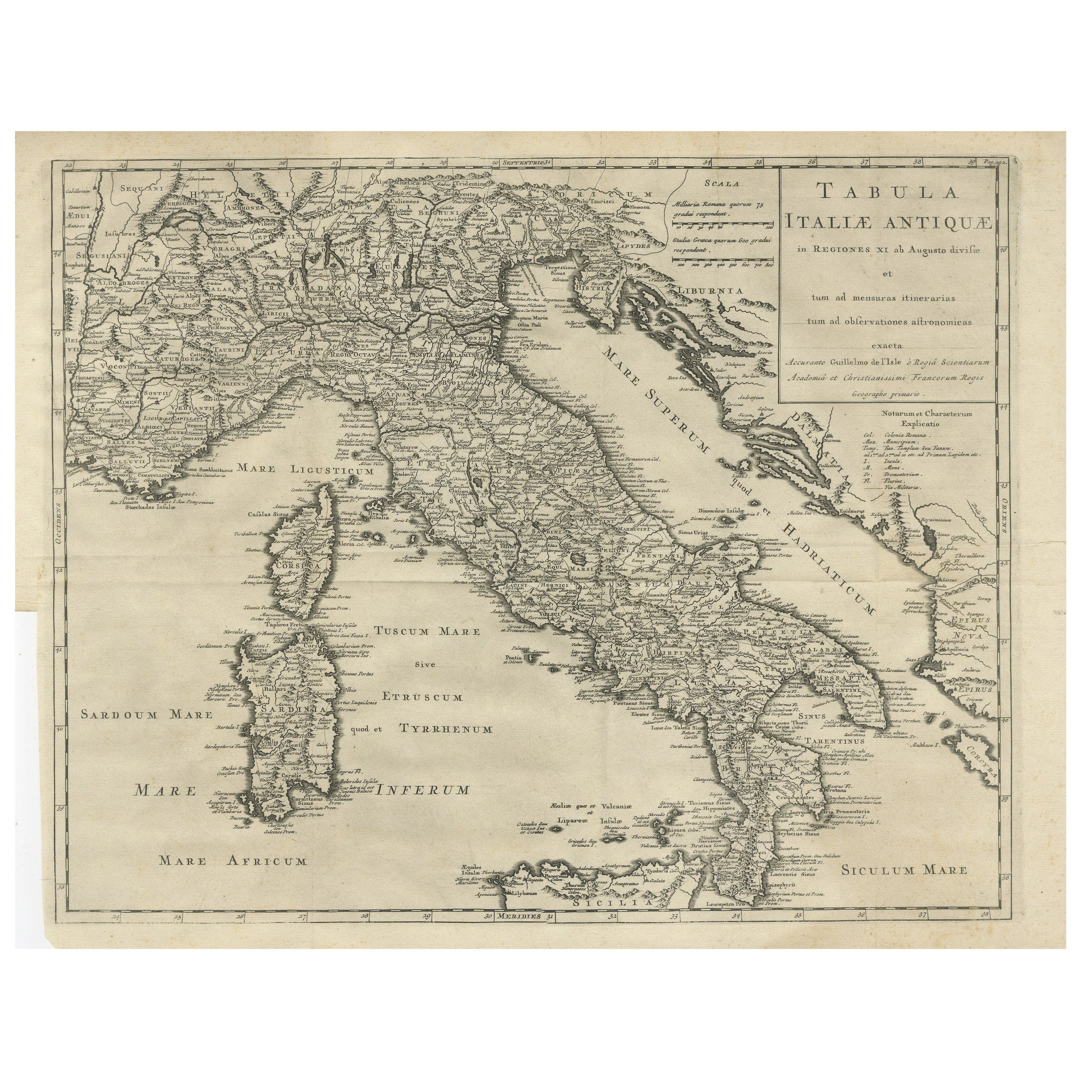
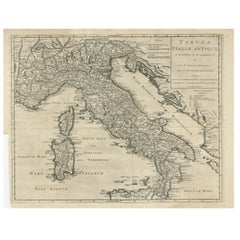
- Antique Engraved Map of Italy in Roman Times, ca.1730Located in Langweer, NLPlain engr. map of Italy according to the division of Emperor Augustus by G. Delisle. Title: "Tabula Italiae Antiquae In Regiones XI Ab Augusto Divisae Et Tum Ad Mensuras Itinerari...Category
Antique 1730s Maps
MaterialsPaper
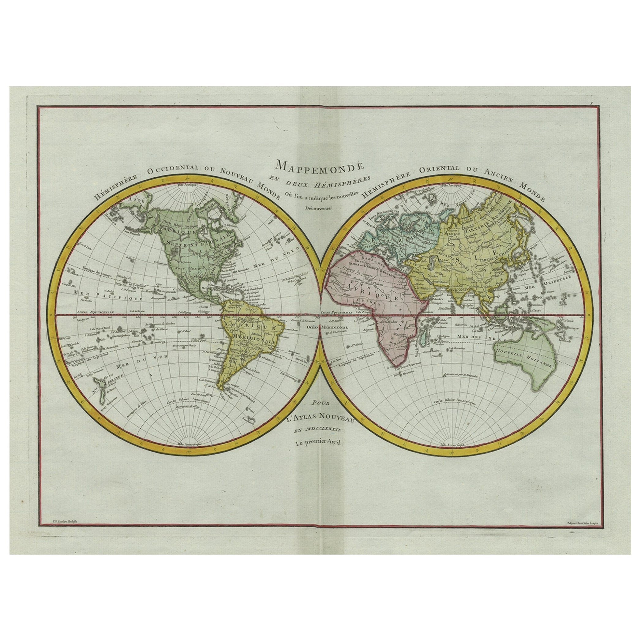
- Original Engraved Antique Map of the World, Colorful and Decorative, C.1780By Pierre François TardieuLocated in Langweer, NLAntique map titled 'Mappemonde en Deux Hemispheres ou l'on a Indique les Nouvelles Decouvertes' - This handsome double hemisphere map presents a ...Category
Antique 18th Century Maps
MaterialsPaper
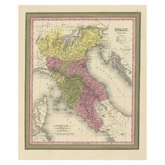
- Old Antique Colourful Decorative Map of Northern Italy, 1846Located in Langweer, NLDescription: Antique map titled 'Italy North Part'. Old map of Northern Italy. This map originates from 'A New Universal Atlas Containing Maps of the various Empires, Kingdoms, S...Category
Antique 1840s Maps
MaterialsPaper
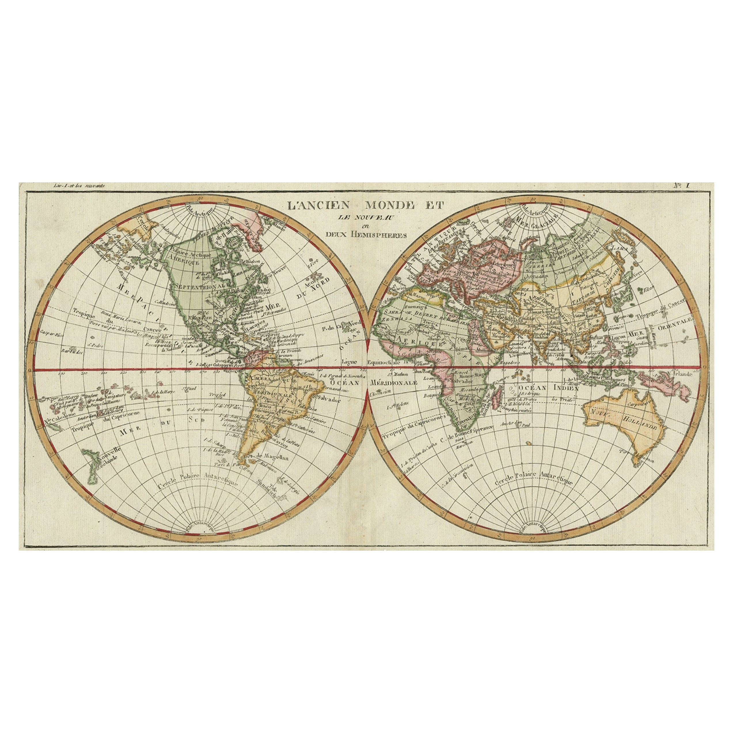
- Very Decorative Original Antique Map of the World, Published in France in c.1780By Rigobert BonneLocated in Langweer, NLAntique map titled 'L'Ancien Monde Et Le Nouveau en Deux Hemispheres' - Double hemisphere map of the World, showing the contemporary geographical...Category
Antique 18th Century Maps
MaterialsPaper
 $673 Sale Price20% Off


You May Also Like
- Large Original Antique Map of Poland by Sidney Hall, 1847Located in St Annes, LancashireGreat map of Poland Drawn and engraved by Sidney Hall Steel engraving Original colour outline Published by A & C Black. 1847 Unframed ...Category
Antique 1840s Scottish Maps
MaterialsPaper
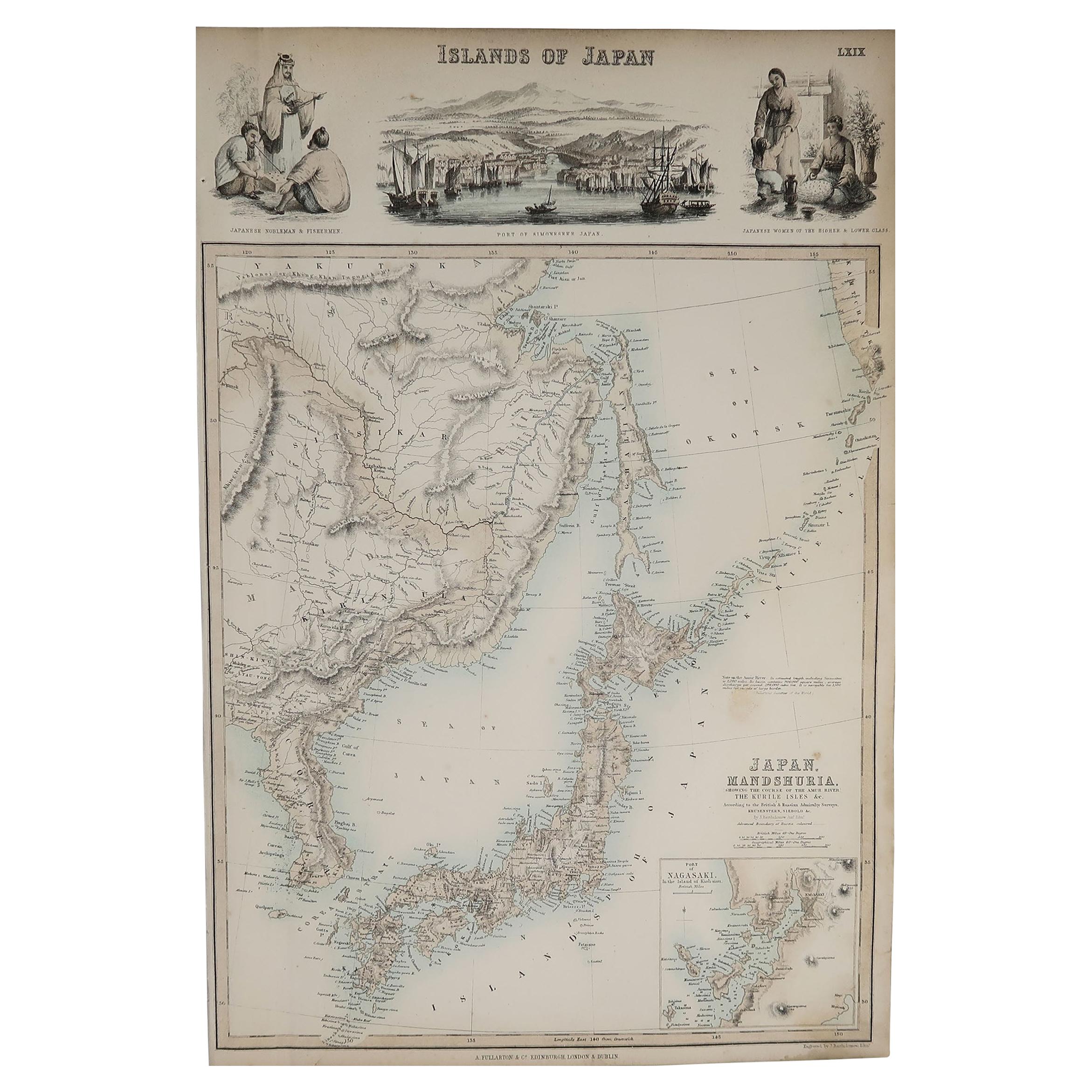
- Original Antique Decorative Map of Japan, Fullarton, C.1870Located in St Annes, LancashireGreat map of Japan Wonderful figural border From the celebrated Royal Illustrated Atlas Lithograph. Original color. Published by Fullarton, Edinburgh, C.1870 Unframed...Category
Antique 1870s Scottish Maps
MaterialsPaper
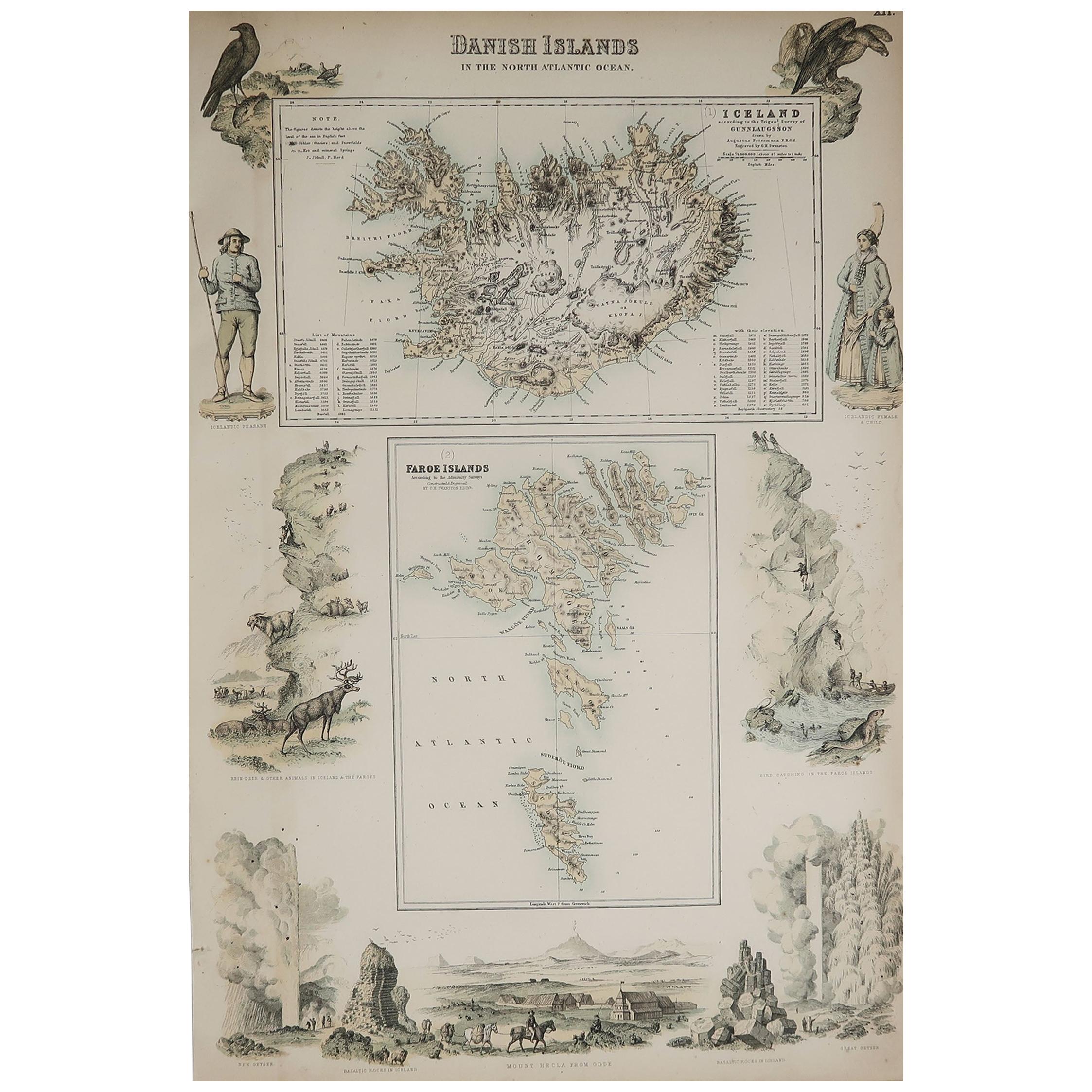
- Original Antique Decorative Map of Iceland & Faroe, Fullarton, C.1870Located in St Annes, LancashireGreat map of Iceland and The Faroe Islands Wonderful figural border From the celebrated Royal Illustrated Atlas Lithograph. Original color. Published by Fullarton, Edinb...Category
Antique 1870s Scottish Maps
MaterialsPaper
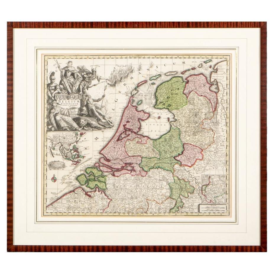
- Matthaus Seutter, Framed 1730 Color Engraving Map of "Belgium Fonderatum"Located in Bridgeport, CTLabel on verso. From Grosser Atlas. The name Belgium comes from the ancient designation "Gallis Belgica". Figural decoration upper left. M. Seutter was a famed German mapmaker in the...Category
Antique 18th Century European Renaissance Maps
MaterialsBrass
- Original Antique Decorative Map of South America-West Coast, Fullarton, C.1870Located in St Annes, LancashireGreat map of Chili, Peru and part of Bolivia Wonderful figural border From the celebrated Royal Illustrated Atlas Lithograph. Original color. Published by Fullarton, Edi...Category
Antique 1870s Scottish Maps
MaterialsPaper
- Original Antique Map of Indonesia, 1861Located in St Annes, LancashireGreat map of Indonesia Drawn and engraved by Edward Weller Original color Published in The Weekly Dispatch Atlas, 1861 Repairs to minor e...Category
Antique 1860s English Victorian Maps
MaterialsPaper


Recently Viewed
View AllMore Ways To Browse
Crab Plates
Antique Map Of Poland
Antique Maps Poland
Antique Map Poland
Gouda Plate
Stock Charts
Antique Furniture East London
Antique Eastern European Furniture
Vintage Map Of The United States
Antique House Plans
Antique Metal Window
Antique Metal Windows
Antique Furniture Rollers
Antiques Compasses
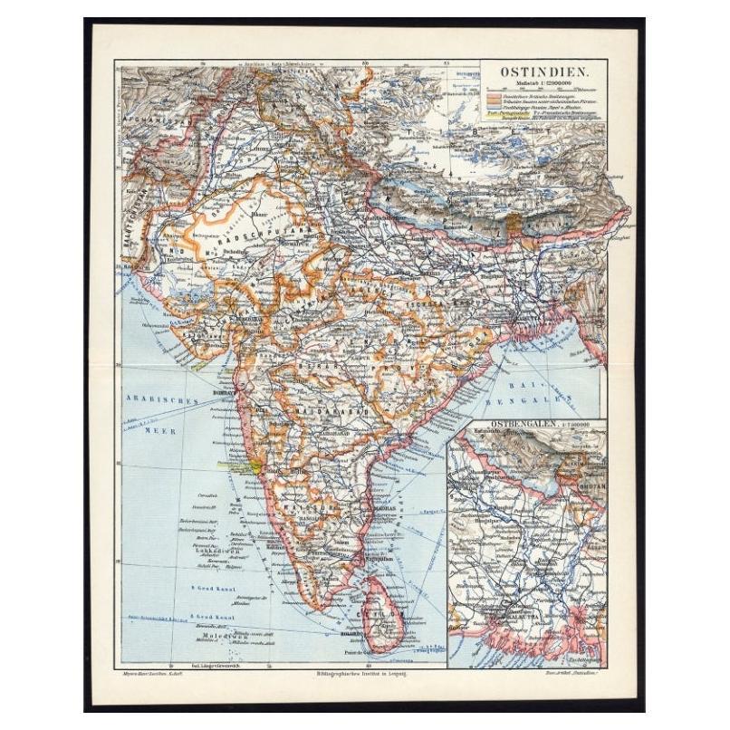
India Map
Antique Map Book
Antique Maps Book
Antique Italian Maps