Cook Maps
to
1
1
1
1
1
1
1
1
16
104
63
29
23
Creator: Cook
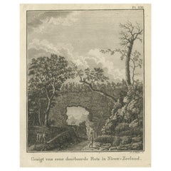
Antique Print of a Landscape with Rock Formation in New Zealand by Cook, 1803
By Cook
Located in Langweer, NL
Antique print New Zealand titled 'Gezigt van eene doorboorde Rots in Nieuw-Zeeland'. Antique print depicting a landscape with rock formation,...
Category
19th Century Antique Cook Maps
Materials
Paper
Related Items
Original Antique Map of South East Asia by Thomas Clerk, 1817
Located in St Annes, Lancashire
Great map of South East Asia
Copper-plate engraving
Drawn and engraved by Thomas Clerk, Edinburgh.
Published by Mackenzie And Dent, 1817
Unframed.
Category
1810s English Antique Cook Maps
Materials
Paper
Collection of 18 Prints of Musical Instruments from Gabinetto Armonico, 1722
Located in valatie, NY
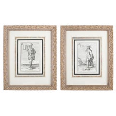
A collection of 18 framed prints from engravings of musical instruments from the book by Gabinetto Armonico, which was published in 1722. The book had a total of 150 instruments. The...
Category
18th Century Italian Baroque Antique Cook Maps
Materials
Paper
H 16.5 in W 13.5 in D 1 in
Antique Map of Principality of Monaco
By Antonio Vallardi Editore
Located in Alessandria, Piemonte
ST/619 - "Old Geographical Atlas of Italy - Topographic map of ex-Principality of Monaco" -
ediz Vallardi - Milano -
A somewhat special edition ---
Category
Late 19th Century Italian Other Antique Cook Maps
Materials
Paper
Antique Golf Print, Royal North Devon Golf Club, Photogravure of Westward Ho
Located in Oxfordshire, GB
Royal North Devon Golf Club 1893 by Mayall & Co. Ltd.
A great image of the members of the 'Royal North Devon Golf Club, Westward Ho!' from 1893. The figures are all photographs superimposed onto a painted background of the course. In the margin is printed 'Permanent Autotype, Produced by Mayall & Co. Ltd. 73 Piccadilly'. The image appears very much photographic but is more of a photomechanical print rather than a photograph.
John Jabez Edwin Paisley Mayall (1813-1901) was an English photographer who in 1860 took the first carte-de-visite photographs of Queen Victoria.
Taken from Royal North Devon:-
Royal North Devon at Westward Ho! Can rightly claim to be the cradle of English Golf. Founded in 1864, it is the oldest golf course in the country and is regarded as the St Andrews of the South. The golf course is as tough as any of the UK's more famous links layouts and has recently been placed in Golf World 's 'Top 100 Courses in the World' that a golfer 'must play'.
Not only is Royal North Devon a great course, it is also a place of huge historical importance. Inside the warmly welcoming clubhouse, the golf museum, honours boards and the clubs top competition trophies are worth a visit on their own and help to tell the story of the game and this remarkable club's unique place in it.
Above all, this is great, natural golf that is largely unchanged from 100 years ago when Harold Hilton et al pronounced Westward Ho! As England's No 1 competition golf course. RND is pure, raw exhilaration and ultimately the experience of playing a fast running links in a stiff breeze still tests the very best in the game.
Many of the great players of the last 100 years were regular competitors at RND but the greatest of them all is without doubt John Henry Taylor...
Category
1890s British Sporting Art Antique Cook Maps
Materials
Paper
H 20 in W 34.25 in D 0.1 in
N.E. View of the United States Capitol, Washington, DC Antique Proof Print 1858
Located in Colorado Springs, CO
This engraved print shows a view of the United States Capitol Building, in Washington, D.C. The print depicts the neoclassical building from the northeast orientation, with a bustling street scene in front. The steel engraving is a proof printing, drawn and engraved by Henry Sartain and published in 1858.
Plans began in May 1854 to build a new cast-iron dome for the United States Capitol. The then-architect of the Capitol Thomas Walter and his team were sold on the aesthetics of a new dome, as well as the utility of a fire-proof one. A year later, on March 3, 1855, President Franklin Pierce...
Category
1850s American Antique Cook Maps
Materials
Paper
H 25 in W 34.25 in D 1 in
Antique Rowing Print, Cambridge University
Located in Oxfordshire, GB
Cambridge preparing for the boat race.
A wonderful atmospheric rowing lithograph of the Cambridge crew getting into a rowing scull preparing for a race....
Category
1890s British Sporting Art Antique Cook Maps
Materials
Paper
New Map of North America from the Latest Discoveries, 1763
Located in Philadelphia, PA
A fine antique 18th century map of the North American seaboard.
Entitled "A New Map of North America from the Latest Discoveries 1763".
By the Cartographer/Engraver - John Spil...
Category
Mid-18th Century English Georgian Antique Cook Maps
Materials
Paper
19th Century Framed Engravings From The New Book Of Martyrs by Henry Southwell
Located in Lowestoft, GB
A collection of 11 framed and glazed engravings taken from the New Book Of Martyrs By Henry Southwell
The 11 engravings show authentic and genuine historical account of the many dre...
Category
19th Century English Antique Cook Maps
Materials
Glass, Pine, Paper
H 14.77 in W 10.24 in D 0.6 in
Antique Billiard Print of a Player, John Roberts Junior
Located in Oxfordshire, GB
John Roberts Junior Photogravure.
Late 19th century study of John Roberts Junior, billiards player, signed in pencil by John Roberts Junior and the artist Thomas Edward Gaunt.
Robe...
Category
1890s German Sporting Art Antique Cook Maps
Materials
Paper
Original Antique Print of Relics of Bonnie Prince Charlie. C.1880
Located in St Annes, Lancashire
Great image of relics belonging to Charles Edward Stuart, Bonnie Prince Charlie
Fine steel engraving by Charles Lawrie
Published by Blackie, Ed...
Category
1880s English Antique Cook Maps
Materials
Paper
Print No. 1 of 400 Depicting a Nautical Schooner Made in the Mid-19th Century
Located in Milan, IT
Print depicting a schooner, no. 1 of 400 copies signed Z21, made in the mid-19th century. Non-coeval briarwood frame; measures with frame 50 x 40 cm.
Category
1850s British Antique Cook Maps
Materials
Paper
H 15.75 in W 19.69 in D 0.79 in
Antique Large Framed Masonic or Oddfellows Decorative Lodge Print
Located in Hamilton, Ontario
This antique print in its original frame was copyrighted by George Henry Patnoe & Henry Brown of Canada in 1909 in a Victorian style. The print depicts the symbolism of the Lodge and...
Category
Early 20th Century North American Late Victorian Cook Maps
Materials
Gesso, Paper
Cook maps for sale on 1stDibs.
Cook maps are available for sale on 1stDibs. These distinctive items are frequently made of paper and are designed with extraordinary care. If you’re looking for additional options, many customers also consider maps by Victor Levasseur, James Cook, and Heinrich Kiepert. Prices for Cook maps can differ depending upon size, time period and other attributes — on 1stDibs, these items begin at $253 and can go as high as $253, while a piece like these, on average, fetch $253.
Creators Similar to Cook
Questions About Cook Maps
- 1stDibs ExpertApril 5, 2022Beryl Cook created 500 completed paintings. She was a British artist who took up painting later in her life than some other artists, around her 30s, and became one of the most popular British artists of the 1970s. Browse a collection of authentic Beryl Cook pieces and prints from top sellers around the world on 1stDibs.
- 1stDibs ExpertApril 5, 2022Whether or not it is safe to cook in old copper pots is a matter of debate. Some experts caution against cooking in antique copper pots that do not feature some other type of metal as lining. This is because of concerns that excessive amounts of copper may leach into food. On 1stDibs, find a collection of antique copper pots.


