Willem Blaeu More Furniture and Collectibles
to
5
7
1
8
8
8
2
2
8
8
8
7
1,024
217
195
176
Creator: Willem Blaeu
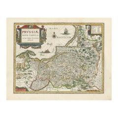
Antique Map of Prussia by Blaeu, circa 1635
By Willem Blaeu
Located in Langweer, NL
Antique map titled 'Prussiae Nova Tabula'. Rare early edition of Blaeu's map of Prussia, embellished with a gorgeous large format cartouche, compass ros...
Category
Mid-17th Century Antique Willem Blaeu More Furniture and Collectibles
Materials
Paper
$684 Sale Price
20% Off
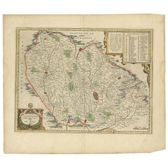
Antique Map of the Region of Le Mans 'France' by Blaeu, circa 1640
By Willem Blaeu
Located in Langweer, NL
Antique Map: Cenomanorum Galliae regionis typus vulgo le Mans – Blaeu, circa 1640
This beautifully engraved and hand-colored map depicts the historical province of Maine in northw...
Category
Mid-17th Century Antique Willem Blaeu More Furniture and Collectibles
Materials
Paper
$475 Sale Price
20% Off
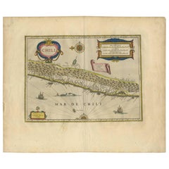
Orignal Hand-Colored Antique Map of Chili by W. Blaeu, 1658
By Willem Blaeu
Located in Langweer, NL
Very decorative antique map of Chili published by W. Blaeu, 1658. This map depicts Chile from Copiapo southward to the island of Chiloé with ships and sea monsters adorning the sea. ...
Category
Mid-17th Century Antique Willem Blaeu More Furniture and Collectibles
Materials
Paper
$888 Sale Price
20% Off
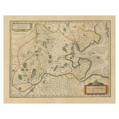
Antique Map of the Region of Oldenburg, Germany
By Willem Blaeu
Located in Langweer, NL
Antique map titled 'Oldenburg Comitatus'. Detailed old map of Oldenburg, Germany. The map also shows Bremen and the Jade Bight. Published by W. Blaeu, circa 1640. Willem Jansz. Blaeu...
Category
Mid-17th Century Antique Willem Blaeu More Furniture and Collectibles
Materials
Paper
$418 Sale Price
20% Off
1640 Willem Blaeu Map Entitled "Contado di molise et principato vltra, " Ric.a003
By Willem Blaeu
Located in Norton, MA
1640 Willem Blaeu map entitled
"Contado di molise et principato vltra,"
Colored
Ric. a003
Measures: 38 x 49.6 cm and wide margins
DBLAEU.
Cou...
Category
17th Century Dutch Antique Willem Blaeu More Furniture and Collectibles
Materials
Paper
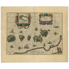
Antique Map of the Spice Islands 'Moluccas', Indonesia by W. Blaeu, circa 1640
By Willem Blaeu
Located in Langweer, NL
Antique map titled 'Moluccae Insulae Celeberrimae'. Highly decorative antique map of the Spice Islands (Moluccas) published by W. Blaeu (circa 1640). This map features a large inset ...
Category
Mid-17th Century Antique Willem Blaeu More Furniture and Collectibles
Materials
Paper
Antique Engraving of Blaeu's first Map of Brazil, Circa 1640
By Willem Blaeu
Located in Langweer, NL
Antique map titled 'Novus Brasiliae Typus'. Fine old color example of Blaeu's first map of Brazil, with north oriented to the right. Includes inset map of Baya de todos Santos, elaborate cartouche, 2 compass roses and richly embellished vignettes of native Brazilian life and animals.
The interior of the map includes vignettes of indigenous animals and native scenes, including cannibalism. Inset within a decorative border is a small map of "Baya de todos Sanctos". In the sea are monsters, a galleon and two compass roses. The large title cartouche features a male and female Brazilian, both of whom are shown naked.
Willem Janszoon Blaeu (1571-1638) was a prominent Dutch geographer and publisher. Born the son of a herring merchant, Blaeu chose not fish but mathematics and astronomy for his focus. He studied with the famous Danish astronomer Tycho Brahe...
Category
Mid-17th Century Dutch Antique Willem Blaeu More Furniture and Collectibles
Materials
Paper
Original Antique Map of the Duchy of Holstein
By Willem Blaeu
Located in Langweer, NL
Antique map titled 'Ducatus Holsatiae Nova Tabula'. Original old map of the Duchy of Holstein, the northernmost territory of the Holy Roman Empire, from the mid-17th Century. To the ...
Category
Mid-17th Century Antique Willem Blaeu More Furniture and Collectibles
Materials
Paper
$1,045 Sale Price
20% Off
Related Items
Antique Map of Principality of Monaco
By Antonio Vallardi Editore
Located in Alessandria, Piemonte
ST/619 - "Old Geographical Atlas of Italy - Topographic map of ex-Principality of Monaco" -
ediz Vallardi - Milano -
A somewhat special edition ---
Category
Late 19th Century Italian Other Antique Willem Blaeu More Furniture and Collectibles
Materials
Paper
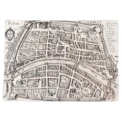
Italian Parchment Map of the City of Pisa Dated, 1640
By Matthäus Merian the Elder
Located in Florence, Tuscany
An antique map of the Tuscan city of Pisa engraved for The 'Itinerarium Italiæ Nov-antiquæ' by Matthäus Merian the Elder and printed in 1640....
Category
1640s Italian Antique Willem Blaeu More Furniture and Collectibles
Materials
Paper
Original Antique Map of South East Asia by Thomas Clerk, 1817
Located in St Annes, Lancashire
Great map of South East Asia
Copper-plate engraving
Drawn and engraved by Thomas Clerk, Edinburgh.
Published by Mackenzie And Dent, 1817
Unframed.
Category
1810s English Antique Willem Blaeu More Furniture and Collectibles
Materials
Paper
Antique Albertus Seba Pair 18th Century Hand-Colored Engravings Butterfly
By Albertus Seba 1
Located in Washington, DC
Rare pair of original hand-colored prints from Sir Albertus Seba's cabinet of natural curiosities. Prints come from published volumes in Amste...
Category
Mid-18th Century Dutch Antique Willem Blaeu More Furniture and Collectibles
Materials
Paper
$700 / set
H 26 in W 12.5 in D 0.3 in
Original Antique Map of Ancient Greece, Achaia, Corinth, 1786
Located in St Annes, Lancashire
Great map of Ancient Greece. Showing the region of Thessaly, including Mount Olympus
Drawn by J.D. Barbie Du Bocage
Copper plate engraving by P.F Tardieu
Original hand color...
Category
1780s French Other Antique Willem Blaeu More Furniture and Collectibles
Materials
Paper
New Map of North America from the Latest Discoveries, 1763
Located in Philadelphia, PA
A fine antique 18th century map of the North American seaboard.
Entitled "A New Map of North America from the Latest Discoveries 1763".
By the Cartographer/Engraver - John Spil...
Category
Mid-18th Century English Georgian Antique Willem Blaeu More Furniture and Collectibles
Materials
Paper
Original Antique Map of Spain and Portugal, circa 1790
Located in St Annes, Lancashire
Super map of Spain and Portugal
Copper plate engraving by A. Bell
Published, circa 1790.
Unframed.
Category
1790s English Other Antique Willem Blaeu More Furniture and Collectibles
Materials
Paper
Original Antique Map of Sweden, Engraved by Barlow, 1806
Located in St Annes, Lancashire
Great map of Sweden
Copper-plate engraving by Barlow
Published by Brightly & Kinnersly, Bungay, Suffolk. 1806
Unframed.
Category
Early 1800s English Antique Willem Blaeu More Furniture and Collectibles
Materials
Paper
Original Antique Blaeu Map of Karst, Carniola, Istria, and Trieste, circa 1640
Located in Langweer, NL
Blaeu Map of Karst, Carniola, Istria, and Trieste, circa 1640
This is an original antique map titled “Karstia, Carniola, Histria et Windorum Marchia,” published by Willem Blaeu in Amsterdam circa 1640. The map depicts the historical regions of Karst (Karstia), Carniola (modern-day Slovenia), Istria (the peninsula shared by Croatia, Slovenia, and Italy), and the Windic March, a medieval border territory.
The engraving shows detailed place names, rivers, mountains, and settlements across present-day Slovenia, northeastern Italy, and northwestern Croatia. The Gulf of Trieste is prominently illustrated at the lower left, with Trieste labelled and coastal settlements clearly indicated. The Adriatic Sea is elegantly engraved with stippled waters, a compass rose, rhumb lines, and a sailing ship, enhancing its decorative maritime appeal.
In the upper left corner is a beautifully designed cartouche bearing the title within a scrollwork frame with foliage and drapery motifs. The lower left includes a mileage scale in Italian miles and a dedication to Guiljelmus Blaeu excudit, confirming its publication from the Blaeu workshop.
Willem Janszoon Blaeu (1571–1638) was one of the leading Dutch cartographers of the early 17th century, succeeded by his son Joan Blaeu. Their maps were known for their precision, aesthetic engraving, and clarity, making the Blaeu atlases the most prestigious publications of the Dutch Golden Age.
Condition:
Good condition. Strong, clean impression on laid paper with wide margins. Light age toning and faint foxing in blank margins, minor creasing along the original centre fold as issued. No tears or repairs noted. Fully suitable for framing.
Framing tips:
Frame this map in a thin black, walnut, or gilt frame to enhance its historic character. Use an off-white or cream archival mat to highlight the detailed engraving and preserve the sheet edges. UV-protective glazing is recommended to protect the paper and ensure its clarity and integrity over time.
Keywords: Here are short keyword blocks formatted for direct copy-pasting into your website SEO or 1stdibs tags:
karst map, carniola map, istria map, trieste map, blaeu map, willem blaeu,
17th century map, dutch cartography, antique balkan map, slovenia antique map,
croatia antique...
Category
17th Century Dutch Antique Willem Blaeu More Furniture and Collectibles
Materials
Paper
$819
H 18.94 in W 22.64 in D 0.01 in
Antique Map of Central Sweden by J. Blaeu, 1662
Located in Langweer, NL
A striking, rare map with a cartouche dedicated to Gabriel Bengtsson Oxenstierna. Published by J. Bleau, Amsterdam, 1662. Contemporary coloring.
Category
Mid-17th Century Antique Willem Blaeu More Furniture and Collectibles
Materials
Paper
$869 Sale Price
20% Off
H 20.48 in W 23.55 in D 0.02 in
Original Antique Map of Ancient Greece- Boeotia, Thebes, 1787
Located in St Annes, Lancashire
Great map of Ancient Greece. Showing the region of Boeotia, including Thebes
Drawn by J.D. Barbie Du Bocage
Copper plate engraving by P.F T...
Category
1780s French Other Antique Willem Blaeu More Furniture and Collectibles
Materials
Paper
Vintage "View of the Center of Paris Taken from the Air" Lithograph Map
Located in San Diego, CA
A very stylish "View of the Center of Paris Taken from the Air" lithograph map published by the Paris Ministry of Tourism, circa early 1950s. The piece measures 27" x 43" and shows...
Category
20th Century French Mid-Century Modern Willem Blaeu More Furniture and Collectibles
Materials
Paper
$680 Sale Price
20% Off
H 43 in W 27 in D 0.25 in
Previously Available Items
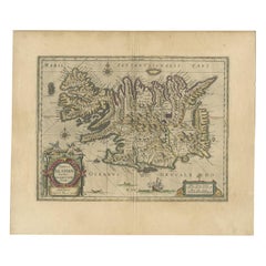
Antique Map of Iceland by Blaeu, circa 1640
By Willem Blaeu
Located in Langweer, NL
Antique map titled 'Tabula Islandiae'. Beautiful map of Iceland, including an erupting volcano, sea monsters, sailing ships, decorative cartouches, compass rose and the spectacular l...
Category
Mid-17th Century Antique Willem Blaeu More Furniture and Collectibles
Materials
Paper
Willem Blaeu more furniture and collectibles for sale on 1stDibs.
Willem Blaeu more furniture and collectibles are available for sale on 1stDibs. These distinctive items are frequently made of paper and are designed with extraordinary care. There are many options to choose from in our collection of Willem Blaeu more furniture and collectibles, although beige editions of this piece are particularly popular. Prices for Willem Blaeu more furniture and collectibles can differ depending upon size, time period and other attributes — on 1stDibs, these items begin at $488 and can go as high as $555,872, while a piece like these, on average, fetch $708.
