Timeless Intaglio
to
294
272
202
195
100
89
51
51
43
41
37
33
26
24
20
15
14
12
10
10
10
9
8
7
7
7
6
5
5
5
5
4
4
3
3
2
2
2
2
2
1
1
1
1
1
1
34
13
7
7
6
Period: Late 20th Century
Period: Late 18th Century
Period: 1840s
Period: Late 17th Century
Period: 1730s
+ 1 more
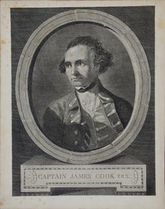
Captain James Cook: 18th C. Portrait by William Hodges After Cook's 2nd Voyage
By William Hodges
Located in Alamo, CA
This is an original 18th Century copper plate engraved portrait of Captain James Cook as a young man. It was engraved by J. Basire after a painting by William Hodges, published in London by W. Strahan and T. Cadell in the Strand in 1777 as the frontispiece to the official journal publication of Cook's 2nd voyage of discovery, "A voyage towards the South Pole, and round the World. Performed in His Majesty's ships the Resolution and Adventure, in the years 1772, 1773, 1774, and 1775". The journal was written by James Cook, Commander of the Resolution, which was the ship used for the voyage and William Hodges, who was the artist on board the ship. This famous image has been used in many articles and tributes to Captain Cook, including a Norfolk Island stamp celebrating his many accomplishments.
This engraved head-and-shoulders portrait of Captain Cook is enclosed in an oval with the appearance of a stone border. Captain Cook is dressed in his naval dress uniform, with a topcoat over a lace shirt. The engraving is printed on watermarked laid, chain-linked paper. The sheet measures 11.5" high x 9" wide. There is some spotting, most prominently in the margins. The print is otherwise in excellent condition.
Captain James Cook (1728-1779) was an English explorer, navigator, surveyor and cartographer, who dramatically changed what was known about the world through his three voyages of discovery in the 1770's. Cook's achievements are too numerous to include here, but for example, Cook charted much of the Pacific Ocean and discovered many island groups, including the Hawaiian islands, which he named the Sandwich Islands, in honor of the head of the British Admiralty and a patron of Cook's. Cook was the first European to explore the eastern coast of Australia, and he was the first to map the New Zealand coastline. He sailed farther south than any other explorer before him, disproving the belief that a huge land mass occupied the South Pole. He also explored the northwest coast of North America, including present day Alaska and adjacent portions of Russia. He proved that the Northwest Passage did not exist.
Cook was an exceptional seaman, navigator and leader of men, which contributed to the success of his explorations, but also saved his ship and crew on many occasions when faced with challenges, such as storms in previously unexplored waters, like occurred in the Great Barrier Reef off the eastern coast of Australia. He is also the first to require his crew to eat citrus fruit which markedly reduced the incidence of survey, which had led to large scale illness and death during earlier ocean voyages. As outstanding as Cook's skills were, they are even more impressive since they were self-taught. Having grown up the son of a farmhand in Northern England he had only four years of formal schooling. He taught himself astronomy, mathematics and other disciplines which were helpful when he continued his education, first in the merchant marine and then in the British Navy. Cook's adventurous career came to a sudden and unfortunate end in 1779, when he was killed in a confrontation with Hawaiian natives...
Category
1770s Portrait Prints
Materials
Engraving
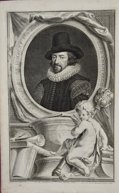
Sir Francis Bacon: 18th C. Portrait of Philosopher, Scientist, Author, Statesman
By Jacobus Houbraken
Located in Alamo, CA
This is an 18th century copperplate engraved portrait of Sir Francis Bacon, Viscount St. Albans, Lord Chancellor by Jacobus Houbraken in 1738 after a p...
Category
1730s Portrait Prints
Materials
Engraving
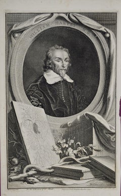
18th C. Portrait of William Harvey, MD: 17th C. Circulatory System Discoveries
By Jacobus Houbraken
Located in Alamo, CA
An 18th century engraved portrait of William Harvey, MD by Jacobus Houbraken after a painting by Wilhem von Bemmel, from "The Heads of Illustrious Pers...
Category
1730s Portrait Prints
Materials
Engraving
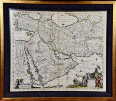
Persia, Armenia & Adjacent Regions: A Hand-colored 17th Century Map by De Wit
By Frederick de Wit
Located in Alamo, CA
This colorful and detailed 17th century copperplate map by Frederick De Wit was published in Amsterdam between 1666 and 1690. It depicts the Caspian Se...
Category
Late 17th Century Old Masters More Prints
Materials
Engraving
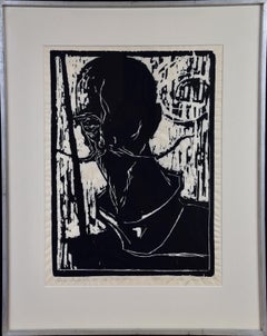
Don Quixote de La Mancha: Signed Limited Edition Woodcut Portrait by De Groat
Located in Alamo, CA
A limited edition woodcut portrait of Don Quixote de la Marcha by George De Groat (1917-1995). Don Quixote is instantly recognizable due to his thin fa...
Category
Late 20th Century American Modern Portrait Prints
Materials
Woodcut
Ancient Roman Medici Marble Vase: An 18th Century Etching by Piranesi
By Giovanni Battista Piranesi
Located in Alamo, CA
This large 18th century etching by Giovanni Battista Piranesi is entitled "Vaso antico di Marmo adornato di eccellenti Sculture si nella parte anteriere che nell' opposta, le quail r...
Category
1770s Old Masters Figurative Prints
Materials
Etching
Spoonbill "Platalea leucorodia": An 18th Century Hand-colored Nozeman Engraving
By Cornelis Nozeman and Jan Christiaan Sepp
Located in Alamo, CA
This a rare 18th century hand-colored large folio-sized copperplate engraving entitled "Platalea leucorodia" (Spoonbill) by Cornelius Nozeman in volume II of his publication 'Nederlandsche Vogelen', engraved by Christiaan Sepp or his son Jan Christiaan Sepp, published in Amsterdam in 1770. This engraving depicts a Platalea leucorodia Spoonbill, a large bird that lives mainly in Europe, Asia and Africa. It commonly migrates long distances on thermal air currents from the colder Northern European climates to Sub-Saharan Africa in the winter, sometimes as far long as Finland to South Africa. The Asian black stork...
Category
1780s Naturalistic Animal Prints
Materials
Engraving
White Stork "Ardea Ciconia": An 18th Century Hand-colored Engraving by Nozeman
By Cornelis Nozeman and Jan Christiaan Sepp
Located in Alamo, CA
This is a rare 18th Century hand-colored large folio-sized copperplate engraving entitled "Ardea Ciconia" (White Stork) by Cornelius Nozeman in volume II of his publication 'Nederlan...
Category
1780s Naturalistic Animal Prints
Materials
Engraving
White Stork "Storch Ciconia": An 18th Century Hand-colored Frisch Engraving
By Johann Leonhard Frisch 1
Located in Alamo, CA
This is a rare 18th Century hand-colored copperplate engraving entitled "Der Storch Ciconia" (White Stork) by Johann Leonhard Frisch is plate 19...
Category
1730s Naturalistic Animal Prints
Materials
Engraving
Coot Bird, "Wasserhuhn": An 18th Century Hand-colored Frisch Engraving
By Johann Leonhard Frisch 1
Located in Alamo, CA
This is a rare 18th Century hand-colored copperplate engraving entitled "Wasserhuhn" (Coot) by Johann Leonhard Frisch , which is plate 208 from ...
Category
1730s Naturalistic Animal Prints
Materials
Engraving
Black Stork, "Ciconia Nigra": An 18th Century Hand-colored Frisch Engraving
By Johann Leonhard Frisch 1
Located in Alamo, CA
This is a rare 18th Century hand-colored copperplate engraving entitled "Ciconia Nigra" (Black Stork) by Johann Leonhard Frisch is plate 197 fro...
Category
1730s Naturalistic Animal Prints
Materials
Engraving
Eurasian Teal Duck: An 18th Century Hand-colored Nozeman Engraving "Anas Crecca"
By Cornelis Nozeman and Jan Christiaan Sepp
Located in Alamo, CA
This is a rare 18th Century hand-colored large folio-sized copperplate engraving entitled "Anas Crecca" (Eurasian Teal) by Cornelius Nozeman in volume II of his publication 'Nederlan...
Category
1770s Naturalistic Animal Prints
Materials
Engraving
The Heidelberg Tun: A Framed 17th Century Engraving of a Huge Wine Cask
Located in Alamo, CA
"The Heidelberg Tun" is a 17th century engraving by an unknown artist. It depicts a famous huge ornamental wine cask that resided in the wine cellar of Heidelberg Castle. The cask shown here, built in 1664, is the second of four Heidelberg Tuns; the first was destroyed during the Thirty Years' War, between 1618 and 1648. This cask was built in 1664 when Karl Ludwig ordered Heidelberg cellar master...
Category
Late 17th Century Old Masters Interior Prints
Materials
Engraving
Daniel Marot's The Siege of the Dutch Fortified City of Ypres by Louis XIV
By Daniel Marot
Located in Alamo, CA
"Ypres, Grand Ville Riche & Marchande" is an engraving and etching by Daniel Marot (le Vieux) (1661–1752). It depicts a view of the siege of the city of Ypres and its citadel on the left in the Spanish Netherlands by Louis XIV's troops. This battle took place between March 18 and March 25, 1678, as part of the Franco-Dutch War. Marot illustrated in great detail (best appreciated with magnification) the French attack on the strong pentagonal citadel on the extreme left, which had been built recently in anticipation of a French attack. The trenches built by the French approaching the town are seen on the right. King Louis XIV can be seen in the foreground surveying the battle mounted on his white horse, surrounded by his officers and troops.
The print is presented in an attractive ornate black wood frame with a cream-colored double mat with a black inner trim. It is glazed with plexiglas. The frame measures 25.38" x 22.63" x .88". The engraving, frame, mat and glazing are in excellent condition.
Artist: Daniel Marot (1661–1752) was also called "Le Vieux". He was the son of the famous architect, Jean Marot. Marot had diverse interests and talents. In addition to his art, he designed garden projects, architectural ornaments, furniture, and even upholstery. Marot as a Huguenot protestant was forced to leave France in 1685 following the revocation of the Edict of Nantes. He emigrated to Holland, where he worked for William of Orange (an arch enemy of his former employer Louis XIV). Marot was largely responsible for the interiors of Williams palace at the Loo. In 1694 he went Britain as William had married Queen Mary and he had become King William III of England. He later returned to Holland in about 1698 and died in the Hague in 1752. He left a lasting legacy on the decorative arts in the Netherlands, where his grand version of the Louis XIV style remained popular into the 1730s.
Historical Background: In October 1677, Mary Stuart, niece and possible successor of Charles II of England, married Louis XIV's arch enemy William III of Orange...
Category
Late 17th Century Old Masters Landscape Prints
Materials
Engraving, Etching
Muse Terpsichore: Framed Hand-colored 19th C. Engraving after 17th C. Painting
Located in Alamo, CA
"Dessine par Gallier" is a hand-colored engraving and etching by Pierre Laurent (1739-1809) and Pierre Audouin (1768-1822) after a painting by Eustache Le Sueur...
Category
Late 18th Century Romantic Figurative Prints
Materials
Engraving, Etching
Viscount Thomas Belasise: 17th Century Hand-colored Portrait by Robert White
Located in Alamo, CA
This is a hand-colored engraving by Robert White (1645-1703) after a painting by Abraham Blooteling (or Bloteling) (1634–1690) entitled "The Effigies of the Right honorable: Thomas B...
Category
Late 17th Century Other Art Style Portrait Prints
Materials
Engraving
Plymouth, England: A Hand-Colored 17th Century Sea Chart by Captain Collins
By Captain Greenvile Collins
Located in Alamo, CA
This hand-colored sea chart of the area around Plymouth, England from "Great Britain's Coasting Pilot. Being a New and Exact Survey of the Sea-Coast of England", first published in 1...
Category
Antique Late 17th Century English Maps
Materials
Paper
Flanders, Holland & Norfolk: Hand-Colored 17th Century Sea Chart by Collins
By Captain Greenvile Collins
Located in Alamo, CA
This hand-colored chart of the seas about Flanders, Holland, Frisia, and Norfolk is from "Great Britain's Coasting Pilot. Being a New and Exact Survey of the Sea-Coast of England" by...
Category
Antique Late 17th Century English Maps
Materials
Paper
Edinburgh, Scotland Coast: A 17th Century Hand-Colored Sea Chart by Collins
By Captain Greenvile Collins
Located in Alamo, CA
This hand-colored sea chart is entitled "Edinburgh Firth" from "Great Britain's Coasting Pilot. Being a New and Exact Survey of the Sea-Coast of England" by Captain Greenville Collin...
Category
Antique Late 17th Century English Maps
Materials
Paper
Dartmouth, England: A Hand-Colored 17th Century Sea Chart by Captain Collins
By Captain Greenvile Collins
Located in Alamo, CA
This hand-colored sea chart of the area around Dartmouth, England is from "Great Britain's Coasting Pilot. Being a New and Exact Survey of the Sea-Coast of England", first published ...
Category
Antique Late 17th Century English Maps
Materials
Paper
"Africa Vetus": a 17th Century Hand-Colored Map by Sanson
By Nicolas Sanson
Located in Alamo, CA
This original hand-colored copperplate engraved map of Africa entitled "Africa Vetus, Nicolai Sanson Christianiss Galliar Regis Geographi" was originally created by Nicholas Sanson d...
Category
Antique Late 17th Century French Maps
Materials
Paper
California, Alaska and Mexico: 18th Century Hand-Colored Map by de Vaugondy
By Didier Robert de Vaugondy
Located in Alamo, CA
This an 18th century hand-colored map of the western portions of North America entitled "Carte de la Californie et des Pays Nord-Ouest separés de l'Asie par le détroit d'Anian, extra...
Category
Antique 1770s French Maps
Materials
Paper
North & South America: A 17th Century Hand-colored Map by Jansson & Goos
By Johannes Janssonius
Located in Alamo, CA
A 17th century hand-colored map of North & South America entitled "Americae Descriptio" by the cartographer Johannes Jansson, published in Jansson's Atlas Minor in Amsterdam in 1628....
Category
Antique 1620s Dutch Maps
Materials
Paper
Southern & Eastern Europe: A Large 17th C. Hand-colored Map by Sanson & Jaillot
By Nicolas Sanson
Located in Alamo, CA
This large hand-colored map entitled "Estats de L'Empire des Turqs en Europe, ou sont les Beglerbeglicz our Gouvernements" was originally created by Nicholas Sanson d'Abbeville and t...
Category
Antique 1690s French Maps
Materials
Paper
Vienna, Austria: A Large 17th Century Hand-Colored Map by Sanson and Jaillot
By Nicolas Sanson
Located in Alamo, CA
This large 17th century hand-colored map of Vienna, Austria and the surrounding countryside and villages entitled "Plan de la Ville de Vienne en Austrich...
Category
Antique 1690s French Maps
Materials
Paper
Portugal: A Large 17th Century Hand-colored Map by Sanson and Jaillot
By Nicolas Sanson
Located in Alamo, CA
This large hand-colored map entitled "Le Royaume de Portugal et des Algarves Divisee en see Archeveches, Eveches et Territoires Par le Sr Sanson" was originally created by Nicholas S...
Category
Antique 1690s French Maps
Materials
Paper
Southern Greece: A Large 17th C. Hand-colored Map by Sanson and Jaillot
By Nicolas Sanson
Located in Alamo, CA
This large original hand-colored copperplate engraved map of southern Greece and the Pelopponese Peninsula entitled "La Moree Et Les Isles De Zante, Cefalonie, Ste. Marie, Cerigo & C...
Category
Antique 1690s French Maps
Materials
Paper
Africa: A Large 17th Century Hand-Colored Map by Sanson and Jaillot
By Nicolas Sanson
Located in Alamo, CA
This large original hand-colored copperplate engraved map of Africa entitled "L'Afrique divisee suivant l'estendue de ses principales parties ou sont distingues les uns des autres, L...
Category
Antique 1690s French Maps
Materials
Paper
The Normandy Region of France: A 17th C. Hand-colored Map by Sanson and Jaillot
By Nicolas Sanson
Located in Alamo, CA
This large hand-colored map entitled "Le Duché et Gouvernement de Normandie divisée en Haute et Basse Normandie en divers Pays; et par evêchez, avec le Gouvernement General du Havre ...
Category
Antique 1690s French Maps
Materials
Paper
Persia, Armenia & Adjacent Regions: A 17th Century Hand-colored Map by De Wit
By Frederick de Wit
Located in Alamo, CA
A large 17th century hand colored copperplate engraved map entitled "Novissima nec non Perfectissima Scandinaviae Tabula comprehendens Regnorum Sueciae, Daniae et Norvegiae distincte...
Category
Antique Late 17th Century Dutch Maps
Materials
Paper
17th Century Hand Colored Map of the Liege Region in Belgium by Visscher
By Nicolaes Visscher II
Located in Alamo, CA
An original 17th century map entitled "Leodiensis Episcopatus in omnes Subjacentes Provincias distincté divisusVisscher, Leodiensis Episcopatus" by Nicolaes Visscher II, published in Amsterdam in 1688. The map is centered on Liege, Belgium, includes the area between Antwerp, Turnhout, Roermond, Cologne, Trier and Dinant.
This attractive map is presented in a cream-colored mat measuring 30" wide x 27.5" high. There is a central fold, as issued. There is minimal spotting in the upper margin and a tiny spot in the right lower margin, which are under the mat. The map is otherwise in excellent condition.
The Visscher family were one of the great cartographic families of the 17th century. Begun by Claes Jansz Visscher...
Category
Antique Late 17th Century Dutch Maps
Materials
Paper
Large 17th Century Hand Colored Map of England and the British Isles by de Wit
By Frederick de Wit
Located in Alamo, CA
A large hand colored 17th century map of England and the British Isles by Frederick de Wit entitled "Accuratissima Angliæ Regni et Walliæ Principatus", published in Amsterdam in 1680. It is a highly detailed map of England, Scotland, the Scottish Isles...
Category
Antique Late 17th Century Dutch Maps
Materials
Paper
Dutch Map and City Plan of La Roche-sur-Foron, France, 17th Century Hand Colored
By Coenraet Decker
Located in Alamo, CA
"Rupes Allobrogum vulgo La Roche" by Dutch engraver Coenraet Decker (1650-1685) is from the atlas Theatrum Statuum Regiae Celestudinis Sabaudiae Ducis, published in 1682. This richly...
Category
Antique Late 17th Century Dutch Maps
Materials
Paper
Italy, Sicily, Sardinia, Corsica and Dalmatian Coast: A 17th Century Dutch Map
By Theodorus Danckerts
Located in Alamo, CA
This hand colored 17th century Dutch map entitled "Novissima et Accuratissima totius Italiae Corsicae et Sardiniae Descriptio" by Theodore Danckerts depicts the Italian Peninsula in ...
Category
Antique Late 17th Century Dutch Maps
Materials
Paper
