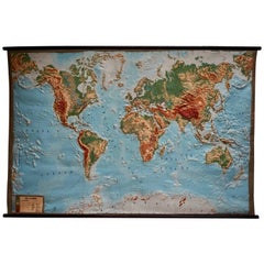
Large Vintage Map
to
14
75
70
148
92
24
21
19
17
16
8
6
3
5
3
2
2
2
Sort By
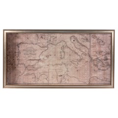
Large Framed Map of the Mediterranean
Located in Queens, NY
Large map/chart chart of The Mediterranean and the Grecian Archipelago showing Italy, Sardinia
Category
20th Century French Mid-Century Modern Large Vintage Map
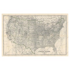
Old Map of the American Railroad Network and All Weather Roads on Verso, 1931
Located in Langweer, NL
This is the “New Census Edition” of Clason’s United States Green Guide. It features two large maps
Category
1930s Large Vintage Map
Materials
Paper
$432 Sale Price
20% Off
H 20.71 in W 32.8 in D 0 in
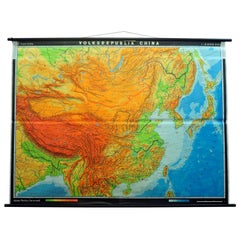
Vintage Picture Poster Wall Chart Rollable Large Map Peoples Republic of China
Located in Berghuelen, DE
A vintage wall chart illustrating a map of people's republic of china. Used as teaching material in
Category
Late 20th Century German Country Large Vintage Map
Materials
Canvas, Wood, Paper
$420
H 63 in W 84.26 in D 0.79 in
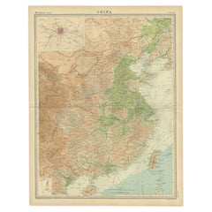
Original Old Map of Eastern China, Also Depicting Taiwan 'Formosa', 1922
Located in Langweer, NL
Large map of China titled 'China - Peking'. Old map of eastern China depicting Kiangsi, Chekiang
Category
20th Century Large Vintage Map
Materials
Paper
$211 Sale Price
20% Off
H 23.23 in W 17.92 in D 0 in
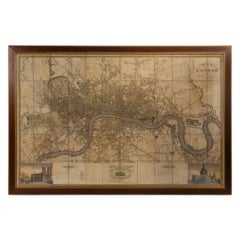
Large Scale Map of the London Metropolis
Located in Dallas, TX
The product is a large scale map of the London Metropolis, specifically focusing on the city in
Category
Mid-20th Century English Large Vintage Map
Materials
Paper
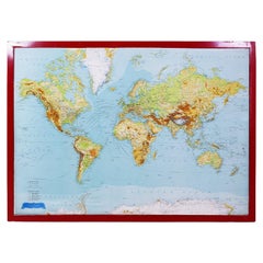
George Philip's Large Relief Map of the World 150x110cm
By George Philip & Son
Located in Linkebeek, BE
George Philip's Large Relief Map of the World 150x110cm
PHILIP, George Relief Map of the World
Category
20th Century British Large Vintage Map
Materials
Plastic, Wood
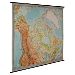
Very Large Vintage Map of Canada, German, Education, Institution, Cartography
Located in Hele, Devon, GB
This is a very large vintage map of Canada. A German, quality printed educational or institution
Category
Mid-20th Century German Large Vintage Map
Materials
Paper
$3,017
H 77.56 in W 85.04 in D 1.19 in
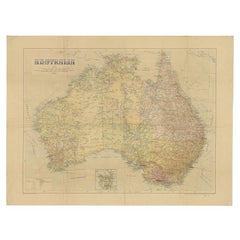
Large Detailed Map of Australia Wint Inset of Tasmania, 1937
Located in Langweer, NL
Antique map titled 'Australia'. Large folding map of Australia. With inset map of Tasmania. Printed
Category
20th Century Large Vintage Map
Materials
Paper
$336 Sale Price
20% Off
H 29.73 in W 39.57 in D 0 in
World Relief Map
Located in Antwerp, BE
Large world relief map.
Measures: Width 232 cm.
Height 158 cm.
Category
Mid-20th Century German Mid-Century Modern Large Vintage Map
Materials
Acrylic
Large Topographical and Geological Map of the Teshio Oil Field, '1936'
Located in Langweer, NL
Topographical and geological map of the Teshio oil field. Shows location of oil well, oil sand
Category
20th Century Large Vintage Map
Materials
Linen, Paper
$1,154 Sale Price
20% Off
H 72.64 in W 38.39 in D 0.02 in
20th Century Large Vintage Oval Wall Map of the World Globe Conference Table 13'
Located in Dayton, OH
Monumental oval classroom map of the world / wall globe from the second half of the 20th century
Category
20th Century Large Vintage Map
Materials
Metal
$2,400 Sale Price
20% Off
H 83 in W 158.5 in D 3 in
Geographical Map of Italy
Located in Alessandria, Piemonte
BOLIS Publishing House - Bergamo.
A beautiful large map of Italy, on paper but suitably reinforced
Category
Mid-20th Century Italian Other Large Vintage Map
Materials
Paper
8 Foot Framed World Map by Philips
Located in Norwell, MA
1951 map of the world by George Philip and Son. Large beautiful map as it was in 1951. Nice patina
Category
1950s North American Large Vintage Map
Materials
Paper
German Antique Map of Southeastern Australia, 1904
Located in Langweer, NL
This large antique map is taken from; 'Andrees Allgemeiner Handatlas in 126 Haupt-Und 139
Category
20th Century Large Vintage Map
Materials
Paper
$72 Sale Price
20% Off
H 10.8 in W 17.3 in D 0.001 in
Antique Map of Central Asia and India, 1904
Located in Langweer, NL
Antique map titled 'Zentralasien und Vorderindien'. Map of Central Asia and India. This large
Category
20th Century Large Vintage Map
Materials
Paper
Antique Map of New Zealand and Tasmania, 1904
Located in Langweer, NL
This large antique map is taken from; 'Andrees Allgemeiner Handatlas in 126 Haupt-Und 139
Category
20th Century Large Vintage Map
Materials
Paper
Antique Railroad Map of the United States by Rand, McNally & Co, 1900
Located in Langweer, NL
portions of The Dominion of Canada, The Republic of Mexico and the West Indies'. Large railroad map of the
Category
20th Century Large Vintage Map
Materials
Linen, Paper
$2,254 Sale Price
25% Off
H 30.91 in W 43.9 in D 0.02 in
Large 1950's Philips' Hanging Globe
By Philips
Located in Hastings, GB
A superb decorators' interior design piece, this very large hanging globe made by the Philips
Category
1950s English Mid-Century Modern Large Vintage Map
Materials
Brass
Original Vintage Poster Union Of South Africa Map Natural & Industrial Resources
Located in London, GB
image of a larger map of Africa marking South Africa in front of the Union flag of South Africa framing
Category
1940s British Large Vintage Map
Materials
Paper
$1,331
H 19.69 in W 29.53 in D 0.04 in
Large French Paris Metro Map 1960s
Located in North Hollywood, CA
Large French Paris Metro Map 1960s.
A large Vintage French framed map of the Parisian Metro from
Category
Mid-20th Century French Industrial Large Vintage Map
Materials
Wood, Paper
Large Vintage School Map Sunflower Jung Koch Quentell 117cm
By Jung Koch Quentell 1
Located in Poperinge, BE
Beautiful large vintage school map, school poster about the sunflower, paper on linen, by Jung Koch
Category
1970s German Large Vintage Map
Materials
Metal
Large Vintage School Map The Honeybee Jung Koch Quentell
Located in Poperinge, BE
Beautiful large vintage school map, school poster about the honey bee, paper on linen, by Jung Koch
Category
1960s German Large Vintage Map
Materials
Canvas, Wood, Paper
Large European 1930's Nautical Map Reader Magnifying Glass
Located in Haddonfield, NJ
This European set of two nautical magnifying glass map-readers are quite unusual and rarely found
Category
1930s German Industrial Large Vintage Map
Materials
Metal
$2,000 Sale Price
20% Off
H 5.95 in W 15.8 in D 15.8 in
Large Vintage France Map, Continental, Historical Cartography, Late 20th Century
Located in Hele, Devon, GB
This is a large vintage map of France. A Continental, framed example of historical cartography
Category
Late 20th Century European Mid-Century Modern Large Vintage Map
Materials
Glass, Wood, Paper
$1,212
H 36.62 in W 28.35 in D 1.38 in
Antique Large 15 Drawer Staking Map Posters Chest Drawing File Walnut Cabinet
Located in San Diego, CA
Versatile antique 15 drawer file cabinet posters documents etc, circa 1970's walnut finish large
Category
20th Century American Mission Large Vintage Map
Materials
Brass
$1,978
H 43.5 in W 45.5 in D 35 in
Large Rollable Map Central America Northern South America Wall Chart Poster
Located in Berghuelen, DE
A fantastic pull-down wall chart depicting a map of Central America and Northern South America
Category
Mid-20th Century German Country Large Vintage Map
Materials
Canvas, Wood, Paper
$420
H 60.24 in W 96.86 in D 0.79 in
On the Map: Large scale color monotype, Western mountain landscape with blue sky
By Michele Zalopany
Located in New York, NY
Large scale color monotype of a Western landscape with sapphire blue sky, green trees, river
Category
1980s Contemporary Large Vintage Map
Materials
Monotype
1944 original map Les vins de Champagne – Vignobles du Bar-Séquanais
Located in PARIS, FR
used by larger Champagne houses.
This 1944 map was produced during the final stages of World War II, a
Category
1940s Large Vintage Map
Materials
Lithograph, Paper
$1,202
H 25.6 in W 17.72 in
Vintage Rollable Map Northern Germany Poland Seaside Wallchart Baltic Sea
Located in Berghuelen, DE
The large impressive cottagecore pull-down map illustrates Northern Germany, Poland and parts of
Category
Late 20th Century German Country Large Vintage Map
Materials
Canvas, Wood, Paper
$420
H 60.63 in W 95.67 in D 0.79 in
Vintage Mural Map Mediterranean Sea Near East Countries Rollable Wall Chart
Located in Berghuelen, DE
A large countrycore pull-down map showing the countries surrounding the Mediterranean Sea
Category
1970s German Country Large Vintage Map
Materials
Canvas, Wood, Paper
$420
H 58.67 in W 105.91 in D 0.79 in
Original Vintage WWII Poster Central Kitchens War Food Centrale Keukens Map Chef
Located in London, GB
smiling chef winking at the viewer and holding a spoonful of hot food from a large pot over a map of the
Category
1940s Dutch Large Vintage Map
Materials
Paper
$770
H 38.59 in W 27.96 in D 0.04 in
Vintage Mural World Map Earth Poster Pull-Down Wall Chart Poster Print
Located in Berghuelen, DE
A large decorative world map – named our earth, impressive wall chart decoration, published by
Category
1970s German Country Large Vintage Map
Materials
Canvas, Wood, Paper
$420
H 50.01 in W 82.68 in D 0.79 in
Large Antique Tiger Oak Flat File
Located in Dekalb, IL
artwork, prints, maps, textiles, or
large documents
• Solid oak construction with
Category
1940s American Industrial Large Vintage Map
Materials
Oak
Large Vintage School Chart Ergot Mold Jung Koch Quentell
By Jung Koch Quentell 1
Located in Poperinge, BE
Beautiful large vintage school map, school poster about ergot (Claviceps purpurea), a fungus that
Category
1970s German Large Vintage Map
Materials
Canvas, Wood, Paper
Large Vintage School Chart Tulip Flowers Jung Koch Quentell 117cm
By Jung Koch Quentell 1
Located in Poperinge, BE
Beautiful large vintage school map, school poster about the tulip, paper on linen, originally from
Category
1970s German Large Vintage Map
Materials
Linen, Wood, Paper
$318
H 46.07 in W 32.29 in D 0.79 in
Original Vintage Large Industrial Oak Wood File Cabinet with Multiple Drawers
Located in Warszawa, Mazowieckie
of color every year. This cabinet has 25 flat drawers in which can safely store maps, prints or large
Category
1930s European Industrial Large Vintage Map
Materials
Brass
$7,210 Sale Price
20% Off
H 53.55 in W 53.55 in D 32.29 in
Going Solo, Signed by Roald Dahl, First Edition in Original Dust Jacket, 1986
By Roald Dahl
Located in Colorado Springs, CO
half title page. The inscription is large and very legible. Two maps, “East Africa” on pg. 10 and “The
Category
1980s American Modern Large Vintage Map
Materials
Paper
$2,250
H 9.5 in W 6.5 in D 1 in
Vintage Turkish Oushak Rug with Tribal Style
Located in Dallas, TX
unfolds like a celestial map: a large-scale concentric medallion radiates outward into corner spandrels
Category
Mid-20th Century Turkish Oushak Large Vintage Map
Materials
Wool
Sea Fish Saltvandsfisk Rollable Poster Print Wall Chart, Denmark 1960s
Located in Nuernberg, DE
series of wall maps appeared from 1820 to 1836 with a volume of six volumes, including 63 large-format
Category
1960s German Mid-Century Modern Large Vintage Map
Materials
Aluminum
$240
H 39.5 in W 27.5 in D 0.13 in
Vintage 18 Karat Rare African Souvenir Charm Bracelet
Located in New York, NY
Vintage 18 Karat RARE African Souvenir Charm Bracelet featuring an extra large Giraffe, extra large
Category
Mid-20th Century African Modern Large Vintage Map
Materials
18k Gold, Yellow Gold
Jo Mora, Evolution of the Cowboy 1933, from Jo Mora Estate
Located in Phoenix, AZ
books, made large murals, and published charts, maps (cartes) and diagrams of the West and Western
Category
1930s Other Art Style Large Vintage Map
Materials
Lithograph
$7,000
H 31 in W 25 in
Mushrooms of Middle Europe Print Cardboard Wall Chart, Germany 1930s
Located in Nuernberg, DE
series of wall maps appeared from 1820 to 1836 with a volume of six volumes, including 63 large-format
Category
1930s German Mid-Century Modern Large Vintage Map
Materials
Paper
$320
H 13.13 in W 27.13 in D 0.13 in
Set of Two Mushrooms Scientific Models Europe , Germany 1960s
Located in Nuernberg, DE
from 1820 to 1836 with a volume of six volumes, including 63 large-format maps. The emerging 20th
Category
1960s German Folk Art Large Vintage Map
Materials
Wood, Paper
Lee's Lieutenants by Douglas Southhall Freeman, Three Vols., First Edition, 1942
Located in Colorado Springs, CO
and Lee’s surrender at Appomattox. The set also includes a large fold out map detailing the battle
Category
1940s American Large Vintage Map
Materials
Leather, Paper
$4,250
H 9.69 in W 7.13 in D 7.19 in
Antique Map of New Zealand by G.F. Cram, 'circa 1906'
Located in Langweer, NL
Antique map titled 'New Zealand'. Large map of New Zealand with a small legend of the Chatham
Category
20th Century Large Vintage Map
Materials
Paper
$336 Sale Price
20% Off
H 27.17 in W 18.51 in D 0.02 in
Mid-Century Dutch Topographical Wall Map of Australia and Oceania on Linen
Located in Houston, TX
This large wall map was printed in Germany in 1961 and is mounted on linen on a simple wooden dowel
Category
1960s German Mid-Century Modern Large Vintage Map
Materials
Linen, Wood, Paper
$1,095
H 69 in W 89 in D 1.2 in
City of Zurich, Decorative Wall-Mounted Map of the City, 1950s
Located in Zürich, CH
If you need something unique to decorate your walls, here it is. This large Map was designed 1956
Category
1950s Swiss Industrial Large Vintage Map
Materials
Paper
Original Vintage Poster Union Of South Africa Map Natural & Industrial Resources
Located in London, GB
image of a larger map of Africa marking South Africa in front of the Union flag of South Africa framing
Category
1940s Large Vintage Map
Materials
Paper
$1,331
H 19.69 in W 29.53 in
1980s Iconic Italian Ceramic Bel Paese Cheese by Galbani Advertising Plate
Located in Milan, IT
in white has four Galbani logos and a large map on Italy in green in the center.
Collector's note
Category
1980s Italian Industrial Large Vintage Map
Materials
Ceramic
$266
H 0.79 in W 13.39 in D 12.6 in
Map Case
Located in Dallas, TX
Large Gray Map Case with 12 numbered drawers and wood herringbone pattern on back.
Category
20th Century American Large Vintage Map
Materials
Metal
Large Air France Map on Acrylic by M. Morel, 1980
By Air France
Located in Frankfurt / Dreieich, DE
Large air France world map on acrylic by M. Morel, 1980.
Very good condition.
Category
1980s French Modern Large Vintage Map
Materials
Acrylic, Paper
Original Vintage WWII Poster Central Kitchens War Food Centrale Keukens Map Chef
Located in London, GB
smiling chef winking at the viewer and holding a spoonful of hot food from a large pot over a map of the
Category
1940s Large Vintage Map
Materials
Paper
$770
H 38.59 in W 27.96 in
Large Gold Gemset Costa Rica Charm
Located in New York, NY
Unusual large figural map of Costa Rica. 18K yellow gold, set with a diamond and three sapphires
Category
1940s American Large Vintage Map
Materials
Diamond, Blue Sapphire, Gold, 18k Gold
Alviero Martini Prima Classe Vintage messenger type classic shoulder bag.
By Alviero Martini
Located in Kashiwa, Chiba
is all about Southeast Asian counties, such as Philippine and Indonesia and large Africa map focused
Category
1990s Italian Large Vintage Map
Science and Industry Sign from United States Testing Co
Located in Dallas, TX
surround the logo featuring a large Microscope with a map of the US in the background showing their testing
Category
1940s American Mid-Century Modern Large Vintage Map
Materials
Masonite, Paint
- 1
Get Updated with New Arrivals
Save "Large Vintage Map", and we’ll notify you when there are new listings in this category.
Large Vintage Map For Sale on 1stDibs
With a vast inventory of beautiful furniture at 1stDibs, we’ve got just the large vintage map you’re looking for. A large vintage map — often made from paper, wood and oak — can elevate any home. You’ve searched high and low for the perfect large vintage map — we have versions that date back to the 20th Century alongside those produced as recently as the 20th Century are available. A large vintage map made by Victorian designers — as well as those associated with Industrial — is very popular.
How Much is a Large Vintage Map?
Prices for a large vintage map can differ depending upon size, time period and other attributes — at 1stDibs, they begin at $67 and can go as high as $3,475, while the average can fetch as much as $71.
