Antonio Zatta More Furniture and Collectibles
1
to
1
1
1
1
1
1
1
1,018
219
162
157
Creator: Antonio Zatta
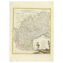
Antique Map of the Region of Languedoc, Foix, Roussillon and Rouergue by Zatta
By Antonio Zatta
Located in Langweer, NL
Antique map titled 'Li Governi di Linguadoca, di Foix e di Rossiglione con il Rouergue'. Old map of France showing the regions of Languedoc, Foix, Roussillon and Rouergue. This map o...
Category
18th Century Antique Antonio Zatta More Furniture and Collectibles
Materials
Paper
Related Items
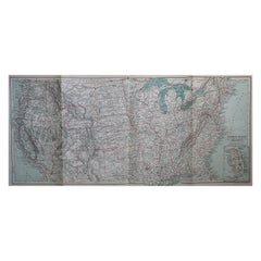
Original Antique Map of The United States of America, circa 1890
Located in St Annes, Lancashire
Great map of the USA
By The Stanford's Geographical Establishment
Original colour
Unframed.
Category
1890s English Victorian Antique Antonio Zatta More Furniture and Collectibles
Materials
Paper
Original Antique Map of The World by Thomas Clerk, 1817
Located in St Annes, Lancashire
Great map of The Eastern and Western Hemispheres
On 2 sheets
Copper-plate engraving
Drawn and engraved by Thomas Clerk, Edinburgh.
Published by Mackenzie And Dent, 1817
...
Category
1810s English Antique Antonio Zatta More Furniture and Collectibles
Materials
Paper
Antique 18th Century Map of the Province of Pensilvania 'Pennsylvania State'
Located in Philadelphia, PA
A fine antique of the colony of Pennsylvania.
Noted at the top of the sheet as a 'Map of the province of Pensilvania'.
This undated and anonymous map is thought to be from the Gentleman's Magazine, London, circa 1775, although the general appearance could date it to the 1760's.
The southern boundary reflects the Mason-Dixon survey (1768), the western boundary is placed just west of Pittsburgh, and the northern boundary is not marked.
The map has a number of reference points that likely refer to companion text and appear to be connected to boundaries. The western and southern boundaries are marked Q, R, S, for example. A diagonal line runs from the Susquehanna R to the Lake Erie P. A broken line marked by many letters A, B, N, O, etc., appears in the east.
There are no latitude or longitude markings, blank verso.
Framed in a shaped contemporary gilt wooden frame and matted under a cream colored matte.
Bearing an old Graham Arader Gallery...
Category
18th Century British American Colonial Antique Antonio Zatta More Furniture and Collectibles
Materials
Paper
H 10.25 in W 13.25 in D 0.5 in
Large Original Antique Map of the United States of America. 1891
By Rand McNally & Co.
Located in St Annes, Lancashire
Fabulous map of The United States
Original color
By Rand, McNally & Co.
Dated 1891
Unframed
Free shipping.
Category
1890s American Antique Antonio Zatta More Furniture and Collectibles
Materials
Paper
No Reserve
H 20.5 in W 13.5 in D 0.07 in
Original Antique Map of the American State of Washington, 1889
Located in St Annes, Lancashire
Great map of Washington
Drawn and Engraved by W. & A.K. Johnston
Published By A & C Black, Edinburgh.
Original colour
Unframed.
Category
1880s Scottish Victorian Antique Antonio Zatta More Furniture and Collectibles
Materials
Paper
Original Antique Map of the American State of Oregon, 1889
Located in St Annes, Lancashire
Great map of Oregon
Drawn and Engraved by W. & A.K. Johnston
Published By A & C Black, Edinburgh.
Original colour
Unframed.
Category
1880s Scottish Victorian Antique Antonio Zatta More Furniture and Collectibles
Materials
Paper
1854 Map of Massachusetts, Connecticut and Rhode Island, Antique Wall Map
Located in Colorado Springs, CO
This striking wall map was published in 1854 by Ensign, Bridgman & Fanning and has both full original hand-coloring and original hardware. This impression is both informative and highly decorative.
The states are divided into counties, outlined in red, green, and black, and subdivided into towns. Roads, canals, and railroad lines are prominently depicted, although they are not all labeled. The mapmakers also marked lighthouses, banks, churches, and prominent buildings, with a key at right. The map is an informative and comprehensive overview of the infrastructural development of New England prior to the Civil War. Physical geographies depicted include elevation, conveyed with hachure marks, rivers and lakes. The impression features an inset map of Boston...
Category
19th Century American Antique Antonio Zatta More Furniture and Collectibles
Materials
Paper
H 38.13 in W 45 in D 3.5 in
Original Antique Map of Spain and Portugal, Engraved By Barlow, 1806
Located in St Annes, Lancashire
Great map of Spain And Portugal
Copper-plate engraving by Barlow
Published by Brightly & Kinnersly, Bungay, Suffolk. 1806
Unframed.
Category
Early 1800s English Antique Antonio Zatta More Furniture and Collectibles
Materials
Paper
No Reserve
H 8 in W 10 in D 0.07 in
Original Antique Map of the American State of Pennsylvania, 1889
Located in St Annes, Lancashire
Great map of Pennsylvania
Drawn and Engraved by W. & A.K. Johnston
Published By A & C Black, Edinburgh.
Original colour
Unframed.
Repair to a minor tear on bottom edge.
Category
1880s Scottish Victorian Antique Antonio Zatta More Furniture and Collectibles
Materials
Paper
No Reserve
H 10.75 in W 15.75 in D 0.07 in
Antique Map of Principality of Monaco
By Antonio Vallardi Editore
Located in Alessandria, Piemonte
ST/619 - "Old Geographical Atlas of Italy - Topographic map of ex-Principality of Monaco" -
ediz Vallardi - Milano -
A somewhat special edition ---
Category
Late 19th Century Italian Other Antique Antonio Zatta More Furniture and Collectibles
Materials
Paper
1908 "Map of Texas" by The Kenyon Company
Located in Colorado Springs, CO
Presented is an antique map of the state of Texas, printed as a pocket map in 1908 by The Kenyon Company. The state map is brightly colored by county, with principal cities and towns listed. The congressional districts are numbered and boldly outlined in red. Rivers, roads, and railroads all appear prominently on this fantastic map...
Category
Early 1900s American Antique Antonio Zatta More Furniture and Collectibles
Materials
Paper
Super Rare Antique French Map of Chine and the Chinese Empire, 1780
Located in Amsterdam, Noord Holland
Super Rare Antique French Map of Chine and the Chinese Empire, 1780
Very nice map of Asia. 1780 Made by Bonne.
Additional information:
Type: Map
...
Category
18th Century European Antique Antonio Zatta More Furniture and Collectibles
Materials
Paper
Antonio Zatta more furniture and collectibles for sale on 1stDibs.
Antonio Zatta more furniture and collectibles are available for sale on 1stDibs. These distinctive items are frequently made of paper and are designed with extraordinary care. There are many options to choose from in our collection of Antonio Zatta more furniture and collectibles, although beige editions of this piece are particularly popular. If you’re looking for additional options, many customers also consider more furniture and collectibles by Jakob van der Schley, Homann Heirs, and James Cook. Prices for Antonio Zatta more furniture and collectibles can differ depending upon size, time period and other attributes — on 1stDibs, these items begin at $388 and can go as high as $388, while a piece like these, on average, fetch $388.


