
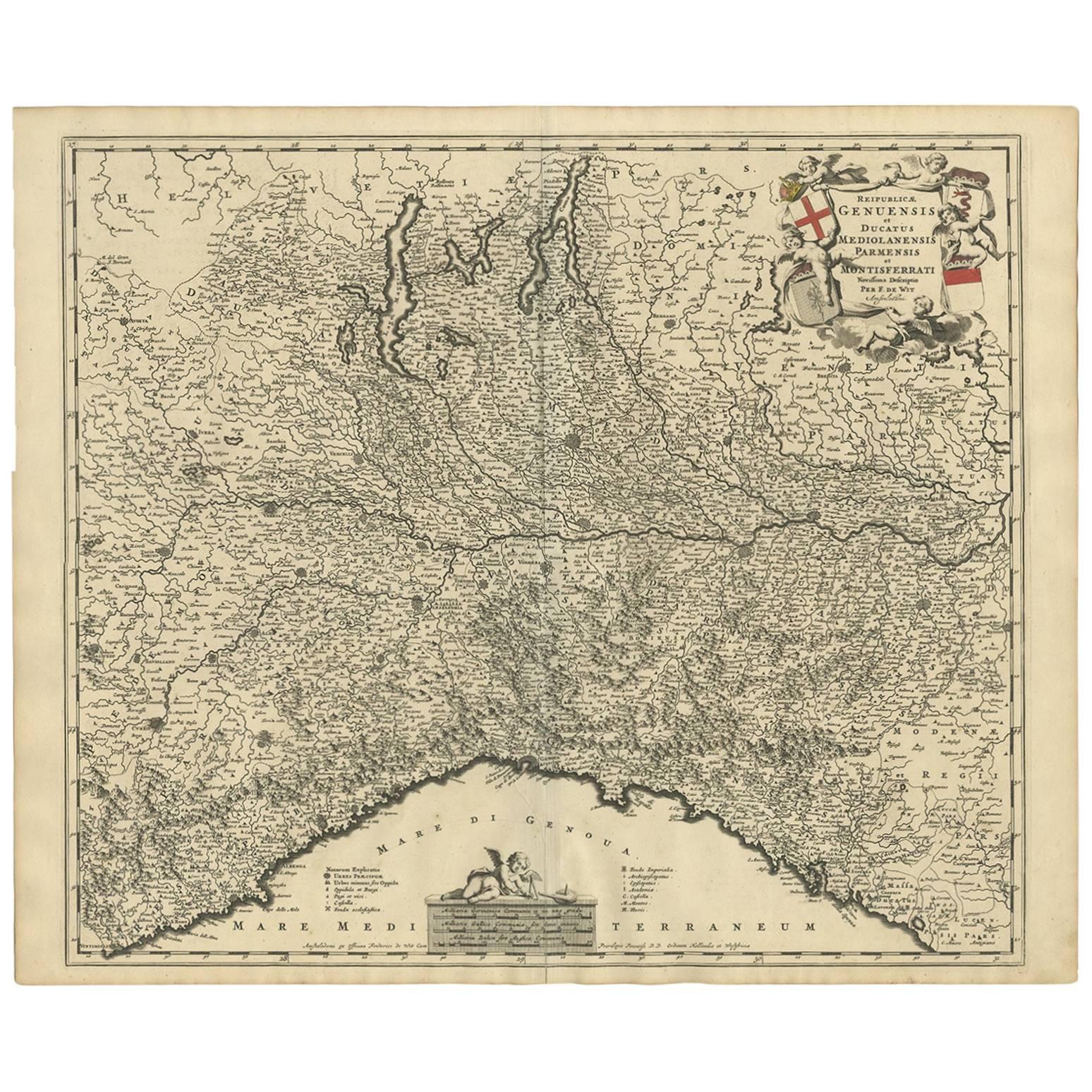
Antique Map of Northern Italy and Livorno by E. Bowen, 1747
View Similar Items


Want more images or videos?
Request additional images or videos from the seller
1 of 5
Antique Map of Northern Italy and Livorno by E. Bowen, 1747
About the Item
- Dimensions:Height: 14.02 in (35.6 cm)Width: 9.93 in (25.2 cm)Depth: 0.02 in (0.5 mm)
- Materials and Techniques:
- Period:
- Date of Manufacture:1747
- Condition:Two small worm holes. Please study image carefully.
- Seller Location:Langweer, NL
- Reference Number:Seller: BG-033321stDibs: LU305439344951
About the Seller
5.0
Platinum Seller
These expertly vetted sellers are 1stDibs' most experienced sellers and are rated highest by our customers.
Established in 2009
1stDibs seller since 2017
1,938 sales on 1stDibs
More From This SellerView All
- Antique Map of Moscovy 'Russia' by E. Bowen, 1747Located in Langweer, NLBeautiful map of European Russia by the English cartographer Emmanuel Bowen. It depicts the European portion of Russia extending from the Gulf of Finland to the Ural Mountains. The m...Category
Antique Mid-18th Century Maps
MaterialsPaper
 $191 Sale Price45% Off
 - Antique Map of Sweden by Bowen, 1747Located in Langweer, NLAntique map titled 'A New & Accurate Map of Sweden'. This map covers Sweden and Finland (shown as part of Sweden) as well as parts of modern day Estonia,...Category
Antique 18th Century Maps
MaterialsPaper
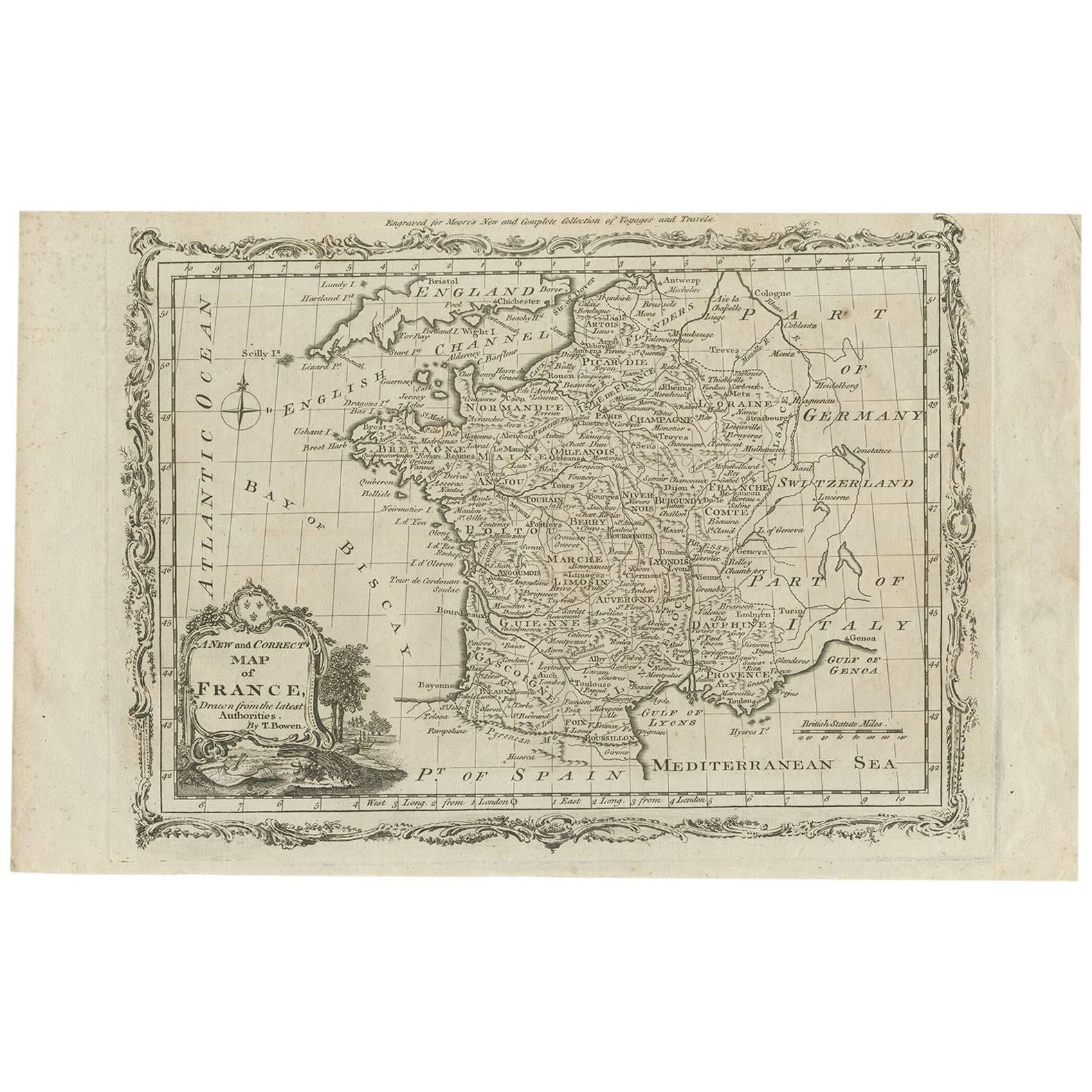
- Antique Map of France by T. Bowen, 1785Located in Langweer, NLDecorative antique map of France titled 'A new and accurate map of France, Drawn from the latest Authorities by T. Bowen'. Engraved for Moore’s new and complete collection of Voyages...Category
Antique Late 18th Century Maps
MaterialsPaper
 $140 Sale Price20% Off
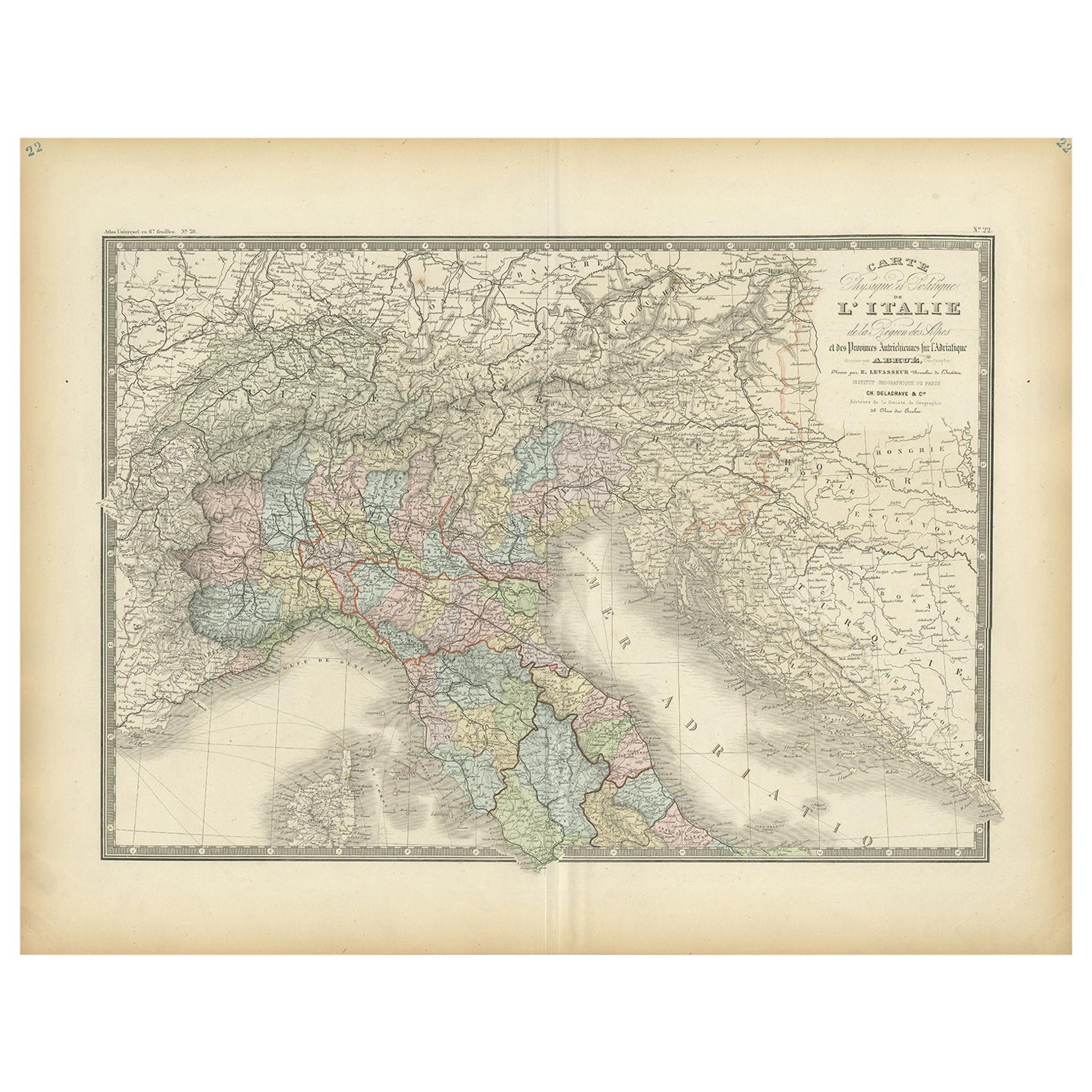
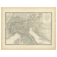
 - Antique Map of Northern Italy by Levasseur, 1875Located in Langweer, NLAntique map titled 'Carte l'Italie (..)'. Large map of Northern Italy. This map originates from 'Atlas de Géographie Moderne Physique et Politique' by A. Levasseur. Published 1875.Category
Antique Late 19th Century Maps
MaterialsPaper
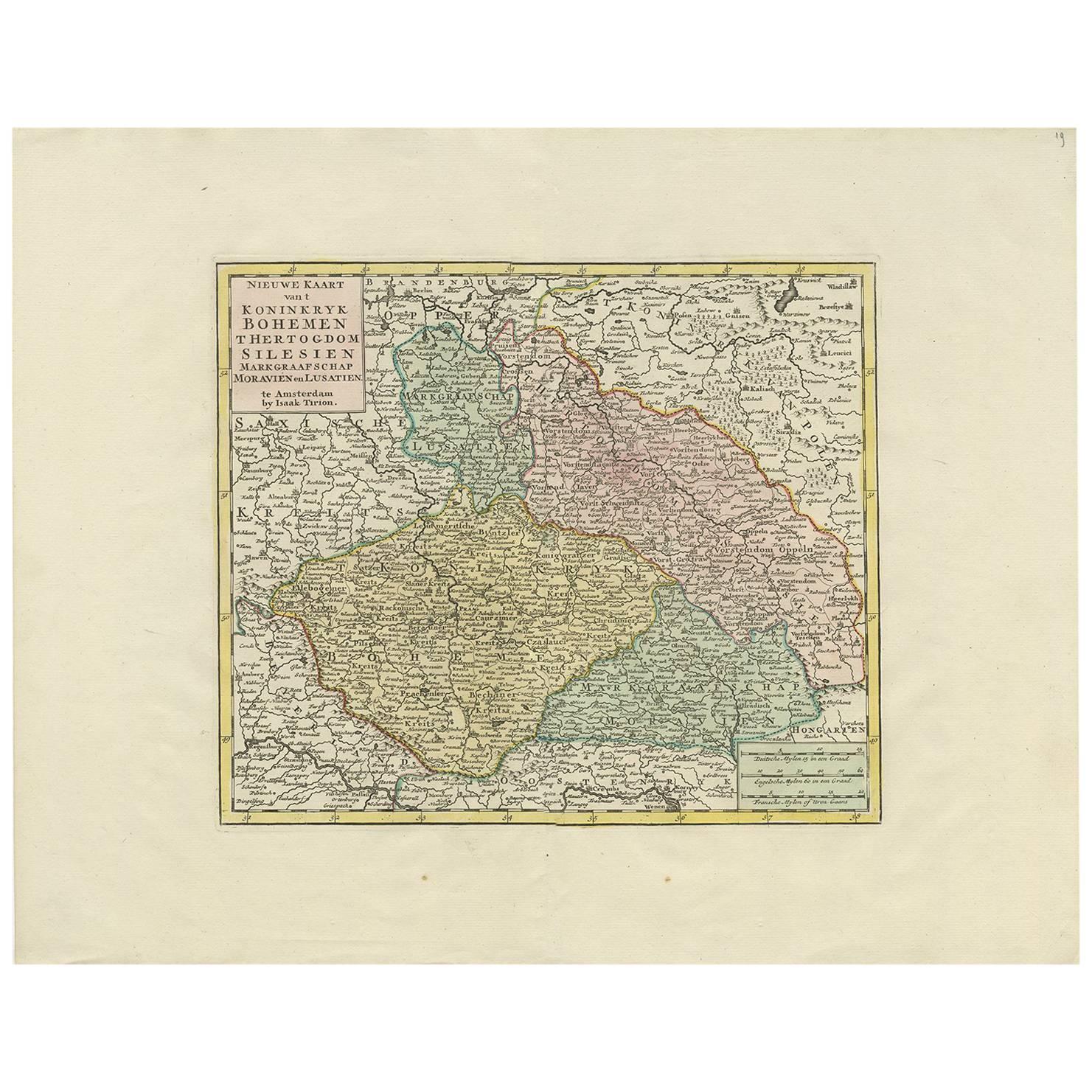
- Antique Map of Czech Republic by I. Tirion, 1747Located in Langweer, NLAntique map titled 'Nieuwe Kaart van t Koninkryk Bohemen t Hertogdom Silesien markgraafschap Moravien en Lusatien'. Including the towns of Berlin, Vienna, Regensburg.Category
Antique Mid-18th Century Maps
MaterialsPaper
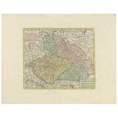 $383 Sale Price32% Off
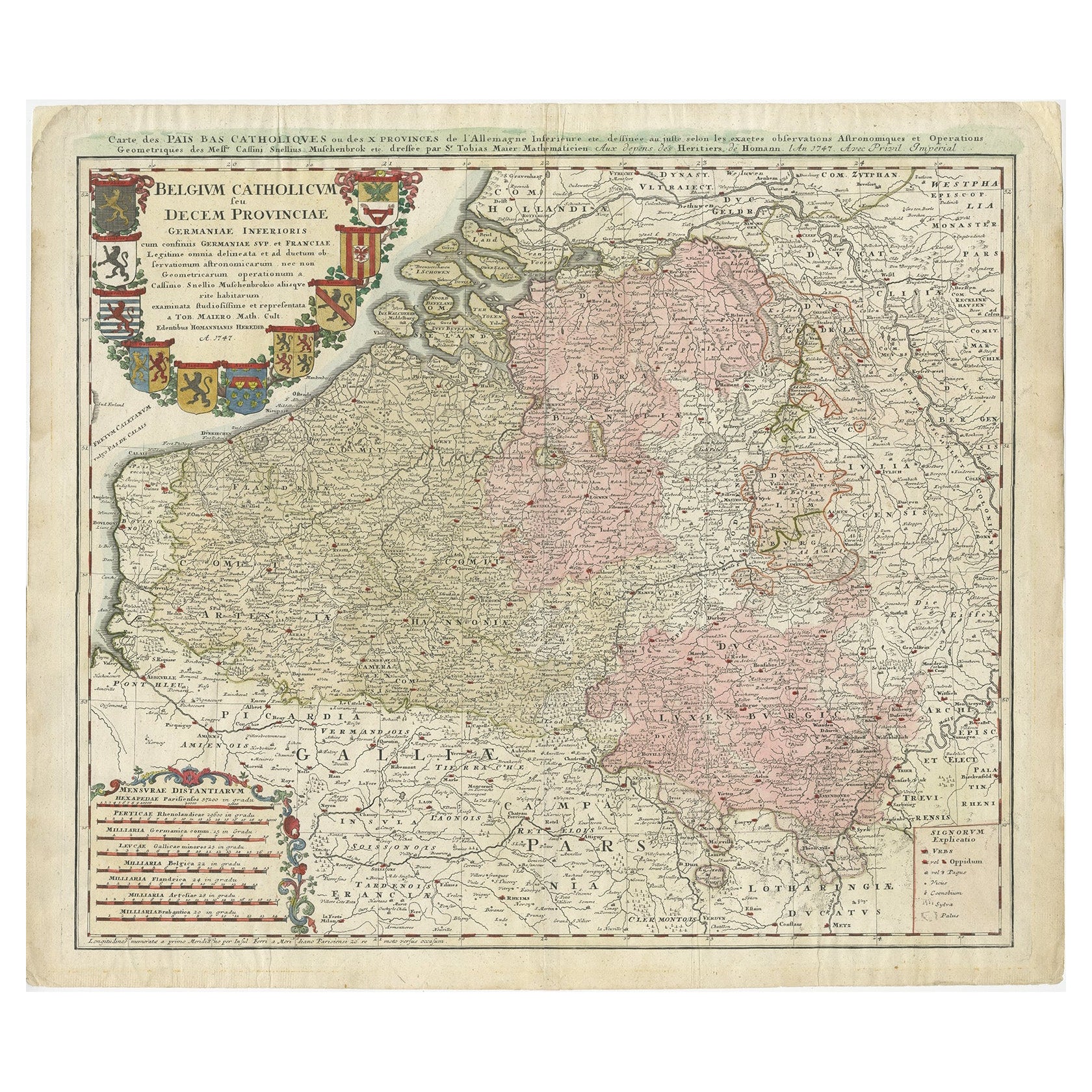
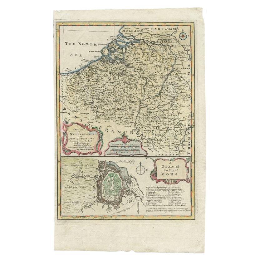
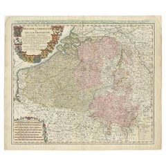
 - Antique Map of Belgium and Luxembourg by Homann Heirs, 1747Located in Langweer, NLAntique map titled 'Belgium Catholicum seu Decem provinciae Germaniae Inferioris cum confiniis Germaniae sup. et Francia (..).' Detailed map of Belgium ...Category
Antique 18th Century Maps
MaterialsPaper

You May Also Like
- Antique Map of Italy by Andriveau-Goujon, 1843By Andriveau-GoujonLocated in New York, NYAntique Map of Italy by Andriveau-Goujon, 1843. Map of Italy in two parts by Andriveau-Goujon for the Library of Prince Carini at Palazzo Carini i...Category
Antique 1840s French Maps
MaterialsLinen, Paper
 $3,350 / set
 - Original Antique Map of Italy. C.1780Located in St Annes, LancashireGreat map of Italy Copper-plate engraving Published C.1780 Unframed.Category
Antique Early 1800s English Georgian Maps
MaterialsPaper

- Original Antique Map of Italy. Arrowsmith. 1820Located in St Annes, LancashireGreat map of Italy Drawn under the direction of Arrowsmith Copper-plate engraving Published by Longman, Hurst, Rees, Orme and Brown, 1820 Unframed.Category
Antique 1820s English Maps
MaterialsPaper

- Northern Scotland: A 16th Century Hand-colored Map by MercatorBy Gerard MercatorLocated in Alamo, CAA framed hand-colored 16th century map of Northern Scotland by Gerard Mercator entitled "Scotiae pars Septentrionalis", published in Amsterdam in 1636. It is a highly detailed map of the northern part of Scotland, with the northwest Highlands and the cities Inverness and Aberdeen, as well as the Orkney Islands and the Hebrides. There is a decorative title cartouche in the upper left corner. The map is presented in an antiqued brown wood...Category
Antique 16th Century Dutch Maps
MaterialsPaper
- Northern Scotland: A 17th Century Hand-colored Map by MercatorBy Gerard MercatorLocated in Alamo, CAThis is a framed hand-colored 17th century map of Northern Scotland by Gerard Mercator entitled "Scotiae pars Septentrionalis", published in Amsterdam in 1636. It is a highly detailed map of the northern part of Scotland, with the northwest Highlands and the cities Inverness and Aberdeen, as well as the Orkney Islands and the Hebrides. There is a decorative title cartouche in the upper left corner. The map is presented in an antiqued brown wood...Category
Antique 1630s Dutch Maps
MaterialsPaper
- Antique Map of Principality of MonacoBy Antonio Vallardi EditoreLocated in Alessandria, PiemonteST/619 - "Old Geographical Atlas of Italy - Topographic map of ex-Principality of Monaco" - ediz Vallardi - Milano - A somewhat special edition ---Category
Antique Late 19th Century Italian Other Prints
MaterialsPaper
 $227 Sale Price74% Off


Recently Viewed
View AllMore Ways To Browse
Antique Map Of Northern Italy
Sea Chart Map
North Sea Chart
Bonne Map
Bag With Map
New Zealand Map
South Pole
Antique Ireland Map
Antique Irish Map
Antique Maps Ireland
Antique Ireland Maps
Antique Irish Maps
Antique Map Ireland
Antique Map Of Ireland
Antique Maps Of Ireland
George Fleet
Antique Railroad Maps
Map Of New Zealand