Items Similar to Detailed Antique Map of Northern Spanish Region of Aragon, c.1650

Want more images or videos?
Request additional images or videos from the seller
1 of 5
Detailed Antique Map of Northern Spanish Region of Aragon, c.1650
About the Item
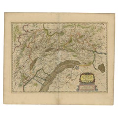
Antique map titled 'Arragonia Regnum'.
Detailed map of northern Spanish region of Aragon. The map is centered on the city of Zaragoza, aka, Saragossa. Shows towns, rivers, castles, mountains, etc.
Artists and Engravers: Willem Janszoon Blaeu (1571-1638) was a prominent Dutch geographer and publisher. Born the son of a herring merchant, Blaeu chose not fish but mathematics and astronomy for his focus. He studied with the famous Danish astronomer Tycho Brahe, with whom he honed his instrument and globe making skills. Blaeu set up shop in Amsterdam, where he sold instruments and globes, published maps, and edited the works of intellectuals like Descartes and Hugo Grotius. In 1635, he released his atlas, Theatrum Orbis Terrarum, sive, Atlas novus. Joan Blaeu (23 September 1596 - 28 May 1673) was a Dutch cartographer. He was born in Alkmaar, the son of cartographer Willem Blaeu.
Condition: Good. General age-related toning. Repair on folding line, French text on verso. Please study image carefully.
- Dimensions:Height: 19.3 in (49 cm)Width: 22.84 in (58 cm)Depth: 0 in (0.02 mm)
- Materials and Techniques:
- Period:1650-1659
- Date of Manufacture:circa 1650
- Condition:Repaired: Repair on folding line.
- Seller Location:Langweer, NL
- Reference Number:
About the Seller
5.0
Platinum Seller
These expertly vetted sellers are 1stDibs' most experienced sellers and are rated highest by our customers.
Established in 2009
1stDibs seller since 2017
1,916 sales on 1stDibs
Typical response time: <1 hour
- ShippingRetrieving quote...Ships From: Langweer, Netherlands
- Return PolicyA return for this item may be initiated within 14 days of delivery.
More From This SellerView All
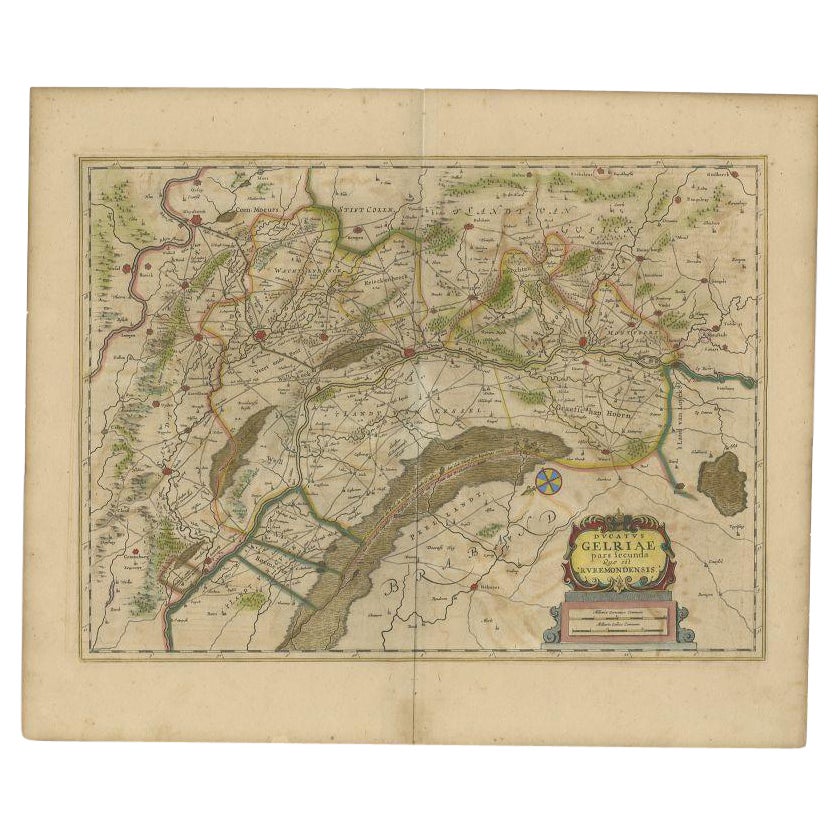
- Antique Map of the Region of Roermond by Janssonius, c.1650By Johannes JanssoniusLocated in Langweer, NLAntique map titled 'Ducatus Gelriae'. Map of the region around Roermond, the Netherlands. This map includes the cities of Gennep, Goch, Venlo, Roermond, Maaseik, Weert, Wachtendonk a...Category
Antique 17th Century Maps
MaterialsPaper
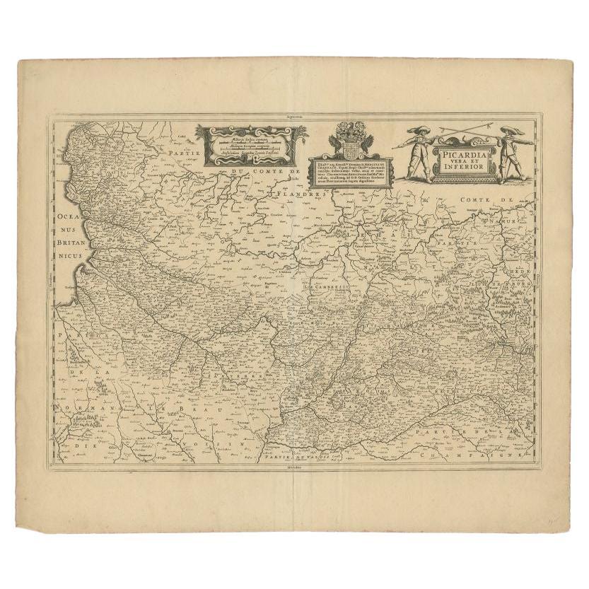
- Antique Map of the Region of Picardy by Janssonius 'c.1650'By Johannes JanssoniusLocated in Langweer, NLAntique map of France titled 'Picardia vera et inferior'. Detailed map of the Picardy region of France. Shows the cities of Calais, Abbeville, St. Quentin, Rethel and others. Ar...Category
Antique 17th Century Maps
MaterialsPaper
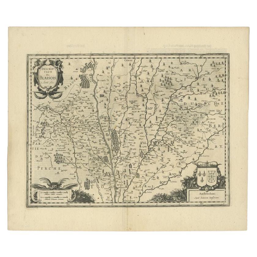
- Antique Map of the Region of Blois by Janssonius, c.1650Located in Langweer, NLAntique map titled 'Description du Blaisois'. Old map of the region of Blois, France. It shows the city of Blois, Amboise, the Loire River and more. Artists and Engravers: Johann...Category
Antique 17th Century Maps
MaterialsPaper
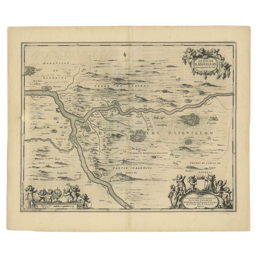
- Antique Map of the Region of Aiguillon by Janssonius, c.1650Located in Langweer, NLAntique map titled 'Le Duche d'Aiguillon'. Beautiful map of the Aiguillon region of France. It shows the region between the Lot and Garonne rivers. Artists and Engravers: Johanne...Category
Antique 17th Century Maps
MaterialsPaper
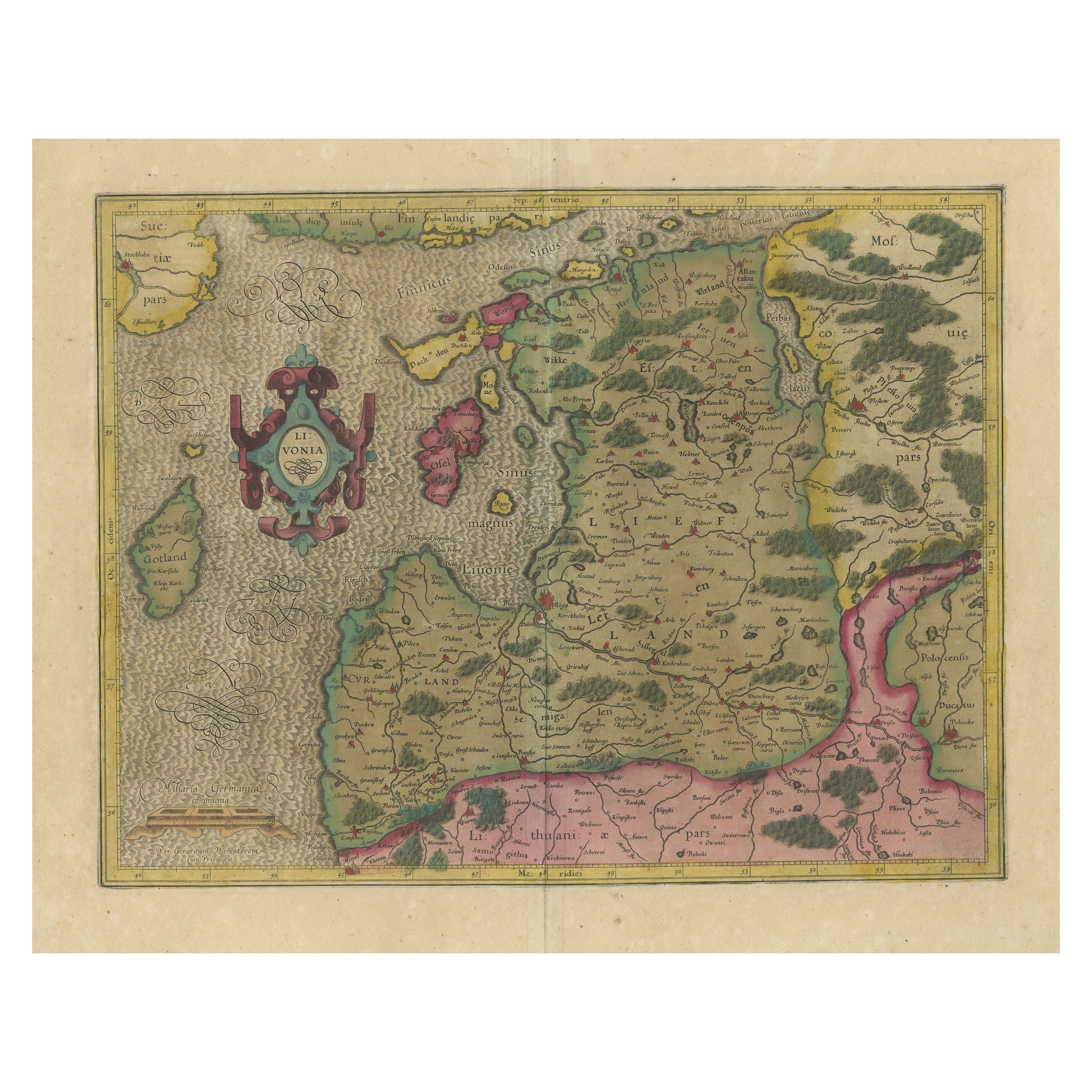
- Original Antique Map of the Northern Baltic RegionLocated in Langweer, NLTitle: "Livonia: Antique Map of the Northern Baltic Region" Description: This antique map, titled "Livonia," is a detailed representation of the northern Baltic region. Centered on ...Category
Antique Early 17th Century Maps
MaterialsPaper
- Antique Map of the Vermandois Region by Janssonius, circa 1650By Johannes JanssoniusLocated in Langweer, NLAntique map titled 'Vermandois'. Old map of the Vermandois region, France. Vermandois was a French County that appeared in the Merovingian period. Its na...Category
Antique Mid-17th Century Maps
MaterialsPaper


You May Also Like
- Original Antique Map of Spain and Portugal, circa 1790Located in St Annes, LancashireSuper map of Spain and Portugal Copper plate engraving by A. Bell Published, circa 1790. Unframed.Category
Antique 1790s English Other Maps
MaterialsPaper
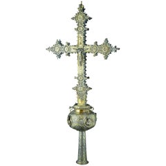
- Processional Cross, Silver, Barbastro, Aragón, Spain, 16th CenturyLocated in Madrid, ESWith hallmarks. It is necessary to indicate the survival in this piece of some details from the Spanish Gothic silverware (cresting, which appears around the XV century; the endings ...Category
Antique 16th Century Spanish Renaissance Religious Items
MaterialsSilver
- Original Antique Map of Spain and Portugal by Thomas Clerk, 1817Located in St Annes, LancashireGreat map of Spain and Portugal Copper-plate engraving Drawn and engraved by Thomas Clerk, Edinburgh. Published by Mackenzie And Dent, 1817 Unframed.Category
Antique 1810s English Maps
MaterialsPaper
- Original Antique Map of Spain and Portugal, Engraved By Barlow, 1806Located in St Annes, LancashireGreat map of Spain And Portugal Copper-plate engraving by Barlow Published by Brightly & Kinnersly, Bungay, Suffolk. 1806 Unframed.Category
Antique Early 1800s English Maps
MaterialsPaper
- 1594 Maurice Bouguereau Map of the Region Limoges, France, Ric0015Located in Norton, MA1594 Maurice Bouguereau map of the region Limoges, France, entitled "Totivs Lemovici et Confinium Pro Uinciarum Quantum ad Dioecefin Lemo Uicenfen Fpectant," Hand Colored Ric0015 Jean IV Le Clerc...Category
Antique 16th Century Dutch Maps
MaterialsPaper
- 1635 Willem Blaeu Map of Northern France"Comitatvs Bellovacvm" Ric.a08Located in Norton, MA1635 Willem Blaeu map of northern France, entitled. "Comitatvs Bellovacvm Vernacule Beavvais," Colored Ric.a008 “COMITATVS BELLOVACVM…” Amsterdam: W...Category
Antique 17th Century Unknown Maps
MaterialsPaper


Recently Viewed
View AllMore Ways To Browse
Spanish French Antiques
Northern French Furniture
Spanish Shops
Antique Shop Collectables
Antique And Collectible Shop
Map Spain
Maps Spain
Map Of Spain
Antique Curiosity Shop
Dutch 1650
Castle Dutch
Orbis Map
Antique French Globe
Antique Maps And Globes
Antique Globes And Maps
Antique Hone
Antique Paper Globe
Antique Map Spain