Items Similar to Large 17th Century Hand Colored Map of England and the British Isles by de Wit


Want more images or videos?
Request additional images or videos from the seller
1 of 12
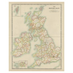
Large 17th Century Hand Colored Map of England and the British Isles by de Wit
About the Item
A large hand colored 17th century map of England and the British Isles by Frederick de Wit entitled "Accuratissima Angliæ Regni et Walliæ Principatus", published in Amsterdam in 1680. It is a highly detailed map of England, Scotland, the Scottish Isles, the Isle of Wight and eastern portions of Ireland. The colorful cartouche in the upper right includes two putti holding a banner with the title of the map and de Wit's name and additional little angels are holding a colorful royal coat of arms.
The map is presented in a large attractive brown wood frame with red interior trim and gold highlight along the forward edge. There is a horizontal central fold, as issued. There is mild color offset from the opposite side of the map resulting from it residing folded in an atlas, possibly for hundreds of years, as it is now 340 years old. There are small faint spots, but the map is otherwise in very good condition.
Frederick de Wit (circa 1630-1706) moved to Amsterdam from Gouda in 1646. He learned cartography from the famous Dutch cartographer, Willem Blaeu. De Wit opened his own map and printing business in 1654. His success gradually expanded his business and by the 1670s he was publishing atlases.
- Creator:Frederick de Wit (Artist)
- Dimensions:Height: 35 in (88.9 cm)Width: 30.5 in (77.47 cm)Depth: 2 in (5.08 cm)
- Materials and Techniques:Paper,Engraved
- Place of Origin:
- Period:Late 17th Century
- Date of Manufacture:1680
- Condition:Wear consistent with age and use.
- Seller Location:Alamo, CA
- Reference Number:
About the Seller
5.0
Vetted Seller
These experienced sellers undergo a comprehensive evaluation by our team of in-house experts.
1stDibs seller since 2020
12 sales on 1stDibs
- ShippingRetrieving quote...Ships From: Alamo, CA
- Return PolicyA return for this item may be initiated within 7 days of delivery.
More From This SellerView All
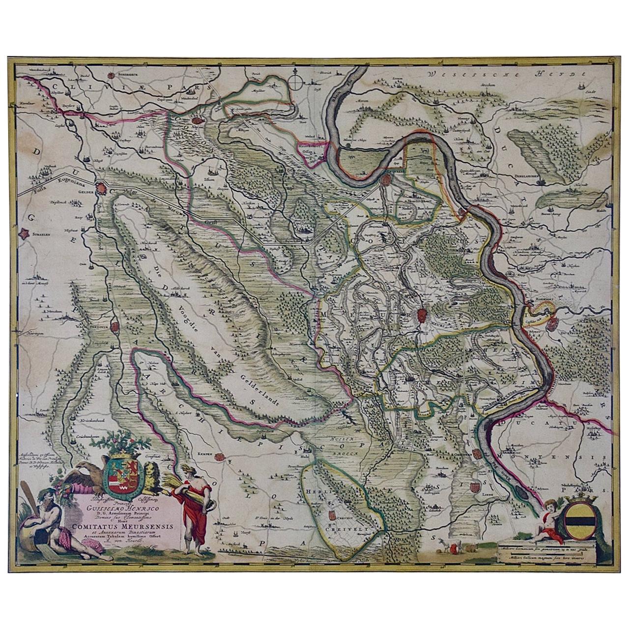
- Germany West of the Rhine: A Hand-colored 18th Century Map by de WitBy Frederick de WitLocated in Alamo, CAThis original 18th century hand-colored map of the county of Moers, Germany entitled "Illustrissimo Celsissmo Principi GUILIELMO HENRICO D.G. Arausionum Principi Domino suo Clementis...Category
Antique Early 18th Century Dutch Maps
MaterialsPaper
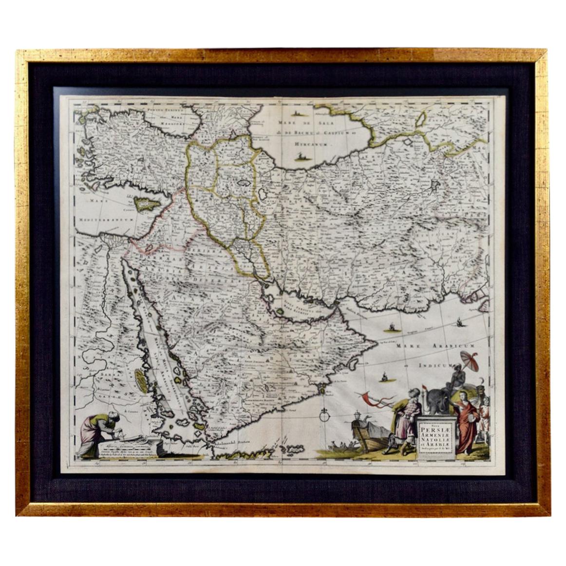
- Persia, Armenia & Adjacent Regions: A 17th Century Hand-colored Map by De WitBy Frederick de WitLocated in Alamo, CAA large 17th century hand colored copperplate engraved map entitled "Novissima nec non Perfectissima Scandinaviae Tabula comprehendens Regnorum Sueciae, Daniae et Norvegiae distincte...Category
Antique Late 17th Century Dutch Maps
MaterialsPaper
- 17th Century Hand-Colored Map of Southeastern England by Mercator and HondiusBy Gerard MercatorLocated in Alamo, CAA 17th century copperplate hand-colored map entitled "The Sixt Table of England" by Gerard Mercator and Jodocus Hondius, published in Amsterdam in 1635 in 'Cosmographicall Descriptio...Category
Antique Mid-17th Century Dutch Maps
MaterialsPaper
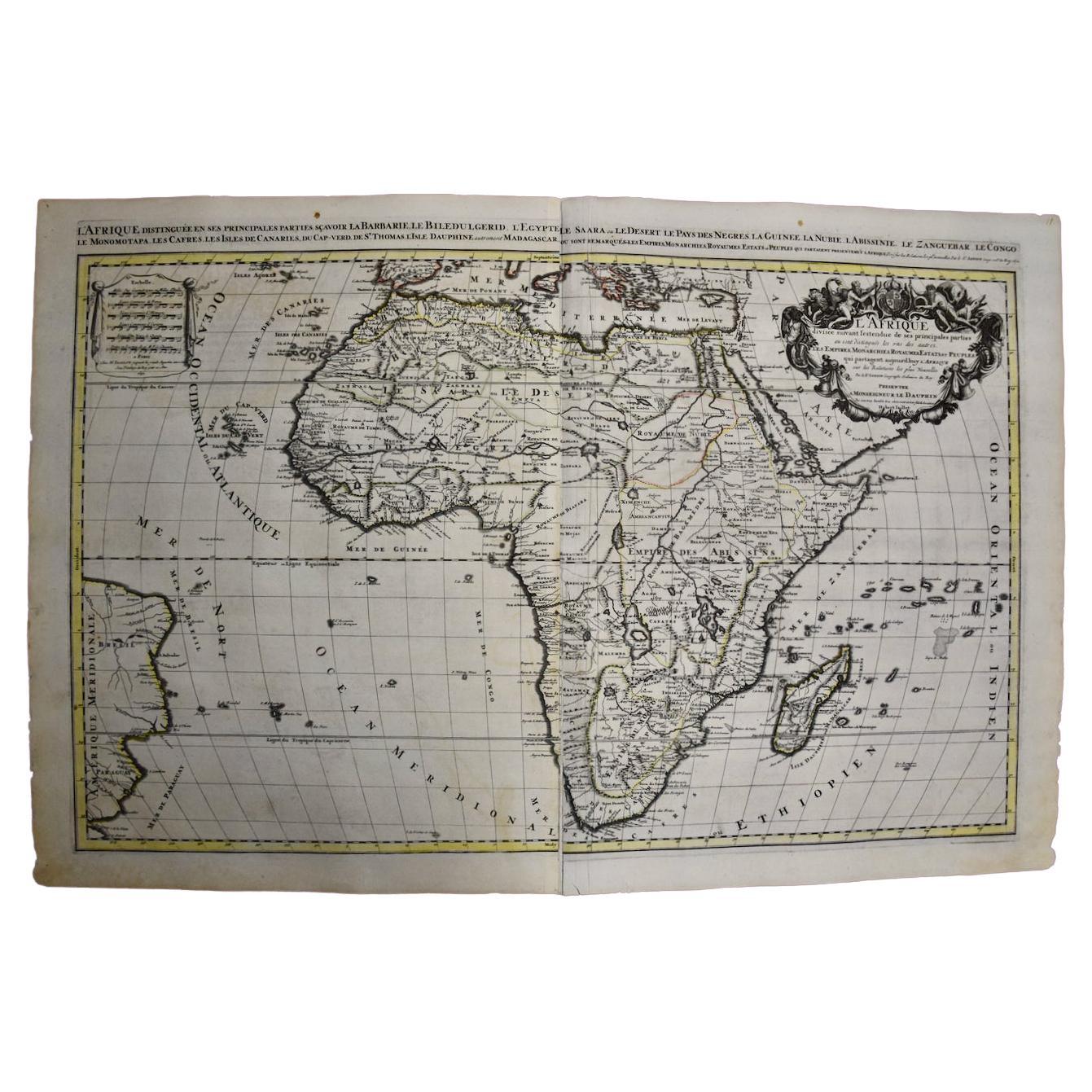
- Africa: A Large 17th Century Hand-Colored Map by Sanson and JaillotBy Nicolas SansonLocated in Alamo, CAThis large original hand-colored copperplate engraved map of Africa entitled "L'Afrique divisee suivant l'estendue de ses principales parties ou sont distingues les uns des autres, L...Category
Antique 1690s French Maps
MaterialsPaper
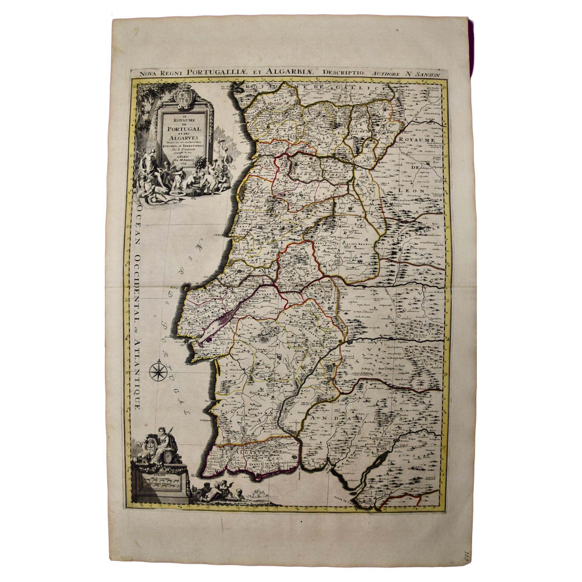
- Portugal: A Large 17th Century Hand-colored Map by Sanson and JaillotBy Nicolas SansonLocated in Alamo, CAThis large hand-colored map entitled "Le Royaume de Portugal et des Algarves Divisee en see Archeveches, Eveches et Territoires Par le Sr Sanson" was originally created by Nicholas S...Category
Antique 1690s French Maps
MaterialsPaper
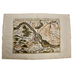
- Vienna, Austria: A Large 17th Century Hand-Colored Map by Sanson and JaillotBy Nicolas SansonLocated in Alamo, CAThis large 17th century hand-colored map of Vienna, Austria and the surrounding countryside and villages entitled "Plan de la Ville de Vienne en Austrich...Category
Antique 1690s French Maps
MaterialsPaper


You May Also Like
- Large Antique Map of France by De Wit, c.1680By Frederick de WitLocated in Langweer, NLAntique map titled 'Accuratissima Galliae Tabula vulgo Royaume de France'. Detailed map of France. Shows provinces, cities, rivers etc. Artists and Engravers: Frederick de Wit (1...Category
Antique 17th Century Maps
MaterialsPaper
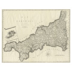
- Large Antique County Map of Cornwall and the Isles of Scilly, EnglandLocated in Langweer, NLAntique map titled 'A Map of Cornwall from the best Authorities'. Original old county map of Cornwall, England. With inset map of the Scilly Islands. Engraved by John Cary. Originate...Category
Antique Early 19th Century Maps
MaterialsPaper
- Antique Map of the British Isles with Contemporary Hand ColoringLocated in Langweer, NLAntique map titled 'Les Isles Britanniques'. Original antique map of the British Isles, with original/contemporary hand coloring. Published by Crepe, circa 1767.Category
Antique Late 18th Century Maps
MaterialsPaper
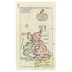
- Interesting Small Map of the British Isles with Hand ColoringLocated in Langweer, NLAntique map titled 'Insularum Britannicarum Tabula'. Interesting small map of the British Isles by Wells. This map originates from 'Oikumenes Periegesis, sive, Dionysii Geographia em...Category
Antique Early 18th Century Maps
MaterialsPaper
- Antique Map of the British Isles by Johnston '1909'Located in Langweer, NLAntique map titled 'The British Isles'. Original antique map of the British Isles. With inset maps of the Shetland Islands, Chanel Islands, and London. T...Category
Early 20th Century Maps
MaterialsPaper
- Antique Map of the British Isles by H. Chatelain, 1719By Henri-Abraham ChatelainLocated in Langweer, NLBeautiful hand colored large format map of the British Isles, with large insets of the Eastern and Western Hemispheres and the coats of arms for Engl...Category
Antique Early 18th Century Maps
MaterialsPaper


Recently Viewed
View AllMore Ways To Browse
England Map
Large Coat Of Arms
Frederick Antique Furniture
Map Of England
Coat Of Arms England
Gold Maps
Gold Map
Dutch 17th Century Large
Britain Map
Hand Colored Map
Map Of Britain
Antique Map England
Antique Maps England
Antique England Map
Antique Maps Of England
Antique Map Of England
Little Angel
Collectable Angel