Items Similar to Large Antique Map of New Guinea and New Britain Showing Capt. Cooks Tract, 1773


Want more images or videos?
Request additional images or videos from the seller
1 of 5
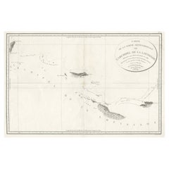
Large Antique Map of New Guinea and New Britain Showing Capt. Cooks Tract, 1773
About the Item
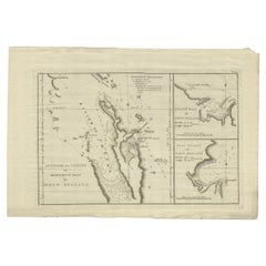
Antique map titled 'A Chart of Captain Carteret's Discoveries at New Britain, with part of Captain Cooke's Passage thro Endeavour Streights, & of Captain Dampier's tract & discoveries in 1699 & 1700, at New Guinea and New Britain'.
This sea chart of Papua New Guinea shows the new discoveries of Captains Cook, Carteret, and Dampier along New Guinea, New Britain, and New Ireland. The chart details the path of Captain Cook's voyage along the southwestern coast of the island of New Guinea in today's Irian Jaya, Indonesia's easternmost province. Cook sailed between Australia and New Guinea and proved the existence of the Strait of Torres. The chart also details the explorations of Carteret and Dampier which focused on the northern portion of New Guinea and the nearby Pacific islands. Published in John Hawkesworth's 'An Account of the Voyages Undertaken by the Order of his Present Majesty for Making Discoveries in the Southern Hemisphere, and Successively Performed by Commodore Byron, Captain Wallis, Captain Carteret, and Captain Cook'. Artists and Engravers: Engraved by William Whitchurch.
Artist: Engraved by William Whitchurch.
Condition: Good, general age-related toning. Few repairs on tears. Please study image carefully.
Date: 1773
Overall size: 71 x 29 cm.
Image size: 63 x 21.5 cm.
- Dimensions:Height: 27.96 in (71 cm)Width: 11.42 in (29 cm)Depth: 0 in (0.01 mm)
- Materials and Techniques:
- Period:
- Date of Manufacture:1773
- Condition:
- Seller Location:Langweer, NL
- Reference Number:
About the Seller
5.0
Platinum Seller
These expertly vetted sellers are 1stDibs' most experienced sellers and are rated highest by our customers.
Established in 2009
1stDibs seller since 2017
1,932 sales on 1stDibs
Typical response time: <1 hour
- ShippingRetrieving quote...Ships From: Langweer, Netherlands
- Return PolicyA return for this item may be initiated within 14 days of delivery.
More From This SellerView All
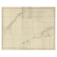
- Antique Map of New Guinea and New Britain by P. Carteret, circa 1773Located in Langweer, NLAntique map titled 'A chart of captn Carteret's Discoveries at New Britain'. Philip Carterets map of New Guinea and the islands of New Britain and New Ireland with the tracks of William Dampier...Category
Antique Late 18th Century Maps
MaterialsPaper
- Detailed Map of New Zealand Showing the Route of Capt. Cook's First Voyage, 1803Located in Langweer, NLAntique map New Zealand titled 'De Rivier de Theems en Mercurius Baai in Nieuw Zeeland'. Detailed map of New Zealand showing the route of Capta...Category
Antique 19th Century Maps
MaterialsPaper
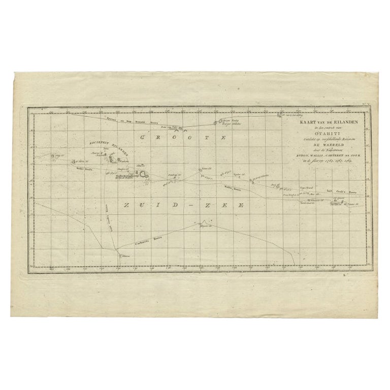
- Antique Map of French Polynesia by Cook Showing His Route, 1803Located in Langweer, NLAntique map Tahiti titled 'Kaart van de Eilanden in den omtrek van Otahiti (..)'. Antique map of French Polynesia with the tracks around the island of Tahiti by Captain Byron, Wallis...Category
Antique 19th Century Maps
MaterialsPaper
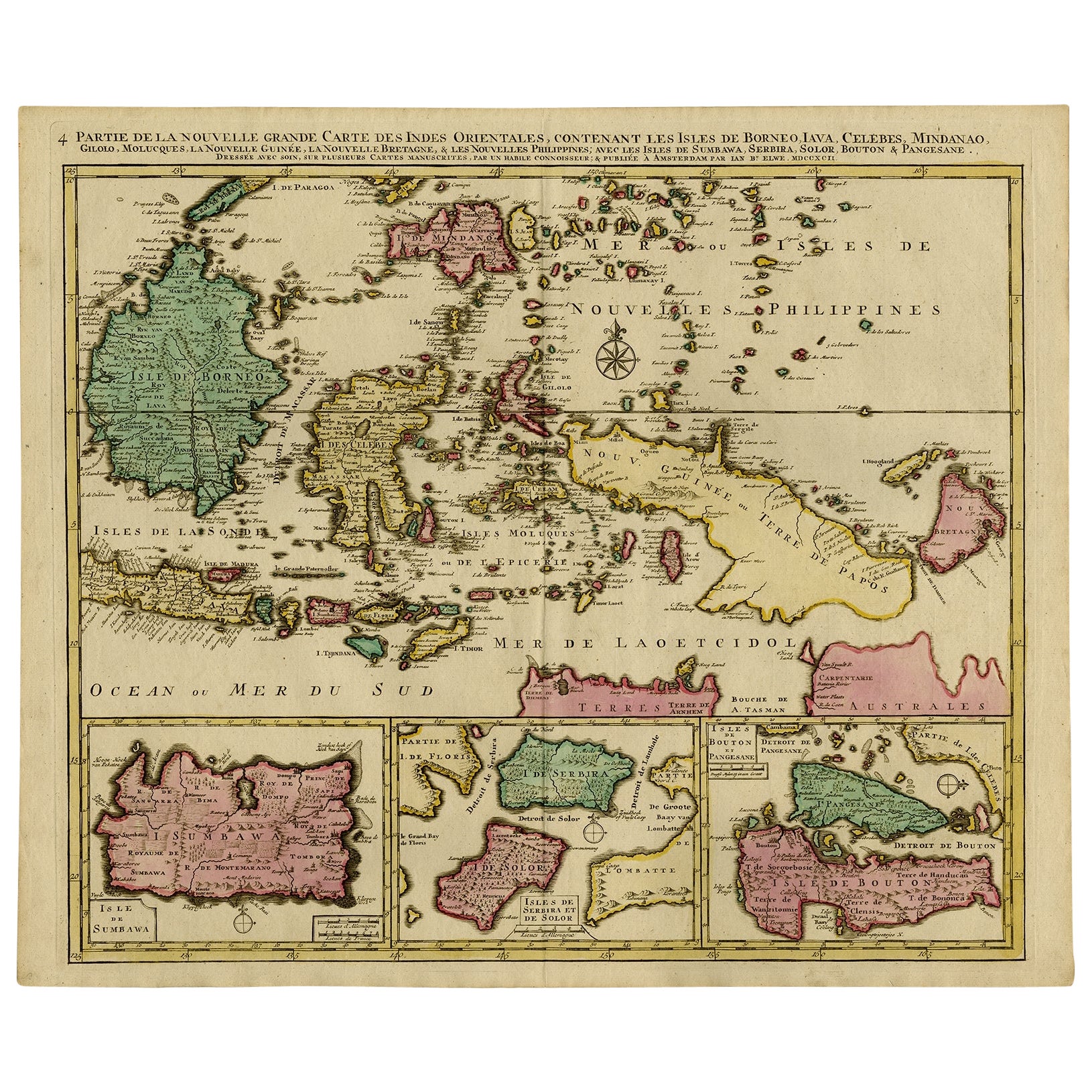
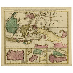
- Old Map of Indonesian Islands Borneo, Celebes, New Guinea & New Britain, 1792Located in Langweer, NLAntique map titled 'Partie de la Nouvelle Grande Carte des Indes Orientales, contenant les Isles de Borneo, Iava, Celebes, Mindanao (..)'. Detailed map of the Indonesian islands Bo...Category
Antique 1790s Maps
MaterialsPaper
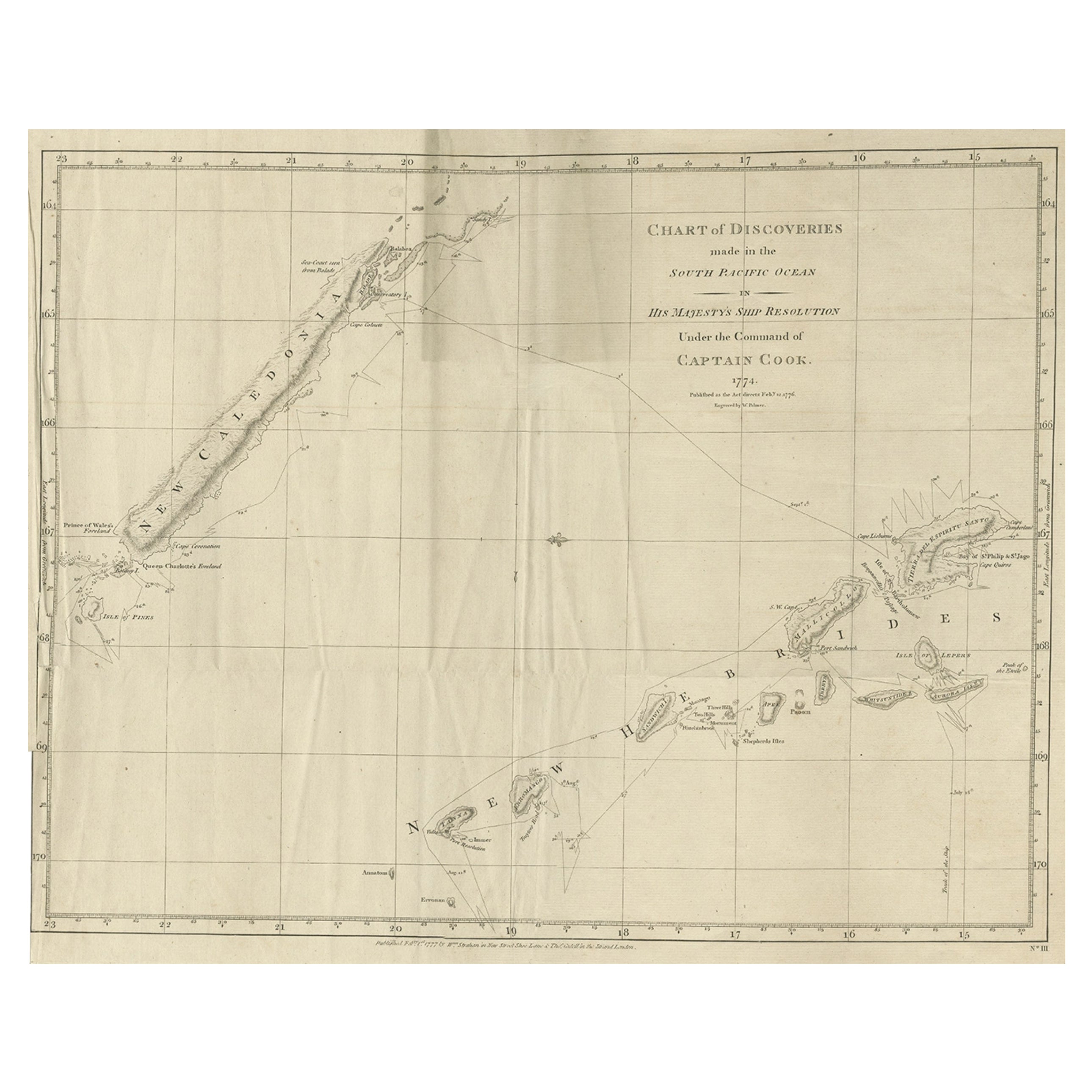
- Rare Engraving of New Caledonia & New Hebrides from Capt. Cook's Travels, 1777Located in Langweer, NLAntique map titled 'Chart of Discoveries made in the South Pacific Ocean'. Rare engraving from the official British Admiralty sanctioned edition of the accounts of Cook’s second voyage. All other later copies made of this image by other publishers were unauthorised, usually smaller and inferior in quality. Made after Cook's discovery of the island group on 4 September 1774, which he named New Caledonia...Category
Antique 1770s Maps
MaterialsPaper
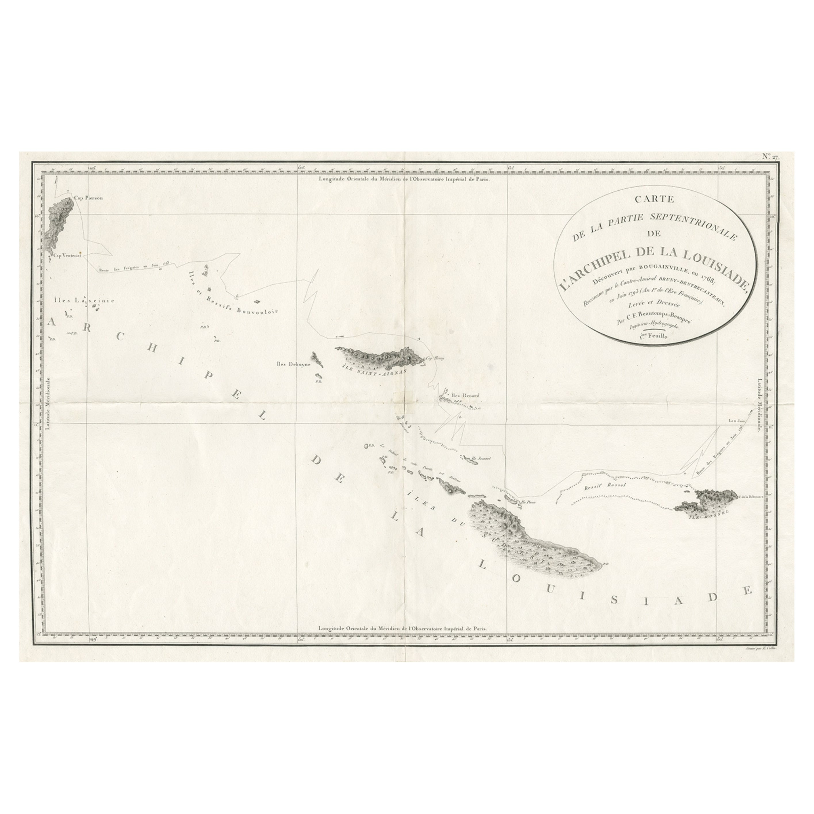
- Uncommon Rare Map Showing The Louisiade Archipelago, Papua New Guinea, ca.1798Located in Langweer, NLAntique map titled 'Carte de la Partie Septentrionale de l'Archipel de la Louisiade'. Uncommon map showing the area around the Louisiade Archipelago, named for Louis XV by Louis ...Category
Antique 1790s Maps
MaterialsPaper

You May Also Like
- Large Original Antique Map of New Mexico, Usa, C.1900Located in St Annes, LancashireFabulous map of New Mexico. Original color. Engraved and printed by the George F. Cram Company, Indianapolis. Published, C.1900. Unframed. Free shipping.Category
Antique 1890s American Maps
MaterialsPaper
- Large Original Antique Map of New Hampshire, USA, 1894By Rand McNally & Co.Located in St Annes, LancashireFabulous map of New Hampshire Original color By Rand, McNally & Co. Published, 1894 Unframed Free shipping.Category
Antique 1890s American Maps
MaterialsPaper
- Large Original Antique Map of New Jersey, USA, circa 1900Located in St Annes, LancashireFabulous map of New Jersey Original color Engraved and printed by the George F. Cram Company, Indianapolis. Published, circa 1900 Unframed Repairs to minor edge tearsCategory
Antique 1890s American Maps
MaterialsPaper
- Large Original Vintage Map of British Island Possessions, circa 1920Located in St Annes, LancashireGreat map of British Island Possessions Original color. Good condition Published by Alexander Gross Unframed.Category
Vintage 1920s English Maps
MaterialsPaper
- Large Antique 1859 Map of North AmericaLocated in Sag Harbor, NYThis Map was made by Augustus Mitchell in 1859 It is in amazing condition for being 163 years old. This price is for the rolled up easy to ship version of this piece. I will be Frami...Category
Antique Mid-19th Century American Maps
MaterialsCanvas, Paper

- 1872 Chambers's Miscellany of Instructive and Entertaining Tracts - 8 VolumesBy William Chambers 1Located in Morristown, NJ8 of 10 volumes (2-7 and 9-10) Chambers's Miscellany of Instructive & Entertaining Tracts New and Revised Edition, printed 1872 by W. & R. Chambers, Edinburgh. Uniformly bound in hal...Category
Antique 1870s Scottish Edwardian Books
MaterialsLeather, Paper

Recently Viewed
View AllMore Ways To Browse
Antique New Furniture
Antique Furniture New
New Antique Furniture
New Today
Antique Large Island
Toner Chart
Pacific Islands
Southern New And Used Furniture
Large Maps On Paper
Used Office Furniture Nearby
Antique British Maps
Antique Maps Of Britain
Map Of The Pacific
Antique Northern Ireland
Antique Furniture Northern Ireland
Cook Islands
Antique Southwestern Furniture
Antique Britain Map