Items Similar to Uncommon and Rare Map of the Caspian Sea by Order of the Czar, 1742

Want more images or videos?
Request additional images or videos from the seller
1 of 5
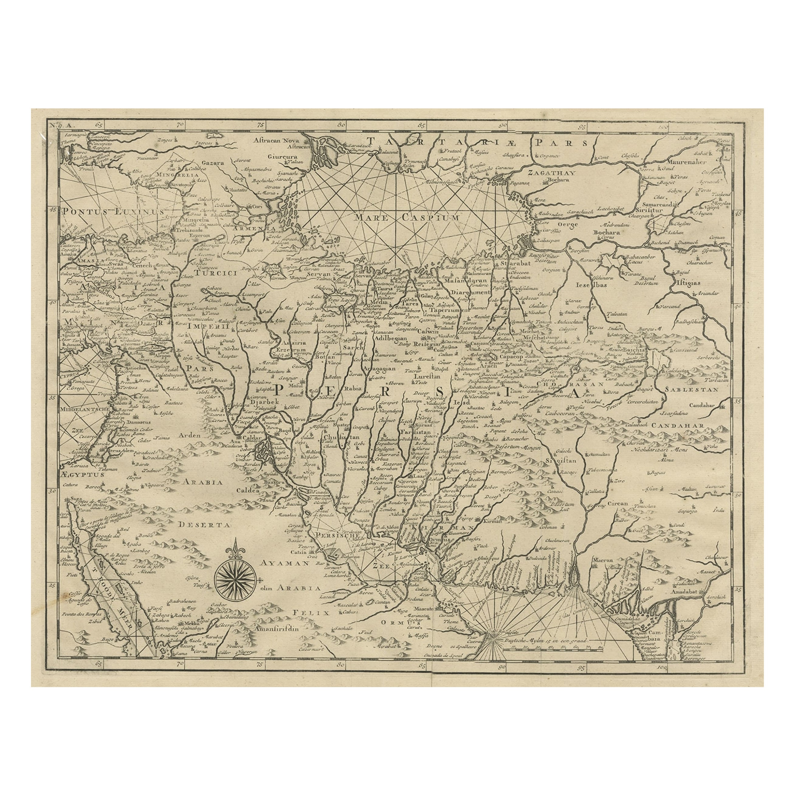
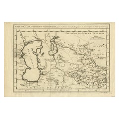
Uncommon and Rare Map of the Caspian Sea by Order of the Czar, 1742
About the Item
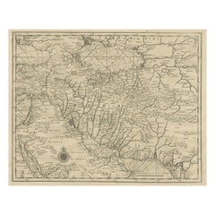
Antique map, titled: 'Kaert van de Kaspische Zee volgens bevel van den Czaer (…).'
Uncommon map of Caspian Sea. Source unknown, to be determined.
Artists and Engravers: Made by 'Guillaume de L'Isle' after an anonymous artist. The de L'Isle family was one of the most influential Geographers of the early 18th century in France. Claude de L'Isle, born 1644, had four sons, of which Guillaume was the most notable. Guillaume was born 1675 and became member of the "Academie Royale des Sciences" with the age of twenty-seven, and was honoured later with the title "Premier Geographe du Roi". His largest project, the "Atlas de Geographie", was published until 1774 in Paris and Amsterdam (Covens and Mortier). He died in 1726.
Condition:
Good, given age. Some spots in the margins. Right edge with a few tiny tears. Original folds as issued. General age-related toning and/or occasional minor defects from handling. Please study scan carefully.
- Dimensions:Height: 18.82 in (47.8 cm)Width: 10.99 in (27.9 cm)Depth: 0 in (0.02 mm)
- Materials and Techniques:
- Period:1740-1749
- Date of Manufacture:1742
- Condition:Condition: Good, given age. Some spots in the margins. Right edge with a few tiny tears. Original folds as issued. General age-related toning and/or occasional minor defects from handling. Please study scan carefully.
- Seller Location:Langweer, NL
- Reference Number:
About the Seller
5.0
Platinum Seller
These expertly vetted sellers are 1stDibs' most experienced sellers and are rated highest by our customers.
Established in 2009
1stDibs seller since 2017
1,916 sales on 1stDibs
Typical response time: <1 hour
- ShippingRetrieving quote...Ships From: Langweer, Netherlands
- Return PolicyA return for this item may be initiated within 14 days of delivery.
More From This SellerView All
- Rare Antique Map of Persia, Incl the Caspian Sea and the Arabian Peninsula, 1726Located in Langweer, NLRare untitled antique map of Persia. It covers from the Gulf of Suez eastward to Ahmedabad (Amadabad) in modern day western India. This map, centered on Persia, includes the Caspian Sea and part of the Arabian Peninsula...Category
Antique 1720s Maps
MaterialsPaper
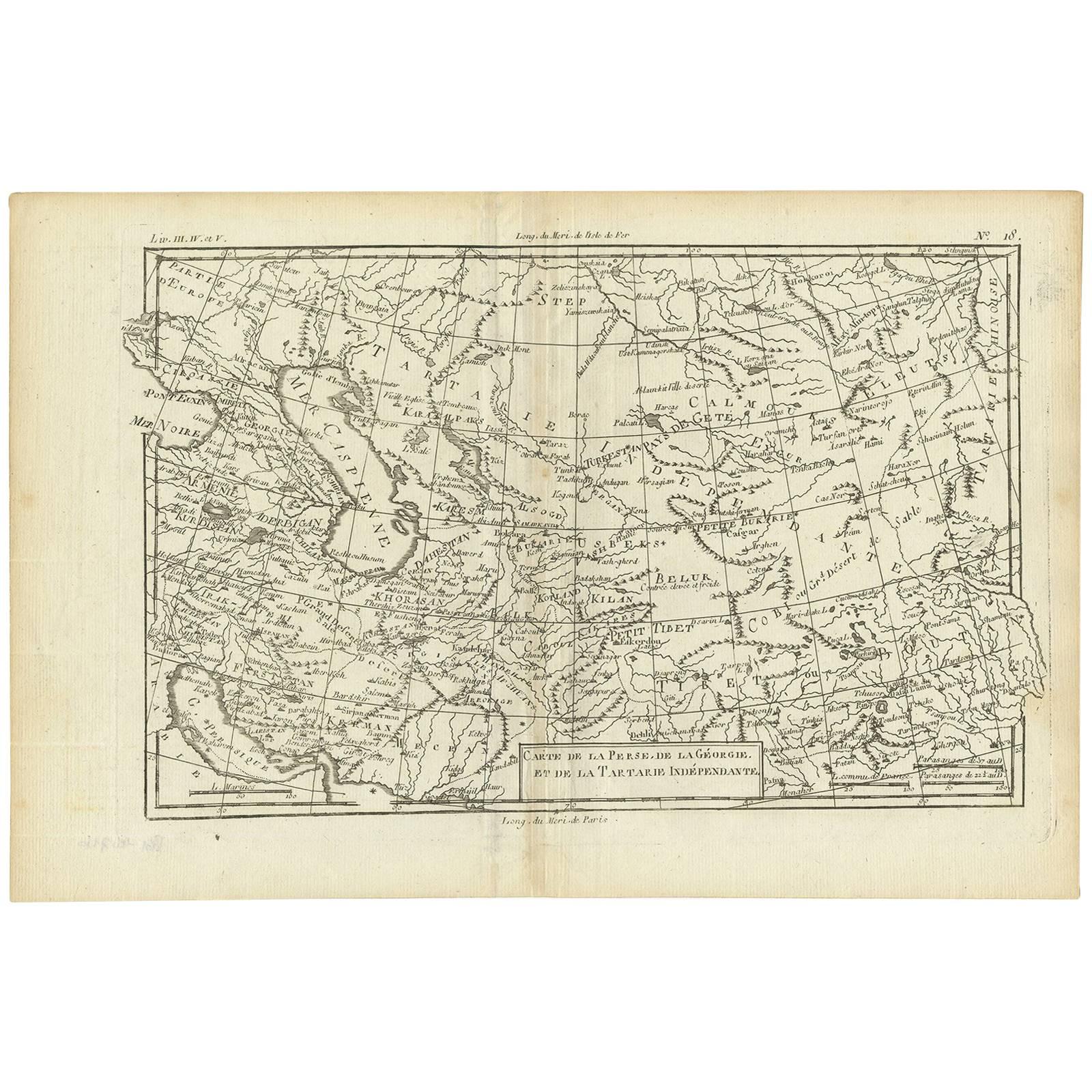
- Antique Map of the Persian Gulf and Caspian Sea Region by R. Bonne, 1780Located in Langweer, NLAntique print titled 'Carte de la Perse, de la Georgie, et de la Tartarie Independante'. Shows the region from the Persian Gulf and Caspian Sea in the wes...Category
Antique Late 18th Century Maps
MaterialsPaper
- Antique Map of the Caspian Sea, Uzbekistan, Northern Persia Etc, C.1735Located in Langweer, NLAntique map titled 'Nova Maris Caspii et Regions Usbeck (..).' Detailed map of Central Asia centered on the Caspian Sea, showing Uzbekistan to the east of ...Category
Antique 18th Century Maps
MaterialsPaper
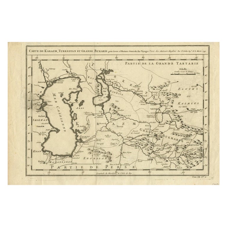
- Antique Map Centered on Turkestan, Including the Black and Caspian Seas, 1749Located in Langweer, NLAntique map titled 'Carte De Karazm, Turkestan Et Grande Bukarie'. Original antique map centered on Turkestan. Extends to include the Black and Caspian Seas...Category
Antique 18th Century Maps
MaterialsPaper
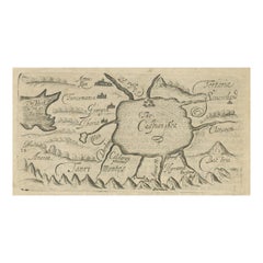
- Uncommon Miniature Map of the Region around the Caspian Sea, ca.1800Located in Langweer, NLUncommon miniature map of the region around the Caspian Sea. Including the black sea and several mountains. Source unknown, to be determined. Artist...Category
Antique Early 1800s Maps
MaterialsPaper
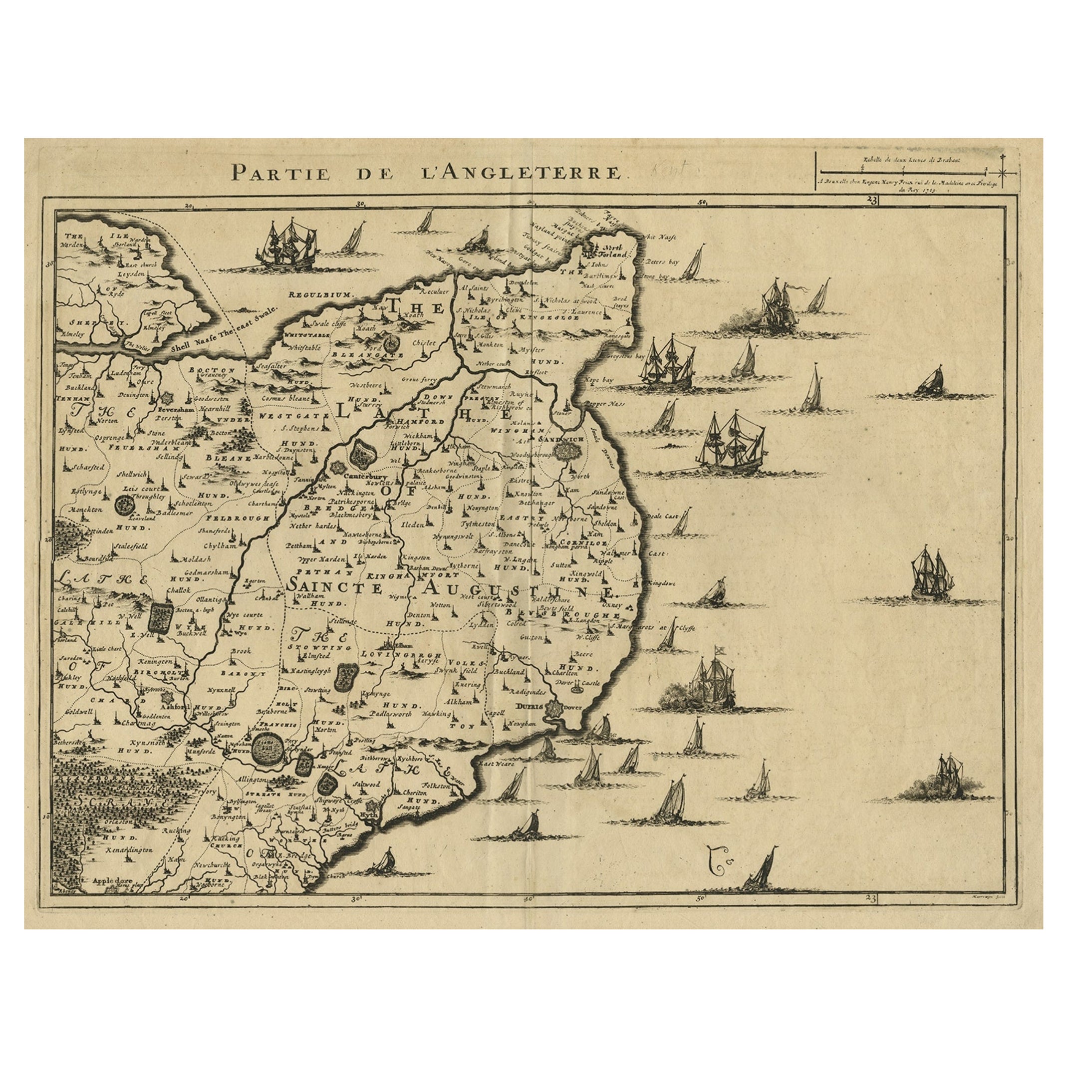
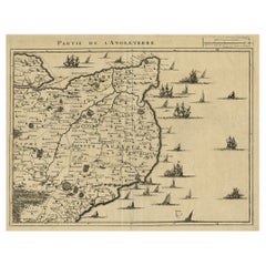
- Uncommon Antique Map of the English Channel Coastline, ca.1709Located in Langweer, NLAntique map titled 'Partie de L'Angleterre' Uncommon map of the English Channel coastline with many boats on the sea. Source unknown, to be determined. Artists and Engravers: Made...Category
Antique Early 1700s Maps
MaterialsPaper
You May Also Like
- Hand-Colored 18th Century Homann Map of the Black Sea, Turkey and Asia MinorBy Johann Baptist HomannLocated in Alamo, CAAn attractive original early 18th century hand-colored map of the Black Sea and Turkey entitled "Carte de L'Asie Minevre ou de la Natolie et du Pont Evxin Tiree des Voyages et des Ob...Category
Antique Early 18th Century German Maps
MaterialsPaper
- Hand-Colored 18th Century Homann Map of Denmark and Islands in the Baltic SeaBy Johann Baptist HomannLocated in Alamo, CAAn 18th century copper plate hand-colored map entitled "Insulae Danicae in Mari Balthico Sitae utpote Zeelandia, Fionia, Langelandia, Lalandia, Falstria, Fembria Mona" created by Joh...Category
Antique Early 18th Century German Maps
MaterialsPaper
- Map of the Republic of GenoaLocated in New York, NYFramed antique hand-coloured map of the Republic of Genoa including the duchies of Mantua, Modena, and Parma. Europe, late 18th century. Dimension: 25...Category
Antique Late 18th Century European Maps
- Map "Estuary- Mouth of the Thames"Located in Alessandria, PiemonteST/426 - Antique French Map of the estuary of the Thames, map dated 1769 - "Mape of the entrance of the Thames. Designed by filing of Navy cards fo...Category
Antique Mid-18th Century French Other Prints
MaterialsPaper
- The Normandy Region of France: A 17th C. Hand-colored Map by Sanson and JaillotBy Nicolas SansonLocated in Alamo, CAThis large hand-colored map entitled "Le Duché et Gouvernement de Normandie divisée en Haute et Basse Normandie en divers Pays; et par evêchez, avec le Gouvernement General du Havre ...Category
Antique 1690s French Maps
MaterialsPaper
- Original Antique Map of The Netherlands, Engraved by Barlow, Dated 1807Located in St Annes, LancashireGreat map of Netherlands Copper-plate engraving by Barlow Published by Brightly & Kinnersly, Bungay, Suffolk. Dated 1807 Unframed.Category
Antique Early 1800s English Maps
MaterialsPaper


