Items Similar to Antica Carta Geografica Regno di Napoli - 1706 - XVIII Secolo Francia

Want more images or videos?
Request additional images or videos from the seller
1 of 10
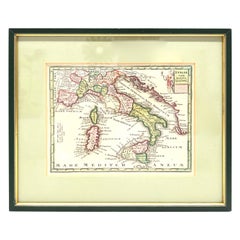
Antica Carta Geografica Regno di Napoli - 1706 - XVIII Secolo Francia
$897.88
£662.33
€750
CA$1,244.06
A$1,349.99
CHF 715.38
MX$16,557.02
NOK 8,852.75
SEK 8,365.38
DKK 5,711.11
About the Item
Antica Cartina Regno di Napoli XVIII Secolo 1:700000
Descrizione:
Meravigliosa Cartina con raffigurazione del regno di Napoli , la cartina è stata realizzata in Francia nella prima metà del XVIII secolo (1706).
La Cartina è in ottime condizioni come da foto viene venduta con cornice realizzata nella seconda meta del XX Secolo.
Origine:
Francia.
Periodo di Produzione:
XVIII Secolo (1706).
Misure Cartina (cm):
Altezza: 88
Larghezza: 62.
About the Seller
1.0
Vetted Professional Seller
Every seller passes strict standards for authenticity and reliability
Established in 2000
1stDibs seller since 2022
6 sales on 1stDibs
- ShippingRetrieving quote...Shipping from: Milano, Italy
- Return Policy
Authenticity Guarantee
In the unlikely event there’s an issue with an item’s authenticity, contact us within 1 year for a full refund. DetailsMoney-Back Guarantee
If your item is not as described, is damaged in transit, or does not arrive, contact us within 7 days for a full refund. Details24-Hour Cancellation
You have a 24-hour grace period in which to reconsider your purchase, with no questions asked.Vetted Professional Sellers
Our world-class sellers must adhere to strict standards for service and quality, maintaining the integrity of our listings.Price-Match Guarantee
If you find that a seller listed the same item for a lower price elsewhere, we’ll match it.Trusted Global Delivery
Our best-in-class carrier network provides specialized shipping options worldwide, including custom delivery.More From This Seller
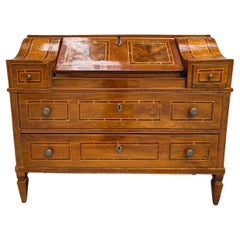
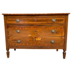
View AllAntica Ribalta Luigi XVI Con Intarsio E Lastronatura XVIII Secolo
Located in Milano, MI
Antica Ribalta Luigi XVI
Descrizione:
Antica ribalta Luigi XVI realizzata in Italia nella seconda metà del XVIII secolo, la ribalta è composta da due cas...
Category
Antique Early 18th Century European Louis XVI Commodes and Chests of Dra...
Materials
Wood
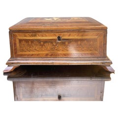
antica scatola intarsiata luigi XVI - scatola neoclassica - box - antiques
Located in Milano, MI
antica scatola intarsiata luigi XVI - scatola neoclassica - box - antiques
bellissima scatola in legno intarsiato
interni perfettamente ricoperti da tessu...
Category
Antique Early 1700s Italian Decorative Boxes
Materials
Wood
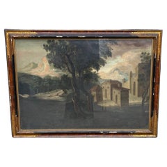
antico paesaggio - scuola romana - olio su tela - fine 18 secolo - dipinto
Located in Milano, MI
antico paesaggio - scuola romana - olio su tela - fine 18 secolo - dipinto
antico paesaggio - scuola romana - olio su tela - fine 18 secolo - dipinto
...
Category
Antique 1890s Italian Paintings
Materials
Canvas
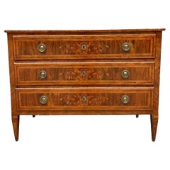
Antico Cassettone Luigi XVI Tre Cassetti Lastronato Intarsio Frontale XVIII Sec
Located in Milano, MI
Antico Cassettone Luigi XVI
Descrizione:
Antico cassettone Luigi XVI realizzato in Italia nella seconda metà del XVIII secolo, il cassettone e composto d...
Category
Antique Mid-18th Century European Louis XVI Commodes and Chests of Drawers
Materials
Wood
Antico Cassettone Luigi XVI - Tre Cassetti - Intarsio Floreale - XVIII Secolo 🇮
Located in Milano, MI
Antico Como Luigi XVI Tre Cassetti XVIII Secolo
Descrizione:
Antico Cassettone Luigi XVI a tre cassetti realizzato in Italia nel XVIII Secolo , il casset...
Category
Antique Early 18th Century European Louis XVI Commodes and Chests of Dra...
Materials
Wood
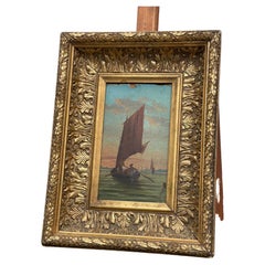
Dipinto Acquarello Su Carta Raffigurazione Di Barca a Vela Artista Francese, Co
Located in Milano, MI
dipinto acquarello su carta raffigurazione di barca a vela artista francese - cornice oro zecchino
Descrizione :
bellissimo dipinto olio su cartoncino rappresentante una barca ...
Category
Antique 1850s French Paintings
Materials
Paper
You May Also Like
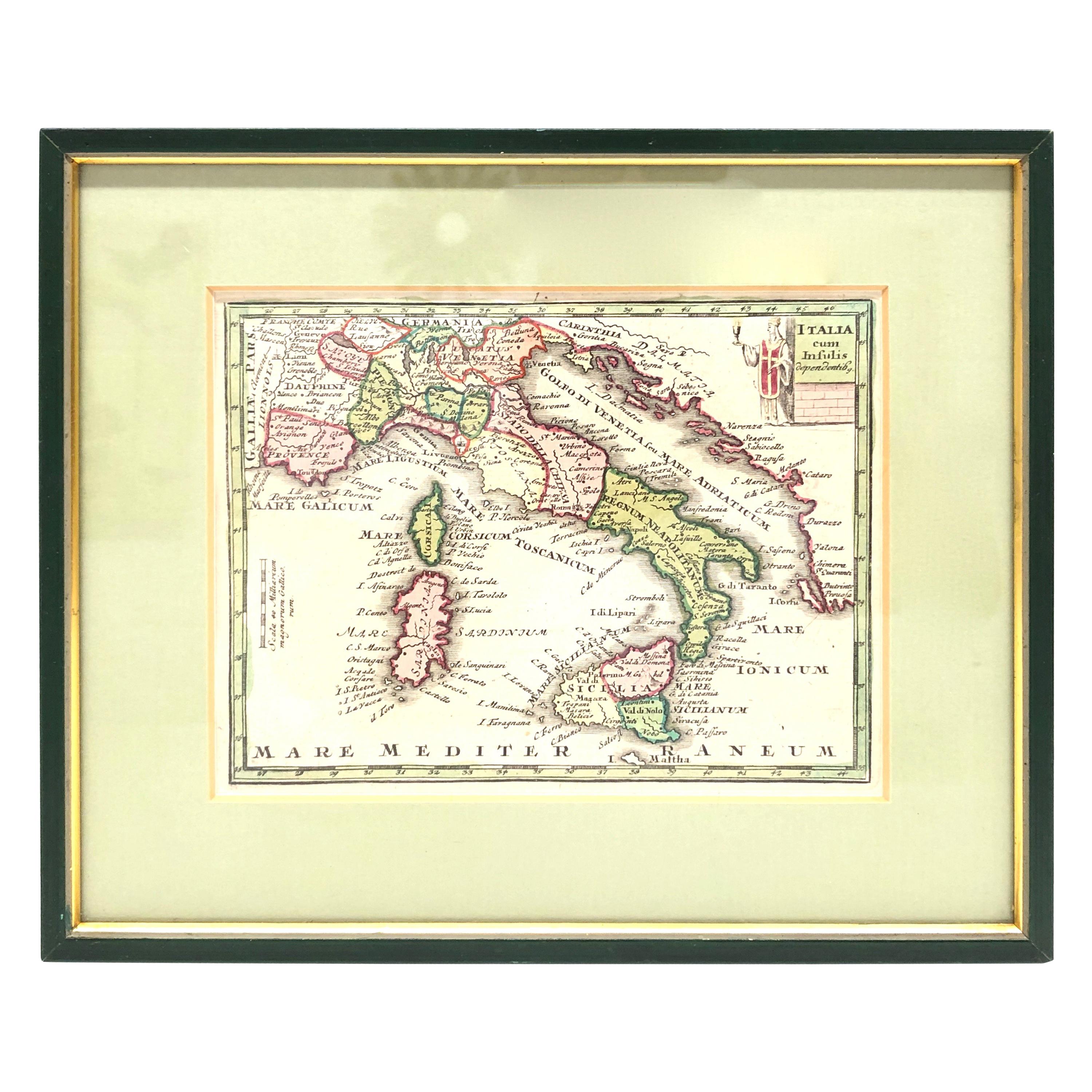
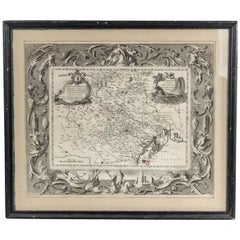
1970s Framed Antique Map of Italy 1746 Original
Located in Nuernberg, DE
An extraordinary original antique map, framed in the 1970s by Brehm Nuremberg, Germany, showing Italy. Map is dated 1746 and approx. 7 ¼" wide and 5 ¾" high in viewable size. Framed ...
Category
Vintage 1970s Decorative Art
Materials
Glass, Wood
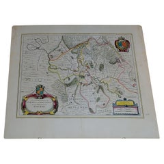
Antique Map of Italy, Showing Corsica, Sardinia, Croatia, Malta and More, C.1740
Located in Langweer, NL
Antique map titled 'Nieuwe Kaart van Italie na de Nieuwste waarnemingen van de l'Isle en andere.'
Attractive detailed map showing Italy as well as Corsica, Sardinia, Minorca, Croat...
Category
Antique 18th Century Maps
Materials
Paper

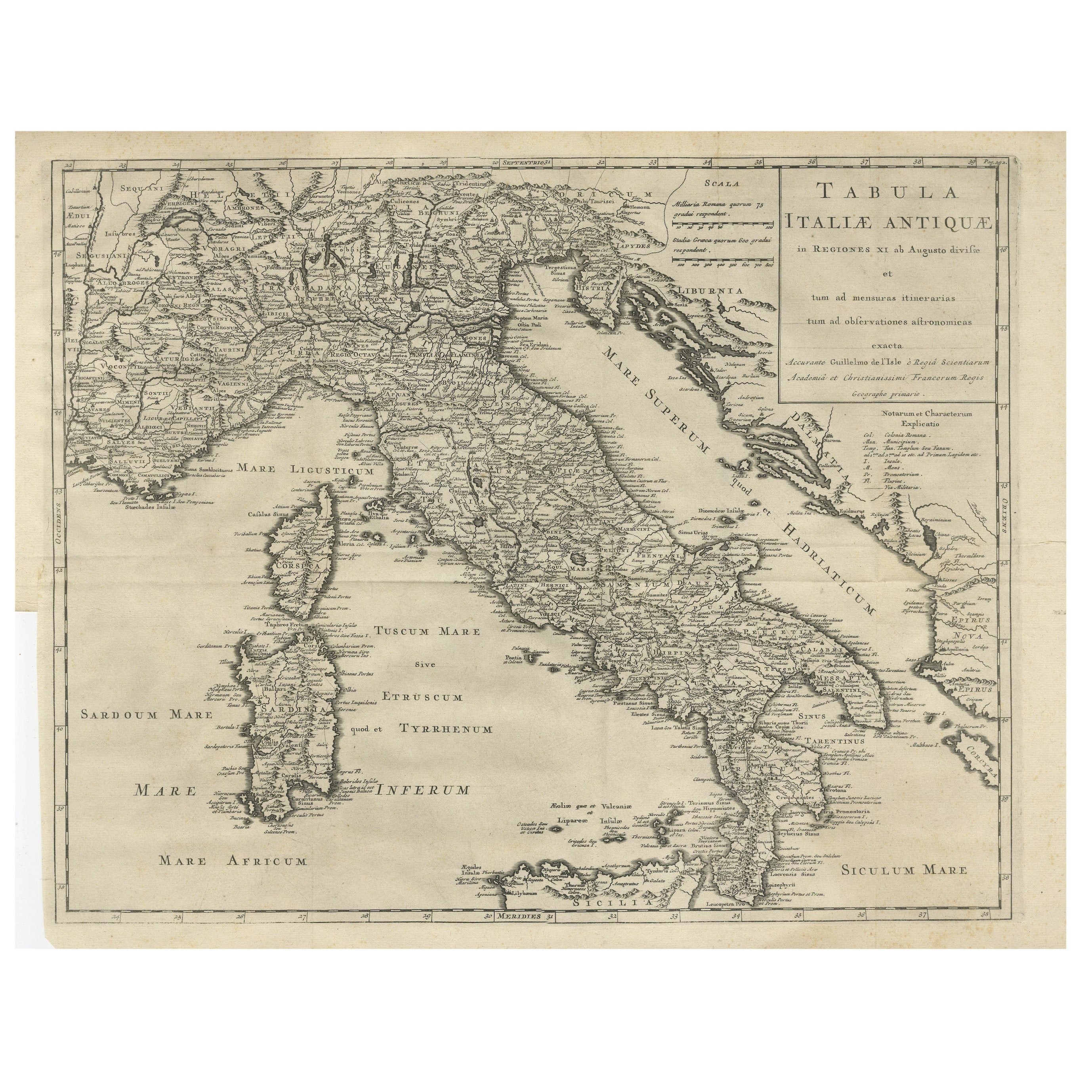
Antique Engraved Map of Italy in Roman Times, ca.1730
Located in Langweer, NL
Plain engr. map of Italy according to the division of Emperor Augustus by G. Delisle.
Title: "Tabula Italiae Antiquae In Regiones XI Ab Augusto Divisae Et Tum Ad Mensuras Itinerari...
Category
Antique 1730s Maps
Materials
Paper
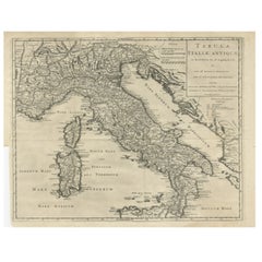
$651 Sale Price
20% Off
Italian Neo-Classic Map of Italy
Located in Queens, NY
Italian Neo-classic style framed print of map of Italy
Category
20th Century Italian Neoclassical Paintings
Materials
Paper
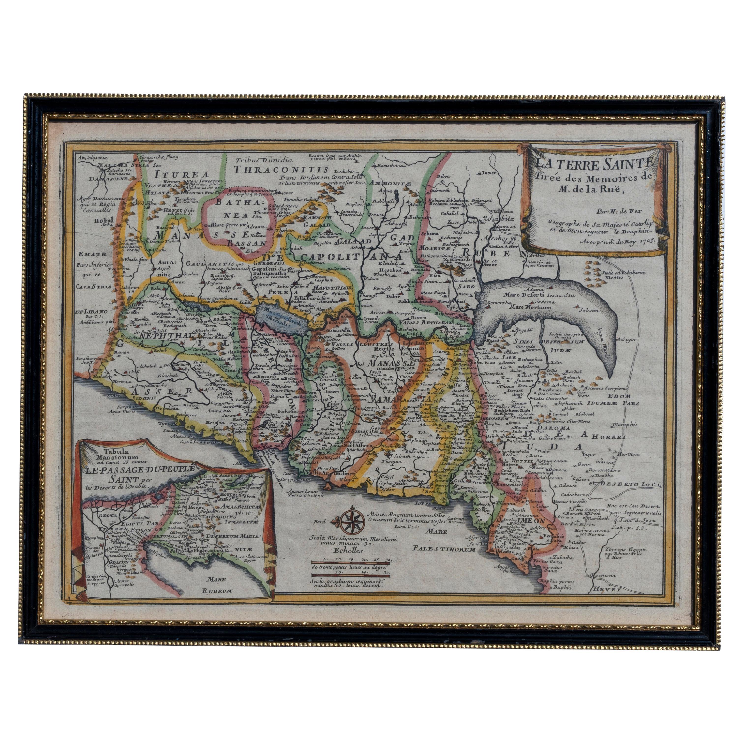
Map Holy Land La Terre Sainte Engraved van Loon Published N de Fer 1703 French
Located in BUNGAY, SUFFOLK
La Terre Sainte, The Holy Land, Tiree Des Memoires De M.De.La Rue. Par N. de Fer. Geographe de Sa Majeste Catoliq et de Monseigneur le Dauphin. Avec Privil du Roi 1703
Detailed map of the Holy Land from Nicholas de Fer's L'Atlas Curieux ou le Monde. East is oriented at the top.
MAKER Nicolas de Fer 1646-1720
The French cartographer and engraver, Nicolas de Fer, was a master at creating maps that were works of art. The maps that he published were printed during the Baroque period when the decorative arts were characterized by ornate detail. De Fer’s detailed maps and atlases were valued more for their decorative content than their geographical accuracy.
Nicolas de Fer was born in 1646. His father, Antoine de Fer, owned a mapmaking firm. At the age of twelve, Nicolas was apprenticed to a Parisian engraver named Louis Spirinx. The family business was starting to decline when his father died in 1673. Nicolas de Fer’s mother, Genevieve, took over the business after the death of her husband. In 1687 the business was passed on to Nicolas and the profits increased after he took over the firm. Nicolas de Fer was a prolific cartographer who produced atlases and hundreds of single maps. He eventually became the official geographer to King Louis XIV of France and King Philip V...
Category
Antique Early 1700s French Louis XIV Maps
Materials
Paper

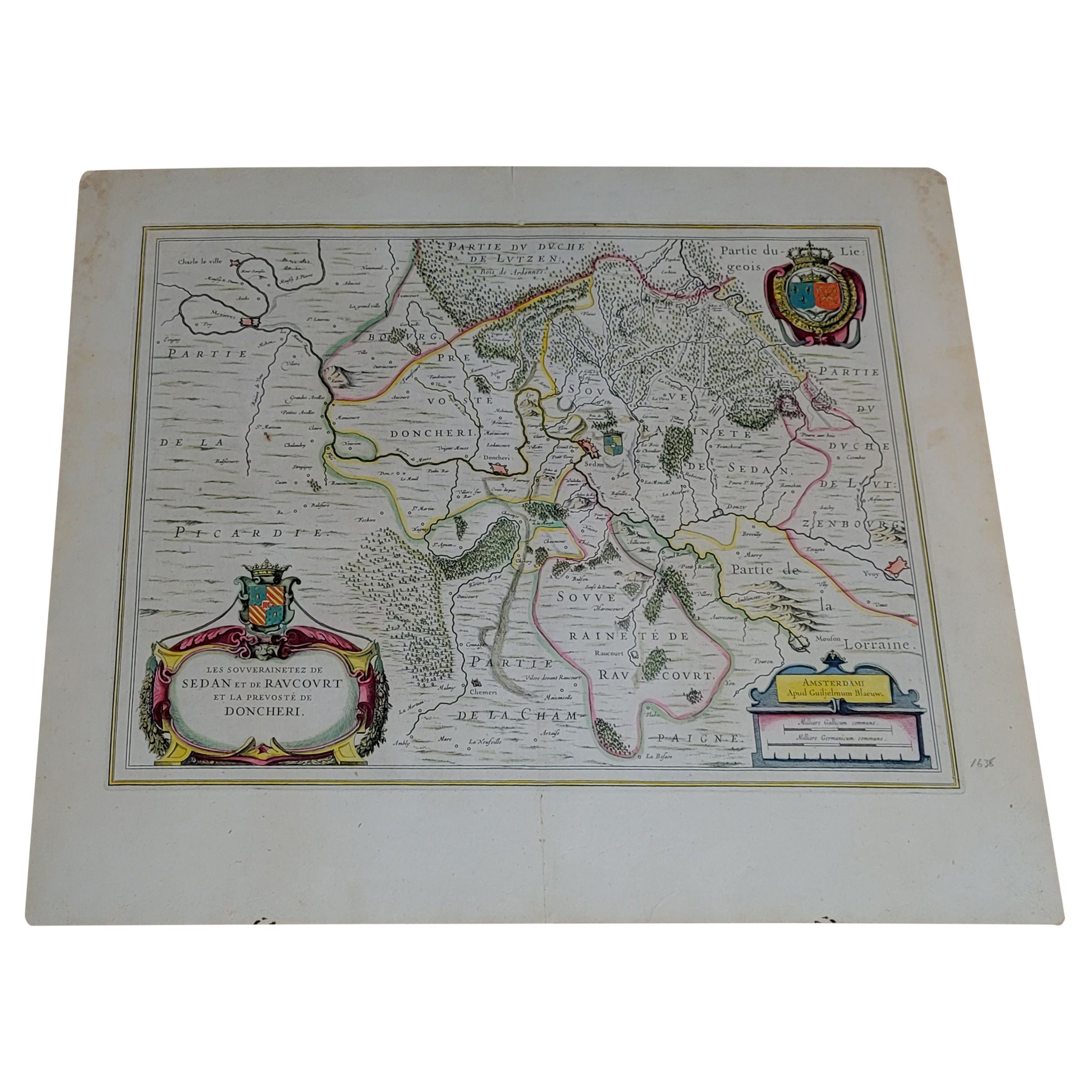
1656 "La Souverainete de Sedan et de Raucourt, et la Prevoste de Doncheri Ric004
Located in Norton, MA
1656 map entitled
"La Souverainete de Sedan et de Raucourt, et la Prevoste de Doncheri,"
Hand Colored
Ric0004.
Description:
Lovely map centered on Sedan and Doncheri an...
Category
Antique 17th Century Dutch Maps
Materials
Paper
More Ways To Browse
Louis Xviii
Victorian Brass Picture Frame
Antique Bedroom Paintings
Art Deco Metal Picture Frame
Asymmetrical Art Deco
1930 Vintage Picture Frames
Antique Art Nouveau Picture Frames
Double Picture Frames
1940 Vintage Picture Frames
Antique Hand Carved Picture Frames
Antique Mirrored Picture Frames
Vintage Picture Frame Murano Glass
Decorative Small Frame
Heart Picture Frame
Antique Gold Gilt Frame
Antique Gilded Picture Frames
Antique Oval Picture Frames
Art Deco Photo Frame