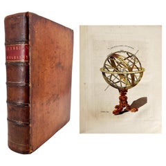
Items Similar to First Edition Guthrie's Geographical Grammmar in Miniature, 1807


Want more images or videos?
Request additional images or videos from the seller
1 of 5
First Edition Guthrie's Geographical Grammmar in Miniature, 1807
$716.56
$895.7020% Off
£529.49
£661.8720% Off
€600
€75020% Off
CA$992.64
CA$1,240.8020% Off
A$1,084.99
A$1,356.2420% Off
CHF 571.44
CHF 714.3020% Off
MX$13,341.03
MX$16,676.2820% Off
NOK 7,141.42
NOK 8,926.7720% Off
SEK 6,718.66
SEK 8,398.3320% Off
DKK 4,568.96
DKK 5,711.2020% Off
About the Item
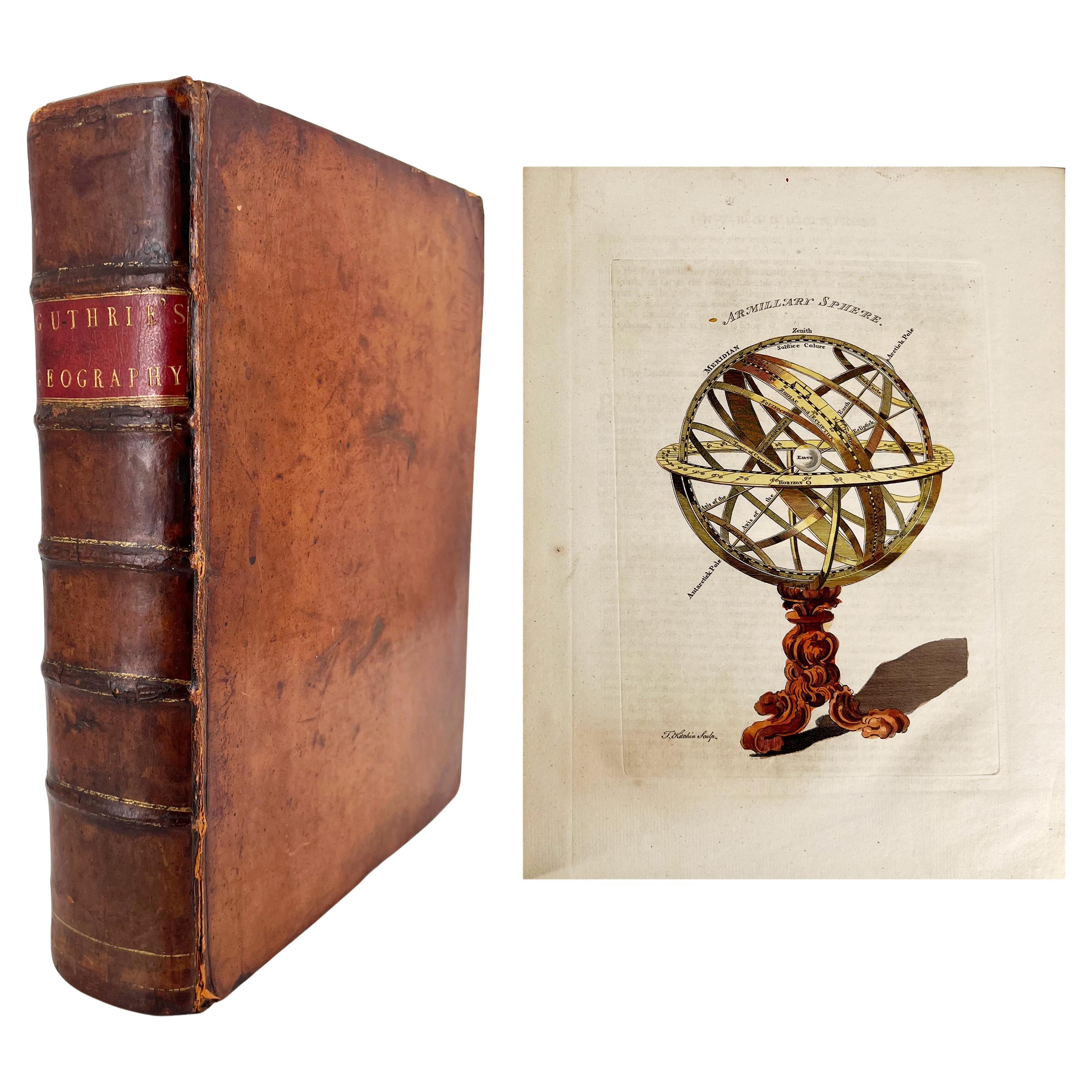
First edition of 'Guthrie's Geographical Grammar in Miniature'. 358 p. 13 fold. engr. maps, contemp. calf. Gilt spine. sm. 8vo. Upper hinge showing but strong; old bookplate "Ex Bibliotheca Majoris Seminarii Constantiensis" and sm. ticket on upper pastedown; title-p. w. owner's stamp (prob. of the same seminary); one map w. tiny wormhole. Binding sl. rubbed along extremities. A fine copy. = Contains a worldmap and maps of Scandinavia, the Russian dominions, Great Britain and Ireland, France, Belgium ("The Netherlands"), Prussia and Poland, the German Empire and Switzerland, Spain and Portugal, Italy, East Indies, USA, and The Netherlands ("United Provinces").
- Dimensions:Height: 5.71 in (14.5 cm)Width: 3.75 in (9.5 cm)Depth: 0.99 in (2.5 cm)
- Materials and Techniques:
- Period:
- Date of Manufacture:1807
- Condition:Please read description for details.
- Seller Location:Langweer, NL
- Reference Number:Seller: BG-051521stDibs: LU3054321003462
About the Seller
5.0
Recognized Seller
These prestigious sellers are industry leaders and represent the highest echelon for item quality and design.
Platinum Seller
Premium sellers with a 4.7+ rating and 24-hour response times
Established in 2009
1stDibs seller since 2017
2,620 sales on 1stDibs
Typical response time: <1 hour
- ShippingRetrieving quote...Shipping from: Langweer, Netherlands
- Return Policy
Authenticity Guarantee
In the unlikely event there’s an issue with an item’s authenticity, contact us within 1 year for a full refund. DetailsMoney-Back Guarantee
If your item is not as described, is damaged in transit, or does not arrive, contact us within 7 days for a full refund. Details24-Hour Cancellation
You have a 24-hour grace period in which to reconsider your purchase, with no questions asked.Vetted Professional Sellers
Our world-class sellers must adhere to strict standards for service and quality, maintaining the integrity of our listings.Price-Match Guarantee
If you find that a seller listed the same item for a lower price elsewhere, we’ll match it.Trusted Global Delivery
Our best-in-class carrier network provides specialized shipping options worldwide, including custom delivery.More From This Seller
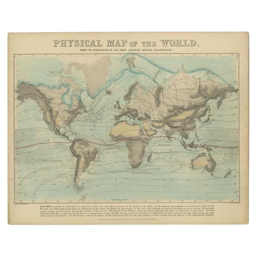
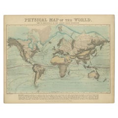
View AllAntique Physical Map of the World by Reynolds, 1849
Located in Langweer, NL
Antique physical map of the world, showing the discoveries of the most eminent modern geographers. Originates from 'Geographical Diagrams '.
Artists and Engravers: Published by J...
Category
Antique 19th Century Maps
Materials
Paper
$267 Sale Price
20% Off
Antique Map of the World by Balbi '1847'
Located in Langweer, NL
Antique map titled 'Planisphère'. Original antique map of the world. This map originates from 'Abrégé de Géographie (..)' by Adrien Balbi. Pub...
Category
Antique Mid-19th Century Maps
Materials
Paper

$238 Sale Price
20% Off
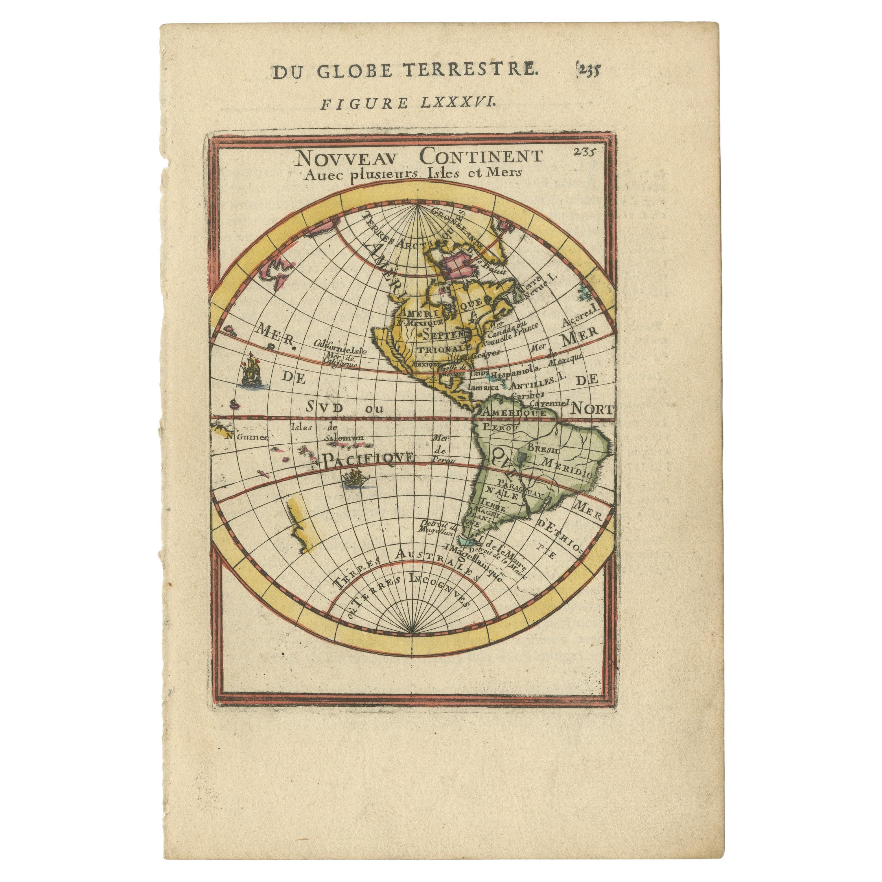
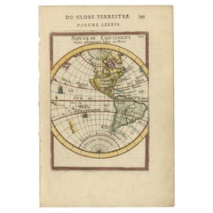
Antique Miniature Map of the Western Hemisphere, California as an Island, c.1683
Located in Langweer, NL
Antique miniature map titled 'Nouveau Continent avec plusieurs Isles et Mers'. Decorative map of the Western Hemisphere, published by Alain Manesson Mallet. The map shows California as an Island...
Category
Antique Late 17th Century French Maps
Materials
Paper
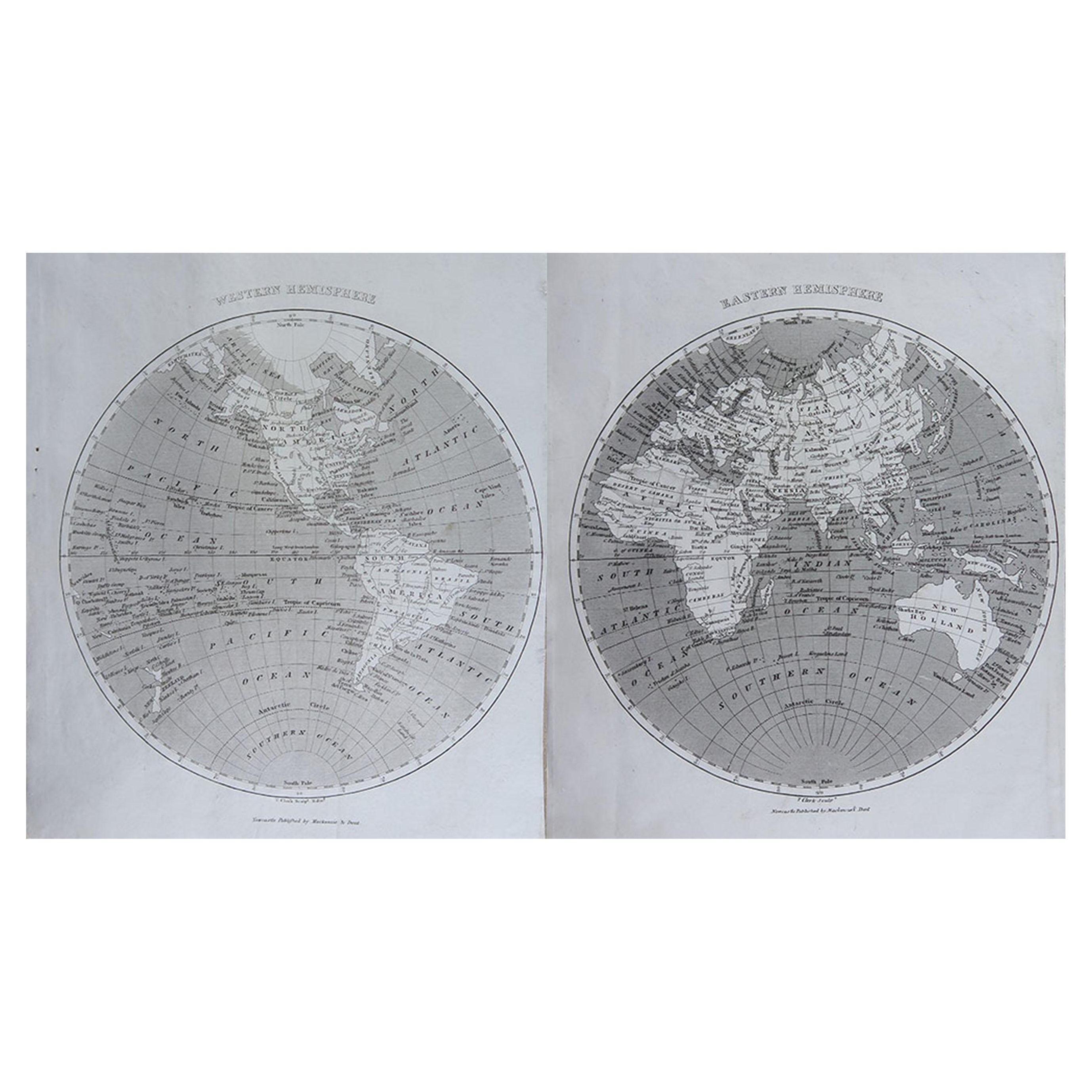
Antique Map of The World in Hemispheres by W. G. Blackie, 1859
Located in Langweer, NL
Antique map titled 'The World in Hemispheres with other projections'. Original antique map of The World. This map originates from ‘The Imperial Atlas of Modern Geography’. Published ...
Category
Antique Mid-19th Century Maps
Materials
Paper

$292 Sale Price
30% Off
Very Decorative Original Antique Map of the World, Published in France in c.1780
By Rigobert Bonne
Located in Langweer, NL
Antique map titled 'L'Ancien Monde Et Le Nouveau en Deux Hemispheres' - Double hemisphere map of the World, showing the contemporary geographical...
Category
Antique 18th Century Maps
Materials
Paper

$735 Sale Price
20% Off
Antique Map of the World on Mercator's Projection, 1788
Located in Langweer, NL
Antique map titled 'Kaart van de Geheele Wereld (..)'. Uncommon small world map on Mercator's projection. Nice detail of the islands throughout the wor...
Category
Antique Late 18th Century Maps
Materials
Paper

$716 Sale Price
20% Off
You May Also Like
A New System of Modern Geography by William Guthrie - 1782
Located in Middletown, NY
A New System of Modern Geography; or, a Geographical, Historical, and Commercial Grammar; and Present State of the Kingdoms of the World. Maps engraved by Mr. Kitchin, C. Dilly and G...
Category
Antique Late 18th Century English Books
Materials
Gold Leaf
Original Antique Map of The World by Thomas Clerk, 1817
Located in St Annes, Lancashire
Great map of The Eastern and Western Hemispheres
On 2 sheets
Copper-plate engraving
Drawn and engraved by Thomas Clerk, Edinburgh.
Published by Mackenzie And Dent, 1817
...
Category
Antique 1810s English Maps
Materials
Paper

Original Antique Map of The World by Dower, circa 1835
Located in St Annes, Lancashire
Nice map of the World
Drawn and engraved by J.Dower
Published by Orr & Smith. C.1835
Unframed.
Free shipping
Category
Antique 1830s English Maps
Materials
Paper

1864 Johnson's Map of the World on Mercator's Projection, Ric.B009
Located in Norton, MA
An 1864 Johnson's map of
the World on Mercator's Projection
Ric.b009
About this Item
"This antique map came from Johnson's New Illustrated (Steel Plate) Family Atlas, publ...
Category
Antique 19th Century Dutch Maps
Materials
Paper

Antique 1798 James Colnett A Voyage to the South Atlantic & Round Cape Hope Book
Located in Hamilton, Ontario
This antique book titled "A Voyage to the South Atlantic and Round Cape Horn into the Pacific Ocean", and authored by W. Bennett, on the work of James Colnet...
Category
Antique Late 18th Century English Georgian Books
Materials
Leather, Paper
Antique Paterson's Guide to Britain, English, Maps, Georgian, Published 1811
Located in Hele, Devon, GB
This is an antique copy of Paterson's New and Accurate guide to Direct & Principal Crossroads. An English, bound book of maps and descriptive tables, published in English by Longman,...
Category
Antique Early 19th Century British Georgian Books
Materials
Paper

More Ways To Browse
German Empire
Map Of Great Britain
Charles Dickens Christmas
Cooking Book
David Hicks Living With Design
Ernest Hemingway Furniture
Miniature Book
Miniature Rooms
T E Lawrence
Charlotte Bronte
Dating Antique French Furniture
Edward Fitzgerald
Polaroid Cameras
Taschen Art Edition
Vintage Interior Design Books
Hotel Lambert
J Cooper
J R R Tolkien