
French Missal Book-Paroissien Roman, 1880
View Similar Items
![[MISSAL]. Paroissien romain contenant les offices. IN A MOTHER-OF-PEARL BINDING](https://a.1stdibscdn.com/missal-paroissien-romain-contenant-les-offices-in-a-mother-of-pearl-binding-for-sale/f_62142/f_392522221712955420094/f_39252222_1712955420906_bg_processed.jpg)
1 of 20
French Missal Book-Paroissien Roman, 1880
About the Item
- Dimensions:Height: 6 in (15.24 cm)Width: 4 in (10.16 cm)Depth: 2 in (5.08 cm)
- Materials and Techniques:
- Place of Origin:
- Period:
- Date of Manufacture:1880
- Condition:Wear consistent with age and use. Good overall condition. Some appropriate age wear.
- Seller Location:Austin, TX
- Reference Number:Seller: N1611stDibs: LU869021291272
You May Also Like
- [MISSAL]. Paroissien romain contenant les offices. IN A MOTHER-OF-PEARL BINDINGLocated in Hillsborough, NJAUTHOR: [MISSAL]. TITLE: Paroissien romain contenant les offices de tous les dimanches et des principales fetes de l'annee. (Roman Parishioner Containing the Services of All Sunday...Category
Antique 1880s British Books
MaterialsMother-of-Pearl
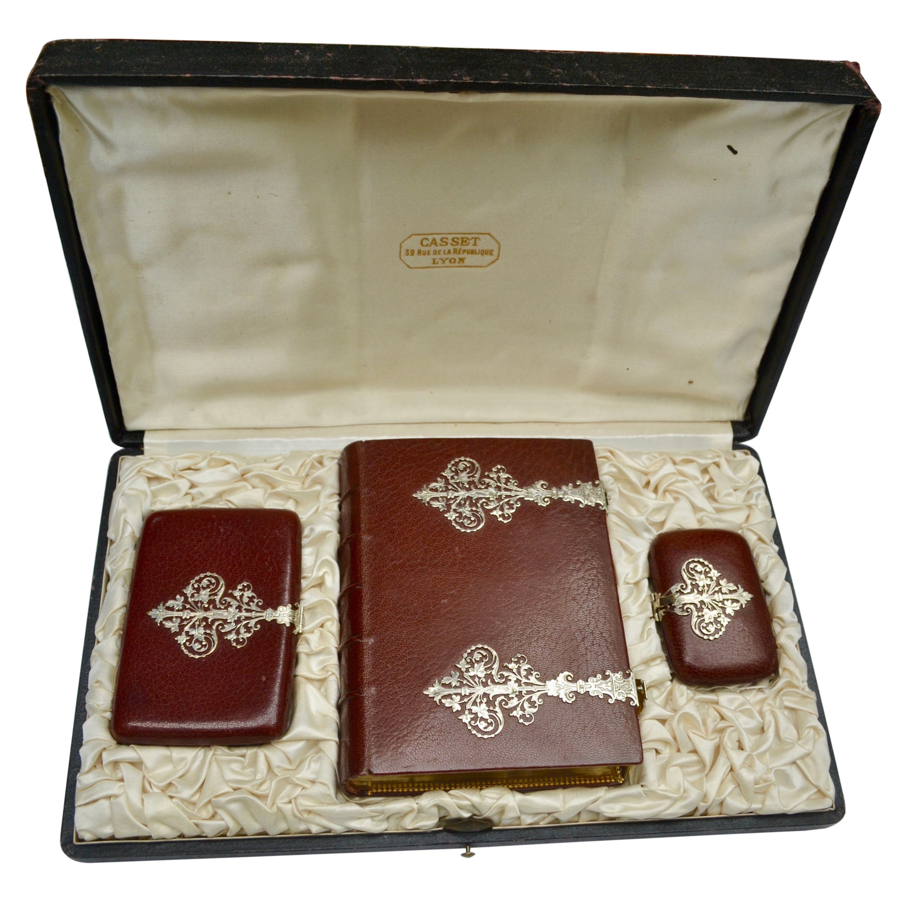
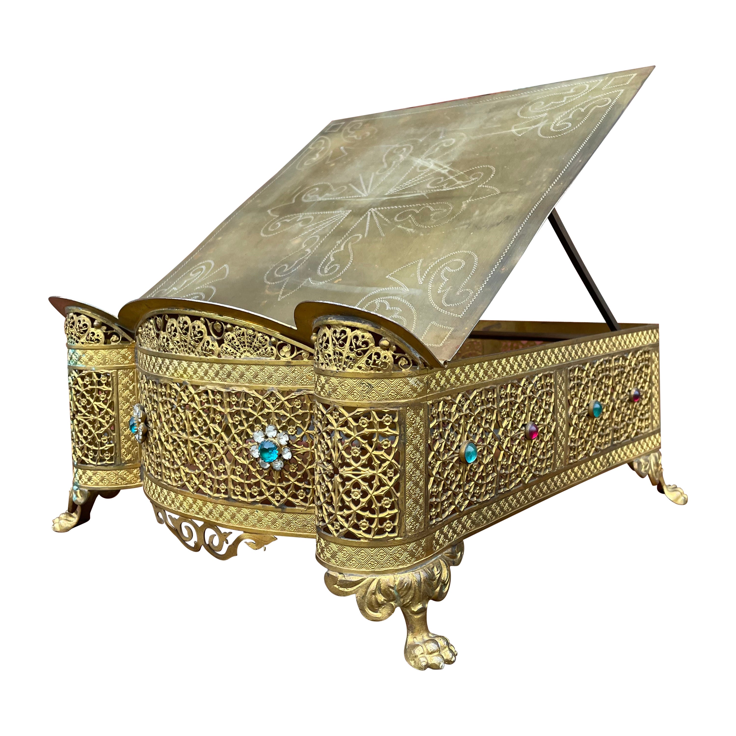
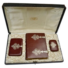
- French Roman Missal, Notebook and Coins/Rosary Purse Set Dated 1878Located in Vancouver, British ColumbiaThis is 19th century boxed French Religious set containing a Missal called Paroissien Romain, a note pad and a purse used for coins or rosary beads presented in its original leather ...Category
Antique Late 19th Century French Renaissance Religious Items
MaterialsSilver
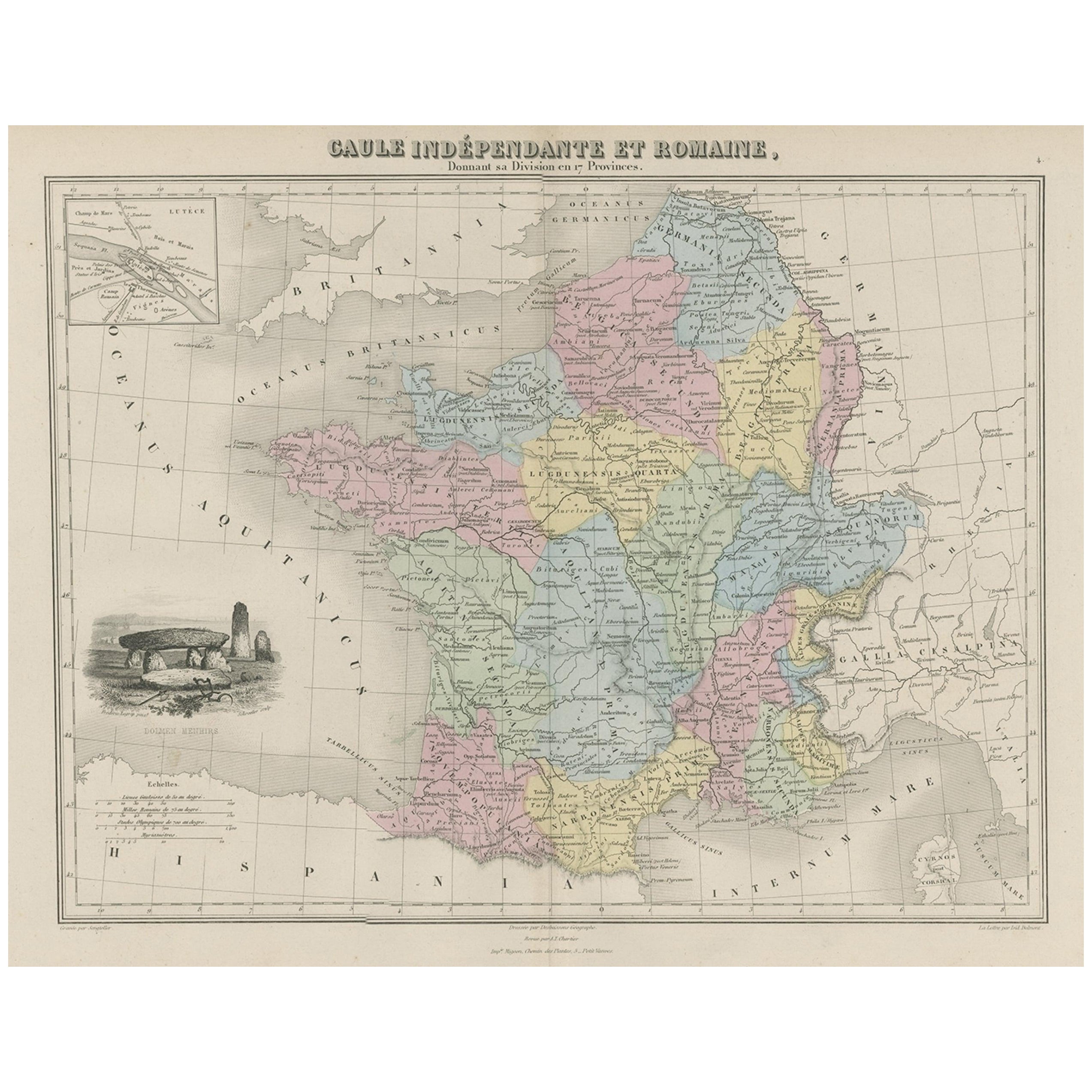
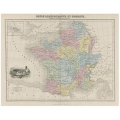
- Antique Map of France in Ancient Roman Times, 1880Located in Langweer, NLAntique map titled 'Gaule indépendante et Romaine'. Old map of Gaul or France in ancient Roman times. The map covers from the southern part of England (Britannia) to the north of S...Category
Antique 19th Century Maps
MaterialsPaper
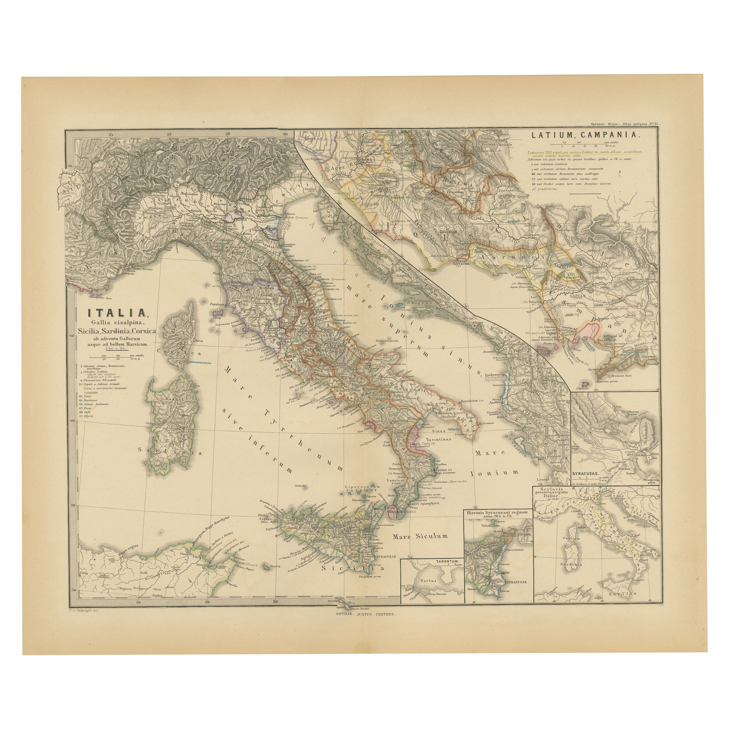
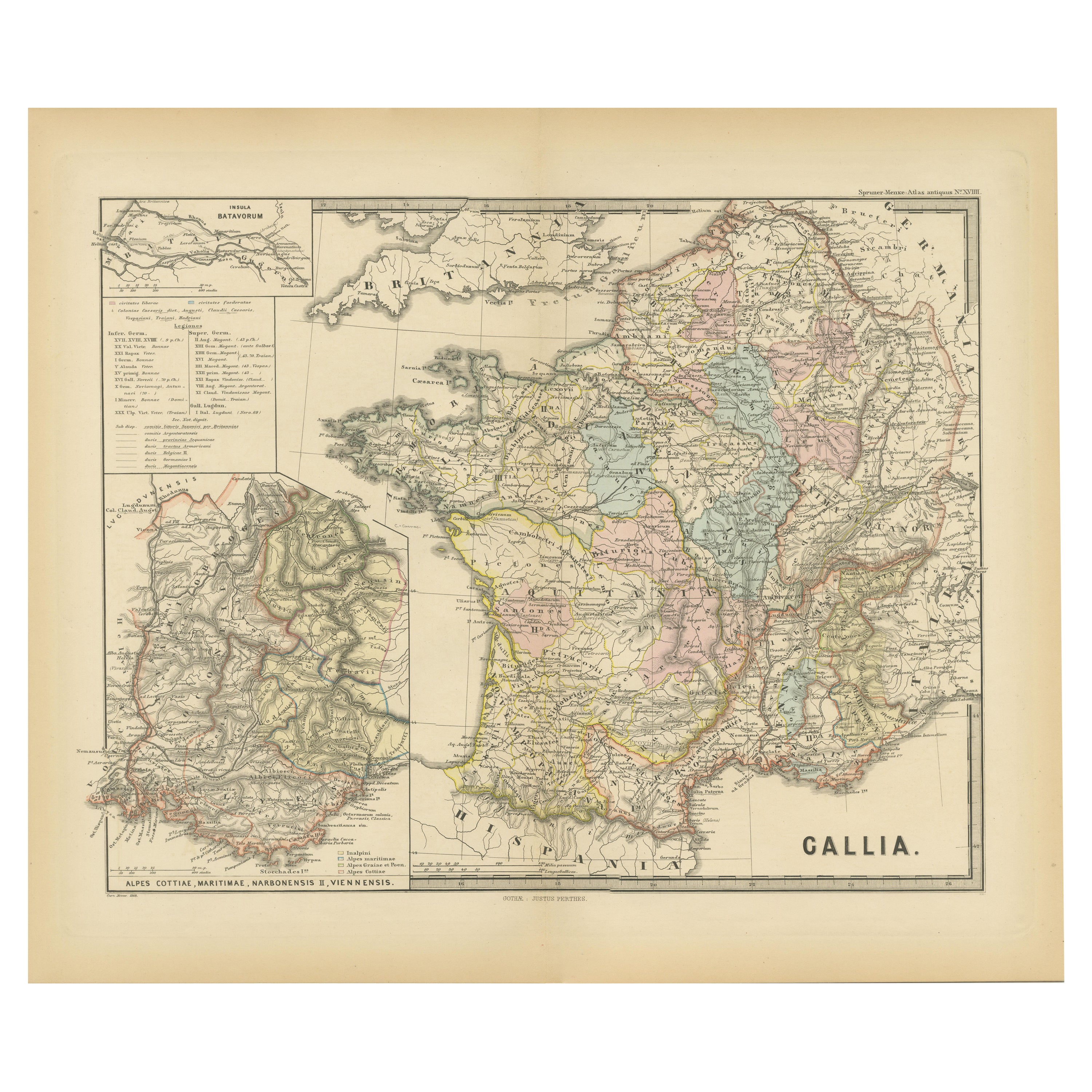
- Roman Italy and Provinces: A Cartographic Snapshot, 1880Located in Langweer, NLThe map titled "ITALIA, Gallia Cisalpina, Sicilia, Sardinia, Corsica" focuses on Italy and its surrounding regions during Roman times. It offers a detailed depiction of the Italian peninsula, the Po Valley (Gallia Cisalpina), and the islands of Sicily, Sardinia, and Corsica. Produced as part of the "Spruner-Menke Atlas Antiquus" by Karl Spruner von Merz and edited by Theodorus Menke, this map reflects the 19th-century European scholarship on ancient geography and history. The period represented is likely during the Roman Republic or early Roman Empire, suggested by the level of detail in regions like Latium and Campania, which were central to Roman culture and power. This era was marked by Roman expansion and consolidation of the Italian peninsula, as well as the Punic Wars, which led to Roman dominance over the Mediterranean. What makes this map interesting is its: 1. **Rich Detail**: The map delineates the intricate network of Roman roads, cities, and colonies, showing the infrastructure that facilitated Roman administration and control. 2. **Strategic Locations**: It identifies strategic locations like harbors and passes, crucial for trade and military campaigns. 3. **Geographic Accuracy**: It reflects the geographical knowledge of the time, with an accurate representation of the topography that shaped the development of these regions. 4. **Cultural and Historical Sites**: Insets of important sites like Syracuse offer a closer look at places of historical significance. 5. **Educational Purpose**: The map was designed to aid in the study of Roman history, providing a visual tool for understanding the ancient world...Category
Antique 1880s Maps
MaterialsPaper
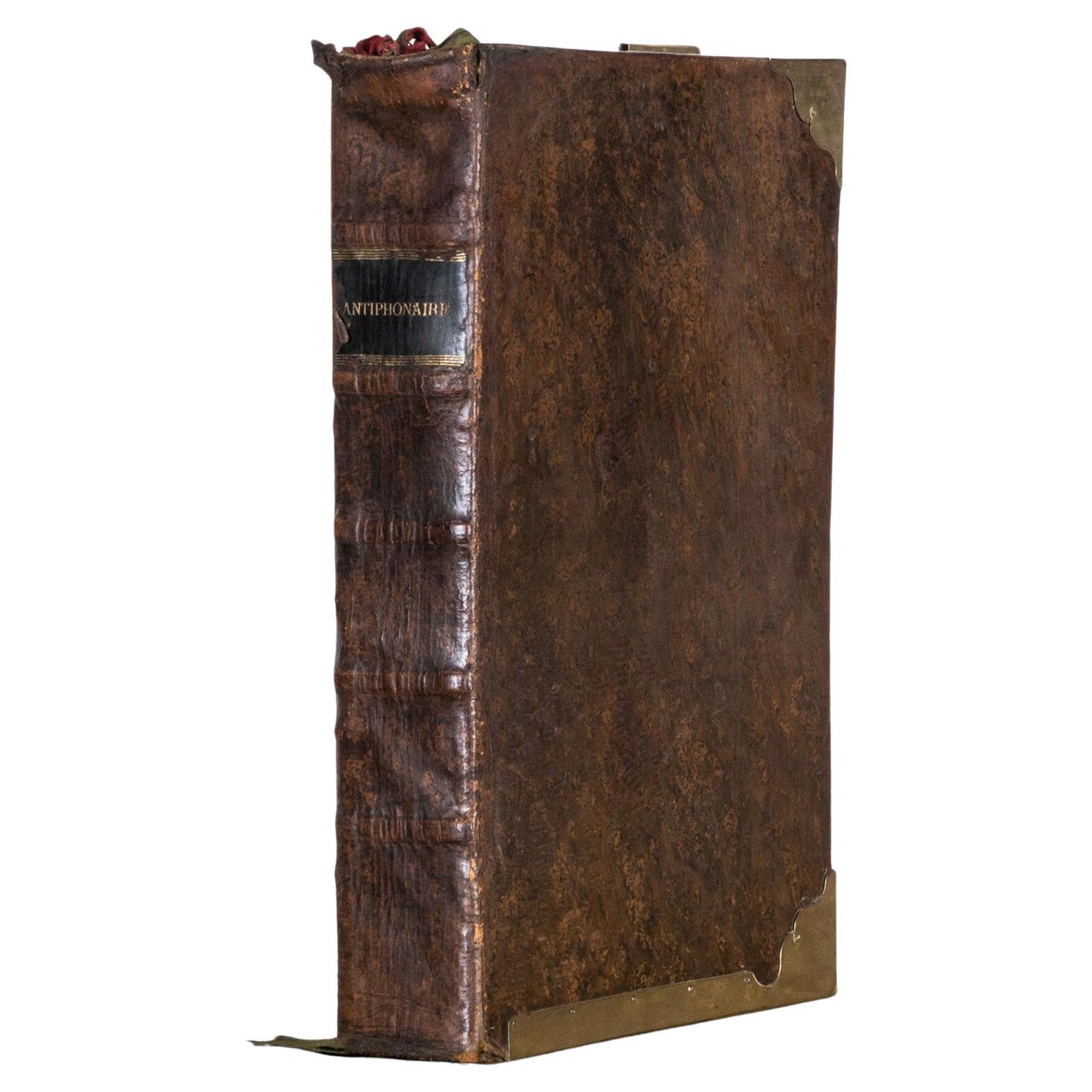
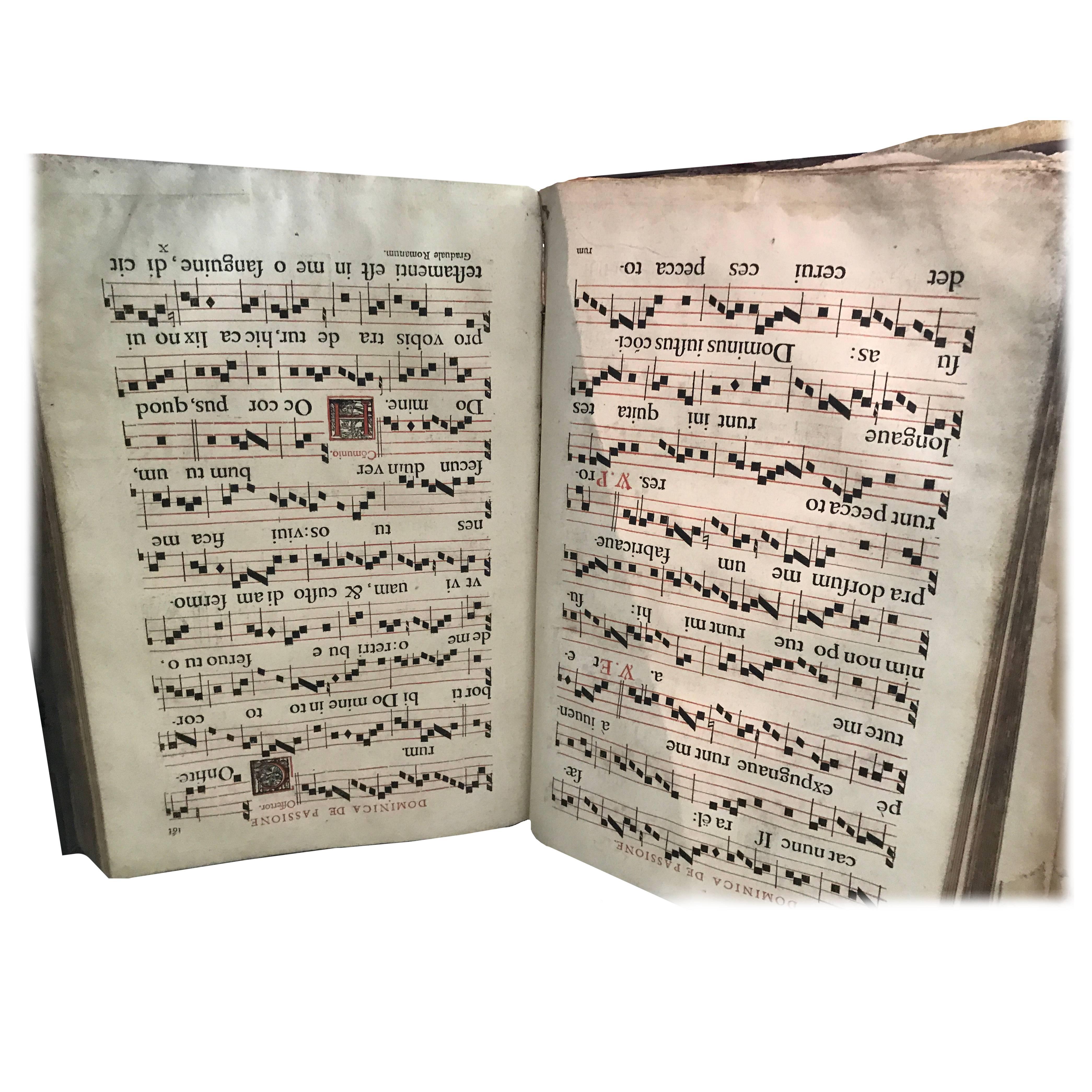
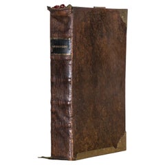
- Large Antique Roman Hymnal or Song Book “Antiphonaire”, 1862Located in AMSTERDAM, NHImpressive antique hymnal or songbook titled "Antiphonaire, Antiphonarium Romanum," featuring Latin Gregorian hymns of Psalms, dated 1862. This large ...Category
Antique 1860s Georgian Religious Items
MaterialsLeather, Paper
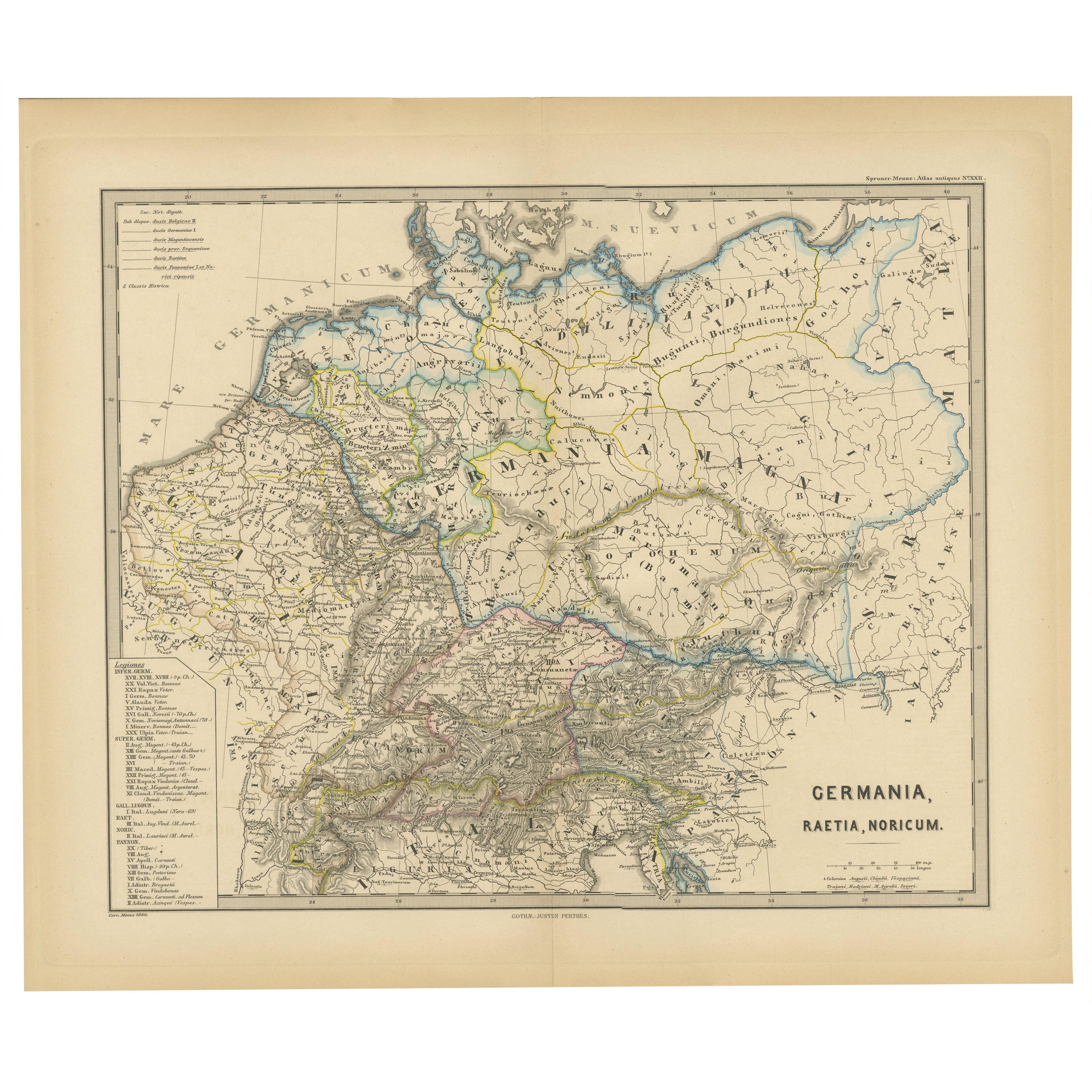
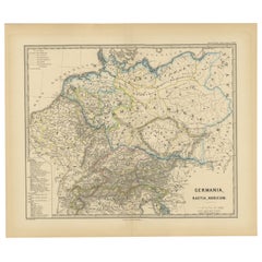
- Roman Frontiers Engraved: Germania, Raetia, and Noricum, Published in 1880Located in Langweer, NLThe map, titled "GERMANIA, RAETIA, NORICUM," depicts the regions of Germania, Raetia, and Noricum, which correspond to parts of modern-day Central and Eastern Europe, including areas of Germany, Austria, Switzerland, and the Balkans. Features of the map include: 1. **Regional Divisions**: The map is divided into the regions of Germania, Raetia, and Noricum, each likely differentiated by color or shading. 2. **Topography**: It details the mountain ranges, rivers, and other geographical features of the region. The Alps, which are central to Raetia, are prominently displayed. 3. **Roman Settlements and Roads**: The map likely marks Roman...Category
Antique 1880s Maps
MaterialsPaper
![[MISSAL]. Paroissien romain contenant les offices. IN A MOTHER-OF-PEARL BINDING](https://a.1stdibscdn.com/missal-paroissien-romain-contenant-les-offices-in-a-mother-of-pearl-binding-for-sale/f_62142/f_392522221712955420094/f_39252222_1712955420906_bg_processed.jpg?width=240)
Recently Viewed
View AllMore Ways To Browse
Roman Missal
Antique Missal
Prada 2019
Rihanna Fenty
Simon Evans
Sinatra Signed Set
Spanish Colonial R
Steve Mccurry Book
Tashen Books
Tiffany And Co Blue Book 2017
Tiffany Blue Book 2017
Tiffany Nature Leaf Ring
Tom Scheerer
Toni Facella
Vintage Indian Leather Jacket
Vintage Leather Bound Bible
Where To Eat Pizza
William Bottomley