Items Similar to Facsimile Joan Blaeu's Atlas Major '12 Volumes'
Want more images or videos?
Request additional images or videos from the seller
1 of 8
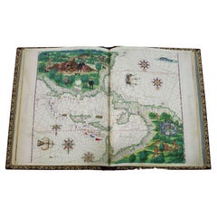
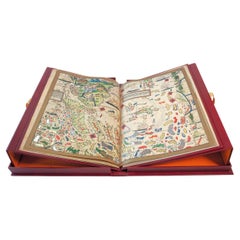
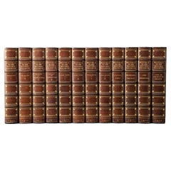
Facsimile Joan Blaeu's Atlas Major '12 Volumes'
About the Item
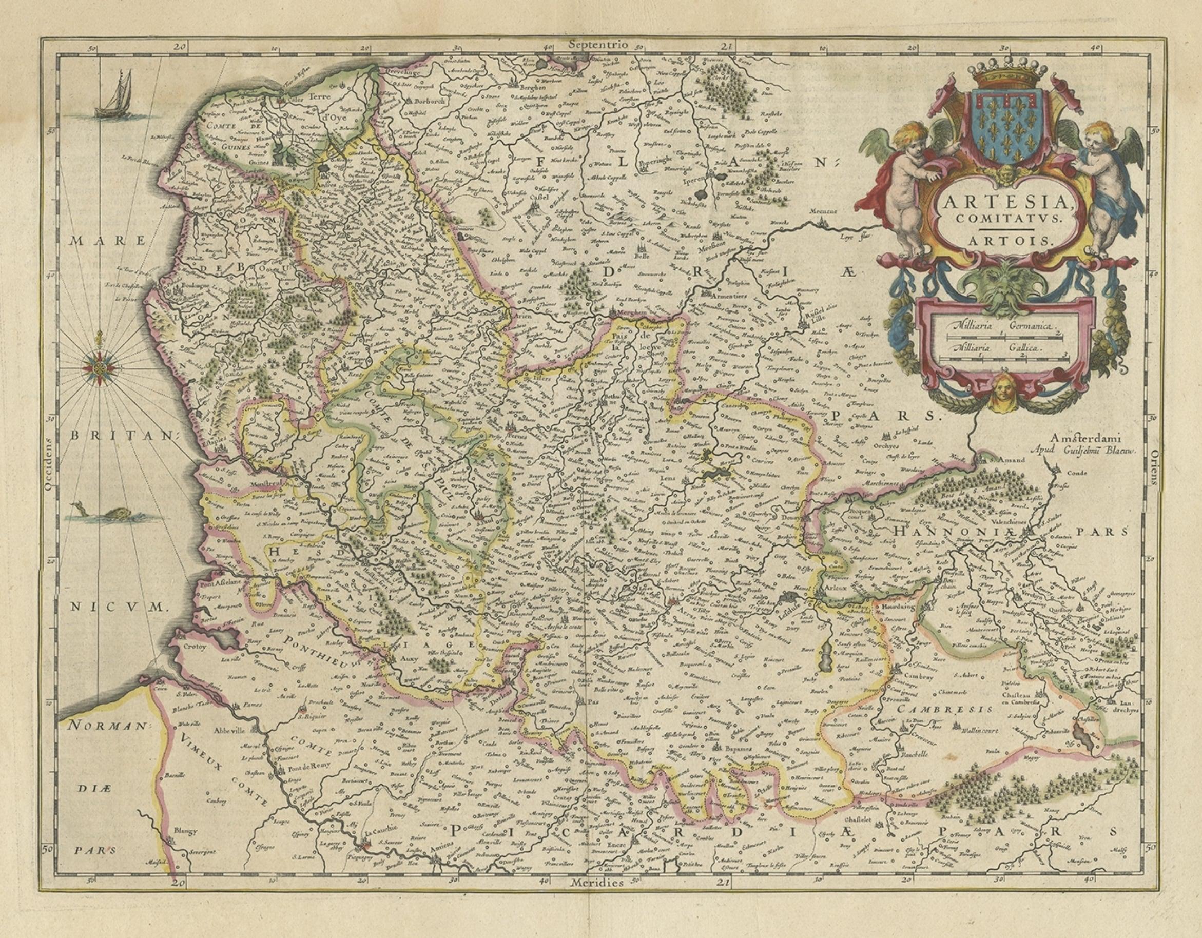
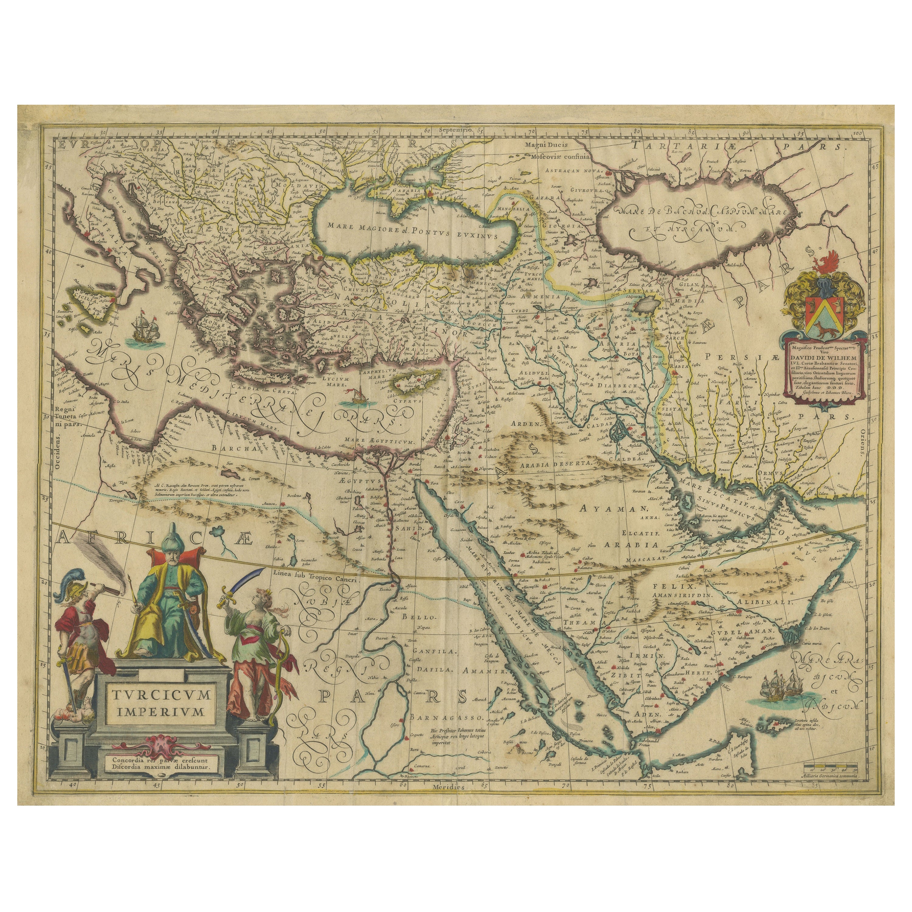
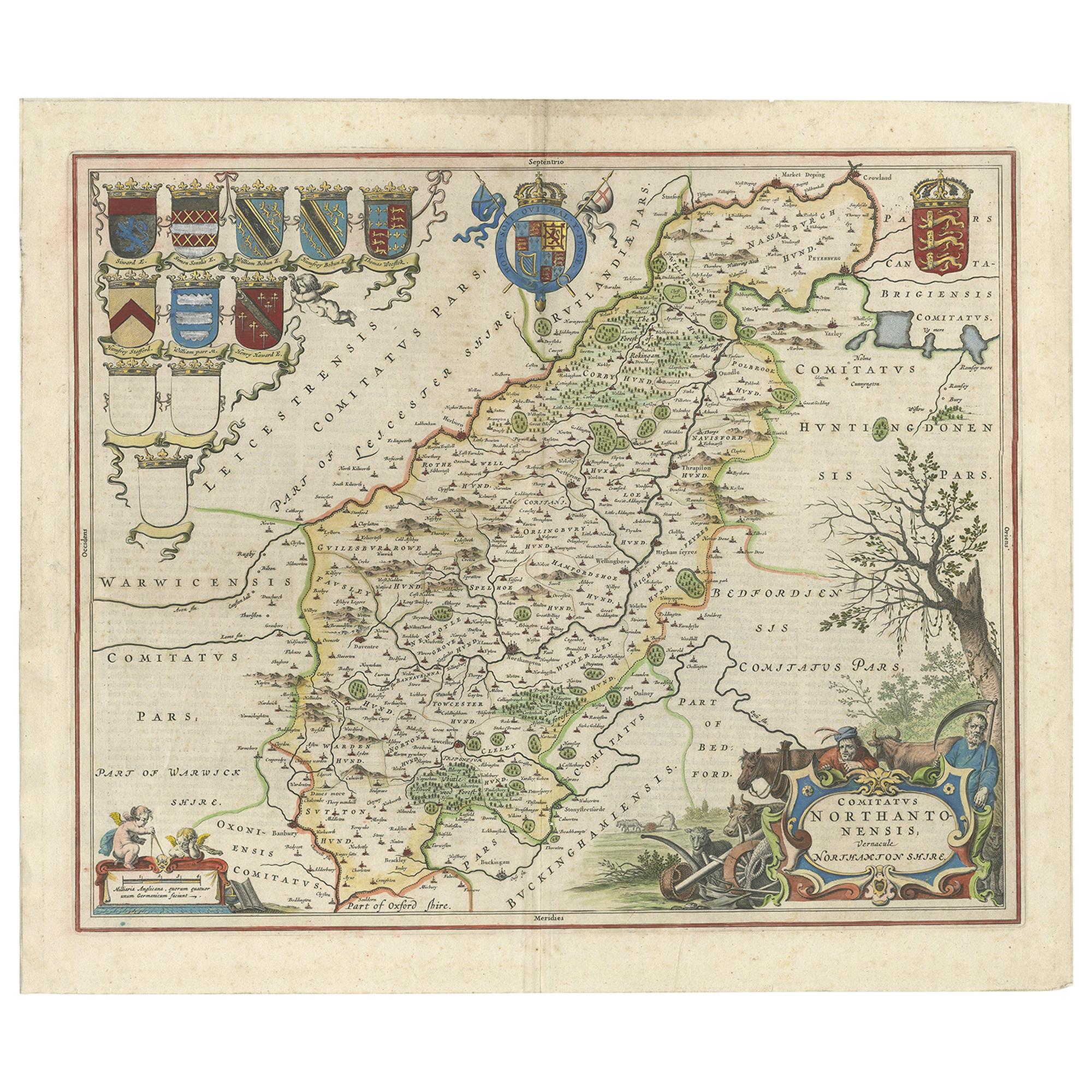
Facsimile of the original French edition of Joan Blaeu's Atlas Major, 1663. Printed in Amsterdam, by N.V. Theatrum Orbis Terrarum, 1967-68. 12 volumes with 609 double-page maps (partly colored.). Large-folio. Original imitation vellum with richly gilt decorated spines and sides. On the backs are blue labels with the title and the number of the volume in gold. Printed in a limited edition of 1000 numbered copies, this set is No. 110.
- Dimensions:Height: 21.46 in (54.5 cm)Width: 13.39 in (34 cm)Depth: 1.97 in (5 cm)
- Sold As:Set of 12
- Materials and Techniques:
- Period:
- Date of Manufacture:circa 1967
- Condition:Wear consistent with age and use. Please study images carefully. Measurements are averages of one volume.
- Seller Location:Langweer, NL
- Reference Number:Seller: BG-059921stDibs: LU305439573123
About the Seller
5.0
Platinum Seller
These expertly vetted sellers are 1stDibs' most experienced sellers and are rated highest by our customers.
Established in 2009
1stDibs seller since 2017
1,916 sales on 1stDibs
Typical response time: <1 hour
- ShippingRetrieving quote...Ships From: Langweer, Netherlands
- Return PolicyA return for this item may be initiated within 14 days of delivery.
Auctions on 1stDibs
Our timed auctions are an opportunity to bid on extraordinary design. We do not charge a Buyer's Premium and shipping is facilitated by 1stDibs and/or the seller. Plus, all auction purchases are covered by our comprehensive Buyer Protection. Learn More
More From This SellerView All
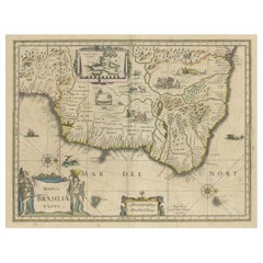
- Old Color Engraving of Blaeu's first Map of Brazil, North Oriented to the RightBy Willem BlaeuLocated in Langweer, NLAntique map titled 'Novus Brasiliae Typus'. Fine old color example of Blaeu's first map of Brazil, with north oriented to the right. Includes inset map of Baya de todos Santos, elaborate cartouche, 2 compass roses and richly embellished vignettes of native Brazilian life and animals. The interior of the map includes vignettes of indigenous animals and native scenes, including cannibalism. Inset within a decorative border is a small map of "Baya de todos Sanctos". In the sea are monsters, a galleon and two compass roses. The large title cartouche features a male and female Brazilian, both of whom are shown naked. Willem Janszoon Blaeu (1571-1638) was a prominent Dutch geographer and publisher. Born the son of a herring merchant, Blaeu chose not fish but mathematics and astronomy for his focus. He studied with the famous Danish astronomer Tycho Brahe...Category
Antique Mid-17th Century Maps
MaterialsPaper
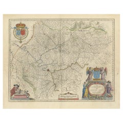
- Mapping the Heart of France: Willem Blaeu's 17th Century Île-de-France, ca.1650Located in Langweer, NLThis original antique map titled "Le Gouvernement de l'Isle de France" represents the Île-de-France region, which historically was one of the provinces of France and contained the ci...Category
Antique 1650s Maps
MaterialsPaper
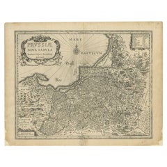
- Antique Map of Prussia by Blaeu, c.1680Located in Langweer, NLAntique map titled 'Prussiae nova Tabula'. Later edition of Blaeu's map of Prussia, embellished with a large cartouche and compass rose. Prussia was a h...Category
Antique 17th Century Maps
MaterialsPaper
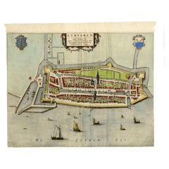
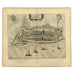
- Antique Map of Stavoren by Blaeu, 1649Located in Langweer, NLAntique map titled 'Staveren'. Original antique map of the city of Stavoren, Friesland, The Netherlands. This map originates from 'Toonneel der Steden van de Vereenighde Nederlanden'...Category
Antique 17th Century Maps
MaterialsPaper
- Antique Map of Stavoren by Blaeu, 1649Located in Langweer, NLAntique map titled 'Staveren'. Original antique map of the city of Stavoren, Friesland, The Netherlands. This map originates from 'Toonneel der Steden van de Vereenighde Nederlanden'...Category
Antique 17th Century Maps
MaterialsPaper
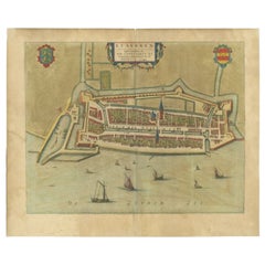
- Antique Map of Stavoren by Blaeu, 1649Located in Langweer, NLAntique map titled 'Staveren'. Original antique map of the city of Stavoren, Friesland, The Netherlands. This map originates from 'Novum Ac Magnum Theatrum Urbium Belgicae Liberae Ac...Category
Antique 17th Century Maps
MaterialsPaper
You May Also Like
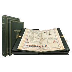
- Atlas Vallard, One-Time Only Limited Facsimile Edition of the Atlas of 1547Located in BARCELONA, ESThis is a one-time only facsimile edition limited to 987 copies of an atlas from the Renaissance, the Atlas Vallard, owned by the Huntington Library in San Marino, CA, made by combin...Category
2010s French Renaissance Books
MaterialsLeather
- Atlas Miller, One-Time Only Limited Facsimile Edition of the Atlas of 1519Located in BARCELONA, ESThis is a unique facsimile reproduction limited to 987 copies of an atlas from the Renaissance, the Atlas Miller, devised as a present from Manuel I of Portugal to fool Emperor Charl...Category
Early 2000s Portuguese Renaissance Books
MaterialsLeather
- 1643 Willem&Joan Blaeu Map NW Flanders "Flandriae Teutonicae Pars PrientaliorLocated in Norton, MA1643 Willem and Joan Blaeu map of northwest Flanders, entitled "Flandriae Teutonicae Pars Prientalior," Ric0012 " Authentic" - Map of the northwest Fl...Category
Antique 17th Century Dutch Maps
MaterialsPaper
- 1654 Joan Blaeu Map the Sutherland, Scotland, Entitled "Southerlandia, "Ric0007Located in Norton, MA1654 Joan Blaeu map of the Sutherland, Scotland, entitled "Southerlandia," Hand Colored Ric0007 Description: Lovely map centered on Sedan and D...Category
Antique 17th Century Dutch Maps
MaterialsPaper
- Atlas of Fernão Vaz Dourado / One-Time Only Limited Edition FacsimileLocated in BARCELONA, ESThis is a one-time only facsimile edition limited to 987 copies Atlas of Fernão Vaz Dourado, the famous Portuguese cartographer, made in 1571. We created it by combining the highest ...Category
2010s Portuguese Renaissance Maps
MaterialsLeather
- 12 Volumes. The Brontë Sisters, Novels.Located in New York, NY12 Volumes. The Brontë Sisters, Novels. Thornton Edition. Bound by Root & Son in 3/4 tan morocco and linen boards, double bordered in gilt-tooling. The spines are faded to brown and ...Category
Early 20th Century British Books
MaterialsLeather