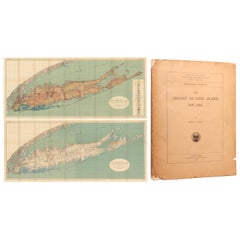
Set of a Book and Two Maps of Long Island, '1914'
View Similar Items


Want more images or videos?
Request additional images or videos from the seller
1 of 5
Set of a Book and Two Maps of Long Island, '1914'
About the Item
- Dimensions:Height: 25.4 in (64.5 cm)Width: 61.62 in (156.5 cm)Depth: 0.02 in (0.5 mm)
- Sold As:Set of 3
- Materials and Techniques:
- Period:
- Date of Manufacture:1914
- Condition:Both maps are on two joined sheets, as issued, and lithographed by Julius Bien. Quarto, 231 pages with paper wrappers. The maps are clean and colorful with faint toning, minor color offsetting, and several small splits at the fold junctions. Text and.
- Seller Location:Langweer, NL
- Reference Number:Seller: BG-124681stDibs: LU3054319881292
About the Seller
5.0
Platinum Seller
These expertly vetted sellers are 1stDibs' most experienced sellers and are rated highest by our customers.
Established in 2009
1stDibs seller since 2017
1,933 sales on 1stDibs
More From This SellerView All
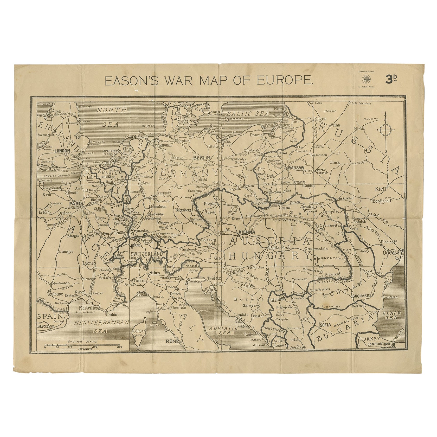
- Eason's War Map of Europe, circa 1914Located in Langweer, NLAntique map titled 'Eason's War Map of Europe'. Printed in Ireland. Source unknown, to be determined. Artists and Engravers: Anonymous. Condition: Good, ...Category
20th Century Maps
MaterialsPaper
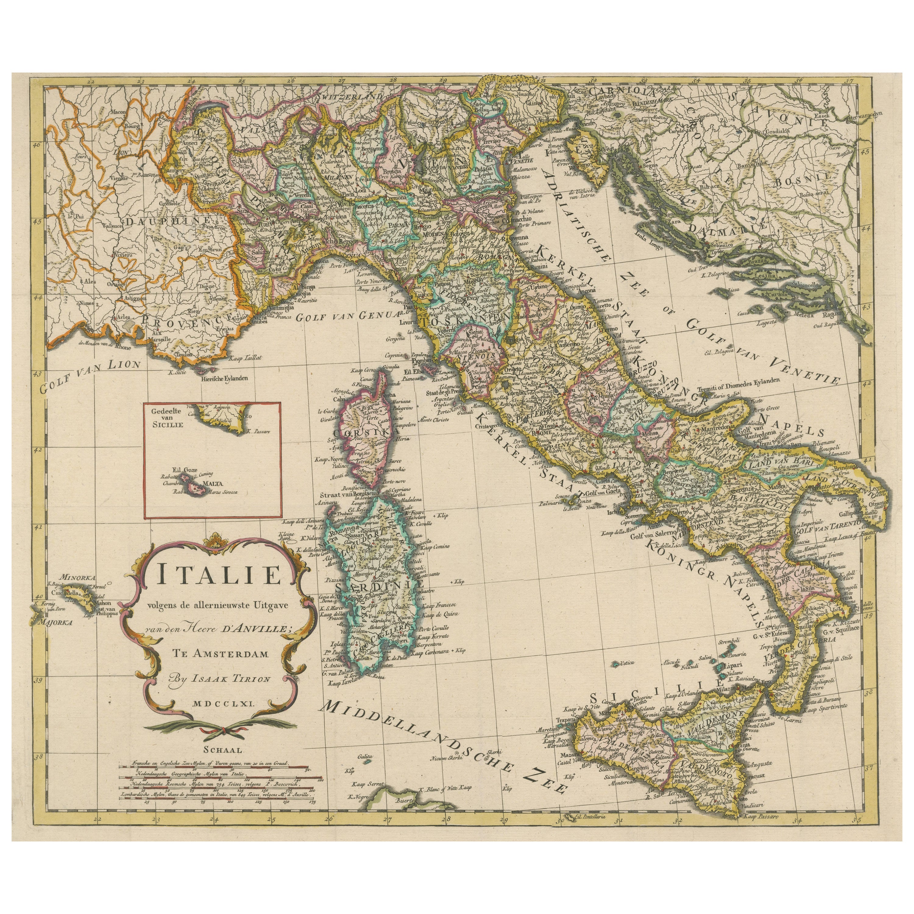
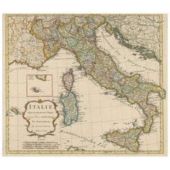
- Detailed Antique Map of Italy and surrounding IslandsLocated in Langweer, NLAntique map titled 'Italie volgens de allernieuwste Uitgave van den Heere d'Anville'. Very detailed antique map, based on D'Anville's important map of It...Category
Antique Mid-18th Century Maps
MaterialsPaper
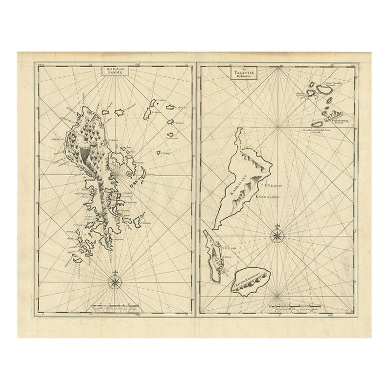
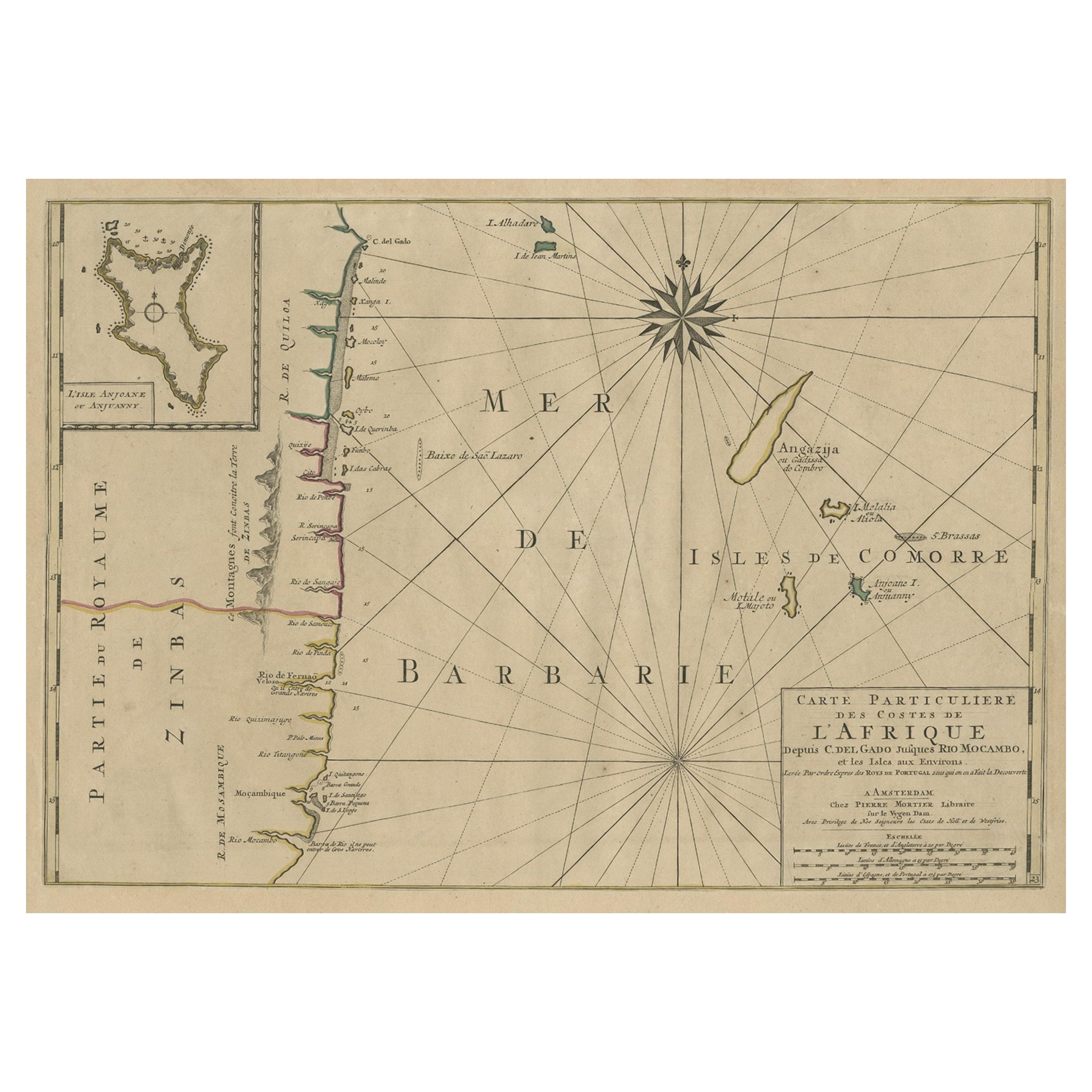
- Antique Map of Sangir Island and the Talaud Islands by Valentijn, 1726Located in Langweer, NLAntique map titled 'Het Eyland Sangir & De Talautse Eylanden'. Two maps on one sheet. To the left, a map of Sangir Island, Indonesia. To the right, a map of the Talaud Islands, Indon...Category
Antique 18th Century Maps
MaterialsPaper
 $456 Sale Price20% Off
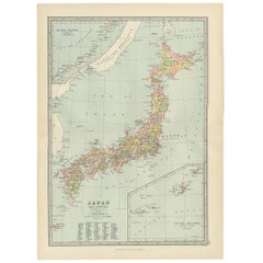
 - Antique Map of Japan, the Kurile Islands and Liu Kiu Islands, 1886Located in Langweer, NLThe map is an exquisite piece, showcasing Japan's vibrant geography. Engraved by J. Bartholomew and published by George Philip & Son in London & Liverpool, it presents a detailed and...Category
Antique Late 19th Century Maps
MaterialsPaper
 $105 Sale Price20% Off
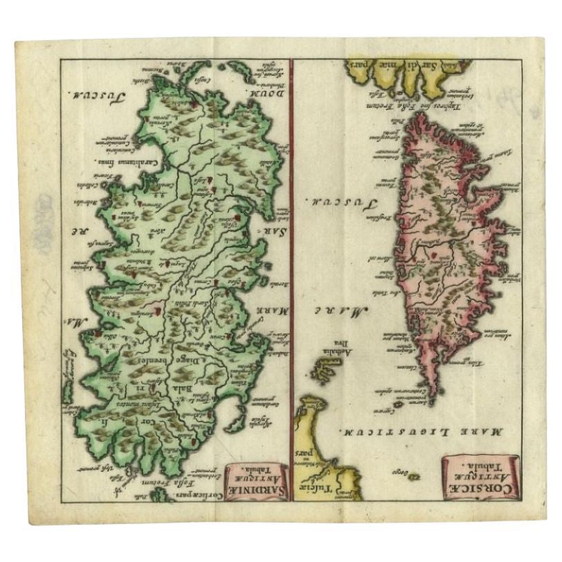
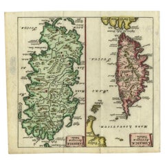
 - Antique Map of the Islands of Corsica and Sardinia, 1685Located in Langweer, NLAntique map titled 'Corsicae Antiquae Tabula - Sardiniae Antiquae Tabula.' Two charming miniature maps on one sheet, showing the islands Corsica and Sardinia from the pocket atlas 'I...Category
Antique 17th Century Maps
MaterialsPaper
 $197 Sale Price20% Off
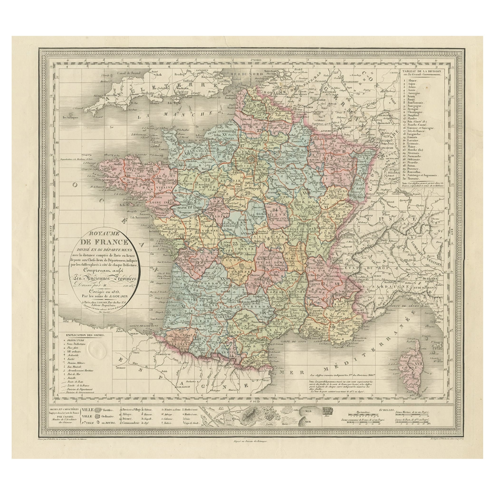
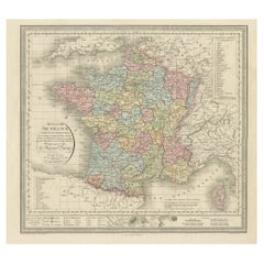
 - Antique Map of France and the Island of Corsica, c.1825Located in Langweer, NLAntique map titled 'Royaume de France divisé en 86 Départemens'. Old map of France, revised in 1825. Also shows the Island of Corsica. Source unknown, to be determined. Artists and E...Category
Antique 19th Century Maps
MaterialsPaper

You May Also Like
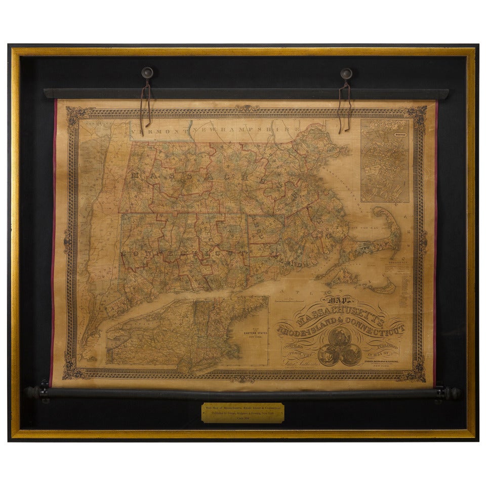
- 1854 Map of Massachusetts, Connecticut and Rhode Island, Antique Wall MapLocated in Colorado Springs, COThis striking wall map was published in 1854 by Ensign, Bridgman & Fanning and has both full original hand-coloring and original hardware. This impression is both informative and highly decorative. The states are divided into counties, outlined in red, green, and black, and subdivided into towns. Roads, canals, and railroad lines are prominently depicted, although they are not all labeled. The mapmakers also marked lighthouses, banks, churches, and prominent buildings, with a key at right. The map is an informative and comprehensive overview of the infrastructural development of New England prior to the Civil War. Physical geographies depicted include elevation, conveyed with hachure marks, rivers and lakes. The impression features an inset map of Boston...Category
Antique 19th Century American Maps
MaterialsPaper
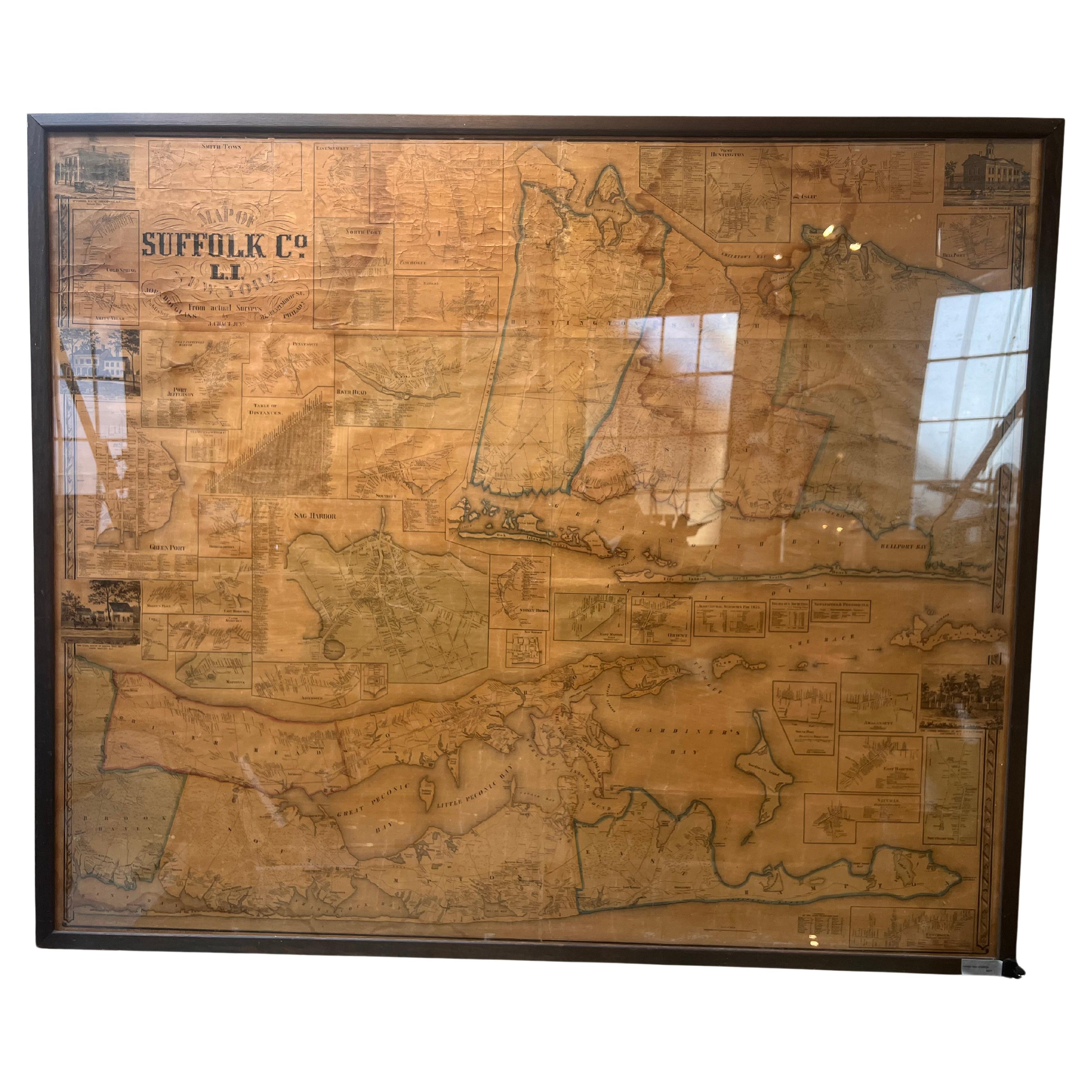
- Framed Mid-19th Century Wall Map of Long Island, the HamptonsLocated in Sag Harbor, NYA Framed museum quality find. This large wall map dates to the mid-1800s. Detailed inset maps of, Sag Harbor, East Hampton, Amagansett, Shelter Island and most villages in Long Islan...Category
Antique Mid-19th Century American Maps
MaterialsLinen, Paper
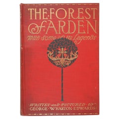
- Antique 1914 the Forest of Arden Legends BookLocated in Seguin, TXThe Forest of Arden: With Some of its Legends by George Wharton Edwards, illustrated by the author. Published by Frederick A. Stokes, New York...Category
Early 20th Century American Edwardian Books
MaterialsPaper
- Set of Two Bvlgari Brand Book Catalogue Jewellery and Watches 2013By BulgariLocated in North Hollywood, CASet of two Bvlgari catalogues, jewelry and watches. Collection of 2013. Hardcover black cloth catalogues of one of the most famous Luxury Jewellery maker in the world. Sotirio Bulgar...Category
2010s Italian Expressionist Books
MaterialsPaper
- “The Paris Salons”, 1895-1914 Furniture ‘Book’Located in Montelabbate, PUThis is the third in a multi-volume collection providing a visual catalogue record of the decorative arts of the Paris Salons. Included in this volume are reproductions of the catalo...Category
Early 20th Century Books
MaterialsPaper
- Map Jersey Guernsey Scilly Islands AlderneyLocated in BUNGAY, SUFFOLKRare map of The Islands of Guernsey and Jersey, including Alderney & the Scilly Islands just purchased more information to follow In the original cream mount and gilded frame.Category
Antique 18th Century English Georgian Maps
MaterialsPaper


Recently Viewed
View AllMore Ways To Browse
Ocean Books
Map Railroad
Antique Map New Jersey
New Jersey Antique Map
Antique Maps Of New Jersey
Antique Map Of New Jersey
Staten Island Used Furniture
Antique Railway Maps
Atlantic Ocean Antique Map
Antique Geological Maps
Map Connecticut
Map Of Connecticut
Antique Furniture Staten Island
Copying Press
Antique Books Chinese
Marbled Plates
Copy Press
Mexico Book