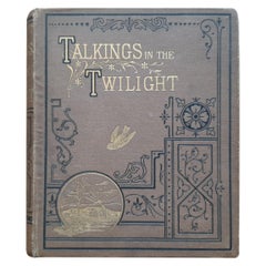
Talking in the Twilight by J.J.J. Published, circa 1885
View Similar Items


Want more images or videos?
Request additional images or videos from the seller
1 of 5
Talking in the Twilight by J.J.J. Published, circa 1885
About the Item
- Dimensions:Height: 6.11 in (15.5 cm)Width: 4.93 in (12.5 cm)Depth: 0.79 in (2 cm)
- Materials and Techniques:
- Period:
- Date of Manufacture:circa 1885
- Condition:Please study images carefully.
- Seller Location:Langweer, NL
- Reference Number:Seller: BG-11873-11stDibs: LU3054321405362
About the Seller
5.0
Recognized Seller
These prestigious sellers are industry leaders and represent the highest echelon for item quality and design.
Platinum Seller
Premium sellers with a 4.7+ rating and 24-hour response times
Established in 2009
1stDibs seller since 2017
2,439 sales on 1stDibs
Typical response time: 1 hour
Authenticity Guarantee
In the unlikely event there’s an issue with an item’s authenticity, contact us within 1 year for a full refund. DetailsMoney-Back Guarantee
If your item is not as described, is damaged in transit, or does not arrive, contact us within 7 days for a full refund. Details24-Hour Cancellation
You have a 24-hour grace period in which to reconsider your purchase, with no questions asked.Vetted Professional Sellers
Our world-class sellers must adhere to strict standards for service and quality, maintaining the integrity of our listings.Price-Match Guarantee
If you find that a seller listed the same item for a lower price elsewhere, we’ll match it.Trusted Global Delivery
Our best-in-class carrier network provides specialized shipping options worldwide, including custom delivery.More From This Seller
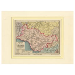
View AllMap of the Kingdom of Württemberg, Oberamt Tettnang in Germany, circa 1885
Located in Langweer, NL
Administrative Map of the Kingdom of Württemberg, Oberamt Tettnang, circa 1885
This detailed antique map titled "Handkarte von dem Königl. Württ. Oberamt Tettnang" was created by G....
Category
Antique 1880s Maps
Materials
Paper
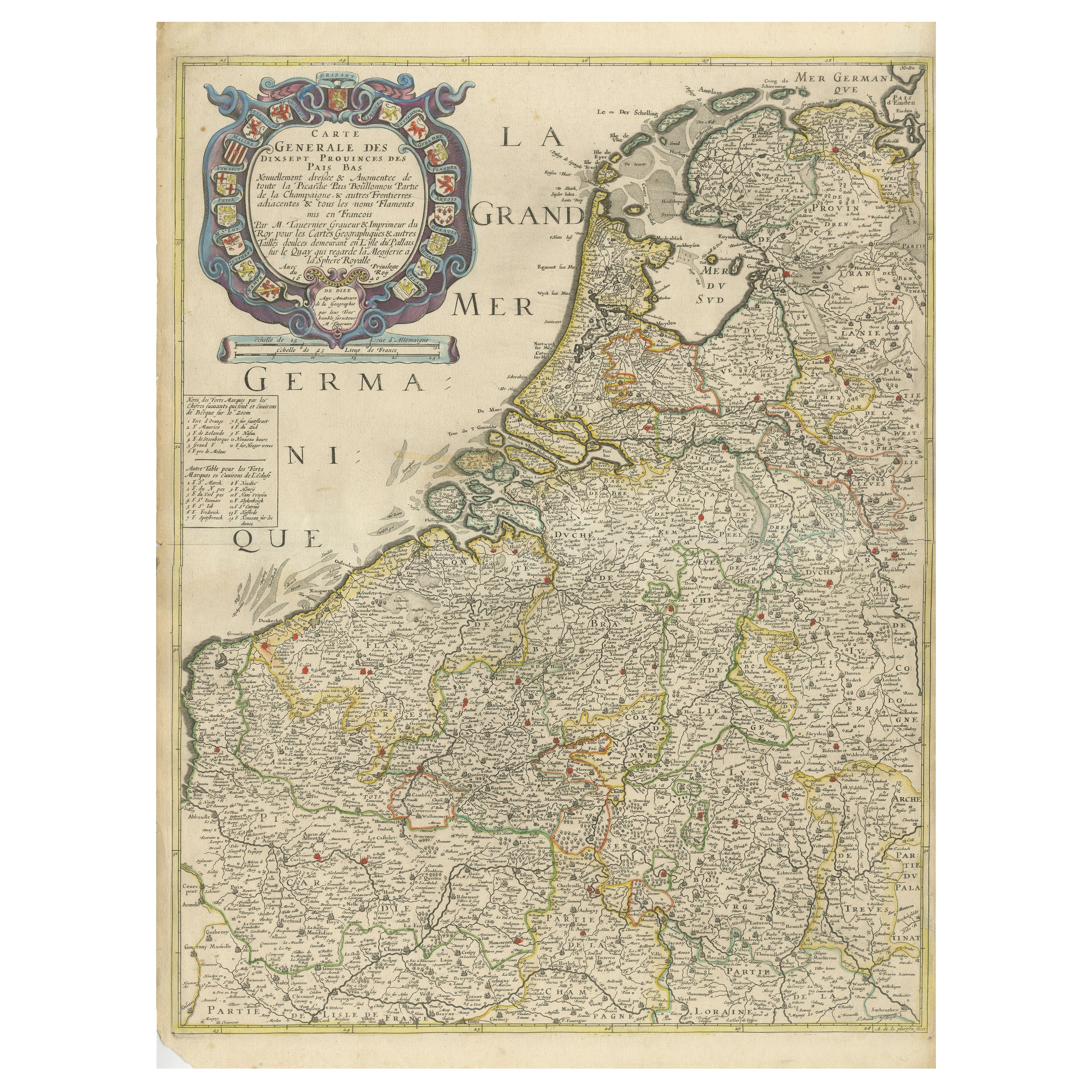
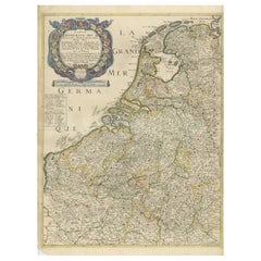
Rare and Early Map of the Seventeen Provinces, Published in circa 1640
Located in Langweer, NL
Antique map titled 'Carte Generale des Dixsept Provinces des Pais Bas'. Rare and Early map of the Seventeen Provinces. The Seventeen Provinces were the Imperial states of the Habsbur...
Category
Antique Mid-17th Century Maps
Materials
Paper
$2,037 Sale Price
20% Off
Free Shipping
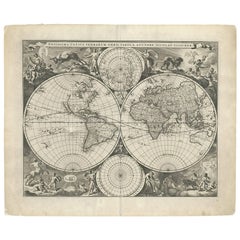
Gorgeous Antique World Map by the Dutch Mapmaker Visscher, published circa 1679
Located in Langweer, NL
Antique map titled 'Novissima Totius Terrarum Orbis Tabula, Auctore Nicolao Visscher'. Gorgeous example of Nicholas Visscher's World map, which appeared...
Category
Antique Late 17th Century Maps
Materials
Paper
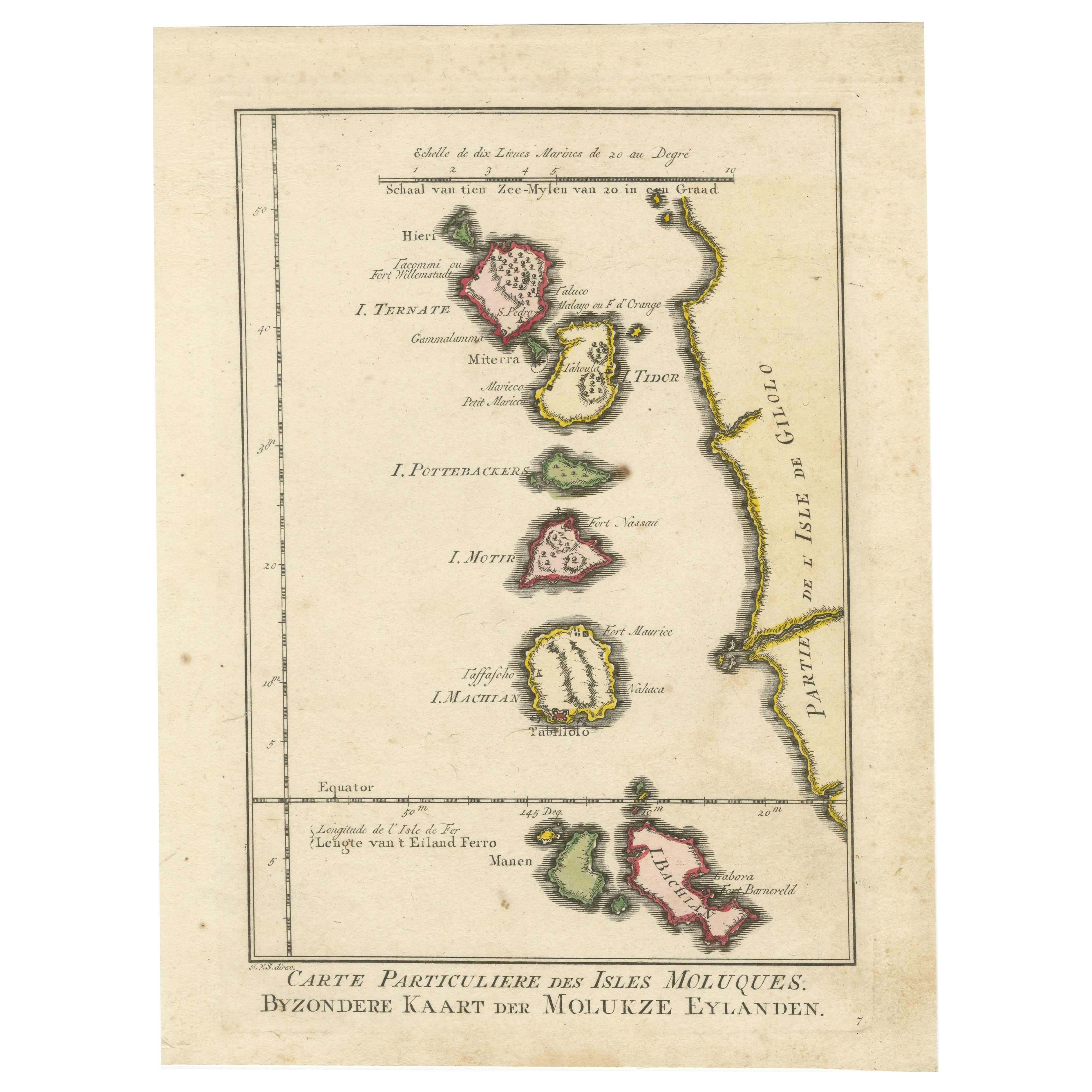
Antique Map of the Moluccas by Stemfoort, 1885
Located in Langweer, NL
Antique map titled 'Kaart der Molukken'. Old map of the southern tip of the Moluccas, or Maluku Islands. With an inset map of part of Ambon Island and an inset map of New Guinea. Thi...
Category
Antique 19th Century Maps
Materials
Paper

$253 Sale Price
20% Off
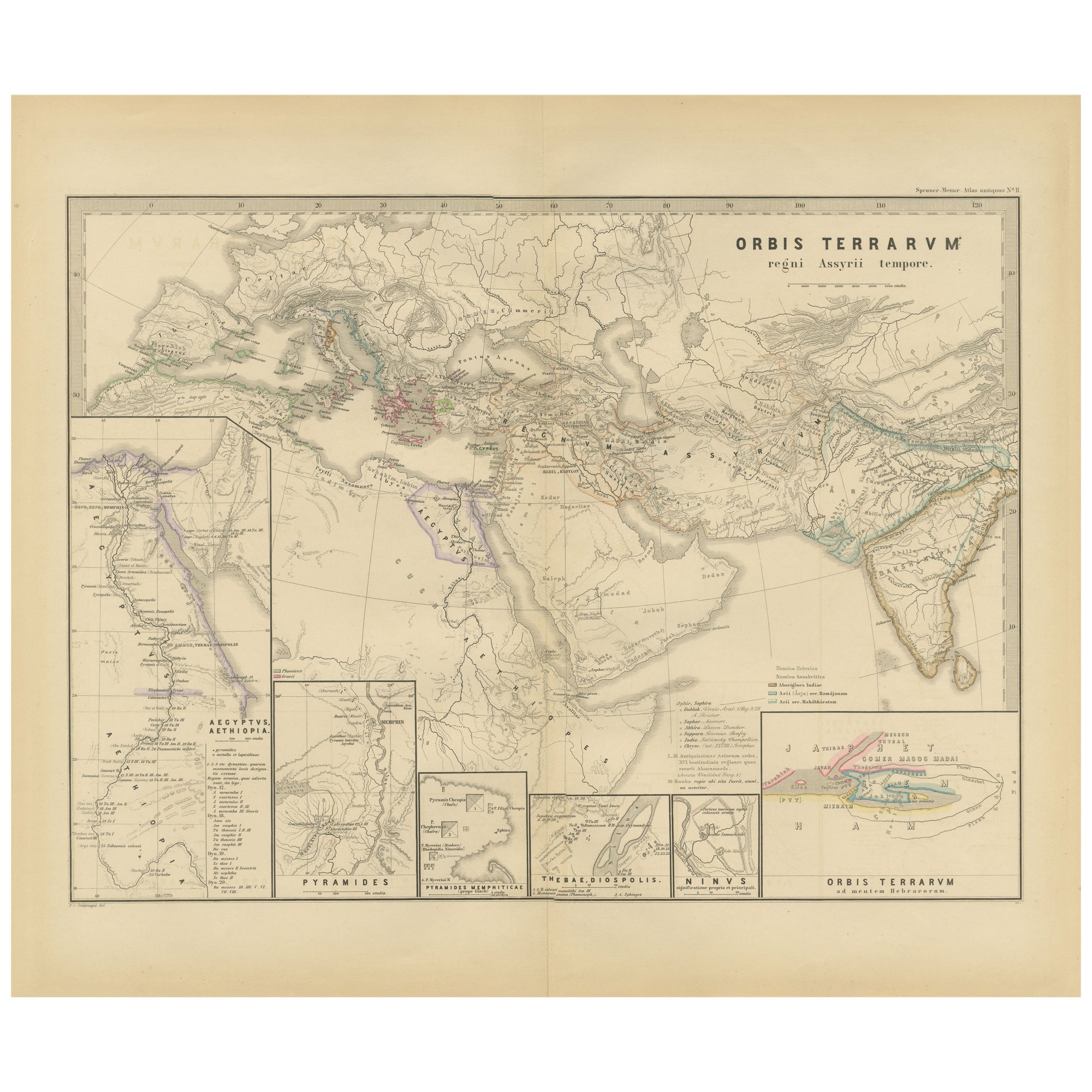
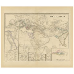
The World in the Assyrian Empire's Era: A Historical Map, Published in 1880
Located in Langweer, NL
This map from the "Spruner-Menke Atlas Antiquus" is titled "ORBIS TERRARVM regni Assyrii tempore," which translates to "The World at the Time of the Assyrian Kingdom." It depicts the...
Category
Antique 1880s Maps
Materials
Paper
$342 Sale Price
20% Off
Free Shipping
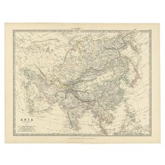
Antique Map of the Asian Continent by Johnston, 1885
Located in Langweer, NL
Antique map titled 'Asia'. Beautiful map of the Asian continent by Keith Johnston F.R.S.E.
Artists and Engravers: Engraved, printed and published by A.K. Johnston.
Condition: ...
Category
Antique 19th Century Maps
Materials
Paper
$324 Sale Price
20% Off
You May Also Like
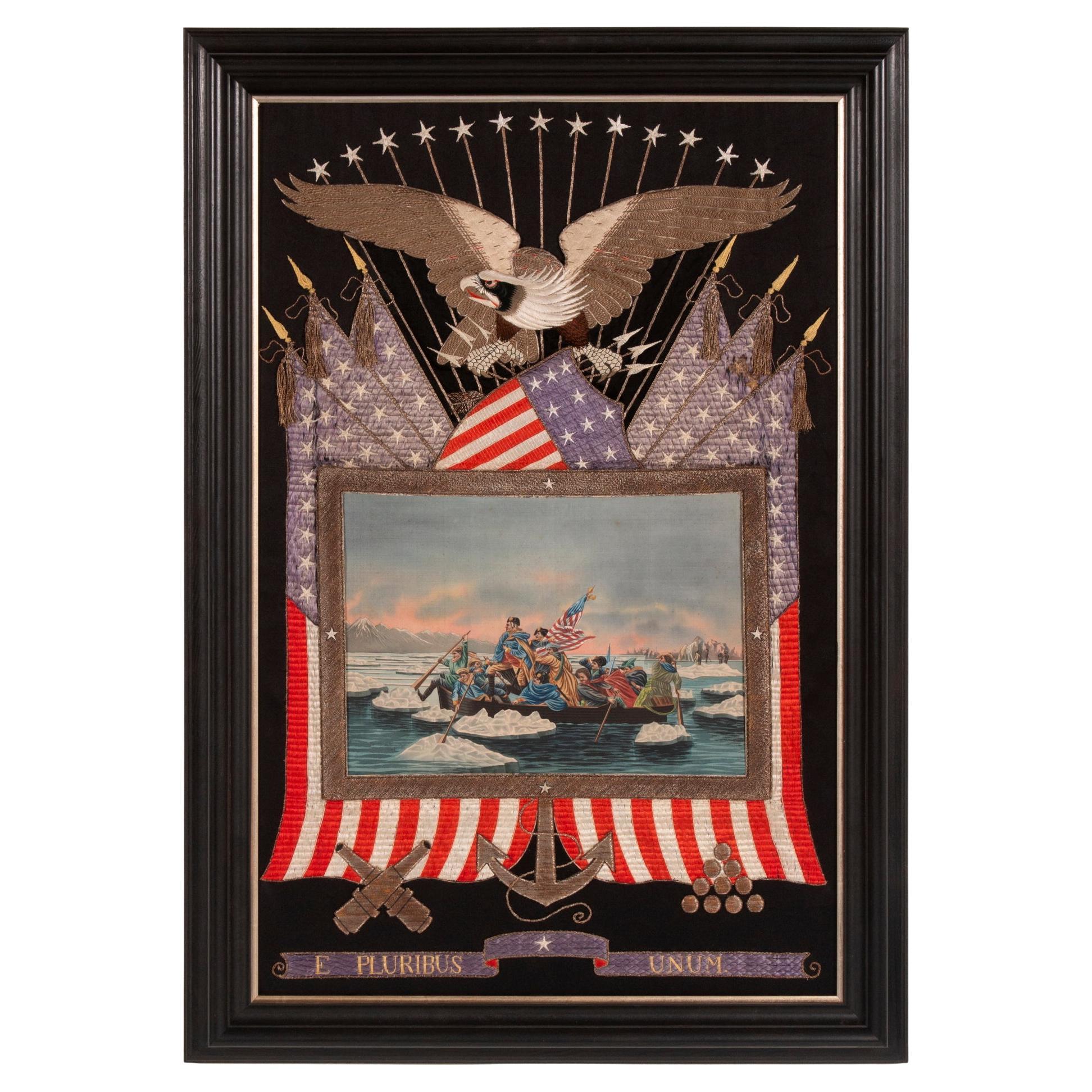
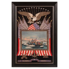
Elaborate Sailor Souvenir of Washington Crossing the Delaware, circa 1885-1912
Located in York County, PA
Elaborate sailor’s souvenir embroidery from the orient with a beautiful hand-painted image of Washington crossing the Delaware, surrounded by a large eagle, federal shield, crossed flags, a cannon, cannonballs, and anchor, circa 1885-1910:
Between roughly 1880 and 1915, American sailors visiting the orient could obtain beautiful needlework embroideries on shore, with patriotic American themes. These extraordinary works of art were acquired as mementos of a long voyage, often with the hope that they might be presented as gifts for loved ones and friends.
Using silk floss, elaborately embellished with both silver and gold metallic bullion thread...
Category
Antique Late 19th Century Asian Political and Patriotic Memorabilia
Materials
Silk
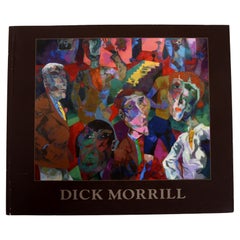
Dick Morrill: A Part to Play in the Process, Published by Katharine T. Carter
Located in valatie, NY
Dick Morrill: A Part to Play in the Process, Published by Katharine T. Carter. 1st Ed softcover. Outstanding and vibrant photographs of this artist's work...
Category
21st Century and Contemporary Books
Materials
Paper
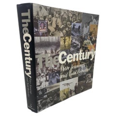
The Century by Peter Jennings and Todd Brewster Published by Doubleday 1998
Located in North Hollywood, CA
The Century by Peter Jennings and Todd Brewster Published by Doubleday 1998.What was it like to watch the Wright Brothers soar into the sky? To hear the first crackling voice aired o...
Category
Late 20th Century American Mid-Century Modern Books
Materials
Paper
1842 Wall Map of the United States by J. H. Young, Published by S. A. Mitchell
Located in Colorado Springs, CO
Presented is an 1842 hanging “Map of the United States,” engraved by J. H. Young and published by Samuel Augustus Mitchell, Philadelphia. This is a beautiful example of the rare 1842...
Category
Antique 1840s American Maps
Materials
Paper

The Woman Who Wouldn't Talk, Signed by Susan McDougal, First Edition, 2003
Located in Colorado Springs, CO
McDougal, Susan, with Pat Harris. The Woman Who Wouldn't Talk: Why I Refused to Testify Against the Clintons & What I Learned in Jail. New York: Carroll and Graf Publishers, 2003. Si...
Category
Early 2000s American Books
Materials
Paper

1840 Map of the City of Washington Published by William M. Morrison
Located in Colorado Springs, CO
This map, printed in 1840, is a detailed representation of Washington, D.C. in the mid-19th century. The map shows block numbers, wards, and government buildings as well as details o...
Category
Antique 1840s American Federal Maps
Materials
Paper

Recently Viewed
View AllMore Ways To Browse
Frederick Law Olmsted
George W Russell
Gucci Coffee Table Book
Handwritten Lyrics
Hip Hop Pendant
Josephus Flavius
Kazuyo Sejima
Marcus Aurelius Meditations
Mary Hadley
Merriweather Post
Morris T J Cobden Sanderson
Olson Kundig
Pirelli Calendar
Sherlock Holmes Books
Shiro Kuramata Book
Slim Aarons Book
Speer Collectibles
The Big Book Of Chic