Items Similar to 1720 Panoramic Vista of Istanbul and the Bosphorus - with Column of Pompey


Want more images or videos?
Request additional images or videos from the seller
1 of 6
1720 Panoramic Vista of Istanbul and the Bosphorus - with Column of Pompey
About the Item
Title: "1701-1720 Bosphore de Thrace and Views of Istanbul - Chatelain/Guedeville"
Description: This finely detailed folio from Chatelain's 'Atlas Historique', dated 1720, features a panoramic bird's-eye view of Istanbul from the Bosporus, with bustling maritime activity.
Accompanying are two smaller illustrations: the Aqueduct of Constantinople and the Column of Pompeii. The plate is adorned with informative French text about the historical and strategic significance of these landmarks.
Preserved in very good condition on thick paper, this piece reflects the rich cartographic history of early 18th-century Amsterdam.
The Aqueduct of Valens, also known in Turkish as Valens Su Kemeri, is a Roman aqueduct system constructed in the late 4th century AD to supply Constantinople, the capital of the Eastern Roman Empire. It was initiated during the reign of Emperor Constantius II and completed by Emperor Valens in 373. Remarkably, the aqueduct was operational for many centuries, being maintained and extended by both the Byzantines and the Ottomans. The original system carried water from the slopes of the hills between Kağıthane and the Sea of Marmara, stretching over 250 kilometers in total length, including various reservoirs and cisterns throughout Constantinople.
In its early days, the aqueduct sourced water from the regions of Danımandere and Pınarca. Its initial phase, completed in the 4th century, spanned 268 kilometers. A subsequent expansion in the 5th century extended the system by an additional 451 kilometers, drawing water from as far as Vize, around 120 kilometers from Constantinople. These expansions made it the longest aqueduct system from the ancient world.
One of the most visible parts of the aqueduct is the bridge known as the Bozdoğan Kemeri, located in Istanbul's Fatih district. This bridge, originally measuring 971 meters, still stands as a significant historical landmark, crossing the valley between the hills now home to Istanbul University and the Fatih Mosque.
Despite the grand scale and the complexity of this ancient engineering marvel, it was not immune to damage and required continuous maintenance. In the 4th century, Gregory of Nazianzus described it as an "underground and aerial river," attesting to its impressive reach and construction. After several restorations throughout history, including works by Emperors Theodosius II and Justinian the Great, the aqueduct remained a critical part of Constantinople's water supply system for over 700 years.
- Dimensions:Height: 14.38 in (36.5 cm)Width: 16.74 in (42.5 cm)Depth: 0 in (0.02 mm)
- Materials and Techniques:Paper,Engraved
- Period:1720-1729
- Date of Manufacture:1720
- Condition:Preserved in very good condition on thick paper. Later handcoloring. Folding line middle. Study the images carefully.
- Seller Location:Langweer, NL
- Reference Number:
About the Seller
5.0
Platinum Seller
These expertly vetted sellers are 1stDibs' most experienced sellers and are rated highest by our customers.
Established in 2009
1stDibs seller since 2017
1,919 sales on 1stDibs
Typical response time: <1 hour
- ShippingRetrieving quote...Ships From: Langweer, Netherlands
- Return PolicyA return for this item may be initiated within 14 days of delivery.
More From This SellerView All
- Antique Map of the Bay of Bantam, c.1720Located in Langweer, NLRare, untitled miniature map of the Bay of Bantam with various Islands including Pulo Dua and Pulo Batto. This map originates from a small travelogue and may originate from an editio...Category
Antique 18th Century Maps
MaterialsPaper
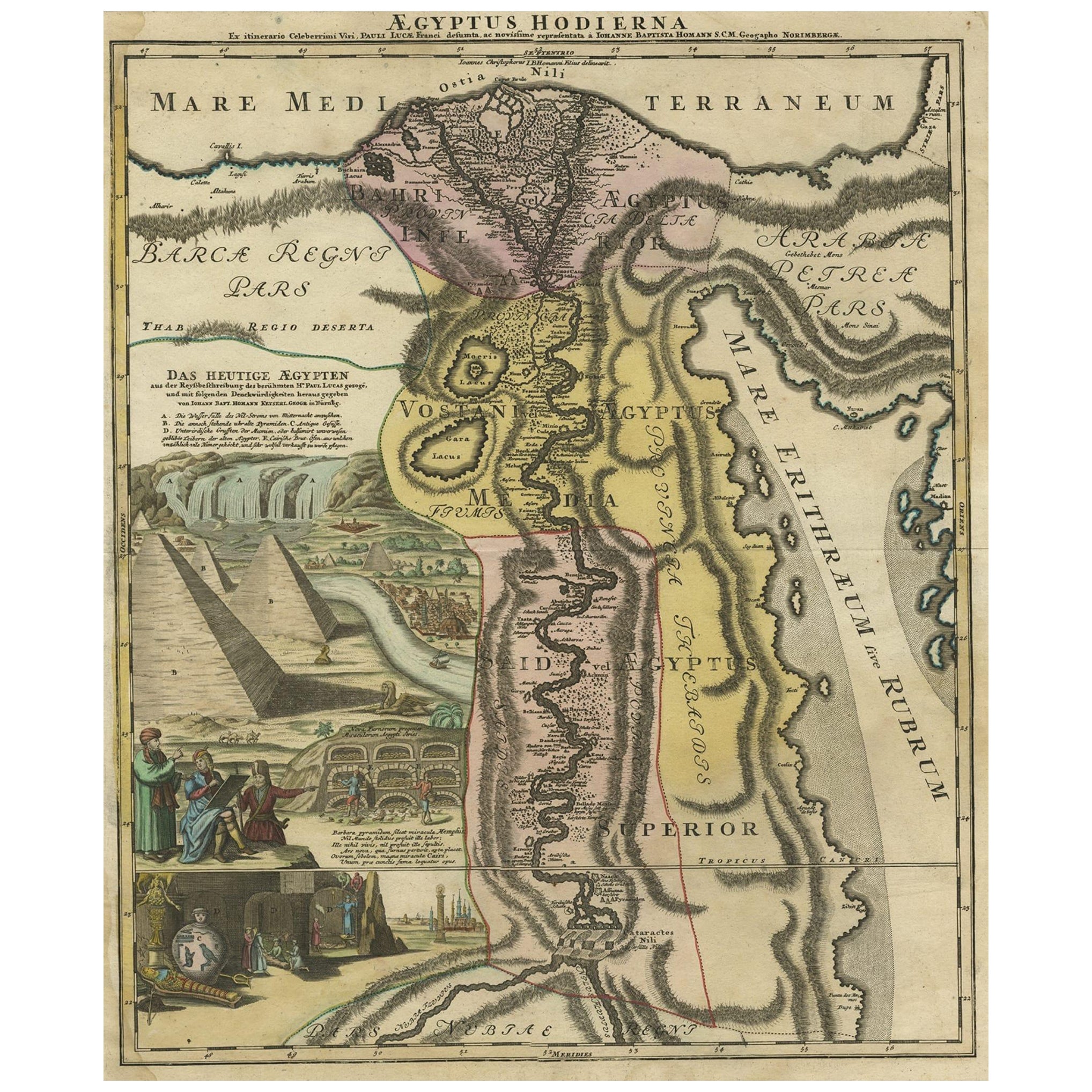
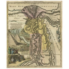
- Antique Map of Egypt and the Nile River with Sphinx, Pyramids, Etc, c.1720Located in Langweer, NLAntique map titled 'Aegyptus Hodierna Ex itinerario Celeberrimi (..)'. Original antique map of Egypt, focused on the Nile River Valley from the Mediterr...Category
Antique 18th Century Maps
MaterialsPaper
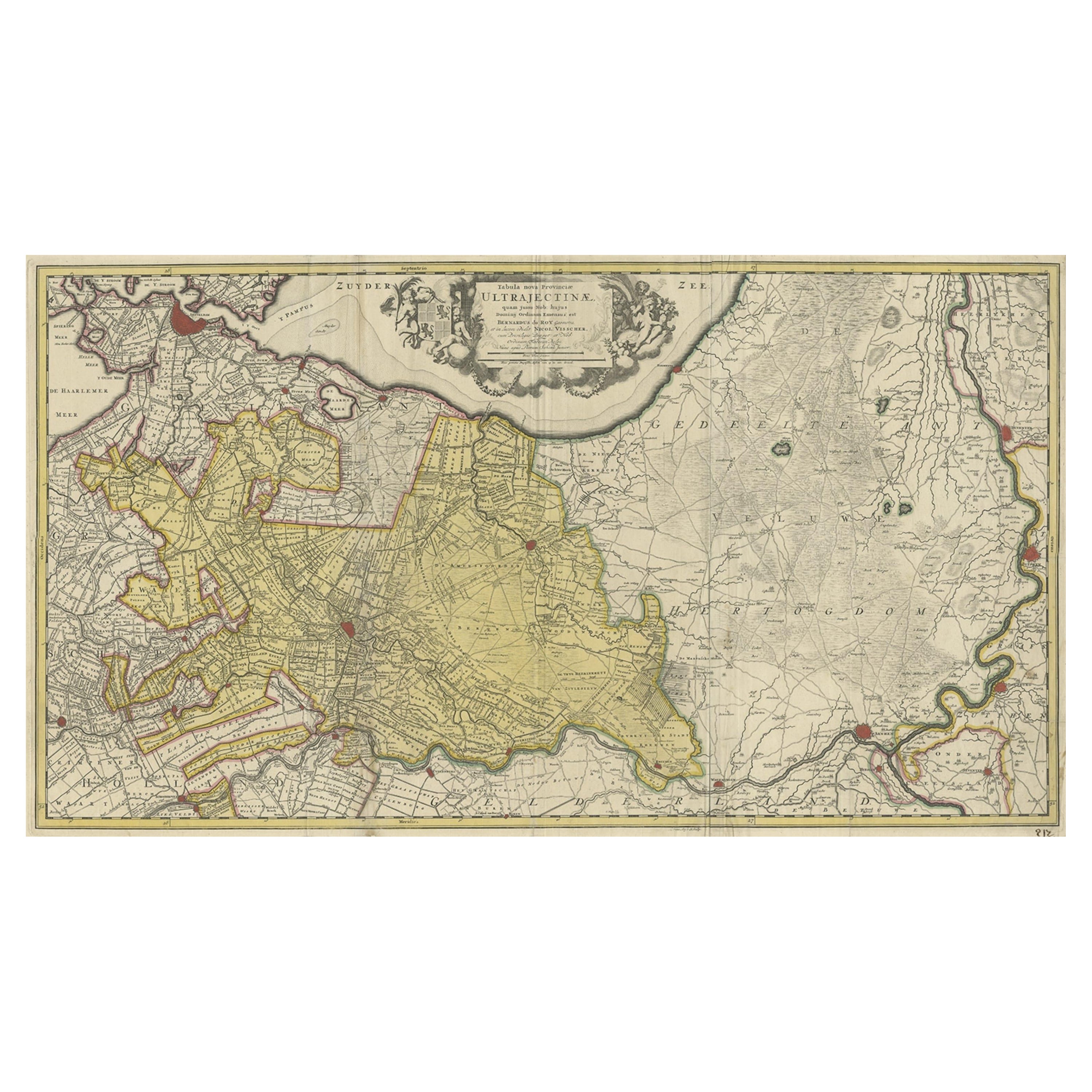
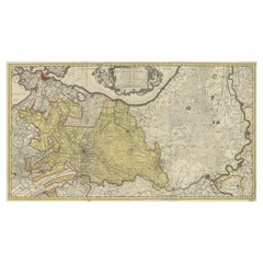
- Original Antique Map of the Province of Utrecht, the Netherlands, ca.1720Located in Langweer, NLAntique map titled ‘Tabula Nova Provinciae Ultrajectinae (..)’. Original antique map of the province of Utrecht, the Netherlands. It shows the region of Amsterdam, Utrecht, Gouda, ...Category
Antique 1720s Maps
MaterialsPaper
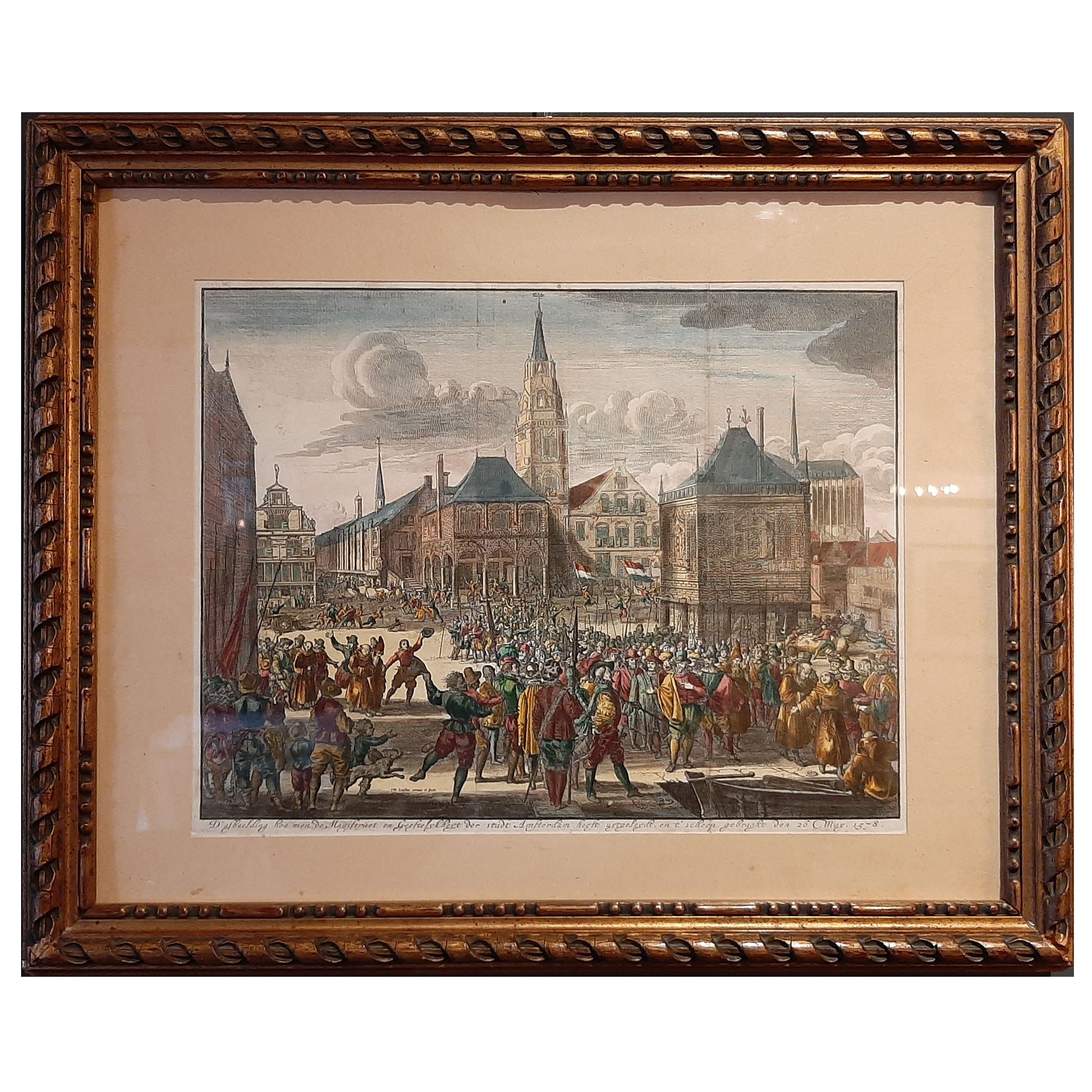
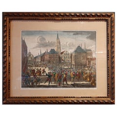
- Framed Scene of the Alteration of Amsterdam, Dam square, The Netherlands, c.1720Located in Langweer, NLAntique print titled 'd'Afbeelding hoe men de Magistraet en Geestelykheyt der stadt Amsterdam heeft uytgeleydt en t'scheep gebraght den 26 May 1578'. Scene of the Alteration of Amsterdam on the Dam square...Category
Antique 1720s Prints
MaterialsPaper
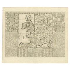
- Antique Map of the British Isles and Part of Europe by Chatelain, c.1720Located in Langweer, NLAntique map titled 'Carte pour l'Intelligence de l'Histoire d'Angleterre (..)'. Decorative map showing the British Isles and the various regions conquered in Europe. Includese two elaborate family trees for the House of York...Category
Antique 18th Century Maps
MaterialsPaper
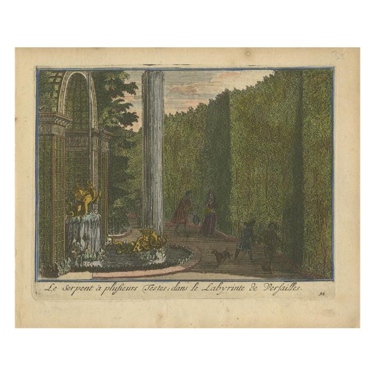
- Antique Hand-Colored Print of the Labyrinth of Versailles, c.1720Located in Langweer, NLAntique print titled 'Le Serpent à plusieurs Testes: dans le Labyrinte de Versailles'. This print illustrates the fable 'The Snake with several heads' of the labyrinth of Versailles ...Category
Antique 18th Century Prints
MaterialsPaper


You May Also Like
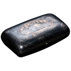
- Ancient Silver Tobacco Can with View of Costantinople/Istanbul, Early 1800Located in Roma, ITTurkish Silverwave, first half of the 19th century. On cover nice view of the city of Costantinople/Istanbul. Inside two seals engraved seals on top and bottom sides. This artwo...Category
Antique 19th Century Turkish Tobacco Accessories
MaterialsSilver
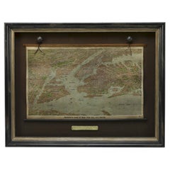
- 1912 "Panoramic View of New York City and Vicinity" by Jacob RuppertLocated in Colorado Springs, COThis is an attractive and very scarce map of New York, published by the Yorkville brewer Jacob Ruppert in 1912. The map shows an expansive view of the region reaching from Sandy Hook in the south and Yonkers to the north, to Hicksville in the east and past Newark to the west. This beautifully colored birds eye view shows waterways with all shipping traffic, boroughs, and clearly labeled railroad routes. It is presented on period dowels and backed on its original linen. Jacob Ruppert was born in New York City in 1842 to Bavarian immigrants. His father owned a brewery in Manhattan where young Jacob learned the business of brewing. In 1862, Jacob established the Jacob...Category
Vintage 1910s American Maps
MaterialsPaper
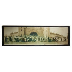
- Photography Panoramic 1914 Indiana State Prison on the Outside Looking inLocated in Savannah, GAOver one hundred people, a trolley car and a couple of automobiles were photographed for this amazing circa 1914 panorama photograph in front of th...Category
Vintage 1910s American Other Photography
MaterialsGlass, Wood, Paper
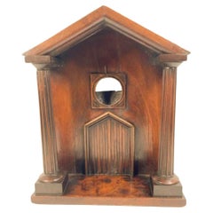
- Georgian Mahogany Watch Hutch in the Form of a Columned PorticoLocated in Chapel Hill, NCGeorge III mahogany watch hutch of architectural form having fluted columns on a stepped base and supporting a gabled roof. The setback facade with a double door below a circular "wi...Category
Antique Late 18th Century English George III Architectural Models
MaterialsWood
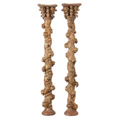
- Pair of Solomonic Colonial Carved and Gilded ColumnsLocated in Guadalajara, Jalisco, MXA beautiful pair of 18th Century Solomonic Gilded Columns.Category
Antique 18th Century Spanish Baroque Religious Items
MaterialsWood
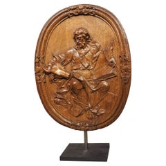
- Antique French Carved and Incurved Oak Bas Relief Plaque of St Luke, circa 1720Located in Dallas, TXA magnificent display of mastery level woodworking, this antique oval plaque of St Luke was not only carved in bas relief, but it has an incurved shape. The concave plaque has severa...Category
Antique 1720s French Louis XV Wall-mounted Sculptures
MaterialsMetal, Steel
Recently Viewed
View AllMore Ways To Browse
Blackwood Furniture
The Malay Archipelago
Antique Map Alabama
Fiji Map
Antique Map Of Southeastern Us
Malay Archipelago Map
Map Prussia Germany
Bad Bentheim
English County Maps By Blaeu
Map Of Lebanon
Wenceslas Hollar
Poired Metal
Antique Map Austro Hungarian
Arkansas Indian Map
Antique Cabbage Cutter
Brinkman Co
Eso Antique Maps
Map Of Charlevoix