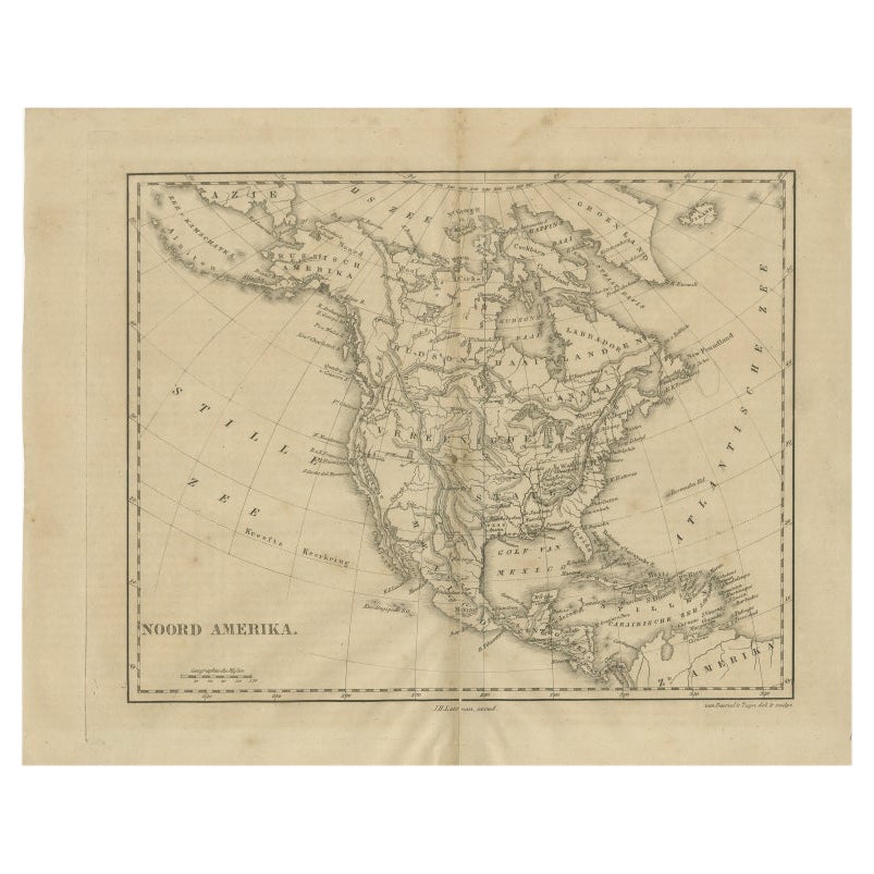
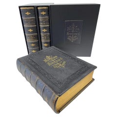
1860 "Johnson's North and South Carolina" by Johnson & Browning
View Similar Items


Want more images or videos?
Request additional images or videos from the seller
1 of 6
1860 "Johnson's North and South Carolina" by Johnson & Browning
About the Item
- Dimensions:Height: 23.75 in (60.33 cm)Width: 30.5 in (77.47 cm)Depth: 0.75 in (1.91 cm)
- Style:Victorian (Of the Period)
- Materials and Techniques:
- Place of Origin:
- Period:
- Date of Manufacture:1860
- Condition:Additions or alterations made to the original: Framed by Rio Grande Custom Framing in Colorado Springs, CO, in December of 2024. Wear consistent with age and use. Minor fading.
- Seller Location:Colorado Springs, CO
- Reference Number:Seller: M3771stDibs: LU909742864422
About the Seller
4.9
Platinum Seller
Premium sellers with a 4.7+ rating and 24-hour response times
Established in 2010
1stDibs seller since 2011
452 sales on 1stDibs
Typical response time: 1 hour
Authenticity Guarantee
In the unlikely event there’s an issue with an item’s authenticity, contact us within 1 year for a full refund. DetailsMoney-Back Guarantee
If your item is not as described, is damaged in transit, or does not arrive, contact us within 7 days for a full refund. Details24-Hour Cancellation
You have a 24-hour grace period in which to reconsider your purchase, with no questions asked.Vetted Professional Sellers
Our world-class sellers must adhere to strict standards for service and quality, maintaining the integrity of our listings.Price-Match Guarantee
If you find that a seller listed the same item for a lower price elsewhere, we’ll match it.Trusted Global Delivery
Our best-in-class carrier network provides specialized shipping options worldwide, including custom delivery.More From This Seller
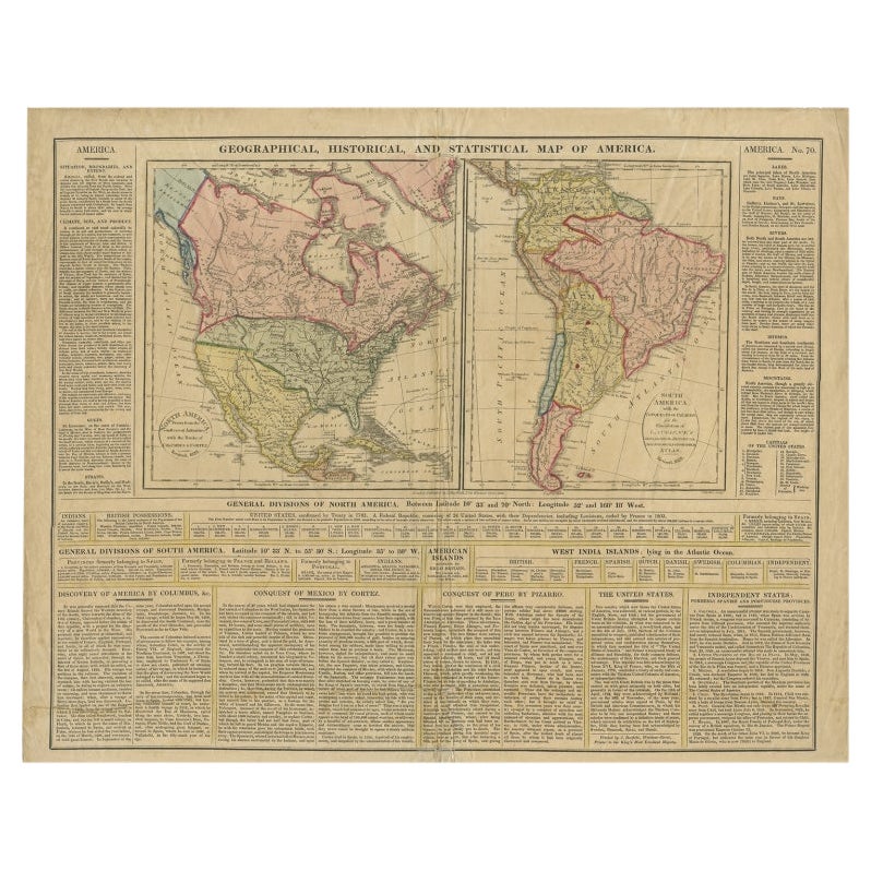
View All1846 "North America" Map, Engraved by I. Dower
Located in Colorado Springs, CO
Presented is an original 1846 map of “North America.” The map was drawn and engraved by I. Dower and published in London by Orr & Company. The map depicts North America, to include G...
Category
Antique 1840s English Victorian Maps
Materials
Paper

1868 "Lloyd's Topographical Railway Map of North America..." Hanging Wall Map
Located in Colorado Springs, CO
Presented is “Lloyd's Topographical Railway Map of North-America, or the United States Continent in 1900.” This map was published by J. T. Lloyd, in New York, in 1868. A large, hangi...
Category
Antique 1860s American Late Victorian Maps
Materials
Linen, Paper

1864 Map of North America, Antique Hand-Colored Map, by Adolphe Hippolyte Dufour
Located in Colorado Springs, CO
Offered is a map of North America entitled Amerique du Nord from 1864. This rare, separately published wall map was produced by Adolphe Hippolyte Dufour. This map includes vibrant an...
Category
Antique 1860s French Maps
Materials
Paper

The Lives of the Signers of the Declaration of Independence by N. Dwight, 1860
Located in Colorado Springs, CO
Dwight, Nathaniel. The Lives of the Signers of the Declaration of Independence. New York: A. S. Barnes & Burr, 1860. Later printing. Octavo. Rebound in ¼ leather and cloth boards, wi...
Category
Antique 1860s American Federal Books
Materials
Leather, Paper
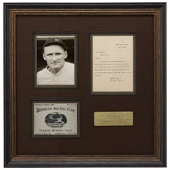
Walter Johnson, Washington Senators Hall of Fame Pitcher, Signed Letter, 1925
Located in Colorado Springs, CO
Offered is a collage featuring a typed letter signed by baseball’s Walter Johnson, a reproduction scorecard from the 1924 World Series, and a photo of Johnson in his uniform. All elements are framed and matted together in a custom-built frame.
The letter is dated November 7, 1925 and addressed to a Mr. Leo Bicher. In his letter, he explains how he missed the letter at first and will send a signed baseball to Bicher if there is another exposition in the future. At the bottom, Johnson signed his name in dark ink. The score card celebrates the Washington Base Ball Club as the 1924 World Series pennant winners. The Washington Senators...
Category
Vintage 1920s American Sports Equipment and Memorabilia
Materials
Paper
The Battles of America by Sea and Land by Robert Tomes and John Laird Wilson
Located in Colorado Springs, CO
Tomes, Robert and John Laird Wilson. The Battles of America by Sea and Land. New York: Patterson & Neilson, 1878. Thick quarto three volume set. Original full leather boards, embosse...
Category
Antique 1870s American Victorian Books
Materials
Leather, Fabric, Paper
You May Also Like
1862 Johnson's Map of New York State by Johnson & Browning
Located in Langweer, NL
Title: 1862 Johnson's Map of New York State by Johnson & Browning
Description:This is an 1862 map of New York State, titled "Johnson's New York," created by Johnson & Browning. The ...
Category
Antique 1860s Maps
Materials
Paper

$259 Sale Price
20% Off
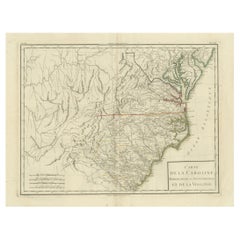
Antique Map of South Carolina, North Carolina, and Virginia by Tardieu, 1802
Located in Langweer, NL
This is an original antique map titled "Carte de la Caroline Méridionale et Septentrionale et de la Virginie," depicting the regions of South Carolina, North Carolina, and Virginia in the early 19th century. Created by Pierre Antoine Tardieu, this map provides a detailed view of the geographical and political landscape of these southeastern United States areas.
Map Details:
- **Title**: Carte de la Caroline Méridionale et Septentrionale et de la Virginie
- **Creator**: Pierre Antoine Tardieu (1784-1869)
- **Publication Date**: Early 19th century
- **Dimensions**: Approximately 34.5 x 43.5 cm (13.5 x 17.25 inches)
- **Features**: The map includes detailed representations of South Carolina, North Carolina, and Virginia, highlighting political boundaries, major cities, rivers, and other geographical features. The title cartouche is located in the lower right corner, and the outlines are hand-colored to distinguish different regions.
Key Geographic Features and Areas:
1. **South Carolina**:
- Major cities such as Charleston and Columbia are marked.
- The map details the rivers and topography, including the Savannah River and various inland features.
2. **North Carolina**:
- Key locations such as Raleigh and New Bern...
Category
Antique Early 1800s Maps
Materials
Paper
$519 Sale Price
20% Off
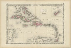
1864 Johnson's Map of the West Indies and Bermuda
Located in Langweer, NL
Title: 1864 Johnson's Map of the West Indies and Bermuda
Description: This is an 1864 map titled "Johnson's West Indies," published by Johnson and Ward. The map provides a detailed ...
Category
Antique 1860s Maps
Materials
Paper
$296 Sale Price
20% Off
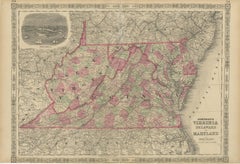
1864 Johnson's Map of Virginia, Delaware, and Maryland with Fort Monroe Inset
Located in Langweer, NL
Title: 1864 Johnson's Map of Virginia, Delaware, and Maryland with Fort Monroe Inset
Description: This 1864 map titled "Johnson's Virginia, Delaware, and ...
Category
Antique 1860s Maps
Materials
Paper
$278 Sale Price
20% Off
1864 Johnson's Map of New York State with City Insets
Located in Langweer, NL
Title: 1864 Johnson's Map of New York State with City Insets
Description: This 1864 map, titled "Johnson's New York," was published by Johnson and Ward and features a detailed depic...
Category
Antique 1860s Maps
Materials
Paper

$259 Sale Price
20% Off
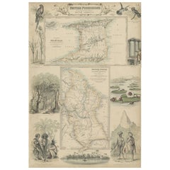
British Possessions on the North West Coast of South America, 1860
Located in Langweer, NL
The antique print is a page from an 1860 A Fullarton atlas, providing a comprehensive view of the British possessions on the northwest coast of South America during that time. It features a detailed map of the Island of Trinidad, as well as maps of British Guiana with routes by Sir Robert Schomburgk.
The print includes ornate vignettes that showcase both the region's rich biodiversity with illustrations of local birds such as the Scarlet Ibis and Hummingbirds of Trinidad, and the giant water lily known as Victoria Regia.
In addition to the natural history, the print also portrays cultural elements through depictions of the indigenous populations, specifically the Macusi and Caribisi Indians. It illustrates various aspects of their life, from the preparation of cassava and coffee to their dwellings, costumes, and idols. An image of a sugar mill...
Category
Antique 1860s Maps
Materials
Paper
$315 Sale Price
20% Off
Free Shipping
Recently Viewed
View AllMore Ways To Browse
Charleston Used Office Furniture
Double Rocks Glasses
Railroad Table
Curved Bench Seating With Back
Custom Poker Table
Dagmar Design
Danish Modern Loveseat
Decanter Glass Gold
Desk 51
Dining Chair Tulip Chair
Dining Chairs Chrome Curved
Dining Table Plateau
Dr Chairs
Draped Couch
Eames Chair Cushion
Encyclopedie Diderot
Exposed Wood Sofa
Fluted Travertine Dining Table