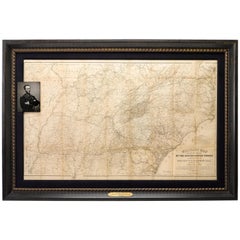
1865 Military Map Showing the Marches of the U.S. Forces under W. T. Sherman
View Similar Items
Want more images or videos?
Request additional images or videos from the seller
1 of 5
1865 Military Map Showing the Marches of the U.S. Forces under W. T. Sherman
About the Item
- Dimensions:Height: 39 in (99.06 cm)Width: 57 in (144.78 cm)Depth: 2.25 in (5.72 cm)
- Materials and Techniques:
- Place of Origin:
- Period:
- Date of Manufacture:1865
- Condition:Wear consistent with age and use.
- Seller Location:Colorado Springs, CO
- Reference Number:Seller: M0831stDibs: LU909711814713
About the Seller
4.9
Platinum Seller
These expertly vetted sellers are 1stDibs' most experienced sellers and are rated highest by our customers.
Established in 2010
1stDibs seller since 2011
400 sales on 1stDibs
More From This SellerView All
- 1812 United States Map, by Pierre Tardieu, Antique French Map Depicting the U.S.By Pierre François TardieuLocated in Colorado Springs, CO1812 "United States of Nth America -- Carte des Etats-Unis De L'Amerique Septentrionale" Two-Sheet Map by Tardieu This attractive map, published in Paris in 1812, is one of the most rare large format maps from the period. It features a view of the East Coast of the U.S. from Maryland to just below South Carolina. Additionally, Ellicott’s plan for the City of Washington D.C. is included at the top right and an illustration of Niagara Falls is shown at the bottom right with a description in both French and English. This extremely detailed map not only depicts the mountainous regions of the southeastern U.S., but also includes names of regions, rivers, and towns. Based on the first state of Arrowsmith’s 4-sheet map of the United States, this map is completely engraved by Tardieu in Paris and showcases high quality engravings. This detailed map of the recently independent United States includes one of the largest and earliest examples of the Ellicott plan of Washington DC. The artist, Pierre François Tardieu (PF Tardieu) was a very well-known map engraver, geographer, and illustrator. Awarded a bronze medal by King Louis-Phillipe for the accuracy and beauty of his map-making, Tardieu produced many fine works including maps of Louisiana...Category
Antique 1810s French Maps
MaterialsPaper
- 1856 U.S. Coast Survey Map of Chesapeake Bay and Delaware BayLocated in Colorado Springs, COPresented is U.S. Coast Survey nautical chart or maritime map of Chesapeake Bay and Delaware Bay from 1856. The map depicts the region from Susquehanna, Maryland to the northern Oute...Category
Antique 1850s American Maps
MaterialsPaper
- 1865 "Johnson's California, Utah, Nevada, Colorado, New Mexico, Arizona" MapLocated in Colorado Springs, COPresented is an original 1865 "Johnson's California, with Territories of Utah, Nevada, Colorado, New Mexico, and Arizona” map. First published in 1864, thi...Category
Antique Mid-19th Century Maps
MaterialsPaper
- 1865 "Johnson's Missouri and Kansas" Map by Johnson and WardLocated in Colorado Springs, COPresented is an original 1865 "Johnson's Missouri and Kansas” map. This map was issued as pages 59 and 60 in the 1865 edition of “Johnson's New Illustrated ...Category
Antique Mid-19th Century Maps
MaterialsPaper
- 1865 "Johnson's Nebraska, Dakota, Colorado, Idaho & Kansas" Map, Johnson & WardLocated in Colorado Springs, COPresented is an original 1865 "Johnson's Nebraska, Dakota, Colorado, Idaho & Kansas” map. This map was issued as page 63 in the 1865 edition of “Johnson's N...Category
Antique Mid-19th Century Maps
MaterialsPaper
- 1861 Topographical Map of the District of Columbia, by Boschke, Antique MapLocated in Colorado Springs, COPresented is an original map of Albert Boschke's extremely sought-after "Topographical Map of the District of Columbia Surveyed in the Years 1856 ...Category
Antique 1860s American Historical Memorabilia
MaterialsPaper


You May Also Like
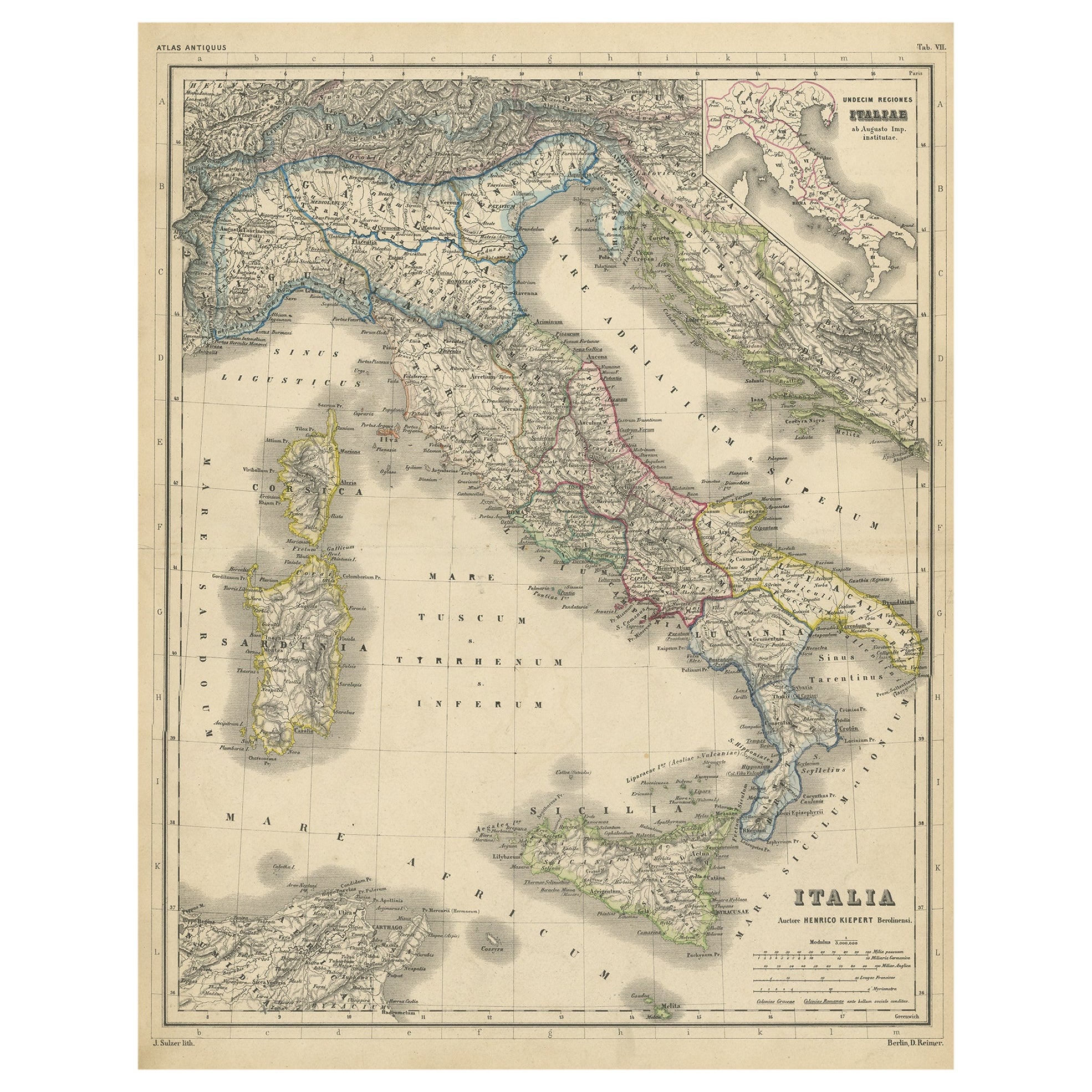
- Attractive Antique Map of Italy with Inset of Maps Showing The Regions, c.1870Located in Langweer, NLAntique map titled 'Italia'. Old map of Italy, with a small inset map depicting the various regions. This map originates from 'Atlas Antiquus, tw...Category
Antique 19th Century Maps
MaterialsPaper
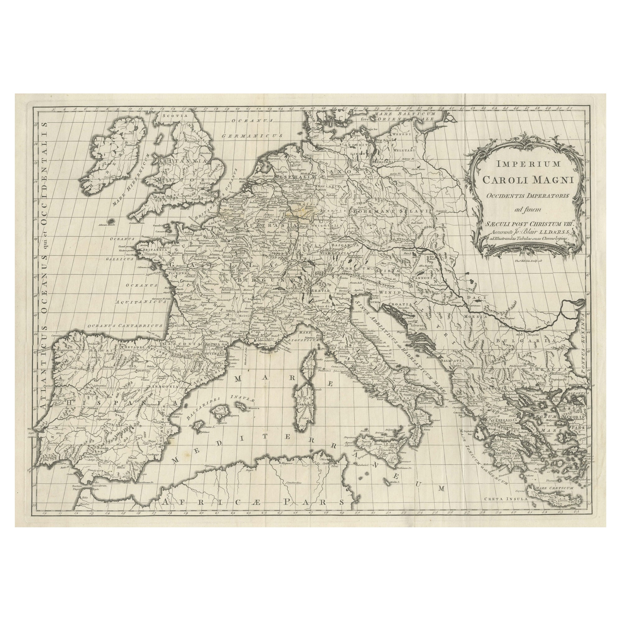
- Large Antique Map of Europe, Showing the Empire of CharlemagneLocated in Langweer, NLAntique map titled 'Imperium Caroli Magni (..)'. Large antique map of Europe, showing the Empire of Charlemagne in the 8th Century. Engraved by T. Kitchin. Published J. Blair, circa ...Category
Antique Late 18th Century Maps
MaterialsPaper
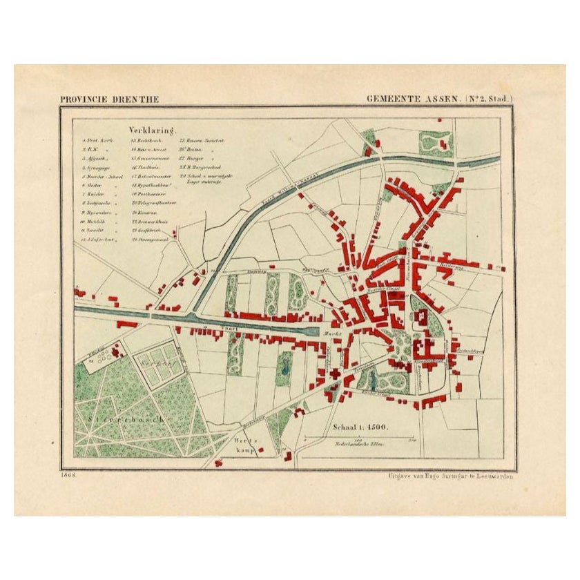
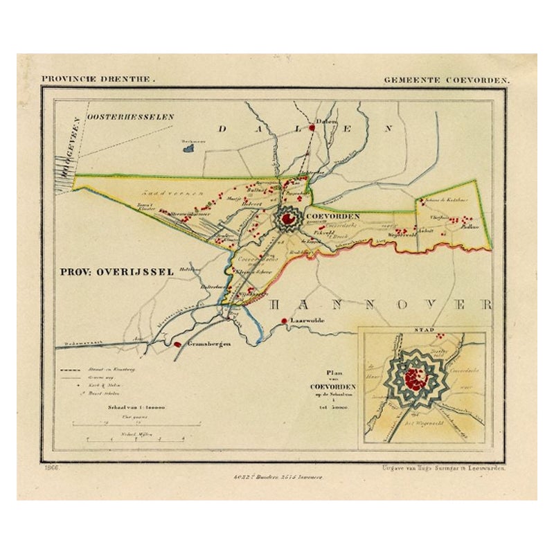
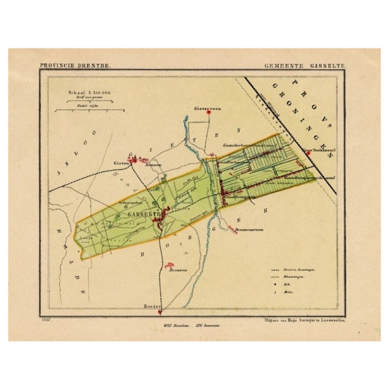
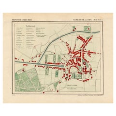
- Antique Map of the City of Assen in The Netherlands, 1865Located in Langweer, NLDrenthe - Gemeente Assen. (no 2, Stad). These scarse detailed maps of Dutch Towns originate from the 'Gemeente-atlas' of Jacob Kuyper. This atlas of all towns in the Netherlands was ...Category
Antique 19th Century Maps
MaterialsPaper
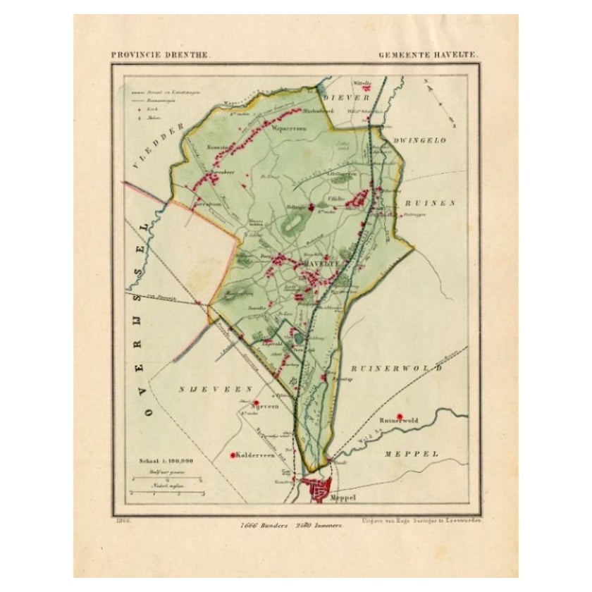
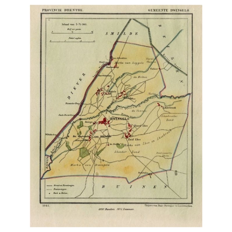
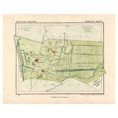
- Antique Map of the Township of Havelte in The Netherlands, 1865Located in Langweer, NLDrenthe: Gemeente Havelte, Wapserveen, Uffelte. These scarse detailed maps of Dutch Towns originate from the 'Gemeente-atlas' of Jacob Kuyper. This atlas of all towns in the Netherla...Category
Antique 19th Century Maps
MaterialsPaper
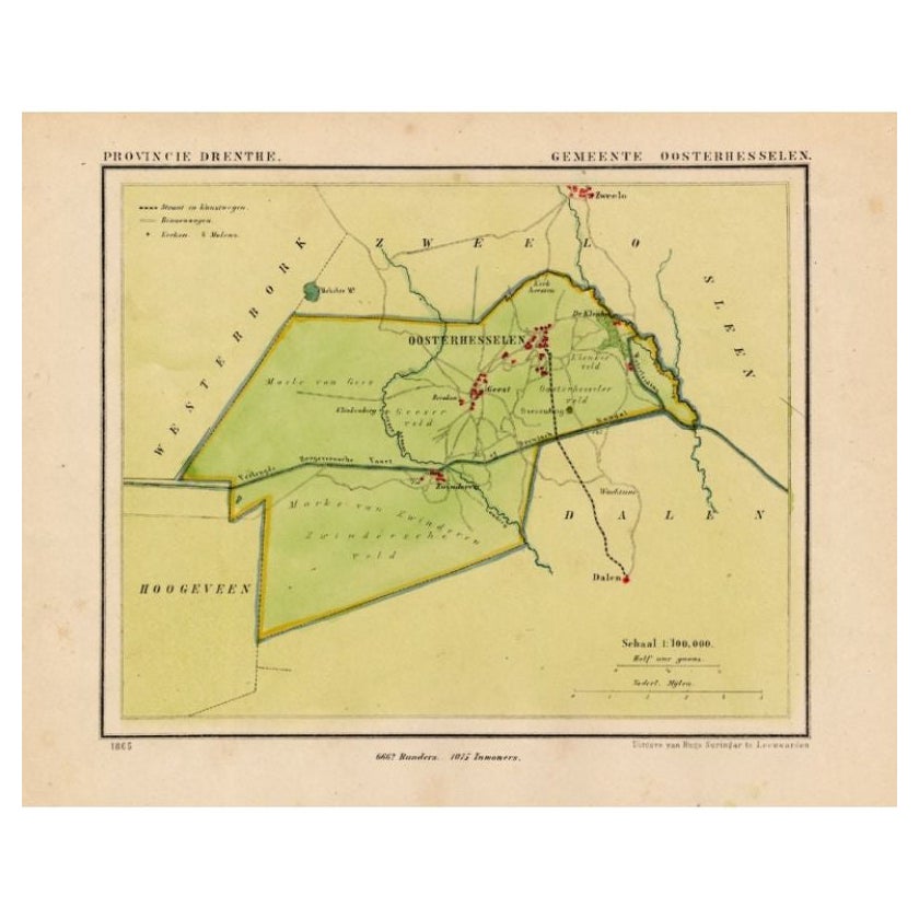
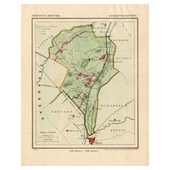
- Antique Map of the Township of Oosterhesselen in the Netherlands, 1865Located in Langweer, NLDrenthe: Gemeente Oosterhesselen, Zwinderen. These scarse detailed maps of Dutch Towns originate from the 'Gemeente-atlas' of Jacob Kuyper. This atlas of all towns in the Netherlands...Category
Antique 19th Century Maps
MaterialsPaper
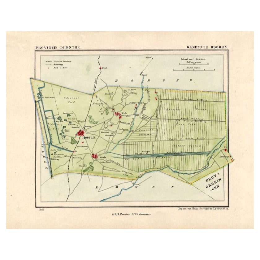
- Antique Map of the Township of Odoorn in the Netherlands, 1865Located in Langweer, NLDrenthe: Gemeente Odoorn, Exlo, Valthe. These scarse detailed maps of Dutch Towns originate from the 'Gemeente-atlas' of Jacob Kuyper. This atlas of all towns in the Netherlands was ...Category
Antique 19th Century Maps
MaterialsPaper


Recently Viewed
View AllMore Ways To Browse
Railroad Collectibles
Savannah Used Furniture
A And J Bell
Alexandria Antique Furniture
Antique Furniture Alexandria
Nashville Used Furniture
Antique Railroad Collectibles Collectibles
Antique Railroad Collectables
Antique Railroad Collectibles
Louis 14th Furniture
Louis 14th
E C Bell
Louis The 14th
Louis The 14th Furniture
Confederate General
Antique Mo
Antique Railroad Maps
Antique Louis The 14th Furniture