Items Similar to 1870 "Johnson's North Carolina and South Carolina" Published by A. J. Johnson

Want more images or videos?
Request additional images or videos from the seller
1 of 7
1870 "Johnson's North Carolina and South Carolina" Published by A. J. Johnson
$995
£748.72
€865.57
CA$1,404.97
A$1,523.40
CHF 808.45
MX$18,762.58
NOK 10,020.22
SEK 9,456.78
DKK 6,460.85
About the Item
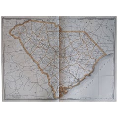
Presented is an original 1870 "Johnson's North Carolina and South Carolina" map. First published in 1865, this map was issued as pages 51 and 52 in the 1870 edition of “Johnson's New Illustrated (Steel Plate) Family Atlas.” The map is engraved, with attractive hand coloring and a decorative border. North Carolina and South Carolina are labeled, outlined in pink, and colored by county. Depicted but not colored are the neighboring states of Georgia, Tennessee, Kentucky, and Virginia. The map is beautifully detailed, with railroads, roads, rivers and creeks, mountain ranges, and important cities and towns all marked. The map also shows the Atlantic Ocean and coastline in nice detail. At bottom right is an inset map of “Map of Charleston Harbor.”
The publishing company of A.J. Johnson was a successor of Johnson and Ward, a successor to Johnson and Browning, themselves a successor to the famous publishing company, J. H. Colton and Company. A combination of both new plates and older, updated ones, all of the maps in this famous 1870 atlas were compiled, drawn, and engraved under the supervision of A. J. Johnson.
This 1870 publication of “Johnson's New Illustrated (Steel Plate) Family Atlas” is also notable for its inclusion of a treatise on physical geography by Professor A. Guyot, marking the first year his essay appeared and his name featured on the cover. The atlas was recognized with a First Prize Medal at the Universal Exposition of 1867 in Paris.
“Johnson's New Illustrated Family Atlas” was a comprehensive world atlas featuring 60 full-color maps. Designed to be both educational and a decorative addition to a home library, it reflected the 19th-century fascination with detailed and ornate cartographic publications. In addition to maps, the atlas included geographical, statistical, and historical information, as well as a dictionary of religious denominations, a testament to its extensive scope and utility. The treatise on physical geography by A. Guyot further demonstrates that period’s growing interest in scientific inquiry, making the atlas a valuable resource not just for navigation and geography, but also for understanding the natural world.
CONDITION:
Fine condition overall. Hand Colored. Page 51 and 52 from “Johnson's New Illustrated (Steel Plate) Family Atlas.” Decorative border. Colored by county in North Carolina and South Carolina, uncolored for bordering states of Georgia, Tennessee, Kentucky, and Virginia. Publication line: "Entered according to Act of Congress in the Year 1865, by A.J. Johnson, in the Clerks Office of the District Court of the United States for the Southern District of New York". Toning to paper, more noticeable along the margins. Full margins, staining at top.
Artfully framed in a custom-built wooden frame with UV glass and acid-free mats.
Framed Dimensions: 23 1/2" H x 30" W x 1" D.
Accompanied by our company's letter of authenticity.
- Dimensions:Height: 23.5 in (59.69 cm)Width: 30 in (76.2 cm)Depth: 1 in (2.54 cm)
- Style:Victorian (Of the Period)
- Materials and Techniques:
- Place of Origin:
- Period:
- Date of Manufacture:1870
- Condition:Additions or alterations made to the original: Framed to archival and conservation standards by Artem Art Services in Colorado Springs, CO in September of 2025. Wear consistent with age and use. Minor fading.
- Seller Location:Colorado Springs, CO
- Reference Number:Seller: M4121stDibs: LU909746597012
About the Seller
4.9
Vetted Professional Seller
Every seller passes strict standards for authenticity and reliability
Established in 2010
1stDibs seller since 2011
464 sales on 1stDibs
- ShippingRetrieving quote...Shipping from: Colorado Springs, CO
- Return Policy
Authenticity Guarantee
In the unlikely event there’s an issue with an item’s authenticity, contact us within 1 year for a full refund. DetailsMoney-Back Guarantee
If your item is not as described, is damaged in transit, or does not arrive, contact us within 7 days for a full refund. Details24-Hour Cancellation
You have a 24-hour grace period in which to reconsider your purchase, with no questions asked.Vetted Professional Sellers
Our world-class sellers must adhere to strict standards for service and quality, maintaining the integrity of our listings.Price-Match Guarantee
If you find that a seller listed the same item for a lower price elsewhere, we’ll match it.Trusted Global Delivery
Our best-in-class carrier network provides specialized shipping options worldwide, including custom delivery.More From This Seller
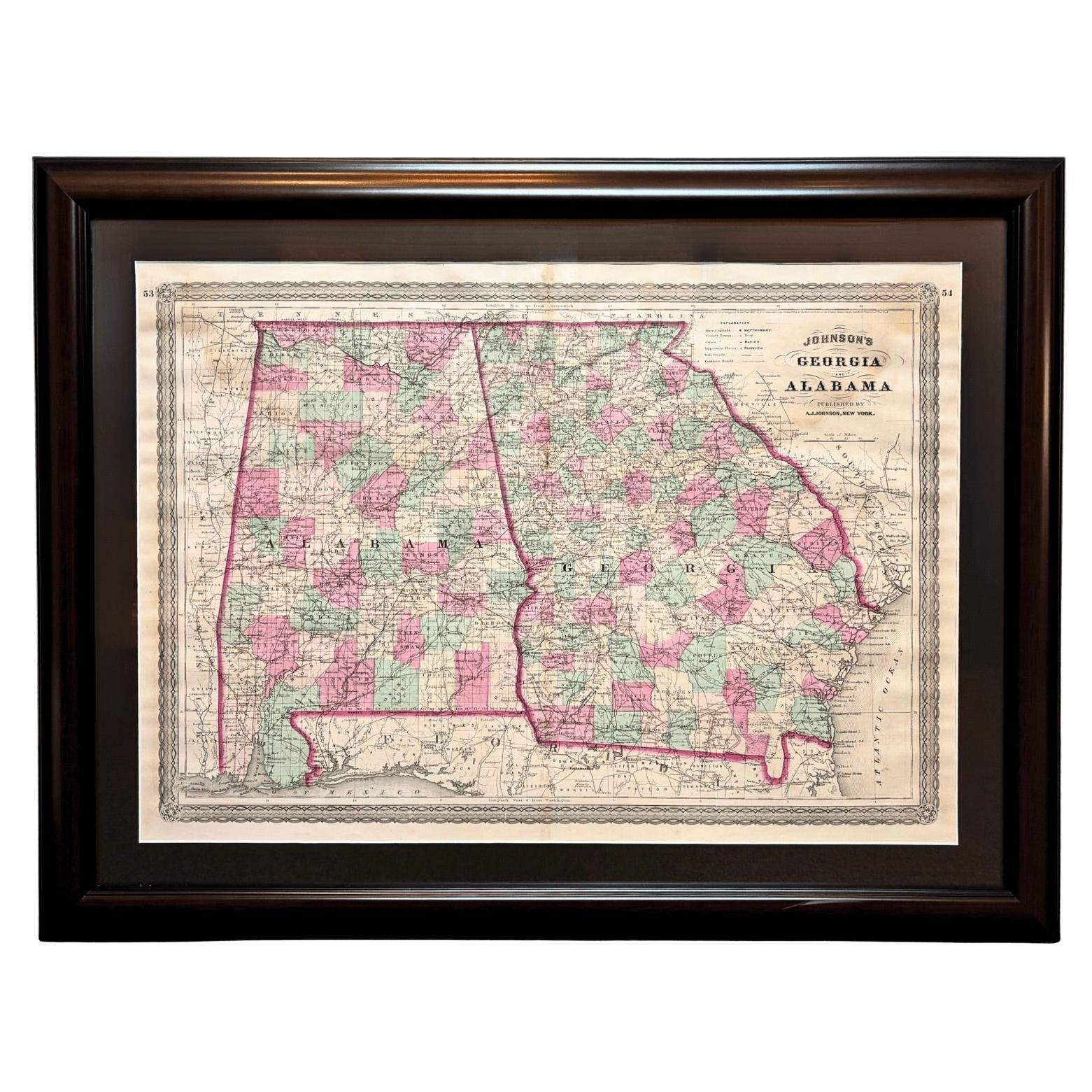
View All1870 "Johnson's Georgia and Alabama" Published by A. J. Johnson
Located in Colorado Springs, CO
Presented is an original 1870 "Johnson's Georgia and Alabama" map. First published in 1863, this map was issued as pages 53 and 54 in the 1870 edition of “Johnson's New Illustrated (...
Category
Antique 1870s American Victorian Maps
Materials
Paper

1866 "Johnson's United States" Map, Published by Johnson and Ward
Located in Colorado Springs, CO
Presented is a detailed map of the United States by A. J. Johnson. Spanning the whole of the continental United States, as well as adjacent parts of Canada and Mexico, the map reflec...
Category
Antique 1860s American Victorian Maps
Materials
Paper

1870 "Johnson's Kentucky and Tennessee" Published by A. J. Johnson
Located in Colorado Springs, CO
Presented is an original 1870 "Johnson's Kentucky and Tennessee" map. First published in 1865, this map was issued as pages 60 and 61 in the 1870 edition of “Johnson's New Illustrate...
Category
Antique 1870s American Victorian Maps
Materials
Paper
1894 "Texas" Map
Located in Colorado Springs, CO
Presented is a very detailed map of Texas, from 1894. The map is very comprehensive, colored by counties, and outlined in red. The map shows the topography, rivers, springs and water...
Category
Antique 1890s American Victorian Maps
Materials
Paper
$950
1856 "Map of the United States" by Ensign, Bridgeman, and Fanning
Located in Colorado Springs, CO
Presented is a scarce American wall map of the United States and Mexico issued by Ensign, Bridgman, and Fanning in 1856. As the title suggests, the map covers all of the United State...
Category
Antique 1850s American Victorian Maps
Materials
Paper

1866 Ensign & Bridgman's Rail Road Map of the United States
Located in Colorado Springs, CO
Presented is an 1866 issue of “Ensign & Bridgeman’s Rail Road Map of the United States, showing Depots & Stations.” First published in 1856, this is the third edition, following anot...
Category
Antique 1860s American Late Victorian Maps
Materials
Paper

You May Also Like
Original Antique Map of the American State of North Carolina, 1903
Located in St Annes, Lancashire
Antique map of North Carolina
Published By A & C Black. 1903
Original colour
Good condition
Unframed.
Free shipping
Category
Antique Early 1900s English Maps
Materials
Paper

Large Original Antique Map of North Carolina, USA, 1894
By Rand McNally & Co.
Located in St Annes, Lancashire
Fabulous map of North Carolina
Original color
By Rand, McNally & Co.
Published, 1894
Unframed
Free shipping.
Category
Antique 1890s American Maps
Materials
Paper

Original Antique Map of the American State of South Carolina, 1903
Located in St Annes, Lancashire
Antique map of South Carolina
Published By A & C Black. 1903
Original colour
Good condition
Unframed.
Free shipping
Category
Antique Early 1900s English Maps
Materials
Paper

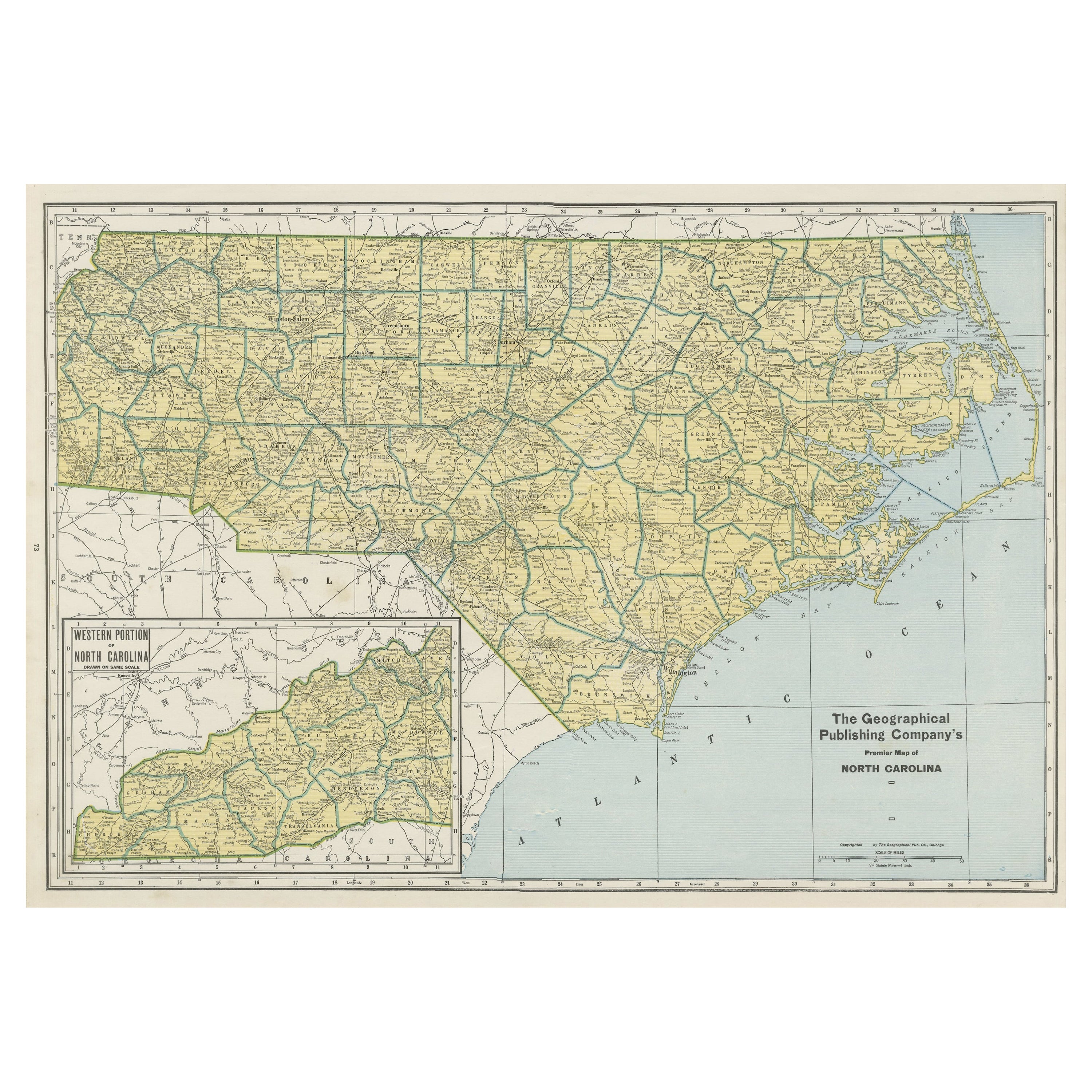
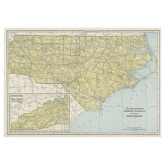
Colourful Old Detailed Map of Northern Carolina, United States of America
Located in Langweer, NL
Vintage map titled 'The Geographical Publishing Company's Premier Map of North Carolina'. Beautiful map of North Carolina. This map originates from Comme...
Category
Early 20th Century Maps
Materials
Paper
$277 Sale Price
20% Off
Antique Map of North Carolina, with inset map of the western part
Located in Langweer, NL
Antique map titled 'North Carolina'. Original antique map of North Carolina, United States. With inset map of the western part of North Carolina....
Category
Antique Late 19th Century Maps
Materials
Paper

$277 Sale Price
20% Off
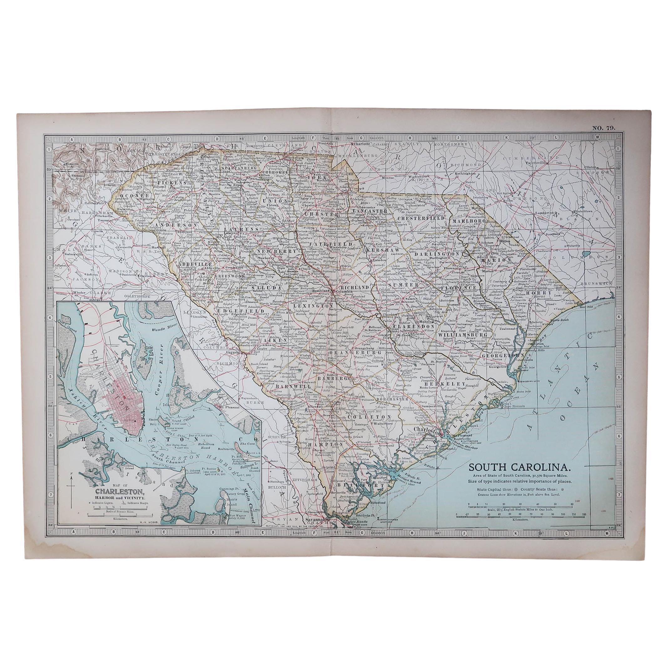
Large Original Antique Map of South Carolina, USA, 1894
By Rand McNally & Co.
Located in St Annes, Lancashire
Fabulous map of South Carolina
Original color
By Rand, McNally & Co.
Published, 1894
Unframed
Free shipping.
Category
Antique 1890s American Maps
Materials
Paper