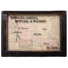
1874 Antique Map of Nebraska, Dakota, Montana, and Wyoming
View Similar Items
Want more images or videos?
Request additional images or videos from the seller
1 of 6
1874 Antique Map of Nebraska, Dakota, Montana, and Wyoming
About the Item
- Dimensions:Height: 15.5 in (39.37 cm)Width: 22 in (55.88 cm)Depth: 1.5 in (3.81 cm)
- Materials and Techniques:
- Place of Origin:
- Period:
- Date of Manufacture:1874
- Condition:Wear consistent with age and use.
- Seller Location:Colorado Springs, CO
- Reference Number:Seller: M1521stDibs: LU909717766352
About the Seller
4.9
Platinum Seller
These expertly vetted sellers are 1stDibs' most experienced sellers and are rated highest by our customers.
Established in 2010
1stDibs seller since 2011
402 sales on 1stDibs
More From This SellerView All
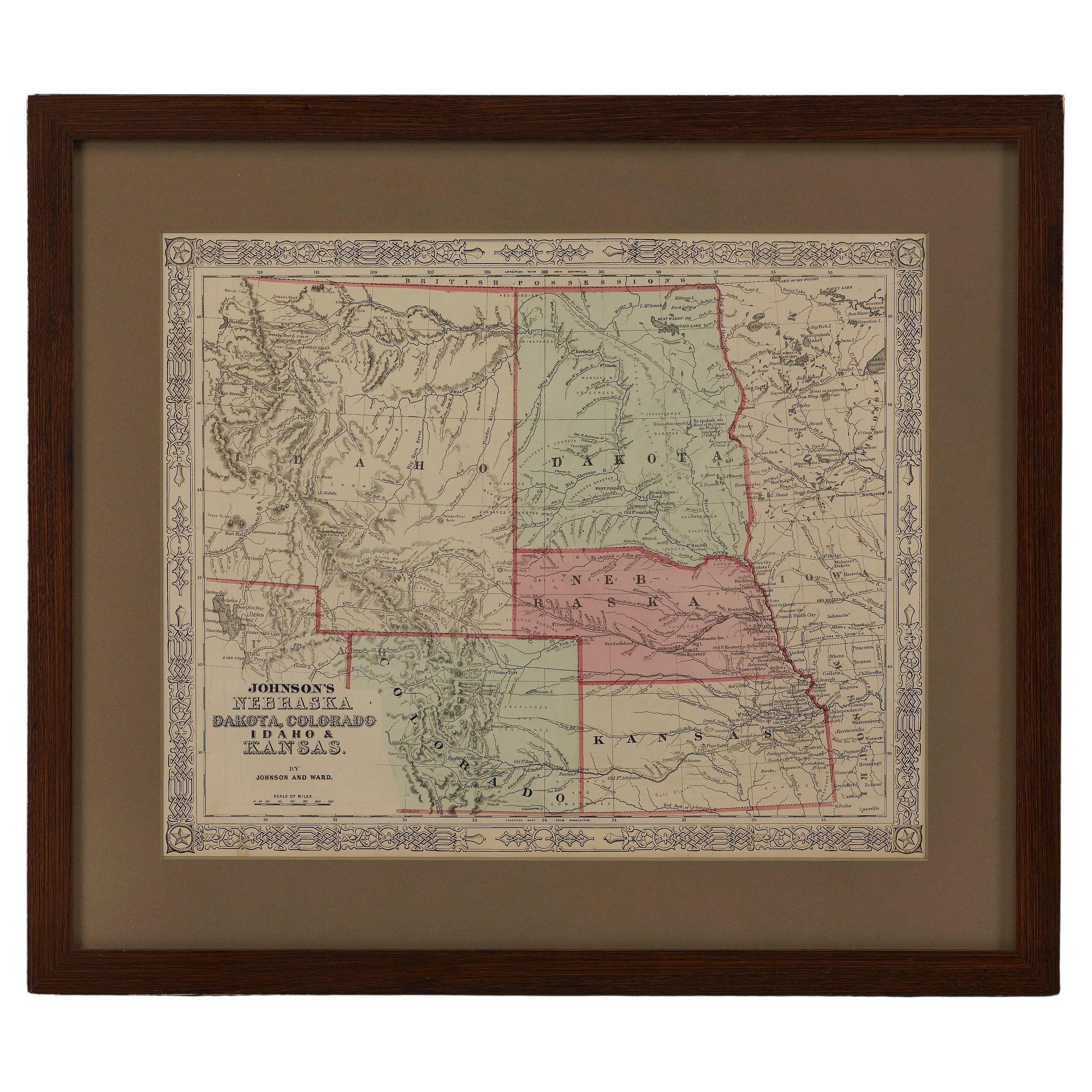
- 1865 "Johnson's Nebraska, Dakota, Colorado, Idaho & Kansas" Map, Johnson & WardLocated in Colorado Springs, COPresented is an original 1865 "Johnson's Nebraska, Dakota, Colorado, Idaho & Kansas” map. This map was issued as page 63 in the 1865 edition of “Johnson's N...Category
Antique Mid-19th Century Maps
MaterialsPaper
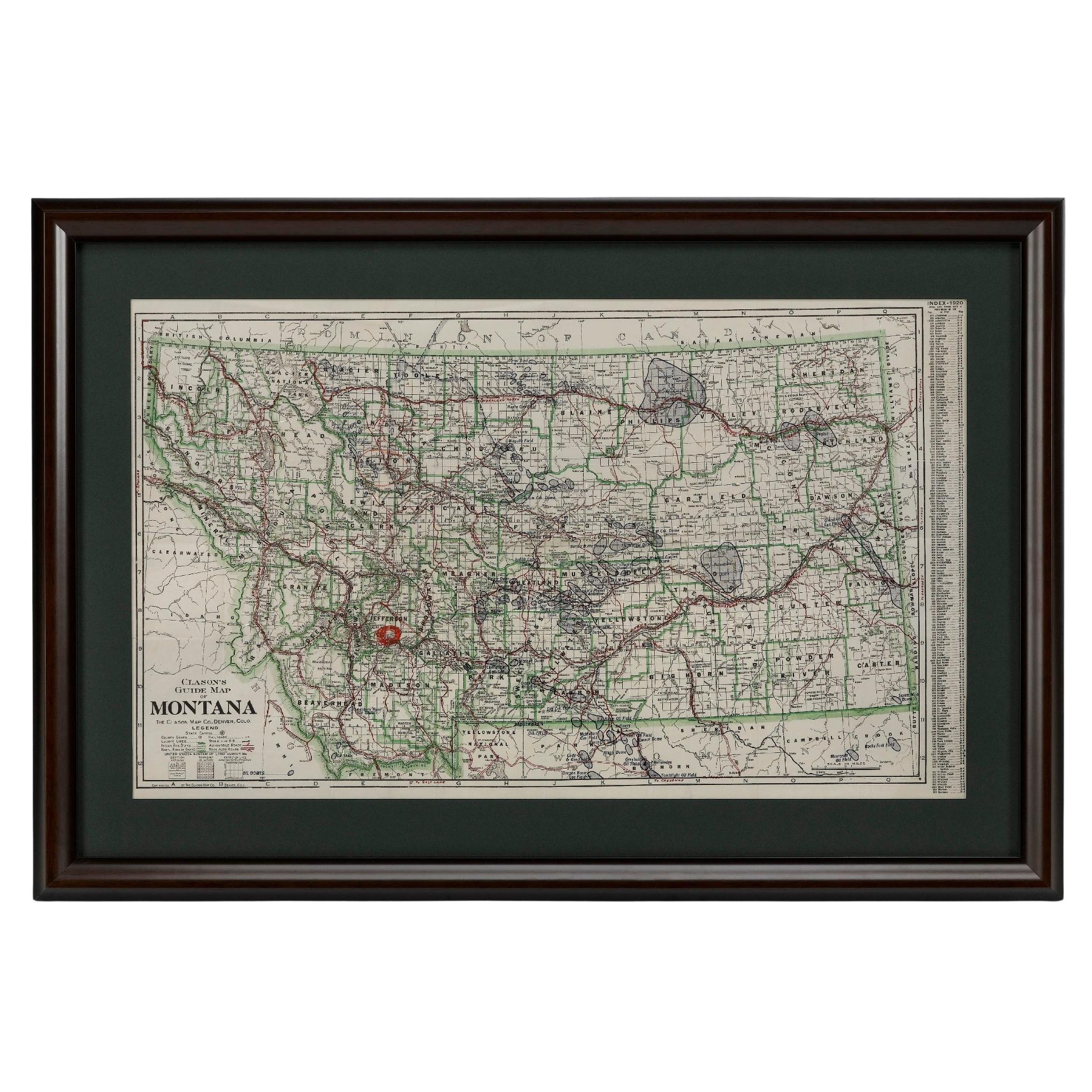
- "Clason's Guide Map of Montana" by The Clason Map Company, Circa 1920sLocated in Colorado Springs, COPresented is “Clason's Guide Map of Montana,” published in the early 1920s by the Clason Map Company. Issued as a folding map, this map identifies county boundaries, county seats, Na...Category
Vintage 1920s American Art Deco Maps
MaterialsPaper
- 1854 Map of Massachusetts, Connecticut and Rhode Island, Antique Wall MapLocated in Colorado Springs, COThis striking wall map was published in 1854 by Ensign, Bridgman & Fanning and has both full original hand-coloring and original hardware. This impression is both informative and highly decorative. The states are divided into counties, outlined in red, green, and black, and subdivided into towns. Roads, canals, and railroad lines are prominently depicted, although they are not all labeled. The mapmakers also marked lighthouses, banks, churches, and prominent buildings, with a key at right. The map is an informative and comprehensive overview of the infrastructural development of New England prior to the Civil War. Physical geographies depicted include elevation, conveyed with hachure marks, rivers and lakes. The impression features an inset map of Boston...Category
Antique 19th Century American Maps
MaterialsPaper
- 1861 Topographical Map of the District of Columbia, by Boschke, Antique MapLocated in Colorado Springs, COPresented is an original map of Albert Boschke's extremely sought-after "Topographical Map of the District of Columbia Surveyed in the Years 1856 ...Category
Antique 1860s American Historical Memorabilia
MaterialsPaper
- 1907 Map of Colorado, Antique Topographical Map, by Louis NellLocated in Colorado Springs, COThis highly detailed pocket map is a topographical map of the state of Colorado by Louis Nell from 1907. The map "has been complied from all availabl...Category
Antique Early 1900s American Maps
MaterialsPaper
- 1847 Antique Map of Mexico, Texas and California by Samuel Augustus MitchellBy Samuel Augustus Mitchell 1Located in Colorado Springs, COPresented is the second edition of Samuel Augustus Mitchell's Map of Mexico, Including Yucatan & Upper California, an important map showing the progress of the Mexican-American War. ...Category
Antique 1840s American Maps
MaterialsPaper


You May Also Like
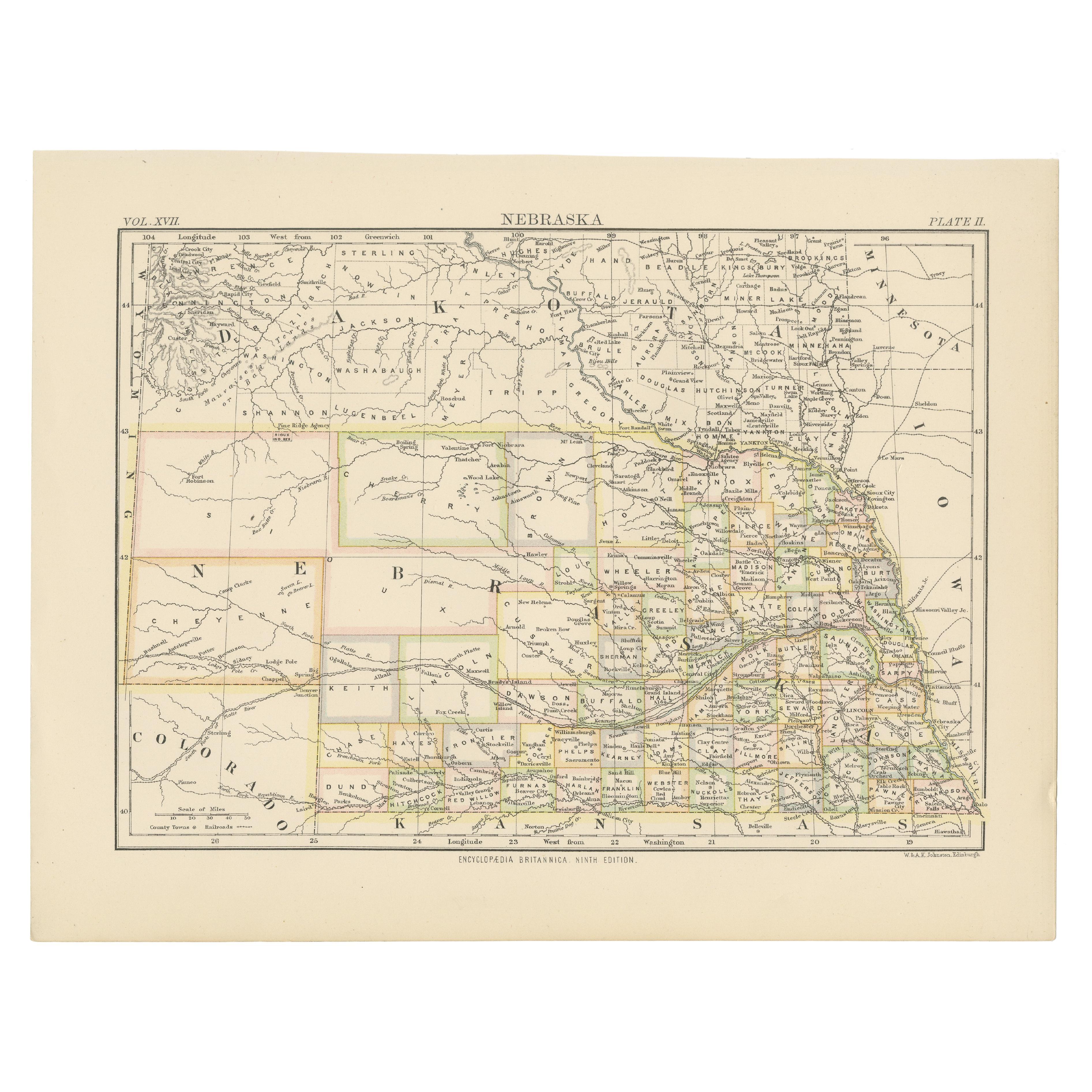
- Antique Map of NebraskaLocated in Langweer, NLAntique map titled 'Nebraska'. Original antique map of Nebraska, United States. This print originates from 'Encyclopaedia Britannica', Ninth Edition. Pu...Category
Antique Late 19th Century Maps
MaterialsPaper
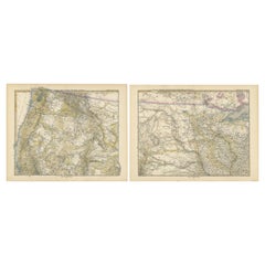
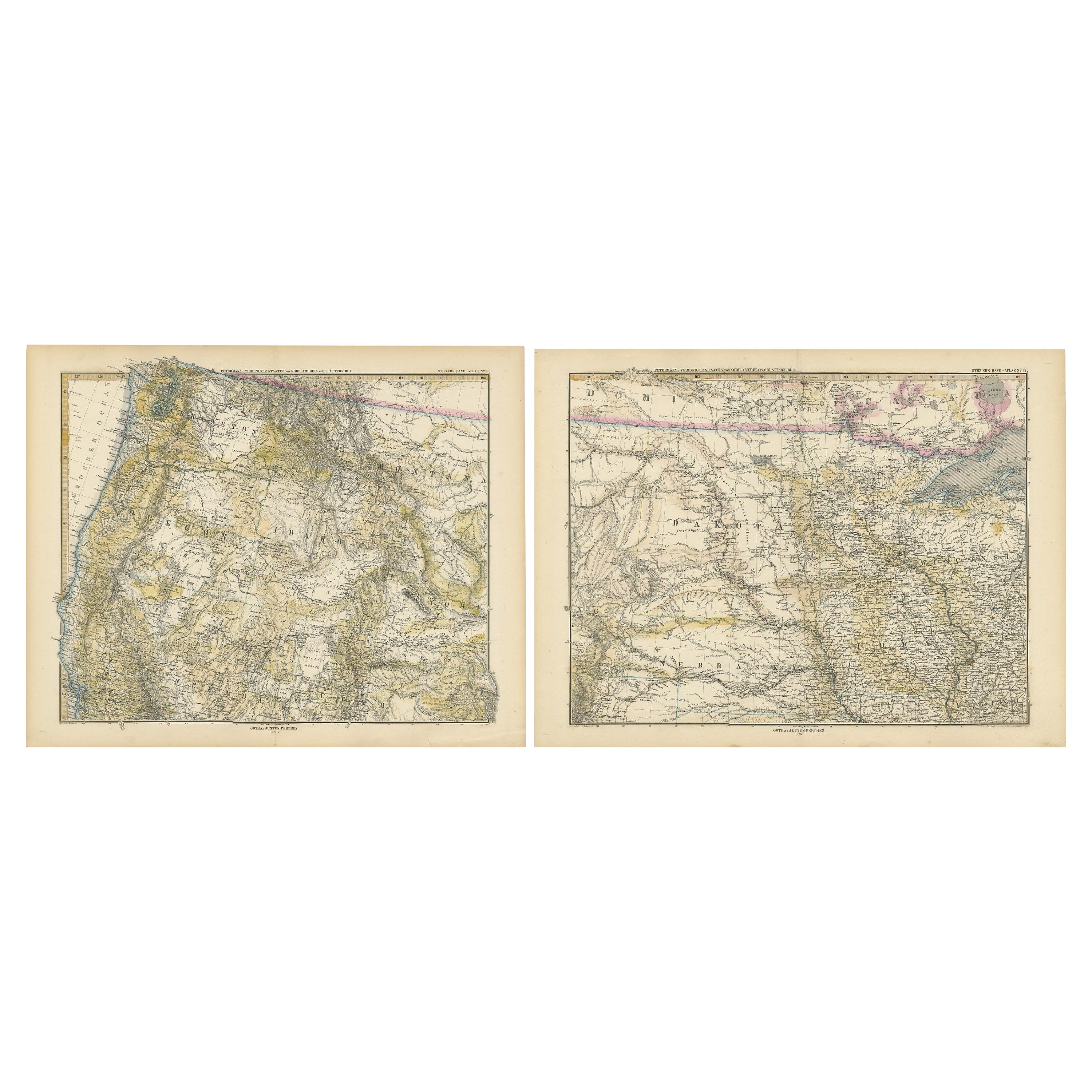
- Set of two Antique Maps of the region of Oregon, Idaho, Wyoming, Nebraska & IowaLocated in Langweer, NLSet of two individual antique maps of part of the United States. It shows the region and surroundings of Oregon, Idaho, Wyoming, Nebraska, Iowa, Dakota and Wisconsin. Published as pa...Category
Antique Late 19th Century Maps
MaterialsPaper
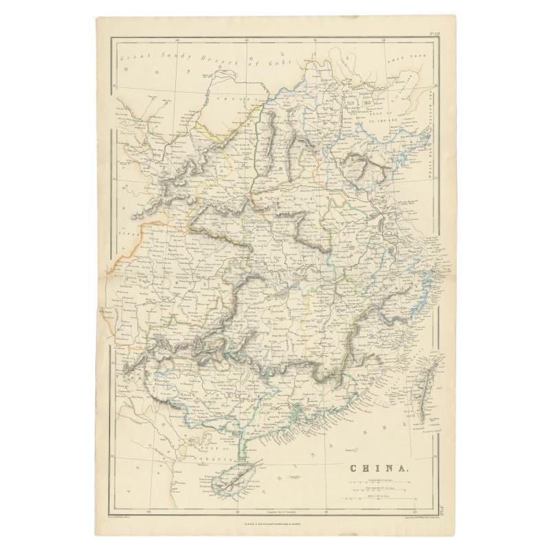
- Antique Map of China, 1874Located in Langweer, NLAntique map titled 'China'. Detailed map of China originates from Blackie's 'The Comprehensive Atlas & Geography of the World'. Artists and Engravers: ...Category
Antique 19th Century Maps
MaterialsPaper
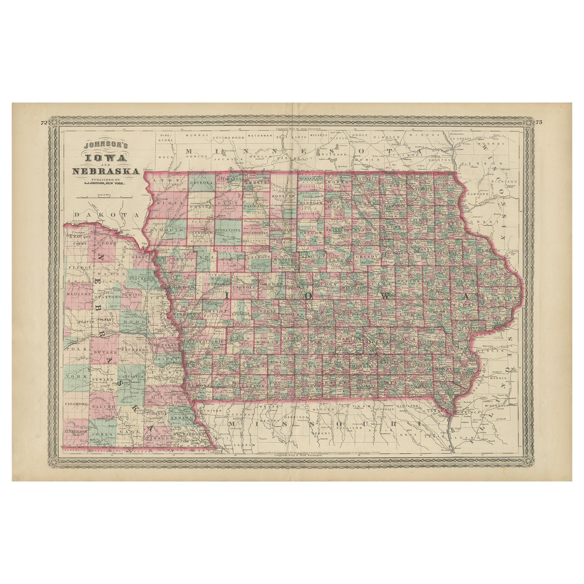
- Antique Map of Iowa and Nebraska by Johnson, '1872'Located in Langweer, NLAntique map titled 'Johnson's Iowa and Nebraska'. Original map of Iowa and Nebraska. This map originates from 'Johnson's New Illustrated Family Atlas of th...Category
Antique Late 19th Century Maps
MaterialsPaper
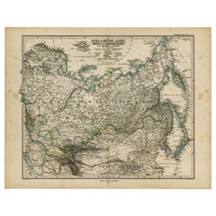
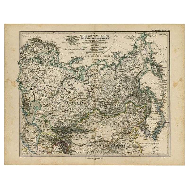
- Antique Map of Russia and Surroundings by Stieler, 1874Located in Langweer, NLAntique map titled 'Nord- & Mittal-Asien, Ubersicht des Russischen Reiches.' A map of Russia in scale 1:20.000.000. The depicted area spans from Iran and Sweden in the left edge of t...Category
Antique 19th Century Maps
MaterialsPaper
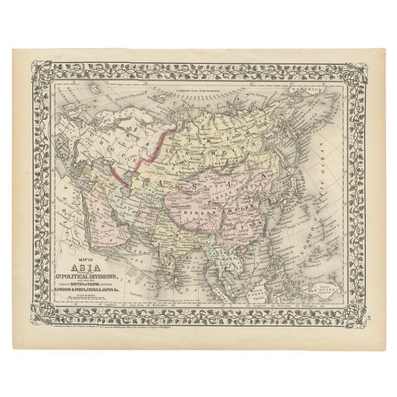
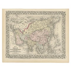
- Antique Map of Asia Showing Its Political Divisions, 1874Located in Langweer, NLAntique map titled 'Map of Asia showing its Gt. Political Divisions and also the various routes of Travel between London & India, China & Japan & c'. This map covers from the Arabian...Category
Antique 19th Century Maps
MaterialsPaper
 $79 Sale Price20% Off