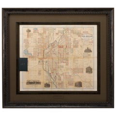
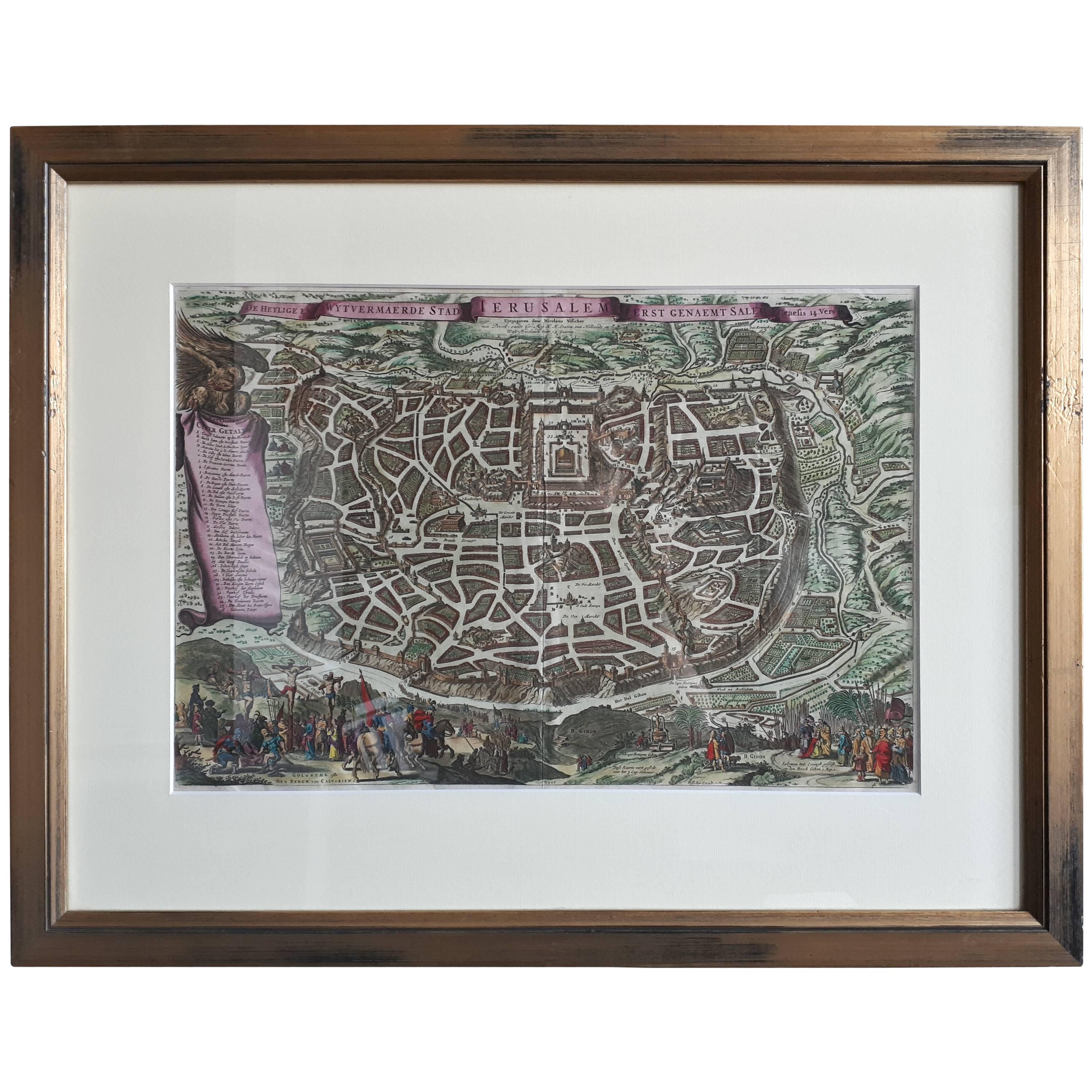
1883 The City of Denver, Colorado, Published by H.L. Thayer, Antique Map
View Similar Items
Want more images or videos?
Request additional images or videos from the seller
1 of 6
1883 The City of Denver, Colorado, Published by H.L. Thayer, Antique Map
About the Item
- Dimensions:Height: 43.5 in (110.49 cm)Width: 48.5 in (123.19 cm)Depth: 2.5 in (6.35 cm)
- Materials and Techniques:
- Place of Origin:
- Period:
- Date of Manufacture:1883
- Condition:Additions or alterations made to the original: This map has been archivally framed in a custom-built wooden frame. It was framed in 2018 by Art Source International Framing in Boulder, CO. Wear consistent with age and use. Minor fading.
- Seller Location:Colorado Springs, CO
- Reference Number:Seller: M2131stDibs: LU909714011502
About the Seller
4.9
Platinum Seller
These expertly vetted sellers are 1stDibs' most experienced sellers and are rated highest by our customers.
Established in 2010
1stDibs seller since 2011
400 sales on 1stDibs
More From This SellerView All
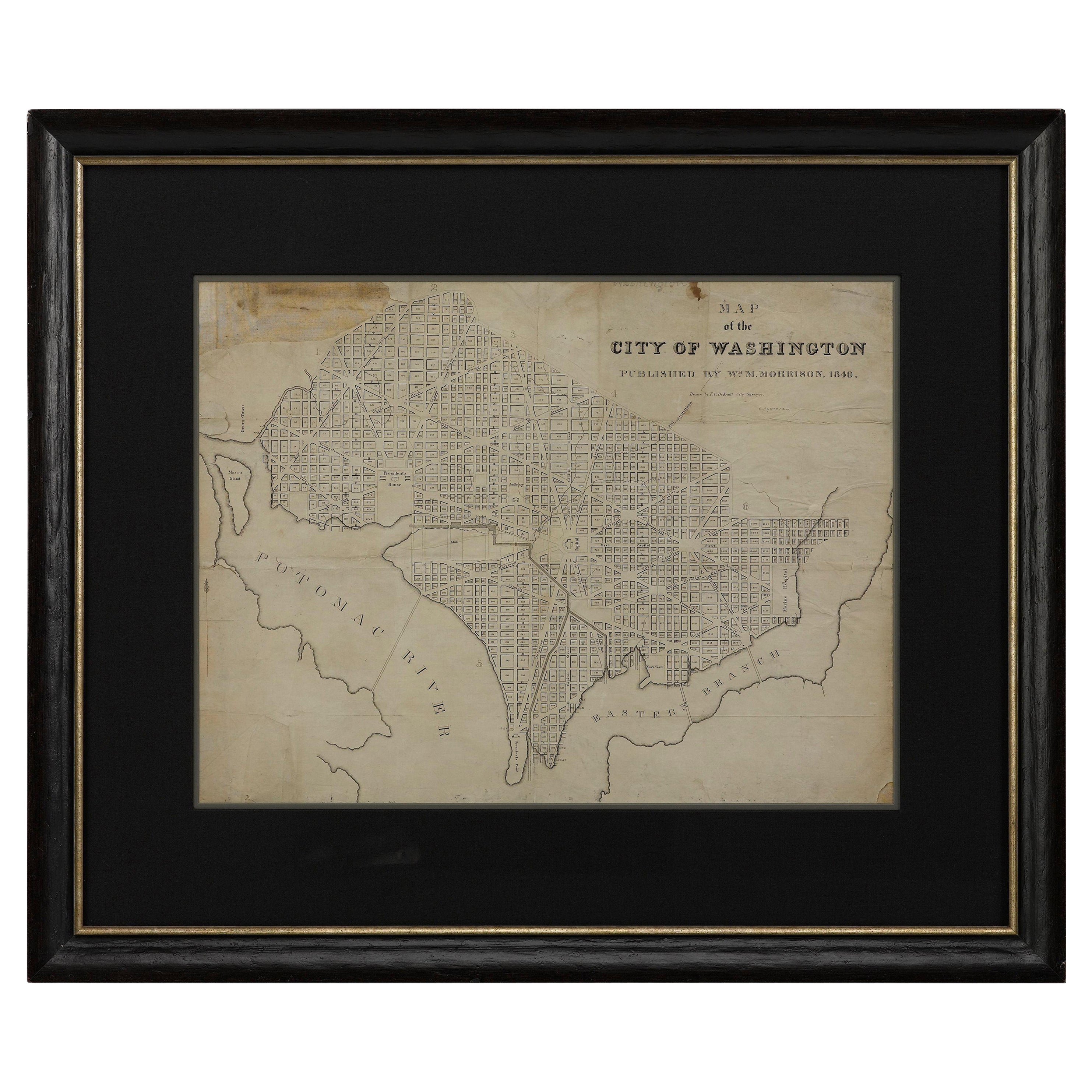
- 1840 Map of the City of Washington Published by William M. MorrisonLocated in Colorado Springs, COThis map, printed in 1840, is a detailed representation of Washington, D.C. in the mid-19th century. The map shows block numbers, wards, and government buildings as well as details o...Category
Antique 1840s American Federal Maps
MaterialsPaper
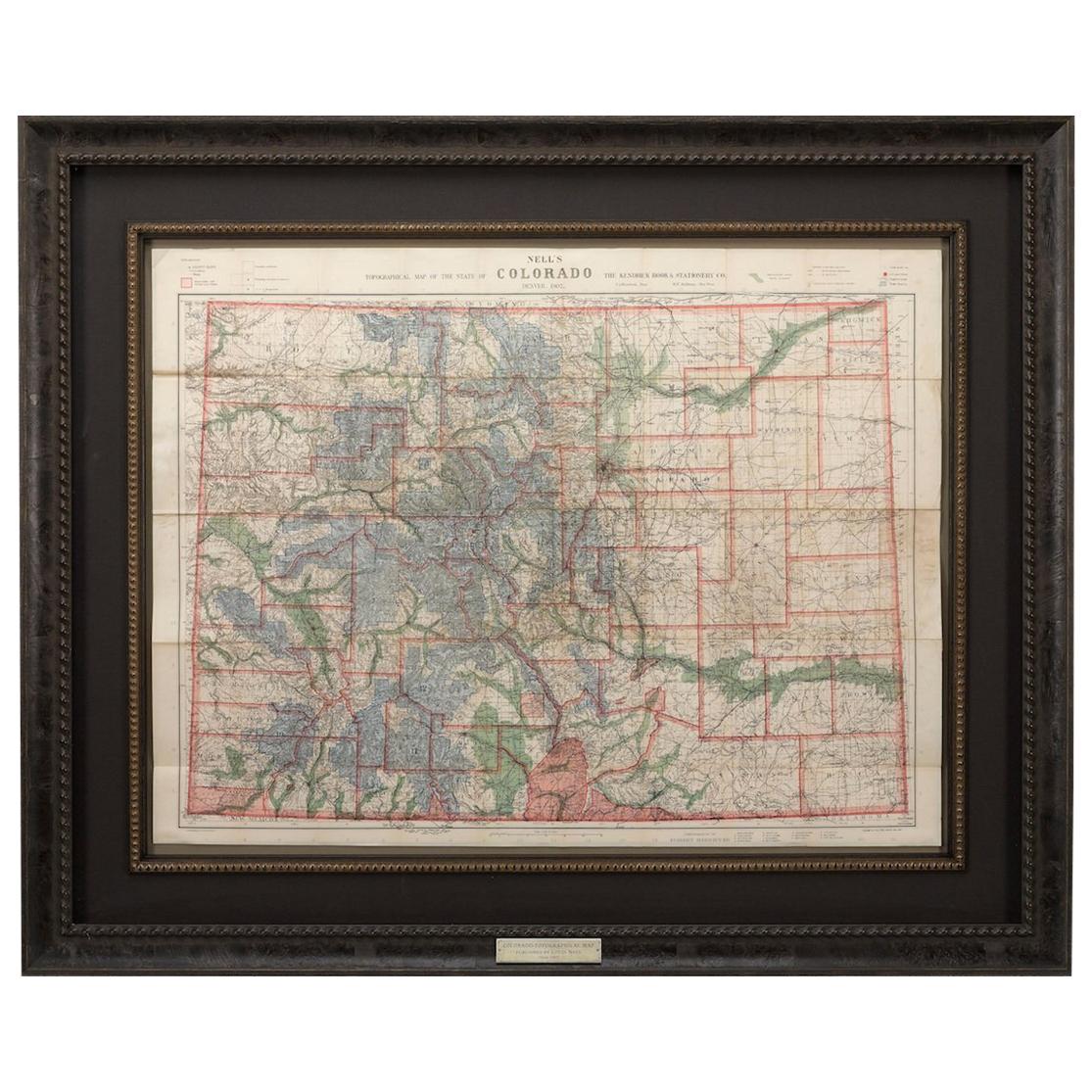
- 1907 Map of Colorado, Antique Topographical Map, by Louis NellLocated in Colorado Springs, COThis highly detailed pocket map is a topographical map of the state of Colorado by Louis Nell from 1907. The map "has been complied from all availabl...Category
Antique Early 1900s American Maps
MaterialsPaper
- 1842 Wall Map of the United States by J. H. Young, Published by S. A. MitchellLocated in Colorado Springs, COPresented is an 1842 hanging “Map of the United States,” engraved by J. H. Young and published by Samuel Augustus Mitchell, Philadelphia. This is a beautiful example of the rare 1842...Category
Antique 1840s American Maps
MaterialsPaper
- 1861 Topographical Map of the District of Columbia, by Boschke, Antique MapLocated in Colorado Springs, COPresented is an original map of Albert Boschke's extremely sought-after "Topographical Map of the District of Columbia Surveyed in the Years 1856 ...Category
Antique 1860s American Historical Memorabilia
MaterialsPaper
- 1840 "New Map of the City of New York With Part of Brooklyn & Williamsburg"Located in Colorado Springs, COPresented is a hand-colored, engraved folding map titled "New Map of the City of New York With Part of Brooklyn & Williamsburg" by J. Calvin Smith. The map was issued bound in the bo...Category
Antique 1840s American Maps
MaterialsPaper
- 1812 United States Map, by Pierre Tardieu, Antique French Map Depicting the U.S.By Pierre François TardieuLocated in Colorado Springs, CO1812 "United States of Nth America -- Carte des Etats-Unis De L'Amerique Septentrionale" Two-Sheet Map by Tardieu This attractive map, published in Paris in 1812, is one of the most rare large format maps from the period. It features a view of the East Coast of the U.S. from Maryland to just below South Carolina. Additionally, Ellicott’s plan for the City of Washington D.C. is included at the top right and an illustration of Niagara Falls is shown at the bottom right with a description in both French and English. This extremely detailed map not only depicts the mountainous regions of the southeastern U.S., but also includes names of regions, rivers, and towns. Based on the first state of Arrowsmith’s 4-sheet map of the United States, this map is completely engraved by Tardieu in Paris and showcases high quality engravings. This detailed map of the recently independent United States includes one of the largest and earliest examples of the Ellicott plan of Washington DC. The artist, Pierre François Tardieu (PF Tardieu) was a very well-known map engraver, geographer, and illustrator. Awarded a bronze medal by King Louis-Phillipe for the accuracy and beauty of his map-making, Tardieu produced many fine works including maps of Louisiana...Category
Antique 1810s French Maps
MaterialsPaper


You May Also Like
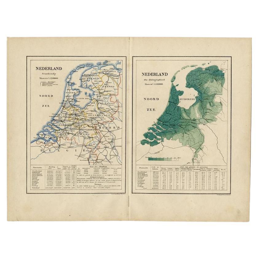
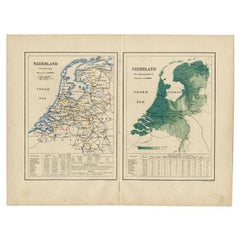
- Antique Map of the Netherlands by Kuyper, 1883Located in Langweer, NLAntique map titled 'Nederland Staatkundig - Nederland Oro-Hydrographisch'. Political and orohydrographic map of the Netherlands, two maps on one...Category
Antique 19th Century Maps
MaterialsPaper
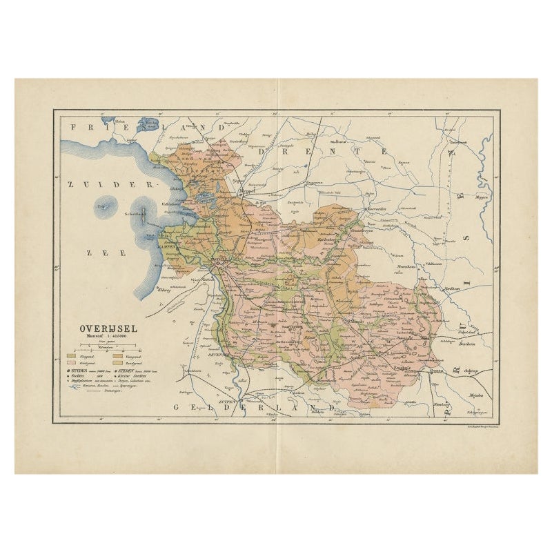
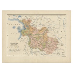
- Antique Map of Overijssel by Kuyper, 1883Located in Langweer, NLAntique map titled 'De Provincie Overijssel'. Map of the province of Overijssel, the Netherlands. This map originates from 'F. C. Brugsma's Atlas van het Koninkrijk der Nederlanden (...Category
Antique 19th Century Maps
MaterialsPaper
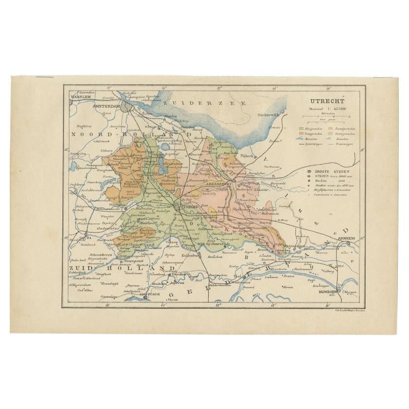
- Antique Map of Utrecht in The Netherlands, 1883Located in Langweer, NLAntique map titled 'Utrecht'. Map of Utrecht, a province of the Netherlands. This map originates from 'Atlas van Nederland volgens de nieuwe spelregels' by J. Kuyper. Artists and En...Category
Antique 19th Century Maps
MaterialsPaper
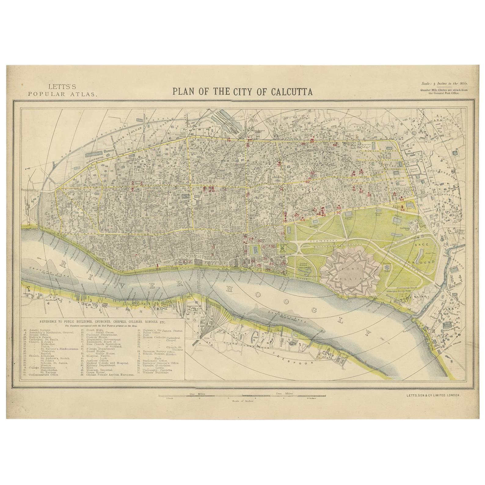
- Antique Plan of the City of Calcutta 'India' by Letts, 1883Located in Langweer, NLBeautiful colored plan showing buildings (with key), Fort William, race ground, canals, railroads, etc. This plan originates from Letts's Popular Atlas.Category
Antique Late 19th Century Maps
MaterialsPaper
 $274 Sale Price33% Off
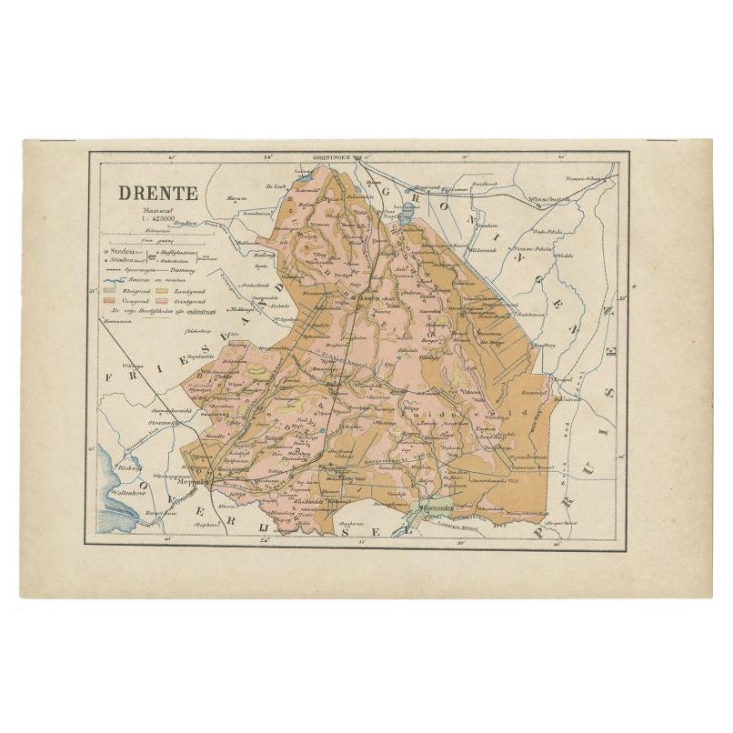
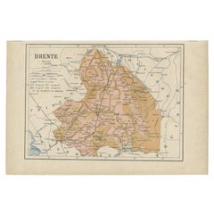
 - Antique Map of Drenthe, Province in the Netherlands, 1883Located in Langweer, NLAntique map titled 'Drenthe'. Map of Drenthe, a province of the Netherlands. This map originates from 'Atlas van Nederland volgens de nieuwe spelregels' by J. Kuyper. Artists and ...Category
Antique 19th Century Maps
MaterialsPaper
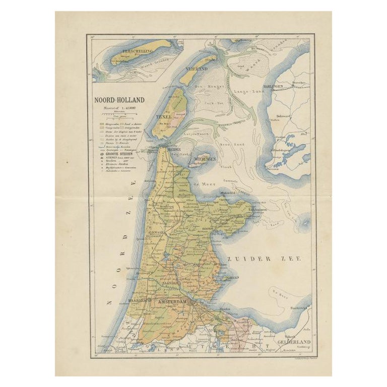
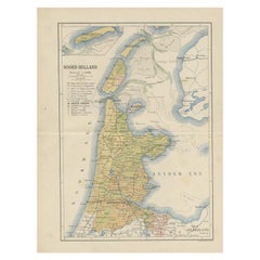
- Antique Map of the Dutch Province of Noord-Holland, 1883Located in Langweer, NLAntique map titled 'Noord-Holland'. Map of Noord-Holland, a province of the Netherlands. This map originates from 'Atlas van Nederland volgens de nieuwe spelregels' by J. Kuyper. Art...Category
Antique 19th Century Maps
MaterialsPaper

Recently Viewed
View AllMore Ways To Browse
Railroad Collectibles
Antique Furniture Oregon
Denver Used Office Furniture
Antique Railroad Collectibles Collectibles
Antique Railroad Collectables
Antique Railroad Collectibles
Antique Map California
Antique Maps California
Antique Map Of California
Antique Maps Of California
California Antique Map
Colorado Mining
Pocket Map
Fisher Antique
Gold Silver Map
Antique Railroad Maps
Antique Hand Colored Photograph
Windsor House Antiques