Maps
to
1,936
2,521
131
2,657
79
18
9
6
5
4
4
4
3
1
1
2,936
2,181
476
3
289
34
10
127
7
35
9
2
5
4
4
2
2,579
92
35
30
30
329
228
143
126
112
2,657
2,657
2,657
104
29
9
8
7
Maps For Sale
Period: 20th Century
Period: 19th Century
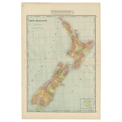
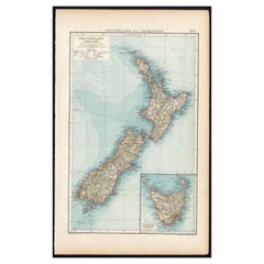
Antique Map of New Zealand by G.F. Cram, 'circa 1906'
Located in Langweer, NL
Antique map titled 'New Zealand'. Large map of New Zealand with a small legend of the Chatham Islands. On the verso, a map of the North Polar regions and a map of Tasmania can be fou...
Category
20th Century Maps
Materials
Paper
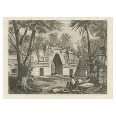
Original Rare Antique Print of a Ruin in Peru, 1857
Located in Langweer, NL
Untitled print of a ruin in Peru. This print originates from 'Die Kunstwerke vom Alterthum bis auf die Gegenwart, oder, Wegweiser durch das ganze Gebiet der bildenden Kunst : enthalt...
Category
19th Century Antique Maps
Materials
Paper
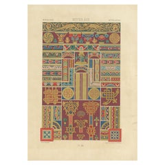
Pl. 40 Antique Print of Decorative Art in the Middle Ages by Racinet, 1869
Located in Langweer, NL
Old print of decorative art in the Middle Ages. This print originates from 'L'Ornement polychrome'. A beautiful work containing about...
Category
19th Century Antique Maps
Materials
Paper
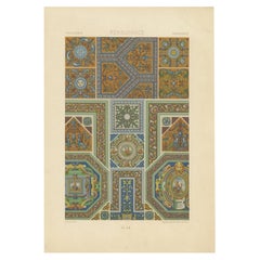
Pl. 65 Antique Print of Decorative Art in the Renaissance Period by Racinet, 1869
Located in Langweer, NL
Old print of decorative art in the Renaissance period. This print originates from 'L'Ornement polychrome'. A beautiful work containing about 2000 patterns of all the styles of Art ol...
Category
19th Century Antique Maps
Materials
Paper
Antique Map of New Zealand and Tasmania, 1904
Located in Langweer, NL
This large antique map is taken from; 'Andrees Allgemeiner Handatlas in 126 Haupt-Und 139 Nebenkarten', Bielefeld; Leipzig: Velhagen & Klasing 1899. Andrees Allgemeiner Handatlas was...
Category
20th Century Maps
Materials
Paper
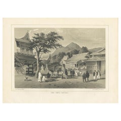
Antique Print of the Chief Temple in Hakodate in Japan, 1856
Located in Langweer, NL
Antique print titled ‘Chief Temple Hakodadi‘. View of the chief temple in Hakodate, Japan. This print originates from 'Narrative of the expedition of an American squadron to the Chin...
Category
19th Century Antique Maps
Materials
Paper
Antique Map of Persia and Tartary by Lowry, '1852'
Located in Langweer, NL
Antique map titled 'Persia and Tartary'. Original map of Persia and Tartary. This map originates from 'Lowry's Table Atlas constructed and engraved from the most recent Authorities' ...
Category
Mid-19th Century Antique Maps
Materials
Paper
Antique Colored Belgium Map Flandria Gallica Flanders Henricus Hondius
Located in Dayton, OH
Antique hand colored map of Flanders, Belgium, engraved by Henricus Hondius.
Sans frame - 21.25” x 18”.
Category
19th Century Renaissance Antique Maps
Materials
Paper
Antique Print of Decorative Art in the Renaissance Period, 1869
Located in Langweer, NL
Old print of decorative art in the Renaissance period. This print originates from 'L'Ornement polychrome'. A beautiful work containing about 2000 patterns of all the styles of Art ol...
Category
19th Century Antique Maps
Materials
Paper
Map of the Southeastern USA and Atlantic States – Vintage 1903 Geography
Located in Langweer, NL
Map of the Southeastern USA and Atlantic States – Vintage 1903 Geography
This original engraved map, titled “United States of North America (South Eastern Sheet) with the Atlantic S...
Category
Early 20th Century Maps
Materials
Paper
Original Antique Print of Byzantine Decorative Art, 1869
Located in Langweer, NL
Old print of Byzantine decorative art. This print originates from 'L'Ornement polychrome'. A beautiful work containing about 2000 patterns of all the styles of Art old and Asian, mid...
Category
19th Century Antique Maps
Materials
Paper
Old Map of the Oceans Around Australia, Indonesia and New Zealand, 1880
Located in Langweer, NL
Antique map titled 'Océanie'.
Old map of the oceans around Australia, Indonesia and New Zealand. With vignettes of people from Polynesia and the old monument Laparouse. This map ...
Category
1880s Antique Maps
Materials
Paper
Antique Map of Moldova to Thessaly and from the Adriatic to the Black Sea, 1880
Located in Langweer, NL
Antique map titled 'Turquie d'Europe'.
Map of the european parts of Turkey. The map covers from Moldova to Thessaly and from the Adriatic to the Black Sea. Greece and the island ...
Category
1880s Antique Maps
Materials
Paper
Antique Map of Sweden by Delamarche, 1806
Located in Langweer, NL
Antique map titled 'La Suede.' Decorative map of Sweden and part of Finland by Robert de Vaugondy, revised and published by Delamarche. Source unknown, t...
Category
19th Century Antique Maps
Materials
Paper
Antique Print of the State Bedroom of Warwick Castle, River Aron, England, c1850
Located in Langweer, NL
Antique print titled 'State Bedroom-Warwick Castle'.
Lithograph of the State Bedroom of the famous Warwick Castle in England.
Warwick Castle is a medieval castle developed fro...
Category
19th Century Antique Maps
Materials
Paper
Antique Map of The World in Hemispheres by W. G. Blackie, 1859
Located in Langweer, NL
Antique map titled 'The World in Hemispheres with other projections'. Original antique map of The World. This map originates from ‘The Imperial Atlas of Modern Geography’. Published ...
Category
Mid-19th Century Antique Maps
Materials
Paper
Print of a Fortified Mosque and of Nobility in Aceh, Sumatra, Indonesia, 1874
Located in Langweer, NL
Antique print Indonesia titled 'Een versterkte Missigit' and 'Atchineezen'. Antique print depicting two scenes in Indonesia. Originates from 'De Oorlog tusschen Nederland en Atchin' ...
Category
19th Century Antique Maps
Materials
Paper
Ceremony for the Son of the King in the Village of Mua on Tongatapu, Tonga, 1803
Located in Langweer, NL
Antique print titled 'De Natsche, eene plechtigheid ter eere van 's Konings Zoon op Tongataboo'.
Antique print depiciting a ceremony for the son of the King of Tonga in the villa...
Category
Early 1800s Antique Maps
Materials
Paper
Original Antique Print of a Castle in Madrid, Spain, 1833
Located in Langweer, NL
Antique print titled 'Schloss zu Madrid'.
Lithograph of a castle in Madrid, Spain. This print originates from 'Neuen Bildergalerie für die Jugend'.
Artists and Engravers: Ano...
Category
1830s Antique Maps
Materials
Paper
Antique Map of Oceania by Levasseur, '1875'
Located in Langweer, NL
Antique map titled 'Carte générale de l'Océanie'. Large map of Oceania. This map originates from 'Atlas de Géographie Moderne Physique et Politique' by A. Levasseur. Published 1875.
Category
Late 19th Century Antique Maps
Materials
Paper
Antique Map of Italy and Corsica, c.1860
Located in Langweer, NL
Antique map titled 'North & Central Italy and the Island of Corsica'.
Old map of North and Central Italy, and the island of Corsica. With an inset map of the region of Rome. Orig...
Category
19th Century Antique Maps
Materials
Paper
1863 "Lloyd's New Map of the United States, the Canadas, and New Brunswick"
Located in Colorado Springs, CO
Presented is “Lloyd's New Map of the United States, the Canadas and New Brunswick, From the latest Surveys, Showing Every Railroad & Station Finished to June 1863, and the Atlantic and Gulf Coasts.” A large, Civil War-era hanging map of the United States and adjacent territories, this map covers the area from the Atlantic Ocean and extends as far west as the 103 meridian, to “Dacotah,” Nebraska, Kansas, "Indian Territory," and Texas. The southern continuation of Florida is shown in an inset map along the right margin. This map was published by J. T. Lloyd, in New York, in 1863. According to the publisher’s marking at lower right, this map was originally issued in two states: "in Sheets, Colored" for 50 cents, and "Varnished nicely, with Rollers" for $1.
Throughout the map, the counties are colored and the towns and cities well labeled. A reference key in the bottom margin provides symbols for railroads, turnpikes and wagon roads, state capitals, cities and towns, and village post offices. As emphasized in the map’s title, this map is especially notable for the countless railway lines and stations depicted, with distances noted between points, listing “every railroad and finished station to June 1863.” Additionally, two shipping agents and their routes are drawn out of New York City. The map includes details of the steamship routes into New York and Philadelphia from Liverpool and on to California and Oregon via an overland Nicaraguan trek, presumably to assist gold rush emigrants.
This expansive and impressive map depicts the eastern half of the United States in the third year of the Civil War. In order not to recognize the legitimacy of the Confederate States of America, each state is shown in the same manner as the Union states. The only indication that the American Civil War was in progress when this map was published is a printed notice that Gideon Wells, Secretary of the Navy, wishes to acquire a quote on 100 copies of Lloyd’s Mississippi River map...
Category
1860s American Antique Maps
Materials
Linen, Wood, Paper
Antique Map of Arabia by Tardieu '1843'
Located in Langweer, NL
Antique map titled 'Arabie'. Attractive small map of Arabia. This map originates from 'Dictionnaire Universel de Geographie Moderne' 4th Edition, by A.Pe...
Category
Mid-19th Century Antique Maps
Materials
Paper
Antique Map of Landes ‘France’ by V. Levasseur, 1854
Located in Langweer, NL
Antique map titled 'Dépt. des Landes'. Map of the French department Landes, France. This area is known for its production of Chalossais, a white cow cheese with a gentle, acidic edge...
Category
Mid-19th Century Antique Maps
Materials
Paper
Antique Map of Persia and Afghanistan by Johnston '1909'
Located in Langweer, NL
Antique map titled 'Persia and Afghanistan'. Original antique map of Persia and Afghanistan. This map originates from the ‘Royal Atlas o...
Category
Early 20th Century Maps
Materials
Paper
Antique Map of the German Empire by Levasseur, '1875'
Located in Langweer, NL
Antique map titled 'Carte générale de l'Europe Centrale (..)'. Large map of the German Empire. This map originates from 'Atlas de Géographie Moderne Phys...
Category
Late 19th Century Antique Maps
Materials
Paper
Antique Map of the Netherlands by Brugsma, c.1870
Located in Langweer, NL
Antique map titled 'Het Koningrijk der Nederlanden'. Map of the Netherlands. This map originates from 'F. C. Brugsma's Atlas van het Koninkrijk der Nederlanden (..)'.
Artists and...
Category
19th Century Antique Maps
Materials
Paper
Antique Map of Pennsylvania and New Jersey by Johnson, 1872
Located in Langweer, NL
Antique map titled 'Johnson's Pennsylvania and New Jersey'. Original map showing Pennsylvania and New Jersey. This map originates from 'Johnson's New Illustrated Family Atlas of the ...
Category
Late 19th Century Antique Maps
Materials
Paper
Decorative Vintage Print, Dutch Chart of Australia, 1st Edition, 1952
Located in Langweer, NL
The vintage school chart of Australia titled "Australië," created by W. Bakker & H. Rush and published in 1952:
**Title**: Australië
**Creators**: W. Bakker & H. Rush
**Publication ...
Category
Mid-20th Century European Maps
Materials
Canvas
The Empires of Mauritania, Carthage & Numidia 'Barbary Coast', Africa, 1842
Located in Langweer, NL
Antique map titled 'Carte de l'Afrique Propre de la Numidie (..)'.
Map of the empires of Mauritania, Carthage and Numidia (Barbary Coast). This map originates from 'Atlas univers...
Category
1840s Antique Maps
Materials
Paper
Original Antique Print of Decorative Art in the Middle Ages, 1869
Located in Langweer, NL
Old print of decorative art in the Middle Ages. This print originates from 'L'Ornement polychrome'. A beautiful work containing about...
Category
19th Century Antique Maps
Materials
Paper
Antique Map of the Kingdoms of Sweden and Norway by Wyld '1845'
Located in Langweer, NL
Antique map titled 'Kingdoms of Sweden and Norway'. Original antique map of the Kingdoms of Sweden and Norway. This map originates from 'An Atlas of the World, Comprehending Separate...
Category
Mid-19th Century Antique Maps
Materials
Paper
Antique Map of the Prussian Monarchy by Levasseur, '1875'
Located in Langweer, NL
Antique map titled 'Carte générale de la Monarchie Prussienne (..)'. Large map of the Prussian Monarchy. This map originates from 'Atlas de Géographie Moderne Physique et Politique' ...
Category
Late 19th Century Antique Maps
Materials
Paper
Antique Map of Australia, New Zealand and Oceania by F. von Stülpnagel, 1850
Located in Langweer, NL
Antique map titled 'Australien und Polynesien in Mercators Projection'. A map of Australia, New Zealand and Oceania. This includes Fiji, Tahiti and several other island groups in the...
Category
Mid-19th Century Antique Maps
Materials
Paper
Antique Map of The Dutch City of Gorinchem by Smulders, Lithograph, 1916
Located in Langweer, NL
Antique map Gorinchem titled 'Gorkum'. Antique map depicting the city of Gorinchem, The Netherlands.
Artists and Engravers: Lithograph by J. Smulders & Co, Den Haag.
Condition...
Category
20th Century Maps
Materials
Paper
Antique Map of the French Colony Guadeloupe by V. Levasseur, 1854
Located in Langweer, NL
Antique map titled 'Colonies Françaises (en Amerique). Detailed map of the island of Guadeloupe in the Caribbean Sea, with decorative frame containing views of the island. This map o...
Category
Mid-19th Century Antique Maps
Materials
Paper
Antique Map of Greece by Lapie, 1842
Located in Langweer, NL
Antique map titled 'Carte de la Grèce Ancienne'. Map of Greece. This map originates from 'Atlas universel de géographie ancienne et moderne (..)' by Pier...
Category
Mid-19th Century Antique Maps
Materials
Paper
Antique Map of the Hautes Pyrenees 'France' by V. Levasseur, 1854
Located in Langweer, NL
Antique map titled 'Dépt. des Htes. Pyrénées'. Map of the French department of Hautes Pyrenees, France. This area is home to the wine producing region, Madiran. Madrian is best known...
Category
Mid-19th Century Antique Maps
Materials
Paper
Vintage Folding Map of the Streets of Moscow, Russia, circa 1950
Located in Langweer, NL
Antique map titled 'Carte Illustree des Rues de Moscou'. Vintage folding map of the streets of Moscow, Russia. Published by Intourist.
Category
20th Century Maps
Materials
Paper
Antique Map of the French Colonies in Senegal and Madagascar by V. Levasseur
Located in Langweer, NL
The antique map titled 'Colonies Françaises (en Afrique)' presents a decorative depiction of the French colonies located in Senegal and Madagascar within Africa. Surrounding the map ...
Category
Mid-19th Century Antique Maps
Materials
Paper
Antique Map of the East Indies by Wyld '1845'
Located in Langweer, NL
Antique map titled 'Archipelago of the Indian Ocean'. Original antique map of the East Indies. This map originates from 'An Atlas of the World, Comprehending Separate Maps of its Var...
Category
Mid-19th Century Antique Maps
Materials
Paper
Antique Map of Côtes du Nord ‘France’ by V. Levasseur, 1854
Located in Langweer, NL
Antique map titled 'Dépt. des Côtes du Nord'. Map of the French department of Cotes du Nord, a maritime region in Brittany, France. The whole is surrounded by elaborate decorative en...
Category
Mid-19th Century Antique Maps
Materials
Paper
Antique World Map on Mercator's Projection, Ocean Currents and Trade Routes 1903
Located in Langweer, NL
Title: Antique World Map on Mercator's Projection, 1903, Showing Ocean Currents and Trade Routes
Description:
This antique map, titled "Chart of the World on Mercator's Projection,"...
Category
Early 20th Century Maps
Materials
Paper
Antique Map of Seine et Oise 'France' by V. Levasseur, 1854
Located in Langweer, NL
Antique map titled 'Dépt. de Seine et Oise'. Map of the French department of Seine-et-Oise. Centred on Versailles, its administrative centre, Seine-et-Oise extends from Espernon to M...
Category
Mid-19th Century Antique Maps
Materials
Paper
Antique Map of Basses-Alpes ‘France’ by V. Levasseur, 1854
Located in Langweer, NL
Antique map titled 'Dépt. des Basses-Alpes'. Map of the French department of Basses-Alpes, France. The whole is surrounded by elaborate decorative engravings designed to illustrate b...
Category
Mid-19th Century Antique Maps
Materials
Paper
Antique Nautical Portolano of Isle De Poro by Antoine Roux, France, 1844
By Antoine Roux
Located in Milan, IT
Antique portolano, nautical map of Isle De Poro engraved on a copper plate by Antoine Roux, Marseille France 1844, from his work Recueil des principaux plans des ports et de Rades de...
Category
1840s French Antique Maps
Materials
Paper
Fine Pair of Floor Globes by J & G Cary, Dated 1820 and 1833
Located in Lymington, Hampshire
A fine pair of 15 inch floor globes by J & G Cary, dated 1820 and 1833, each set into a mahogany stand with a vase shaped support and three legs centred on a compass, one with a labe...
Category
Early 19th Century English Regency Antique Maps
Materials
Mahogany
Large 1950's Philips' Hanging Globe
By Philips
Located in Hastings, GB
A superb decorators' interior design piece, this very large hanging globe made by the Philips' company in the 1950's hangs from a brass chain, the ...
Category
1950s English Mid-Century Modern Vintage Maps
Materials
Brass
Antique European War Folding Map, ‘circa 1915’
Located in Langweer, NL
Antique folding map of the European War (1914-1915) titled 'The Eastern Campaign '. From Petrograd to Berlin, geographically colored. Published on linen b...
Category
Early 20th Century Maps
Materials
Paper
Antique Map of Sweden & Norway by A.K. Johnston '1865'
Located in Langweer, NL
Antique map titled 'Sweden & Norway (Scandinavia)'. With an inset map of Stockholm and environments. This map originates from the ‘Royal Atlas of Modern Geography’ by Alexander Keith...
Category
Mid-19th Century Antique Maps
Materials
Paper
Antique Map of Belgium by J. Tallis, circa 1851
Located in Langweer, NL
A highly decorative and detailed mid-19th century map of Belgium which was drawn and engraved by J. Rapkin (vignettes by J. Marchant and J. B. Allen) an...
Category
Mid-19th Century Antique Maps
Materials
Paper
Large U.S. Coast and Geodetic Survey Chart A of the Atlantic Coast, 1877
Located in Nantucket, MA
Large U.S. Coast and Geodetic Survey Chart A of the Atlantic Coast, 1877, re-issued in February 1881, a printed paper laid down on linen navigational chart of the U.S. Atlantic coast...
Category
1880s American Other Antique Maps
Materials
Linen
Antique Lithography Map, Western Russia, English, Framed, Cartography, Victorian
Located in Hele, Devon, GB
This is an antique lithography map of Western Russia. An English, framed atlas engraving of cartographic interest by John Rapkin, dating to the early Victorian period and later, circ...
Category
Mid-19th Century British Early Victorian Antique Maps
Materials
Wood
1864 Johnson's Map of New York State with City Insets
Located in Langweer, NL
Title: 1864 Johnson's Map of New York State with City Insets
Description: This 1864 map, titled "Johnson's New York," was published by Johnson and Ward and features a detailed depic...
Category
1860s Antique Maps
Materials
Paper
Antique Map of West Kalimantan, Borneo, Indonesia, 1900
Located in Langweer, NL
Antique map titled 'Borneo en Belitoeng'. Old map of West Kalimantan, Borneo. This map originates from 'Atlas van Nederlandsch Oost- en West-Indië' by I. Dornseiffen.
Artists and...
Category
20th Century Maps
Materials
Paper
1802 German Map of Kashmir and Surrounding Regions by Weimar, Based on Gentil
Located in Langweer, NL
Title: 1802 German Map of Kashmir and Surrounding Regions by Weimar, Based on Gentil
Description: This rare and finely detailed antique map, titled Charte von Kaschemir, was pub...
Category
Early 1800s Antique Maps
Materials
Paper
America "Amérique Septentrionale": A 19th Century French Map by Delamarche
By Maison Delamarche 1
Located in Alamo, CA
This framed mid 19th century map of North America entitled "Amérique Septentrionale" by Felix Delamarche was published in Paris in 1854 by Quay de l'Horloge du Palais, avec les Carte...
Category
Mid-19th Century American Other Antique Maps
Materials
Paper
19th Century Chart of New England Coast, 1847
By U.S. Government
Located in Nantucket, MA
19th Century Chart of New England Coast: the U.S. Coast Survey Sketch A - Section 1, a triangulation chart showing the progress of the survey and details along the New England coas...
Category
1840s American Other Antique Maps
Materials
Paper
