Maps
to
1,770
2,224
81
2,308
76
9
5
4
2
1
1
1
2,926
2,181
476
3
289
34
10
127
7
35
9
2
5
3
4
2
2,270
65
28
13
10
267
189
120
97
88
2,308
2,308
2,308
104
29
9
8
7
Maps For Sale
Period: 19th Century
Period: Early 1900s
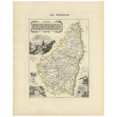
Map of Ardèche France with Annonay and Vineyards by Vuillemin, 19th c
Located in Langweer, NL
Map of Ardèche France with Annonay and Vineyards by Vuillemin, 19th c
This beautifully engraved 19th-century map of Ardèche, a department in southeastern France, comes from Alexandr...
Category
Mid-19th Century French Antique Maps
Materials
Paper
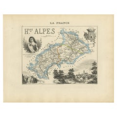
Map of Hautes-Alpes France with Gap and Alpine Scenery by Vuillemin, c.1850
Located in Langweer, NL
Map of Hautes-Alpes France with Gap and Alpine Scenery by Vuillemin
Description:
This elegant 19th-century map of the Hautes-Alpes department in southeastern France was created by A...
Category
Mid-19th Century French Antique Maps
Materials
Paper
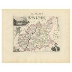
Map of Basses-Alpes France with Digne and Lavender Region by Vuillemin, c.1850
Located in Langweer, NL
Map of Basses-Alpes France with Digne and Lavender Region by Vuillemin, 19th c
This finely engraved 19th-century map of the Basses-Alpes department of France (known today as Alpes-d...
Category
Mid-19th Century French Antique Maps
Materials
Paper
Map of Allier France with Saint-Pourçain Wine Region by Vuillemin, 19th c
Located in Langweer, NL
Map of Allier France with Saint-Pourçain Wine Region by Vuillemin, 19th c
This decorative 19th-century map of Allier, a central department of France, comes from the celebrated Nouve...
Category
Mid-19th Century French Antique Maps
Materials
Paper
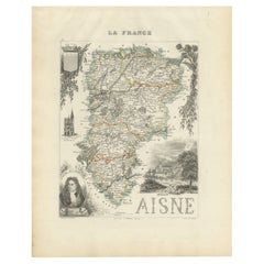
Map of Aisne France with Soissons and Champagne Vineyards by Vuillemin, 19th c
Located in Langweer, NL
Map of Aisne France with Soissons and Champagne Vineyards by Vuillemin, 19th c
Description:
This richly detailed 19th-century engraved and hand-colored map of the department of Aisn...
Category
Mid-19th Century French Antique Maps
Materials
Paper
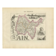
Map of Ain France with Vineyards of Bugey and Notable Portraits, c.1850
Located in Langweer, NL
Map of Ain France with Portraits of Bichat and Joubert by Vuillemin, 19th c
This highly decorative 19th-century map of the French department of Ain is taken from the celebrated Nouv...
Category
Mid-19th Century French Antique Maps
Materials
Paper
Large Antique Map of the State of Texas, 1861
Located in Langweer, NL
Antique map titled 'Johnson's New Map of the State of Texas' Large map of Texas, shows railroads, wagon roads, the U.S. Mail Route, rivers, ports, ...
Category
Mid-19th Century Antique Maps
Materials
Paper
Small Antique Map of the European Turkey, Greece & Ionian Islands – c.1860
Located in Langweer, NL
Antique Map of the European Turkey, Greece & Ionian Islands – Stieler, c.1860
Original antique map titled *Die Europaeische Türkei, Griechenland und die ...
Category
1860s Antique Maps
Materials
Paper
English Mahogany Wooden Folio Stand, Map and Document Holder, circa 1820
Located in Hamilton, Ontario
Regency era mahogany wood folio stand rack, map, poster, document holder used in a library, office or den, circa 1820. Folds out to six positions ...
Category
Early 19th Century English Regency Antique Maps
Materials
Wood
1882 Antique Map of Mexico Highlighting Geographical and Political Boundaries
Located in Langweer, NL
This 1882 map of Mexico, published by Blackie and Son as part of the 'Comprehensive Atlas and Geography of the World,' provides a highly detailed representation of the country's geog...
Category
1880s Antique Maps
Materials
Paper
1847 Antique Map of Mexico, Texas and California by Samuel Augustus Mitchell
Located in Colorado Springs, CO
Presented is the second edition of Samuel Augustus Mitchell's Map of Mexico, Including Yucatan & Upper California, an important map showing the progress of the Mexican-American War. ...
Category
1840s American Antique Maps
Materials
Paper
Antique Map of South America by Wyld, circa 1850
By J. Wyld
Located in Langweer, NL
Beautiful folding map of South America titled 'Colombia Prima or South America Drawn from the Large Map in Eight Sheets by Louis Stanislas D ' Arcy Delarochette'. Three insets in the...
Category
Mid-19th Century British Antique Maps
Materials
Paper
1876 Map of the United States: Detailing the Railroads and Unsettled Territories
Located in Langweer, NL
Stanford’s Smaller Railway Map of the United States, 1876
This original 1876 map, titled "Stanford's Smaller Railway Map of the United States Distinguishing the Unsettled Territorie...
Category
1870s Antique Maps
Materials
Paper
Large Antique County Map of Cornwall and the Isles of Scilly, England
Located in Langweer, NL
Antique map titled 'A Map of Cornwall from the best Authorities'. Original old county map of Cornwall, England. With inset map of the Scilly Islands. Engraved by John Cary. Originate...
Category
Early 19th Century Antique Maps
Materials
Paper
Mexico City by Braun & Hogenberg c. 1590
Located in Stamford, CT
Mexico by Braun & Hogenberg c. 1590
Category
Mid-19th Century European Spanish Colonial Antique Maps
Materials
Glass, Wood, Paper
Antique Map of The United States of North America, Pacific States, 1882
Located in Langweer, NL
The map is from the same 1882 Blackie Atlas and focuses on the Pacific States of the United States of America during that period. Here are some details and historical context about t...
Category
1880s Antique Maps
Materials
Paper
Pair of 19th Century English J & W Cary Celestial/Terrestrial Table Model Globes
Located in Milford, NH
A fine assembled pair of 12-inch English table model globes on stands manufactured by J & W. Cary, the left globe with cartouche labeled “The New Celestial Globe, on which are correc...
Category
Early 19th Century English Antique Maps
Materials
Brass
Rare 1864 Civil War Era Map of Arkansas, Mississippi, and Louisiana
Located in Langweer, NL
Title: Rare 1864 Civil War Era Map of Arkansas, Mississippi, and Louisiana
Description: This captivating antique map, titled "Johnson's Arkansas, Mississippi, and Louisiana," was pu...
Category
1860s Antique Maps
Materials
Paper
Large and Extremely Rare Terrestrial Globe by Newton
By Newton Globes - Planer & Newton
Located in Lymington, Hampshire
A large and extremely rare 24-inch terrestrial globe by Newton
Our most magnificent and rare globes were a pair of 24-inch Newton globes.
These too were updated in 1852 (terre...
Category
Mid-19th Century English Antique Maps
Materials
Mahogany
Rare 1864 Civil War Era Map of Massachusetts, Connecticut, and Rhode Island
Located in Langweer, NL
Title: Rare 1864 Civil War Era Map of Massachusetts, Connecticut, and Rhode Island
Description: This exquisite antique map, titled "Johnson's Massachusetts, Connecticut, and Rhode I...
Category
1860s Antique Maps
Materials
Paper
Pl. 88 Antique Print of Decorative Art in the 18th Century by Racinet, 1869
Located in Langweer, NL
Old print of decorative art in the 18th century. This print originates from 'L'Ornement polychrome'. A beautiful work containing about 2000 patterns of all the styles of Art old and ...
Category
19th Century Antique Maps
Materials
Paper
English Engraved Hand Colored Map of the North Eastern United States, circa 1817
Located in Charleston, SC
English copper engraved hand colored map of the North Eastern United States matted under glass in a gilt frame, Early 19th Century. Drawn and Engraved for Thomson's New General Atlas...
Category
1810s English George III Antique Maps
Materials
Paper, Paint, Giltwood, Glass
Victorian Visions of the New World: A Detailed Tallis Map of North America, 1851
Located in Langweer, NL
The map presented here is an intricate example from the series of maps produced by John Tallis & Company. Tallis maps are known for their detailed and elaborate style, often includin...
Category
1850s Antique Maps
Materials
Paper
Antique Map of the City of Kolkata by Balbi '1847'
Located in Langweer, NL
Antique map titled 'Calcutta'. Original antique map of the city of Kolkata, India. This map originates from 'Abrégé de Géographie (..)' by Adrien Balbi. Published 1847.
Category
Mid-19th Century Antique Maps
Materials
Paper
Antique Map of The Regions of Italy and Sicily during the Roman Empire, 1880
Located in Langweer, NL
This map is an original antique engraving titled "ITALIAE REGIONES IIII SICILIA," which translates to "The Regions of Italy and Sicily." This detailed historical map portrays the reg...
Category
1880s Antique Maps
Materials
Paper
Antique Map of the United States by Titus '1871'
Located in Langweer, NL
Antique map titled 'The United States of America'. Original antique map of the United States. This map originates from 'Atlas of Prebl...
Category
Late 19th Century Antique Maps
Materials
Paper
Antique Map of North America by Lowry '1852'
Located in Langweer, NL
Antique map titled 'North America'. Original map of North America. This map originates from 'Lowry's Table Atlas constructed and engraved from the...
Category
Mid-19th Century Antique Maps
Materials
Paper
Antique Map of the Western Hemisphere by Lapie, France, circa 1830
Located in Langweer, NL
Antique Map of the Western Hemisphere by Lapie, France, circa 1830
This beautifully engraved and delicately hand-colored map, titled Hémisphère du Nouveau Continent (Ouest), depict...
Category
1830s Antique Maps
Materials
Paper
Ptolemaic Armillary Sphere Charles-François Delamarche Paris, 1805-1810 Circa
Located in Milano, IT
Charles-François Delamarche
Ptolemaic armillary sphere
Paris, circa 1805-1810
Wood and papier-mâché
covered with printed and partly hand-coloured paper
It measures 15.74” in height, ...
Category
Early 1800s French Empire Antique Maps
Materials
Paper, Wood
Antique Map of Germany c.1830 by Thomas Kelly – Hand-Coloured Copper Engraving
Located in Langweer, NL
Antique Map of Germany by Thomas Kelly, London, circa 1830, with hand colouring
Finely engraved map of Germany titled 'Germany', published by Thomas Kelly at 17 Paternoster Row, London, circa 1830. This historical map outlines the German states, duchies, and surrounding regions including parts of Austria, Switzerland, France, Poland, and Bohemia. Borders are hand-coloured by region, and major rivers, mountain ranges, and cities such as Berlin, Hamburg, Frankfurt, and Munich are clearly marked. Engraved by H. Cooper.
This beautifully detailed copperplate engraving features original hand colouring and displays the political divisions of early 19th-century Germany, including Prussia, Bavaria, Saxony, and Württemberg, along with neighboring regions such as Austria, Switzerland, Bohemia, and parts of Poland and France. Major cities like Berlin, Munich, Hamburg, and Frankfurt are clearly marked, as well as rivers, mountain ranges, and regional borders. Engraved by H. Cooper.
A fine historical map ideal for collectors, interior decorators, or anyone with an interest in European history or cartography.
Technique and material: Copperplate engraving, original hand colouring
Condition report : Good condition. Strong impression with hand colour. Small chips and edge wear to upper margin, not affecting image. Light age toning and minor handling marks. Tight on the left and right margins.
Framing tip:
Use a neutral or antique white mat to highlight the engraved detail. A dark wood or classic gilt frame complements the historical aesthetic. UV-filtering glass recommended to protect the original colouring.
Keywords for SEO:
antique map, map of Germany, 1830s map, hand-colored map, Thomas Kelly map, old Germany map, Prussia map...
Category
1830s Antique Maps
Materials
Paper
Antique Map of the Northeastern United States and Canada by Tardieu, 1802
Located in Langweer, NL
This antique map titled "Carte de la Partie Septentrionale des Etats Unis," created by Pierre Antoine Tardieu, depicts the northeastern part of the United States and parts of Canada....
Category
Early 1800s Antique Maps
Materials
Paper
19th Century Illustrated Map of Ceylon (Sri Lanka) with Notable Landmarks
Located in Langweer, NL
John Tallis & Company is known for producing maps and atlases that were highly regarded for their accurate cartographic detail and their distinctive style. They often included ornate...
Category
1850s Antique Maps
Materials
Paper
1882 Cartographic Views of Ireland's North and South Regions
Located in Langweer, NL
Title: 1882 Maps of Ireland: Northern and Southern Regions
These two maps provide a detailed representation of Ireland as it was in 1882, divided into the northern and southern regi...
Category
1880s Antique Maps
Materials
Paper
1864 Johnson's Map of the West Indies and Bermuda
Located in Langweer, NL
Title: 1864 Johnson's Map of the West Indies and Bermuda
Description: This is an 1864 map titled "Johnson's West Indies," published by Johnson and Ward. The map provides a detailed ...
Category
1860s Antique Maps
Materials
Paper
Antique Map of North America by Johnston, 1882
Located in Langweer, NL
Antique map titled 'North America'.
Old map of North America. This map originates from 'The Royal Atlas of Modern Geography, Exhibiting, in a Series of Entirely Original and Authen...
Category
19th Century Antique Maps
Materials
Paper
Antique Map of the United States of America by Lapie '1842'
Located in Langweer, NL
Antique map titled 'Carte des États-Unis d'Amérique'. Map of the United States of America (USA). This map originates from 'Atlas universel...
Category
Mid-19th Century Antique Maps
Materials
Paper
Original Antique Map of the American State of Colorado, 1903
Located in St Annes, Lancashire
Antique map of Colorado
Published By A & C Black. 1903
Original colour
Good condition
Unframed.
Free shipping
Category
Early 1900s English Antique Maps
Materials
Paper
Map of Shropshire, 1844: Telford, Shrewsbury, Oswestry, Bridgnorth & Wellington
Located in Langweer, NL
Old Map of Shropshire by Samuel Lewis, 1844: Telford, Shrewsbury, Oswestry, Bridgnorth, and Wellington
This 1844 map of Shropshire is an antique engraving from Samuel Lewis' Topogr...
Category
1840s Antique Maps
Materials
Paper
Antique Map of North America from an Old Dutch School Atlas, 1852
Located in Langweer, NL
Antique map titled 'Noord-Amerika'. Map of North America. This map originates from 'School-Atlas van alle deelen der Aarde' by Otto Petri. Artists and Engra...
Category
19th Century Antique Maps
Materials
Paper
Antique Map of the Eastern Hemisphere by Lapie, France, circa 1830
Located in Langweer, NL
Antique Map of the Eastern Hemisphere by Lapie, France, circa 1830
This finely engraved and hand-colored antique map, titled Hémisphère de l'ancien continent (Eastern Hemisphere), w...
Category
1830s Antique Maps
Materials
Paper
Old World Map Featuring Captain Cook's Exploration Routes and Polar Views, 1787
Located in Langweer, NL
1786 World Map with Polar Projections - "Globo Terrestre" by Giovanni Maria Cassini
This 1786 map titled "Globo Terrestre" by Giovanni Maria Cassini offers a fascinating and detai...
Category
1860s Antique Maps
Materials
Paper
18th-Century Dutch Garden Design by Gijsbert van Laar, Published in 1802
Located in Langweer, NL
18th-Century Dutch Garden Design by Gijsbert van Laar – Magazijn van tuin-sieraaden, 1802
This exquisite hand-colored engraving is from the renowned work 'Magazijn van tuin-sieraa...
Category
Early 1800s Antique Maps
Materials
Paper
An Ornate and Historical Tallis Map of Jamaica with Decorative Vignettes, 1851
Located in Langweer, NL
This original antique map of Jamaica is part of the renowned series created by the Tallis Company, known for their detailed and decorative maps ...
Category
1850s Antique Maps
Materials
Paper
Antique Map of Cyprus (Cypern) from Meyer's Lexikon, Leipzig, circa 1890
Located in Langweer, NL
Antique Map of Cyprus (Cypern) from Meyer's Lexikon, Leipzig, circa 1890
This finely detailed antique map titled "Cypern" presents the island of Cyprus as it appeared in the late 19...
Category
1890s Antique Maps
Materials
Paper
Original Antique Map of the American State of Washington, 1889
Located in St Annes, Lancashire
Great map of Washington
Drawn and Engraved by W. & A.K. Johnston
Published By A & C Black, Edinburgh.
Original colour
Unframed.
Category
1880s Scottish Victorian Antique Maps
Materials
Paper
Antique Map of North America by Lapie '1842'
Located in Langweer, NL
Antique map titled 'Carte de l'Amérique septentrionale'. Map of North America, with an inset map of the Aleutian Islands. This map originates from 'Atlas universel de géographie anci...
Category
Mid-19th Century Antique Maps
Materials
Paper
Antique Map of North America and the West Indies by Stieler, circa 1865
Located in Langweer, NL
Antique map titled 'Nord-America und West-Indien'. Old map of North America and the West Indies. This map originates from Stieler's 'Schul-Atlas'.
Category
Mid-19th Century Antique Maps
Materials
Paper
Antique Map of North and South America by Pierre Antoine Tardieu (1784-1869)
Located in Langweer, NL
This is an original antique map titled "Carte Générale et Politique de l'Amérique," depicting the political and geographical features of North and South America. This map, created by Pierre Antoine Tardieu, illustrates the continent's boundaries, major regions, and significant features as understood in the early 19th century.
Map Details:
- **Title**: Carte Générale et Politique de l'Amérique
- **Creator**: Pierre Antoine Tardieu (1784-1869)
- **Publication Date**: Early 19th century
- **Dimensions**: Approximately 34.5 x 43.5 cm (13.5 x 17.25 inches)
- **Features**: The map includes detailed representations of North and South America, highlighting political boundaries, major cities, rivers, and mountain ranges. The title cartouche is located in the lower right corner, and the outlines are hand-colored to distinguish different regions and countries.
Condition Overview:
1. Paper Quality: The paper shows typical signs of aging, such as slight yellowing, but remains in good condition without major tears or damage.
2. Edges and Corners: The edges are slightly worn, with minor fraying and small tears, particularly near the center fold. These imperfections do not significantly impact the overall readability or aesthetic value.
3. Center Fold: A center fold is present, which is common for maps of this period that were often folded for storage or publication. The fold appears intact without significant separation or damage, except for a small split at the lower end.
4. Color and Print Quality: The hand-colored outlines remain vibrant and clear, highlighting the borders of different regions. The print quality is excellent, with sharp, legible text and detailed illustrations.
5. Staining and Spots: There are a few spots and stains, particularly near the edges and along the fold. These do not obscure any critical details of the map.
Historical Context
Around the year 1800, the Americas were a region of significant political change and exploration. Here’s an overview of the region during that period:
Political Landscape
1. North America:
- United States: The United States was a young nation, having gained independence from Great Britain in 1776. The early 19th century was a period of westward expansion and the establishment of new states.
- Canada: Canada was divided into British colonies, including Upper Canada (Ontario) and Lower Canada (Quebec). The British maintained control over these territories following the American Revolution.
- Mexico: Mexico was part of the Spanish Empire, known as New Spain. It would gain independence from Spain in 1821.
2. Central and South America:
- Spanish Colonies: Much of Central and South America was under Spanish colonial rule. Significant regions included New Granada (Colombia), Peru, and the Viceroyalty of the Rio de la Plata (Argentina).
- Portuguese Brazil: Brazil was a Portuguese colony and the largest territory in South America. It would gain independence from Portugal in 1822.
- Independence Movements: The early 19th century was marked by independence movements across Latin America, led by figures such as Simón Bolívar and José de San Martín, which resulted in the creation of new nations.
3. Caribbean:
- The Caribbean islands were controlled by various European powers, including Spain, France, Great Britain, and the Netherlands. These islands were significant for their sugar plantations and as hubs of the Atlantic slave trade.
Socio-Economic Conditions
1. Trade and Commerce:
- The Americas were integral to global trade, exporting commodities such as sugar, tobacco, cotton, and coffee. The port cities of Havana, Veracruz, and Buenos Aires were crucial trade...
Category
Early 1800s Antique Maps
Materials
Paper
Antique 1882 Antique Map of Peru and Bolivia: Andes Mountains and Amazon Rivers
Located in Langweer, NL
Antique 1882 Map of Peru and Bolivia: Andes Mountains, Amazon Rivers, Historic Borders
This map from 1882 provides a detailed representation of the countries of Peru and Bolivia in ...
Category
1880s Antique Maps
Materials
Paper
Antique Map of The United States Southern Section by A & C. Black, 1870
Located in Langweer, NL
Antique map titled 'United States Southern Section'. Original antique map of Map of The United States Southern Section. This map originates from ‘Black's General Atlas of The World’....
Category
Late 19th Century Antique Maps
Materials
Paper
1847 Ornamental Map of the United States & Mexico by H. Phelps
Located in Colorado Springs, CO
Offered is an original 1847 ornamental map of the U.S. entitled "Ornamental Map of the United States & Mexico" by Humphrey Phelps. The map was issued as an act of Congress by Phelps on Fulton Street, New York. The broadside is elaborately hand-colored.
This is a very detailed and graphic propaganda map of the United States expressing U.S. dominance of the North American continent. The hand-colored map proclaims the Manifest Destiny, with the recent acquisition of Upper California and Texas at the conclusion of the Mexican-American War. The newly acquired land is boldly colored, standing in stark contrast to the rest of the U.S. The map details a potential route for a railroad running from New York City, to Buffalo, to Chicago, then west along the Oregon Trail to Oregon City. This route anticipates the construction of the transcontinental railroad by nearly 20 years.
The map includes elaborately detailed renderings of George Washington, Hernan Cortez, and Montezuma at top to represent European expansion to the Americas. At bottom are four inset designs with text showing the following: a chronological history of the U.S. beginning from settlement to the U.S. victory in the Mexican-American war; an illustration of General Zachary Taylor with details on the Oregon Territory; an illustration of the Aztec Temple of the Sun in Tenochtitlan and a chronology of the Conquest of the Aztec Empire under Cortez; a portrait of General Antonio Lopez de Santa Anna...
Category
1840s American Antique Maps
Materials
Paper
Large Original Antique Map of the The Windward Islands. 1894
Located in St Annes, Lancashire
Superb Antique map of The Windward Islands
Published Edward Stanford, Charing Cross, London 1894
Original colour
Good condition
Unframed.
Free shipping
Category
1890s English Antique Maps
Materials
Paper
1877 Satirical Map of the Eastern War: Europe's Powers as Caricatured Characters
Located in Langweer, NL
Title: 1877 Caricature Map of the Eastern War - "Carte de la Guerre en Orient" by H. Demare
Description: This 1877 satirical map, titled "Carte de la Guerre en Orient," was publis...
Category
1870s Antique Maps
Materials
Paper
Nautical Chart of Cape Verde Islands by J.W. Norie, 1824 Coastal Map
Located in Langweer, NL
Nautical Chart of Cape Verde Islands by J.W. Norie, 1824 Coastal Map
This beautifully engraved nautical chart, titled “A New Chart of the Cape Verde Islands,” was drawn by J.W. Nori...
Category
Early 19th Century English Antique Maps
Materials
Paper
Map of Turkish Dominions in Europe, Ottoman Balkan Territories 1813
Located in Langweer, NL
Map of Turkish Dominions in Europe, Ottoman Balkan Territories 1814
This antique map titled "Turkish Dominions in Europe" provides a detailed depiction of the Balkan Peninsula and a...
Category
1810s Antique Maps
Materials
Paper
Teruel 1901: A Cartographic Depiction of Heritage and Natural Splendor in Spain
Located in Langweer, NL
Original antique map of Teruel in Spain, with highlighted gold. The province of Teruel, located in the region of Aragon in eastern Spain, is known for several unique features:
1. **Mudejar Architecture**: Teruel is famous for its well-preserved Mudejar architecture, which is a style that is a fusion of Christian and Islamic design. This includes notable examples like the Tower of El Salvador and the Teruel Cathedral, both of which are UNESCO World Heritage sites.
2. **Dinopolis**: It hosts Dinópolis, a paleontological park that is one of the largest of its kind in Europe, featuring dinosaur fossils and interactive...
Category
Early 1900s Antique Maps
Materials
Paper
Small Map of the United States
Located in Langweer, NL
Antique map titled 'Amérique septe. Physique'. Small map of the United States. lithographed by C. Callewaert brothers in Brussels circa 1870.
Category
Mid-19th Century Antique Maps
Materials
Paper
Large Original Antique Map of The Greek Islands. 1894
Located in St Annes, Lancashire
Superb Antique map of The Greek Islands
Published Edward Stanford, Charing Cross, London 1894
Original colour
Good condition
Unframed.
Free shipping
Category
1890s English Antique Maps
Materials
Paper
