Maps
to
185
334
22
356
3
3
2
1
1
2,926
2,181
476
3
289
34
10
127
7
35
9
2
5
3
4
2
346
12
10
9
2
81
76
63
22
15
356
356
356
5
1
1
1
1
Maps For Sale
Period: Early 20th Century
Period: 1750s
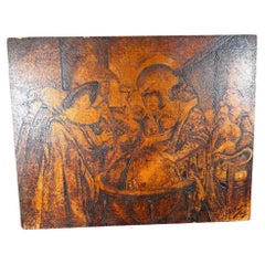
The Astronomer Unique Historical Folk Art Painting Signed 1918
Located in South Burlington, VT
Unique Historical Work of Art Dated 1918 "L' Astronome (The Astronomer) by Fedinant Roybet.
This is an original and one-of-a-kind artistic presentation- a superb pyrography incis...
Category
Early 20th Century French Maps
Materials
Wood
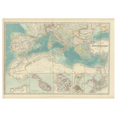
Antique Map of the Basin of the Mediterranean by Johnston '1909'
Located in Langweer, NL
Antique map titled 'Basin of the Mediterranean'. Original antique map of the basin of the Mediterranean. With inset maps of the Strait of Gibraltar, Morocco, Maltese Islands, Valetta...
Category
Early 20th Century Maps
Materials
Paper
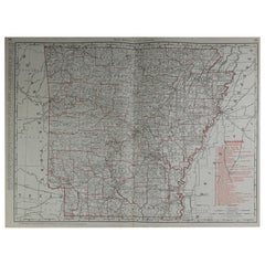
Large Original Antique Map of Arkansas by Rand McNally, circa 1900
Located in St Annes, Lancashire
Fabulous monochrome map with red outline color
Original color
By Rand, McNally & Co.
Published, circa 1900
Unframed
Minor edge tears.
Category
Early 1900s American Edwardian Antique Maps
Materials
Paper
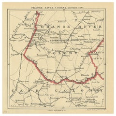
Antique Map of the Southern Part of the Orange River Colony by Stanford, 1901
Located in Langweer, NL
Antique map titled 'Orange River Colony, southernpart'. Lithograph of the southern part of the Orange River Colony, Africa. The Orange River Colony was the British colony created aft...
Category
Early 20th Century Maps
Materials
Paper
Cortesi's Masterpiece: A Comprehensive and Authoritative Map of Uruguay, 1903
Located in Langweer, NL
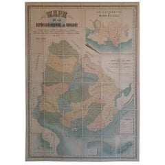
Antique map titled 'Mapa de la Republica Oriental del Uruguay'. Large and detailed folding map of Uruguay. This monumental map depicts all of Uruguay with unprecedented accuracy and detail. Impressively, it serves the multiple roles of being an advanced topographic, economic and political map, as well as being a meticulous sea chart of the Rio de la Plata and the adjacent waters of the Atlantic. The republic's 20 departments are defined in various colors, while a legend, 'Referencias' identifies symbols representing the locations of departmental capitals, town, roads, railways, public schools and lighthouses, amongst other details. Every single river and stream is delineated and named and the ridges of hills are delicately expressed. The map features four insets, including a large map of the capital, Montevideo, as well as maps of Colonia, Maldonado and Punta del Este and the Island of Flores. The hydrographical information provided is truly profound, and renders the map fit for use in maritime commerce.
In 1901, the Uruguayan House of Representatives commissioned the geographer Saturnino Cortesi to employ the most progressive geographical sources, both military and civilian, to devise an authoritative national map of the republic. Cortesi clearly had access to a vast archive of topographical surveys...
Category
Early 20th Century Maps
Materials
Paper
Large Original Vintage Map of The North Pole, circa 1920
Located in St Annes, Lancashire
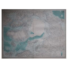
Great maps of The North Pole.
Unframed.
Original color.
By John Bartholomew and Co. Edinburgh Geographical Institute.
Published, circa 1920.
Free shipp...
Category
1920s British Vintage Maps
Materials
Paper
1908 John Bartholomew Miniature Map of Penang, Malacca, and Negri Sembilan
Located in Langweer, NL
1908 John Bartholomew Map of Penang, Malacca, and Negri Sembilan from Handy Atlas of Church and Empire
Description:
This finely detailed early twentieth-century map features two...
Category
Early 1900s Antique Maps
Materials
Paper
1750 Bellin Map of the Red River (Tonkin River) and Hanoi, Vietnam
Located in Langweer, NL
Title: 1750 Bellin Map of the Red River and Hanoi, Vietnam
Description: This finely engraved eighteenth-century French map, titled Carte du Cours de la Riviere de Tunquin, was created by the renowned cartographer Jacques-Nicolas Bellin and published in 1750. It depicts the course of the Red River, historically referred to as the Tonkin River, from Hanoi, labeled as Cacho, Ville Capitale du Tunquin, to the Gulf of Tonkin, labeled as Baye de Tunquin. Bellin’s work was based on navigational surveys by an English explorer, as stated in the title, reflecting the growing European interest in Southeast Asia during the early colonial period.
The Red River Delta was a crucial region for trade and agriculture, forming the backbone of Vietnam’s economic and cultural history. The river originates in China and flows through northern Vietnam, passing through Hanoi before emptying into the Gulf of Tonkin. This map captures the strategic importance of the river, as it served as a major trade route for goods and a point of interest for European navigators, merchants, and missionaries seeking access to Indochina.
The map includes numerous geographical details. Hanoi is prominently labeled as the capital of Tonkin, a historical term used by Europeans to describe northern Vietnam. The surrounding settlements, islands, and tributaries are carefully marked, illustrating the intricate network of waterways that characterized the region. Notable features include Île de la Potterie, referring to a location known for ceramic production, and various sandbanks and fortified locations along the river.
A decorative compass rose is placed in the upper left corner, reinforcing the map’s navigational purpose. The scale of measurement is provided in French leagues, labeled as Grandes Lieues...
Category
1750s Antique Maps
Materials
Paper
Large Original Vintage Map of South Africa, circa 1920
Located in St Annes, Lancashire
Great map of South Africa
Original color.
Good condition / repair to a minor edge tear middle bottom
Published by Alexander Gross
Unframed.
...
Category
1920s English Edwardian Vintage Maps
Materials
Paper
Large Original Vintage Map of British Island Possessions, circa 1920
Located in St Annes, Lancashire
Great map of British Island Possessions
Original color. Good condition
Published by Alexander Gross
Unframed.
Category
1920s English Vintage Maps
Materials
Paper
Antique Map of West Asia, circa 1900
Located in Langweer, NL
Antique map titled 'Persia, Afghanistan and Beloochistan'. Folding map on linen.
Published circa 1900. Stamp below title.
Category
Early 20th Century Maps
Materials
Paper
Detailed Regional Map of the Gulf of Bengal and the Lower Ganges River, ca.1750
Located in Langweer, NL
Title of this original and rare antique map: Nouvelle Carte Du Royaume De Bengale
Mapmaker: Jacques-Nicolas Bellin (1703-1772).
He was among the most important mapmakers of the eighteenth century. In 1721, at only the age of 18, he was appointed Hydrographer to the French Navy. In August 1741, he became the first Ingénieur de la Marine of the Dépôt des cartes...
Category
1750s Antique Maps
Materials
Paper
Detailed Antique Map of Portugal, Published for the 'Gentleman's Magazine', 1758
Located in Langweer, NL
Antique map Portugal titled 'A Map of the Kingdom of Portugal'.
Detailed map of Portugal, published for the 'Gentleman's Magazine'.
Artist...
Category
1750s Antique Maps
Materials
Paper
Old Map of Australia Showing The Routes of the Main Explorers, ca.1900
Located in Langweer, NL
Antique print, untitled. This map shows Australia with the routes of explorers in the continent and marking the furthest point reached.. Source unknown, to be determined.
Artists ...
Category
Early 1900s Antique Maps
Materials
Paper
Old Original Antique Map of the Sunda Islands of Indonesia, 1756
Located in Langweer, NL
Title: Isles De La Sonde.
Attractive old decorative map of the Isles de la Sonde, Borneo, Sumatra, Java and Malacca ( Malaysia) with the Straits of Malacca. Penang is spelled as P...
Category
1750s Antique Maps
Materials
Paper
Original Antique Map of the American State of California ( Northern Part ), 1903
Located in St Annes, Lancashire
Antique map of California ( Northern part )
Published By A & C Black. 1903
Original colour
Good condition
Unframed.
Free shipping
Category
Early 1900s English Antique Maps
Materials
Paper
Original Antique Map of the American State of Oregon, 1903
Located in St Annes, Lancashire
Antique map of Oregon
Published By A & C Black. 1903
Original colour
Good condition
Unframed.
Free shipping
Category
Early 1900s English Antique Maps
Materials
Paper
Original Antique Map of the American State of Missouri ( Southern part ), 1903
Located in St Annes, Lancashire
Antique map of Missouri ( Southern Part )
Published By A & C Black. 1903
Original colour
Good condition
Unframed.
Free shipping
Category
Early 1900s English Antique Maps
Materials
Paper
Original Antique Map of the American State of Missouri ( Northern part ), 1903
Located in St Annes, Lancashire
Antique map of Missouri ( Northern Part )
Published By A & C Black. 1903
Original colour
Good condition
Unframed.
Free shipping
Category
Early 1900s English Antique Maps
Materials
Paper
Original Antique Map of the American State of Nebraska, 1903
Located in St Annes, Lancashire
Antique map of Nebraska
Published By A & C Black. 1903
Original colour
Good condition
Unframed.
Free shipping
Category
Early 1900s English Antique Maps
Materials
Paper
Original Antique Map of the American State of South Dakota, 1903
Located in St Annes, Lancashire
Antique map of South Dakota
Published By A & C Black. 1903
Original colour
Good condition
Unframed.
Free shipping
Category
Early 1900s English Antique Maps
Materials
Paper
Original Antique Map of the American State of North Dakota, 1903
Located in St Annes, Lancashire
Antique map of North Dakota
Published By A & C Black. 1903
Original colour
Good condition
Unframed.
Free shipping
Category
Early 1900s English Antique Maps
Materials
Paper
Original Antique Map of the American State of Mississippi, 1903
Located in St Annes, Lancashire
Antique map of Mississippi
Published By A & C Black. 1903
Original colour
Good condition
Unframed.
Free shipping
Category
Early 1900s English Antique Maps
Materials
Paper
Original Antique Map of the American State of Pennsylvania( Western Part ), 1903
Located in St Annes, Lancashire
Antique map of Pennsylvania ( Western part )
Published By A & C Black. 1903
Original colour
Good condition
Unframed.
Free shipping
Category
Early 1900s English Antique Maps
Materials
Paper
Original Antique Map of the American State of Pennsylvania( Eastern Part ), 1903
Located in St Annes, Lancashire
Antique map of Pennsylvania ( Eastern part )
Published By A & C Black. 1903
Original colour
Good condition
Unframed.
Free shipping
Category
Early 1900s English Antique Maps
Materials
Paper
Original Antique Map of the American State of New York ( Northern Part ) 1903
Located in St Annes, Lancashire
Antique map of New York ( Northern Part )
Published By A & C Black. 1903
Original colour
Good condition
Unframed.
Free shipping
Category
Early 1900s English Antique Maps
Materials
Paper
Original Antique Map of the American States of Vermont & New Hampshire, 1903
Located in St Annes, Lancashire
Antique map of Vermont and New Hampshire
Published By A & C Black. 1903
Original colour
Good condition
Unframed.
Free shipping
Category
Early 1900s English Antique Maps
Materials
Paper
Large Original Vintage Map of Switzerland, circa 1920
Located in St Annes, Lancashire
Great map of Switzerland
Original color.
Good condition
Published by Alexander Gross
Unframed.
Category
1920s English Vintage Maps
Materials
Paper
Large Original Vintage Map of New Zealand, South Island, circa 1920
Located in St Annes, Lancashire
Great map of South Island, New Zealand
Original color.
Good condition / repair to a minor tear on right edge
Published by Alexander Gross
Unframed.
Category
1920s English Edwardian Vintage Maps
Materials
Paper
Heliograph of Tin Mining in Tronoh, Perak and Tambun in Sabah, Malaysia, 1907
Located in Langweer, NL
Three views of the Mining Industry in Malaysia around 1907.
1. Lankshuts at Tronoh, Perak
2. Puddling Machinery, Tambun in Sabah
3. Shaking Machinery at Red Hill
This helio...
Category
Early 1900s Antique Maps
Materials
Paper
Antique Map of Northern China and Far Eastern Russia Around the Amur River, 1754
Located in Langweer, NL
Antique map titled 'Carte De La Tartarie Orientale (..)'. A map for this far eastern portion of what is present day northern China and far eastern Russia...
Category
1750s Antique Maps
Materials
Paper
Original Antique Map of the Region of Torneå 'Tornio' in Northern Finland, 1759
Located in Langweer, NL
Antique map titled 'Carte des Environs de Tornea'.
Original antique map of the region of Torneå (or Tornio), in northern Finland. This print originates from volume 19 of 'Histoir...
Category
1750s Antique Maps
Materials
Paper
Four Rare Heliograph Views of Mining Near Sungei Bessi River in Malaysia, 1907
Located in Langweer, NL
Four views of early Mining operations in Malaysia at the beginning of the 20th century. Published in 1907.
1) A Sand-Lake of Residue (Sungai of Sungei Bessi)
2) Chinese Smelting...
Category
Early 1900s Antique Maps
Materials
Paper
Large Original Vintage Map of New Zealand, North Island, circa 1920
Located in St Annes, Lancashire
Great map of North Island, New Zealand
Original color.
Good condition / minor foxing to right edge
Published by Alexander Gross
Unframed.
Category
1920s English Edwardian Vintage Maps
Materials
Paper
Detailed Map of Dutch Rivers, with the Rhine, Maas, de Merwe en de Lek, C.1750
Located in Langweer, NL
Antique map titled 'Kaart van den Loop der Rivieren de Rhyn, de Maas, de Waal, de Merwe en de Lek, door de Provincien van Gelderland, Holland en Utrecht'.
...
Category
1750s Antique Maps
Materials
Paper
Detailed Original Antique Map of the Russian Empire in Asia, 1750
Located in Langweer, NL
Antique map titled 'Partie Orientale de l'Empire de Russie en Asie (..)'.
Detailed map of the Russian Empire in Asia.
Artists and Engravers: Gilles Robert de Vaugondy (1688-1766) was the head of a leading family of geographers in eighteenth century France. Gilles got his start when he jointly inherited the shop of Pierre-Moullart Sanson, grandson of the famous geographer Nicholas Sanson. The inheritance included the business, its stock of plates, and a roller press...
Category
1750s Antique Maps
Materials
Paper
Antique Map of New Zealand by Johnston '1909'
Located in Langweer, NL
Antique map titled 'New Zealand'. Original antique map of New Zealand. With inset maps of Chatham, Auckland, Wellington, Dunedin, and New Gu...
Category
Early 20th Century Maps
Materials
Paper
Copper Engraving with a Panoramic View of Mexico City, 1754
Located in Langweer, NL
Antique print titled 'Nouveau Mexico'.
Copper engraving with a panoramic view of Mexico city. This print originates from 'Histoire générale des voyages, ou nouvelle collection de...
Category
1750s Antique Maps
Materials
Paper
Old Copper Engraving of the Port City Dabhol in India, 1757
Located in Langweer, NL
Antique print titled 'Dabul'.
Old print of the port city Dabhol in India. In the 15th and 16th centuries, Dabul was an opulent Muslim trade center. Around 1660 it was annexed to th...
Category
1750s Antique Maps
Materials
Paper
Old Original Antique Map of the Islands of East Indonesia, 1756
Located in Langweer, NL
Title: Isles Moluques.
Old and rare, this decorative map of the Maluku Islands in the period it was still controlled by the Dutch colonial power. It also shows the island of Bali, Lombok, part of Borneo (Kalimantan), Celebes (Sulawesi), Timor, The Lesser Sunda Islands, West Papua...
Category
1750s Antique Maps
Materials
Paper
Fine Engraving Depicting an Officer's Mess in the Low Countries, 'Holland', 1754
Located in Langweer, NL
Title on Page (Dutch and French): CORPS DE GARDE van Hollandsche Officiers / Corps de Garde des Officiers Hollandois". Amst., 1754.
Fine engraving depicting an officer's mess by J. Punt and P. Tanjé after a painting by C. Troost, with coat of arms engraved in lower margin and dedication to G. Braamcamp ("beminnaar der schilderkonst").
Waiting room with reading, smoking and card playing officers. Right, one of them studies a map of the Netherlands. On the wall a coat of arms with the Dutch lion. At the bottom of the margin the coat of arms and an assignment to Gerrit Braamcamp, who had the original painting in his collection.
Cornelis Troost...
Category
1750s Antique Maps
Materials
Paper
Antique View of The N.W. side of Saypan and one of The Ladrones Islands, 1757
Located in Langweer, NL
Antique print titled 'Vue de deux des Iles des Larrons - Gezigt van twee der Eilanden Ladrones (..)'.
View of two Ladrones Islands; View of the N.W. side of Saypan, one of the La...
Category
1750s Antique Maps
Materials
Paper
Old Print of the Spanish Conquest of Cusco or Cuzco, Capital of the Incas, c1750
Located in Langweer, NL
Antique print titled 'Grundriss von Cuzco bey der Eroberung von den Spaniern'.
Old plan of the city of Cusco, Peru, often spelled Cuzco. It shows Cusco during the conquest by the...
Category
1750s Antique Maps
Materials
Paper
Original Antique Map of the Ancient Netherlands and Belgium, c.1750
Located in Langweer, NL
Description: Antique map titled 'Naauwkeurige Kaart van het Oude Nederland (..)'.
Original antique map of the Netherlands and Belgium. This map originates from 'Vaderlandsche his...
Category
1750s Antique Maps
Materials
Paper
Large Antique Map of the Region of Berry, Nivernois & Bourbonnais, France, 1753
Located in Langweer, NL
Antique map titled 'Gouvernements généraux du Berry, du Nivernois et du Bourbonois'.
Large, original antique map of the region of Berry, Nivernois and Bourbonnais, France. Featur...
Category
1750s Antique Maps
Materials
Paper
Antique Hand-Colored Map of Northern Portugal, 1756
Located in Langweer, NL
Antique map Portugal titled 'Parte Sepentrional del Reyno de Portugal'.
Antique map of Northern Portugal. This map originates from 'Atlas Port...
Category
1750s Antique Maps
Materials
Paper
Nice Antique Map of the Empire of Japan. Centered on the Bay of Osaka, ca.1752
Located in Langweer, NL
Antique map titled 'Carte de L'Empire de Japon (..).'
Map of the Empire of Japan. Centered on the Bay of Osaka, this map covers from Hirado (here identified as I. Firando) and Naga...
Category
1750s Antique Maps
Materials
Paper
Antique Map of Germany by Johnston '1909'
Located in Langweer, NL
Antique map titled 'Empire of Germany'. Original antique map of Germany. With inset maps of Frankfurt and Munich. This map originates from the ‘...
Category
Early 20th Century Maps
Materials
Paper
Large Original Antique City Plan of Minneapolis and St Paul, USA, circa 1900
Located in St Annes, Lancashire
Fabulous colorful map of Minneapolis and St Paul, Minnesota.
Original color
By Rand, McNally & Co.
Published, circa 1900
Unframed
Minor edge tears
Free shipping.
Category
Early 1900s American Antique Maps
Materials
Paper
Antique Map of Persia and Afghanistan by Johnston '1909'
Located in Langweer, NL
Antique map titled 'Persia and Afghanistan'. Original antique map of Persia and Afghanistan. This map originates from the ‘Royal Atlas o...
Category
Early 20th Century Maps
Materials
Paper
Antique Map of the United States of North America by Johnston '1909'
Located in Langweer, NL
Antique map titled 'United States of North America'. Original antique map of United States of North America ( South West Sheet ). With inset maps of Chicago...
Category
Early 20th Century Maps
Materials
Paper
Antique Map of Austria- Hungary by Johnston, '1909'
Located in Langweer, NL
Antique map titled 'Austria- Hungary'. Original antique map of Austria- Hungary. This map originates from the ‘Royal Atlas of Modern Geography’....
Category
Early 20th Century Maps
Materials
Paper
Original Antique Map of England and Wales from the 1909 Royal Atlas
Located in Langweer, NL
The antique map titled 'England and Wales' is a historical cartographic representation of these two nations. This original antique map of England...
Category
Early 20th Century Maps
Materials
Paper
Antique Map of the United States ' North East ' by Johnston '1909'
Located in Langweer, NL
Antique map titled 'United States of North America'. Original antique map of United States of North America ( North East ). This map orig...
Category
Early 20th Century Maps
Materials
Paper
Large Sea Chart of the British Islands, 1918
Located in Langweer, NL
Antique map titled 'The British Islands'.
Large sea chart of the British Islands. It shows Ireland, Scotland, England, the Shetland Islands and part of Fra...
Category
1910s Vintage Maps
Materials
Paper
Original Antique Map of the Northwestern Part of Russia in Europe, 1753
Located in Langweer, NL
Antique map titled 'Partie septentrionale de la Russie Européenne'.
Detailed map of the Northwestern part of Russia, from the Gulf of Finland and Poland, to the western part of Asian Russia.
Artists and Engravers: Gilles Robert de Vaugondy (1688-1766) was the head of a leading family of geographers in eighteenth century France. Gilles got his start when he jointly inherited the shop of Pierre-Moullart Sanson, grandson of the famous geographer Nicholas Sanson. The inheritance included the business, its stock of plates, and a roller press...
Category
1750s Antique Maps
Materials
Paper
Prince of Orange, First King of the Netherlands & Grand Duke of Luxembourg, 1750
Located in Langweer, NL
Antique portrait titled 'Willem de I. Prins van Oranje enz. enz. enz'.
Portrait of William I, Prince of Orange. William I Frederick, born Willem Frederik Prins van Oranje-Nassau ...
Category
1750s Antique Maps
Materials
Paper
Old Map of Turkmenistan, Uzbekistan, Afghanistan, Tajikistan, Kyrgyzstan, 1757
Located in Langweer, NL
Antique map titled 'Kort over det Lille Bukarie og de naest graensende Lande. af Engelske Skribentere ved N. Bellin Ingenieur ved Marinen efter Söe Etaten'.
Map of present-day Turkmenistan, Uzbekistan, Afghanistan, Tajikistan, Kyrgyzstan including part of China. Originates from 'Almindelig histoirie over reiser til lands og bands (..)'. This 17 volume set is a translation of Collection of voyages and travels edited by Awnsham and John Churchill and Thomas Osborne...
Category
1750s Antique Maps
Materials
Paper
