Maps
to
2,446
2,934
116
3,053
26
12
1
1
2,926
2,181
476
3
289
34
10
127
7
35
9
2
5
3
4
2
3,039
30
20
4
3
245
109
80
72
31
3,053
3,053
3,053
63
24
16
13
13
Maps For Sale
Period: 18th Century and Earlier
Period: Early 1900s
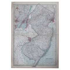
Original Antique Map of the American State of New Jersey, 1903
Located in St Annes, Lancashire
Antique map of New Jersey
Published By A & C Black. 1903
Original colour
Good condition
Unframed.
Free shipping
Category
Early 1900s English Antique Maps
Materials
Paper
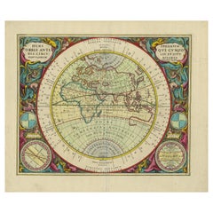
Antique Map of the Eastern Hemisphere by Valk & Chenk '1708'
Located in Langweer, NL
Antique map titled 'Hemispherium Orbis Antiqui, Cumzonis Circulis, Et Sity populorum Diverso'. Decorative example of Andreas Cellarius's map of the Eastern Hemisphere, illustrating with climatic zones ranging from Frigida Borealis to Torrida, with planetary details superimposed. The elaborate border includes fine scrollwork, numerous putti, and additional diagrams showing armillary spheres and climatic zones. Andreas Cellarius was born in 1596 in Neuhausen and educated in Heidelberg. He emigrated to Holland in the early 17th century and 1637 moved to Hoorn, where he became the rector of the Latin School. Cellarius' best known work is his Harmonia Macrocosmica, first issued in 1660 by Jan Jansson, as a supplement to Jansson's Atlas Novus. The work consists of a series of Celestial Charts...
Category
Early 18th Century Antique Maps
Materials
Paper
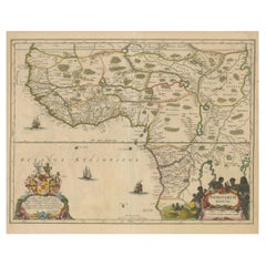
1675 Map of the Kingdom of the Black People (Nigritarum Regnum) by Janssonius
Located in Langweer, NL
This original antique map, titled 'Nigritarum Regnum' (The Kingdom of the Black People), was produced by the renowned Dutch cartographer Johannes Janssonius and published in 'Joannis...
Category
1670s Antique Maps
Materials
Paper
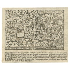
Rare and Interesting Small Antique Woodcut Map of the Mediterranean, 1568
Located in Langweer, NL
Very rare untitled antique woodcut map showing the region of the missionary journeys of Apostle Paul. It shows the Mediterranean with Greece, Asia Minor (Turkey), Northern Africa, So...
Category
16th Century Antique Maps
Materials
Paper
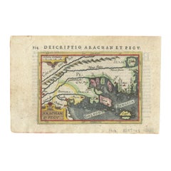
1616 Petrus Bertius Map of Arakan and Pegu in Southeast Asia
Located in Langweer, NL
Title: 1616 Petrus Bertius Map of Arakan and Pegu in Southeast Asia
Description: This early seventeenth-century map, titled Descriptio Arachan et Pegu, was published in 1616 by P...
Category
1610s Antique Maps
Materials
Paper
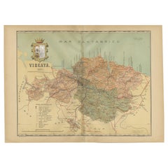
Cartographic Heritage: The 1901 Map of the Vizcaya Province in Spain
Located in Langweer, NL
This is a historical map of the province of Vizcaya (Biscay) in Spain, dated 1901. The title on the map is "VIZCAYA. 1901." It shows the topographical details of the region with cont...
Category
Early 1900s Antique Maps
Materials
Paper
Map of Saint Helena Island: Early 18th-Century Copper Engraving by F. Bernard
Located in Langweer, NL
Map of Saint Helena Island: Early 18th-Century Copper Engraving by F. Bernard
This rare and beautifully detailed copper engraving of Saint Helena Island dates from around 1722 and...
Category
1720s Antique Maps
Materials
Paper
Italia Antiqua Philippo Cluvero – 1603 Hondius Map of Ancient Italy, Handcolored
Located in Langweer, NL
Italia Antiqua Philippo Cluvero – 1603 Hondius Map of Ancient Italy with Hand Color
This stunning early 17th-century map, *Italia Antiqua Philippo Cluvero Borusso Designatore*, wa...
Category
Early 1600s Antique Maps
Materials
Paper
Antique Map of Peru by van der Aa, 'circa 1720'
Located in Langweer, NL
Antique map titled 'Le Perou, Grand Pays de l Amerique Meridionale (..)'. Decorative map of Peru including portions of Ecuador and northern Chile and Boliv...
Category
Early 18th Century Antique Maps
Materials
Paper
Map of Groningen from The Genealogy of the Illustrious Counts of Nassau (1615)
Located in Langweer, NL
Title: Map of Groningen from "The Genealogy of the Illustrious Counts of Nassau" (1615)
Description: This antique map, titled "Gronenga," offers a detailed depiction of the forti...
Category
1610s Antique Maps
Materials
Paper
1625 Petrus Plancius / Cloppenburg Map of the Holy Land with Biblical Vignettes
Located in Langweer, NL
1625 Petrus Plancius / Johannes Cloppenburg Map of the Holy Land with Biblical Vignettes
This exquisite 1625 map by Petrus Plancius and Johannes Cloppenburg represents the Holy Lan...
Category
1620s Antique Maps
Materials
Paper
Map of Europe Highlighting Ancient and Modern Geographical Divisions (1794)
Located in Langweer, NL
Map of Europe Highlighting Ancient and Modern Geographical Divisions (1794). Germany, France, Italy, Spain, and the British Isles – Map by D’Anville (1794).
This detailed 18th-cent...
Category
1790s Antique Maps
Materials
Paper
Antique Plan of Fort Mardyck Mardijk, France by S. Beaulieu, 1649
Located in Langweer, NL
Plan of Fort Mardyck (Fort Mardijk) and surroundings by Sébastian de Pontault Beaulieu. Mardyck is a former commune in the Nord department in northern France. It is an associated com...
Category
Mid-17th Century Antique Maps
Materials
Paper
Original Antique Map of the American State of Ohio ( Southern Part ), 1903
Located in St Annes, Lancashire
Antique map of Ohio ( Southern part )
Published By A & C Black. 1903
Original colour
Good condition
Unframed.
Free shipping
Category
Early 1900s English Antique Maps
Materials
Paper
Antique Map of the Mediterranean and the Persian Gulf by Danckerts, c.1718
Located in Langweer, NL
Antique map titled 'De Gelegentheyt Van't Paradys en 't Landt Canaan.' Dutch Bible map covering the region between the Mediterranean and the Persian Gulf, f...
Category
18th Century Antique Maps
Materials
Paper
Original Antique Map of Spain and Portugal, circa 1790
Located in St Annes, Lancashire
Super map of Spain and Portugal
Copper plate engraving by A. Bell
Published, circa 1790.
Unframed.
Category
1790s English Other Antique Maps
Materials
Paper
View of the City Banten or Bantam Near the Western End of Java, Indonesia, c1725
Located in Langweer, NL
Antique print titled 'La Ville de Bantam capitale du Roiaume de meme nom'.
A bird's eye view of the city Banten or Bantam near the western end of Java in Indonesia. Several tall ...
Category
1720s Antique Maps
Materials
Paper
Early Woodcut Map of Franconia and Surrounding Regions, 1628
Located in Langweer, NL
Title: Early Woodcut Map of Franconia and Surrounding Regions, 1628
Franconia (Franckenlande) is a region in Germany. Historically, Franconia was a significant part of the Holy Roma...
Category
1620s Antique Maps
Materials
Paper
Rare North Atlantic and Caribbean Sea Chart: Newfoundland to Venezuela, 1745
Located in Langweer, NL
This impressive map titled "Terra Neuf, en de Custen van Nieu Vranckryck, Nieuw Engeland... Venezuela," published by Louis Renard in 1745, captures the North Atlantic coastline, enco...
Category
1740s Antique Maps
Materials
Paper
Antique Map of the Duchy of Westphalia, Germany
Located in Langweer, NL
Original antique map titled 'Westphalia Ducatus'. Fine map of the Duchy of Westphalia, Germany. The map is centered on Meschede and includes Arensberg, Beelick, and Brilon. Published...
Category
Mid-17th Century Antique Maps
Materials
Paper
London 1744 Published Watercolour Antique Map of East Africa by Eman Bowen
Located in West Sussex, Pulborough
We are delighted to offer for sale this New and Accurate Map of Nubia & Abissinia, together with all the Kingdoms Tributary Thereto, and bordering upon them published in 1744 by Emanuel Bowen
This is a decorative antique engraved map of East Africa...
Category
1740s English George III Antique Maps
Materials
Paper
A Stunning 1744 Bowen Map: South East Germany & Queen of Hungary’s Dominions
Located in Langweer, NL
Title: A New and Correct Map of the South East part of Germany, 1744
This map by Emanuel Bowen, dating to around 1744, beautifully captures the southeastern part of Germany. The det...
Category
1740s Antique Maps
Materials
Paper
Scarce Latin Edition of Guillaume Delisle's 1700 Map of North America
Located in Langweer, NL
Scarce German Edition of Guillaume Delisle's 1700 Map of North America
This beautifully colored and highly detailed map is a rare Latin edition of Guillaume Delisle's influential 17...
Category
Early 1700s Antique Maps
Materials
Paper
Antique Map of Japan with Scale and Compass Rose, c.1730
Located in Langweer, NL
Antique map titled 'Naauwkeurige Kaart van 'T Keizerryk Japan (..).'
Attractive detailed map of Japan. With scale and compass rose. This map originates from 'Hedendaegsche historie...
Category
18th Century Antique Maps
Materials
Paper
Original Antique Map of Egypt in Frame by C. Weigel, circa 1720
Located in Langweer, NL
The map is an antique depiction of ancient Egypt, divided into its regions and nomes, also including areas like Troglodytica, Marmarica, and Ethiopia above Egypt. Christophorus Weige...
Category
Early 18th Century Antique Maps
Materials
Paper
Original Rare Map of the Holy Land Showing the Twelve Tribes of Israel's, 1782
Located in Langweer, NL
Antique map titled 'Carte des Douze Tribus D'Israel (..).'
Map of the Holy Land showing the twelve tribes of Israel's. Tribes are all named...
Category
1780s Antique Maps
Materials
Paper
Antique Map of the British Isles According to the Geography of the Roman Empire
Located in Langweer, NL
Antique map titled 'Insulae Britannicae'. Interesting map of Britain, Scotland, and Ireland. It shows a rudimentary outline of the islands according to the geography of the Roman Emp...
Category
Late 18th Century Antique Maps
Materials
Paper
Map of Soria Province, 1901: Detailed Cartography of Northeastern Spain
Located in Langweer, NL
The map is a historical map of the province of Soria from 1901.
A decorative coat of arms enhances the aesthetic of the map, signifying the historical and cultural significance of ...
Category
Early 1900s Antique Maps
Materials
Paper
Map of Blaisois by Janssonius, 1633, Decorative Antique Map of Loire Valley
Located in Langweer, NL
Map of Blaisois by Janssonius, 1633, Decorative Antique Map of Loire Valley
This finely detailed and colorfully embellished map titled 'Description du Blaisois' was published in 163...
Category
1630s Antique Maps
Materials
Paper
Original Normandy Map by Frederick de Wit, 1705, with Inset of Channel Islands
Located in Langweer, NL
Normandy Map by Frederick de Wit, 1705, with Inset of Channel Islands
Description:
This beautifully engraved and hand-colored map, titled Duché et Gouvernement General de Normandie,...
Category
Early 1700s Antique Maps
Materials
Paper
Map of Le Maine by H. Hondius, 1633, Hand-Colored, Decorative and Historic
Located in Langweer, NL
Map of Le Maine by H. Hondius, 1633, Hand-Colored, Decorative and Historic
This rare and beautifully executed antique map titled 'Le Maine' was published in 1633 by Henricus Hondius...
Category
1630s Antique Maps
Materials
Paper
18th-Century Map of Holstein and Surrounding Duchies by Homann Heirs
Located in Langweer, NL
18th-Century Map of Holstein and Surrounding Duchies by Homann Heirs
Description: This finely detailed 18th-century map by the Homann Heirs (Homannische Erben) illustrates the Duc...
Category
1750s Antique Maps
Materials
Paper
Antique Copper Engraved Map of Germany in the Early 18th Century, c.1740
Located in Langweer, NL
Antique map Germany titled 'Allemagne'.
Rare miniature map of Germany and surroundings. Also depicting the Baltic Sea and the Gulf of Venice. S...
Category
18th Century Antique Maps
Materials
Paper
Original Antique Sea Chart of the Northern Part of Hispaniola, Western Cuba
Located in Langweer, NL
Antique map titled 'Pas kaart van de Noord Kust van Espaniola (..)'. Beautiful sea chart of the northern part of Hispaniola, western Cuba. The map includes the Turks & Caicos Islands and southern part of the Bahamas. Shows Guanahami or S. Salvador. Guanahani is an island in the Bahamas that was the first land in the New World sighted and visited by Christopher Columbus' first voyage, on October 12, 1492. It is not known precisely which island it was, and several theories have been put forth by historians. Guanahani is the native Taíno name; Columbus called it San Salvador. Originates from 'De Nieuwe Groote Lightende Zee-Fakkel'. Published by J. van Keulen, circa 1684.
The Van Keulens were a family of chartmakers and publishers. The firm, In de Gekroonde Lootsman (In the Crowned Pilot), was founded in 1678 by Johannes van Keulen (1654-1715). Van Keulen originally registered his business as a vendor of books and instruments (specifically cross-staffs). In 1680, however, he gained a privilege from the States of Holland and West Friesland for the publication of pilot guides and sea atlases.
In that year, van Keulen released his Zee-Atlas (Sea Atlas), which secured him a name in the competitive maritime publishing market. In 1681, he published the first volume of Nieuwe Lichtende Zee-Fakkel (New Shining Sea Torch). This would be the first of an eventual five volumes originally published between 1680 and 1684. A sixth volume was added in 1753. The Zee-Fakkel won van Keulen lasting fame. The atlas had charts compiled by Claes Jansz Vooght and artwork from Jan Luyken...
Category
Late 17th Century Antique Maps
Materials
Paper
Austria by Wolfgang Lazius – A Magnificent 16th-Century Map from Ortelius
Located in Langweer, NL
Title:
Avstriae Descrip – Wolfgang Lazius’ Map of Austria, 16th Century
Description:
This extraordinary map of Austria pays homage to the Austrian humanist and cartographer Wo...
Category
16th Century Antique Maps
Materials
Paper
Original Antique Map of the American State of Michigan ( Southern Part ), 1903
Located in St Annes, Lancashire
Antique map of Michigan ( Southern part )
Published By A & C Black. 1903
Original colour
Good condition
Unframed.
Free shipping
Category
Early 1900s English Antique Maps
Materials
Paper
Map of India and Ceylon with Inset of Calcutta and the Ganges, by Bonne, 1780
Located in Langweer, NL
The map on offer is an antique copperplate engraving of India and Ceylon (Sri Lanka), created by Rigobert Bonne (1727-1794), a prominent French cartographer. Here is a breakdown of t...
Category
1780s Antique Maps
Materials
Paper
Three Views of Fort James, Van der Schley, c.1760
Located in Langweer, NL
Three views of Fort James. The Dutch subtitles read: a) Grondtekening van ?t eiland St. James, op de Gambra Ao 1732. B) Noord-Oostlyk gezigt van ?t Fort St. James. C) Noord-Noord-Wes...
Category
18th Century Antique Maps
Materials
Paper
Antique Map of Boulogne-sur-Mer by Bellin '1764'
Located in Langweer, NL
Antique map titled 'Plan de la Ville de Boulogne'. Original antique map of Boulogne-sur-Mer, France. This map originates from 'Le petit atlas maritime: recueil de cartes et plans des...
Category
Mid-18th Century Antique Maps
Materials
Paper
Old Map of the Mughal Empire, Persia in the West to Lake Chimay etc., ca.1685
Located in Langweer, NL
Antique map titled 'L'Empire du Grand Mogol'. Old map of India and Central Asia.
The map extends from Persia in the West to Lake Chimay and the Bay of Bengal...
Category
1680s Antique Maps
Materials
Paper
Original Antique Map of the American State of New York ( Western Part ) 1903
Located in St Annes, Lancashire
Antique map of New York ( Western Part )
Published By A & C Black. 1903
Original colour
Good condition
Unframed.
Free shipping
Category
Early 1900s English Antique Maps
Materials
Paper
Original Antique Map of the American State of Tennessee, 1903
Located in St Annes, Lancashire
Antique map of Tennessee
Published By A & C Black. 1903
Original colour
Good condition
Unframed.
Free shipping
Category
Early 1900s English Antique Maps
Materials
Paper
Antique Map of Edom, an Ancient Kingdom in Transjordan, 1773
Located in Langweer, NL
Antique print titled 'Idumea, of thet Land der Philistynen'. Old map of Edom, an ancient kingdom in Transjordan located between Moab to the northeast, the Arabah to the west and the ...
Category
18th Century Antique Maps
Materials
Paper
Map of Constantinople, Bosphorus, the Coasts of Greece and the Archipelago, 1785
Located in Langweer, NL
This is a large 1785 map titled "Carte de la Ville de Constantinople et du Bosphore de Thrace", which includes detailed maps of Constantinople (modern-day Is...
Category
1780s Antique Maps
Materials
Paper
Original Antique Map of the American State of Alabama, 1903
Located in St Annes, Lancashire
Antique map of Alabama
Published By A & C Black. 1903
Original colour
Good condition
Unframed.
Free shipping
Category
Early 1900s English Antique Maps
Materials
Paper
Circa 1691 Frederick de Wit Map: Middle East with Arabia, Persia & More
Located in Langweer, NL
Circa 1691 Frederick de Wit Map: Middle East with Arabia, Persia & More
This exquisite hand-colored map, circa 1691, by Frederick de Wit, illustrates the Middle East, spanning from Turkey and Egypt to Afghanistan, with a detailed representation of the Arabian Peninsula.
The map's detailing in Arabia is based on Nicolas Sanson's influential 1654 map, which was one of the most accurate and detailed depictions of the region up to the mid-seventeenth century.
The decorative title cartouche is richly adorned with images of exotic figures, animals, and a merchant ship, symbolizing the region's historical trade importance. Additionally, a mapmaker is shown working with traditional tools, adding a touch of authenticity to the cartographic art.
This is the fourth state of the map, published between 1691 and 1696. The map measures 21.8 inches in width by 18.5 inches in height, featuring a sharp impression, with minimal staining and a carefully repaired centerfold separation at the bottom.
Keywords:
- Middle East historical map
- Frederick de Wit map
- 17th century maps
- Arabian Peninsula map
- Persia (Iran) map
- Turkey and Egypt map...
Category
1690s Antique Maps
Materials
Paper
Original Antique Map of the American State of Idaho & Wyoming, 1903
Located in St Annes, Lancashire
Antique map of Idaho and Wyoming
Published By A & C Black. 1903
Original colour
Good condition
Unframed.
Free shipping
Category
Early 1900s English Antique Maps
Materials
Paper
Hand-Colored 17th-Century Map of Orléanais in France by Frederik De Wit c. 1688
Located in Langweer, NL
Title: Hand-Colored 17th-Century Map of Orléanais by Frederik De Wit c. 1688
Description: This beautifully crafted map, "Gouvernement General du Pays Orléanois," illustrates the Orl...
Category
1680s Antique Maps
Materials
Paper
Antique Map of Portugal by Nolin '1704'
Located in Langweer, NL
Antique map titled 'Le Royaume de Porutgal divisé en cinq grandes Provinces (..)'. Rare and very decorative map of Portugal. It shows the territory of ...
Category
Early 18th Century Antique Maps
Materials
Paper
Antique Miniature Map of the Turkish Empire by Bertius '1618'
Located in Langweer, NL
Antique miniature map titled 'Turcicum Imperium'. Rare miniature map of the Turkish Empire. This map originates from 'Tabularum Geographicarum Contractarum Libri septem (..)' by P. B...
Category
Early 17th Century Antique Maps
Materials
Paper
Original Antique Map of the American State of Alaska, 1903
Located in St Annes, Lancashire
Antique map of Alaska
Published By A & C Black. 1903
Original colour
Good condition
Unframed.
Free shipping
Category
Early 1900s English Antique Maps
Materials
Paper
Biblical Map and Family Trees of the Holy Land by Chatelain, ca. 1720
Located in Langweer, NL
Title: 1720 Chatelain Map of the Holy Land with Biblical Family Trees and Chronology
Description:
This fascinating 18th-century folio map by Henry Abraham Chatelain combines geo...
Category
1710s Antique Maps
Materials
Paper
Beautiful Large Scale Map of Spain and Portugal Published by Herman Moll in 1711
Located in Langweer, NL
Title: A New and Exact Map of Spain & Portugal
Author: Herman Moll
Date: 1711
Medium: Hand-colored copperplate engraving
Herman Moll (c. 1654-1732) was one of the most important London mapmakers in the first half of the eighteenth century. Moll was probably born in Bremen, Germany, around 1654. He moved to London to escape the Scanian Wars. His earliest work was as an engraver for Moses Pitt on the production of the English Atlas, a failed work which landed Pitt in debtor's prison. Moll also engraved for Sir Jonas Moore, Grenville Collins, John Adair, and the Seller & Price firm. He published his first original maps in the early 1680s and had set up his own shop by the 1690s.
Moll's work quickly helped him become a member of a group which congregated at Jonathan's Coffee House at Number 20 Exchange Alley, Cornhill, where speculators met to trade stock. Moll's circle included the scientist Robert Hooke...
Category
1710s Antique Maps
Materials
Paper
Coast of Northumberland, England, Incl the Holy & Farne Islands, Etc, 1693
Located in Langweer, NL
Antique map titled 'Holy Island, Staples and Barwick.'
A map of the coast of Northumberland, England. This map includes Holy Island, Buckton, Sunderland and the Farne Islands. Th...
Category
1690s Antique Maps
Materials
Paper
1621 Ptolemy & Magini Map of Taprobana (Sumatra) with Elephant Inset
Located in Langweer, NL
Title: 1620 Ptolemy and Magini Map of Taprobana (Sumatra) with Elephant Inset, Italian Edition
Description: This rare and beautifully hand-colored 1620 map engraving, Tavola Duode...
Category
1620s Antique Maps
Materials
Paper
Antique Map of the Turkish Empire by Tirion 'c.1760'
Located in Langweer, NL
Antique map titled 'Nieuwe Kaart van het Turksche Ryk gelegen in Europa, Asia en Africa'. Original antique map of the Turkish Empire. The map is centered on the Mediterranean Sea but...
Category
Mid-18th Century Antique Maps
Materials
Paper
1738 Map of the Philippines & Eastern Indonesia: Spice Islands by Tirion
Located in Langweer, NL
1738 Map of the Philippines & Eastern Indonesia: Spice Islands by Tirion/Albrizzi
This beautifully hand-colored map from circa 1738, created by Tirion and Albrizzi, showcases the Philippines and the eastern part of Indonesia, reflecting the Dutch colonial interests in the region.
The map features a detailed representation of the numerous islands, including the renowned Spice or Banda Islands, pivotal to the Dutch spice trade.
Key regions include the Philippines (Isole Filippine), the Mariana Islands (Ladrones), with Guam, the Caroline and Palau Islands (Nieuwe Fillippynsche Eilenden), the Moluccas (Moluccos) known as the Spice Islands, the eastern tip of Java and Borneo, and a portion of Papua New Guinea.
Measuring 12.8 inches wide by 11.1 inches high, the map is in excellent condition with a crisp impression, slight foxing, and minor printer's creases, printed on a bright sheet with a lion watermark.
Keywords:
- Philippines historical map
- Eastern Indonesia map...
Category
1730s Antique Maps
Materials
Paper
18th-Century Map of Tyrol and Surrounding Regions by Johann Baptist Homann
Located in Langweer, NL
18th-Century Map of Tyrol and Surrounding Regions by Johann Baptist Homann
Description: This striking 18th-century map by Johann Baptist Homann depicts the County of Tyrol (Tirol)...
Category
1720s Antique Maps
Materials
Paper
