Maps
to
1,667
2,084
56
2,142
26
3
3
2
1
1
1
2,926
2,181
476
3
289
34
10
127
7
35
9
2
5
3
4
2
2,119
28
15
11
10
176
110
80
23
20
2,142
2,142
2,142
24
16
13
12
12
Maps For Sale
Period: Early 20th Century
Period: 18th Century
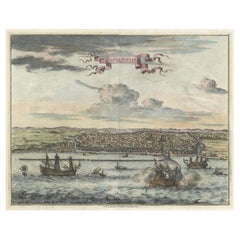
Original Antique Bird's Eye View of Banten or Bantam in Java, Indonesia, 1725
Located in Langweer, NL
Antique print titled 'La Ville de Bantam capitale du Roiaume de meme nom'.
A bird's eye view of the city Banten or Bantam near the western end of Java in Indonesia. Several tall ...
Category
1720s Antique Maps
Materials
Paper
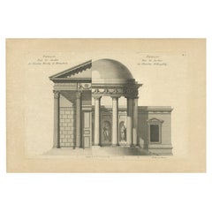
Pl. 8 Antique Print of Garden Pavilions by Le Rouge, c.1785
Located in Langweer, NL
Antique print titled 'Pavillon pour les jardins (..)'. Copper engraving showing the pavilions of knight Worsley of Hovingham and knight Willoughby. This print originates from 'Jardin...
Category
18th Century Antique Maps
Materials
Paper
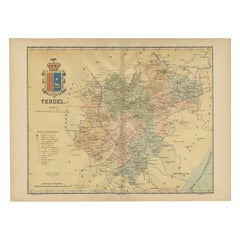
Teruel 1901: A Cartographic Depiction of Heritage and Natural Splendor in Spain
Located in Langweer, NL
Original antique map of Teruel in Spain, with highlighted gold. The province of Teruel, located in the region of Aragon in eastern Spain, is known for several unique features:
1. **Mudejar Architecture**: Teruel is famous for its well-preserved Mudejar architecture, which is a style that is a fusion of Christian and Islamic design. This includes notable examples like the Tower of El Salvador and the Teruel Cathedral, both of which are UNESCO World Heritage sites.
2. **Dinopolis**: It hosts Dinópolis, a paleontological park that is one of the largest of its kind in Europe, featuring dinosaur fossils and interactive...
Category
Early 1900s Antique Maps
Materials
Paper
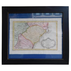
French Framed Copper Engraved Hand Colored Map of Carolina & Georgia, Circa 1757
Located in Charleston, SC
French copper engraved hand colored map of Carolina & Georgia matted under glass with a painted frame, mid-18th century
Category
1750s French Louis XV Antique Maps
Materials
Paper, Paint, Wood, Glass
Antique Print of the Melville House in Fife, Scotland, 1725
Located in Langweer, NL
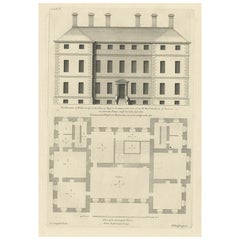
Antique print titled 'The Elevation of Melvin House in the Shire of Fyfe (..)'.
Old engraving of Melville House in Fife, Scotland. This print originates from 'Vitruvius Britannic...
Category
18th Century Antique Maps
Materials
Paper
Map Silk Embroidered Western Eastern Hemisphere New Old World Asia America Afri
Located in BUNGAY, SUFFOLK
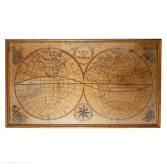
A rare, late-18th century, silk, embroidered, double hemisphere, world map, blackwork, sampler, showing the tracks of captain cook’s three voyages
- Illustrating public understanding of the world in the late-18th century and the recent discoveries of the time delineating the tracks of Captain Cook’s three voyages.
- Shows the incentive for further exploration during the 19th century as no mass is indicated within the southern polar region, the interior portions of western North America, Africa, and Australia are still relatively void of detail even though California is no longer shown as an island.
- Includes beautifully worked allegories of the four continents Asia, the Americas, Africa & Europe, a cartouche being supported by two angels and a compass
- The cream, silk ground is finely embroidered with a variety of stiches in black, silk threads emulating the black ink on maps.
-“Recent international conflicts and voyages by Captain Cook and others made the study of geography exciting at the time this map was made. Elaborate embroidered maps...
Category
18th Century British Georgian Antique Maps
Materials
Silk
Very Attractive Map of North and South America and Western Part of Africa, 1744
Located in Langweer, NL
Antique map titled 'Nieuwe Kaart van America.' Very attractive map of North and South America, the western part of Africa and south west Europe. With full contemporary hand colouring...
Category
18th Century Antique Maps
Materials
Paper
Venetian Trade Routes in the Levant – Antique Map by Pieter van der Aa, ca.1720
Located in Langweer, NL
Venetian Trade Routes in the Levant – Antique Map by Pieter van der Aa, Early 18th Century
This finely engraved map, published by Pieter van der Aa in Leiden, provides a detailed d...
Category
1720s Antique Maps
Materials
Paper
Map of Lancashire
Located in Cheshire, GB
Saxton Map of Lancashire hand coloured. Encased in an ebonised frame.
Dimensions
Height 21 Inches
Width 24 Inches
Depth 1 Inches
Category
Early 20th Century British Maps
Materials
Paper
Chart of the Harbour of Liverpool
Located in Cheshire, GB
PL Burdett A Chart of the Harbour of Liverpool hand coloured. Encased in an ebonised frame.
Dimensions
Height 23.5 Inches
Width 28 Inches
Depth 1 Inches
Category
Early 20th Century British Maps
Materials
Paper
Original Antique Map of Tartary 'Northern China & Far Eastern Russia', 1757
Located in Langweer, NL
Antique map titled 'Carte de la Tartarie Orientale (..)'.
Original antique map of what is present day northern China and far eastern Russia. Centere...
Category
1750s Antique Maps
Materials
Paper
1718 Holy Land Map - Twelve Tribes, Six Provinces, Hand-Colored, Antique Map
Located in Langweer, NL
Title: Terra Sancta in XII olim Tribus nunc VI Provincias Dispertita
Cartographer: Christoph Weigel the Elder (1654–1725)
Publisher: Johann Ernst Adelbulner
Publication Locatio...
Category
1710s Antique Maps
Materials
Paper
Europe Divided into Principal States by Jean Denis Janvier, Paris, 1782
Located in Langweer, NL
This is a historical map of Europe titled "L'Europe divisee en ses Principaux Etats," created by Jean Denis Janvier in 1782.
This beautiful map depicts the political boundaries and...
Category
1780s Antique Maps
Materials
Paper
Original Antique Map of the American State of Massachusetts, 1903
Located in St Annes, Lancashire
Antique map of Vermont and New Hampshire
Published By A & C Black. 1903
Original colour
Good condition
Unframed.
Free shipping
Category
Early 1900s English Antique Maps
Materials
Paper
1773 Map of Persia, Gujarat & Malabar Coasts – Arabia to India, Hand-Colored
Located in Langweer, NL
1773 Bellin map of Persia, Gujarat and Malabar coasts with Arabia and Maldives
Description:
This finely engraved and delicately hand-colored 18th-century map titled Kaart van de Kusten van Persië, Guzaratte en Malabar was produced by the eminent French cartographer Jacques-Nicolas Bellin and engraved by Jakob van der Schley. It was published in 1773 in Amsterdam by E. van Harrevelt and D. Changuion, as part of a Dutch edition of Bellin’s maritime atlas focused on the East Indies and the Indian Ocean.
The map presents the coastline bordering the Arabian Sea, extending from the Persian Gulf and parts of the Arabian Peninsula to the shores of Gujarat and the Malabar Coast in southwestern India. It provides a detailed representation of the coastlines of Persia (modern-day Iran), the western coast of India, and a portion of southern Arabia including the Oman Peninsula. Coastal towns, rivers, ports, and geographical landmarks are clearly labeled, including prominent trading centers like Surat, Goa, Calicut, Cochin, and Cape Comorin (now Kanyakumari).
Additionally, the map shows the Laccadive Islands (Laka Dives) and the Maldives (Maldivische Eilanden), with attention to navigational details such as shoals, sandbanks, and anchor points. A large compass rose and clear latitude and longitude markings enhance its utility as a navigational aid.
A highly decorative title cartouche at lower left features maritime iconography such as sea creatures, a fountain, and shells. An inset legend beneath the map provides explanations in Dutch for the symbols used to indicate bays, capes, ports, forts, islands, and towns.
This is a copperplate engraving printed on laid paper with full original hand coloring. It retains its original fold lines as issued. The condition is generally good, with minor age toning and a few light spots in the margins. No repairs or restoration are visible. The paper is strong, and the impression remains crisp and clear.
This historical map is a significant and attractive example of 18th-century European cartography, especially valued for its depiction of maritime trade regions and coastal geography during the age of exploration and colonial expansion.
To frame this 1773 Bellin map attractively and safely:
- Use acid-free matting in a neutral tone like cream or antique white
- Consider double matting with a subtle inner color that complements the map
- Choose a simple wooden frame in walnut, cherry, or aged oak for a classic look
- Use UV-protective glass or acrylic to prevent fading
- For a full display, consider float mounting to show the edges and fold lines
- Allow 2 to 3 inch mat margins to balance the composition and enhance presentation
Keywords:
Bellin map 1773, van der Schley, Persia coast map, Gujarat map, Malabar map...
Category
1780s Antique Maps
Materials
Paper
Antique Map of Mexico by Johnston, '1909'
Located in Langweer, NL
Antique map titled 'Mexico'. Original antique map of Mexico. This map originates from the ‘Royal Atlas of Modern Geography’. Published by W. & A....
Category
Early 20th Century Maps
Materials
Paper
Map of Southern South America – Richly Detailed Engraving by K.Johnston, 1903
Located in Langweer, NL
Title (80 characters, keyword-first):
Map of Southern South America – Richly Detailed Engraving by Keith Johnston, 1903
Description:
This elegant map titled "South America: Southern...
Category
Early 20th Century Maps
Materials
Paper
Map of Northern South America – Vibrant Engraving by Keith Johnston, 1903
Located in Langweer, NL
Map of Northern South America – Vibrant Engraving by Keith Johnston, 1903
This beautifully engraved map titled "South America: Northern Sheet" was created by Keith Johnston, F.R.G.S...
Category
Early 20th Century Maps
Materials
Paper
Map of the West India Islands and Central America – Colorful 1903 Engraving
Located in Langweer, NL
Map of the West India Islands and Central America – Colorful 1903 Engraving
This vibrant engraved map, titled "West India Islands and Central America," was created by Keith Johnston...
Category
Early 20th Century Maps
Materials
Paper
Map of Western United States 1903 – Railroads, State Borders, and Terrain
Located in Langweer, NL
Map of Western United States 1903 – Railroads, State Borders, and Terrain
This beautifully engraved map titled "United States of North America (Western Sheet)" was created by Keith ...
Category
Early 20th Century Maps
Materials
Paper
Canada’s West – 1903 Engraved Map by Johnston – Unique and Historic
Located in Langweer, NL
This beautiful and detailed map, titled "Dominion of Canada (Western Sheet)," was created by Keith Johnston and published in 1903.
It presents a fascinating depiction of Canada's w...
Category
Early 20th Century Maps
Materials
Paper
Canada Map 1903 - Dominion of Canada, West Central Sheet
Located in Langweer, NL
Title: Canada Map 1903 - Dominion of Canada, West Central Sheet
Description:
This fascinating 1903 map of the Dominion of Canada’s West Central regions by T.R. Johnston offers a viv...
Category
Early 20th Century Maps
Materials
Paper
Canada Map 1903 - East Central Dominion - Ontario, Quebec & More
Located in Langweer, NL
Canada Map 1903 - East Central Dominion - Ontario, Quebec & More
This captivating antique map, titled "Dominion of Canada (East Central Sheet)" and published in 1903 by Keith Johnst...
Category
Early 20th Century Maps
Materials
Paper
Explore North America in 1903 - Intricately Detailed Antique Map
Located in Langweer, NL
North America, 1903 - A Colorful Historical Map with Detailed Borders
This attractive map of North America was engraved, printed, and published by W. & A.K. Johnston in 1903. A wond...
Category
Early 20th Century Maps
Materials
Paper
Highly Detailed Antique Map of the Holy Land Showing 12 Tribes of Israel, c.1720
Located in Langweer, NL
Antique map titled 'Heylige Land verdeeld in de Twaalf Stammen Israels (..).'
Highly detailed map of the Holy Land divided into 12 tribes of Israel...
Category
1720s Antique Maps
Materials
Paper
Egypt and Lower Nubia, 1903 - Historical Map Highlighting Nile and Red Sea
Located in Langweer, NL
Egypt and Lower Nubia, 1903 - Historical Map Highlighting Nile and Red Sea
This beautifully detailed map titled "Egypt, Arabia Petraea, and Lower Nubia" was engraved, printed, and p...
Category
Early 20th Century Maps
Materials
Paper
Antique Map of Central Africa, 1903, With Colonial Territories Explorers Routes
Located in Langweer, NL
Antique Map of Central Africa, 1903, Featuring Colonial Territories and Explorers’ Routes
This antique map, titled "Central Africa," was engraved and published in 1903 by W. & A.K. ...
Category
Early 20th Century Maps
Materials
Paper
Antique Map of Africa, Highlighting Colonial Divisions, Geographic Features 1903
Located in Langweer, NL
Title: Antique Map of Africa, 1903, Highlighting Colonial Divisions and Geographic Features
Description: This antique map, titled "Africa," was engraved and published in 1903 by W. ...
Category
Early 20th Century Maps
Materials
Paper
Large Antique Map of the German Empire
Located in Langweer, NL
Antique map titled 'A Map of Germany (..)'. Large antique map of the German Empire, highly detailed. Engraved by T. Kitchin. Published J. Blair, cir...
Category
Late 18th Century Antique Maps
Materials
Paper
Map of Friesland (La Frise), from a French Atlas - circa 1756
Located in Langweer, NL
Title: Map of Friesland (La Frise), from "Atlas Nouveau Portatif" (1756)
This is an 18th-century map of Friesland (Frise), a northern province of the Netherlands, engraved by *Georg...
Category
1750s Antique Maps
Materials
Paper
French Antique Map of France and Western Europe, 1765
Located in Langweer, NL
Antique map titled 'Carte de tous les Lieux, célébres dans l'Histoire (..)'. Beautiful old map of France and western Europe. This map originates from 'Atlas Historique de la France A...
Category
18th Century Antique Maps
Materials
Paper
Historical Map of Northern Europe and Russia - Engraved for I. Harrison, 1788
Located in Langweer, NL
Historical Map of Northern Europe and Russia - Engraved for I. Harrison, 1788
This impressive historical map titled A New Map of Europe Containing Denmark, Norway, Sweden and Russ...
Category
1780s Antique Maps
Materials
Paper
Antique Map of New Zealand, 1903, Featuring the North and South Islands and Alps
Located in Langweer, NL
Title: Antique Map of New Zealand, 1903, Featuring the North and South Islands and the Southern Alps
Description:
This antique map, titled "New Zealand," was engraved and published ...
Category
Early 20th Century Maps
Materials
Paper
Antique Map of Australia, 1903, with Colonial Divisions and Detailed Topography
Located in Langweer, NL
Title: Antique Map of Australia, 1903, with Colonial Divisions and Detailed Topography
Description: This antique map, titled "Australia," was engraved and published in 1903 by W. & ...
Category
Early 20th Century Maps
Materials
Paper
Antique Map of Oceania, 1903, Featuring the Pacific Islands and Australasia
Located in Langweer, NL
Title: Antique Map of Oceania, 1903, Featuring the Pacific Islands and Australasian Region
Description:
This antique map, titled "Oceania," was engraved and published in 1903 by W. ...
Category
Early 20th Century Maps
Materials
Paper
Pl. 8 Antique Plan of the House of Mr. Morel by Le Rouge, c.1785
Located in Langweer, NL
Antique print titled 'Plan de la Maison de Ville et de Campagne de Mr. Morel'. Copper engraving showing a plan of the house of Mr. Morel. This print originates from 'Jardins Anglo-Ch...
Category
18th Century Antique Maps
Materials
Paper
Antique Map of China, Taiwan, Korea, Hong-Kong and Japan, 1903
Located in Langweer, NL
Antique Map of China, Taiwan, Korea, Hong-Kong and Japan, 1903
Description: This antique map, titled "India (Southern Sheet) and the South Eastern Provinces," was engraved and publi...
Category
Early 20th Century Maps
Materials
Paper
Antique Map of Southern India and South Eastern Provinces, 1903
Located in Langweer, NL
Title: Antique Map of Southern India and South Eastern Provinces, 1903, with Intricate Detail
Description:
This antique map, titled "India (Southern Sheet) and the South Eastern Pro...
Category
Early 20th Century Maps
Materials
Paper
Antique Map of Northern India, Featuring Boundaries & Himalayan Detail, 1903
Located in Langweer, NL
Antique Map of Northern India, 1903, Featuring Provincial Boundaries and Himalayan Detail
This antique map, titled "India (Northern Sheet)," was engraved and published in 1903 by W....
Category
Early 20th Century Maps
Materials
Paper
Antique Map of Central Asia - Featuring the Caspian Sea and Silk Road Regions
Located in Langweer, NL
Antique Map of Central Asia, 1903, Featuring the Caspian Sea and Silk Road Regions
This antique map, titled "Central Asia," was engraved and published in 1903 by W. & A.K. Johnston ...
Category
Early 20th Century Maps
Materials
Paper
Antique Map of Persia and Afghanistan, 1903, with Delicate Pastel Borders
Located in Langweer, NL
Title: Antique Map of Persia and Afghanistan, 1903, with Delicate Pastel Borders and Detailed Topography
Description:
This antique map, titled "Persia and Afghanistan," was engraved...
Category
Early 20th Century Maps
Materials
Paper
Antique Map of Asia with Intricate Provincial Boundaries, Published in 1903
Located in Langweer, NL
Title: Antique Map of Asia, 1903, with Intricate Provincial Boundaries and Coastal Features
Description:
This antique map, titled "Asia," was engraved and published in 1903 by the r...
Category
Early 20th Century Maps
Materials
Paper
Alicante in a 1901 Antique Map: Maritime Gateway of Spain's Costa Blanca
Located in Langweer, NL
An original antique map of the province of Alicante, dated 1901. It is part of the atlas series by D. Benito Chias y Carbo, featuring cartographic elements.
Here are some characteri...
Category
Early 1900s Antique Maps
Materials
Paper
Antique Print of Duncombe Park by Campbell, 1725
Located in Langweer, NL
Antique print titled 'Elevation of Duncomb Park in Yorkshire (..)'. Old engraving of Duncombe Park, Yorkshire. Duncombe Park is the seat of the Duncombe family whose senior members a...
Category
18th Century Antique Maps
Materials
Paper
Original Antique Map of the American State of South Carolina, 1903
Located in St Annes, Lancashire
Antique map of South Carolina
Published By A & C Black. 1903
Original colour
Good condition
Unframed.
Free shipping
Category
Early 1900s English Antique Maps
Materials
Paper
Rare 18th C. Newport Map
Located in Sandwich, MA
Rare 18th C, Map titled "A plan of the town of Newport in the province of Rhode Island". Earliest printed plan of Newport, published for the use of the British just prior to their o...
Category
1770s American Antique Maps
Materials
Paper
Antique Map of the Cities of the Qing Dynasty Provinces in China, 1738
Located in Langweer, NL
Antique print titled 'Cities of the Province of Kyang-si, Fo-kyen, Shan-Si & Yun-nan'. Old map depicting four walled cities of the Chinese Qing dynasty provinces Yunnan, Shanxi, Fuji...
Category
18th Century Antique Maps
Materials
Paper
Old Map of North Africa Depicting Libya, Morocco, Algeria, Tunis Etc, 1922
Located in Langweer, NL
Antique map of Africa titled 'Northern Africa'.
Old map of North Africa depicting Libya, Morocco, Algeria, Tunis and surroundings. This map originates from 'The Times' atlas.
...
Category
1920s Vintage Maps
Materials
Paper
Antique Map of European Russia, 1903, with Colorful Provincial Boundaries
Located in Langweer, NL
Title: Antique Map of European Russia, 1903, with Colorful Provincial Boundaries
Description:
This antique map, titled "European Russia," was engraved and published in 1903 by W. & ...
Category
Early 20th Century Maps
Materials
Paper
Antique Map of Sweden & Norway, 1903, with Intricate Topographical Detail
Located in Langweer, NL
Title: Antique Map of Sweden & Norway, 1903, with Intricate Topographical Detail
Description:
This antique map, titled "Sweden & Norway (Scandinavia)," was engraved and published in...
Category
Early 20th Century Maps
Materials
Paper
Antique Map of the Austro-Hungarian Monarchy, 1903, with Colorful Borderlines
Located in Langweer, NL
Title: Antique Map of the Austro-Hungarian Monarchy, 1903, with Colorful Provincial Borders
Description:
This antique map, titled "Austro-Hungarian Monarchy," was engraved and publi...
Category
Early 20th Century Maps
Materials
Paper
Antique Map of the German Empire, 1903, Northern Portion with Coastal and Inland
Located in Langweer, NL
Title: Antique Map of the German Empire, 1903, Northern Portion with Coastal and Inland Detail
Description:
This antique map, titled "Empire of Germany (Northern Portion)," was engr...
Category
Early 20th Century Maps
Materials
Paper
Antique Map of the German Empire, 1903, with Intricate Provincial Boundaries
Located in Langweer, NL
Title: Antique Map of the German Empire, 1903, with Intricate Provincial Boundaries
Description:
This antique map, titled "Empire of Germany (Southern Portion)," was engraved and pu...
Category
Early 20th Century Maps
Materials
Paper
Antique Map of Belgium and The Netherlands with Delicate Pastel Coloration, 1903
Located in Langweer, NL
Antique Map of Belgium and The Netherlands, 1903, with Delicate Pastel Coloration
This antique map, titled "Belgium and The Netherlands," was engraved and published in 1903 by the d...
Category
Early 20th Century Maps
Materials
Paper
Antique Map of Italy, 1903, Featuring Islands of Sardinia and Sicily
Located in Langweer, NL
Title: Antique Map of Italy, 1903, Featuring Islands of Sardinia and Sicily
Description:
This finely detailed antique map, titled "Italy," was engraved and published in 1903 by the ...
Category
Early 20th Century Maps
Materials
Paper
Antique Map of Spain and Portugal, 1903, Regional Boundaries and Coastal Detail
Located in Langweer, NL
Antique Map of Spain and Portugal, 1903, Featuring Regional Boundaries and Coastal Detail
Description: This antique map, titled "Spain & Portugal," was engraved and published in 190...
Category
Early 20th Century Maps
Materials
Paper
Antique Map of France, 1903, with Inset of Paris and Corsica
Located in Langweer, NL
Title: Antique Map of France, 1903, with Inset of Paris and Corsica
Description:
This antique map, titled "France," was engraved and published in 1903 by the renowned W. & A.K. John...
Category
Early 20th Century Maps
Materials
Paper
Antique Map of Europe, 1903, with Intricate Political Boundaries and Rich Detail
Located in Langweer, NL
Title: Antique Map of Europe, 1903, with Intricate Political Boundaries and Rich Detail
Description:
This antique map, titled "Europe," is a finely engraved and beautifully colored ...
Category
Early 20th Century Maps
Materials
Paper
