Maps
to
1,831
2,372
95
2,470
78
9
5
4
3
3
2
2
1
1
2,926
2,181
476
3
289
34
10
127
7
35
9
2
5
3
4
2
2,422
74
28
24
19
301
219
137
106
95
2,470
2,470
2,470
104
29
9
8
7
Maps For Sale
Period: 19th Century
Period: Early 20th Century
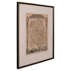
Antique Lithography Map, Shropshire, English, Framed, Cartography, Victorian
Located in Hele, Devon, GB
This is an antique lithography map of Shropshire. An English, framed atlas engraving of cartographic interest, dating to the mid 19th century and later.
Superb lithography of Shrop...
Category
Mid-19th Century British Victorian Antique Maps
Materials
Wood
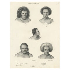
Old Print Depicting Various Inhabitants of Tonga Tabu, ca.1836
Located in Langweer, NL
Antique print titled 'Tonga-Tabu'.
Old print depicting various inhabitants of Tonga Tabu. This print originates from 'Entdeckungs, Reise der Franzosischen Corvette Astrolabe Unternomen auf Befehl Konig Karls...
Category
1830s Antique Maps
Materials
Paper
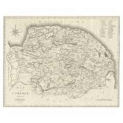
Large Antique County Map of Norfolk, England
Located in Langweer, NL
Antique map titled 'A Map of Norfolk from the best Authorities'. Original old county map of Norfolk, England. Engraved by John Cary. Originates from 'N...
Category
Early 19th Century Antique Maps
Materials
Paper
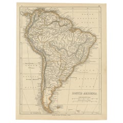
Antique Map of South America by Lowry, 1852
Located in Langweer, NL
Antique map titled 'South America'. Original map of South America. This map originates from 'Lowry's Table Atlas constructed and engraved from the most recent authorities' by J.W. Lo...
Category
Mid-19th Century Antique Maps
Materials
Paper
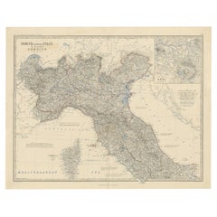
Antique Map of North and Central Italy and the Island of Corsica, c.1860
Located in Langweer, NL
Antique map titled 'North & Central Italy and the Island of Corsica'.
Old map of North and Central Italy, and the island of Corsica. With an inset map of the region of Rome. Orig...
Category
19th Century Antique Maps
Materials
Paper
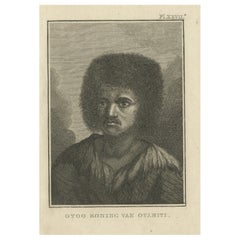
Original Antique Engraving of Otoo, King of Tahiti, by Cook, 1803
By James Cook
Located in Langweer, NL
Antique print titled 'Otoo Koning van Otahiti'. Antique print depiciting Otoo, King of Tahiti. Originates from 'Reizen Rondom de Waereld door James Cook (..)'.
Artists and Engrave...
Category
19th Century Antique Maps
Materials
Paper
Antique Map of St. Louis and Chicago
Located in Langweer, NL
Antique map titled 'The City of St. Louis Missouri - The City of Chicago Illinois'. Dual map on single page showing St. Louis and Chicago. Finely produ...
Category
Mid-19th Century Antique Maps
Materials
Paper
Antique Map of the East Indies by Levasseur, '1875'
Located in Langweer, NL
Antique map titled 'Carte de la Malaisie'. Large map of the East Indies. This map originates from 'Atlas de Géographie Moderne Physique et Politique' by A. Levasseur. Published 1875.
Category
Late 19th Century Antique Maps
Materials
Paper
Antique Map of the Eastern United States with Inset Map of Texas
Located in Langweer, NL
Antique map titled 'Verein-Staaten von Nord-America mit Ausnahme Florida's und der Westlichen Territorien'. This map extends as far west as Louisiana and only includes the northern p...
Category
Mid-19th Century Antique Maps
Materials
Paper
Old Hand-Colored Print of Officers and Horses of the Belgium Army, 1833
Located in Langweer, NL
One nicely hand coloured print of an original serie of 23 plates, showing officers and soldiers discussing matters. published in 1833. Rare.
From a serie of beautiful lithographed...
Category
1830s Antique Maps
Materials
Paper
Original Antique Engraving of Otago by Cook, 1803
By James Cook
Located in Langweer, NL
Antique print titled 'Otago Bevelhebber van het Eiland Amsterdam'. Antique print depicting Otago, commander of the Island Amsterdam. Originates from 'Reizen Rondom de Waereld door James Cook...
Category
19th Century Antique Maps
Materials
Paper
Antique Map of Kentucky
Located in Langweer, NL
Antique map titled 'Kentucky'. Original antique map of Kentucky, United States. This print originates from 'Encyclopaedia Britannica', Ninth E...
Category
Late 19th Century Antique Maps
Materials
Paper
Large Antique County Map of Cambridgeshire, England
Located in Langweer, NL
Antique map titled 'A Map of Cambridgeshire from the best Authorities'. Original old county map of Cambridgeshire, England. Engraved by John Cary. Originates from 'New British Atlas'...
Category
Early 19th Century Antique Maps
Materials
Paper
Antique Map of the Antilles by Lapie, '1842'
Located in Langweer, NL
Antique map titled 'Carte des Antilles du Golfe du Méxique'. Map of the Antilles. This map originates from 'Atlas universel de géographie ancienne et moderne (..)' by Pierre M. Lapie...
Category
Mid-19th Century Antique Maps
Materials
Paper
Antique Print of Villefranche in the Nice and Savoy Region of France, c.1865
Located in Langweer, NL
Antique print titled 'Villefranche près de Nice'. Original antique print of Villefranche near Nice, France. This print originates from 'Nice Et Savoie, Sites Pittoreques, Monuments, ...
Category
19th Century Antique Maps
Materials
Paper
Rare Original Antique View in Old Colours of Villefranche in France, c.1860
Located in Langweer, NL
Antique print titled 'Villefranche'. View of Villefranche near Nice, France. Source unknown, to be determined.
Artists and Engravers: Published by Lemercier, Paris.
Condition: ...
Category
19th Century Antique Maps
Materials
Paper
Antique Map of Western States, Michigan, Wisconsin, Iowa by A & C. Black, 1870
Located in Langweer, NL
Antique map titled 'Western States, Michigan, Wisconsin, Minnesota, Iowa with portions of Illinois & Indiana'. Original antique map of Western States, Michigan, Wisconsin, Minnesota,...
Category
Late 19th Century Antique Maps
Materials
Paper
Antique Engraving of the Dead Chief of Tahiti Island in the Pacific, 1803
By James Cook
Located in Langweer, NL
Antique print titled 'Het Lijk van Thee, Opperste van O-Tahiti, zoodanig als men zulks na zijnen dood bewaarde'. Antique print depicting the remnents of Thee, Chief of Tahiti. Origin...
Category
19th Century Antique Maps
Materials
Paper
Nice Antique Print of a Breton Cow, a French Cattle Breed from Brittany, 1862
Located in Langweer, NL
Antique print titled 'Vache Bretonne' - This rare plate shows a Breton Cow, a French cattle breed from Brittany. From: 'Les Races bovines au concours universel agricole de Paris en 1...
Category
1860s Antique Maps
Materials
Paper
Antique Map of England and Wales, with References to the Counties
Located in Langweer, NL
Antique map titled 'England and Wales'. Original antique map of England and Wales, with references to the counties. Source unknown, to be determined. Published circa 1820.
Category
Early 19th Century Antique Maps
Materials
Paper
Colourful Antique Map of England and Wales Divided in Counties, 1854
Located in Langweer, NL
Antique map titled 'A Map Shewing the Places in England & Wales Sending Members to Parliament with the numbers returned, divisions of counties and population, places of county electi...
Category
19th Century Antique Maps
Materials
Paper
Large Antique County Map of Lincolnshire, England
Located in Langweer, NL
Antique map titled 'A Map of Lincolnshire from the best Authorities'. Original old county map of Lincolnshire, England. Engraved by John Cary. Originates from 'New British Atlas' by ...
Category
Early 19th Century Antique Maps
Materials
Paper
Original Antique Print of Byzantine Decorative Art, 1869
Located in Langweer, NL
Old print of Byzantine decorative art. This print originates from 'L'Ornement polychrome'. A beautiful work containing about 2000 patterns of all the styles of Art old and Asian, mid...
Category
19th Century Antique Maps
Materials
Paper
Large Antique County Map of Worcestershire, England
Located in Langweer, NL
Antique map titled 'A Map of Worcestershire from the best Authorities'. Original old county map of Worcestershire, England. Engraved by John Cary. Originates from 'New British Atlas'...
Category
Early 19th Century Antique Maps
Materials
Paper
Large Antique County Map of Westmorland, England
Located in Langweer, NL
Antique map titled 'A Map of Westmoreland from the best Authorities'. Original old county map of Westmorland, England. Engraved by John Cary. Originates from 'New British Atlas' by J...
Category
Early 19th Century Antique Maps
Materials
Paper
Large Antique County Map of Derbyshire, England
Located in Langweer, NL
Antique map titled 'A Map of Derbyshire from the best Authorities'. Original old county map of Derbyshire, England. Engraved by John Cary. Originates from 'New British Atlas' by John...
Category
Early 19th Century Antique Maps
Materials
Paper
Large Antique County Map of the West Riding of Yorkshire 'North Part', England
Located in Langweer, NL
Antique map titled 'A Map of the North Part of the West Riding of Yorkshire from the best Authorities'. Original old county map of the north part of the West Riding of Yorkshire, Eng...
Category
Early 19th Century Antique Maps
Materials
Paper
Large Antique County Map of Northamptonshire, England
Located in Langweer, NL
Antique map titled 'A Map of Northamptonshire from the best Authorities'. Original old county map of Northamptonshire, England. Engraved by John Cary. Originates from 'New British At...
Category
Early 19th Century Antique Maps
Materials
Paper
Large Antique County Map of Northumberland, England
Located in Langweer, NL
Antique map titled 'A Map of Northumberland from the best Authorities'. Original old county map of Northumberland, England. Engraved by John Cary. Originates from 'New British Atlas'...
Category
Early 19th Century Antique Maps
Materials
Paper
Large Antique County Map of Buckinghamshire, England
Located in Langweer, NL
Antique map titled 'A Map of Buckinghamshire from the best Authorities'. Original old county map of Buckinghamshire, England. Engraved by John Cary. Originates from 'New British Atla...
Category
Early 19th Century Antique Maps
Materials
Paper
Antique Map of Cook's Strait in New Zealand, 1803
Located in Langweer, NL
Antique map New Zealand titled 'Kaart van Cooks Straat in Nieuw Zeeland'. Antique map of Cook's Strait in New Zealand. Originates from 'Reizen ...
Category
19th Century Antique Maps
Materials
Paper
Antique Engraving of Chinese Costumes, c.1860
Located in Langweer, NL
Antique print titled 'Costume Chinese'. Print of Chinese costumes. Source unknown, to be determined.
Artists and Engravers: Anonymous.
Condition:...
Category
19th Century Antique Maps
Materials
Paper
Antique Map of Southern Italy by J. Tallis, circa 1851
Located in Langweer, NL
Decorative and detailed mid-19th century map of Southern Italy which was drawn and engraved by John Rapkin (vignettes by A. H. Wray and J. Rogers...
Category
Mid-19th Century Antique Maps
Materials
Paper
Antique Print of the Statue of Joan of Arc by Knight, 1835
Located in Langweer, NL
Antique print titled 'Statue of the Maid of Orleans at Rouen'. Old print of the statue of Joan of Arc in Rouen, France. This print originates from 'One...
Category
19th Century Antique Maps
Materials
Paper
Antique Map of Northern Africa by Levasseur, '1875'
Located in Langweer, NL
Antique map titled 'Carte de l'Afrique Septentrionale'. Large map of Northern Africa. This map originates from 'Atlas de Géographie Moderne Physique et...
Category
Late 19th Century Antique Maps
Materials
Paper
Decorative Antique Map of Sweden and Part of Finland, 1806
Located in Langweer, NL
Antique map titled 'La Suede.'
Decorative map of Sweden and part of Finland by Robert de Vaugondy, revised and published by Delamarche. Source unknown, to be determined.
Artists and Engravers: Made by 'Charles Francois Delamarche' after an anonymous artist. Charles Francois Delamarche (1740-1817) founded the important and prolific Paris based Maison Delamarche map publishing firm in the late 18th century. A lawyer by trade Delamarche entered the map business with the acquisition from Jean-Baptiste Fortin of Robert de Vaugondy's map plates...
Category
Early 1800s Antique Maps
Materials
Paper
French Antique Map of Oceania with Details of the Australian Colonies, c.1840
Located in Langweer, NL
Antique map Oceania titled 'Océanie par C.V. Monin'. Old map of Oceania with an inset of New South Wales. Originates from 'Atlas Classique de la Géographie Ancienne (..)'.
Artists ...
Category
19th Century Antique Maps
Materials
Paper
Antique Print of Mosaic Found at Pompeii by Knight, 1835
Located in Langweer, NL
Antique print titled 'Mosaic, found at Pompeii'. Old print of mosaic found at Pompeii. This print originates from 'One Hundred and Fifty Wood Cuts selected from the Penny Magazine'. ...
Category
19th Century Antique Maps
Materials
Paper
Steel Engraved Map of Part of the Bengal Presidency 'India & Bangladesh', 1831
Located in Langweer, NL
Antique map titled 'India Bengal Presidency'. Old steel engraved map of part of the Bengal Presidency. The Bengal Presidency (1757–1912), later reorganized as the Bengal Province (19...
Category
1830s Antique Maps
Materials
Paper
Antique Colored Belgium Map Flandria Gallica Flanders Henricus Hondius
Located in Dayton, OH
Antique hand colored map of Flanders, Belgium, engraved by Henricus Hondius.
Sans frame - 21.25” x 18”.
Category
19th Century Renaissance Antique Maps
Materials
Paper
Old Hand-Colored Print with a View of Marseille, France, ca.1885
Located in Langweer, NL
Antique print titled 'Marseille aus der Vogelschau'.
Old print with a view of Marseille, France. This print originates from a German illustrated newsletter, published circa 1885.
...
Category
1850s Antique Maps
Materials
Paper
Antique Map of Persia and Tartary by Lowry, '1852'
Located in Langweer, NL
Antique map titled 'Persia and Tartary'. Original map of Persia and Tartary. This map originates from 'Lowry's Table Atlas constructed and engraved from the most recent Authorities' ...
Category
Mid-19th Century Antique Maps
Materials
Paper
Original Rare Antique Print of a Ruin in Peru, 1857
Located in Langweer, NL
Untitled print of a ruin in Peru. This print originates from 'Die Kunstwerke vom Alterthum bis auf die Gegenwart, oder, Wegweiser durch das ganze Gebiet der bildenden Kunst : enthalt...
Category
19th Century Antique Maps
Materials
Paper
Pl. 40 Antique Print of Decorative Art in the Middle Ages by Racinet, 1869
Located in Langweer, NL
Old print of decorative art in the Middle Ages. This print originates from 'L'Ornement polychrome'. A beautiful work containing about...
Category
19th Century Antique Maps
Materials
Paper
Pl. 65 Antique Print of Decorative Art in the Renaissance Period by Racinet, 1869
Located in Langweer, NL
Old print of decorative art in the Renaissance period. This print originates from 'L'Ornement polychrome'. A beautiful work containing about 2000 patterns of all the styles of Art ol...
Category
19th Century Antique Maps
Materials
Paper
Antique Print of the Chief Temple in Hakodate in Japan, 1856
Located in Langweer, NL
Antique print titled ‘Chief Temple Hakodadi‘. View of the chief temple in Hakodate, Japan. This print originates from 'Narrative of the expedition of an American squadron to the Chin...
Category
19th Century Antique Maps
Materials
Paper
Antique Print of Decorative Art in the Renaissance Period, 1869
Located in Langweer, NL
Old print of decorative art in the Renaissance period. This print originates from 'L'Ornement polychrome'. A beautiful work containing about 2000 patterns of all the styles of Art ol...
Category
19th Century Antique Maps
Materials
Paper
Original Antique Print of Byzantine Decorative Art, 1869
Located in Langweer, NL
Old print of Byzantine decorative art. This print originates from 'L'Ornement polychrome'. A beautiful work containing about 2000 patterns of all the styles of Art old and Asian, mid...
Category
19th Century Antique Maps
Materials
Paper
Antique Map of Peru, Ecuador and Bolivia by Lapie, 1842
Located in Langweer, NL
Antique map titled 'Carte du Perou et du Haut Perou'. Map of Peru, Ecuador and Bolivia. This map originates from 'Atlas universel de géographie ancienne et...
Category
19th Century Antique Maps
Materials
Paper
Old Map of the Oceans Around Australia, Indonesia and New Zealand, 1880
Located in Langweer, NL
Antique map titled 'Océanie'.
Old map of the oceans around Australia, Indonesia and New Zealand. With vignettes of people from Polynesia and the old monument Laparouse. This map ...
Category
1880s Antique Maps
Materials
Paper
Antique Map of Sweden by Delamarche, 1806
Located in Langweer, NL
Antique map titled 'La Suede.' Decorative map of Sweden and part of Finland by Robert de Vaugondy, revised and published by Delamarche. Source unknown, t...
Category
19th Century Antique Maps
Materials
Paper
Antique Map of Moldova to Thessaly and from the Adriatic to the Black Sea, 1880
Located in Langweer, NL
Antique map titled 'Turquie d'Europe'.
Map of the european parts of Turkey. The map covers from Moldova to Thessaly and from the Adriatic to the Black Sea. Greece and the island ...
Category
1880s Antique Maps
Materials
Paper
Antique Map of The World in Hemispheres by W. G. Blackie, 1859
Located in Langweer, NL
Antique map titled 'The World in Hemispheres with other projections'. Original antique map of The World. This map originates from ‘The Imperial Atlas of Modern Geography’. Published ...
Category
Mid-19th Century Antique Maps
Materials
Paper
Antique Print of the State Bedroom of Warwick Castle, River Aron, England, c1850
Located in Langweer, NL
Antique print titled 'State Bedroom-Warwick Castle'.
Lithograph of the State Bedroom of the famous Warwick Castle in England.
Warwick Castle is a medieval castle developed fro...
Category
19th Century Antique Maps
Materials
Paper
Antique Map of Oceania by Levasseur, '1875'
Located in Langweer, NL
Antique map titled 'Carte générale de l'Océanie'. Large map of Oceania. This map originates from 'Atlas de Géographie Moderne Physique et Politique' by A. Levasseur. Published 1875.
Category
Late 19th Century Antique Maps
Materials
Paper
Print of a Fortified Mosque and of Nobility in Aceh, Sumatra, Indonesia, 1874
Located in Langweer, NL
Antique print Indonesia titled 'Een versterkte Missigit' and 'Atchineezen'. Antique print depicting two scenes in Indonesia. Originates from 'De Oorlog tusschen Nederland en Atchin' ...
Category
19th Century Antique Maps
Materials
Paper
Ceremony for the Son of the King in the Village of Mua on Tongatapu, Tonga, 1803
Located in Langweer, NL
Antique print titled 'De Natsche, eene plechtigheid ter eere van 's Konings Zoon op Tongataboo'.
Antique print depiciting a ceremony for the son of the King of Tonga in the villa...
Category
Early 1800s Antique Maps
Materials
Paper
Original Antique Print of a Castle in Madrid, Spain, 1833
Located in Langweer, NL
Antique print titled 'Schloss zu Madrid'.
Lithograph of a castle in Madrid, Spain. This print originates from 'Neuen Bildergalerie für die Jugend'.
Artists and Engravers: Ano...
Category
1830s Antique Maps
Materials
Paper
