Items Similar to Antique Charts of the World – Physical Features and Ethnographical Map, 1884

Video Loading
Want more images or videos?
Request additional images or videos from the seller
1 of 14
Antique Charts of the World – Physical Features and Ethnographical Map, 1884
$383.98
£283.17
€320
CA$530.27
A$581.83
CHF 304.50
MX$7,160.40
NOK 3,836.30
SEK 3,593.27
DKK 2,437.19
About the Item
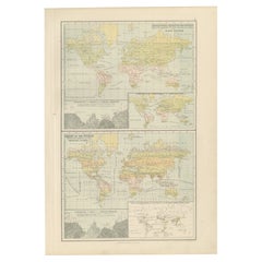
Antique Charts of the World – Physical Features and Ethnographical Map, 1884
Description:
This fascinating double plate from the New and Revised Edition of Black’s General Atlas of the World, published in Edinburgh in 1884, brings together a series of instructive thematic world charts. Unlike traditional political maps, these plates focus on physical geography, climate, population, and ethnography, reflecting the 19th-century desire to present the world through scientific and comparative lenses.
The upper section, titled “Chart of the World Exhibiting its Chief Physical Features and Currents of the Ocean,” emphasizes global natural forces. It shows prevailing ocean currents, trade winds, rainfall distribution, and climatic zones. Insets illustrate the distribution of rain and snow across the globe, as well as regional wind patterns, highlighting the importance of meteorology for navigation and agriculture in the Victorian era.
The lower section is the “Ethnographical Chart of the World Showing the Distribution and Varieties of the Human Race.” This map divides the continents by ethnographic groupings, reflecting contemporary 19th-century anthropological and cultural classifications. Alongside this is a map of prevailing world religions, color-coded to distinguish between Christianity, Islam, Hinduism, Buddhism, Judaism, and other traditions. A comparative chart of the sizes of major world cities by population further enhances the plate, offering a striking demographic snapshot of the late 1800s.
Together, these maps illustrate the Victorian fascination with categorization, science, and empire. They not only represent geography but also reflect how Europeans of the period viewed humanity and the natural world in relation to global order and progress. As such, they are an important historical document, combining physical and human geography into a single visual framework.
Condition report:
Very good condition. Original coloring is clear and well-preserved. Light toning in margins with faint age-related patina. No tears or significant damage. Plate mark visible. Sold with the frame.
Framing tips:
This plate works particularly well in a large double-window archival mat to show both upper and lower charts. For a striking display, use a neutral mat such as ivory or light cream, with a black or walnut frame to contrast the soft pastel tones. This presentation emphasizes its educational and decorative qualities.
Technique: Engraving with original hand coloring
Maker: Black’s General Atlas, Edinburgh, 1884
- Dimensions:Height: 17.84 in (45.3 cm)Width: 12.29 in (31.2 cm)Depth: 0.01 in (0.2 mm)
- Materials and Techniques:
- Place of Origin:
- Period:
- Date of Manufacture:1884
- Condition:Very good condition. Original coloring is clear and well-preserved. Light toning in margins with faint age-related patina. No tears or significant damage. Plate mark visible. Sold without the frame.
- Seller Location:Langweer, NL
- Reference Number:Seller: BG-13601-3-21stDibs: LU3054346496822
About the Seller
5.0
Recognized Seller
These prestigious sellers are industry leaders and represent the highest echelon for item quality and design.
Platinum Seller
Premium sellers with a 4.7+ rating and 24-hour response times
Established in 2009
1stDibs seller since 2017
2,618 sales on 1stDibs
Typical response time: <1 hour
- ShippingRetrieving quote...Shipping from: Langweer, Netherlands
- Return Policy
Authenticity Guarantee
In the unlikely event there’s an issue with an item’s authenticity, contact us within 1 year for a full refund. DetailsMoney-Back Guarantee
If your item is not as described, is damaged in transit, or does not arrive, contact us within 7 days for a full refund. Details24-Hour Cancellation
You have a 24-hour grace period in which to reconsider your purchase, with no questions asked.Vetted Professional Sellers
Our world-class sellers must adhere to strict standards for service and quality, maintaining the integrity of our listings.Price-Match Guarantee
If you find that a seller listed the same item for a lower price elsewhere, we’ll match it.Trusted Global Delivery
Our best-in-class carrier network provides specialized shipping options worldwide, including custom delivery.More From This Seller
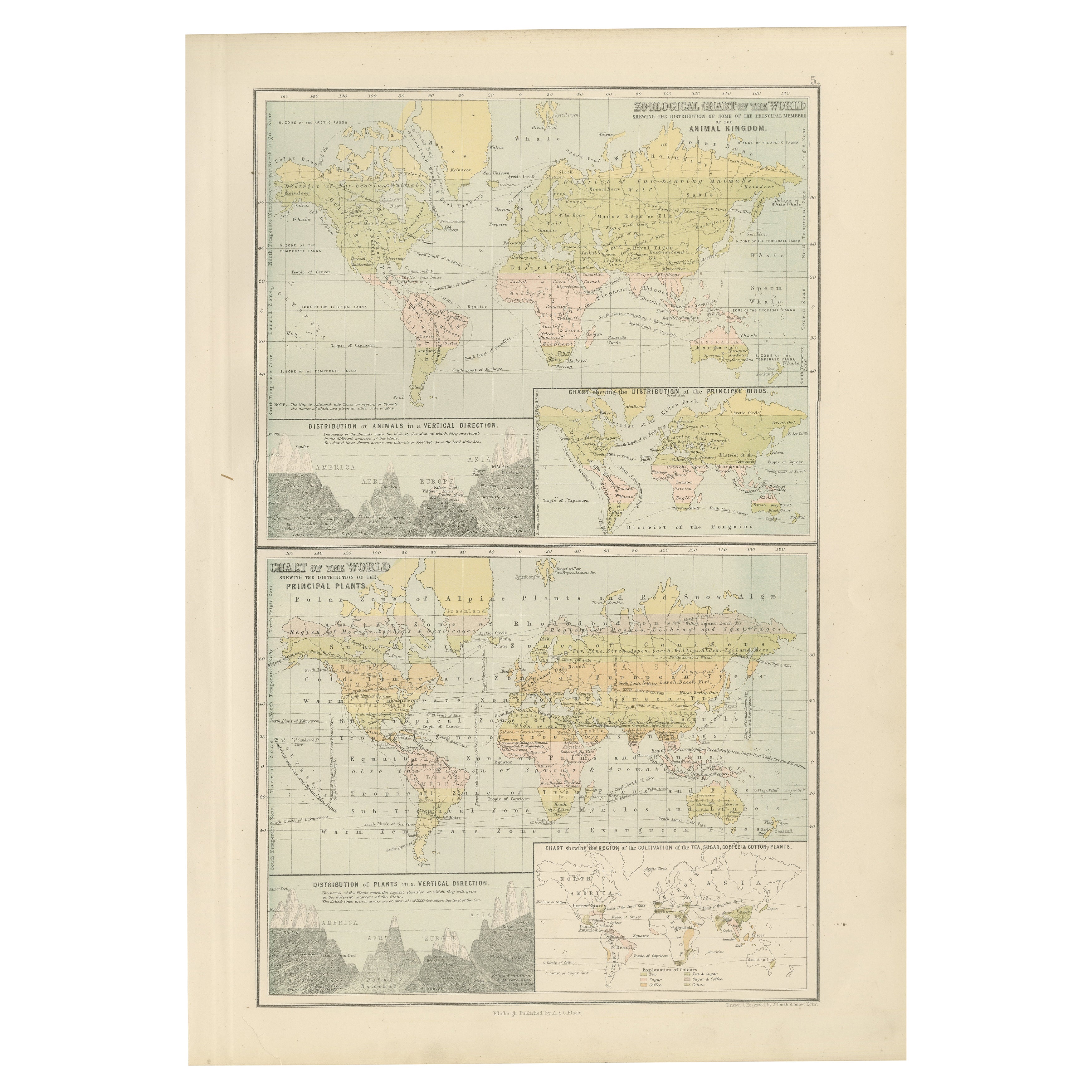
View AllAntique Zoological and Botanical Chart of the World – Decorative Map, 1884
Located in Langweer, NL
Antique Zoological and Botanical Charts of the World – Black’s Atlas, 1884
This double plate from the New and Revised Edition of Black’s General Atlas of the World, published in Edi...
Category
Antique 1880s Scottish Maps
Materials
Paper
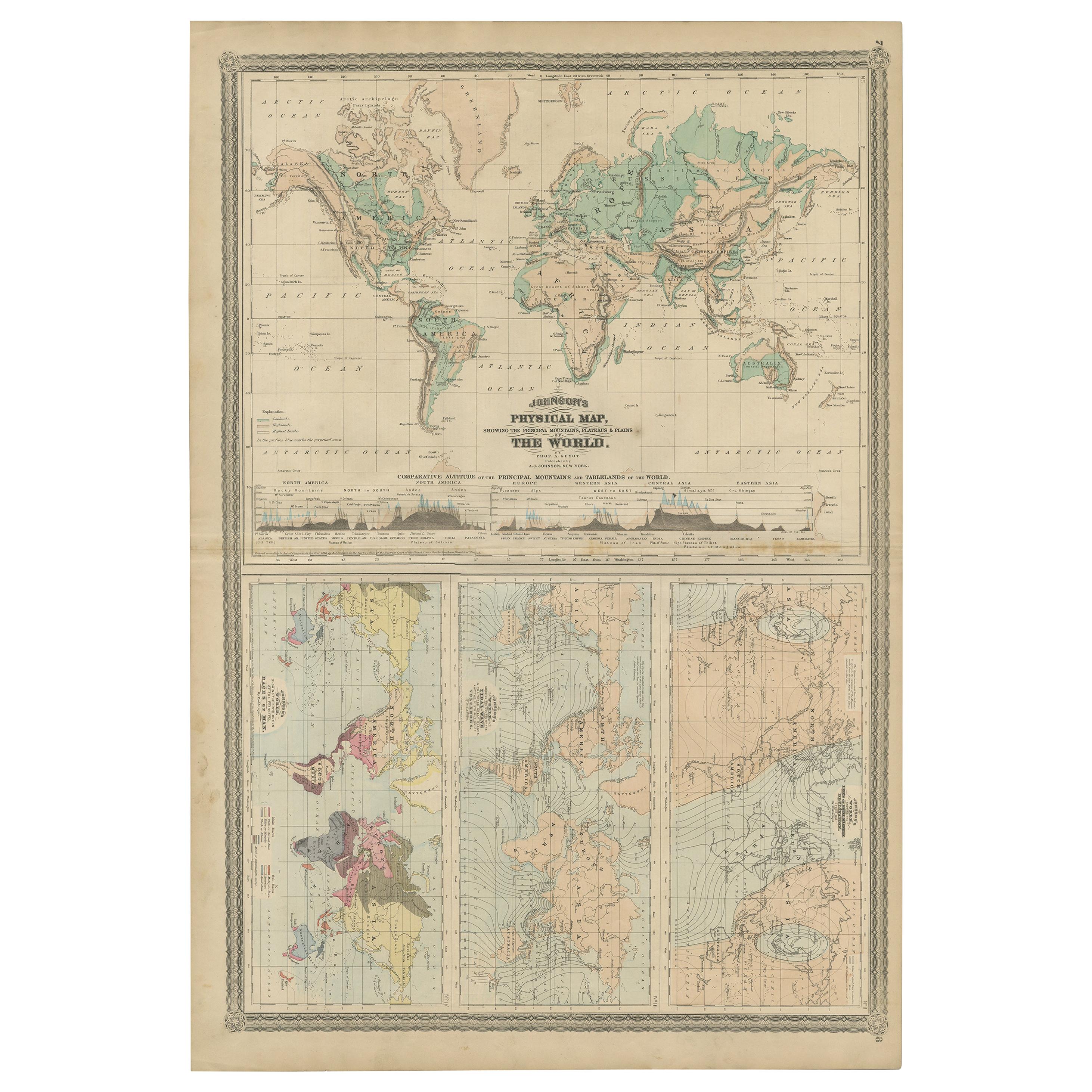
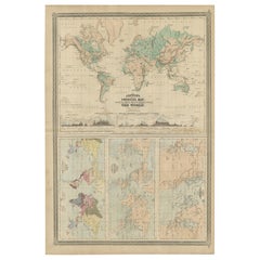
Four Physical Maps of the World on One Sheet , 1872
Located in Langweer, NL
Four physical maps of the world on one sheet. The upper map shows lowlands, highlands and highest lands. The other maps show world's races, ocean current and volcanoes, and magnetic ...
Category
Antique Late 19th Century Maps
Materials
Paper
$335 Sale Price
20% Off
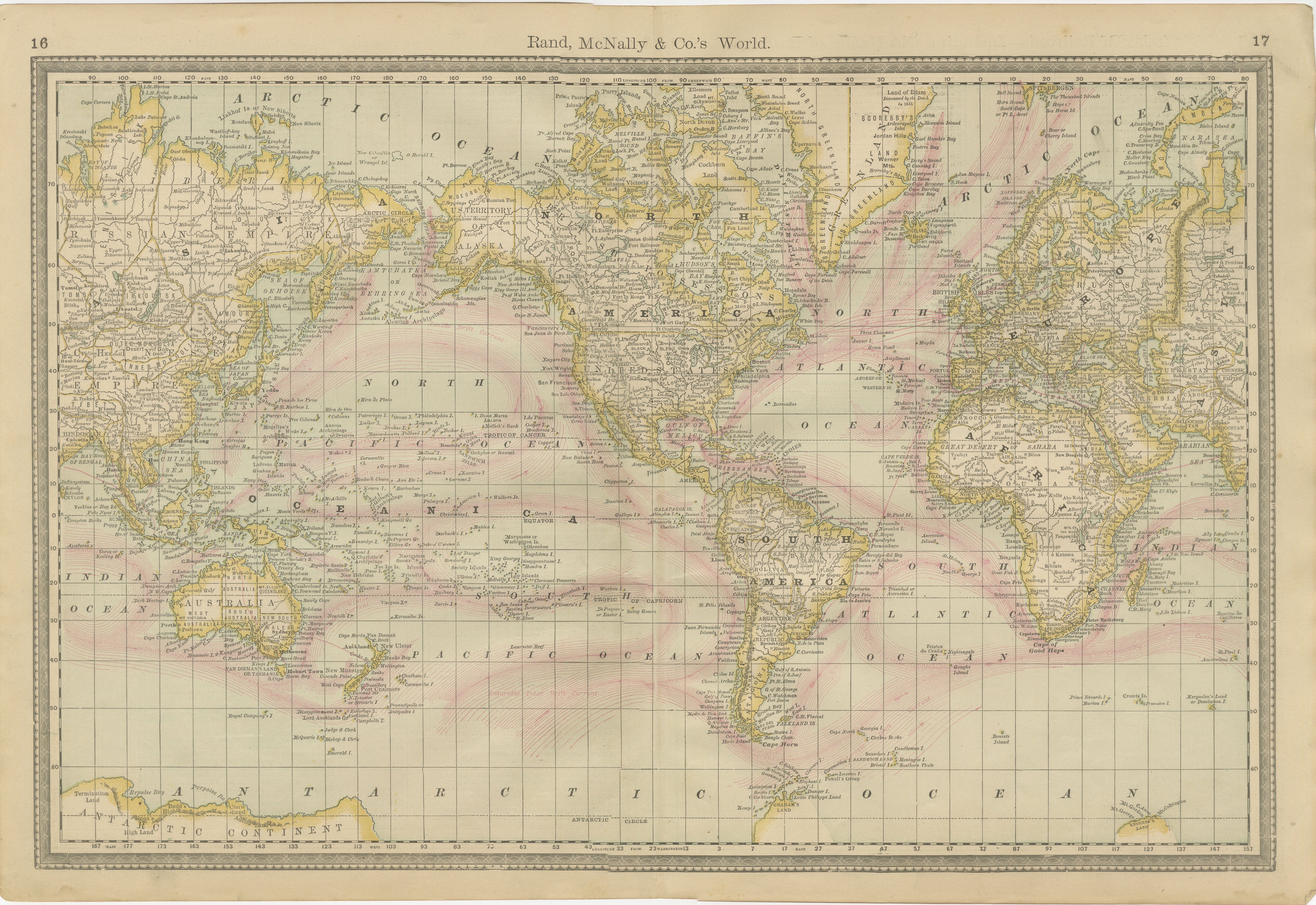
World Antique Map c.1888 – Rand McNally, Continents & Territories
Located in Langweer, NL
Antique Map of Mexico – Rand McNally, circa 1888
This antique map titled “Rand, McNally & Co.’s Mexico” was published around 1888 and depicts Mexico in the late 19th century, a peri...
Category
Antique Late 19th Century American Maps
Materials
Paper
Antique Map of The World in Hemispheres on Various Projections, 1882
Located in Langweer, NL
This stunning 1882 'Antique Map of The World in Hemispheres' showcases an exquisite blend of cartographic precision and artistic elegance. Crafted under the watchful eye of W.G. Blac...
Category
Antique 1880s Maps
Materials
Paper

$268 Sale Price
20% Off
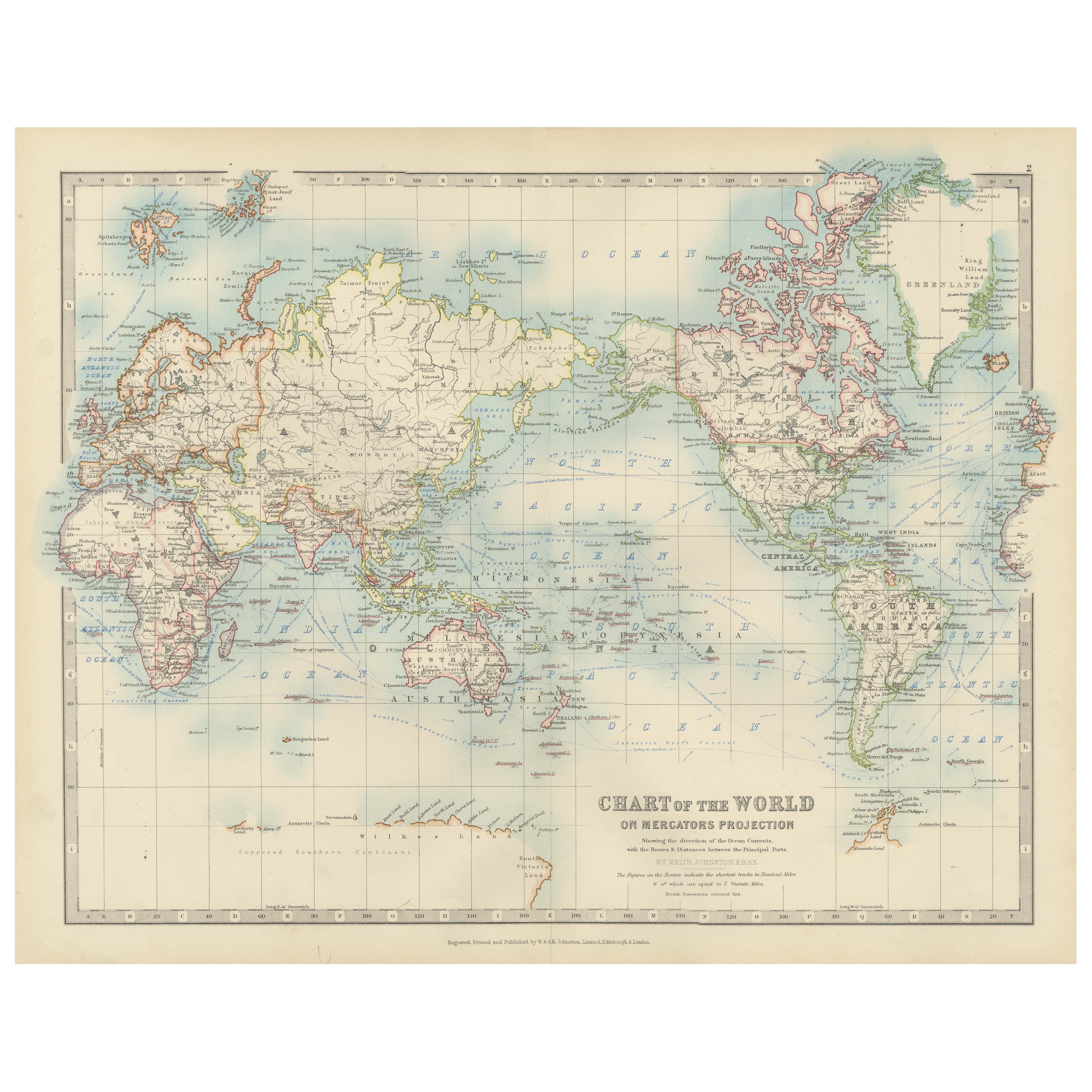
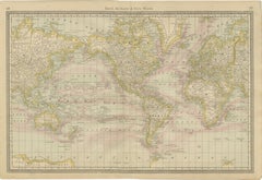
Antique World Map on Mercator's Projection, Ocean Currents and Trade Routes 1903
Located in Langweer, NL
Title: Antique World Map on Mercator's Projection, 1903, Showing Ocean Currents and Trade Routes
Description:
This antique map, titled "Chart of the World on Mercator's Projection,"...
Category
Early 20th Century Maps
Materials
Paper

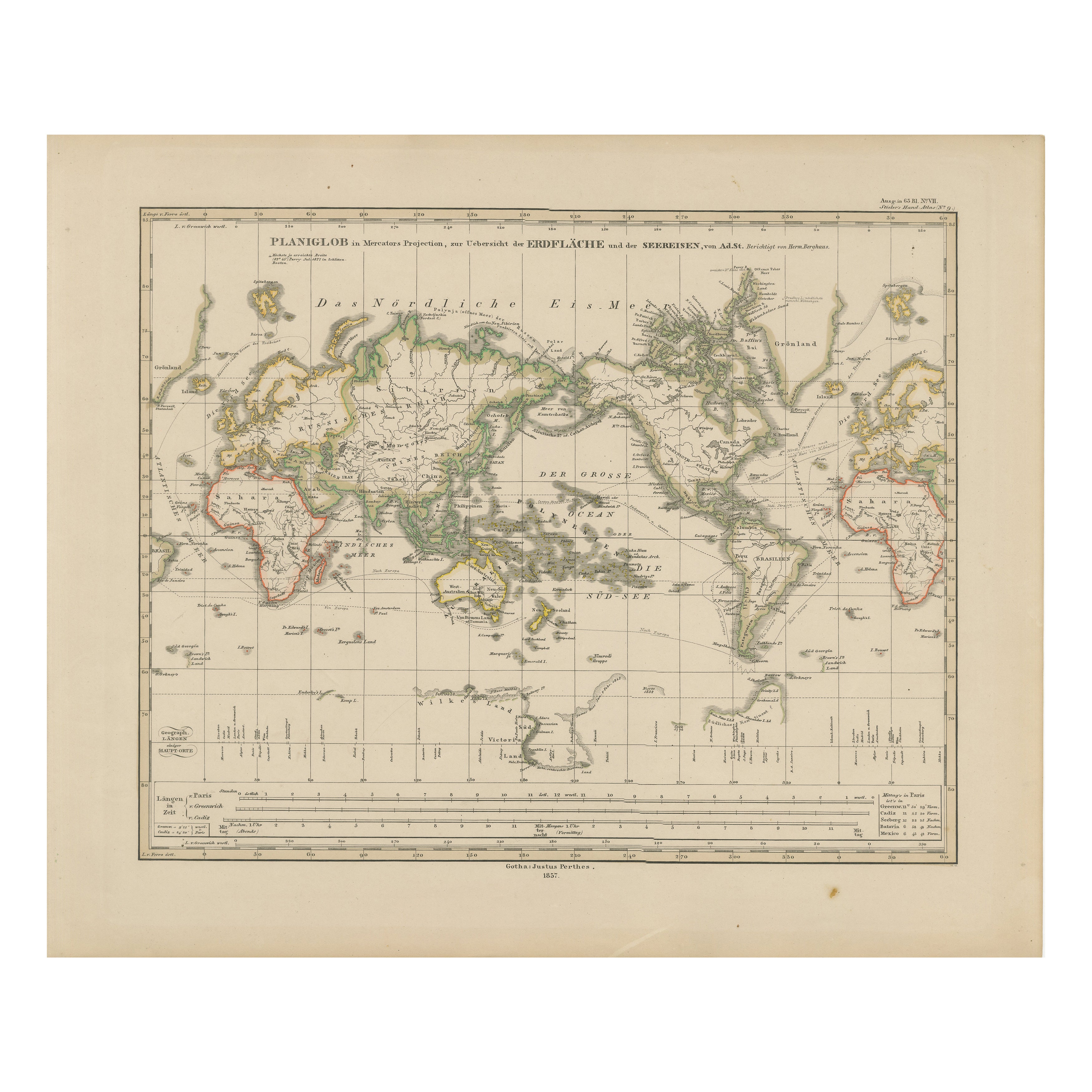
World Map – Mercator Projection with Global Sea Routes, Published in 1857
Located in Langweer, NL
World Map – Mercator Projection with Global Sea Routes 1857
This attractive antique print shows a world map titled “Planiglob in Mercators Projection zur Übersicht der Erdfläche und...
Category
Antique Mid-19th Century German Maps
Materials
Paper

You May Also Like
Original Antique Map of The World by Dower, circa 1835
Located in St Annes, Lancashire
Nice map of the World
Drawn and engraved by J.Dower
Published by Orr & Smith. C.1835
Unframed.
Free shipping
Category
Antique 1830s English Maps
Materials
Paper

Original Antique Map of The World by Thomas Clerk, 1817
Located in St Annes, Lancashire
Great map of The Eastern and Western Hemispheres
On 2 sheets
Copper-plate engraving
Drawn and engraved by Thomas Clerk, Edinburgh.
Published by Mackenzie And Dent, 1817
...
Category
Antique 1810s English Maps
Materials
Paper

Large Original Antique Map of The World, Fullarton, C.1870
Located in St Annes, Lancashire
Great map of the World. Showing both hemispheres
From the celebrated Royal Illustrated Atlas
Lithograph. Original color.
Published by Fullarton, Edinburgh, C.1870
Unframed.
Rep...
Category
Antique 1870s Scottish Maps
Materials
Paper

Large Original Antique Map of the World, Fullarton, circa 1870
Located in St Annes, Lancashire
Great map of the World.
From the celebrated Royal Illustrated Atlas
Lithograph. Original color.
Published by Fullarton, Edinburgh, circa 1870.
Unframed.
Category
Antique 1870s Scottish Maps
Materials
Paper

1864 Original illustrated planisphere - World Map - Geography
Located in PARIS, FR
Immerse yourself in the epic journey of the past with the Illustrated Historical Planisphere of 1864 by Charpentier! 🗺️ This cartographic treasure transports you through the intrica...
Category
1860s Prints and Multiples
Materials
Linen, Lithograph, Paper

1864 Johnson's Map of the World on Mercator's Projection, Ric.B009
Located in Norton, MA
An 1864 Johnson's map of
the World on Mercator's Projection
Ric.b009
About this Item
"This antique map came from Johnson's New Illustrated (Steel Plate) Family Atlas, publ...
Category
Antique 19th Century Dutch Maps
Materials
Paper
