Items Similar to Antique Ireland Map with County Divisions – Decorative Wall Chart, 1884


Video Loading
Want more images or videos?
Request additional images or videos from the seller
1 of 11
Antique Ireland Map with County Divisions – Decorative Wall Chart, 1884
$428.57
£318.55
€360
CA$591.74
A$656.20
CHF 344.78
MX$8,017.63
NOK 4,313.71
SEK 4,049.16
DKK 2,741.22
About the Item
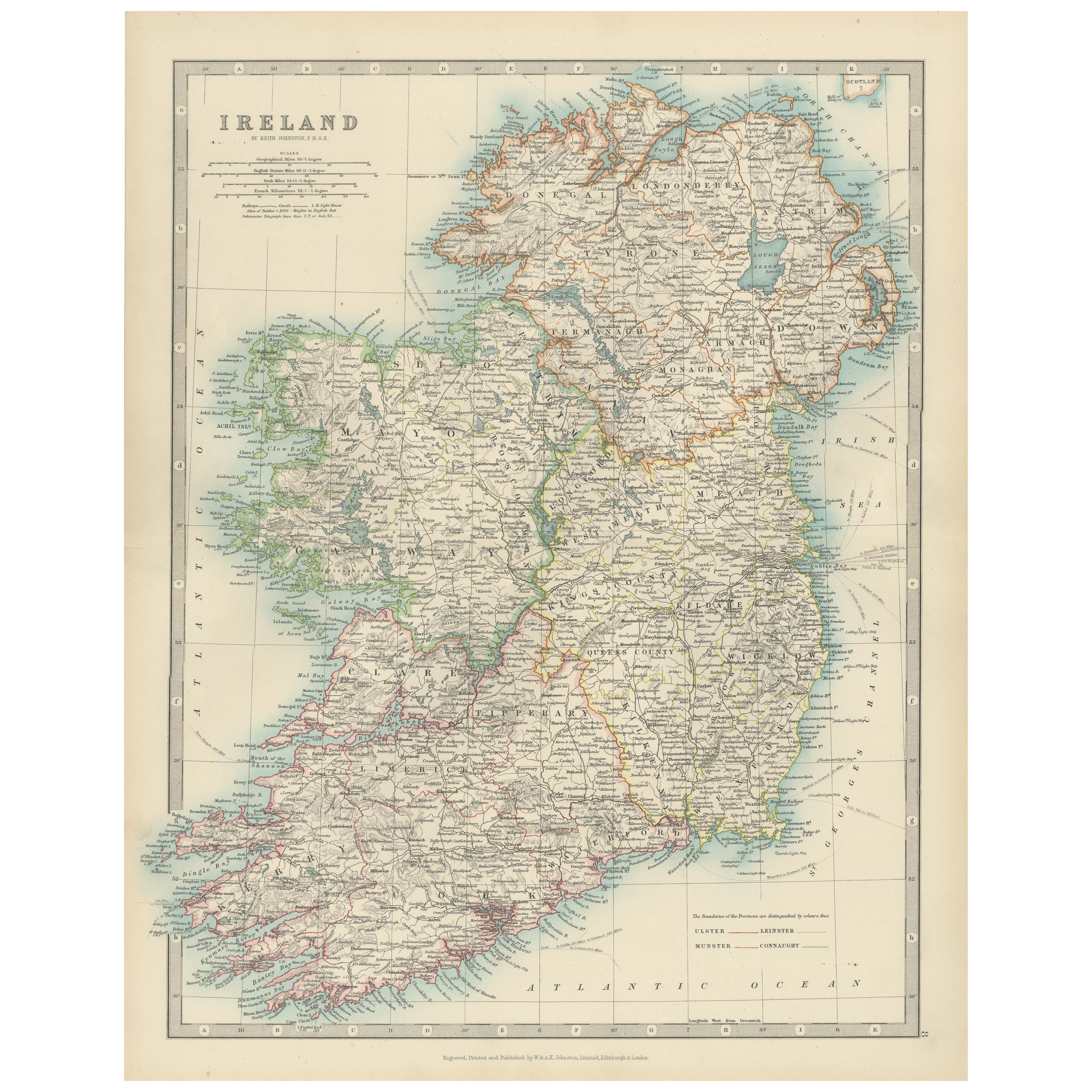
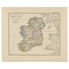
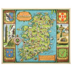
Antique Map of Ireland with Counties – Black’s Atlas, 1884
Description:
This finely detailed engraved map of Ireland was published in the New and Revised Edition of Black’s General Atlas of the World, Edinburgh, 1884. It presents the entire island of Ireland divided into counties, each shaded in a distinct hand-applied color wash, and offers an exceptional record of Ireland in the late 19th century.
The map shows all four provinces—Ulster, Connaught, Leinster, and Munster—with their counties carefully distinguished. Major towns and cities are clearly labeled, including Dublin, Cork, Galway, Limerick, and Belfast. The road and rail networks are finely drawn, reflecting Ireland’s increasing connectivity during the Victorian period. Rivers, lakes, bays, and coastal features are meticulously engraved, with the Shannon River and Lough Neagh particularly prominent.
An inset map in the lower right corner shows Ireland’s position relative to Great Britain and Europe. This emphasizes the island’s geographical context, situated at the edge of the Atlantic and adjacent to the Irish Sea and St. George’s Channel.
This map is both a decorative and historical piece, offering a valuable insight into Ireland before the political transformations of the 20th century. It stands as an elegant example of late Victorian cartography, blending accuracy, clarity, and artistry.
Condition report:
Very good condition. Original hand coloring remains clear and vibrant. Center fold as issued. Margins with light age toning and faint spotting, consistent with age.
Framing tips:
An archival mat in ivory or cream pairs well with the soft pastel coloring of the counties. A dark oak or black frame offers contrast, while a gilt frame highlights its Victorian character. UV-protective glass is recommended to preserve the freshness of the colors.
Technique: Engraving with original hand coloring
Maker: Black’s General Atlas, Edinburgh, 1884
- Dimensions:Height: 24.1 in (61.2 cm)Width: 17.84 in (45.3 cm)Depth: 0.01 in (0.2 mm)
- Materials and Techniques:
- Place of Origin:
- Period:
- Date of Manufacture:1884
- Condition:Very good condition. Original hand coloring remains clear and vibrant. Center fold as issued. Margins with light age toning and faint spotting, consistent with age.
- Seller Location:Langweer, NL
- Reference Number:Seller: BG-13601-3-81stDibs: LU3054346514702
About the Seller
5.0
Recognized Seller
These prestigious sellers are industry leaders and represent the highest echelon for item quality and design.
Platinum Seller
Premium sellers with a 4.7+ rating and 24-hour response times
Established in 2009
1stDibs seller since 2017
2,609 sales on 1stDibs
Typical response time: <1 hour
- ShippingRetrieving quote...Shipping from: Langweer, Netherlands
- Return Policy
Authenticity Guarantee
In the unlikely event there’s an issue with an item’s authenticity, contact us within 1 year for a full refund. DetailsMoney-Back Guarantee
If your item is not as described, is damaged in transit, or does not arrive, contact us within 7 days for a full refund. Details24-Hour Cancellation
You have a 24-hour grace period in which to reconsider your purchase, with no questions asked.Vetted Professional Sellers
Our world-class sellers must adhere to strict standards for service and quality, maintaining the integrity of our listings.Price-Match Guarantee
If you find that a seller listed the same item for a lower price elsewhere, we’ll match it.Trusted Global Delivery
Our best-in-class carrier network provides specialized shipping options worldwide, including custom delivery.More From This Seller
View AllAntique Map of Ireland, 1903, with Intricate County Boundaries & Coastal Details
Located in Langweer, NL
Title: Antique Map of Ireland, 1903, with Intricate County Boundaries and Coastal Detail
Description:
This antique map of Ireland, engraved and published in 1903 by the esteemed W. ...
Category
Early 20th Century Maps
Materials
Paper

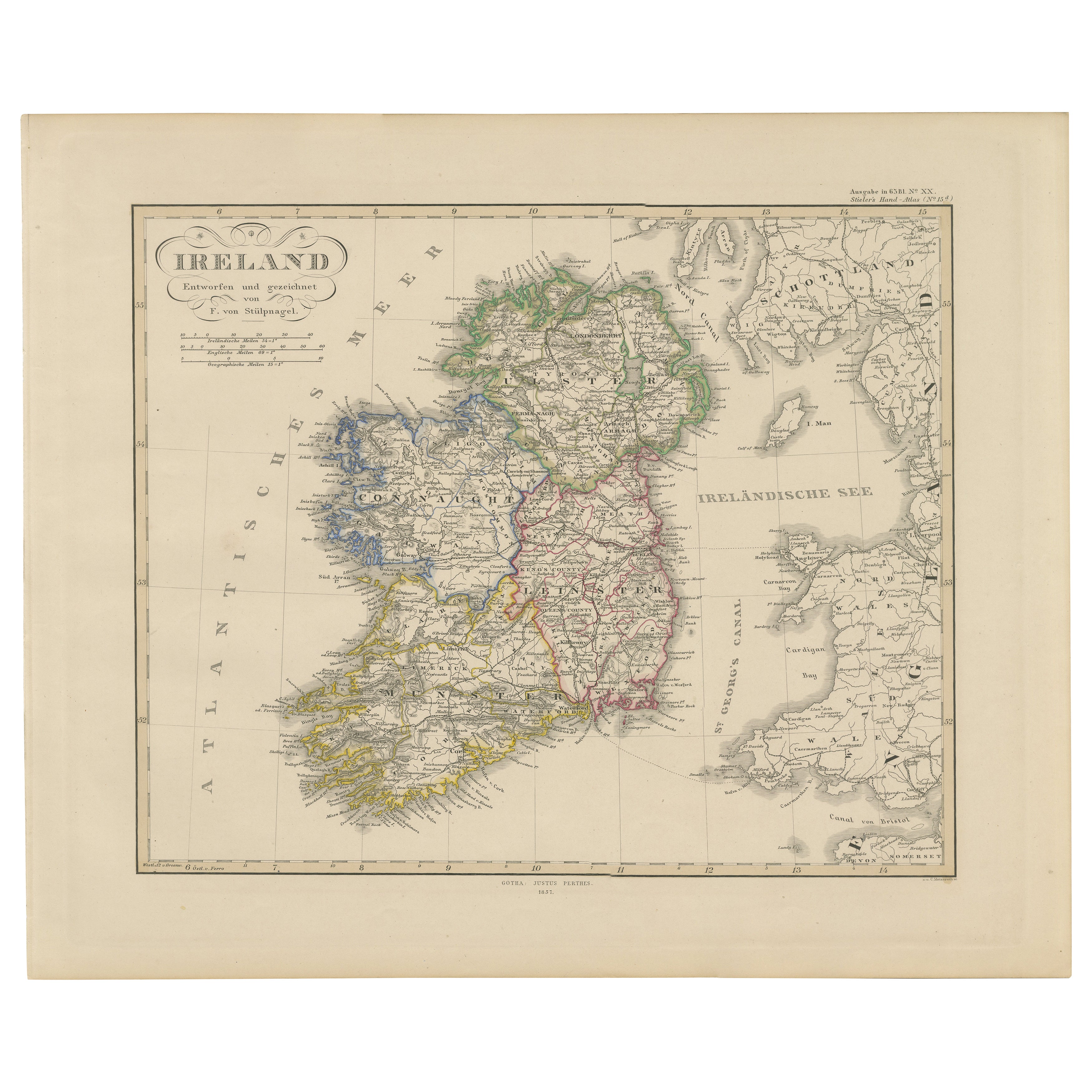
Ireland Map – Provincial and County Divisions 1851
Located in Langweer, NL
Ireland Map – Provincial and County Divisions 1851
This fine antique print shows Ireland titled simply “Ireland,” published in 1851 by Justus Perthes in Gotha as part of Adolf Stiel...
Category
Antique Mid-19th Century German Maps
Materials
Paper
Map of Ireland: Early 19th Century - from the 1802 Tardieu Atlas
Located in Langweer, NL
Antique Map Description
**Title:** Carte d'Irlande
**Publication Details:**
- **Atlas Title:** Nouvel Atlas Universel de Géographie Ancienne et Moderne
- **Purpose:** For the Nouve...
Category
Antique Early 1800s Maps
Materials
Paper

$419 Sale Price
20% Off
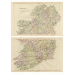
1882 Cartographic Views of Ireland's North and South Regions
Located in Langweer, NL
Title: 1882 Maps of Ireland: Northern and Southern Regions
These two maps provide a detailed representation of Ireland as it was in 1882, divided into the northern and southern regi...
Category
Antique 1880s Maps
Materials
Paper
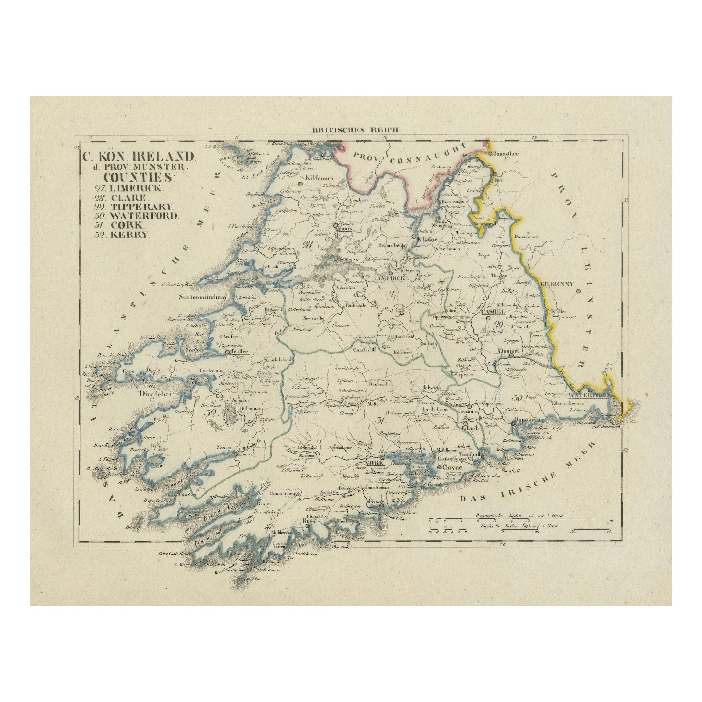
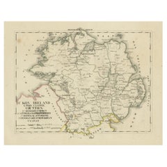
Antique 1830 Map of Munster, Ireland with Limerick, Cork, Kerry and Tipperary
Located in Langweer, NL
Title: Antique 1830 Map of Munster, Ireland with Limerick, Cork, Kerry, and Tipperary
Description: This 1830 German-language map, titled Britisches Reich – C. Kon: Ireland, focu...
Category
Antique 1830s Maps
Materials
Paper
Antique 1830 Map of Ulster, Ireland with Armagh, Down, Antrim, Donegal, Tyrone
Located in Langweer, NL
Title: Antique 1830 Map of Ulster, Ireland with Armagh, Down, Antrim, Donegal, and Tyrone
Description: This 1830 German-language map, titled Britisches Reich – C. Kon: Ireland, ...
Category
Antique 1830s Maps
Materials
Paper
You May Also Like
Large Original Antique Map of Ireland. C.1900
Located in St Annes, Lancashire
Fabulous map of Ireland
Original color.
Engraved and printed by the George F. Cram Company, Indianapolis.
Published, C.1900.
Unframed.
Free shipping.
Category
Antique 1890s American Maps
Materials
Paper

Original Antique Map of Ireland- Kerry. C.1840
Located in St Annes, Lancashire
Great map of Kerry
Steel engraving
Drawn under the direction of A.Adlard
Published by How and Parsons, C.1840
Unframed.
Category
Antique 1840s English Maps
Materials
Paper

Original Vintage Travel Poster Map of Ireland Showing Places of Note & Interest
Located in London, GB
Original vintage poster - Map of Ireland showing places of note and interest. Colorful illustrated map of Ireland by David William Burley (1901-1990) including images of historic arc...
Category
Vintage 1950s British Posters
Materials
Paper
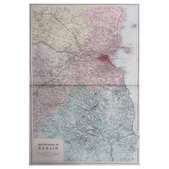
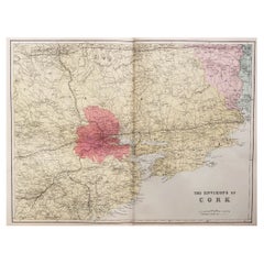
Large Original Antique Map of the Environs of Cork, Ireland, circa 1880
Located in St Annes, Lancashire
Great map of The Environs of Cork
Published circa 1880
Unframed
Free shipping.
Category
Antique 1880s Scottish Maps
Materials
Paper
Original Antique Map of Ireland- Tipperary and Waterford. C.1840
Located in St Annes, Lancashire
Great map of Tipperary and Waterford
Steel engraving
Drawn under the direction of A.Adlard
Published by How and Parsons, C.1840
Unframed.
Category
Antique 1840s English Maps
Materials
Paper

Large Original Antique Map of The Environs of Dublin, Ireland, circa 1880
Located in St Annes, Lancashire
Great map of The Environs of Dublin
Published circa 1880
Unframed
Free shipping.
Category
Antique 1880s Scottish Maps
Materials
Paper