Items Similar to Original Antique Hand- Map of Africa by Allard '1697'


Want more images or videos?
Request additional images or videos from the seller
1 of 6
Original Antique Hand- Map of Africa by Allard '1697'
About the Item
Antique map titled 'Novissima et Perfectissima Africae (..)'. Beautiful large map of Africa. This is the 3rd state of the map, with climate notation added in border (1697, Betz 162, Norwich 54). Very decorative cartouche. Published by A. Allard, 1697.
- Dimensions:Height: 21.66 in (55 cm)Width: 25.2 in (64 cm)Depth: 0.02 in (0.5 mm)
- Materials and Techniques:
- Period:Late 17th Century
- Date of Manufacture:1697
- Condition:Repaired: Professional repairs on folding line. General age-related toning, minor wear and soiling. Blank verso. Please study images carefully.
- Seller Location:Langweer, NL
- Reference Number:
About the Seller
5.0
Platinum Seller
These expertly vetted sellers are 1stDibs' most experienced sellers and are rated highest by our customers.
Established in 2009
1stDibs seller since 2017
1,947 sales on 1stDibs
Typical response time: <1 hour
- ShippingRetrieving quote...Ships From: Langweer, Netherlands
- Return PolicyA return for this item may be initiated within 14 days of delivery.
More From This SellerView All
- Original Antique Map of AfricaLocated in Langweer, NLAntique map titled 'Afrika'. Original antique map of Africa, drawn by Van Beusekom. Published by 'Seyffardt's Boekhandel' in Amsterdam, circa 1870.Category
Antique Late 19th Century Maps
MaterialsPaper
- Original Hand-Colored Antique Map of Africa by Elwe '1792'Located in Langweer, NLAntique map titled 'l'Afrique Divisée en ses Empires, Royaumes, et Etats'. Decorative large map of Africa. The cartography is typical for the 17th century with the Nile originating i...Category
Antique Late 18th Century Maps
MaterialsPaper
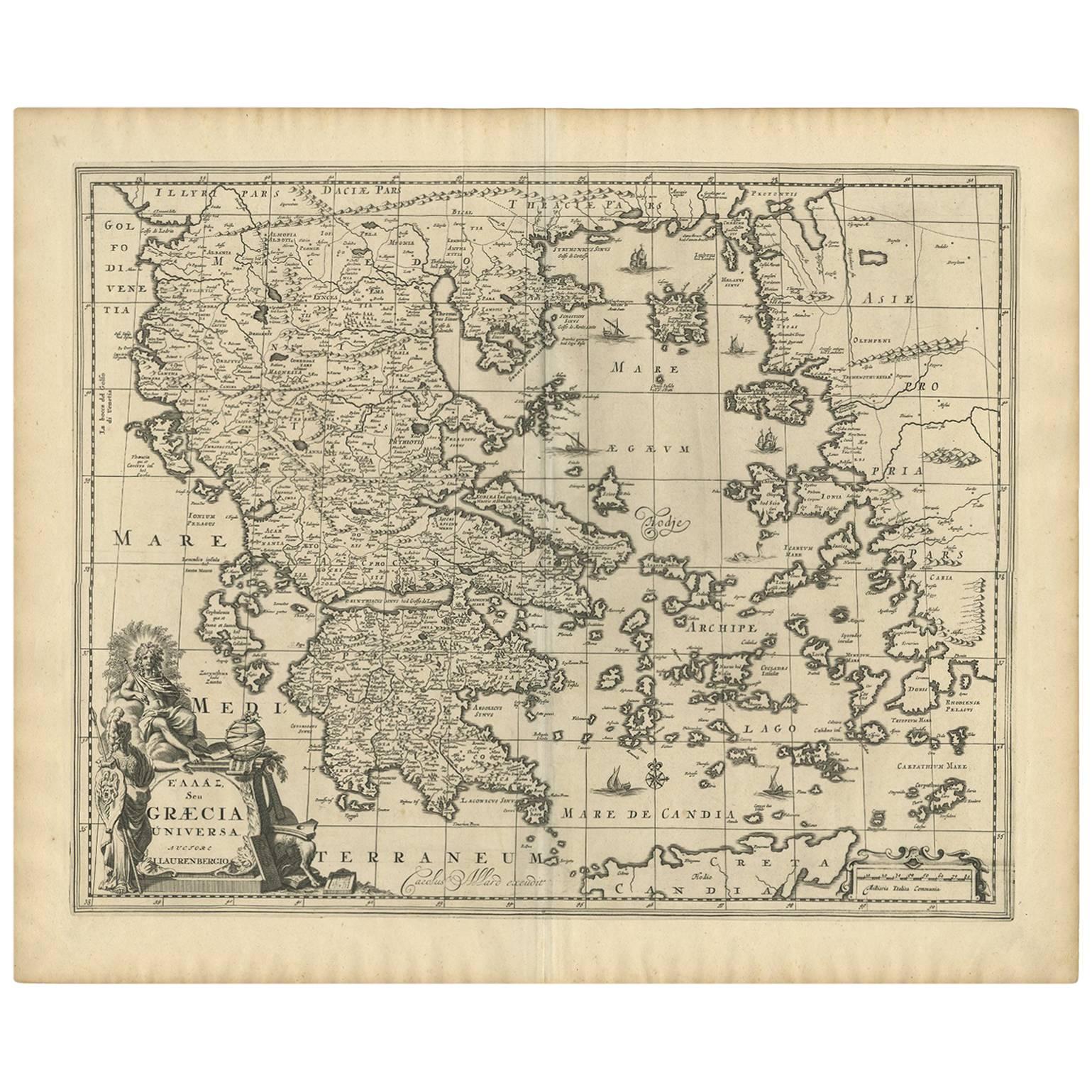
- Antique Map of Greece by Allard (c.1698)Located in Langweer, NLAntique map titled 'Hellas seu Graecia Universa' Detailed map of Greece, with Crete, the Aegean Islands, and part of Turkey. With two cartouches, compass rose and scale. Carolus Alla...Category
Antique Late 17th Century Maps
MaterialsPaper
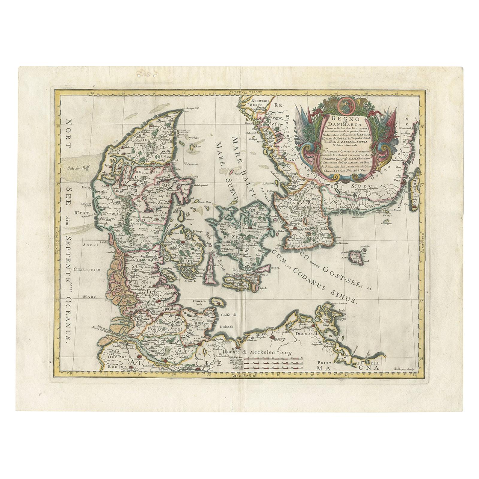
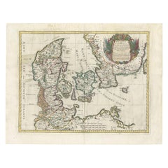
- Antique Map of Denmark by De Rossi (1697)Located in Langweer, NLAntique map of Denmark titled 'Regno di Danimarca'. Old map of Denmark showing Jutland, Funen, Zealand, Lolland-Falster, Bornholm, etc. This map was engraved by S. Roges and publishe...Category
Antique Late 17th Century Maps
MaterialsPaper
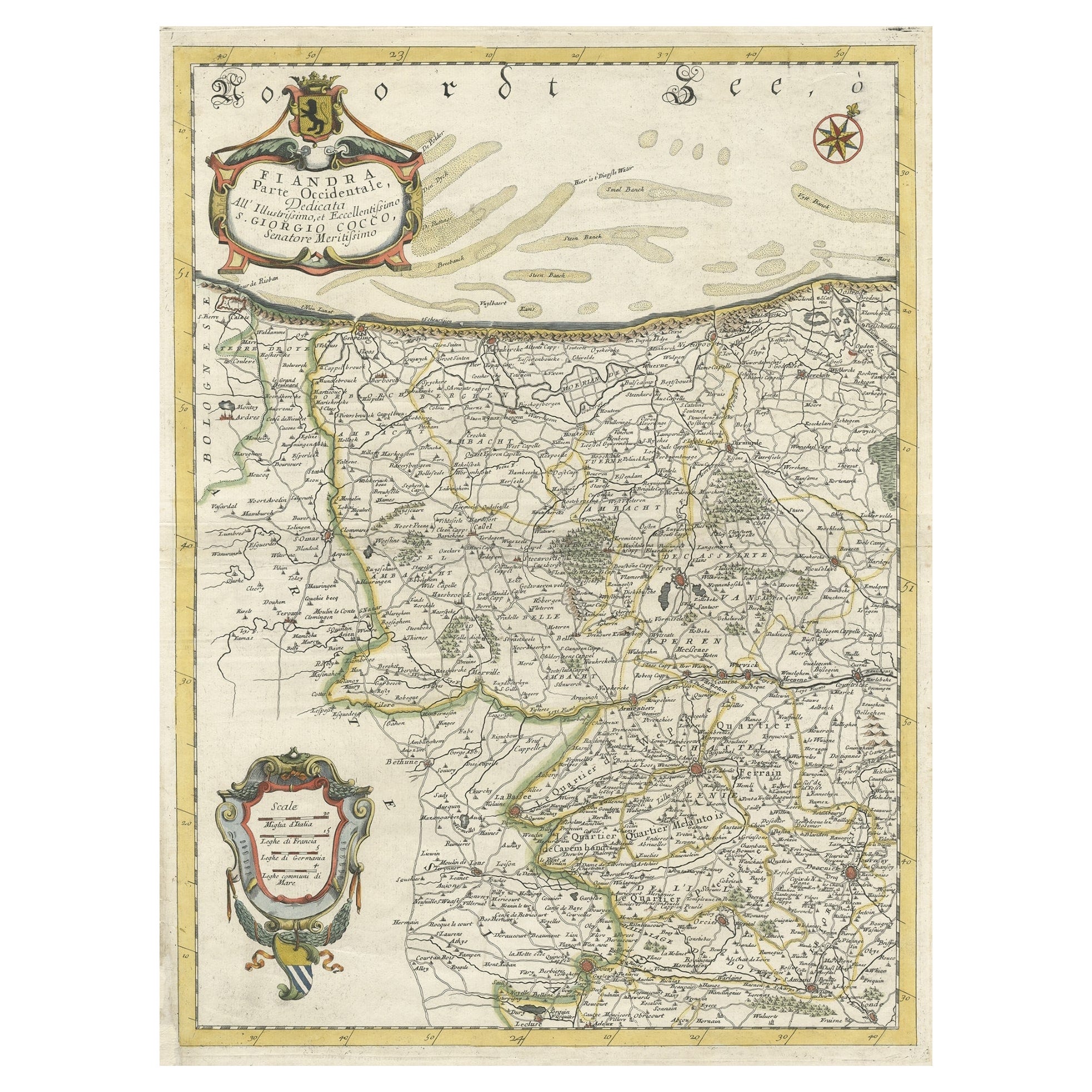
- Decorative Original Antique Map of the North of Flanders, Belgium, 1697Located in Langweer, NLAntique map titled 'Fiandra Parte Occidentale (..)'. Depicts northern part of Flanders, from North Sea, extends through the northern region of France to the cities of Douai and V...Category
Antique 1690s Maps
MaterialsPaper
- Uncoulored Original Antique Map of Western Africa, 1749Located in Langweer, NLInteresting detailed German antique map titled 'Neue Vorstellung der Abendlaendischen Küsten von Africa (..)'. Original antique map of Western Africa. This map originates from 'Neue ...Category
Antique Mid-18th Century Maps
MaterialsPaper


You May Also Like
- Original Antique Map of South Africa, Arrowsmith, 1820Located in St Annes, LancashireGreat map of South Africa. Drawn under the direction of Arrowsmith. Copper-plate engraving. Published by Longman, Hurst, Rees, Orme and Br...Category
Antique 1820s English Maps
MaterialsPaper
- Original Antique Map of Russia By Arrowsmith. 1820Located in St Annes, LancashireGreat map of Russia Drawn under the direction of Arrowsmith Copper-plate engraving Published by Longman, Hurst, Rees, Orme and Brown, 1820 Unframed.Category
Antique 1820s English Maps
MaterialsPaper
- 17th Century Hand-Colored Map of West Africa by Mercator/HondiusLocated in Alamo, CAA 17th century hand-colored map entitled "Guineae Nova Descriptio" by Gerard Mercator and Jodocus Hondius, published in their 'Atlas Minor' in Amsterdam in 1635. It is focused on the...Category
Antique Mid-17th Century Dutch Maps
MaterialsPaper
- "Africa Vetus": a 17th Century Hand-Colored Map by SansonBy Nicolas SansonLocated in Alamo, CAThis original hand-colored copperplate engraved map of Africa entitled "Africa Vetus, Nicolai Sanson Christianiss Galliar Regis Geographi" was originally created by Nicholas Sanson d...Category
Antique Late 17th Century French Maps
MaterialsPaper
- Original Antique Map of Italy. C.1780Located in St Annes, LancashireGreat map of Italy Copper-plate engraving Published C.1780 Unframed.Category
Antique Early 1800s English Georgian Maps
MaterialsPaper

- Original Antique Map of Asia. C.1780Located in St Annes, LancashireGreat map of Asia Copper-plate engraving Published C.1780 Two small worm holes to right side of map Unframed.Category
Antique Early 1800s English Georgian Maps
MaterialsPaper


Recently Viewed
View AllMore Ways To Browse
Antique 17th Century Map
Africa Map
Map Of Africa
Maps Of Africa
Antique Large Maps
Very Large African
Antique State Maps
Antique Map Border
Antique Africa Map
Antique African Map
Antique Maps Africa
Antique Map Africa
Africa Antique Map
Africa Map Antique
Antique Africa Maps
Antique African Maps
Antique Map Of Africa
Antique Maps Of Africa