Items Similar to Antique Map of the Brandenburg Region by Sanson, c.1705


Want more images or videos?
Request additional images or videos from the seller
1 of 5
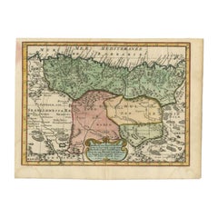
Antique Map of the Brandenburg Region by Sanson, c.1705
About the Item
Antique map Germany titled 't Markgraafschap en Keurvorstendom van Brandenburg'. Antique map of the Brandenburg region in Germany. Includes the cities of Berlin, Landsberg, Wittenberg and more. Artists and Engravers: Nicholas Sanson d'Abbeville (1600 - 1667) and his descendents were important French cartographer's active through the 17th century.
Artist: Nicholas Sanson d'Abbeville (1600 - 1667) and his descendents were important French cartographer's active through the 17th century.
Condition: Very good, please study image carefully.
Date: c.1705
Overall size: 29.5 x 22 cm.
Image size: 0.001 x 24 x 18 cm.
Antique prints have long been appreciated for both their aesthetic and investment value. They were the product of engraved, etched or lithographed plates. These plates were handmade out of wood or metal, which required an incredible level of skill, patience and craftsmanship. Whether you have a house with Victorian furniture or more contemporary decor an old engraving can enhance your living space. We offer a wide range of authentic antique prints for any budget.
- Dimensions:Height: 22 in (55.88 cm)Width: 29.5 in (74.93 cm)Depth: 0.001 in (0.03 mm)
- Materials and Techniques:
- Period:
- Date of Manufacture:circa 1705
- Condition:
- Seller Location:Langweer, NL
- Reference Number:Seller: BGI-005551stDibs: LU3054327770752
About the Seller
5.0
Platinum Seller
These expertly vetted sellers are 1stDibs' most experienced sellers and are rated highest by our customers.
Established in 2009
1stDibs seller since 2017
1,957 sales on 1stDibs
Typical response time: <1 hour
- ShippingRetrieving quote...Ships From: Langweer, Netherlands
- Return PolicyA return for this item may be initiated within 14 days of delivery.
More From This SellerView All
- Antique Map of Russia by N. Sanson, 1705Located in Langweer, NLA strongly engraved map of European Russia showing its political divisions, major topographical features, cities and towns. Extends to the Sea of Azov and the tip of the Caspian Sea ...Category
Antique Early 18th Century Maps
MaterialsPaper
- Antique Map of Asia by Sanson, circa 1705By Nicolas SansonLocated in Langweer, NLDutch edition of Sanson's map of Asia. Shows a large, dramatic version of Terre de Jesso, drawn from the discoveries of the Maarten de Vries expedition of 1643.Category
Antique Early 18th Century Dutch Maps
MaterialsPaper
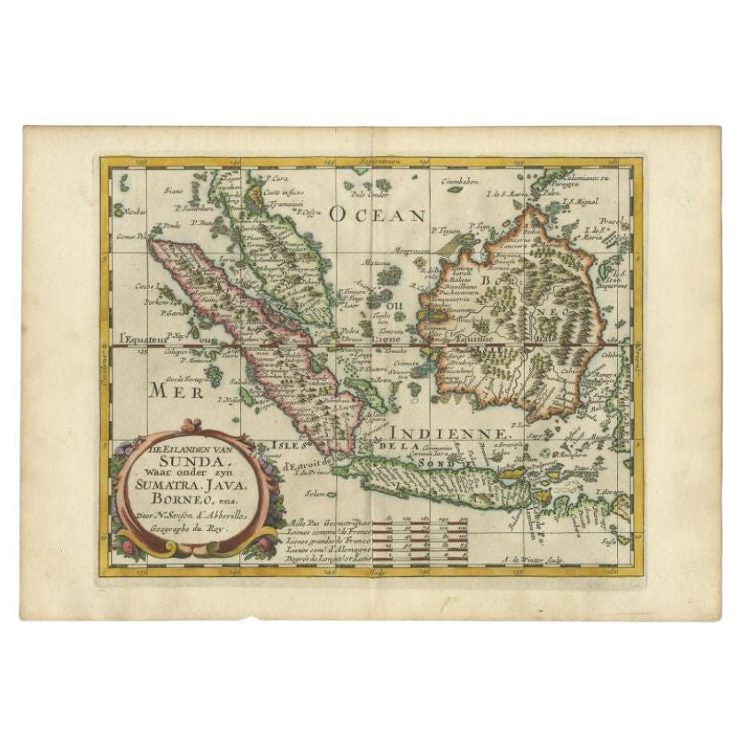
- Antique Map of the Bangka Belitun Island by Sanson, 1705Located in Langweer, NLAntique map Sunda Islands titled 'De Eilanden van Sunda, waar onder zyn Sumatra, Java, Borneo enz'. Old map of the Bangka Belitun Islands, part of the Greater Sunda Islands, includin...Category
Antique 18th Century Maps
MaterialsPaper
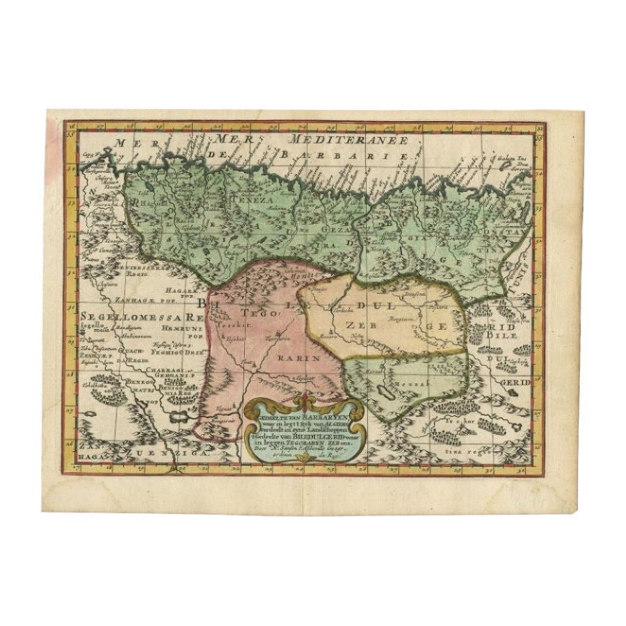
- Antique Map of Barbary and Biledulgerid by Sanson, 1705Located in Langweer, NLAntique map, titled: 'Gedeelte van Barbaryen (…).' - Decorative hand colored map of a part of Barbary (Algeria) and Biledulgerid (Tegoryn, Zeb etc.), North Africa. Source unknown, to...Category
Antique 18th Century Maps
MaterialsPaper
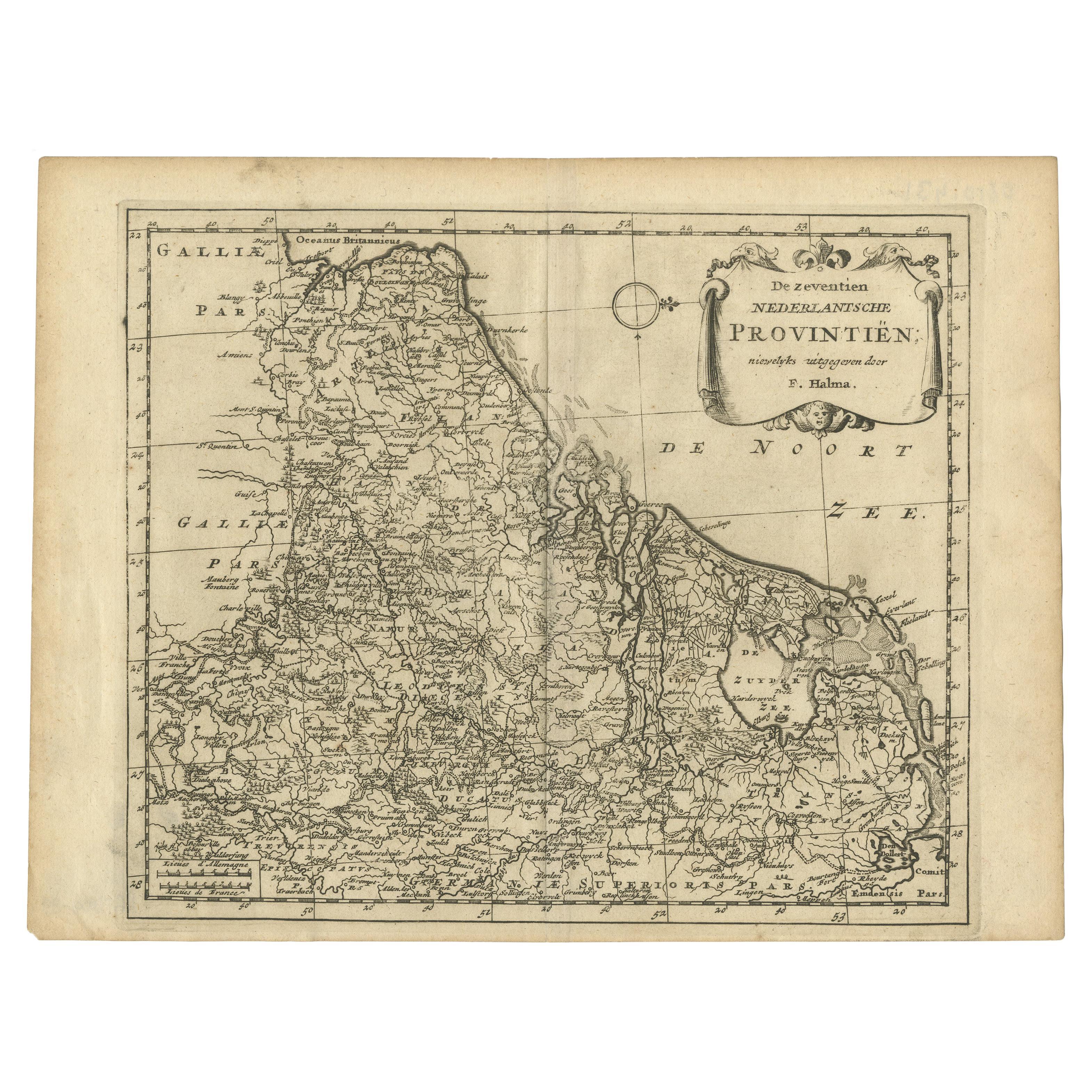
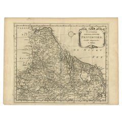
- Antique Map of the Seventeen Provinces by Halma '1705'Located in Langweer, NLAntique map titled 'De zeventien Nederlantsche Provintiën'. Original antique map of the Seventeen Provinces, the Imperial states of the Habsburg Netherlands in the 16th century. This...Category
Antique Early 18th Century Maps
MaterialsPaper
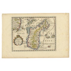
- Antique Map of Madagascar by N. Sanson, circa 1680By Nicolas SansonLocated in Langweer, NLAntique map titled 'Isle de Madagascar ou de St. Laurens. Tiree de Sanutu &c'. Antique map of Madagascar, first published by Sanson in 1657. Sanson n...Category
Antique Late 17th Century Maps
MaterialsPaper


You May Also Like
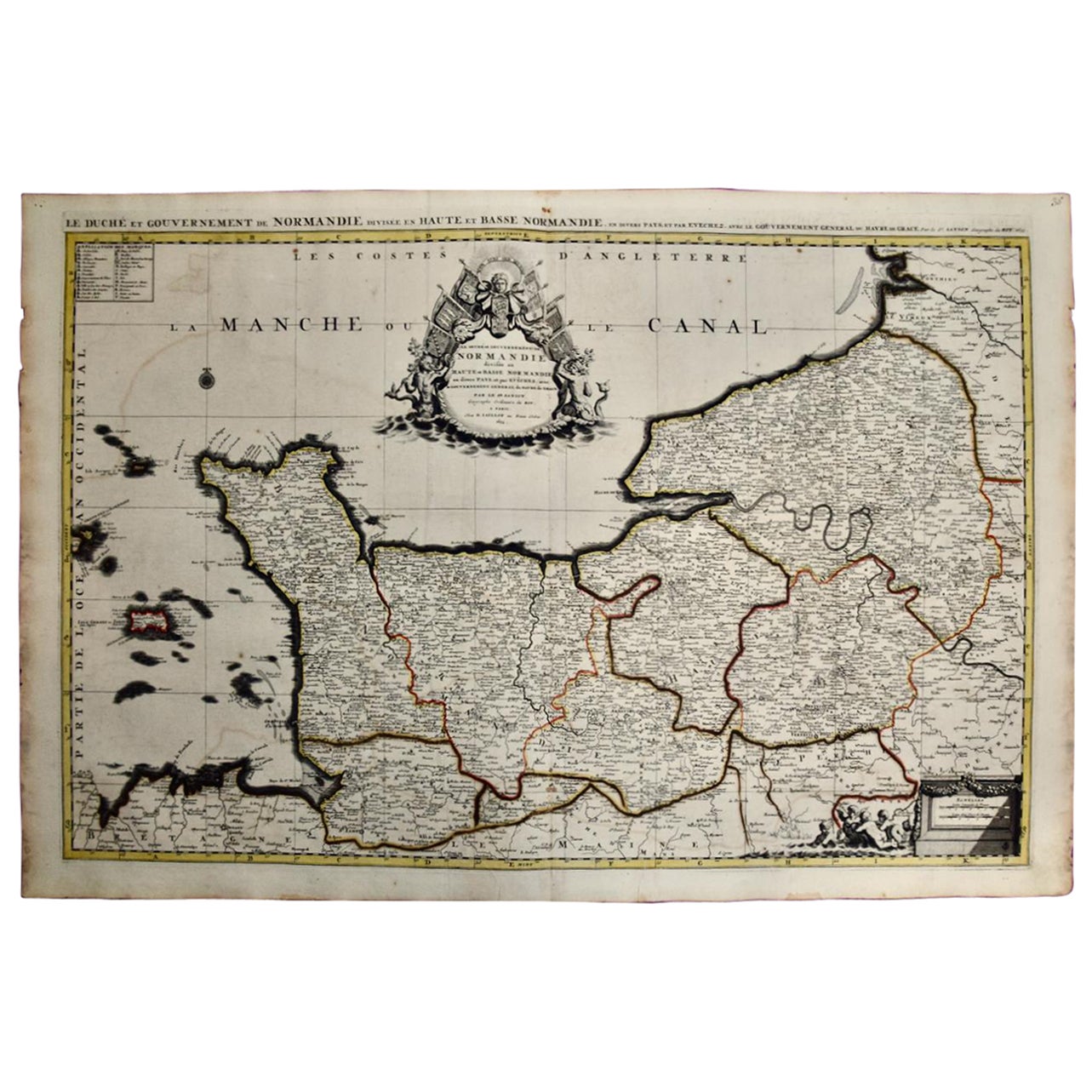
- The Normandy Region of France: A 17th C. Hand-colored Map by Sanson and JaillotBy Nicolas SansonLocated in Alamo, CAThis large hand-colored map entitled "Le Duché et Gouvernement de Normandie divisée en Haute et Basse Normandie en divers Pays; et par evêchez, avec le Gouvernement General du Havre ...Category
Antique 1690s French Maps
MaterialsPaper
- "Africa Vetus": a 17th Century Hand-Colored Map by SansonBy Nicolas SansonLocated in Alamo, CAThis original hand-colored copperplate engraved map of Africa entitled "Africa Vetus, Nicolai Sanson Christianiss Galliar Regis Geographi" was originally created by Nicholas Sanson d...Category
Antique Late 17th Century French Maps
MaterialsPaper
- 17th Century Map of Denmark by French Cartographer Sanson, Dated 1658By Nicolas SansonLocated in Copenhagen, K17th century map of Denmark by French cartographer Sanson. Nicolas Sanson (20 December 1600-7 July 1667) was a French cartographer, termed by some the creator of French geography an...Category
Antique 17th Century French Maps
MaterialsPaper
- 1861 Topographical Map of the District of Columbia, by Boschke, Antique MapLocated in Colorado Springs, COPresented is an original map of Albert Boschke's extremely sought-after "Topographical Map of the District of Columbia Surveyed in the Years 1856 ...Category
Antique 1860s American Historical Memorabilia
MaterialsPaper
- Greece, "Graeciae Antiquae"" A 17th Century Hand-colored Map by SansonBy Nicolas SansonLocated in Alamo, CAThis is an original 17th century hand colored copperplate engraved map of Greece entitled "Graeciae Antiquae Tabula Hanc Geographicam" by Nicolas d'Abbeville Sanson, engraved and pub...Category
Antique Mid-17th Century French Maps
MaterialsPaper
- 1594 Maurice Bouguereau Map of the Region Limoges, France, Ric0015Located in Norton, MA1594 Maurice Bouguereau map of the region Limoges, France, entitled "Totivs Lemovici et Confinium Pro Uinciarum Quantum ad Dioecefin Lemo Uicenfen Fpectant," Hand Colored Ric0015 Jean IV Le Clerc...Category
Antique 16th Century Dutch Maps
MaterialsPaper


Recently Viewed
View AllMore Ways To Browse
French 17th C Furniture
German 18th C
Lithograph City Maps
City Map Lithograph
18c Engraved Prints
Map Berlin
Berlin Maps
Rare Compass
Map Of United Kingdom
Antique Presentation Plates
Antique Mallet
Antique 16th Century Plates
Antique Caribbean Furniture
Antique Booksellers
Antique Bookseller
17th Century Plate Set
Compass Rose Antique
Antique Rose Compass