Items Similar to Antique Map of Italy by Andriveau-Goujon, 1843


Want more images or videos?
Request additional images or videos from the seller
1 of 12
Antique Map of Italy by Andriveau-Goujon, 1843
About the Item
Antique Map of Italy by Andriveau-Goujon, 1843. Map of Italy in two parts by Andriveau-Goujon for the Library of Prince Carini at Palazzo Carini in Palermo, circa 1843. In excellent condition on two panels, dissected and mounted on original linen in 32 sections. Comes with original marbleized cardboard slipcase in rich purple and orange and paper label of the Prince of Carini.
Map dimensions in two parts; each of the two sections measures 38.5" W x 26.25" L for a total overall dimension of 38.5 W x 52.5 L. Box dimensions: 5.5" W x 1.5" D x 7" H.
- Creator:Andriveau-Goujon (Maker)
- Dimensions:Height: 0.38 in (9.66 mm)Width: 38.5 in (97.79 cm)Depth: 52.5 in (133.35 cm)
- Sold As:Set of 2
- Materials and Techniques:
- Place of Origin:
- Period:
- Date of Manufacture:1843
- Condition:Wear consistent with age and use. Excellent antique condition.
- Seller Location:New York, NY
- Reference Number:1stDibs: LU108421930732
About the Seller
4.9
Platinum Seller
Premium sellers with a 4.7+ rating and 24-hour response times
Established in 1993
1stDibs seller since 2014
578 sales on 1stDibs
Typical response time: <1 hour
- ShippingRetrieving quote...Shipping from: New York, NY
- Return Policy
Authenticity Guarantee
In the unlikely event there’s an issue with an item’s authenticity, contact us within 1 year for a full refund. DetailsMoney-Back Guarantee
If your item is not as described, is damaged in transit, or does not arrive, contact us within 7 days for a full refund. Details24-Hour Cancellation
You have a 24-hour grace period in which to reconsider your purchase, with no questions asked.Vetted Professional Sellers
Our world-class sellers must adhere to strict standards for service and quality, maintaining the integrity of our listings.Price-Match Guarantee
If you find that a seller listed the same item for a lower price elsewhere, we’ll match it.Trusted Global Delivery
Our best-in-class carrier network provides specialized shipping options worldwide, including custom delivery.More From This Seller
View AllMap of the Republic of Genoa
Located in New York, NY
Framed antique hand-coloured map of the Republic of Genoa including the duchies of Mantua, Modena, and Parma.
Europe, late 18th century.
Dimension: 25...
Category
Antique Late 18th Century European Maps

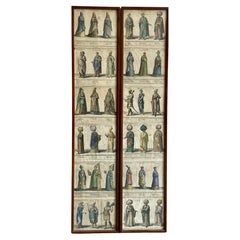
Set of Six Engravings of Italian Regional Dress
By Alessandro d'Anna
Located in New York, NY
Set of six engravings of Italian regional dress. Set of six framed antique engravings from a series of Italian regional dress after Alessandro d'...
Category
Antique Late 18th Century Italian Prints
Materials
Paper
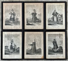
$1,650 / set
Pair Framed Antique Engravings of Ottoman Personages
Located in New York, NY
Pair framed antique engravings of ottoman personages. Set of 12 hand coloured antique engravings of 36 diverse personages of Ottoman and Oriental background spectacularly attired in ...
Category
Antique Early 18th Century European Prints
Materials
Paper
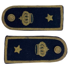
Pair of Italian Military Epaulettes
Located in New York, NY
Pair of Italian Military epaulettes. Handsome pair of black and gold thread stitched functioning naval epaulettes with the crown of Savoy, stars and b...
Category
Vintage 1930s Italian Historical Memorabilia
Materials
Metallic Thread
Set of Bronze Artillery Cannons with Italian Royal Insignia
Located in New York, NY
Set of bronze artillery cannons with Italian royal insignia. Set of three vintage patinated bronze artillery models including a larger cannon on hand ca...
Category
Early 20th Century Italian Models and Miniatures
Materials
Bronze

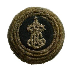
Italian Military Decoration
Located in New York, NY
Italian military decoration. Military ornament, reign of King Carlo Alberto of Piedmont-Sardinia, Italy, 1831-1849.
Dimension: 2.5" diameter x 1.25 D...
Category
Antique Early 19th Century Italian Historical Memorabilia
Materials
Metallic Thread
You May Also Like
Antique Map of Arabia by Tardieu '1843'
Located in Langweer, NL
Antique map titled 'Arabie'. Attractive small map of Arabia. This map originates from 'Dictionnaire Universel de Geographie Moderne' 4th Edition, by A.Pe...
Category
Antique Mid-19th Century Maps
Materials
Paper
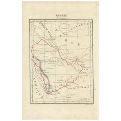
$185 Sale Price
20% Off
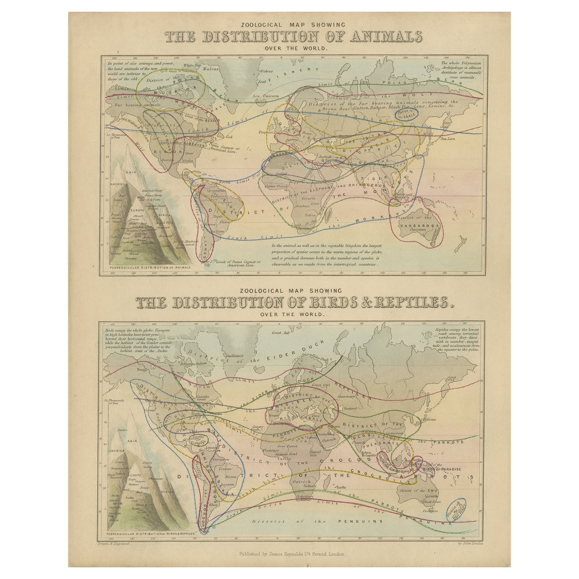
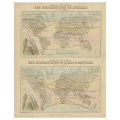
Antique Zoological Map, 1843
Located in Langweer, NL
Two antique world maps on one sheet. The upper map shows the distribution of animals over the world. The lower map shows the distribution of birds & reptiles over the world. Originat...
Category
Antique 19th Century Maps
Materials
Paper
$203 Sale Price
20% Off
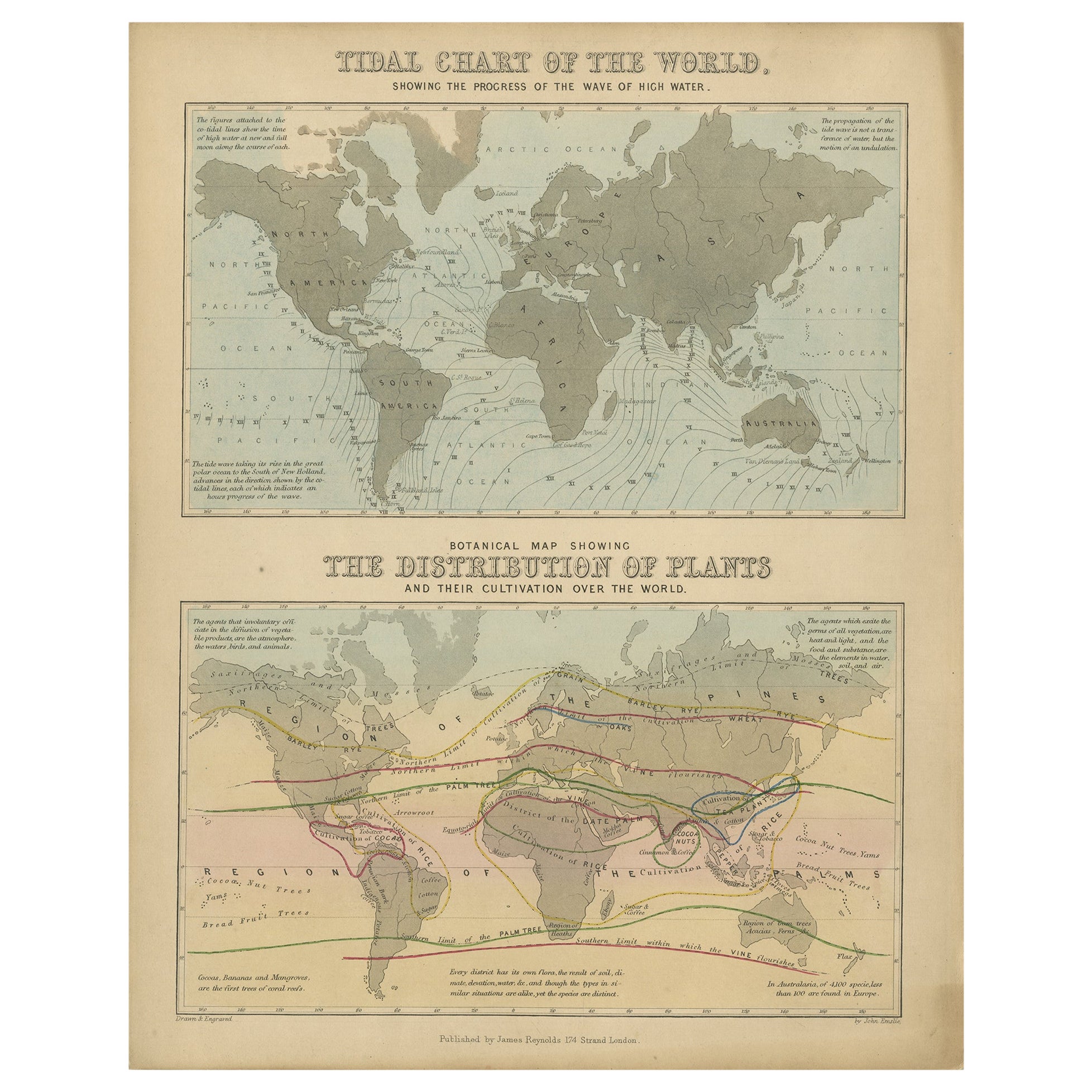
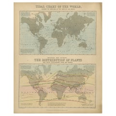
Antique Tidal Chart and Botanical Map, 1843
Located in Langweer, NL
Two antique world maps on one sheet. The upper map is a tidal chart of the world and shows the progress of the wave of high water. The lower botanical map shows the distribution of p...
Category
Antique 19th Century Maps
Materials
Paper
$203 Sale Price
20% Off
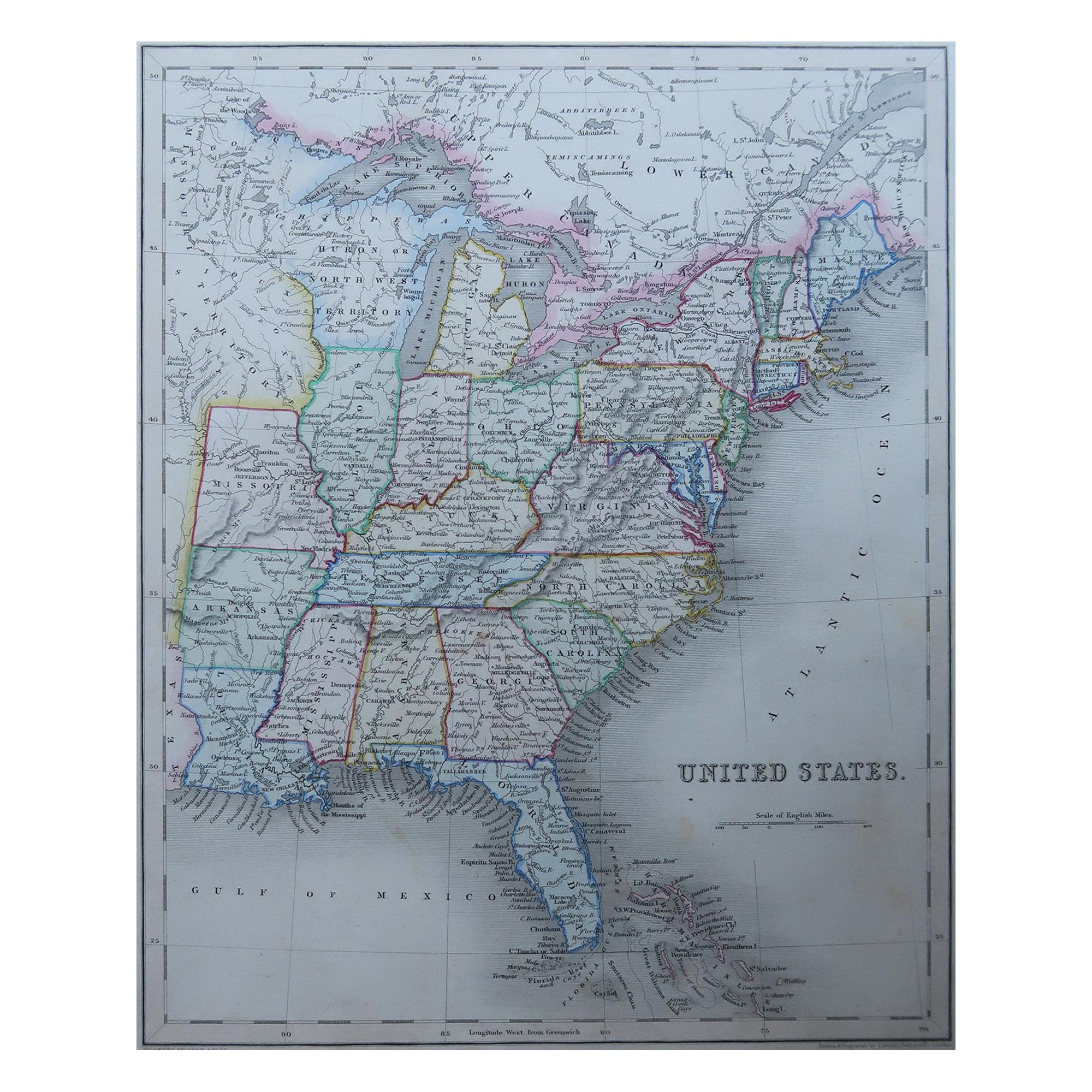
Original Antique Map of United States, Grattan and Gilbert, 1843
Located in St Annes, Lancashire
Great map of United States
Drawn and engraved by Archer
Published by Grattan and Gilbert. 1843
Original colour
Unframed.
Category
Antique 1840s English Maps
Materials
Paper

Antique Map of Italy by Lapie, 1842
Located in Langweer, NL
Antique map titled 'Carte de l'Italie Ancienne'. Map of Italy. This map originates from 'Atlas universel de géographie ancienne et moderne (..)' by Pierre...
Category
Antique Mid-19th Century Maps
Materials
Paper

$462 Sale Price
20% Off
Antique Map of Italy by R. Bonne, circa 1780
Located in Langweer, NL
Beautiful map of Italy, Corsica, Sardinia and Sicily. Highly detailed, showing towns, rivers, some topographical features and political boundaries. Published by R. Bonne, circa 1780.
Category
Antique Late 18th Century Maps
Materials
Paper

$277 Sale Price
20% Off
Recently Viewed
View AllMore Ways To Browse
Antique Linen Box
Antique Map Box
Antique Map Ceylon
Antique Sri Lanka Map
Sri Lanka Engraving
Antique Engravings Globes
Map Railroad
Antique Navigational Tools
Persian Maps
Key Trade Sign
Antique Puerto Rico
World Map Of Trade Routes
Antique Blackwood Furniture
Antique Ecuador
Antique Maps Of Israel
Map Of Israel
Antique Maps Of Russian Empire
Korea Map