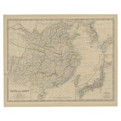
Antique Map of China and an Inset Map of Japan, 1882
View Similar Items


Want more images or videos?
Request additional images or videos from the seller
1 of 5
Antique Map of China and an Inset Map of Japan, 1882
About the Item
- Dimensions:Height: 19.53 in (49.6 cm)Width: 24.06 in (61.1 cm)Depth: 0 in (0.01 mm)
- Materials and Techniques:
- Period:
- Date of Manufacture:1882
- Condition:
- Seller Location:Langweer, NL
- Reference Number:Seller: BG-11823-351stDibs: LU3054326143922
About the Seller
5.0
Platinum Seller
These expertly vetted sellers are 1stDibs' most experienced sellers and are rated highest by our customers.
Established in 2009
1stDibs seller since 2017
1,947 sales on 1stDibs
More From This SellerView All
- Antique Map of Eastern Canada with an inset Map of Newfoundland, 1882Located in Langweer, NLAntique map titled 'Dominion of Canada'. Old map of Eastern Canada with an inset map of Newfoundland. This map originates from 'The Royal Atlas of Modern Geography, Exhibiting, in a ...Category
Antique 19th Century Maps
MaterialsPaper
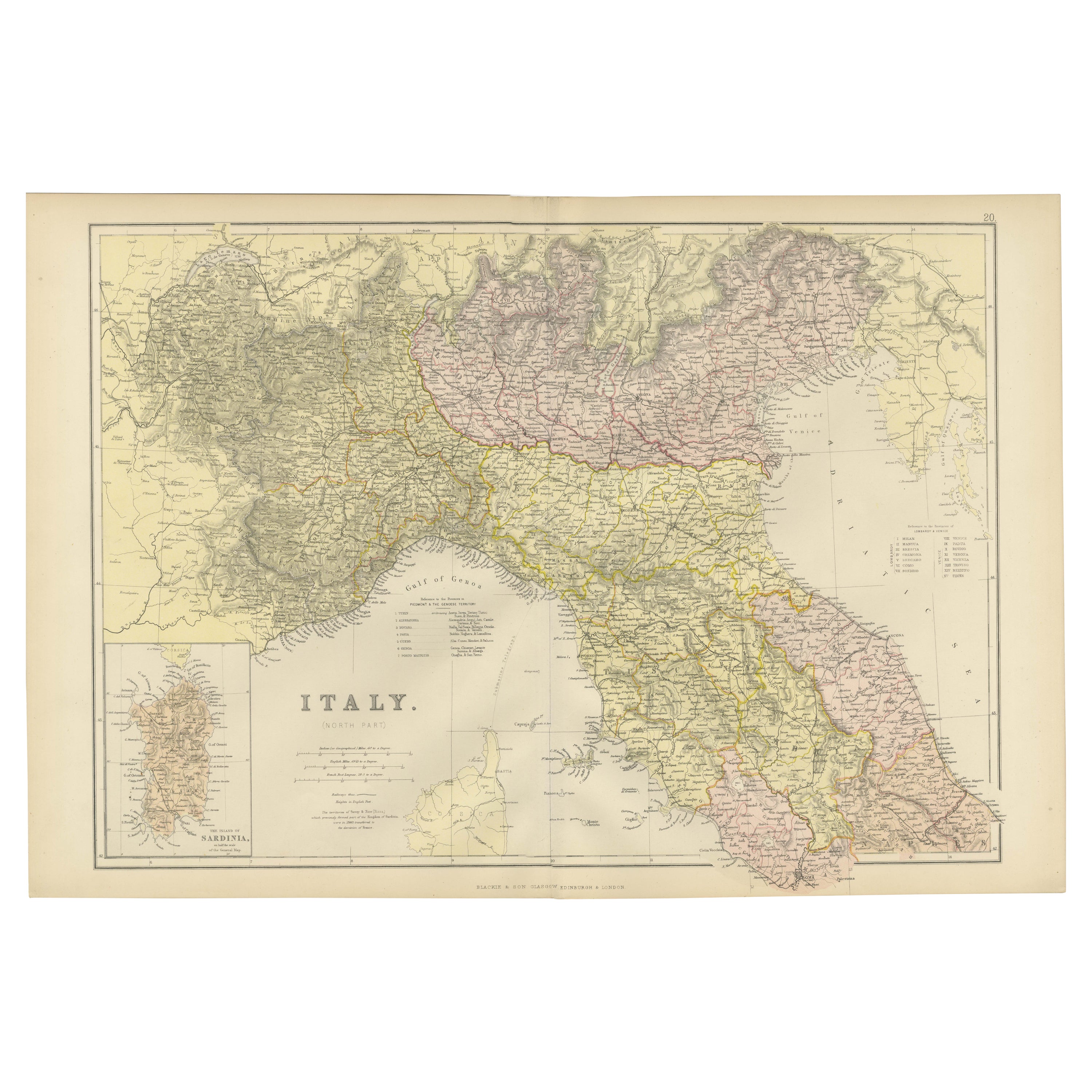
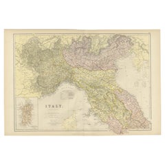
- Original Antique Map of Italy with an Inset of Sardinia, 1882Located in Langweer, NLEmbark on a historical odyssey with an original Antique Map of Italy from the esteemed 'Comprehensive Atlas and Geography of the World,' meticulously crafted in 1882. This captivatin...Category
Antique 1880s Maps
MaterialsPaper
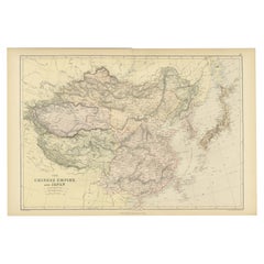
- Old Map of the Chinese Empire and Japan, 1882Located in Langweer, NLAn original antique map titled "The Chinese Empire and Japan," dating from an 1882 atlas by Blackie & Son. It is a color map with geographical features such as mountain ranges, river...Category
Antique 1880s Maps
MaterialsPaper
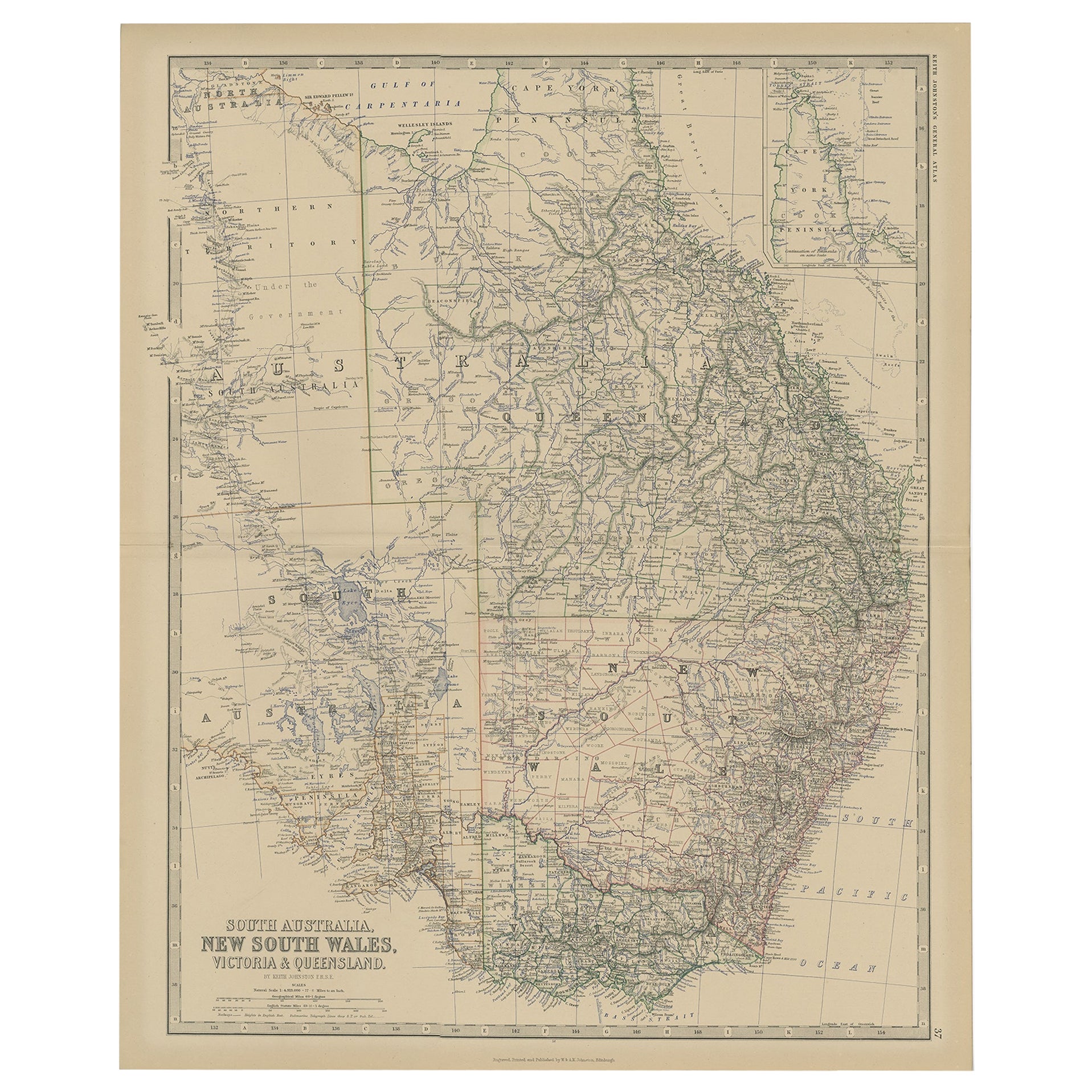
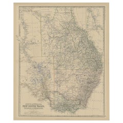
- Old Map of Southern Australia, with an Inset Map of Cape York Peninsula, 1882Located in Langweer, NLAntique map titled 'South Australia, New South Wales, Victoria & Queensland'. Old map of Southern Australia, with an inset map of Cape York Peninsula. This map originates from 'T...Category
Antique 1880s Maps
MaterialsPaper
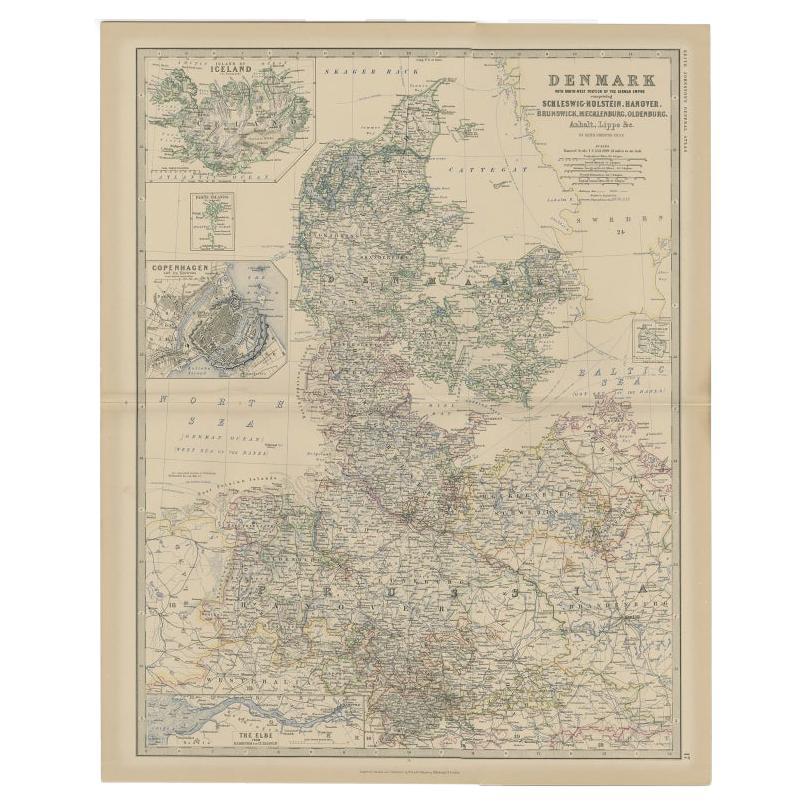
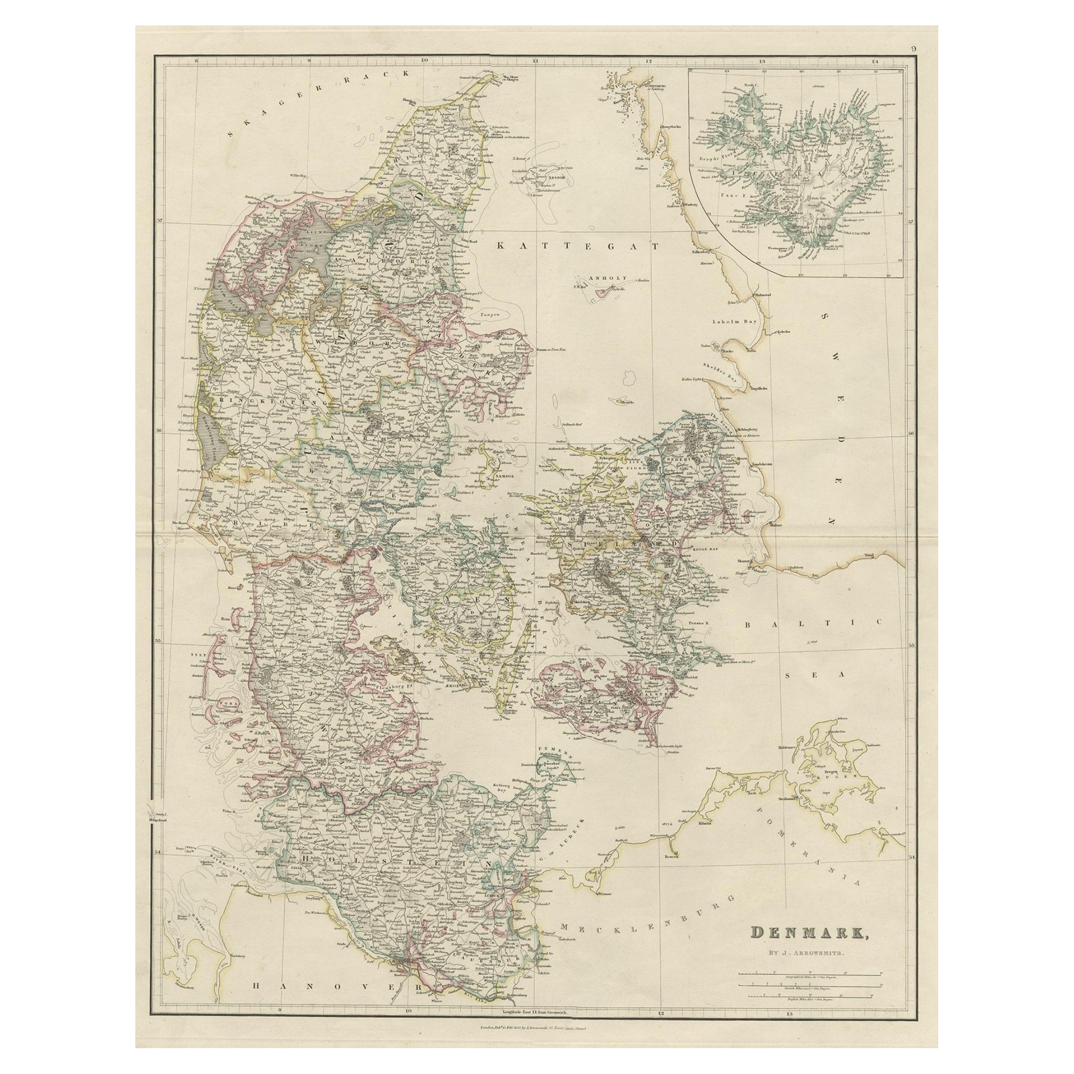
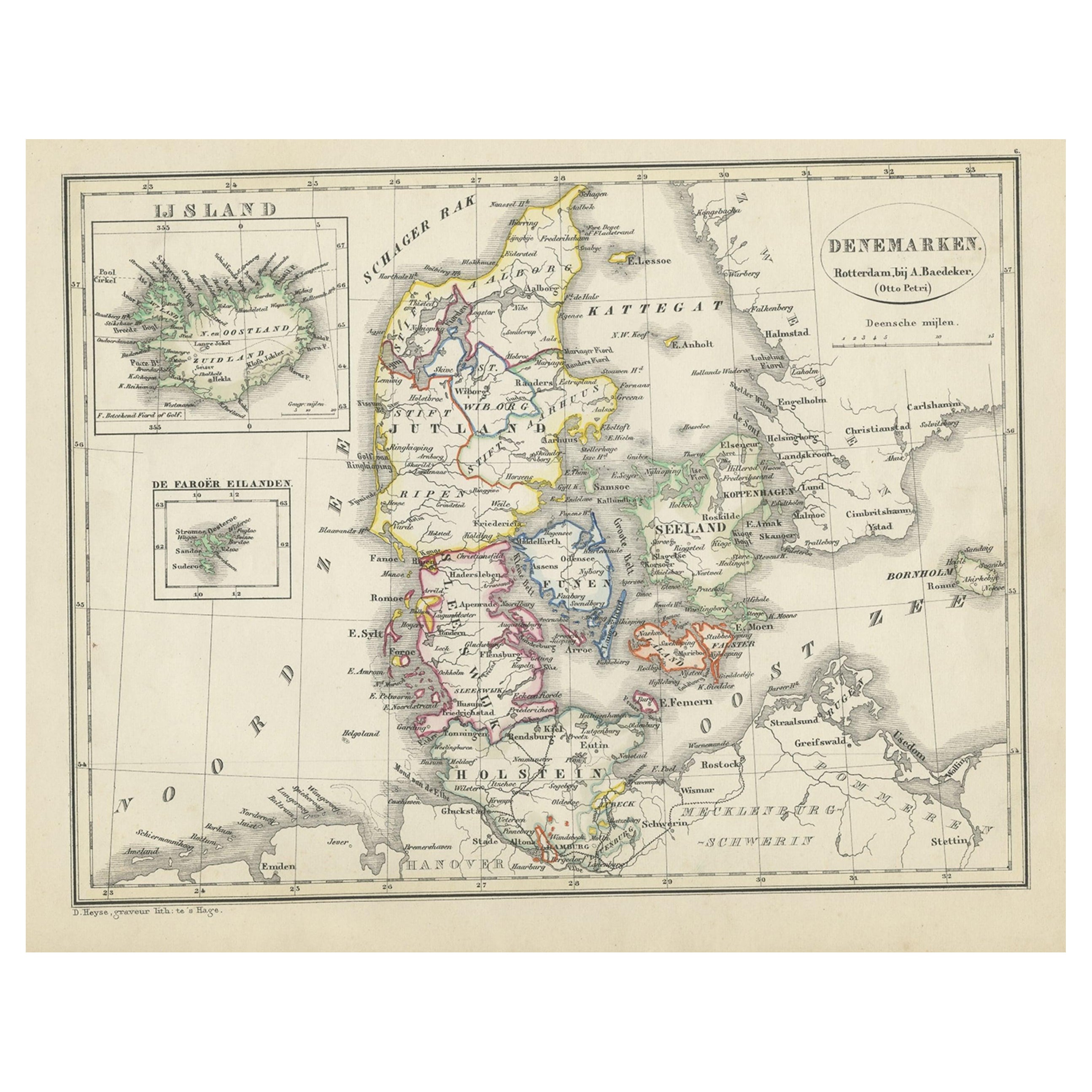
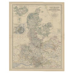
- Antique Map of Denmark with Inset Maps of Iceland, Copenhagen and the Elbe, 1882Located in Langweer, NLAntique map titled 'Denmark with North-West portion of the German Empire comprising Schleswic-Holstein, Hanover, Brunswick, Meckleburg, Oldenburg, Anhalt, Lippe & c'. Old map of Denm...Category
Antique 19th Century Maps
MaterialsPaper
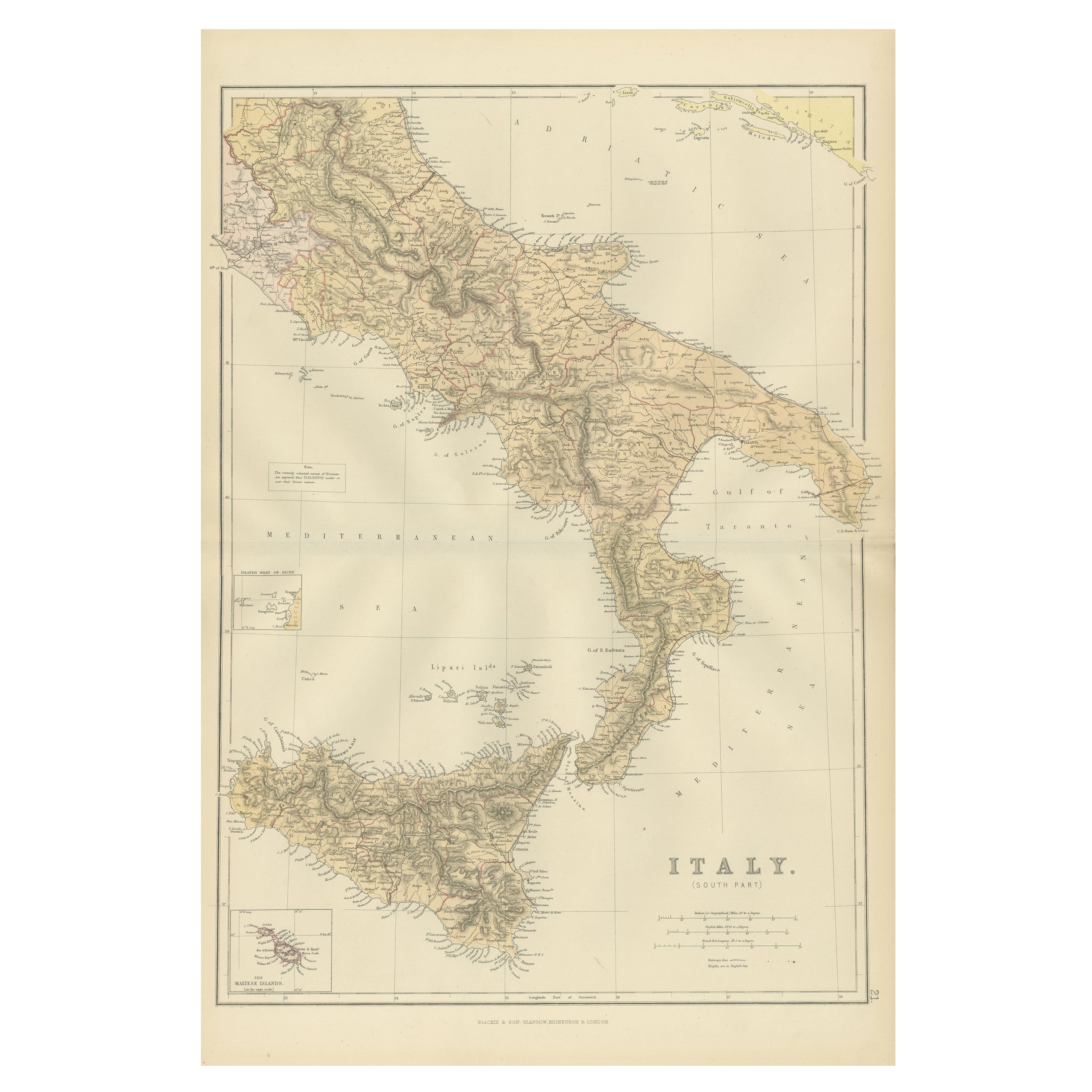
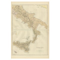
- Original Antique Map of the South Part of Italy with an Inset of Malta, 1882Located in Langweer, NLEmbark on a captivating journey through the southern part of Italy with an original Antique Map from the esteemed 'Comprehensive Atlas and Geography of the World,' meticulously craft...Category
Antique 1880s Maps
MaterialsPaper

You May Also Like
- Original Antique Map of China, Arrowsmith, 1820Located in St Annes, LancashireGreat map of China Drawn under the direction of Arrowsmith Copper-plate engraving Published by Longman, Hurst, Rees, Orme and Brown, 1820 Unfr...Category
Antique 1820s English Maps
MaterialsPaper

- Framed Map of ChinaLocated in Greenwich, CTMap of China, 19th century. European print map of China Conservation frame with walnut frame Overall dimension : 28 1/2" wide 31" high 2" depth with fra...Category
Antique 19th Century European Qing Prints
MaterialsPaper
 $3,800
 - Large Original Antique Map of China, Fullarton, C.1870Located in St Annes, LancashireGreat map of China From the celebrated Royal Illustrated Atlas Lithograph by Swanston. Original color. Published by Fullarton, Edinburgh. C.1870 Repairs to minor edge te...Category
Antique 1870s Scottish Maps
MaterialsPaper
- Original Antique Map of China by Thomas Clerk, 1817Located in St Annes, LancashireGreat map of China Copper-plate engraving Drawn and engraved by Thomas Clerk, Edinburgh. Published by Mackenzie And Dent, 1817 Unframed.Category
Antique 1810s English Maps
MaterialsPaper

- Super Rare Antique French Map of Chine and the Chinese Empire, 1780Located in Amsterdam, Noord HollandSuper Rare Antique French Map of Chine and the Chinese Empire, 1780 Very nice map of Asia. 1780 Made by Bonne. Additional information: Type: Map ...Category
Antique 18th Century European Maps
MaterialsPaper
- Antique French Map of Asia Including China Indoneseia India, 1783Located in Amsterdam, Noord HollandVery nice map of Asia. 1783 Dedie au Roy. Additional information: Country of Manufacturing: Europe Period: 18th century Qing (1661 - 1912) Condition: Overall Condition B (Good Used)...Category
Antique 18th Century European Maps
MaterialsPaper
 $648 Sale Price20% Off


Recently Viewed
View AllMore Ways To Browse
Japanese Antique Collectables
Chinese Inset
Large Map Of The World
Japan Antiques Collectables
Antique And Collectable Fairs
Old World Antique Maps
Antique Old World Map
Old Antique World Map
Old World Antique Map
Antique Maps Of States
Large Maps On Paper
China Map
Chinese Maps
Chinese Map
Map Of China
16th Century Japanese
Chinese Hundred Antiques
Scottish China