Items Similar to Antique Map of the City of Leeuwarden by Kuyper, 1868
Want more images or videos?
Request additional images or videos from the seller
1 of 5
Antique Map of the City of Leeuwarden by Kuyper, 1868
About the Item
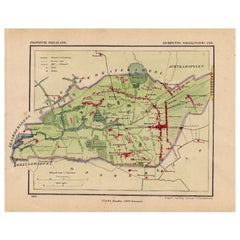
Antique map titled 'Provincie Friesland - Gemeente Leeuwarden No. 2 Stad'. Map of the city of Leeuwarden, Friesland. This map originates from 'Gemeente-Atlas van Nederland' by J. Kuyper.
Artists and Engravers: Published by H. Suringar.
Condition: Good, general age-related toning. Minor wear, blank verso. Please study image carefully.
Date: 1868
Overall size: 26.5 x 20 cm.
Image size: 18.5 x 15 cm.
We sell original antique maps to collectors, historians, educators and interior decorators all over the world. Our collection includes a wide range of authentic antique maps from the 16th to the 20th centuries. Buying and collecting antique maps is a tradition that goes back hundreds of years. Antique maps have proved a richly rewarding investment over the past decade, thanks to a growing appreciation of their unique historical appeal. Today the decorative qualities of antique maps are widely recognized by interior designers who appreciate their beauty and design flexibility. Depending on the individual map, presentation, and context, a rare or antique map can be modern, traditional, abstract, figurative, serious or whimsical. We offer a wide range of authentic antique maps for any budget
- Dimensions:Height: 7.88 in (20 cm)Width: 10.44 in (26.5 cm)Depth: 0 in (0.01 mm)
- Materials and Techniques:
- Period:
- Date of Manufacture:1868
- Condition:
- Seller Location:Langweer, NL
- Reference Number:
About the Seller
5.0
Platinum Seller
These expertly vetted sellers are 1stDibs' most experienced sellers and are rated highest by our customers.
Established in 2009
1stDibs seller since 2017
1,933 sales on 1stDibs
Typical response time: <1 hour
- ShippingRetrieving quote...Ships From: Langweer, Netherlands
- Return PolicyA return for this item may be initiated within 14 days of delivery.
More From This SellerView All
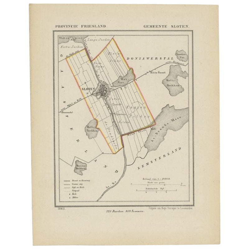
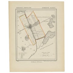
- Antique Map of Sloten by Kuyper, 1868Located in Langweer, NLAntique map titled 'Provincie Friesland - Gemeente Sloten'. Map of the township of Sloten, Friesland. This map originates from 'Gemeente-Atlas van Nederland' by J. Kuyper. Artists an...Category
Antique 19th Century Maps
MaterialsPaper
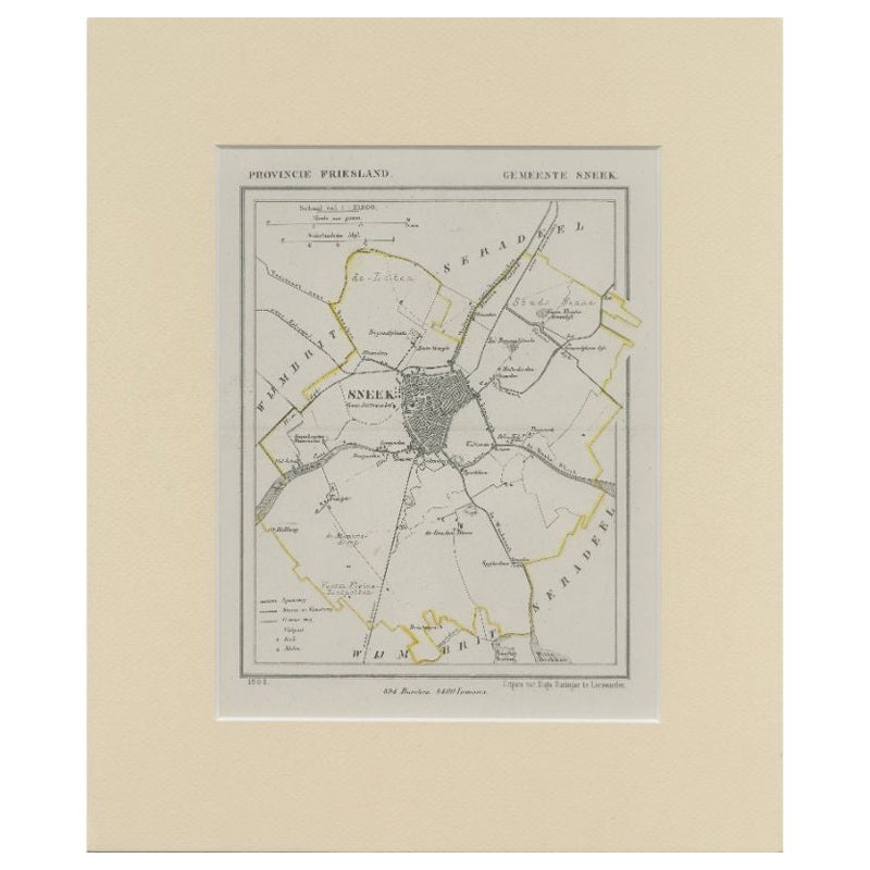
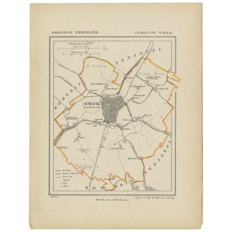
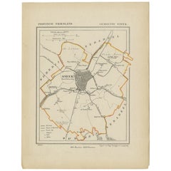
- Antique Map of Sneek by Kuyper, 1868Located in Langweer, NLAntique map titled 'Provincie Friesland - Gemeente Sneek'. Map of the township of Sneek, Friesland. This map originates from 'Gemeente-Atlas van Nederland' by J. Kuyper. Artists and ...Category
Antique 19th Century Maps
MaterialsPaper
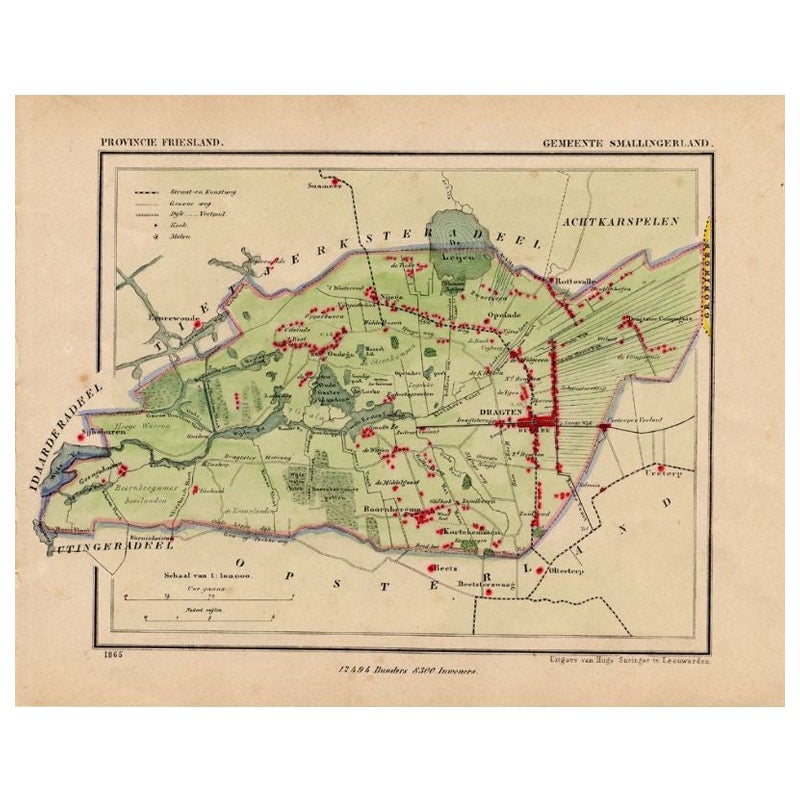
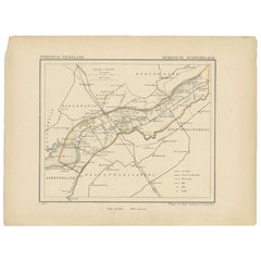
- Antique Map of Smallingerland by Kuyper, 1868Located in Langweer, NLAntique map titled 'Provincie Friesland - Gemeente Smallingerland'. Map of the township of Smallingerland including Drachten, Opeinde and many other villages. This map originates fro...Category
Antique 19th Century Maps
MaterialsPaper
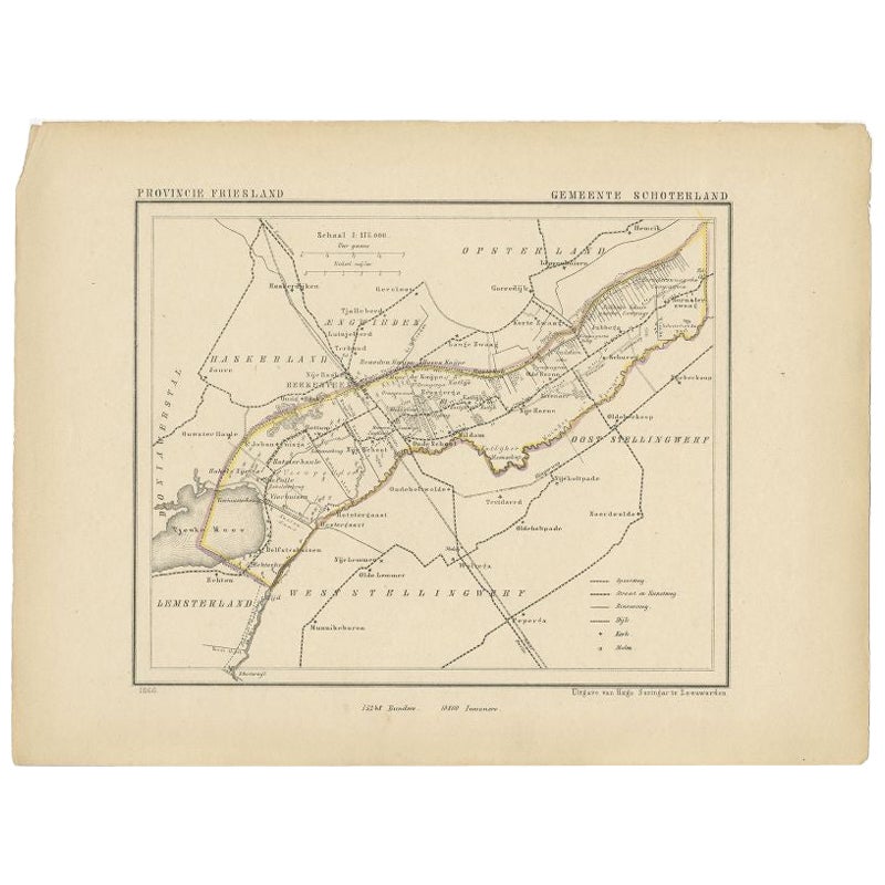
- Antique Map of Schoterland by Kuyper, 1868Located in Langweer, NLAntique map titled 'Provincie Friesland - Gemeente Schoterland'. Map of the township of Schoterland including Rottum, Oudeschoot, Mildam and many other villages. This map originates ...Category
Antique 19th Century Maps
MaterialsPaper
- Antique Map of Sneek by Kuyper, 1868Located in Langweer, NLAntique map titled 'Provincie Friesland - Gemeente Sneek'. Map of the township of Sneek, Friesland. This map originates from 'Gemeente-Atlas van Nederland' by J. Kuyper. Artists and ...Category
Antique 19th Century Maps
MaterialsPaper
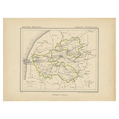
- Antique Map of Franekeradeel by Kuyper, 1868Located in Langweer, NLAntique map titled 'Provincie Friesland - Gemeente Franekeradeel'. Map of the township of Franekeradeel including Franeker, Achlum, Dongjum, Midlum and many other villages. This map ...Category
Antique 19th Century Maps
MaterialsPaper
You May Also Like
- 1840 Map of the City of Washington Published by William M. MorrisonLocated in Colorado Springs, COThis map, printed in 1840, is a detailed representation of Washington, D.C. in the mid-19th century. The map shows block numbers, wards, and government buildings as well as details o...Category
Antique 1840s American Federal Maps
MaterialsPaper
- 1868 Map of the Upper Part of the Island of Manhattan Above 86th StreetBy Wm. Rogers Mfg. Co.Located in San Francisco, CAThis wonderful piece of New York City history is over 150 years old. It depicts 86th street and above. It was lithographed by WC Rogers and company. It was made to show what was the Battle of Harlem during the Revolutionary war...Category
Antique 1860s American American Colonial Maps
MaterialsPaper
- Antique Map of American Cities, Vignette of New York City, circa 1920Located in St Annes, LancashireGreat maps of American Cities Unframed Original color By John Bartholomew and Co. Edinburgh Geographical Institute Published, circa 1920Category
Vintage 1920s British Maps
MaterialsPaper
- 1861 Topographical Map of the District of Columbia, by Boschke, Antique MapLocated in Colorado Springs, COPresented is an original map of Albert Boschke's extremely sought-after "Topographical Map of the District of Columbia Surveyed in the Years 1856 ...Category
Antique 1860s American Historical Memorabilia
MaterialsPaper
- Original Antique Map / City Plan of Brussels by Tallis, circa 1850Located in St Annes, LancashireGreat map of Brussels. Steel engraving. Published by London Printing & Publishing Co. (Formerly Tallis), C.1850 Free shipping.Category
Antique 1850s English Maps
MaterialsPaper
- Italian Parchment Map of the City of Lucca Dated 1640By Matthäus Merian the ElderLocated in Roma, ITAn antique map of the Tuscan city of Lucca engraved for The 'Itinerarium Italiæ Nov-antiquæ' by Matthäus Merian the Elder and printed in 1640...Category
Antique 1640s Italian Maps
MaterialsParchment Paper, Paper


Recently Viewed
View AllMore Ways To Browse
City Used Office Furniture
Antique Russian Wood Furniture
Antique Russian Wood
Compass Antique Map
Antique Compass Map
Antique Britain Map
Large Antique Map Of The World
Antique China Map
Antique Map Britain
Antique Map China
Antique Chinese Maps
Antique Map Of China
Premier Antiques
Compass 18th Century
Antique Maps Of China
18th Century Compass
Antique Furniture Building Plans
Antique Maps Spain