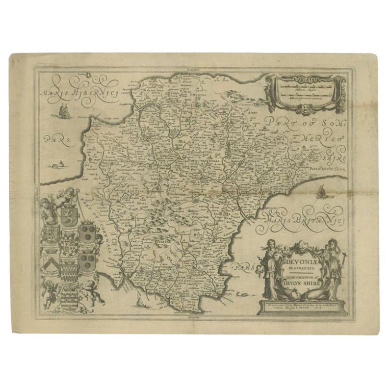
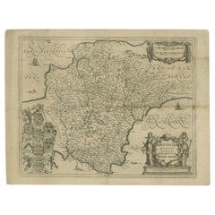
Antique Map of the County of Devon by Overton, 1713
View Similar Items


Want more images or videos?
Request additional images or videos from the seller
1 of 5
Antique Map of the County of Devon by Overton, 1713
About the Item
- Dimensions:Height: 17.52 in (44.5 cm)Width: 21.66 in (55 cm)Depth: 0.02 in (0.5 mm)
- Materials and Techniques:
- Period:
- Date of Manufacture:1713
- Condition:Repaired: Repair on folding lines. Original/contemporary hand coloring. Repair on folding lines. Small hole in image center, shows some wear. Blank verso, please study images carefully.
- Seller Location:Langweer, NL
- Reference Number:Seller: BG-12705-141stDibs: LU3054321191082
About the Seller
5.0
Platinum Seller
These expertly vetted sellers are 1stDibs' most experienced sellers and are rated highest by our customers.
Established in 2009
1stDibs seller since 2017
1,957 sales on 1stDibs
More From This SellerView All
- Antique Map of the County of Devon by Overton, 1713Located in Langweer, NLAntique map titled 'Devoniae Descriptio - The Description of Devon Shire'. Map of the County of Devon, England. This map originates from the 1713 edition of the 'Overton Atlas'. Henry Overton only revised the Devon map...Category
Antique 18th Century Maps
MaterialsPaper
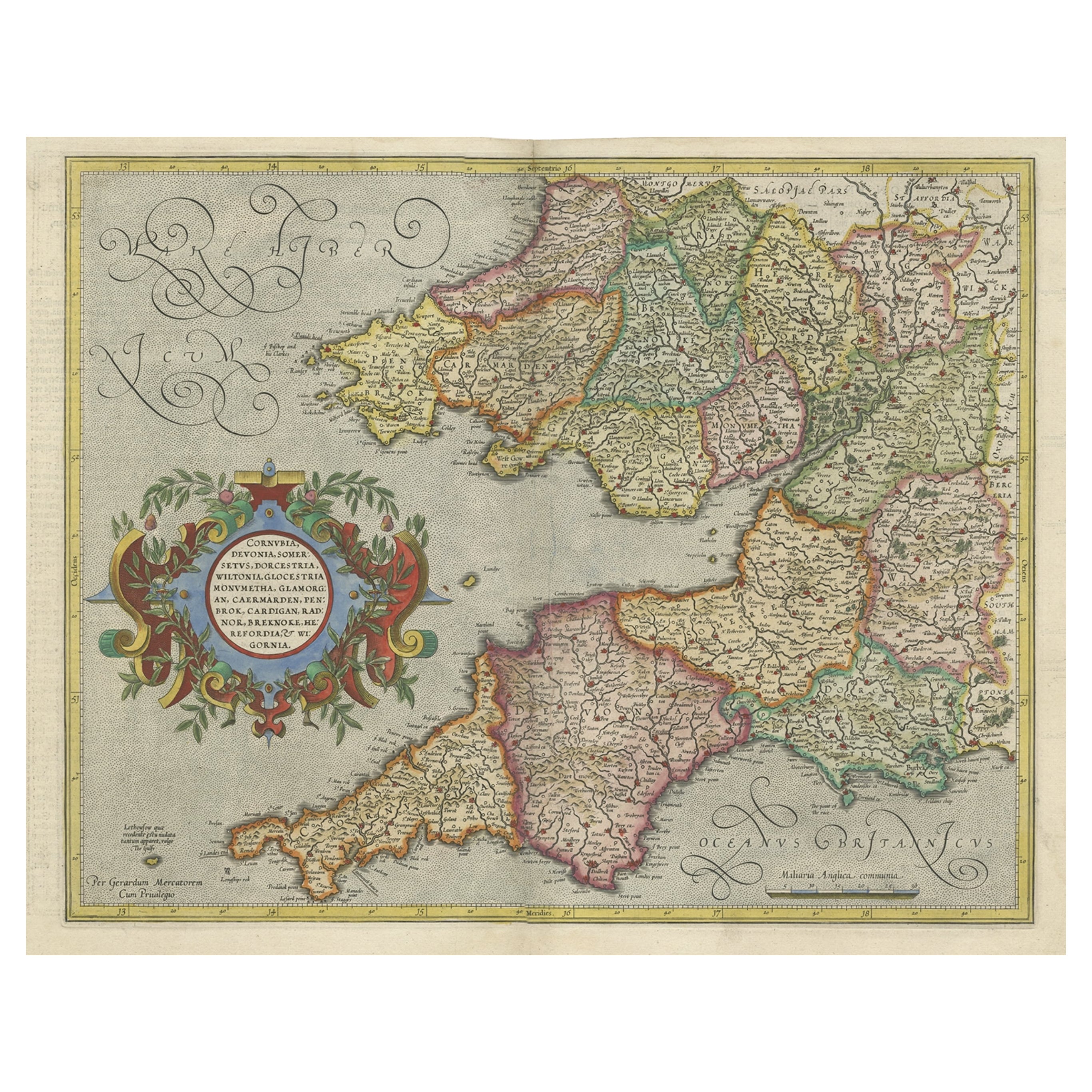
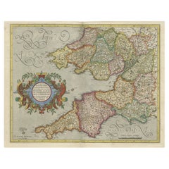
- Original Antique Map of the English counties Cornwall, Devon, Dorset, etc, 1633Located in Langweer, NLAntique map titled 'Cornubia, Devonia, Somersetus, Dorcestria, Wiltonia, Glocestria, Monumetha, Glamorgan, Caermarden, Penbrok, Cardigan, Radnor, Breknoke et Herfordia'. Old map of the English counties of Cornwall, Devon, Somerset, Dorset, Wiltshire, Gloucestershire, Herefordshire, Worcestershire etc. Originates from the 1633 German edition of the Mercator-Hondius Atlas Major, published by Henricus Hondius and Jan Jansson under the title: 'Atlas: das ist Abbildung der gantzen Welt, mit allen darin begriffenen Laendern und Provintzen: sonderlich von Teutschland, Franckreich, Niderland, Ost und West Indien: mit Beschreibung der selben.' Artists and Engravers: Gerard Mercator (1512 - 1594) originally a student of philosophy was one of the most renowned cosmographers and geographers of the 16th century, as well as an accomplished scientific instrument maker. He is most famous for introducing Mercators Projection, a system which allowed navigators to plot the same constant compass bearing on a flat...Category
Antique 1630s Maps
MaterialsPaper
- Antique Map of Essex by Overton, circa 1710Located in Langweer, NLAntique map titled 'Essex, devided into Hundreds, with the most antient and fayre Towne Colchester (..)'. Map of Essex, England. Includes an inset town pl...Category
Antique Early 18th Century Maps
MaterialsPaper
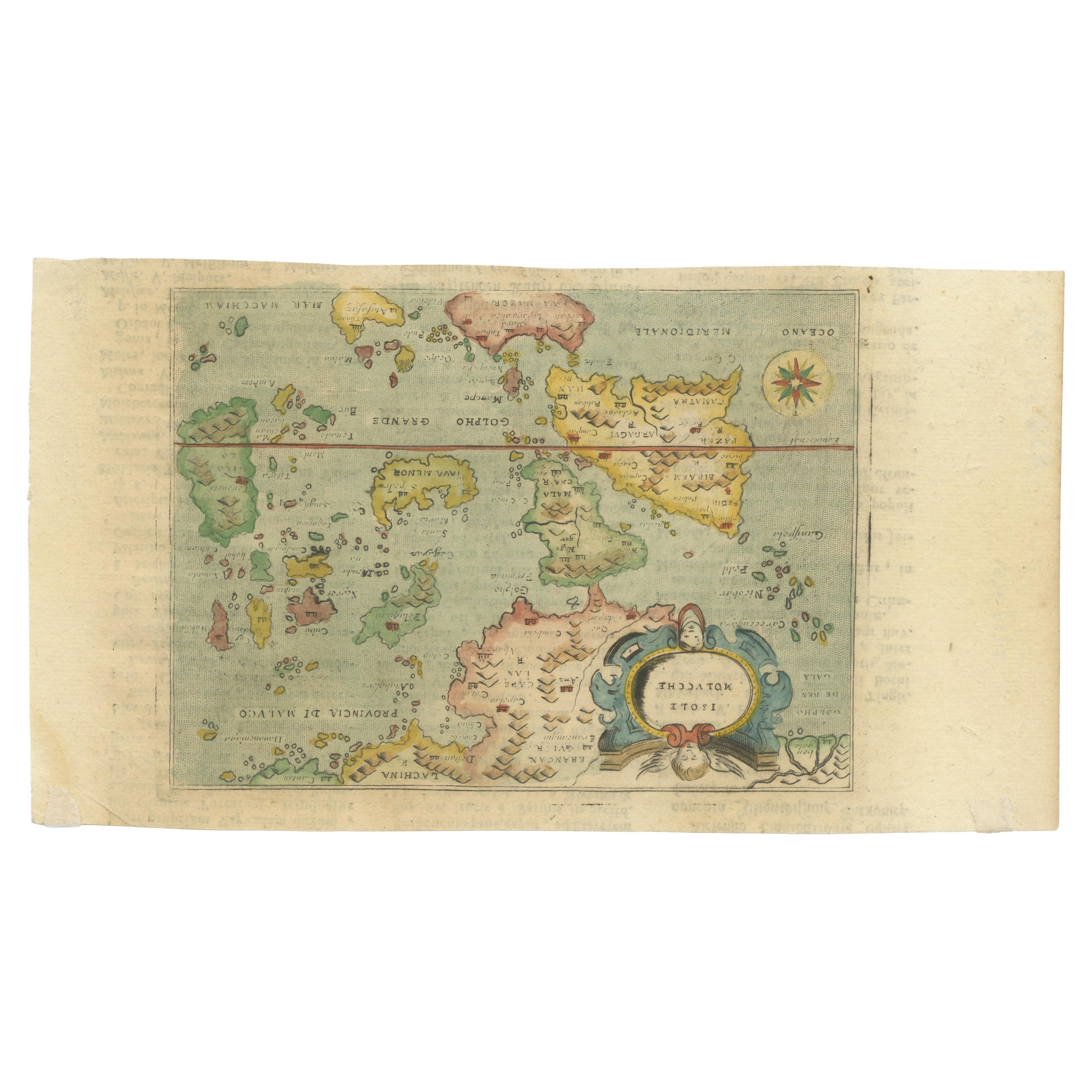
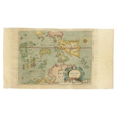
- Antique Miniature Map of the Maluku Islands by Lasor a Varea, 1713Located in Langweer, NLAntique map titled 'Isole Molucche'. Rare miniature map of the Maluku Islands or the Moluccas, Indonesia. This map originates from 'Universus Terrarum Orbis...Category
Antique Early 18th Century Maps
MaterialsPaper
- Antique Map of the Island of Java, Indonesia by P. Van Der Aa, 1713Located in Langweer, NLThis rare map shows the Indonesian island of Java. With compass rose and scale. From: Nouvel Atlas, très exact et fort commode pour toutes sortes de personnes, Contenant Les Principa...Category
Antique Early 18th Century Maps
MaterialsPaper
 $489 Sale Price35% Off
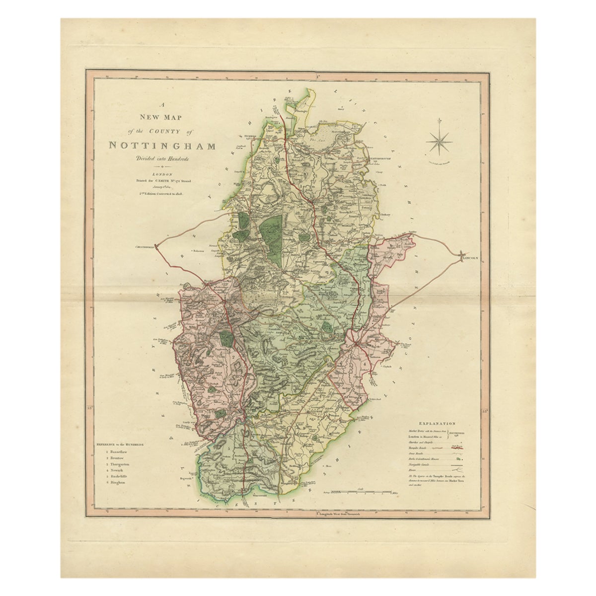
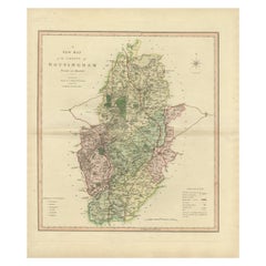
 - Antique Decorative Map of The County of Nottinghamshire, England, 1804Located in Langweer, NLAntique county map of Nottinghamshire first published c.1800. Villages, towns, and cities illustrated include Worksop, Neware, Tuxford, and Maplebe...Category
Antique Early 1800s Maps
MaterialsPaper

You May Also LikeView All
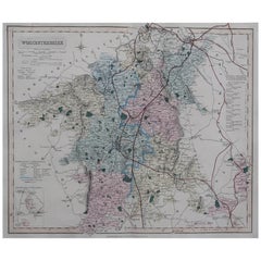
- Original Antique English County Map, Worcestershire, J & C Walker, 1851Located in St Annes, LancashireGreat map of Worcestershire Original colour By J & C Walker Published by Longman, Rees, Orme, Brown & Co. 1851 Unframed.Category
Antique 1850s English Other Maps
MaterialsPaper
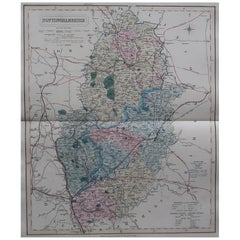
- Original Antique English County Map, Nottinghamshire, J & C Walker, 1851Located in St Annes, LancashireGreat map of Nottinghamshire Original colour By J & C Walker Published by Longman, Rees, Orme, Brown & Co. 1851 Unframed.Category
Antique 1850s English Other Maps
MaterialsPaper
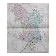
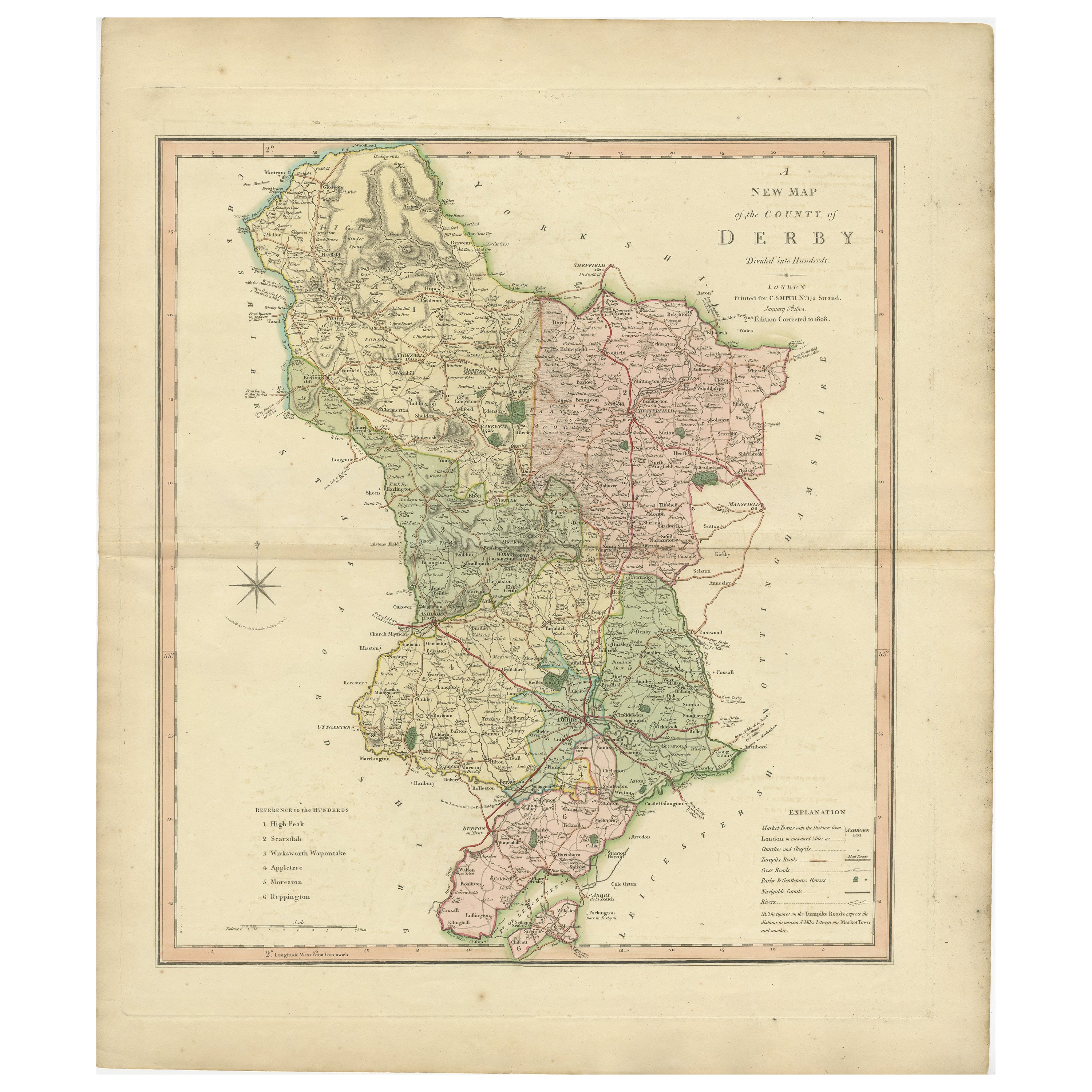
- Original Antique English County Map, Derbyshire, J & C Walker, 1851Located in St Annes, LancashireGreat map of Derbyshire Original colour By J & C Walker Published by Longman, Rees, Orme, Brown & Co. 1851 Unframed.Category
Antique 1850s English Other Maps
MaterialsPaper
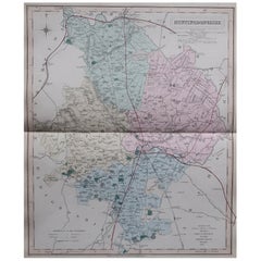
- Original Antique English County Map, Huntingdonshire, J & C Walker, 1851Located in St Annes, LancashireGreat map of Huntingdonshire Original colour By J & C Walker Published by Longman, Rees, Orme, Brown & Co. 1851 Unframed.Category
Antique 1850s English Other Maps
MaterialsPaper
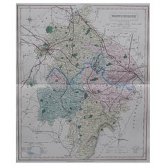
- Original Antique English County Map, Warwickshire, J & C Walker, 1851Located in St Annes, LancashireGreat map of Warwickshire Original colour By J & C Walker Published by Longman, Rees, Orme, Brown & Co. 1851 Unframed.Category
Antique 1850s English Other Maps
MaterialsPaper
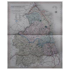
- Original Antique English County Map, Northumberland, J & C Walker, 1851Located in St Annes, LancashireGreat map of Northumberland Original colour By J & C Walker Published by Longman, Rees, Orme, Brown & Co. 1851 Unframed.Category
Antique 1850s English Other Maps
MaterialsPaper